
Detour: Part II

The day had finally come to enter White Mountain National Forest. We awoke just as the first bits of light were coming into the sky. We wanted the earliest start possible for the challenging day ahead.
From the shelter it was 5 miles and 3500 vertical feet to the summit of Mt Moosilauke. For those reading without much hiking experience, let’s just say that’s basically straight up. And somehow the vertical descent is at an even steeper degree. Fun stuff.
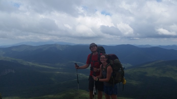
We took off both nervous and excited, very grateful for a sunny day. Over the next three hours, the trail only went up. Up and up and up. As we ascended, we were solely surrounded by pine trees, the trail littered with large boulders. Though quite the physical endeavor, we reached the summit somehow surprised it wasn’t more difficult. We admired the encompassing mountains from both the south and north summits, happy that only a little haze obstructed our view.

While enjoying our rest, I suddenly began to feel a little uncomfortable on the exposed summit. The doxycycline I was taking to combat Lyme made me incredibly susceptible to sunburn. I had to leave the summit. Bastard tick.
We continued hiking and were soon under the forest canopy. The descent off Moosilauke began immediately. And it was so damn pretty. But equally treacherous. The trail paralleled a waterfall during the entire descent though it wasn’t a great time for distraction…
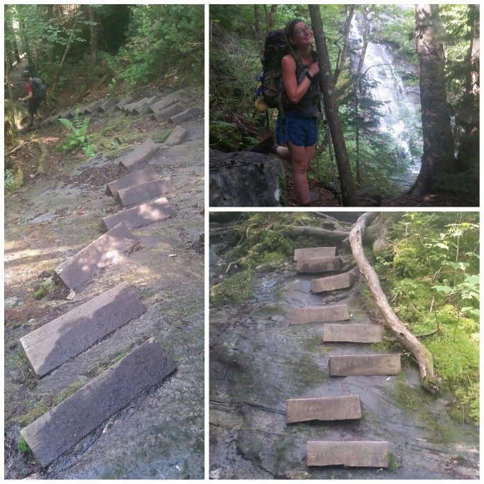
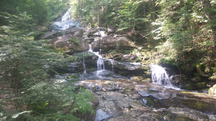
With oh so careful footing, we made it to flatter land. At the base of the falls, we took a long lunch and prepared for the remaining 7.7 miles for the day.We took off thinking the hardest part of the day was behind us. After all, 7.7 miles with a 1600 ft climb should take us less than 3 hours. 4 absolute max.

But the trail was quite tricky in this section full of quick ups and downs, big bogs, and large boulders. We were more than disheartened to check the guidebook and realize we had only completed 3.3 miles in a little over 2 hours. That’s about a mile and a half an hour. Sigh.

Though our surroundings were stunning in every way, I couldn’t help feeling frustrated over this slow pace. I was tired from this draining day and was looking for the shelter around every corner. Just as dusk was setting in, we finally arrived at our haven for the night. 16 miles took us nearly 14 hours to complete. Exhausted is an understatement. I felt as though I was no longer in charge – The Whites would call the shots.
The next morning brought fog and another challenging double peeked mountain – The Kinsmans. We got another early start and began our ascent. It was a 2000 ft climb over 2.5 miles to the first summit which looked easier than yesterday’s climb up Moosilauke. But, again, the guidebook doesn’t always tell the whole story.
Up we climbed, paralleling a stream with beautiful falls. This climb was almost solely rock climbing up massive boulders. Up and up, knees to chest, over and over again. The fog got denser, and the wind fiercely whipped its way around the mountain. Occasionally, the sun would burn off a patch of fog creating a small window allowing us glimpses of our surroundings. We watched the battle in the sky between the sun and the fog, the wind pledging its allegiance to neither. And once above tree line, well, we did our best to get back under tree line to escape the icy winds.
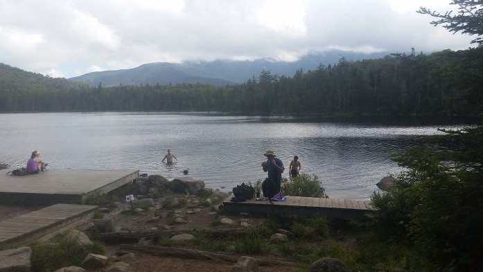
We began the steep descent off the second summit, happy to be shielded from the wind. The trail began a more gradual descent once we came to Lonesome Lake Hut. We stopped to explore the first Hut we encountered since we had read so much about them. The Whites are home to the Appalachian Mountain Club’s (AMC) huts. These large wooden cabins vary in size, but all have many bunks, a full kitchen, indoor composting toilets, and a big dining area all ran “off grid.” The cost, over $100 per night (meals included), tends to put a night in a Hut out of a thru-hikers budget. Thankfully, the AMC allows thru-hikers to do work for stay for free floor space and dinner leftovers. Each hut typically only accepts 2 thru-hikers per night. Snagging a spot can be difficult, and it’s all about timing. This day, we were too early to stick around and wait for work for stay opportunities, but we still popped in briefly to check it out. Our minds were really only on one thing: eating in Lincoln only 3 trail miles away.
Thankfully, these 3 miles only took an hour to complete, and we came to a busy highway. The guidebook indicated a parking area a mile off trail that was significantly safer from which to hitch a ride. We passed under the highway and, once on the other side, we noticed a familiar hiking couple, the Canadians, climbing into a small RV. Exchanging only a glance, BigFoot and I decided to see if there was room for two more, thereby skipping that extra mile to the parking area. As luck would have it, driver and former AT thru hiker, Fat Man Walking, immediately offered us space and a ride to town! Bingo!!
On the drive, Fat Man gave us a description of town and informed us that a man named Chet allowed hikers to camp in his yard for donation or work for stay. We took down directions, said our thank yous, and arrived at a Mexican restaurant for lunch.
Over lunch, we browsed the weather for the upcoming week. Since arriving in the Whites and many, many miles before, we had been praying for good weather in this particular section. Not only do the Whites offer incredible views, bad weather in this section of the trail can be downright dangerous. Think slick rock, steep climbs, skinny ridges, incredibly strong winds, lightning, even snow and ice. Yikes.
I was near tears reading the whole week called for rain. Tomorrow, we had planned on being on Franconia Ridge which boasts three miles of 360° mountain views. I refused to let it be stolen from me. We had come too far, worked too hard not to see this section.
We decided to head to the grocery store and resupply while we still considered what we would do the next day. While walking to the store, I couldn’t believe my reaction to the sun. All of my exposed skin felt like it was on fire. I absolutely had to get out of the sun – immediately.

After picking up our typical hiker supplies, we decided to get second lunch at a nearby McDonald’s and saw many familiar hikers doing the same. Most were heading to Chet’s after, and upon completing more food than I like to admit, we headed over and set up our tent.
Chet greeted us warmly and showed us where to set up camp. About 20 other hikers were there, many of us chatting about the rain heading our way. We rounded off our evening with pizza and beer and went to bed in a happy, calorie coma.
The rain arrived when we awoke. We really didn’t want to take a zero day. Like many others, we had already estimated our finish date and didn’t want to push it back any further. However, there was no point in us missing this section for some arbitrary date. The decision was made – we would take this day off.
It’s a rare and beautiful thing throughout a thru-hike to be around for breakfast time and fill up on my all time favorite breakfast foods. I basically ran my drooling mouth to Flapjacks. The line that ran almost out the door moved quickly.
It was clear by the quick, friendly service and miniature train that ran the entire perimeter of the restaurant that we had made the right choice. I pictured the restaurant enveloped in snow, holiday decorations in full force. They knew what they were doing here.
Our highly anticipated breakfast came out quick despite the large crowd. If you’re ever in Lincoln, NH, Flapjacks is an absolute MUST! Bacon cooked to your liking, perfectly executed eggs, blueberry pancakes with local maple syrup…

Feeling reborn from one of my favorite off trail meals, we left the restaurant and spent most of our drizzly day relaxing at Chet’s. At about 5, a man named Dan showed up with a truck full of hikers returning to Chet’s. Dan was quick to offer a little relaxation time in his condo’s hot tub as well as a cozy bed for the night. BigFoot and I jumped on the opportunity and quickly packed our bags. Soon we were at the nearby condo accompanied by fellow hikers, Glacier Swiss and Cornsilk.
The four of us hopped into the hot tub while Dan made us frozen pizza. Beers were offered. We were stunned by the generosity of yet another stranger. Dan filled the night with questions about our hike as he was planning his 2016 thru-hike. He seemed as happy to entertain us as we all were to be so spoiled. It was truly a perfect, unexpected zero day in Lincoln.
After our night in incredibly comfortable beds, Dan drove us back to the trail. Actually, he stopped on the bridge allowing us to again avoid the one mile walk from the parking area to the trail. Yesterday’s rain was gone, and although a few clouds still remained, we were very excited to be hiking the AT’s famous Franconia Ridge.
The relaxation in town was just what we needed to continue on through the Whites. After a steep ascent, we were soon above tree line, and the views just got better and better. No surprise on this nice Saturday that we were most definitely not alone. Amidst the crowds, we stopped for lunch and took in the sights.
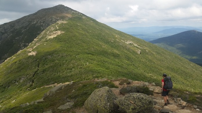

After seeing the views on Franconia Ridge, there was no doubt that we had made the right call by taking a zero due to the rain. For me, I couldn’t have asked for better weather. A day of full sun would have led to more sunburn. I was very grateful for the clouds.
We descended the ridge and climbed Mt. Albert, our final challenge for the day. We arrived at Garfield Ridge Shelter, did our typical chores, and went to sleep feeling very blessed by the day’s sites.

The next morning brought more clouds but no accompanying rain. We set out for the day intending to hike either 10 miles and snag a work for stay spot if we were lucky or an additional 5 miles to a campsite. We set out at a slow pace. Nearly two hours later, we arrived at Galehead Hut a mere 2.7 miles from where we started.


We continued to follow the trail down Twin, knowing Mt. Guyot was ahead. After reaching the summit, we decided to take another rest and eat some lunch.

After lunch, we were back at it. It was around this time I started to notice the lack of white blazes, but being in the Whites, that was not too uncommon. Through this section, the AT follows several pieces of locally named trails with very scant white blazes. Checking your guidebook often and even carrying maps is advised. However, we walked on.
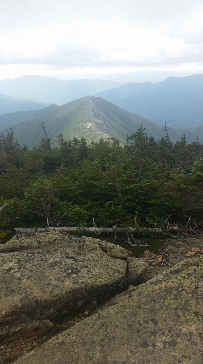
When we saw the view above, the idea of white blazes escaped my mind. We get to go over there!? We were stoked to walk another beautiful ridge line, and we took off quickly to discover what lie ahead.

We continued descending the ridge until we arrived at the cliffs. Then, it was picture time at this EPIC location in the Whites.

Well, time to keep walking as usual. Eventually, we came to a line of pine trees and began to descend off the beautiful ridge we were hiking. Soon, we were back under the treeline once more in surrounded by woods. We hiked on wondering if we would be the lucky hikers to get the work for stay positions at Zealand Falls Hut that we should be arriving at any moment.
Suddenly, the trail narrowed. We wondered if we were supposed to cross the adjacent stream. BigFoot checked it out. Nope. We kept walking and discovered blue blazes on the trees in front of us. Why were there blue blazes? Maybe we just missed the AT.
We turned around looking for the branch in the trail we must have just missed. Have you seen any white blazes recently? Hmm.. neither of us could remember the last one we saw. Thankfully, another hiker we had been seeing throughout the day was approaching.
“Hey. Did we just miss the AT??”
“Um… you missed the AT on Guyot..”
Oh. Shit.
BigFoot was quick to respond, “We’ve been hiking for 4 hours since then!”
“Um.. yeah, you have.” The hiker replied also noting that she was a former caretaker at a shelter in the park.
I guess she was a blessing to us. Not everyone would have known where we were. We most certainly didn’t.
Frustration was boiling inside each of us knowing that we had to retrace every foot step that we had walked over the past four hours. And most of the footsteps were downhill meaning we had to rescale a mountain to get back to the AT only to climb down the mountain on the other side. Stupid.
Well, now what? We were thankful that our “detour” landed us by a beautiful water source, and with a little exploration, we found a well broken in stealth camping site. We were done hiking for the day, and we would fix this problem in the morning.
“Do you still have that whiskey?”
BigFoot did, indeed, still have the half pint of honey whiskey Claudia had gifted us just days before. Detour, you became a hero in our detour.
The whiskey did its job, and soon smiles spanned from cheek to rosy cheek as we glanced our pictures we had taken that afternoon.
In the morning, we left camp, and for the first time on this trip, we began retracing our steps. We arrived back on the beautiful cliffs, this time the view covered in wind whipped clouds. We crossed a group of hikers we had seen yesterday and explained our mistake. They actually had a trail map and showed us where we were and where the AT was. This is what we learned…
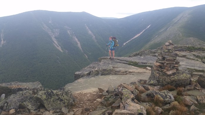

By 11, we made it back to that spot you can see above and returned to the AT. Our mistake cost us an entire afternoon and an entire morning to fix. Yes, of course, we were frustrated. But, we gained a pretty good story and were happy to show off the pictures from Bond Cliff, one of our most treasured spots from our trip on the AT… which is not on the AT.

Pingback: Through The Whites | Infinite Geography