
Thruhiking the Arizona Trail: Flagstaff to Utah

From Flagstaff in the snow around Mount Humphrey’s to the bottom of the Grand Canyon and, at last, reaching the northern terminus, this final section in Arizona had a little bit of everything. Here’s our trail recap of the final 250 miles of the Arizona Trail…
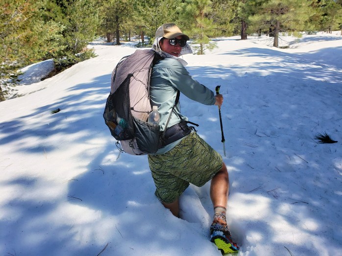
Day 25. After our nero + zero combo in Flagstaff, we resumed hiking towards Mount Humphrey. It was a beautiful day with easy trail, that is until we hit the snow. Suddenly we found ourselves slowed down around 1 mile per hour walking across a trail buried in snow, post holing at times up to our waist. The snow lasted about 6 miles, 6 very slow and long miles. We were elated to drop down in elevation enough to resume hiking a dirt trail. The trail turned into a gravel road, and we were able to make up some time. 33.2 Miles.

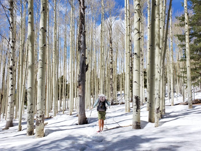
Day 26. The wind picked up overnight and continued on throughout the day. As the sun was rising, we noticed ominous clouds growing bigger, the temperature dropping, and the wind steadily increasing. After our mid morning break, we walked on a series of dirt roads the wind becoming a downright nuisance. Then the snowflakes started falling, and we were suddenly in white out conditions walking as fast as possible to keep warm. The cold distracted us from keeping good track of our turns which brought me to my most annoying moment of the AZT – going 1.5 miles in the wrong direction and turning around to return to trail with the wind strong enough to push me over blowing directly in my face. We put in 35.6 trail miles and 3 extra off trail miles on this very annoying day.


Day 27. We had 28 miles to get to the town of Tusayan just south of the Grand Canyon. About halfway through the day, we arrived at Grandview Firetower for our first glimpse of the canyon we would hike through the following day. After a quick break, we pushed on to Tusayan feeling good about completing 28 miles by 3 PM. We decided to get a fancy hotel for the night, excited for our trip into the canyon the next day.
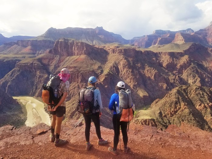
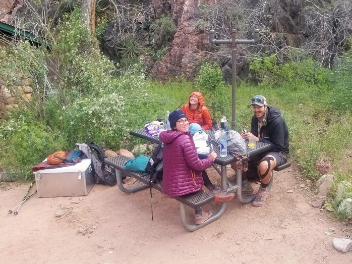
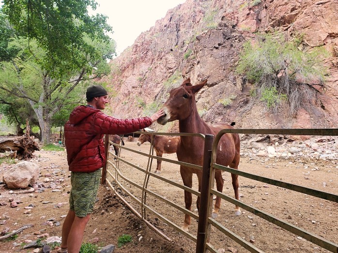
Day 28. Woohoo the long awaited Grand Canyon was here!! We hiked the 6 miles into the park and arranged our backcountry permits so we could spend the night at the bottom. The AZT takes the South Kaibab trail down about 6 miles and 5000 ft across the Colorado River to Bright Angel Campground. From Bright Angel, it’s 13.5 miles up 7000 ft to the North Rim via the North Kaibab trail. We wanted to maximize our time in such an epic spot, so we were thrilled that the park is so accommodating to AZT hikers. Any other tourist would have to wait a couple days for a walk in permit, but AZT hikes are eligible for a “stock site” camping permit the day they walk in (space permitting). We got out permit and resupply, then made our way down the 5000 ft into the canyon.


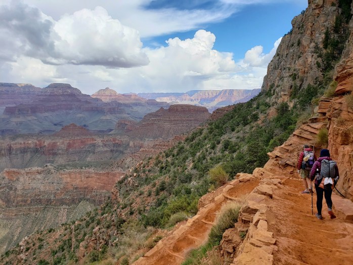
My jaw dropped as we descended further and further, audibly wow-ing my way down. The Grand Canyon is one thing to see from the rim, but an entirely different experience to see from inside. Its size and depth are unimaginable, the views completely unbelievable. Around every corner, the sights changed as the canyon was exposed in different ways. This was one of my favorite days of hiking to date. We ended our 15.5 mile day near the Colorado River at the bottom of the Grand freaking Canyon.

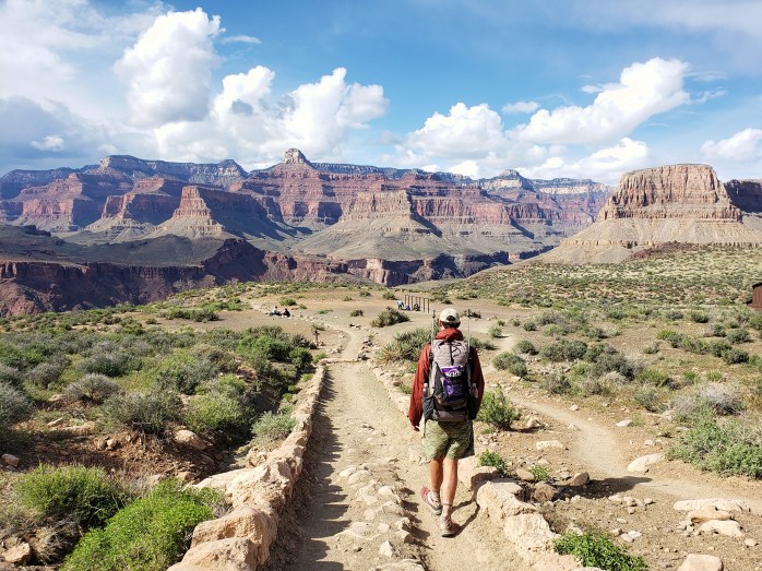


Day 29. 33.9 Miles. We started our morning just as day was breaking. We usually start a little earlier, but didn’t want to miss the views as we made our way up the canyon. The first 6 miles of walking were only moderately inclined which made for a very enjoyable walk as we gazed up at the canyon walls surrounding us. The next 7.5 miles were considerably steeper, but being a National Park, the trail was immaculate. We actually quite enjoyed the long, steady climb up the canyon, still in awe of the views surrounding us. As we neared the North Rim, the South Rim came back into view with Mount Humphreys in the distance. By 11 am, we made it out of the canyon to the snow covered North Rim feeling proud of our quick pace up such a massive climb.


At 9000 ft, the North Rim and Arizona Trail were completely buried under snow. The adjacent road, however, is plowed until the park boundary, so from the perfect trail in the Grand Canyon, we started a very long road walk. At the park boundary, the plowed section ended, and we spent the next couple hours walking on top of snow.


After two very slow and annoying hours, the road resumed being plowed. We took a dinner break in the middle of the closed highway scooping water from the snowmelt trickling down the highway and wondered if we’d be camping on snow covered ground that night. Knowing there was a small general store ahead still closed for the season, I made a lofty, hopeful prediction that the owners would be there doing preseason inventory and would let us sleep inside.
We approached the store an hour later as the sun was setting and the cold was getting serious. As the store came into view, we immediately noticed the truck in the driveway and people carrying boxes. Though the store wouldnt open for another month, the owners had arrived that day to start putting some things in order. We asked if they knew of any camping nearby not covered in snow, and they immediately offered to let us sleep in the store overnight. Nailed it! Hallelujah.
Day 30. We resumed our long highway walk, hitting nearly 4 miles per hour on our second to last day. We had 30 miles of road walk before we would hike our final 27 miles of actual trail to complete the AZT. The day was uneventful as we pushed our pace to put this fairly boring road walk behind us. The morning turned to afternoon as we came to the end of the road closure at Jacob Lake. As we approached the lodge / cafe, a couple cyclists struck up a conversation offering up congratulations for being nearly done. They were a local couple and quickly offered the number of a couple of trail angels in nearby Kabab. We thanked them and went inside to slam French fries and soda. Within the hour, we had a ride setup for us the following day from the northern terminus. We resumed our walk, finally returning to dirt trail and camped for our final night on the AZT. 36.9 Miles.
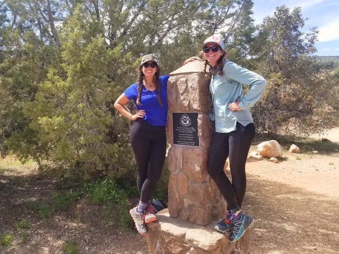
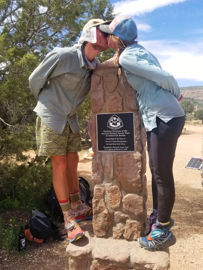
Day 31. Our final 20.3 Miles began a little later than usual. Our ride was scheduled for 2 PM giving us ample time to walk the mostly flat and downhill miles. We took a couple of snack breaks along the way, reminiscing about our month on trail and dreaming up our next adventure. About 5 miles from the state line, we crossed paths with a Hayduke hiker. One Gallon was happy to chat with some hikers as he’d been a little lonely out on the Hayduke. It didn’t take us much time to realize we were talking to a hiking superstar. At maybe 60 years old, One Gallon is using the Hayduke as a warm up for his upcoming PCT thruhike. It will be his fourth time completing the trail which will also complete his Quad Triple Crown. So that’s the AT, PCT, and CDT FOUR. TIMES. EACH. He’s probably the most accomplished and humble hiker I’ve ever met. After gabbing for a few minutes, we parted ways and eagerly scurried to the northern terminus.
As we neared UT, we descended into a campsite near the Antelope Canyon trailhead (famously “The Wave”). The red rock was vibrant against a bright blue sky. We found ourselves a little sad we weren’t continuing north through Utah to discover all the secrets of nature that state holds. We counted down our final three miles as we walked, and suddenly, the terminus was in sight. We were done with another trail, another adventure.


While celebrating our finish, we were approached by 2 men who volunteered checking permits for nearby Antelope Canyon. They gave their congratulations and quickly offered beers for now and a bottle of wine for later. Awesome. Lynn arrived shortly, also with beers. 😎. Not too long after, she drove us to Kanab about an hour away. We stopped for groceries before she brought us to her house were the bottom floor had been dubbed “Chateau Relaxo” which was a hiker’s dream come true. Lynn and her husband Richard were true angels. We were so grateful for a place to stay, clean up, and for letting us use the kitchen! The kindness of strangers will never cease to amaze me.
The next day it was time to begin making our way back to our van in Phoenix about 6 hours away. Luckily, it only took two hitches, and three of us arrived in Phoenix just before midnight. (Thanks Maya and Felix!!)

Days before when climbing out of the Grand Canyon, our group had commented about how seemingly easy that climb had been and how “doable” a double crossing seemed. With the physical ability and geographic proximity, should we just go for it?
The idea had been planted in our minds and started to take root. We just couldn’t shake the desire for the athletic challenge and to revisit the breathtaking scenery inside the Grand Canyon. So, for whatever reason, we picked up our van and immediately returned to the National Park we had been in just days before…
Full Grand Canyon >< Double Crossing >< story coming very soon!!
We are Bekah and Sean (Micro and Bigfoot), and we just finished a thruhike of the Arizona trail! Follow our updates here or on Instagram.

Pingback: Western Wildlands ROUTE Segment 8 – Globe, AZ to Grand Canyon, AZ – Infinite Geography
Pingback: Western Wildlands Route Segment 7 – Grand Canyon, AZ to Kanab, UT – Infinite Geography