
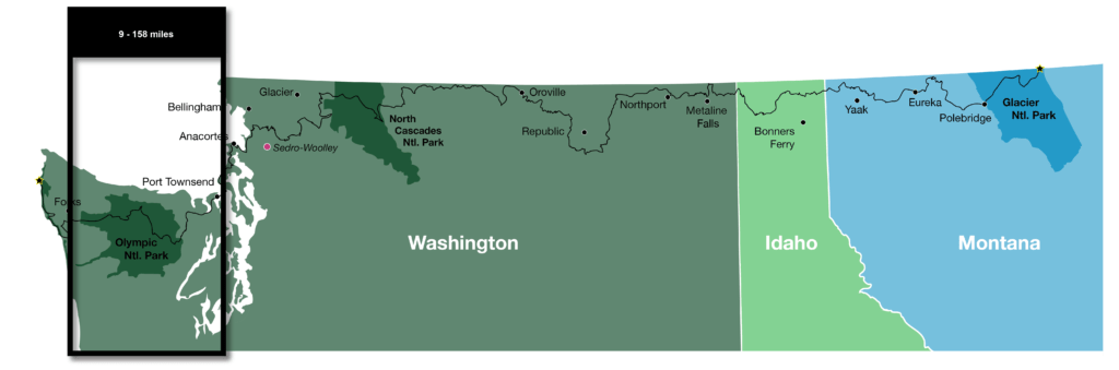
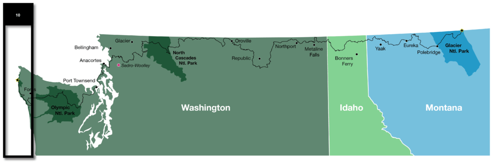
Pacific Northwest Trail Sections 9 & 10 – Olympic National Park

We’re wrapping up a westbound thruhike of the ~1200 mile Pacific Northwest Trail (PNT) as part of a group of six lean, tan superheroes. Read our experience hiking through Olympic National Park from the high mountain passes to the 60 mile beach walk to finish our thruhike at Cape Alava.
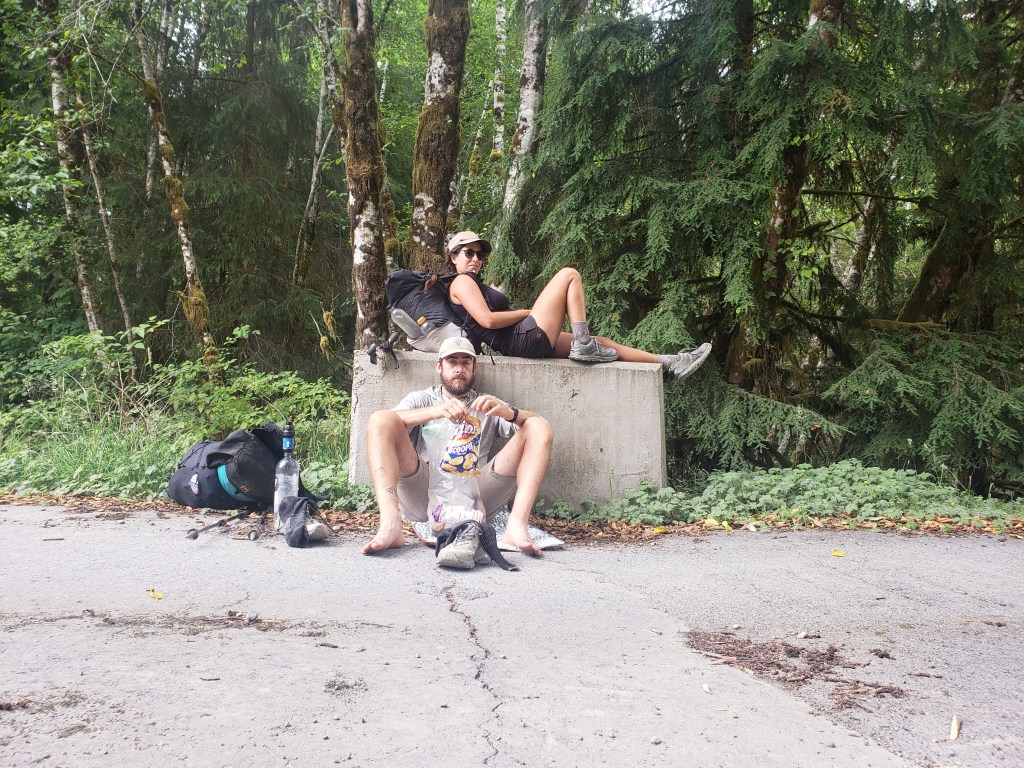
Day 46 – 26 Miles / +9400 ft elevation gain
We woke up on the side of a forest service road with just a couple miles of dirt road ahead of us until we reached single track. After over a hundred miles of “urban hiking” in section 8, we were ecstatic to reach a trailhead and resume walking on dirt. Of course, the trail shot straight up, but we didn’t mind. A steep climb into the Olympics was welcome.
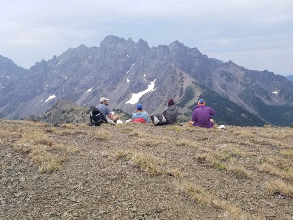
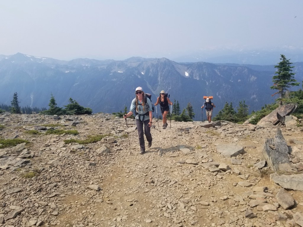
We spent a beautiful day hiking a series of climbs and descents noticing more and more people as we hiked. Our final climb of the day was up Marmot Pass which gave us incredible views of the surrounding mountains. As we began our descent, we noticed a picture perfect campsite with room for just one tent. This was only one of the few nights the whole crew didn’t camp together, but this campsite was too good to walk away from.


Day 47 – 24.2 Miles / +9300 ft elevation gain
In the morning, we caught up with the crew a couple miles down trail and experienced one of our only rainy mornings of the thruhike. Thankfully, the rain was short lived as we climbed up another pass. At the top, we took our morning break in awe of our surroundings. Suddenly, I spotted movement on the ridge in front of us, and we got to watch a bear scale the mountain and saunter along. In a nearby valley, Sean spotted a second bear from the same vantage point. We left the pass in high spirits and continued on.
During the descent, we crossed the official Olympic National Park boundary which requires us to preplan our campsites for permits. As a group, we decided to slow down a little to really soak in our final section of trail which meant we could have a little more leisure time throughout the day.
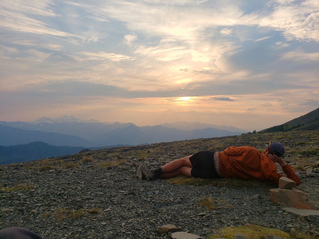
As we approached Hayden Pass, we decided to follow an alternate route that would keep us up higher and take us to Hurricane Ridge so we could hitch to Port Angeles for resupply. We took the alternate trail towards Lost Pass where we immediately started climbing up 1200 ft in 0.7 miles, one of the steepest sets of switchbacks I’d ever seen. After a short flat-ish section, we gained another 1000 ft in a mile bringing us to the top of Cameron Pass. From the top, we got our first good look at Mt Olympus and its glaciated peak. We lingered for a bit of the sunset before a steep descent into camp.

Day 48 – 17.8 Miles / +5600 ft elevation gain
We awoke with a short day ahead of us as we aimed for the Hurricane Ridge Visitor Center to get a ride to Port Angeles. We saw Gusha washing his shorts in a nearby stream. Apparently, he had an overnight visitor. He awoke in the night to find his stuff ravaged through and shiny eyes staring him in the face. After our bear sightings the day before, panic struck. It didn’t take long to realize, though, that it was a deer standing over him. The deer had stolen his hiking shorts and was enjoying a salty treat. In his underwear and headlamp, he chased the deer until he relinquished the shorts while the rest of us slept through what would have been a hilarious event to witness.
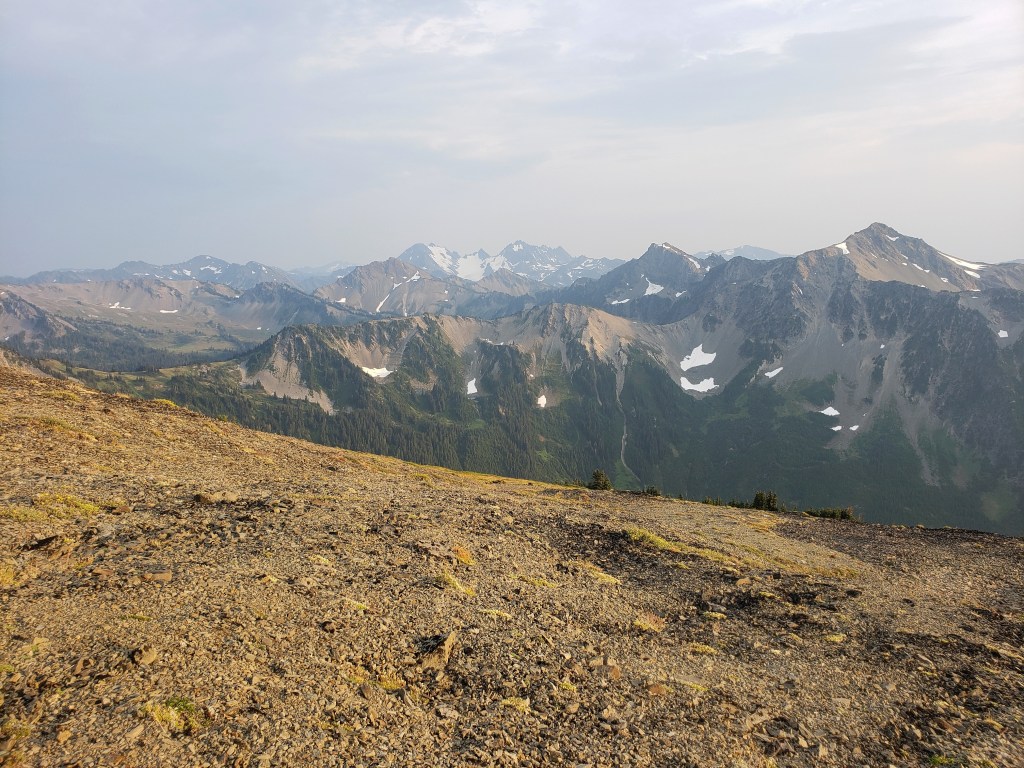
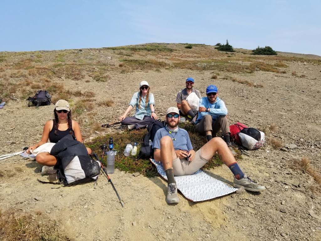
We had two big steep climbs to conquer before we reached an eight mile stretch of dirt road. First up, 2000 ft of gain in a mile and half. After a short break at the top, we headed down to start the next pass. In between, a gorgeous small lake called to us for a quick skinny dip to cool off. We were immediately sweating bullets again as we climbed the next one – 1500 ft of gain in a mile and a half. We had incredible views from the ridge but did notice a little haze from wildfires far south from us. A couple miles later, we made it to Obstruction Point trailhead and the remainder of our day was on dirt road heading towards the visitor center. Just as I arrived at the parking lot, the group had managed to get us all a ride. I hopped into the middle of the sardine pile in the back of a pickup truck as we spent the 20 mile ride trying to make each other as comfortable as possible. We decided to stay in town for the night to clean up and take care of our remaining Olympic NP permits the next morning.


Day 49 – 20 Miles / +3500 ft elevation gain
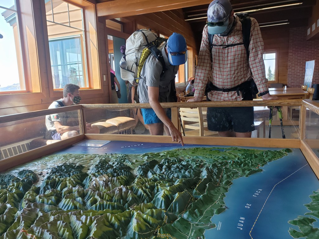
We headed to the ranger station on the outskirts of town to arrange our permits for the final few nights of the hike. The ranger who assisted us was incredibly kind, patient, and knowledgeable about what we would need to do. As we approached the coast, it was imperative that we make a plan that would accommodate the tide charts as certain sections were only passable at low tide. With a plan hatched and permits in hand, we started hitching. It only took a few minutes to get a ride up Hurricane Ridge, and we continued on our way.
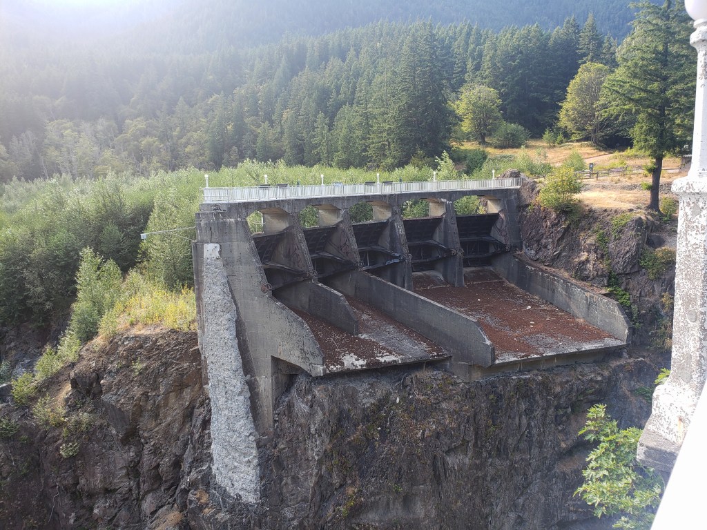
We started our 20 mile day at noon with a long stretch of sweeping downhill switchbacks that ended on gravel road adjacent to the Elwha River. We stopped to check out the 210 foot tall Glines Canyon Dam which was removed in 2011. Two sides of the dam remain, but it no longer crosses the Elwha. We started a gradual climb up a gravel road and spent the final two miles on a beautiful wide trail which brought us to Olympic Hot Springs. It was dark when we arrived, but we still wanted to go for a dip. The six of us found a natural pool hotter than any hot spring I’d ever been in to take a quick, relaxing soak. What a way to end the day.


Day 50 – 28.1 Miles / +9200 ft elevation gain
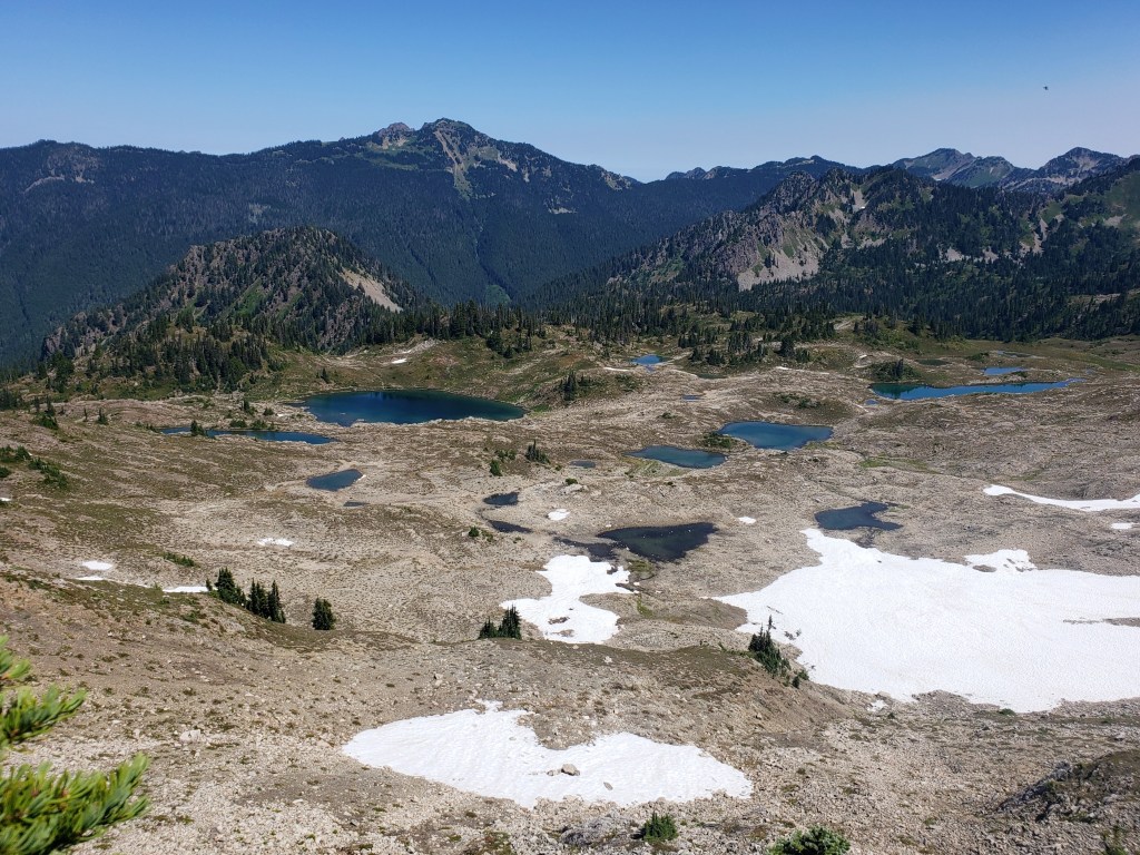
We woke early and started climbing right away. We knew this would be our last real day of climbing and big mountain views before we headed to sea level for the remainder of the hike. Our first climb up Appleton Pass was considerably less steep than what we had conquered in the last few days but seemed to take forever to reach the top. We did a quick descent, then headed up our next big climb which gave us incredible views of Mount Olympus and its glaciers as well as several glimmering lakes in the Seven Lakes Basin area. We took a long break before our hike resumed on the ridge. Before we knew it, we started a huge descent and said goodbye to the high mountain passes. We camped in Hyak Shelter for the night reminded of our days as baby hikers on the Appalachian Trail.


Day 51 – 23.7 Miles / +3000 ft elevation gain
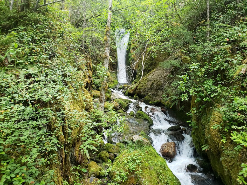
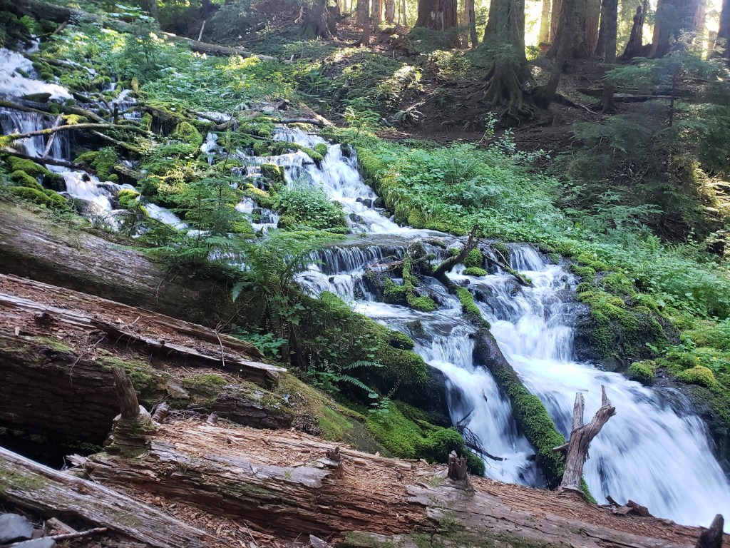
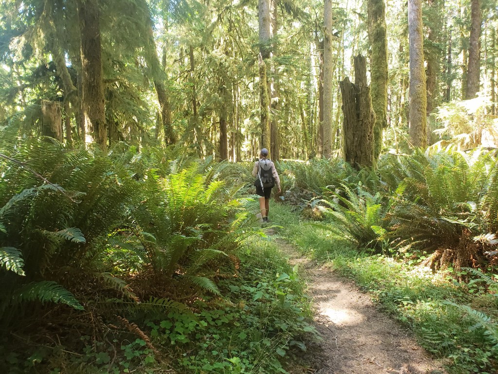
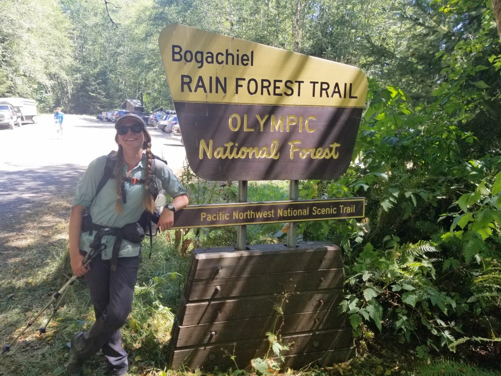
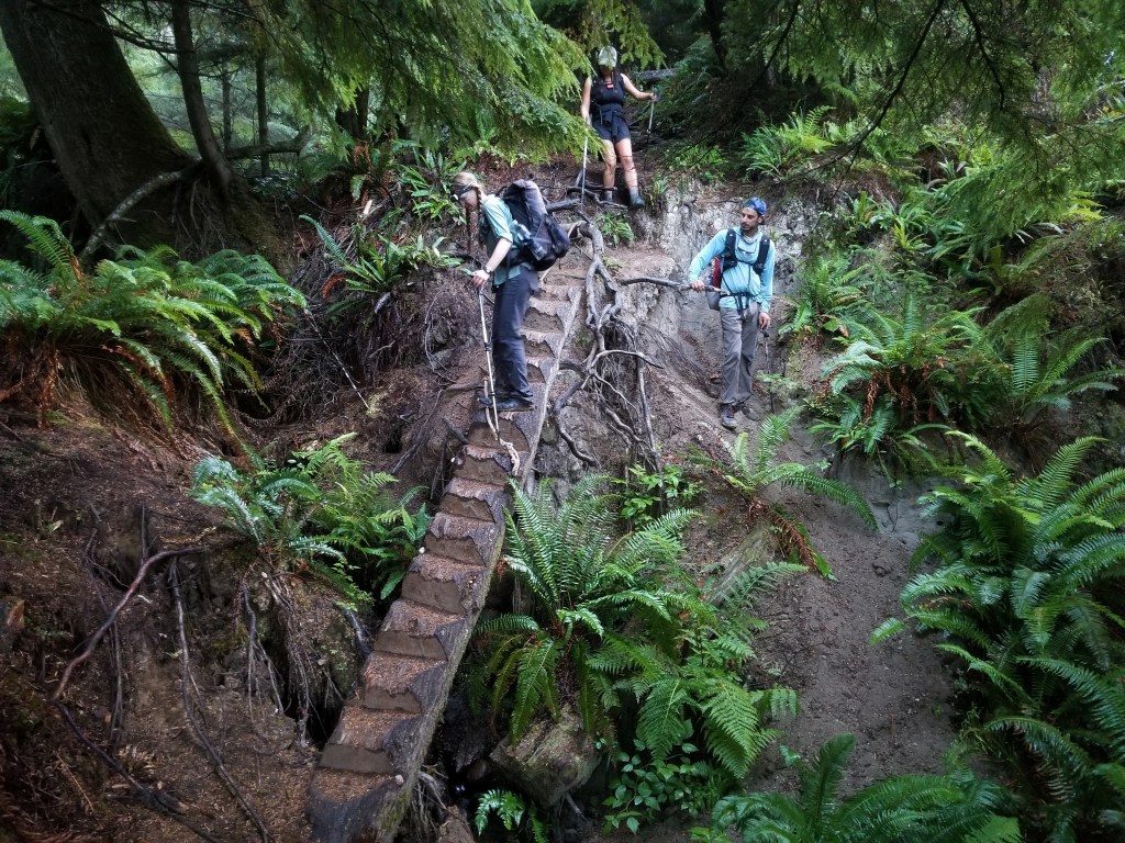
We had a beautiful morning in the lush forest and enjoyed the ferns, mushrooms, and moss that decorated the forest floor. Our walk was simple and pleasant as we briefly exited the national park boundary. In the afternoon, we walked gravel road until we hit the 101. From here, we hitched a few miles to Forks for our final resupply. After a bit of town loitering, we made it back to the trail at Bogachiel State Park where the friendly ranger let us camp in the day use shelter. Our lucky streak continued when a couple of PCT long section hikers and trail angels dropped off beers for our evening. Hot showers, town food, and beers are likely the best way to start the final section to the terminus.

Day 52 – 23.3 Miles / +2100 ft elevation gain
We woke up knowing our day was limited to where the PNT reached the Hoh River at the Pacific Ocean. Right past the Hoh, the trail walks along a beach lined by cliffs. The only time it is able to be crossed is at low tide giving us a window between 4:00 – 6:00 am to get out of there. Therefore, we planned to camp right before the crossing and get up extra early to tackle the challenge the next day.
We just had 23 miles ahead of us with relatively little climbing. We got a later start than usual and walked a couple miles on the highway before heading down gravel logging roads. The sky remained overcast all day with a couple intermittent rain drops. Mostly, the walking was uneventful and a little dull as we eagerly anticipated the next day on the beach.
A sprinkle of rain started as we walked adjacent to the Hoh River and reached a trailhead by the national park boundary. We found a lovely campsite in the trees and went to bed early.


Day 53 – 28.5 Miles / +2000 ft elevation gain
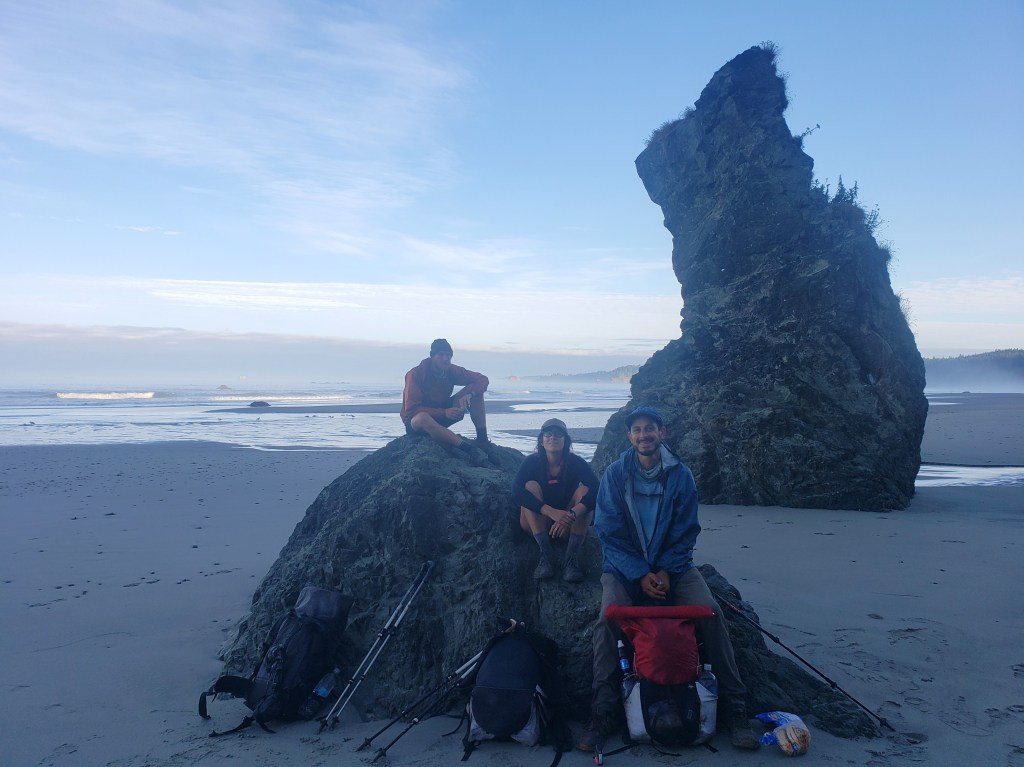
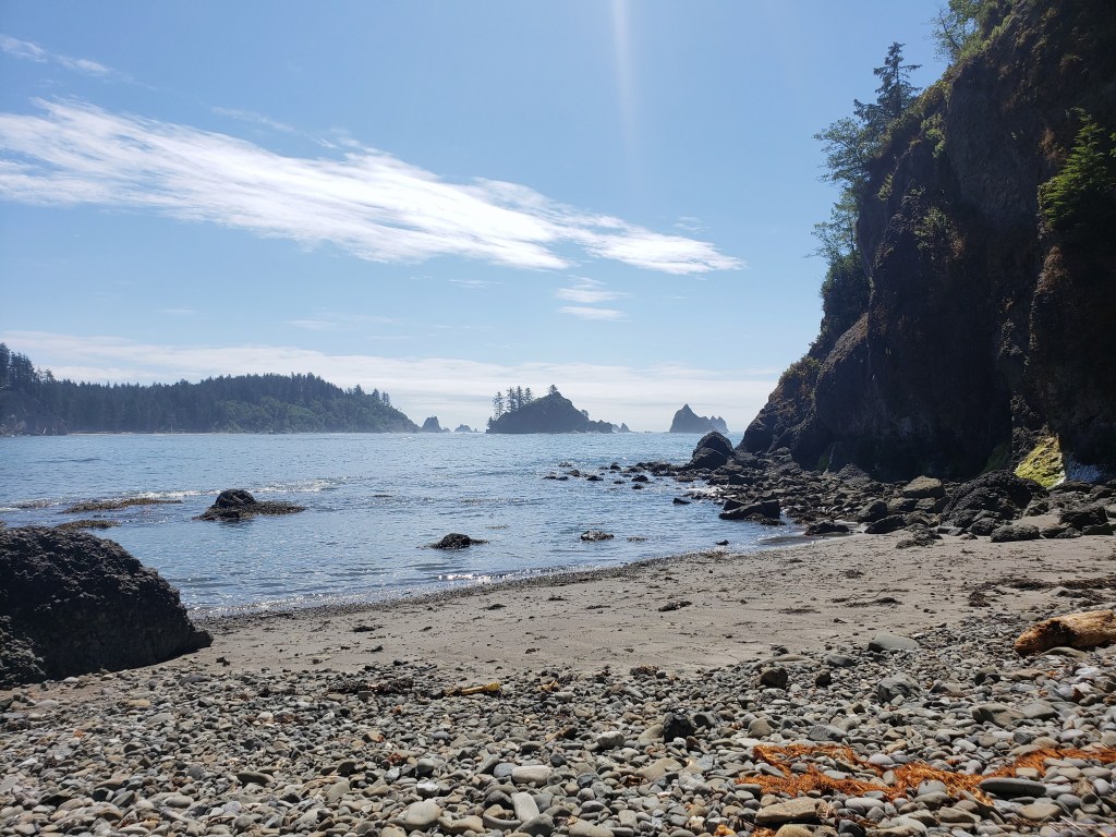
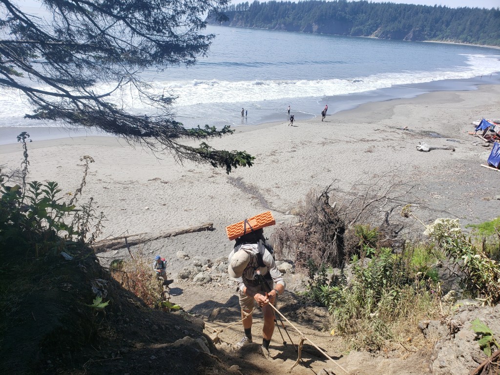
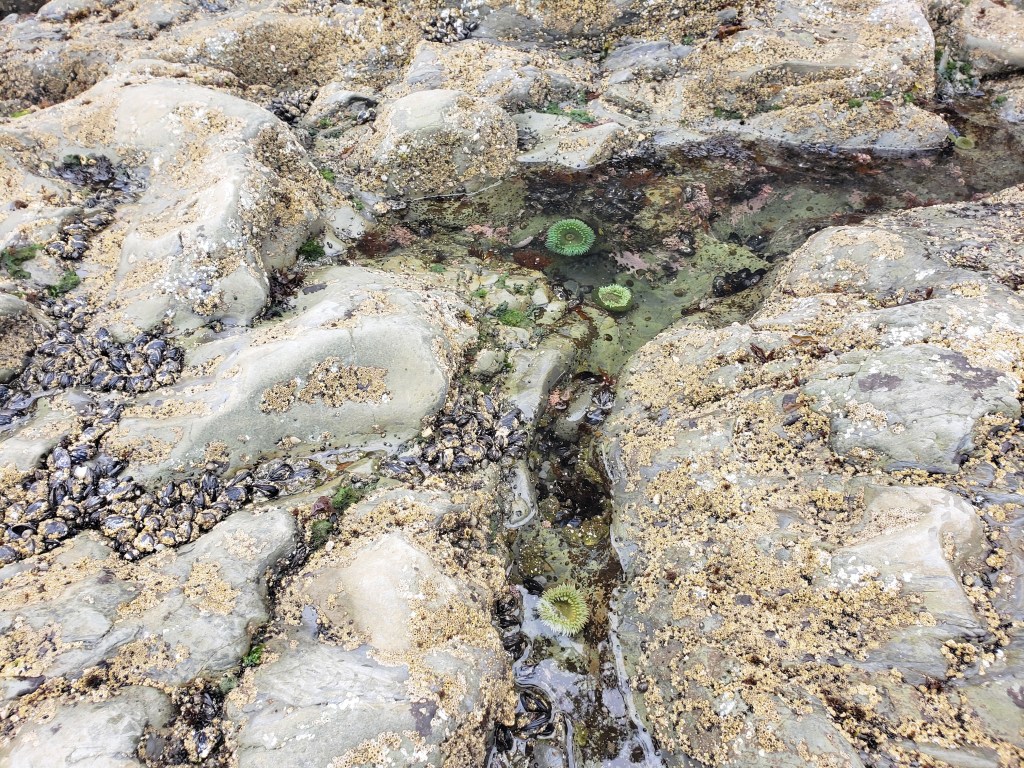
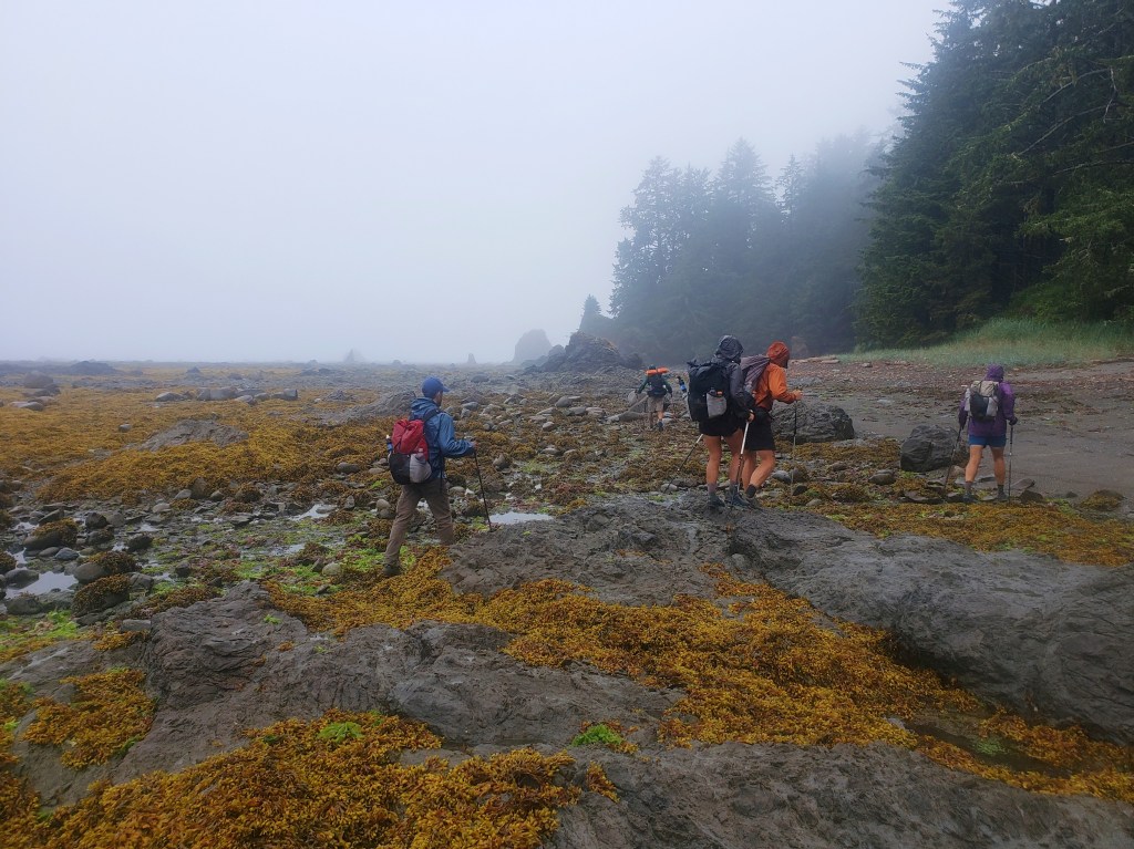
In a slight drizzle, we packed up camp and were ready to hike at 4:00 am by the light of our headlamps. Within a mile, we were on the shore of the Pacific Ocean amazed we had walked here from the Continental Divide. We gazed at the cliff walls to our right and an endless ocean to our left. I shuddered to think about the tide coming in. We made a strict no man left behind policy as we rock hopped and climbed over driftwood. At one point, I chose a slightly different direction thinking it would be a little easier to navigate the obstacles. As I climbed over piles of driftwood, I smelled something foul at my feet. Suddenly, I saw bones and realized I had climbed into a decaying whale carcass. Though no tissue remained, the huge bones were a giveaway. I looked up to notice my group getting further away from me. In a slight panic, adrenaline kicked in and I started hopping driftwood like hurtles attempting to escape the smell of decay and the prospect of being separated. Thankfully, I was quickly back in line. We continued to cross slippery rocks and gaze into tide pools filled with anemones, sea urchins, and star fish. The beach finally came to an end with a big bluff and a rope assist for the steep climb putting the sketchy tidal crossing behind us.
Our morning turned to afternoon all in a similar fashion – a stretch of beach walk followed by a short steep climb into a stretch of rainforest. Several ropes helped assist our climbs and descents from the bluff. High tide came in at 1, so we timed our lunch accordingly so we could safely return to the beach.


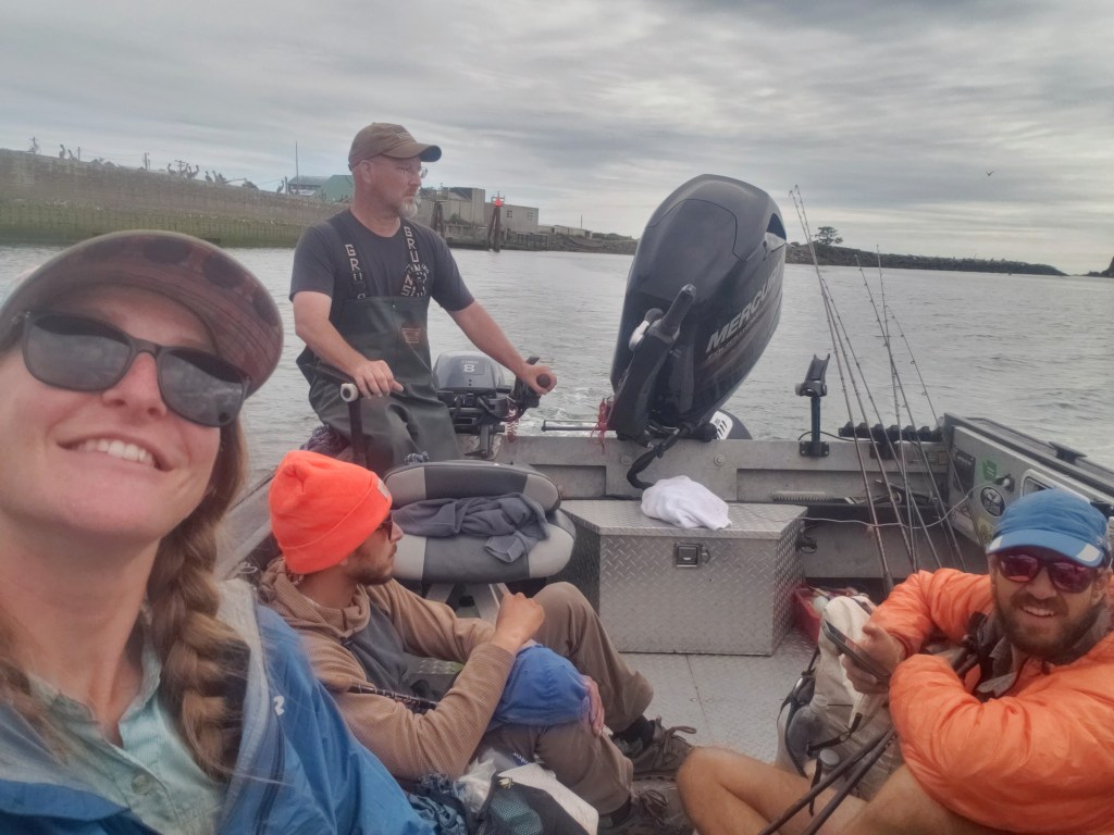
In the afternoon, we walked into the tiny Quileute Native community of La Push where we loitered at a convenience store, then headed down to the marina to try to hitch a boat ride. The official PNT route crosses the Quillayute River via boat, but there isn’t a public ferry. The option is to find a nice local fisherman to putt you across, or walk 4 miles on highway around. We arrived hopeful, but didn’t find anyone right away. Thankfully within about 10 minutes, a couple of curious fisherman volunteered to take us the five minute ride across. We offered them some cash for their help, but they refused. We thanked them for saving us an hour and a half of walking, and continued on our way up the beach.
We weren’t surprised to see lots of people out on the beach near Hole-in-the-wall camp, a popular destination for weekenders and whale watchers on a Friday night. We continued on, trying to keep our final day as short as possible knowing there was rain in the forecast. We arrived at Norwegian Memorial Camp after some slow rocky miles and setup our final campsite of the journey. Rain started to fall just as we went to bed.


Day 54 – 15.3 Miles / mostly flat
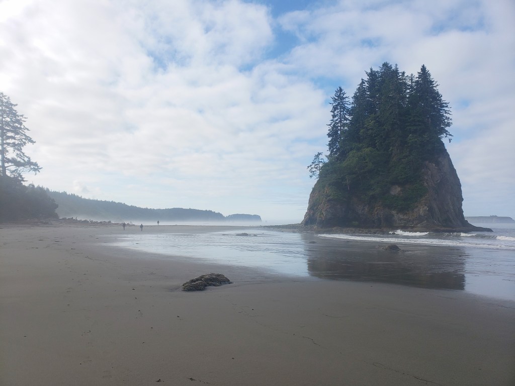
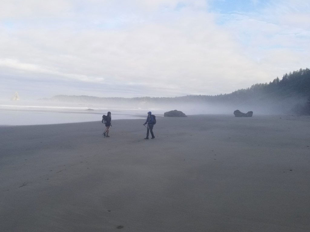
It was just past 4:00 am as we set out on our final 12 miles to Cape Alava, the western most point in Washington and the western terminus to the PNT. As anticipated the rain drizzled on us as we walked. Thankfully, the tide was low and wouldn’t interfere with our day. It was somewhat of a dreary morning, but thankfully wasn’t too chilly or windy. The rocky miles were slow, and we didn’t bother rock hopping. It was pointless to try to stay dry, so we just walked straight through the puddles. Most of us took more than one fall on the slippery rocks as we made our way. I was stoked to see intermittent stretches of sand ahead of us as the rocks were making my feet throb. At one point, I looked up to see what I thought was Gusha and Philly insanely far ahead. I looked again – it must be other hikers. Nope, that’s a bear on a morning beach walk. The crew got to witness the black bear enjoying his morning stroll without a care in the world for us.
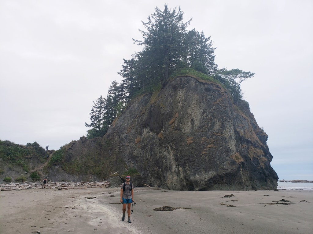
As the morning hours ticked away, we took a final morning break as a group with just three miles to go. The walk seemed over in an instant, and we all grouped up to walk the final .1 to Cape Alava together. Not gonna lie, Cape Alava is really nothing special – another beach with a large rock. No monument or really anything denoting the Pacific Northwest Trail. Just a rock and six wet, haggard hikers rejoicing that the journey was over.
All the moisture prevented me from using my touchscreen too much, so I just have a few pictures. But I’ll never forget that moment of being done after battling intense heat, bushwhacks, long road walks, and extreme climbs. After a few pictures, we headed east towards the forest for our extra 3 bonus miles to the trailhead.
An hour later, we were officially done walking, another thruhike in the books. We found ourselves in the middle of absolutely nowhere with the gang. Thankfully, there was a little camp store with coffee and beer which we enjoyed while trying to hitch a ride. With very little traffic, it took about 2 hours to find a ride. We spent our last few minutes together appropriately on the side of the road as “The Six” before splitting up to go on with our lives. As we departed ways, I found myself in a state a shock to say goodbye to our four friends we had spent every minute of the last 54 days with. We literally knew every time each other pooped, what thinking, how feeling, and what doing. It was a terrible way to say goodbye, and I regretted not booking a hiker rehab Airbnb somewhere to spend a last night together.
It took Sean and I two hitches to get back to society at Port Angeles. We grabbed some food and made a sign for Olympia hoping for one ride to get us the 2+ hours drive to visit our friend before flying away back to our van. Within 10 minutes of hitching with the sign, we were super lucky that James and Cheri (I hope I’m remembering those names right!) thought we looked normal enough to pickup and offered us a ride all the way to Olympia. They had just returned from backpacking in the park and were overly nice. The trail provides!! We spent a couple nights in Olympia hosted by our friends Natalie and Josh before Natalie drove us to SeaTac way early in the morning cause she is a dope friend.
Now, let’s get back to that van we’ve been dreaming about…


Pacific Northwest Trail Sections 9 & 10 – Overall Experience
Wow, Olympic National Park is a backpacker’s dream. It truly has all the natural features you could want – endless mountain views, glaciated peaks, temperature rainforest flora and fauna, plentiful wildlife citings, sandy beaches, fun rope assisted climbs, and sweeping ocean vistas. Dealing with permits and designated camping puts limits on daily mileage, which isn’t too big of a deal, but isn’t the standard hike till you drop game plan that we’re used to abiding by. Nevertheless, we simply had a blast through these sections from busting our butts on the steep high mountain passes to timing our beach crossings with the tide. We got lucky with the ranger in Port Angeles who was incredibly knowledgeable and helped us plot out the days on the beach. Olympic National Park is clearly a trail highlight and finishing the PNT with a 60 mile coastal walk was the most unique finish to a trail possible.
PNT Cumulative Stats
- 54 Total Days
- 5 0-mile Days
- 1180.5 Miles
- 231,700 ft elevation gain
- Average Daily Movement (w/o 0-mile days)
- 24.1 Miles
- 4700 ft elevation gain
Click here for more stories from the PNT.


This sounds like an absolutely exhausting, brutal, and amazing experience! I’m so impressed and I’ve really enjoyed following along and seeing photos of all the scenery. Congrats on a great accomplishment!
Thank you for the kind words! It was a doozy for sure. Probably the most challenging trail we’ve tackled. Glad to have you following along 😊
Congratulations on another adventure completed. And a big shout out to All of the Sixers….. The Crew congratulations
Thank you and thanks for your help as always with a couple boxes!!
Pingback: Pacific Northwest Trail Olympic National Park: A Comprehensive Guide - nationalparks.tours