
What You Actually Need for a Thru-Hike

When it comes to gear, I must admit that I get very overwhelmed very easily. I wanted to make a short and concise list of what the heck you actually need in your pack. If it’s not on this list, you probably don’t need it. I’ll get into the specifics of these categories in another post, but consider this your check list.
- Backpack (no bigger than 50 L, around 40 is better) and Rain Cover
- Your New Bedroom
- A tent or hammock
- Footprint for tent, tarp for the hammock
- A sleeping bag
- A sleeping pad
- Your New Kitchen
- Backpacking stove
- Fuel for said stove
- A cooking pot with lid
- A bowl
- A long handled spoon
- A small pocket knife
- Stuff sack for food
- Water Purification and Storage
- Aquamira or Sawyer Squeeze are the best options
- 1 L Smart Water bottle
- 1 or 2 1 L Platypus Bladder for extra storage
- Your New Wardrobe
- Hiking Outfit
- Pants / Shorts
- Shirt
- Underwear / Bra
- Socks
- Trail Runners or Boots
- Rain Jacket
- Buff (optional)
- Camp Outfit
- Pants / Shorts
- Shirt
- Warm Base Layer Long Sleeve Shirt
- Warm Base Layer Tights
- Underwear
- “Puffy” (Down) Jacket
- Wool Hat
- Gloves
- Socks
- Camp Shoes (Crocs)
- Stuff sack for clothing
- Hiking Outfit
- Trekking Poles
- Miscellaneous
- Toothbrush and toothpaste
- Dr. Bronner’s All Purpose Soap (2 oz)
- Nail Clippers
- Bandaids
- Ibuprofen
- Guidebook / Maps
- Small Pack Towel
- Headlamp
- Small wallet
- Pen / Small Notebook (optional)
- Phone / Camera and Charger(s)
Be prepared to spend some serious cash. Backpacking gear is not cheap. For our AT thru-hike, we spent about $2000 each!! Not all expensive gear is good, but all quality gear is expensive. The more you can invest in gear, the better the quality will be and the lighter your pack will be. Don’t forget, pounds = frowns! The lighter you can get your pack, the happier you will be – I guarantee it. Happy Hiking!!

My Favorite Part of the Appalachian Trail

It’s been three months since I stood on top of Katahdin in a dream-like state after completing my thru-hike. I can’t deny saying that I’m really still processing everything, and the adjustment back into day to day life hasn’t necessarily been easy.
To most people, well, I probably shouldn’t complain. I’m just now starting work after having the past nine months off which has been pretty awesome but, admittedly, a little boring post hike. But with or without a formal job, the way I view day to day life has certainly changed in many ways.
All of this leads me to my point – the answer to my most frequently asked question about the trail.
What was your favorite part of the Appalachian Trail?
When people ask this, I assume they are talking about a geographical location. And your glad I make that assumption – you didn’t want a twenty minute answer anyway.
So, when someone asks what my favorite part of the trail was, I answer The Smokeys, The Whites, and Maine giving brief details of their beautiful contrasting terrain. Quick, the eyes are already glazing over!


But you came here for the long version. So, ask again.
What was your favorite part of the trail?
Being forcibly disconnected. From the news, from the Facebook screen I am now re-addicted to, from the calendar, from money, from a rent payment, from car repair, from politics, from alcohol. While in the woods, you couldn’t have convinced me that I would come out glad for the restriction. Did I miss some of those thing in that list while I was hiking? Yes. Am I ultimately happier without them? Yes.

Being in a beautiful place every damn day. Actually every hour and every minute – I lived outside. Think about that for a minute. Every time it rained or stormed and you sat in a car, office, restaurant, home I was searching for shelter getting drenched from head to toe. For six months, I lived outside. With the rain, the sun, the bugs, the mountains, the stars, the lightning, the fog, the hail, the lakes, the rivers, the trees, the rocks were my home. And it was nothing shy of incredible.

Drinking real water. Collecting your own water, putting a visual on that source, purifying it, and drinking it connected me to my home in the woods completely. I was my environment. I won’t say we drank from beautiful sources 100% of the time, but so often we were drinking from natural springs on top of a mountain. It sure does spoil you for that city stuff.
Being in shape for the first time in my adult life. So, I wasn’t necessarily healthy. No one who eats the shit that hikers eat and gets a caloric deficit every day could really call themselves healthy. But, I was strong. For the first time in my life, I enjoyed exercise. Once I got my trail legs, it was game on. Some people criticize hikers for “going too fast” and “not living in the moment.” The saying “The last one to Katahdin wins” is in many ways true. But – I liked going fast. I’ve not once previously considered myself as an athlete. Successfully completing the Marathon Week Challenge (26.2 miles 7 days in a row) and 2,189 miles later, I have tested my limits and really proved myself..to myself.

Having and accomplishing a goal. Every day we had a target destination, we had something to do, a purpose. We also had flexibility. So this section took us longer or we didn’t get the miles done that we wanted to. So what? I was my own boss. Walking was my job. Please don’t think for a second that just because I didn’t work for pay didn’t mean I wasn’t working. This is without a doubt the most work I’ve ever done for the least amount (no) of pay.

Not having people around. Most nights we would camp with an ever changing group, but throughout the day it was mostly just the two of us. So there was no one to piss us off, no one to be rude to us, no one to take advantage of us, no traffic, no large mass of people interaction. But the ones we did see…
…were nature enthusiasts. Though hikers come from all sorts of backgrounds with all different sorts of opinions, you always have one thing in common. You love nature. That’s why you’re here. You’ll sweat and sunburn and blister and bleed and cry just to get to the tops of those peaks, just to get a glimpse of the waterfall, just to see a sunset, just to get closer to Katahdin (which never really mattered anyway).

Strangers were really nice to you. I was absolutely astounded by how nice strangers could be. Over the near six months, we were warmly welcomed into no less than 5 people’s homes, showered with the gift of food, and blessed with encouragement. “Trail magic” is so real, completely selfless, and really made a difference in our hike. Without it, we may not have finished.

So, does that answer your question? ALL of this was my favorite part, why my experience on the AT will always be a treasured part of my life. And with all of this said, I’m sure it’s a little easier to see why the transition stage could be a little difficult. And why we’re already dreaming up our next adventure.
It seems like we can’t stop, so why should we?
Can’t wait to explore the West in April. Pacific Crest Trail here we come!
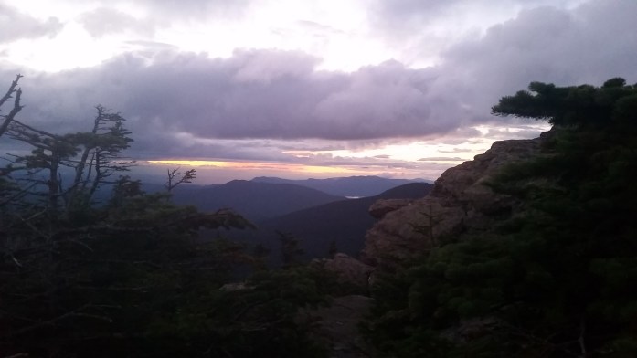
The End of a Journey: The 100-Mile Wilderness and Sumitting Katahdin

We returned to the trail by 1 o’clock and happily entered Maine’s 100-Mile Wilderness. We couldn’t believe how far we had come or how few days we had left on the trail. We knew nothing would stop us from completing the final 115 miles, and in six days we would be standing on Mount Katahdin.

While in town, we managed to check the weather putting as much power into our prayers as possible. We desperately hoped for a nice week, but even more important, good weather for our final climb. Tonight, though, there was a high chance of rain so we did our best to book it to a shelter.
We finished hiking right at nightfall completing 17 miles for the day. To our surprise, we found the shelter basically full, but hopefully asked the hikers to squeeze us in. Though a couple hikers were a bit reluctant, we still managed to get shelter spots and were most grateful come morning. The rain started overnight and poured into the morning hours. We sat and packed, mostly just delaying the inevitable. Eventually, we headed out in the rain which lightened as the day and miles went by. By lunch, the rain stopped for the day. I remembered our lucky weather streak so far through Maine and stayed positive. Only 5 more trail days, you can walk through a little rain.

After the wicked ford, the rest of the day we spent climbing. 15.6 miles wiped us out, and we called it quits at the shelter.
We were happy to be greeted by the sun the next morning. Other than Katahdin, today would be our last day of climbing. From the White Cap Mountain, the final peak of the day, we would get our first glimpse of the finish line.
We kept a great pace all day, really enjoying every part of the day. We were surprised when we arrived at the shelter and found it empty. Wow, a whole shelter to ourselves! We had just completed a 20.7 mile day, our first 20 mile day since…?
We eased into the start of our day in no real hurry. Today, two more days of hiking, and one additional summit day was all we had left. All the daydreams were surfacing: where we would eat on the way home, seeing our friends and family, not hiking all day, staying dry inside on rainy days, bingeing on the Netflix, cooking breakfast in my own kitchen.
After our morning river ford, the rest of the day was easy peasy. We strutted down the trail making excellent time. We were happy to see our friend, Hoff, when we arrived at Potaywadjo Spring Shelter. He had been there all day and had an excellent fire going.
BigFoot and I walked over to the spring to get our night’s water. This may have been one of the most beautiful and perfect water sources we saw on the whole trail. A spring, nearly 10 feet in diameter bursted out of the ground. The crystal clear water floated above a sandy bottom and then cascaded over rocks into a flowing stream. We took our chances by not filtering it. I felt privileged to be drinking from such a gorgeous source.
While we gathered our water, a flood of memories took over. I remembered many picture perfect springs and streams we had gathered from as well as some that were less than desirable. But, for the most part, drinking the water directly from the place it comes from was one of my favorite parts of the trail. To me, it was the ultimate connection to the wilderness – pure, beautiful water.
We enjoyed our evening swapping stories with Hoff and keeping the fire stocked. It had been awhile since we had done the chore of building and maintaining the fire, and this one was truly special. Just as the water had triggered many memories, I reminisced on the fires we had sat around and the people we had shared them with.
Morning came and a little rain came with it. The sky looked like the rain would be short lived, and it soon came to a stop. We hoped it was done and were surprised when it started back up again. We put on the rain gear and walked on. Suddenly, it was a full on downpour, the trail becoming a river. My socks and oh so destroyed shoes were drenched. Well, this is annoying.
We made it to a nearby shelter and waited it out for a few minutes with Rocky Mountain High. She was one of the many hikers we only knew through the logbooks. She had been ahead of us throughout this entire trail, and now, just 2 days from the summit, we were meeting for the first time.

The rain died down and pittered out over the next couple hours. The trail was adjacent to Rainbow Stream and its falls for a couple miles before taking us to the shelter for the night. After this wet day, we were happy to go to bed early and eagerly.
We woke up very early to get a start on our 25 mile day. As the day went on, the clouds cleared. It was nearly 2 o’clock when we got to Abol Bridge marking the end of the 100-Mile Wilderness. We had already completed 15 miles of our day, and the sun was shining. We decided to skip the general store and headed for the entrance to Baxter State Park, home of Katahdin.
After walking nearly a mile, we came to Baxter’s park boundary and soon found an information board. Baxter has a large campground at the base of the mountain where many people (not just thru-hikers) stay at this busy park. Not only do they have miniature shelters for people to rent, there is also one large shelter specifically for thru-hikers. The Birches Shelter holds 16 and tends to fill up. At the information booth, we felt like we had been hit in the gut as we saw that the shelter was already full for the night. It was also noted that the rest of the campground was also booked, and stealth camping within Baxter was not allowed.
Basically, we concluded that we couldn’t enter the park and would have to hike 10 miles into Baxter tomorrow as well as the 10 mile round trip to summit Katahdin. That’s really, really not what I wanted to do.
Frustrated, we walked back to the general store, and, assuming we were done for the day, soothed our woes with beer and chips. When we cracked our beers, a man who had seen us walk past the store the first time noticed our return and asked some questions. We told him our story and frustrations.
“Well, I rented a (mini) shelter with my buddies and two of them backed out. We have two extra spots if you need them.”
!!!!!!!!!!!!!
Now that’s trail magic at its finest!!!
Seth and his buddy Rick were finishing their journey on the AT tomorrow as well. Over the past 20 years, the pair had successfully section hiked all of the Appalachian Trail and were excited to stand on Katahdin as well.
We absolutely could not believe our luck and set out for the ten mile stretch to Katahdin Stream Campground. The terrain was simple, and we walked in a dream like state. We’re here, in Baxter, that’s Katahdin. Holy shit. We did it.
At the campground, we checked in with the ranger station and quickly found our new friends. We cooked our last trail meal and packed our slackpacks for tomorrow. No point in bringing a bulky bag up a steep climb for no reason.
At nightfall, we made our way into our sleeping bags for the last time. I was nervous excited, but overall the long day wore me out, and I got some good sleep. We were glad that Rick’s alarm woke us up early, and we were ready to hike by 7. Did I mention the sun was rising into a bright blue sky? We were beyond thrilled and grateful for this special, beautiful day.
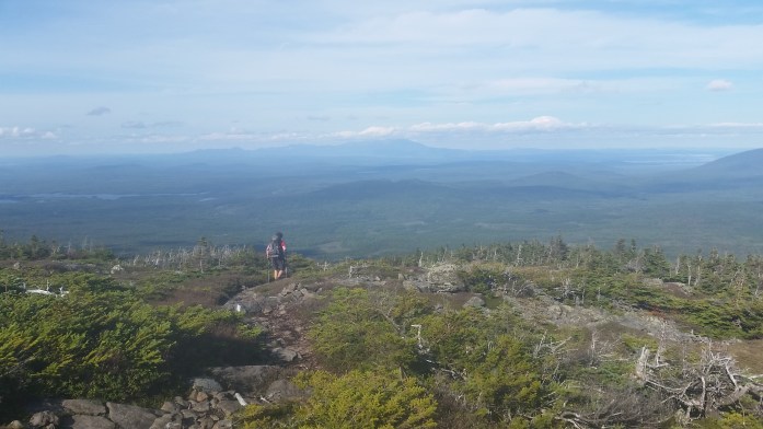
It was 5 miles up the mountain from the campground to the summit. The iconic sign was on our minds. I felt like I was walking in a dream world. None of this seemed real. We walked through the woods passing many people along the way. Once we passed the breathtaking Katahdin Stream Falls, the trail just got steeper and steeper.
We were only a couple miles away from the summit when the trail rose above tree line. Suddenly, the trail was hardly a trail at all, just a maze of white blazes stamped onto rock. This was a rock climb, plain and simple. And the cold winds were seriously whipping. I almost felt like it could’ve carried me right off that mountain.
Up and up into and over the rocks we climbed. With all the emotions and memories flowing through my head, I had to remind myself to really focus on the jungle gym in front of me. I didn’t come this far just to break any bones here!!

We made it to “The Tableland” where the mountain flattens out before rising to the peak. 1.5 miles to the summit. We saw Thoreau Spring. 1 mile to the summit.
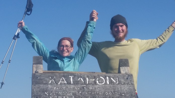
Up we climbed into the mess of rocks and followed the last of the white blazes. The sign was in sight. We’re here. We’re HERE! WE ARE HERE!!!!!
We touched the sign. It was real.
We thru-hiked the entire Appalachian Trail.

Thankfully, we weren’t alone on the summit, and the photo shoot began. Throughout the hour we spent on the summit, we saw many hikers taking in the beauty that is Baxter Peak. Regardless of how far a journey those people had walked, we were all here on this summit now together. Everything about this day was perfect and so very surreal.

We eventually decided it was time to walk back down the mountain. We were hungry after all, and town food was on our mind. For the first time on this trip, we began walking southbound on the Appalachian Trail.
Thankfully, the steep section wasn’t nearly as windy now as it was on the way up. We jungle gym-ed down the mountain, got back below treeline, revisited the falls, and walked our way into Katahdin Stream Campground to retrieve our packs. We were done. We hiked the whole thing. It was time to go home.
We decided to try our luck on a hitch instead of waiting for the shuttle to nearby Millinocket where my parents were patiently waiting on us. A nice couple stopped when they saw us and offered us a ride.
“You guys hiking the trail?”
“We just finished it – the whole thing!!!”
They were as excited to hear our stories as we were to hear theirs. Over the ride, they told us about their organic farm and building their own cabin in Maine. I was going to miss meeting the nicest strangers.
When we got to Millinocket, it wasn’t long before I found my parents. After hellos, we brought our hunger to their immediate attention. We got food and then went to the hotel for a celebratory beer. Good call, Dad!
Over the next three days, we made our way across the country stopping in Maine to see the Atlantic Ocean and Niagara Falls, New York.

Eventually, we were back home again visiting family and friends, answering lots of questions, and eating and drinking whatever we freakin’ wanted.
The 2,189.2 miles were complete. All 14 states were walked through. We battled injury and illness, rain, hail, and snow. We were supported by amazing friends and family and beyond blessed by countless strangers. The long journey was over.
And we’ll never be the same.

Nearing the End

We woke up early at White Wolf Inn feeling some of the affects of perhaps one too many rounds from last night’s 2000 mile celebration. Thankfully, we just had to walk downstairs to a fantastic breakfast and hot coffee. After eating, we returned upstairs to pack our things and made a call to Fat Man Walking. The slackpack offer made over last night’s beers was still on the table. We readied ourselves and piled into Fat Man’s RV.
Fat Man had day packs he lent us, and we returned to the AT. With plans in place, we set out to climb the Bigelows, one of the last big climbs we would have before summitting Katahdin. We were just 188 miles from the long awaited finish line and estimated an additional 11 days on the Appalachian Trail.
It was another beautiful day in Maine. Actually, since crossing the state line, we had seen nothing but beautiful weather. From what I’ve gathered, we were extremely lucky as many hikers trudge through the state soaked in rain and near drowning in mud. I am nothing but grateful.
Our slackpack day was set for 16.7 miles with lots of climbing in between. We had been hoping for one more chance to slackpack, and we noticed right away that this was the perfect stretch to do without a big pack. With last night’s residuals and this day’s tough trail, I’m not sure we would’ve completed the near 17 miles without Fat Man’s help.

The tough day came to an end when we returned to the previously designated meeting point. Fat Man and his pup were already there. Fat Man was quick to offer us sodas and provided water for cooking. We enjoyed a great conversation with this all around awesome guy and eventually crawled into the tent for the night.
In the morning, we said our goodbye’s and so many thank you’s to this amazing trail angel. We set out down the trail with our full bags in tow for a 17.3 mile day. All day it seemed like we were consistently hiking next to some beautiful body of water. At one point, the trail even turned to sand, and we were on the shore of a lake.

We were glad for a relatively easy day, happy that we could maintain a good pace. We arrived at Pierce Pond Shelter for the night accompanied by many hiker friends. We were all happy to be at such a beautiful spot for the night, and several hikers even took a quick dip.

When morning came, we hiked 4 miles to the Kennebec River. The Kennebec is the largest river on the AT without a bridge to cross it. Too quick to ford, the river must be crossed by ferry. When we arrived at the Kennebec, a few others were waiting ahead of us. We filled out our liability form while watching other hikers take their canoe rides across. Soon, it was our turn. I let BigFoot do the paddling and took the free ride.

Now on the other side of the river, we were just a few minutes from a highway crossing. BigFoot and I grabbed a quick hitch to Northern Outdoors, a nearby outfitter, lodge, and brewpub. We also had a couple important packages waiting for us there: our final resupply box and BigFoot’s new sleeping pad.
Upon arriving, we didn’t really intend to stay for food. But when we entered the building, there was no way we were turning down a hot meal. We checked with the desk about our packages, and they told us to have a seat and that they would bring them to us. While waiting on our food, our resupply package arrived. They were still looking for the other one. Not really what we wanted to hear.
Meals arrived and the food shoveling began. Well, at least there was food in front of us when the bad news was broken. No other package. No new sleeping pad.
Over the past week since the Therm-a-explosion started, the sleeping pad had now gone full beach ball at one end. Basically, BigFoot had been sleeping on the ground all week and really didn’t want to go without it for another 10 days.
We began contemplating if we needed to take a zero day to wait on the mail to arrive tomorrow. However, it’s really the last thing either of us wanted to do. BigFoot made a call to the company and found some interesting news. For whatever reason, the package still had not been sent out. But, the customer service rep had a new idea. If we could make it to Greenville, we could pick up a replacement at the outfitter.
Frustrated, we bought a couple beers and sorted our resupply. We decided it was really our only option, and BigFoot would deal with sleeping on the ground for an additional 60 miles.

Packs ready to go, we hitched back to the trail. A very nice Australian man picked us up. He asked about our trip, and we were thrilled to say we only had 150 miles left.
“150 miles! You two are crazy!!”
“Well, we already did 2040.”
The look on his face as he slowly turned to the back seat to look at us was priceless.
“Bless you.”
Well, back down the trail we go. After our stop, we completed 12 miles for the day for a total of 16. We were again happy to see consistent increases in our daily mileage after the slow go over rugged trail in the Whites and Southern Maine.
The next day was a successful 18 miles over relatively easy terrain. It was also our first time that we actually had to take our hiking shoes off to cross a river. There are many places in Maine where fording a river or stream is necessary. That means changing shoes into our Crocs, unbuckling our packs, and slowly crossing through the moving water over slippery rocks. Because the area hadn’t seen much rain, the swells were down allowing for many to be crossed by Frogger style rock hopping.

Twice this day, though, we had to do whole fording process. When we forded the second, we were at our finish spot for the day. BigFoot and I set up our tent and went back down to the river to get our evening’s water. We casually sat and filtered water enjoying chatting with Macklemore, Pocahontas, and Tick. While resting our feet, we noticed some big clouds rolling in but were hoping our no rain streak would win. It didn’t.
Just as I had all the food in the pot for dinner, a downpour burst over my head. Thankfully, our tent was pitched and our things protected. I stood in my rain coat, shorts, and crocks in the pouring rain monitoring our food. Hey, a little rain wasn’t going to stop me from eating. Even a lot of rain wasn’t going to stop me. By the time the soup was ready, the rain slowed down and eventually stopped. I didn’t even mind. I had dry clothes to step into and my dinner was ready to eat!
We got a little more rain overnight but nothing crazy. When morning came, we began our hike. We were 6.7 miles to the road that would take us to Greenville. Thankfully, the morning hike only took us just over 2 hours to complete. When we arrived to the highway, a man was letting out three hikers and cheerily offered us a ride to town, though he apologized that he could not take us back to the trail after our town stop. No worries, we knew we would find a ride back.
The man took us directly to the outfitter. Therm-a-Rest had called ahead for us and the store employees were very helpful. Soon, an exchange of one broken and filthy sleeping pad was made for a brand new one.
I also picked up some trekking pole tip replacements which completed our town chores. Though do you really think we left town without going to a restaurant? Clearly you haven’t been playing attention 😉

We stopped into a local diner and got big breakfasts. All of the clients and employees were discussing only one thing: fly-in weekend. Apparently, Greenville is the host to an international fly-in weekend once a year. During the weekend, hundreds of sea planes would fly into the town and land directly in Moosehead Lake. Oh, that’s all the noise we’ve been hearing.
After eating, we grabbed our packs and were stopped by an older gentleman.
“You two need to check out Robert Redford’s A Walk in the Woods. It’s what your doin!!” (don’t forget your best Maine accent)
“Wait, what was it called?”
“A WALK IN THE WOODS, Robert Redford!!!!!”
“I’ll try to remember. Thanks!”
Ok, it was definitely not the first time someone had mentioned Bill Bryson’s book that was just now appearing on the big screen staring Robert Redford. We both read the book last year, and we both knew the movie was coming out before we stepped foot on the trail. This was probably at least the millionth time someone had mentioned this book / movie to us, and we were pretty over it. I’m sure similar feelings come about when someone mentions Wild to those hiking the Pacific Crest Trail.
We walked around the small town, making a couple stops, and enjoying watching the planes fly overhead and land in the lake. I decided this would probably be my last chance at reliable cell service so I called my parents to confirm the final details of picking us up. Yep, my parents are so cool that they were driving all the way from Indiana to Northern Maine to pick us up from this long journey. With our final plans set, we hitched our ride back to the trail.
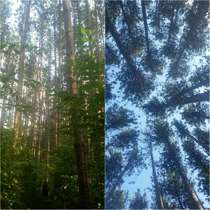
It was finally time to enter the well known 100-mile wilderness. This 100 mile stretch of trail through Maine is so-called because, you guessed it, there are 100 miles of trail without access to any towns. The few roads you do cross are unmarked, gravel logging roads that could maybe save you in an emergency. We left fully prepared for these 100 miles which would leave just 15 more to the summit of Katahdin. This was it – the final stretch of our journey on the Appalachian Trail.
13 States Down, 1 To Go!!!

We managed to pull ourselves away from White Mtn Hostel after our 3 night stay by 11 a.m. During yesterday’s zero, I was really struggling to get the motivation to finish these last three weeks of hiking. Fortunately, all of those feelings of self doubt melted away as I reentered the woods.I mean, how can you complain being surrounded by such beauty? We set out for the day undecided on whether we would tackle 12 or 17 miles.

It was only 4 when we arrived at Gentian Pond Shelter 12 miles in. We debated the extra 5 miles but decided afternoon naps sounded better. By 5, we were joined by our friends Birdie and Easy Go. Their arrival confirmed that we weren’t going anywhere.

The next morning, we awoke earlier than our friends. It was a big day with mixed emotions. Gentian Pond Shelter was only 4.6 miles away from the New Hampshire – Maine state line. The dream of Georgia to Maine was coming true today. As elated as we were, we were also nervous excited for the infamous “most difficult mile on the Appalachian Trail,” Mahoosuc Notch, just 6 miles north of the state line.


The miles went by slowly, though we weren’t surprised. The terrain was the most rugged we had encountered and, indeed, rivaled the difficulty of The Whites. It took us nearly 8 hours to hike 11 miles where we entered the Notch. Let the games begin.
Thankfully, we were hiking on a somewhat cloudy day, but most importantly, a dry day! I can’t believe people attempt this jungle gym in the rain. Mahoosuc Notch, created through glacial activity, is a narrow one mile stretch of car-sized boulders sandwiched between two 400 ft cliffs.Far below the pile of massive rocks, a glacial river is still flowing. For hikers, this calls for some creative maneuvers. Put the trekking poles away – they aren’t going to help you here.
We entered the notch at about 4 p.m knowing we still had at least 3 hours before we would have to worry about dusk. We set off, Bigfoot’s long legs giving him the advantage. Every step was calculated. Large leaps, that demanded perfection, were necessary. Let’s just say, this is one I’m glad Mom didn’t have to witness. Dangerous is such a understatement.

The 1 mile Notch took about an hour and a half to complete. The trail became, well, a trail again, and we soon found a cozy stealth camping spot near a babbling brook for the night.
Morning welcomed a cloudy but otherwise nice day. We began the day climbing Mahoosuc Arm followed by Speck Mountain. Climbing down Speck I mentioned how awesome trail magic sounded. I was nothing but thrilled to find a case of soda waiting for us when we arrived at a parking area.
After a refresher, we started our final climb of the day, the double peeked Baldpate. At the top of the first peek, I decided to check for signal on my phone. Good thing I did – BigFoot’s family was welcoming the first of the next generation, little Abigail Jo. Happy Birthday, Gail!!!

With a little extra pep in our step, we set out for the second summit. The trail turned to just rock face as we climbed the side of the mountain. The wind was whipping creating a really fun game for BigFoot and I as we ducked into and out of quick gusts. It was one of those moments when life makes sense. I’ll never forget that climb.

Once on the other side of the mountain, it was a quick 2 miles to the shelter for the night. We “treated ourselves” to mac n cheese (which somehow we still liked) and went to bed. During the night, I was awoken by BigFoot.
“Do you hear that?”
Noises of rattling plastic and little pops filled the quiet night. Probably mice.
“I think it’s coming from my sleeping pad!”
Sure enough, BigFoot’s Therm-a-Rest was exploding! The glue that attaches the inflating foam to the plastic was coming apart creating a beach ball effect. Unfortunately, this is a product defect that we have seen happen to other hikers. There’s really never a good time for your sleeping pad to malfunction. We laid quietly listening to it tear itself apart.

The next morning, we woke up and hiked 4.5 miles to a road crossing. We were hoping to get a ride into the small town of Andover, ME to resupply. We stood there for twenty minutes witnessing only 1 car and two logging trucks heading down the road. Yikes.
We decided we would wait another 20 minutes knowing there was another road to Andover 10 miles down the trail. We continued waiting but no cars passed.
We had about 3 minutes of waiting left in us before we would call it quits. And, as luck would have it, a car arrived. Actually, the truck approached in the opposite direction, did a donut, and parked where we were standing. 2 familiar hikers exited the truck, saying their thankyou’s and see you later’s. They were clearly slackpacking. Lucky bastards.
But, lucky us too. The man driving the truck was returning to Andover and was quick to offer us a ride.
“We’re helping them slackpack today. Oh, I’m Fat Man Walking’s brother.”
Ohhh… Awesome! We, like many other hikers, had met Fat Man Walking when he generously gave us a a ride in his mini RV into Lincoln. I guess the generosity runs in the family.
After the 8 mile ride, we arrived in the tiny town of Andover. We checked out the two small general stores which were pretty much like resupplying at a gas station – a whole bunch of what you don’t want, and it’s really expensive. Oh well – the steak and eggs breakfast soothed those woes. Bigfoot also made an important call to Therm-a-Rest, and his new sleeping pad was scheduled to be picked up 100 miles north.
By noon, we started looking for a hitch back. After several failed attempts, a local lady slowed down and picked us up. She wasn’t heading that way, she just had the time and wanted to do something nice. Lesson learned from this trip: Sometimes people are awesome. Arriving back at the trail head, no less than 6 hikers were waiting on a ride into Andover. This nice lady let us out and volunteered to take 2 back to town.
We started down the trail debating whether we would complete 7.5 or 10 more miles today. During a break, I took a deep breath and took in my surroundings. Isn’t it cool that we live here? We wake up in the woods, we walk all day in the woods, we eat lunch in the woods, our casual breaks are in the woods, we sleep in the woods, and we do this all over again day after day. I knew it was coming to an end in just a few short weeks. I swear, some moments it was “OMG we STILL have SIXTEEN freaking days left to hike!?!?” and then the next moment was “Oh no, we ONLY have 16 days left to hike!” I knew I would miss the trail. I knew I was ready to be done with it also. Either way, the time was nearing.
The 7.5 miles won, and we found a camping spot along with some familiar faces. The next day we completed 14.8 miles eating far too many Maine wild blueberries along the way. The following day, we were happy to be blessed with semi-flat trail, the first days of many that didn’t include any large climbs. We were 14 miles away from a highway that led to Rangeley, and it was time for another small resupply.

After an easy and beautiful day of hiking, we approached the highway and found a quick hitch. We checked out an outfitter before ducking into a local bar. The kitchen didn’t open for another hour and a half so we had some beers to tide us over. Before we ordered, three hiking friends joined us: Macklemore, White Wolf, and Hardware. We had hiked with Macklemore for the past few weeks off and on. But seeing White Wolf and Hardware was a big surprise. These two, our favorite bro-mance on the trail, were the hikers we had probably spent the most time with. We’ll never forget sharing the joys of a hail storm in Tennessee with White Wolf. Or Hardware’s dedication to Cathy’s Climb honoring his friend’s lost battle to cancer by raising money for research. These are two of our favorite fellow hikers.
After dinner and ice cream, we broke from our friends and headed to the IGA grocery store. After a quick shop, we exited the store and were stunned by a beautiful sun setting over Rangeley Lake. I wanted to just stare into it, but a setting sun means a setting sun. Now, it was a race to get back to the trail and find a decent camping spot before dark.
Thankfully, a man exited and had noted our items while we checked out. He knew we were hikers and offered us a ride back to the trail. We told him it might take a few minutes to sort our items.
“I’m retired. Take your time.”
He and his wife made a lasting impression. With bright smiles, intermingling sentences, and the best ever Maine accents, they told us stories of their kind deeds to other hikers, laughed over the name “trail angels,” gave us their address, and hoped to hear from us. We got back to the trail just as the last bits of lights were leaving the sky. Thankfully, a comfy spot for a tent was nearby.
The next morning, we began our day hiking Saddleback Mountain. Though a somewhat steep climb, we were soon above treeline with magnificent 360 degree views. We found a perfect spot to eat and made lunch.


After properly refueling, we made our way over The Horn where a couple greeted us at the summit.
“You hiked here from Georgia? Well, you both earned yourself a candy bar!”
Almond Snicker’s and Cookies ‘n’ Cream Hershey’s. People are awesome.
In total, it was a tough and oh so beautiful 13.5 mile day.

We woke up with another big day of climbing ahead of us. We were stoked to finish an 18.7 mile day by 6 o’clock. It had been a long time since we had completed that many miles in a day in good pace, and we were anticipating the rumors of good trail ahead taking us into the final stretch.

The end of our day brought us to a road crossing for Stratton, ME. We really hadn’t planned on stopping there, but BigFoot’s suggestion to eat and get our final hotel room was easily decided upon. When we arrived at the parking area, we were thrilled to be greeted by Fat Man Walking.
He was quick to offer us a beer and a ride into town. We made a call ahead to the White Wolf Inn and were on our way. Upon checking in, we ran into our friend Wild Boy and changed our reservation from 2 people to 3 people. After showering, BigFoot and I went to the restaurant downstairs and chatted with Fat Man who was having a beer.

I bought his next round as to thank him for all of his kindness. Though, apparently, most hikers don’t ever buy him a beer, and he was deeply touched. So much so that when our dreams of a final slackpack came up, he was very quick to offer. With a plan hatched for tomorrow’s slackpack, we giddily returned to the room.
Wildboy was still up, and we all decided to go to the bar across the street that was still open. Lucky for us, a local band was playing. We all reminisced on our 2,000 miles we had walked while enjoying our beers and the music. Now, we were only 11 or 12 days from standing on the summit of Katahdin and could barely believe we had walked this far.
Through The Whites

We were finally back to the AT around 11 a.m. from our little “Detour.” We pushed over the other side of Guyot and continued on our way. By about 1 p.m., we made it to Zealand Falls Hut and began to make our lunch. Suddenly, one of the Hut seasonal workers approached us and offered us leftovers from last night’s dinner. Stuffed shells exploding with ricotta and marinara sauce sure did help ease our frustrations from taking the wrong trail. After we got properly full, we resumed hiking.
We enjoyed this easy cruise in the Whites, the only of its sort. At about 4 p.m., we made it to a highway crossing and decided to try and hitch a ride to the nearby AMC Highland Center mentioned in our guidebook. Here, many people stay in the lodge and enjoy the attached dining. We thought it was worth checking out.
Hitching a ride proved easy and soon we were at the Center. We were joined by our friend, Honey Britches, and began to make plans for the night. We considered dinner here, but were halted by the $30 plate price. Ramen would have to cut it. After charging our devices and successfully replacing our Darn Tough socks at the small gift store, we made our way back to the trail and camped at the nearest spot north of the highway.
Morning came and dense fog came with it. Today was a big day. We were making our way up Mt. Washington, the second largest peak on the AT and the largest in New England. Known for its crazy weather and wicked winds, we anticipated stopping at Lake of the Clouds Hut a mere mile from the summit.
Well, let’s get to climbing. We started our day around 7 a.m. consistently behind Honey Britches and ahead of the invisible hikers inevitably behind us. With the weather being so fickle, we were counting on work for stay spots at the hut.

All day we climbed into the fog. No views, cold winds, slick rock. We arrived at Mizpah Spring Hut around 1, very happy for a haven. We took lunch and noticed more thru-hikers arriving. We were unwilling to compromise our work for stay spots thus keeping this break short. We returned to the fog, winds, and drizzle for the next 5 miles.
Unlike other sections we had completed in the Whites, these 5 miles only took us 2 hours. The fog was so dense that we were literally approaching Lake of the Cloud’s porch when we noticed there was even a Hut there. Honey Britches had just arrived and checked about work for stay with a familiar face. This worker was a fellow 2015 thru-hiker that had already completed his hike and found a groovy place to work. He was part of the Pack It Out project in which he and his hiking partners carried out 1,100 lbs of trash. Woah. (More on this cool story here.)
Though the three of us were a little early for work for stay, we were admitted. Quite frankly, I don’t know what we would have done otherwise. We were several hours away from the next camping spot in good weather. Continuing hiking would have been annoying at best and downright dangerous at worst. It was only 3 pm, but I was overjoyed to be out of the wind, fog, and drizzle.
BigFoot and I were given our work task and decided to complete it immediately. We were asked to sort and inventory the chest freezer downstairs. It took us a total of about 15 minutes – definitely worth it for floor space and dinner leftovers.
As the afternoon turned to evening, more and more thru-hikers arrived and not one of them was turned away. We all gathered in the back corner doing our best to keep our gear out of the way. In some ways, I felt bad for the tourists there dodging our things and holding their noses on the way to the restroom as we sat around with very little do to but watch.

At about 6 p.m., dinner was served, but it would still be several hours before the hungry hikers could feast. We all watched in agony as several courses came out of the kitchen. It was a heated debate – fire up the backpacking stoves or hold out.
By 9 p.m., remember this is usually past our bedtime, we were finally told to line up for dinner. The Hallelujah Chorus was in full effect.
While we ate, Honey Britches provided the after dinner entertainment as her work for stay chore. The Hut guests were nothing but impressed as she described the 1800 miles we had all already completed on the AT and the ups, downs, and answers to frequently asked questions.
It was nearly 10 p.m. by the time we were able to get to sleep. I was one of the first to wake up in the morning. I instantly noticed the light peering in the window and the outline of mountain. The fog had cleared!!
Those awake could hardly contain our excitement. At this time, you could see Mt. Monroe that was adjacent to the hut and even the peak of Mt. Washington. I got up to take some pictures and did my best to hurry along BigFoot.

We finally set out for the summit with several excited hikers behind us.


Upon arriving at the summit, we decided to go into the Welcome Center. Mt. Washington can be “climbed” by foot, car, or rail. The Welcome Center hosts huge windows to watch the ever changing views as well as concessions and even its own post office. We were stoked to get some hot coffee before moving down the trail.
While enjoying our break, other hikers were murmuring about staying at White Mountain Hostel in Gorham 14 trail miles away. We were easily persuaded and decided to call ahead. Two highways 21 trail miles apart connect to the small town.. White Mountain Hostel, among others, offers free slackpacking for the 21 mile stretch if you book two nights. We weren’t really sure if the slackpack was something we were interested in, but definitely wanted to stay there one night, so, we went ahead and made our reservation.
We left Mt. Washington in a clear patch, that was quickly replaced by moving fog. The 6 miles between the summit and Madison Spring Hut took us nearly 4 hours.


We took our lunch break with our fellow hikers while we discussed our plans for the night. Each one of us as excited as the other to get to a bed, shower, and town food.
After lunch, we took off and the sun came out in full force. Usually, I’m always happy for a sunshiney day. Today, though, was challenging. My poor hands had had enough sunburn, and the sunscreen did very little to protect them. At this point, they already blistered. From the sun. What the hell!!!

The trail was difficult, the pain was so real, but I tried my best to enjoy the views meanwhile praying that we would get under the tree line soon. It’s a shame that now was the time I was on the Doxys (for the Lyme) as opposed to the rest of the AT that was under the protection of the leaves in the green tunnel.

I was beyond thrilled to get back under the treeline. Honestly, this day in many ways defeated me. We still had a couple hours of walking left, which, so thankfully, became gradually easier and easier with the last two miles being nearly flat and made out of soft dirt. It had taken us nearly 12 hours to complete these 15 miles.
Happy to be done for the day, we called White Mtn Hostel, and they sent a shuttle to pick us all up. I was still on the fence about tomorrow’s potential 21 mile slack pack over the Wildcat Mountains. Could I really hike 21 miles before the sun went down? 15 miles took everything out of me to complete today, could I really squeeze 6 more miles into my day even without a pack?
The hostel shuttle arrived shortly and six smelly hikers piled into the minivan. The driver offered to take us to the store, and we hatched a delicious plan. Nachos. Family style. All the fixins.
We did our best to hurry through the store, but it was still nearly 8 p.m. by the time we got to the hostel. Upon arriving we were given the rules since White Mtn. does things a little differently.
First, all bags and hiking shoes were required to stay in the garage named Funky Town. Next, all hikers must change clothes into their clean loaners. Dirty clothes are left in a hamper, and the hostel employees do the laundry for you communal style.
Once changed, we made our way into a big kitchen where we checked in for the night. We were instantly impressed with how clean the hostel was. Honestly, no other hostel really compared. This is one of the only places we’ve seen with a system to deal with 20+ stinky hikers and their things that actually works.
Once we checked in, we immediately began cooking taco meat and chopping toppings. Massive plates were assembled, and these six hikers couldn’t have been happier.
After dinner, it was the moment of truth. BigFoot left the decision in my hands knowing that I wasn’t feeling my strongest. I’m not sure exactly what convinced me, but the decision was made. Tomorrow we would attempt the 21-mile slackpack challenge over the Wildcats.
Our host told us we would hit the trail as soon as we all had eaten breakfast in the morning. We were given day packs and strict instructions to bring a headlamp. Not everyone finishes before the sun goes down. Gulp.
We went to bed both nervous and a little excited. I remember waking up several times in the night, checking the clock, and trying to get back to sleep. I felt like a kid again – eager, excited, anxious.
Morning came, but first things first. Breakfast! It’s so wonderful to get a good meal in the morning and White Mtn did not disappoint. Creme brulee French toast, hashbrowns, homemade chocolate chip muffins, sausage links, coffee, AND orange juice!!!
The six hikers that arrived yesterday all piled into the van, and we headed toward the trail. It was about 8:30 when we started hiking, later than I would have preferred, but BigFoot and I were determined to finish this stretch before dark. Well… GO!!
The trail went almost exactly straight up, just as the guidebook stated. As we climbed vertical rock face, we were already happy with our decision to slackpack. Not having our big packs was already making a huge impact on our ability to climb and our speed.
At a little after 11, we made it to beautiful Carter Notch Hut sandwiched in between two very steep mountain peaks. We took a quick break to eat some snacks, even timing it to keep us on schedule. Before we knew it, it was climb time once more.
Once at the top, we were happy to see semi-flat terrain and took advantage of it by doing some trail running. The day went by in this fashion – steep climb up, trail run in flat sections, steep descent. (Like near death steep.) Repeat.
By about 3, we knew we were in the clear to make it back to the hostel before sundown. We were also happy that the last 5 miles were easy, just as we had been told this morning. The 21 miles slack pack ends once you hit the highway the hostel is on. No need for hitching, the AT literally takes you right to the hostel driveway.
10.5 hours later, the slackpack was complete, and we celebrated with delivery food! Keep in mind, on flat land we could hike about 3 miles / hour with big bags and 3.5 miles / hour slackpacking. This is a 2 mile / hour average, slackpacking. That’s how hard this day was. Despite the challenge, hiking is a little easier when you know your day ends with a shower, a hot meal, and a comfy bed! Challenge complete and bellies full, we slept oh so peacefully that night.
Morning began once again with a fantastic breakfast. We got our things together and vacated our room, but the hostel allows you to hang out, so we did. And boy did we get comfortable. Truthfully, neither of us wanted to leave, and our fellow hikers were hard to turn down. Should we take a zero day and chill?
Why not??
After a bit of math and guidebook planning, I estimated that this zero day wouldn’t throw off our Katahdin summit date that much if at all. We could still take one more zero day and finish by Sept. 16th. The real question was if we wanted to take that zero day now or later.
Hmm… Now. In our favorite hostel on the trail, with a delicious breakfast, and our hiker friends. I voted now. BigFoot agreed. Zero day it was!!
(By the way check out White Mountain Hostel near Gorham, NH, for a truly relaxing stay during your hike in the Whites. Super friendly staff, shuttles, laundry, CLEAN hangout area, cable / the Netflix, and a delicious breakfast all for $33 / night. Steal of a deal. Call ahead,, they book up!!)
And we earned it, damn it! The Wildcat slackpack was the end of The Whites which were everything everyone told us they would be. Picture perfect in every way. But you really have to work hard to earn those views. We were currently sitting 16 miles away from the NH – ME border. Georgia to Maine was about to come true.
But it’s not just Georgia to Maine. It’s Georgia through Maine with Katahdin standing 282 miles past the state line. We still had nearly three weeks of hiking ahead, and I could hear my spirit waning. And the Southbounders had reported that the first half of Maine was equally as difficult as the Whites had been. Great.
I knew I wasn’t going home with 300 miles left, but I was getting exhausted in every way. The Lyme, the sunburn, the inevitable bruises and scratches, the smell, the rain, the hunger. I was getting really, really over the trail, yet knowing as soon as we were done, I would miss it.
But Maine, in all her glory, awaited, and after enjoying our zero day, we continued hiking north.
Detour: Part II

The day had finally come to enter White Mountain National Forest. We awoke just as the first bits of light were coming into the sky. We wanted the earliest start possible for the challenging day ahead.
From the shelter it was 5 miles and 3500 vertical feet to the summit of Mt Moosilauke. For those reading without much hiking experience, let’s just say that’s basically straight up. And somehow the vertical descent is at an even steeper degree. Fun stuff.
We took off both nervous and excited, very grateful for a sunny day. Over the next three hours, the trail only went up. Up and up and up. As we ascended, we were solely surrounded by pine trees, the trail littered with large boulders. Though quite the physical endeavor, we reached the summit somehow surprised it wasn’t more difficult. We admired the encompassing mountains from both the south and north summits, happy that only a little haze obstructed our view.

While enjoying our rest, I suddenly began to feel a little uncomfortable on the exposed summit. The doxycycline I was taking to combat Lyme made me incredibly susceptible to sunburn. I had to leave the summit. Bastard tick.
We continued hiking and were soon under the forest canopy. The descent off Moosilauke began immediately. And it was so damn pretty. But equally treacherous. The trail paralleled a waterfall during the entire descent though it wasn’t a great time for distraction…
With oh so careful footing, we made it to flatter land. At the base of the falls, we took a long lunch and prepared for the remaining 7.7 miles for the day.We took off thinking the hardest part of the day was behind us. After all, 7.7 miles with a 1600 ft climb should take us less than 3 hours. 4 absolute max.

But the trail was quite tricky in this section full of quick ups and downs, big bogs, and large boulders. We were more than disheartened to check the guidebook and realize we had only completed 3.3 miles in a little over 2 hours. That’s about a mile and a half an hour. Sigh.

Though our surroundings were stunning in every way, I couldn’t help feeling frustrated over this slow pace. I was tired from this draining day and was looking for the shelter around every corner. Just as dusk was setting in, we finally arrived at our haven for the night. 16 miles took us nearly 14 hours to complete. Exhausted is an understatement. I felt as though I was no longer in charge – The Whites would call the shots.
The next morning brought fog and another challenging double peeked mountain – The Kinsmans. We got another early start and began our ascent. It was a 2000 ft climb over 2.5 miles to the first summit which looked easier than yesterday’s climb up Moosilauke. But, again, the guidebook doesn’t always tell the whole story.
Up we climbed, paralleling a stream with beautiful falls. This climb was almost solely rock climbing up massive boulders. Up and up, knees to chest, over and over again. The fog got denser, and the wind fiercely whipped its way around the mountain. Occasionally, the sun would burn off a patch of fog creating a small window allowing us glimpses of our surroundings. We watched the battle in the sky between the sun and the fog, the wind pledging its allegiance to neither. And once above tree line, well, we did our best to get back under tree line to escape the icy winds.
We began the steep descent off the second summit, happy to be shielded from the wind. The trail began a more gradual descent once we came to Lonesome Lake Hut. We stopped to explore the first Hut we encountered since we had read so much about them. The Whites are home to the Appalachian Mountain Club’s (AMC) huts. These large wooden cabins vary in size, but all have many bunks, a full kitchen, indoor composting toilets, and a big dining area all ran “off grid.” The cost, over $100 per night (meals included), tends to put a night in a Hut out of a thru-hikers budget. Thankfully, the AMC allows thru-hikers to do work for stay for free floor space and dinner leftovers. Each hut typically only accepts 2 thru-hikers per night. Snagging a spot can be difficult, and it’s all about timing. This day, we were too early to stick around and wait for work for stay opportunities, but we still popped in briefly to check it out. Our minds were really only on one thing: eating in Lincoln only 3 trail miles away.
Thankfully, these 3 miles only took an hour to complete, and we came to a busy highway. The guidebook indicated a parking area a mile off trail that was significantly safer from which to hitch a ride. We passed under the highway and, once on the other side, we noticed a familiar hiking couple, the Canadians, climbing into a small RV. Exchanging only a glance, BigFoot and I decided to see if there was room for two more, thereby skipping that extra mile to the parking area. As luck would have it, driver and former AT thru hiker, Fat Man Walking, immediately offered us space and a ride to town! Bingo!!
On the drive, Fat Man gave us a description of town and informed us that a man named Chet allowed hikers to camp in his yard for donation or work for stay. We took down directions, said our thank yous, and arrived at a Mexican restaurant for lunch.
Over lunch, we browsed the weather for the upcoming week. Since arriving in the Whites and many, many miles before, we had been praying for good weather in this particular section. Not only do the Whites offer incredible views, bad weather in this section of the trail can be downright dangerous. Think slick rock, steep climbs, skinny ridges, incredibly strong winds, lightning, even snow and ice. Yikes.
I was near tears reading the whole week called for rain. Tomorrow, we had planned on being on Franconia Ridge which boasts three miles of 360° mountain views. I refused to let it be stolen from me. We had come too far, worked too hard not to see this section.
We decided to head to the grocery store and resupply while we still considered what we would do the next day. While walking to the store, I couldn’t believe my reaction to the sun. All of my exposed skin felt like it was on fire. I absolutely had to get out of the sun – immediately.

After picking up our typical hiker supplies, we decided to get second lunch at a nearby McDonald’s and saw many familiar hikers doing the same. Most were heading to Chet’s after, and upon completing more food than I like to admit, we headed over and set up our tent.
Chet greeted us warmly and showed us where to set up camp. About 20 other hikers were there, many of us chatting about the rain heading our way. We rounded off our evening with pizza and beer and went to bed in a happy, calorie coma.
The rain arrived when we awoke. We really didn’t want to take a zero day. Like many others, we had already estimated our finish date and didn’t want to push it back any further. However, there was no point in us missing this section for some arbitrary date. The decision was made – we would take this day off.
It’s a rare and beautiful thing throughout a thru-hike to be around for breakfast time and fill up on my all time favorite breakfast foods. I basically ran my drooling mouth to Flapjacks. The line that ran almost out the door moved quickly.
It was clear by the quick, friendly service and miniature train that ran the entire perimeter of the restaurant that we had made the right choice. I pictured the restaurant enveloped in snow, holiday decorations in full force. They knew what they were doing here.
Our highly anticipated breakfast came out quick despite the large crowd. If you’re ever in Lincoln, NH, Flapjacks is an absolute MUST! Bacon cooked to your liking, perfectly executed eggs, blueberry pancakes with local maple syrup…

Feeling reborn from one of my favorite off trail meals, we left the restaurant and spent most of our drizzly day relaxing at Chet’s. At about 5, a man named Dan showed up with a truck full of hikers returning to Chet’s. Dan was quick to offer a little relaxation time in his condo’s hot tub as well as a cozy bed for the night. BigFoot and I jumped on the opportunity and quickly packed our bags. Soon we were at the nearby condo accompanied by fellow hikers, Glacier Swiss and Cornsilk.
The four of us hopped into the hot tub while Dan made us frozen pizza. Beers were offered. We were stunned by the generosity of yet another stranger. Dan filled the night with questions about our hike as he was planning his 2016 thru-hike. He seemed as happy to entertain us as we all were to be so spoiled. It was truly a perfect, unexpected zero day in Lincoln.
After our night in incredibly comfortable beds, Dan drove us back to the trail. Actually, he stopped on the bridge allowing us to again avoid the one mile walk from the parking area to the trail. Yesterday’s rain was gone, and although a few clouds still remained, we were very excited to be hiking the AT’s famous Franconia Ridge.
The relaxation in town was just what we needed to continue on through the Whites. After a steep ascent, we were soon above tree line, and the views just got better and better. No surprise on this nice Saturday that we were most definitely not alone. Amidst the crowds, we stopped for lunch and took in the sights.

After seeing the views on Franconia Ridge, there was no doubt that we had made the right call by taking a zero due to the rain. For me, I couldn’t have asked for better weather. A day of full sun would have led to more sunburn. I was very grateful for the clouds.
We descended the ridge and climbed Mt. Albert, our final challenge for the day. We arrived at Garfield Ridge Shelter, did our typical chores, and went to sleep feeling very blessed by the day’s sites.

The next morning brought more clouds but no accompanying rain. We set out for the day intending to hike either 10 miles and snag a work for stay spot if we were lucky or an additional 5 miles to a campsite. We set out at a slow pace. Nearly two hours later, we arrived at Galehead Hut a mere 2.7 miles from where we started.


We continued to follow the trail down Twin, knowing Mt. Guyot was ahead. After reaching the summit, we decided to take another rest and eat some lunch.

After lunch, we were back at it. It was around this time I started to notice the lack of white blazes, but being in the Whites, that was not too uncommon. Through this section, the AT follows several pieces of locally named trails with very scant white blazes. Checking your guidebook often and even carrying maps is advised. However, we walked on.
When we saw the view above, the idea of white blazes escaped my mind. We get to go over there!? We were stoked to walk another beautiful ridge line, and we took off quickly to discover what lie ahead.
We continued descending the ridge until we arrived at the cliffs. Then, it was picture time at this EPIC location in the Whites.

Well, time to keep walking as usual. Eventually, we came to a line of pine trees and began to descend off the beautiful ridge we were hiking. Soon, we were back under the treeline once more in surrounded by woods. We hiked on wondering if we would be the lucky hikers to get the work for stay positions at Zealand Falls Hut that we should be arriving at any moment.
Suddenly, the trail narrowed. We wondered if we were supposed to cross the adjacent stream. BigFoot checked it out. Nope. We kept walking and discovered blue blazes on the trees in front of us. Why were there blue blazes? Maybe we just missed the AT.
We turned around looking for the branch in the trail we must have just missed. Have you seen any white blazes recently? Hmm.. neither of us could remember the last one we saw. Thankfully, another hiker we had been seeing throughout the day was approaching.
“Hey. Did we just miss the AT??”
“Um… you missed the AT on Guyot..”
Oh. Shit.
BigFoot was quick to respond, “We’ve been hiking for 4 hours since then!”
“Um.. yeah, you have.” The hiker replied also noting that she was a former caretaker at a shelter in the park.
I guess she was a blessing to us. Not everyone would have known where we were. We most certainly didn’t.
Frustration was boiling inside each of us knowing that we had to retrace every foot step that we had walked over the past four hours. And most of the footsteps were downhill meaning we had to rescale a mountain to get back to the AT only to climb down the mountain on the other side. Stupid.
Well, now what? We were thankful that our “detour” landed us by a beautiful water source, and with a little exploration, we found a well broken in stealth camping site. We were done hiking for the day, and we would fix this problem in the morning.
“Do you still have that whiskey?”
BigFoot did, indeed, still have the half pint of honey whiskey Claudia had gifted us just days before. Detour, you became a hero in our detour.
The whiskey did its job, and soon smiles spanned from cheek to rosy cheek as we glanced our pictures we had taken that afternoon.
In the morning, we left camp, and for the first time on this trip, we began retracing our steps. We arrived back on the beautiful cliffs, this time the view covered in wind whipped clouds. We crossed a group of hikers we had seen yesterday and explained our mistake. They actually had a trail map and showed us where we were and where the AT was. This is what we learned…

By 11, we made it back to that spot you can see above and returned to the AT. Our mistake cost us an entire afternoon and an entire morning to fix. Yes, of course, we were frustrated. But, we gained a pretty good story and were happy to show off the pictures from Bond Cliff, one of our most treasured spots from our trip on the AT… which is not on the AT.
Detour: Part I

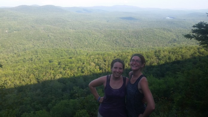
We left Stratton Mountain after breakfast aiming 13.7 miles north to a highway where we would hitch into Manchester Center to resupply. Like our visits to DC and NYC, Stratton had been a planned stop from the beginning. With the last planned stop now behind us, Katahdin was really on our minds. However, The Whites and Maine aside, I still had something especially exciting to look forward to – a visit from a very special friend.
Throughout the past couple weeks, my bravest friend and I had been planning to meet up so she could join us on the hike. A series of texts and calls discussing schedule and location predictions eventually led to us deciding to meet in Hanover, NH, home of Dartmouth College. From Manchester Center, we needed enough supplies to hike 100 miles to get there.
The 13.7 miles took less than six hours on this pretty day. When we arrived at the busy highway, we were happy to see a day hiker returning to his car, and he was quick to offer us a ride 6 miles into town. We did our best to make the stop quick and efficient, and, after eating and shopping, found another easy ride back to the trail. With our freshly resupplied packs, we hiked a mile and a half arriving at the shelter just as the sun was setting.
We were blessed with another pretty day and set out fairly early. We were hoping to hike 22.6 miles, but when we arrived at Little Rock Pond & Shelter 17.8 miles later, we couldn’t pull ourselves away. The water was just too inviting, the shelter welcomed us too warmly, and 5 additional miles became much too far away.

We were lucky to snag the last two spots in the shelter after a quick swim. Over dinner it seemed like everyone was discussing the same thing – tomorrow’s forecast which called for a whole day of rain. Joy.
Overnight, we were awoken more than once by rain pinging against the metal roof overhead. Morning came, but the rain didn’t cease. We slowly packed our bags, mentally preparing ourselves for the soggy day ahead. Suddenly 7 turned to 8 which turned to 9. We weren’t the only ones that were hesitant. In fact, the phrase “zero day” was being tossed around. Oh yeah, we don’t have to walk. We don’t have to go anywhere. So… let’s not?
Neither of us needed convinced. This shelter could be our all day haven from the downpour which would leave us soaked head to toe. Sure, we could trudge through the cold rain arriving at the next shelter that would likely be full. We could then sit around like soggy rats in our tent, debating if cooking in the rain was even worth the hassle. We could get our shoes and socks wet producing not only painful sores on our haggard feet but also a smell somewhere between wet dog and a moldy basement.
No.
BigFoot and I, accompanied by Hoff and Honey Britches, unrolled the Thermarests we had just packed up and made ourselves cozy for our dry day. In the South, I loved the trail so much I faced these “Appalachian Trials” with much more courage and tolerance. 1670 miles and nearly 5 months since we first stepped foot on the AT, I was over the rain. Way over it.
Choosing a zero day felt liberating and, although we had little entertainment, we enjoyed swapping stories as the hours passed. By about 2, the rain stopped. We “considered” moving on, but we weren’t going anywhere. We saw a few hikers come and go, looking as miserable as can be imagined, yet still trying to find a smile.

The next day was dry and sunny, and we left Little Rock Pond with no regrets. Feeling as though we had something to prove, we set out for a 22.3 mile day ending at a shelter on top of Mt Killington. We arrived just in time to see a beautiful sunset, a rarity in the green tunnel that comprises the AT.
A brisk morning awoke us, and we set out. By 11, we had walked 6.3 miles, and my weakness for a hot meal won over. We enjoyed lunch at the Inn at Long Trail a half mile down the highway and contemplated the remaining 500 miles to Katahdin. Though 500 miles seems small compared to the 1700 miles we had already completed, we still had over a month of difficult hiking ahead of us. I did my best not to dwindle on 500 for toolong. Quite frankly, it overwhelmed me.

Instead, a new thought. A reunion awaited 2 days and 44 miles north. On we hiked, completing 19.3 miles for the day. The following day, we completed a difficult 23.3 miles before arriving in the town of West Hartford.
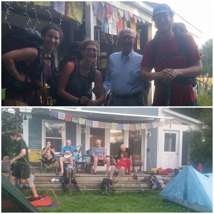
We were making our way through the small town when a bell rang, and a man motioned us over to his house. Cold sodas were immediately offered as well as a bunk in his garage or yard space for a tent. Happy to be done hiking, we gratefully accepted and stayed at Randy’s house with a dozen other hikers for the evening indulging in pizza and more cold soda from town.
In the morning, we woke early as Randy was making coffee and pancakes for the hungry hikers. We politely declined, hoping to make good time into Hanover nine miles away.
The hike was over in three hours, and we walked into town. Well, more like strutted as we drank sodas and munched homemade cookies left in coolers in the driveways of the houses that lined the street. Awesome.

We arrived before noon and snagged our package that was waiting for us at the post office. Our winter gear had arrived for its potential use in the Whites which now were only 43 miles away!

Our timing couldn’t have been better as one phone call indicated that my friend was turning down the street we were on. Let’s give Claudia a warm welcome back to the story, shall we!?

Oh, what a gift!! After we exchanged hugs and words so fast it probably made BigFoot’s head spin, we attempted to do our town chores. We found the hiker friendly laundry and shower facilities on Dartmouth’s campus unfortunately closed. Well… what’s another week’s worth of sweat and dirt??
Next, we successfully resupplied, ate some hot food, shook down Claudia’s pack, and safely stashed her car. We were ready to hit the trail. Just as we were on the outskirts of town, we noticed big, black clouds rolling in. Sigh. Welcome to the AT, Claudia!
We set out anyway knowing we would come to a shelter in less than 2 miles. Thankfully, the rain held out until we arrived. Though we intended to hike further that day, we played it safe and joined a few other hikers in the dry shelter for the evening.
We were quite grateful the rain was mild and short lived. We awoke early the next morning to clouds that dissipated steadily and had all but disappeared by noon. I was happy to see them go – I wanted nothing but a sunshiney experience for Claudia who I was already putting through a physical challenge.
By noon, Claudia had successfully completed her first summit on the AT, and we were blessed with beautiful views. After lunch at a nearby shelter, we continued down the mountain mentally prepping for the next climb. Between these two mountains, we crossed a road and noticed a group of hikers near a truck. Trail Magic. We bee lined for the truck and so happily devoured hotdogs, chips, and sodas.
Feeling powered up, we set out for our final 3 miles for the day. At the summit, it was clear we were really pushing Claudia. She came to the trail in shape and with the best possible attitude, but, put plainly, the AT is hard! I was nothing but proud of her for successfully completing 16.1 miles her first full day on the trail.
The day ended when we saw a sign for Bill Ackerly’s house. Bill, like a few others, graciously allows hikers to camp in his lawn and provides ice cream for every hiker that passes through. We arrived at his house and were warmly greeted by this trail legend. We devoured our ice cream bars, and BigFoot was thrilled to dominate a round of croquet. After we did our typical evening chores, we were all happy to crawl into our tents.

Morning came, and we gladly accepted the offered hot coffee. After we felt properly caffeinated, we set out for another 15 mile day which included a 2500 ft climb up Smarts Mtn followed by a 1400 ft climb up Mt Cube – a tough day even for those of us with our “trail legs.”
We began our first climb which sprawled over 6 miles from Bill’s house. BigFoot and I took off ahead of Claudia, knowing the climb would take her a bit longer. We stopped about halfway up at a good resting point and awaited her arrival.

Reunited, we enjoyed the view together and readied ourselves for the remainder of the climb. Again, BigFoot and I took the lead agreeing to reunite with Claudia at Smarts’ summit.

It took us just shy of an hour to arrive at the firetower that topped Smarts Mtn. We enjoyed the views and broke into our lunch while we anticipated Claudia’s arrival. Soon fellow hiker, Easy Go, joined us. Next, Birdie arrived. Then, Last Chance. Almost an hour had passed, and there was still no sign of my friend. None of other hikers saw her. I had a bad feeling, but decided we would give her a little more time before we retraced our steps.
When we were just about to head back down the mountain, we suddenly saw her emerge at the summit, our faces happier than hers.
“I went the wrong fucking way. For a half hour. Down the mountain.”
Shit.
Although I was quite relieved that she showed up all appendages in tact, feelings of guilt immediately began to sink in. I should’ve been stopping to check her progress. This was totally my fault.
She dumped her bag and, although clearly frustrated with herself, didn’t point blame and barely even seemed mad. She definitely wasn’t the first to take the wrong trail, and she wouldn’t be the last. And now, she had a trail name: Detour.

We told her to rest and take as much time as she needed. After lunch, we started down the mountain. I vowed to keep a better eye on her and, although BigFoot and I inevitably ended up ahead, we stopped at every trail junction to ensure that she stayed on the AT.
It was about 6 pm when we all made it to the summit of Mt Cube. We took a long break at the summit, in awe of the mountains that surrounded us. We were all pretty pooped and decided we would stealth camp at the next water source.
We found plenty of room at Brackett Brooke and set up camp for the night. The next day we planned to hike 11.5 miles to Hikers Welcome Hostel. Here, we would take necessary showers and do laundry as well as say goodbye to my dearest friend.
Morning came, and we took our time breaking down camp. Claudia, though beyond thrilled with her experience, was tired and happy to be returning to town comforts.
“For the record, you two are fucking crazy.”
No truer words were ever spoken.
By late afternoon, we arrived at Hikers Welcome and began our chores. The rumor mill hinted at the possibility of trail angels making dinner that evening. Needless to say, we stuck around and were so happy when the rumors came true. Hamburgers, hotdogs, chips, and watermelon sure beat Pasta Sides.
Right before dusk, BigFoot and I finished packing our bags. We wanted to hike one additional mile to the next shelter, not only to save a little money, but to be as close to the base of Mt. Moosilauke as possible.
I gave Claudia a big squeeze so proud of her accomplishment. We pushed her hard, and she impressed me with her strength, perseverance, and consistent positive attitude. Seriously, Claud, good work.
BigFoot and I raced against the setting sun arriving at the shelter moments before it was too dark to see. After 1790 miles, we could hardly believe we had made it to the Whites known for being both the most beautiful and the most challenging section of the AT.
Tomorrow was truly the beginning of the end.
Upper Goose Pond to Stratton Mtn

I was thankful to awake headache free at Upper Goose Pond Cabin proving the antibiotics were doing their job fighting off the Lyme disease. After we broke down camp, we headed to the cabin for breakfast. There’s really nothing better to a hiker, or I guess anyone for that matter, than a hot breakfast and coffee to start your day. After eating, the NOBO’s headed down the AT with blueberry stained smiles from the delicious pancakes and a little extra caffeine in our steps. Many of us were shooting for the small town of Dalton, MA, 20.6 miles north.

In the past few days, we had started noticing the southbound hiker (SOBO’s) bubble crossing our path as they made their way to Springer over 1500 miles south. They had already conquered Katahdin, all of Maine, and the Whites, and we were happy to exchange must see’s, do’s, and stops for the remainder of our trips.
Around noon, we crossed a highway and our guidebook mentioned the house of “cookie lady” .2 down the road. Unfortunately, she wasn’t home when we arrived, but we were still allowed to get water from her spigot and take a break around the picnic tables.

I took the opportunity to check my phone for service to make a call. I still needed a new prescription for the remainder of my Lyme disease medication which entailed me calling the doctor that had frustrated me so much in the past 10 days and politely asking for a new, more affordable scrip. I tried to erase all the four letter words from my head and put on my sweetest voice. Despite my feelings for her, I ultimately still needed her help.
After a series of automated menus and redirects, I ended up getting her voicemail. Shoot. I left a message and was surprised to see my call returned minutes later. I calmly explained the pharmacists recommendation for the switch from Doxycycline Mono to Doxycycline Hyclate, my now lack of insurance, and the affordability of the latter drug. She obliged without hesitation, asked where to send the new prescription, and wished me luck on the rest of the hike. I guess I was hoping for some sort of apology but was unsurprised when it never surfaced. My new prescription was now waiting for me 10 miles north in Dalton, and my contact with this doctor was done.
I rejoined the group of hikers, happy with my success, when a man pulled in the driveway in his van. He popped his trunk and started unloading large backpacks. We caught on quick – some hikers were out there slackpacking, and this was the meet up point. The man joined us, confirmed our suspicions about the slackpacking, and introduced himself as Tom.
“Levardi??” I asked.
“Yes, actually” he laughed.
“Well… I’m on my way to your house!”
Tom Levardi, mentioned in our beloved guidebook, allows hikers to use his lawn to camp overnight as the AT runs right down his street in Dalton. He said the SOBO’s he was helping slackpack would be arriving momentarily. It took me no time to see the opportunity here – we could slackpack the rest of the ten miles to Tom’s house.
I’m sure he saw my face light up as I quickly put the pieces together, and without much hesitation, I asked if the slackpack would be possible. He cheerfully agreed, and we waited for the SOBO’s to arrive. Within minutes, happy hikers came down the driveway, and we put our bags into Tom’s van. BigFoot and I, accompanied by Dirtface, did a NOBO / SOBO high five as we took their sweaty day packs from them. The three of us practically skipped back to the trail happy for the slackpack surprise. We finished the day’s hike in less than three hours and arrived in Dalton still wearing the smiles that began this morning over blueberry pancakes and coffee.
Tom Levardi’s house was easy to spot with a double white blaze painted on his mailbox post and two trekking poles lining the sidewalk leading up to his front porch. He greeted us with smiles and led us to the garage to grab our packs. He gave us a run down of his simple rules – keep your voices as low as possible, ask before borrowing the bikes, and no smoking. No problem, Tom. We inquired about a bus to get to nearby Pittsfield to pick up my medication and hit the Old Country Buffet that hiker’s dreams are made of. He was quick to offer to drive us and any other hikers that needed to eat or resupply. What a gem.
We pitched our tent and were off to buffet land in no time. Tom said to call when we were done, and he’d swoop us up and take us to the pharmacy. The food shoveling began plate by plate. I scarfed a big plate of salad, and before I knew it, my first heaping plate of hot food also disappeared. BigFoot went to the carving station for a steak and returned with one the size of his plate, too eager to wait on anyone to cut it down to an appropriate portion. He was proud to eat the whole thing, easily 16 oz. I grabbed my second hot plate and got through about half of it when my stomach began feeling a little overwhelmed. Suddenly, I was very light headed, surprised by these unfamiliar pains. The pharmacist warned me of stomach pain as a side affect of my medication – the tick strikes again! I sat jealously watching the rest of the table devour their food while I suffered, feeling robbed of precious calorie intake. My stomach eventually settled, but I was unable to eat anymore. Sigh…
Once the hikers pulled themselves away from the trough, we called Tom and he was on his way. He arrived with another van load of needy hikers and smoothly orchestrated and organized our stops. It took him more than one trip to get everyone where they needed to go which he did without complaint or the slightest indication of annoyance. Soon, I had my medication in hand, the new prescription costing $100 as opposed to $300 for the previously prescribed meds. We made our way back to Tom’s for the evening and enjoyed a short bike ride through Dalton before retiring to the tent.

We started the morning with a bike ride to get bagels and coffee before getting back on the trail. After many, many thank yous to our wonderful host, we began our 14 mile day. 9 miles from Dalton we found ourselves walking through the small town of Cheshire and couldn’t resist a quick stop for lunch before beginning the climb up Mt. Greylock. From Cheshire, it was 5 miles to the shelter we were shooting for with an 1800 ft climb. Mt. Greylock, Massachusetts highest point, was our first climb of that size in quite some time. In fact, it had been 700 miles and nearly 2 months since we had an 1800+ ft climb, and our legs noticed we were a bit out of practice. However, the climb involved very little struggle, and we completed the 5 miles in about 2 hours. We considered hiking the remaining 3 miles and 600 ft ascent to the summit, but the next listed campsite was an additional 3 miles north so we called it quits for the day. I hatched a plan to wake up very early for a chance to see the sunrise from Greylock, committing myself to break out of the bag around 4 a.m.

When early morning came, I awoke to darkness just then remembering my broken headlamp. Shoot. I laid awake waiting for enough light to start packing. At about 5:00, I awoke BigFoot and started rolling up the Therma-rest and sleeping bag. We managed to get packed and walking by 5:38, a new early start record. But, ultimately, the broken headlamp and 3 mile walk stole our chance of seeing the sunrise at the summit. Nevertheless, early mornings are always my favorite time to walk, and I still felt lucky to witness a peak at the color changing sky during the walk.

We took second breakfast at the summit very happy to feel like we were actually back in the mountains again. We chatted with a SOBO who was taking in the view a bit differently – he saying his goodbyes to the peaks as he headed towards the mid-Atlantic states.

After finishing our snacks, we continued down the mountain and found ourselves in yet another town 6 miles later. Our last shower had been in Great Barrington a week before and, although not our longest stretch, it was time to clean up. Thankfully, North Adams YMCA offers free showers to hikers so we hitched a ride from one of the more erratic helpers we had met. Read: she was a crazy person, but nice enough to help out a couple stinky hikers.
After cleaning up, we made our way to a laundromat which was a parking lot away from a Chinese buffet. I tried to eat a bit slower this time but was again halted by the Doxys. Grrr.
After showers, laundry, and lunch we decided we’d go for a hike! It wasn’t before long that we hit the MA / VT state line leaving us just three more states to traverse. This spot also marks the southern terminus of the near 300 mile Vermont Long Trail which coincides with the AT for about 100 miles. At camp three miles north, we noticed an increase in people. Not only were the northbound and southbound AT hikers colliding, now we had northbound and southbound Long Trail (LT) hikers in the mix. Eventually, we find a flat spot for the tent and passed out for the night.

Morning came, but we didn’t feel like moving. We had a 13 mile day planned which meant we didn’t have to hurry. We sat and enjoyed coffee and oatmeal uncharacteristically taking the time to have a hot breakfast. We didn’t start hiking until about 11 a.m. I guess yesterday’s 5:38 start wore us out a bit.
It was a pretty day, and I was quite content with our slow start. The feeling that we were nearing our final destination was starting to set in with less than 600 miles to go until Katahdin. We could barely believe we had made it to Vermont and reminisced on our first few days way down south in Georgia.
We completed our 13 mile day feeling very relaxed and enjoyed a campfire built by the AT SOBO’s and an LT NOBO that were camping nearby. You see, most of the AT NOBO’s had already given up the chore of creating and maintaining campfires. Way down south, campfires were built almost nightly due partially to the chilly weather and partially to the thrill and enjoyment of finishing the day around the fire. Perhaps it was the weather, perhaps it was the chore, or maybe even the campfire had lost its excitement or appeal, regardless – campfires had become a rarity for AT NOBO’s, and this one was a particularly nice reminder of the beginning of our trip.
After a good night’s rest, we managed to get up a little earlier than the day before and set out for a 17 mile day ending at Story Spring Shelter.

This site would put us 7 miles away from the summit of Stratton Mountain where we had made plans to meet up with BigFoot’s friend and former manager, Matt. We were not only looking forward to a night in a bed, shower, and hot meals, but the possibility of setting up jobs with Stratton Mountain Resort for the winter ski season. Hello snow!!

The next morning we woke up early and set out for our short 7 mile hike up Stratton Mountain. We enjoyed the beautiful blue sky and well graded trail up the mountain. Once at the summit, we enjoyed the view from the firetower and could see the gondola on the other mountain peak down.

BigFoot called Matt who agreed to drive up the mountain and pick us up at the twin peak. We made our way down the side trail and were greeted by Matt upon arrival. We came down the mountain directly to breakfast and hot coffee happy to be on a short day of hiking. Matt showed us to our room for the night, and the rest of the day was all about relaxation and making hiking dreams of full bellies and smelling decent come true. We were even fortunate enough to discuss winter jobs as well as catch the Saturday concert series featuring a Johnny Cash cover band.
The next morning we awoke revived and ready for our next stretch of hiking. Well, almost ready. The resort didn’t really have needed hiker resupply so we planned to hitch into town that evening to grocery shop. Manchester Center was 14 trail miles away so, as always, it was time to make moves.

After our quick trip up the mountain, we took the side trail to the opposite peak and continued northward on the AT. I had completed the first week of Doxys, regained a bit of my strength, and felt a bit of my usual overly confident self coming back. Though somehow, despite all the beauty and magnificence of the trail, I was still feeling drained. I was getting tired of walking, tired of the physical feat that is the AT. I found myself craving comfort in many forms – food, couches, entertainment, keeping dry in the rain.
But the battle in my head never lasted long. Somehow deep down, a little voice continued to remind me…
I absolutely 100% knew that I could do these final 551 miles. I knew the treasures that awaited me in the White Mountain National Forest and had heard tales of the beauty of Maine. Giving up wasn’t ever a real option. We would walk on.
Ticked.

After struggling over the hills with a stomach ache and headache, arriving at Amy’s house, taking a break, and eating a real breakfast was just what I needed. I knew something was off. Unknowingly, Amy and fellow hiker, Young Gun, put the pieces together for me.
Over breakfast, Young Gun discussed his recent “not feeling himself” conditions, and Amy voiced her concern about Lyme Disease.
“I’ve gotten Lyme before and I know I have it because I get these headaches that don’t go away.”
Bingo.
I immediately recalled all the pamphlets and signs I’d seen on the trail over the past four months. The blogs and accounts from other hikers about the evil, tiny creatures that you’re lucky to spot. I had been reading about Lyme for over a year preparing for this hike, and I knew that a few special hikers get it every year. As soon as she mentioned headaches, it all clicked. I have Lyme.
Amy continued, (to Young Gun) “If you think you might have Lyme, I’m happy to take you to the local clinic today to get tested.” She smiled, “Any offer I make, I make joyfully. That’s my policy.”
I picked at my waffle for a short minute and voiced my concerns to BigFoot. It was the obvious choice to accept this very gracious offer and spend the day in the clinic. I let our host know my symptoms and concerns, and she verbally rearranged her day to get me to the clinic. A few hours later, we were on our way.
We patiently sat in the waiting room and I filled out paperwork. Not too much time passed before I saw the doctor.
“So, what makes you think you have Lyme Disease?”
I then described my story – our hike that began four months ago, the amount of time I spend in the woods every day, the deer ticks we’ve picked off each other (though I didn’t find a biting tick on me), my knowledge of Lyme, recent fatigue, headache, neck pain, and abdomen pain. Though I thought I was reading Lyme Disease symptoms from a textbox, she seemed unconvinced.
I was surprised when she said, “The chance that you have Lyme is very slim. Many of your symptoms can be attributed to your pack and excessive daily exercise.”
“But what about the headache and neck pain?”
“That could be attributed to dehydration and your pack. I’ll order the blood test, and we’ll go from there.”
I was shown out the door back to the lobby. I was a little confused. I know it must be frustrating for doctors when patients WebMD themselves and self diagnose their conditions. I get that. But I just knew I had Lyme. The symptoms fit, and there was just no way that I felt so out of whack do to dehydration and my pack, especially after just returning from 3 days off. I’ve gotten really in tune with my body considering how much we exercise. I just knew it was Lyme.
I waited and was shortly called to get blood drawn. I asked the nurse drawing blood if I would be able to get a prescription, but she was just drawing blood and suggested I speak with the doctor again.
I returned to the waiting room and, after another twenty minutes passed, I was called back once more. I reiterated my concerns and asked if it would be possible to leave with a prescription in hand in order to get the antibiotics at the nearby pharmacy.
The doctor essentially put her foot down and would not prescribe without the test results claiming that my symptoms weren’t severe enough to suggest Lyme. I even mentioned my knowledge about the possibility of false positives and false negatives for the Lyme Disease tests that I’ve read about. We clearly disagreed, but her answer was final. I had no choice but to wait for the results.
I left feeling let down, just wanting the pain in my head to stop and my energy levels to rise back up. But I wouldn’t have the results for a week, and we didn’t have seven days to spare. We would hike out of this town the next day and be nearly 100 miles away by the time the results came back. And of course, the doctor predicted the test results to take a week – exactly the day my insurance expires.
From the clinic, we grabbed lunch at Boston Market, and Amy picked us back up. She welcomed us back into her home and told us to make ourselves comfortable downstairs with Netflix and a pint of Ben and Jerry’s. A couple movies later, she called us upstairs for guacamole, veggies, and dip while she grilled burgers. Soon her husband, Bill, was home, and we happily ate dinner. By the time the sun set, it was time for us to sleep, and we were shown the half finished garage where they let hikers spend the night. We were instructed to cook ourselves breakfast in the morning, though neither would be home, and leave whenever we were ready.
We said goodnight and goodbye to our hosts, so grateful for the chance encounter. Morning came and light-headedness came with it. BigFoot cooked us breakfast, but I didn’t feel strong enough to leave until 11. Knowing there was a shelter 5.5 miles in, we headed out to the trail and started hiking. It was a slow go and the smallest hills took everything in me to climb over. It took us about 4 hours to complete the short hike, but we both agreed it was for the better not to push it further.

We took afternoon naps and then watched hikers come and go. It was still relatively early in the afternoon, and there were miles to walk. But we stayed put for the evening, did chores, and chatted with a family of section hikers. A few other thru-hikers stayed put for the evening, and we were all asleep by dark.
We awoke to rain, a wonderful motivator not to go anywhere. We waited it out until about 10 am, while I tried my best not to dwell on my permanent headache that radiated into my neck and occasionally my ear as a bonus. The rain stopped, and we decided to hike a bit. This time 8.5 miles would take us to a highway just outside of Pawling, NY where we could eat and camp in the town park.

The hike was a struggle, but I kept my eyes on the prize and, thankfully, the terrain was easy on me. Two lovely ladies were just ending their day hike when we crossed the road, and they got us into town.
We devoured some town food and found another ride out to the park where we pitched our tent for the evening. We sure were happy to be under an awning when a severe storm passed through, dumping buckets of rain all night.
Morning came, and the sun came with it. We packed up and were picked up by more friendly people. We started hiking around 9, and no surprise, my head continued to ache. It had only been three days since I did the blood test with no improvement in my symptoms except a slight rise in energy.

A short 2 miles in, we came to the Appalachian Trail stop for Metro North. Here, hikers have the opportunity to visit NYC directly from the trail landing them in Grand Central Station two hours later (weekend stop only, station in Pawling runs trains all week).

We joked about returning to Megan’s Brooklyn apartment, but continued on. Later that afternoon, we were happy to enter Connecticut and celebrating our arrival in New England!

We completed our twelve mile day just before a brief storm began and made ourselves comfortable for the evening. The next day started early and a thousand foot climb with it. Through the mid-Atlantic states, we had become more accustomed to smaller climbs and generally flatter terrain. It seemed I had lost some muscle strength without the daily training, and that climb really tried me. I found myself chanting “I have, I can, I will” over and over in my head. What really began to concern me was the feelings of self doubt. How did I do this before? Do I really have it in me to hike 800 more miles? Was I “just” a 1400-miler? I did my best to not think about the possibility of Lyme. Maybe it was just a funk. I focused on the terrain, my breathing, my careful steps. I held on to dreams of hiking the Whites and through Maine as my motivation. I kept walking.
And as always, when you walk enough, you get, well, somewhere. And that day it was 15.7 miles, our first “full” day since we left the trail for NYC. We followed that with a 15.3 mile day over many 300-500 ft humps.

The following day, now 6 days since the Lyme test, we began early knowing a road walk detour around an out bridge was ahead. We enjoyed passing the big colonial houses with brightly painted trim and nice Subarus and BMWs in the driveways. I found myself with a craving for hot food and a strong desire to keep my phone charged hoping to hear the word from the clinic. I was hoping for a bit of magic to get that medication before my insurance would expire.
I easily convinced BigFoot into walking into nearby Salisbury, CT for a hot breakfast. Our $15 dollar small breakfast plates tasted a little like disappointment, but the homemade donuts and oversized coffee cup made up for it.

After our overall unnecessary break, we made it up a thousand foot climb to a shelter right before a full on downpour. We rejoiced about our perfect timing and decided 14.8 was enough for the day.

Throughout the afternoon, other not so lucky hikers arrived making us that much more grateful to be dry. My only lament that evening was the mosquito army that plagued the shelter. I don’t know why I didn’t just pitch the tent, but I do know it was not worth sacrificing my precious sleep. Needless hours were spent swatting the bugs out of my face and listening to them buzz in my ears. I barely slept, conceding defeat to my predator.
In the morning, we began our day with a climb up another Bear Mountain and got a beautiful view, a reminder of the unparalleled views that lie in the remaining miles ahead. On we went, the trail following a pretty stream for our final half mile in CT.

Hello, Massachusetts. We immediately began a thousand foot climb up Mt Race, the final .6 miles on exposed ridge to enjoy this sunny day.
After yet another climb that day, we descended Mt. Everett putting us at Guilder Pond 9 miles away from Great Barrington, MA where a resupply box from my mom awaited our arrival.

We hoofed it the rest of the way to town, aware of our 5:00 deadline to get to the post office. I called around to several hotels, most of which were booked and all of which were very expensive. We were considering a hostel when we encountered signs on the trail advertising camping, shower, pool, and Wi-Fi use at a local community center similar to a YMCA for $8 each. Sounds good.
We made it to the highway and hitched a ride into town to snag the box and, of course, food! Next, we checked into the community center, and to our surprise, we weren’t charged a dime!!

After a glorious shower, I finally had the voicemail I had been waiting for. I impatiently made my way through the automated system and was eventually redirected to my test results.
*Drumroll*
“Your test results came back positive for Lyme. Where should we send the prescription?” a different doctor informed me. For once in my life I wanted to be wrong, but I wasn’t at all surprised. My suspicions came true, but at least this way I had a treatment. I had Lyme.
I had them forward a prescription to Great Barrington CVS on the final day I had insurance. I kept my fingers crossed that the meds I needed would be covered the day they were called in though I couldn’t pick them up until the following day.
The moment of truth came the next day when we arrived at CVS. I was hoping the medication would be ready to simply pick up, but unfortunately although the fax had been received, the order hadn’t been filled. The busy pharmacists quoted me at least a half hour so BigFoot, and I decided to grab some food. When we were full and all but ready to hike out, we returned to the pharmacy. The order was ready, and I answered a sad “no insurance” to the friendly pharmacist explaining it had expired at midnight. The look on his face told everything, but he explained that even though the fax was received in time yesterday, since it wasn’t filled it would all be processed today ie – out of pocket. Specifically $300 out of pocket for the 30 day treatment.
It was obvious this was a big blow to me, but the pharmacist had one suggestion. He informed me that doxycycline mono which was prescribed could be replaced by doxycycline hyclate at about a third of the price, but the switch had to be made by my physician. Talking to this doctor was about the last thing I wanted to do, but I made the run around through the automated system to discover that she was, of course, out for the weekend and I’d have to wait until Monday. The pharmacist suggested getting a partial prescription until I could contact her, get the new one, and get it filled in whatever town we’d be in next. So about $40 and a literal and figurative headache later, I got some of the meds I needed.
With many expletives running through my mind, I tried to put on a smile to get a hitch back to the trail. Though we were passed up many times, eventually we got our ride and headed out for a 6.5 mile hike to a shelter. Anger fueled my late afternoon walk and I did my very best not to take it out on those around me. I was just plain frustrated.

My brisk pace, rising endorphins, and just being surrounded by the woods I call home calmed me, and when I reached the shelter I was ready for bed. A large group of young teens were at the shelter on a weekend hike and offered us there leftover rice and lentils. Well, that’s one less chore. Though the camping was full, only one other hiker shared the large shelter with us, and we pitched our tent right inside of it.
We awoke around 7 and packed up. During breakfast, I popped my first antibiotic. It only took an hour for relief to set in. The headache I had been going to sleep with and waking up to that was in no way affected by ibuprofen had finally stopped. The day seemed brighter in every way. Despite my frustrations, we managed to walk 21.1 miles that day, a huge accomplishment compared to the week before.
At early evening we ended our day at Upper Goose Pond Cabin, a beautiful two story shelter with bunks and a caretaker adjacent to the pond where you can swim and free canoe rental. We ended up pitching our tent at the crowded shelter, happy to see some familiar hikers.
I was, honestly, completely exhausted from the day’s hike and happy to crawl into my sleeping bag early. I took my second pill and went right to sleep. The headache didn’t return.
The morning began with the caretaker preparing a blueberry pancake breakfast with coffee for many hungry hikers for donation only. It was the start to a wonderful day and perhaps a restart to the rest of this long journey.
I couldn’t have been happier to have regained my confidence, my strength, and my desire to finish this trail. The previous week had me questioning what the hell I was doing out here and whether I was even capable of hiking over 600 more miles. And, wow what a gift to have met Amy. It’s really hard to say how much longer I would have hiked before I put the pieces together. To my Trail Angel, thank you for your generosity and kindness. You were definitely an important piece of our journey.
But hike on we did, and hike on we will. Whatever the weather, through injury and disease – we’ll get to Katahdin no matter what!!!
