
Summer of Summits: Denver to Long’s Peak

This summer Sean and I are attempting to summit as many 14,000 ft mountains in CO as possible, and we’re reaching the trailheads by bike! Join us on our Summer of Summits.
Day 1 – Denver to Loveland – 58 Miles by bike / +1800 ft elevation


Our Summer of Summits began in Denver with our eyes set on Long’s Peak. Long’s Peak is 14,259 ft in elevation and is a Class 3 climb which requires rock scrambling. For those interested in the route, check out the details for Long’s Peak here at 14ers.com. Do not underestimate the challenge of the climb nor the altitude.
We decided to head to Rocky Mountain National Park by way of Loveland, CO, to hike our first Colorado 14er. As a bonus, we have dear friends in Loveland. Our 58 mile ride was a hot one, over 90° with full sun exposure. We followed Google Maps navigation which linked up several bike paths and most roads at least had a bike lane. Our day ended perfectly with pizza, beer, and catching up with friends.


Day 2 – Loveland to Meeker Campground – 38 Miles by bike / +4000 ft elevation gain
We started our day early in Loveland and headed west towards the mountains on Highway 34. The first 27 miles and 3000 ft of gain took us to Estes Park. The highway was fairly busy with little shoulder, but thankfully our high viz jackets and headlights and taillights did the trick. We safely arrived in Estes Park in the afternoon, had a little picnic outside the grocery store, and got our resupply. Then, we started on our final 11 miles for the day with an additional 1000 miles of climbing. It was a slow go, but we eventually made it to Meeker Campground just 3 miles away from Long’s Peak trailhead. Typically, someone wanting to climb Long’s would stay at the Long’s Peak campground inside the park. But 2020 is no typical year. Meeker is the only one open, first come first serve. We were glad to get a spot and setup camp.


Day 3 – Long’s Peak Summit – 14.8 mile hike / +5000 ft elevation gain; 6 miles by bike / +800 ft elevation gain
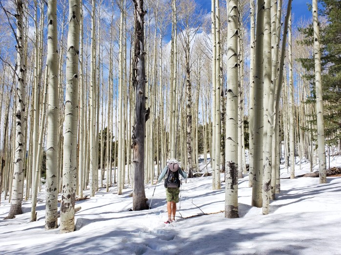
Our day began at 2:00 am. Whether it was nerves or altitude, neither of us slept a wink. We assembled what we would need for the hike, ate some breakfast, and headed 3 miles and up 800 ft to the Long’s Peak trailhead. We arrived and began our hike at 3:20 am. The trail begins through the forest, and then soon we were above treeline. Around 5, we witnessed an incredible sunrise and could finally see the peak we were climbing. At about 6, we came to the end of the hiking portion. The rest would be a climb and scramble.


The first section is the boulder field, about a half mile hopping from boulder to boulder aiming for the “keyhole” to get through to the other side of the mountain. From the keyhole, yellow and red targets mark the route.


After the keyhole, the summit lies 1.5 miles ahead with 1000 ft left to go. The first section past the keyhole is known as the ledges. We followed a group of six carefully skirting the side of the mountain.

The ledges led us to the trough, the longest part of the journey. The trough was full of loose rocks and knees to chest climbs. This section was difficult, especially with the effects of the high altitude. I continuously made a few moves and stopped to catch my breath. I’ll admit to being one of the slower climbers on the route as the altitude really got the best of me.
Once we finished the trough, the narrows were next. We carefully climbed out way on a narrow path around the mountain.


The last section to the top was the homestretch. This was basically a scramble on all fours to the peak. I definitely had some scary moments through this part, but was so thrilled to make it to the top. At about 9:30 we reached the summit, about 3 hours after leaving the keyhole.


We enjoyed a little time at the summit before turning around. For me, coming down was significantly less stressful than going up. We carefully retraced our steps back down the mountain and were relieved to reach the keyhole, scramble through the boulder field, and return to a regular trail.
The six miles down the trail seemed to take forever simply due to being completely physically and mentally drained. At 3:40, we reached the trailhead, grabbed our bikes and took a short nap at a picnic table. After, we rode the 3 miles back to our campsite at Meeker Campground and slept for the next 12 hours straight.

Next, we prepared to head south towards our next 14er, Mount Evans.
If you’re keeping track…
104 Miles by Bike / +6600 ft of elevation gain
14.5 Miles Hiking / +5000 ft elevation gain
1 – 14,000 ft Summit
We are Bekah and Sean, out on an adventure to summit as many CO 14ers as possible this summer and reaching them via bicycle! Follow along here or on Instagram as we complete our Summer of Summits.
West Coast Bike Tour – Highways 101 + 1: Brookings, OR to San Francisco, CA

Our west coast bike tour continues in Northern California with massive redwoods and gorgeous coastline during our 425 miles between Highways 101 and 1. Check out the story and our pictures below 🚴♀️🌎🚴♂️
Day 17 – 58 Miles
We left Brookings early to a bright sunny morning. We were about 6 miles from the Oregon California state line where a big climb would take us into the redwoods. After a brief stop in Coos Bay, we prepared ourselves for a 1200 ft climb followed by a fun descent. The curvy road thankfully didn’t have too much traffic, and we pedaled away surrounded by towering trees.

We were delighted to reach the top and began our descent winding down the highway. Soon, we approached a construction zone that only allowed one lane of traffic through at once. We waited while the cars backed up behind us, but wisely let them pass when it was our turn. This allowed us to take up the rear knowing that there was a great distance between us and the next group of cars through construction. We had the whole lane to ourselves and glided down the highway grinning ear to ear. We stopped at the bottom of the hill for a picnic lunch, then continued on our way. We still had one more big climb ahead of us before camp.
Just south of the tiny town of Klamath, we reached a detour that would take us to Prairie Creek State Park via Newton Drury Scenic Byway. This byway parallels the 101 for about 10 beautiful miles. We made the turnoff the highway and headed uphill once more.

The hard work was not without reward as this byway did not disappoint. After cresting the hill, we set off on an incredible 7 mile descent winding through continuous redwood groves, trees towering in all directions. Here was truly one of my most favorite moments of the tour – effortlessly gliding among giants.
Our descent came to an end at the state park campgrounds where we setup camp for the night at the hiker / biker site.


Day 18 – 27.4 Miles
We woke up excited for our relatively short day ahead. We were aiming for the small town of Trinidad where our friends Cassidy and Dustin, who had housed us in Astoria a week prior, were joining us to camp for the night. We arrived at the campground ahead of them and tend to our chores – showering, laundry, grabbing groceries.
We were stoked when our friends arrived to our camp in the redwoods. In the evening, we made the short walk to the beach to watch the sunset and play with the pup, Althea, and we stayed up probably too late around the campfire gabbing and giggling.


Day 19 – 23.7 Miles
In the morning, we said our goodbyes and pulled away on bikes. Just north of Trinidad, highway 101 became more of a freeway – divided highway, two lanes of traffic in each direction, and entrance / exit ramps. This continued as we headed south through Arcata then to Eureka. Tired from the nigh before and swayed by Eureka’s budget friendly accommodations, we took a short day and rested in a motel.
Day 20 – 75.3 Miles
Leaving Eureka, the 101 continued as a busy freeway. As a plus it had a huge shoulder, but the whizzing traffic and not too scenic of an area made it somewhat of a bore to me. I was thrilled to find the Avenue of Giants scenic byway around lunchtime. This byway, much like the one a couple days ago, also parallels the 101 but this time for about 30 miles. We were thrilled to get off the freeway and again be surrounded by unending redwood groves. That evening, we were headed for another campsite in the redwoods at Richardson Grove State Park.
The Avenue of Giants byway ended just north of Garberville where we stopped for some groceries. Richardson Grove was about 8 more miles down the road.
We arrived at camp delighted to be once again surrounded by the redwoods and even more stoked to be joined by our friends and fellow Sockeye employees, Dani and Ali.

Day 21 – 35.6 Miles
In the morning, we parted ways and continued down the 101. Our 35 mile day would take us to yet another friend’s house. We took off for 28 windy, hilly miles down the 101.
We took a lunch break at turnoff for our friend’s house, mentally preparing for the challenge ahead – 3300 ft of elevation gain in about 7 miles on a mostly gravel road. We knew he had a truck if we couldn’t make it up, but we wanted to give it a try. It took us two full hours of winding up the incredibly steep gravel road with many, many breaks in our lowest gears, but we rejoiced once we made it to the top.
Day 22 – Day 25 – 0 Miles
The next 4 days we rested enjoying the company of our friend and his many dogs. And we picked the perfect time to pause the ride as it rained the majority of the time we were there!
Day 26 – 57.2 Miles
After our rest, we left the house with a slight ascent back over the peak then careening down to the 101. Upon the ascent, I was struggling to make it uphill. Sean almost turned back to see where I was when I rounded the corner, and he could see my flat rear tire. 950 miles, this was our first flat! After about 20 minutes, we were ready to ride again, flat fixed


We rode to the small town of Laytonville and loaded up on groceries. From here, we headed west on Branscomb Rd that would take us to Highway 1. It was great to once again be off the highway. We saw very little traffic and felt rejuvenated after our break. Even the 1000ish foot climb over the coastal mountains didn’t seem too bad. Once we made it to the top, it was sweet, smooth sailing all the way to Highway 1. Not too long after returning southbound, we made it to Fort Bragg where we found a cheap motel for the night.

Day 27 – 44.9 – 1014.1
We left Fort Bragg happy to be back on the coast with nothing but sunshine in the forecast and about 150 miles left to San Francisco. Compared to the 101, Highway 1 is considerably windier with many sharp turns and is a series of continuous hills. We spent the day climbing and descending and ended at Manchester KOA.


Day 28 – 65.9 Miles
Another perfect day of weather! We rode all day in the sunshine pedaling up, coasting down, and repeating over and over. In the late afternoon, we came to a big climb hugging the coast as we climbed up over 1000 ft. From the top, we careened down with big ocean views stretched before us. I audibly wowed my way down the mountain cautious of the steep dropoff to my right.

As we neared sea level we came to a stop through some road work. A stop light was directing traffic through one lane at a time. We followed a string of vehicles and were slowly going uphill around 5mph. We both had a feeling we weren’t going to make it through before the other lane started coming. As predicted, oncoming traffic approached as we were slowly moving uphill with a cliff on one side and a guardrail on the other. Thankfully, the lead car spotted us, and traffic mysteriously meandered around us despite the lack of wiggle room.
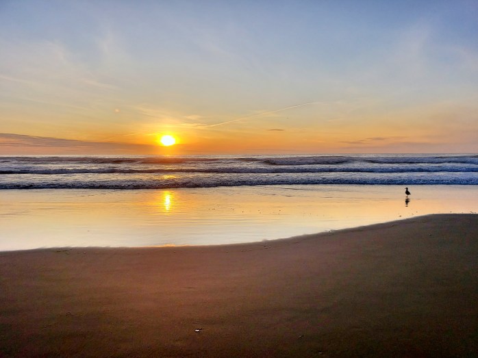
As the sun was setting, we cruised our final 10 miles to Bodega Bay Dunes Campground. As I watched the sun set into the ocean while riding my bike, I was nothing but grateful for the experience of my first long distance ride.
Day 29 – 69.7 Miles
When we realized we were only 70 miles from San Francisco, it wasn’t hard for us to make the decision to push on into the city. We woke up to our warmest morning of the ride and were already hot by 9 am. The news mentioned a wildfire had started overnight in Sonoma county (where we were) but it was inland. With our goal in mind, we started our ride.
The first half of the day was the similar pattern of ups and downs we had come to expect on Highway 1. This section was incredibly rural with very little shade, traffic, and much of, well, anything. We stopped for lunch in Point Reyes and evaluated our mileage. We were right on track for getting into the city before dark.
We took off again thankfully this section was a little bit easier pedaling, and I very much enjoyed some added shade from the trees we started seeing.
When we got to Stinson Beach, we were surprised to see Highway 1 was closed with a reroute going up and over Mt. Tamalpais (Mt Tam). We were already pretty committed to our goal, so we began the climb of nearly 1500 ft. It was a pretty big surprise to add to our 70 mile day, but once we got to the top, the ride down was pretty joyous.


We rejoined Highway 1 and soon enough we were riding our way through Marin City and Sausalito. I put Google maps bicycle navigation on, and got the in ear directions to get us through the city. All I gotta say is, thank God for west coast cities with bike lanes!!!

We were racing the sun, trying to end this long day before it was completely dark. We rode around the San Fransisco Bay with amazing city views and tons of cyclists out. Finally, we reached the iconic Golden Gate Bridge. When we arrived, the south bound pedestrian lane was for bikes only. It was an incredible moment having reached our destination from Seattle so many miles away. The pastel colors blended in the sky perfectly, and were stopped for a brief moment to take it all in.


After crossing the bridge, we had just a couple miles left to get us to a hotel downtown. Again, so grateful for bike paths and lanes!!! We grabbed a few beers and collapsed into bed, proud of our efforts and exhausted.
Day 30 – 21 miles
Though we’d made it to the city, we still had to get to the south side of the Bay area where the San Francisco airport is. This involved a 21 mile ride across the city. Directions in ear we navigated from the heart of downtown through various bike paths and lanes to the opposite side of the Bay. Though I was definitely nervous for this undertaking, I couldn’t help but be proud of myself for getting this done safely and overall confidently. The biking world is all very new to me, but it’s pretty exciting seeing my skills, abilities, and confidence grow.
Sadly, our west coast bike tour has come to an end! Including the ride all the way to the bike shop to get the bikes boxed, we rode 1175 miles in 30 days.
Look for another blog post soon breaking down our stats and review of our ride from Seattle to San Francisco 🚴♀️🌎🚴♂️
We are Bekah and Sean, long distance hikers, bikers, seasonal workers, and global vagabonds. Follow our life in motion here or on Instagram.
Highway 101 West Coast Bike Tour – Astoria, OR to Brookings, OR

2 states and 700 miles down Highway 101 on our bikes!! We finished the Washington section, around the Olympic Peninsula then down the 101, in about a week. After a couple days off, we began riding Oregon’s stunning coast. What an amazing ride so far!
Day 10 – 39.2 Miles
We left the comfort of our friend’s house in Astoria after two relaxing days off and continued south down the 101. We had a goal to make it to Nahelem Bay to meet up with yet another friend. We rode 39 miles and arrived about 3. This was our first of many amazing Oregon State Parks that we would visit during the Oregon stretch. Upon arrival, we found the hiker/ biker campsite and setup camp while we awaited Natalie and Josh’s arrival. We were stoked to reconnect with our friends and spent the evening catching up and walking on the beach.


Day 11 – 72.7 Miles
In the morning, we packed up camp and started riding as early as we could. We tend to be early risers, but the chilly mornings are especially hard to ride through as our feet turn to bricks of ice. Despite the chilly start, we rode all day taking casual breaks at the many state parks and scenic view points stopping for the day at Devil’s Lake Recreation Area. These hiker/ biker campsites have been pretty awesome and all for only $8/ person.
 Day 12 – 25.2 Miles
We started riding towards Newport knowing we would take a break there. Sean’s bike was still giving him a little trouble, so we had our sights set on the bike shop. We arrived at about 1 pm after 25 miles of riding only to find the bike shop was closed on Mondays in October. With little choice, we decided to book a room. Thankfully, there was a decent room for $50 for the night nearby, and we enjoyed taking a short day.

Day 13 – 22.6 Miles
In the morning, we went back to the bike shop. The mechanics there were kind and quick to get his bike in the stand. With a few adjustments, Sean’s bike “Big Red” was riding smoothly. We left Newport around noon and continued south. Not long into our ride, we encountered one of many long bridges. Thankfully, the car tailing us over the bridge was patient, gave us plenty of space, and held back traffic. We rode for about an hour before the billowing clouds let loose. About 22 miles into our day, we entered the town of Yachats. Soaked, we were easily tempted to stop at the Yachats Brewing Company and decided on another hotel room for the night to dry off and warm up.
Day 14 – 55.5 Miles
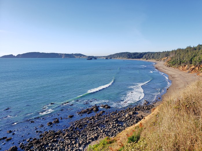
We woke up to a sunny morning and were back at it. Just south of Yachats, we stopped at Cape Perpetua to view the phenomenon of the ocean sink hole named Thor’s Well. We took a few minutes at the overlook at continued pedaling. This was an especially picturesque section of the highway as we hugged the coastline for over 20 straight miles sometimes pumping uphill followed by smooth coasting downhill. We ended our day by setting up camp at Tugman State Park.
Day 15 – 72.2 Miles
After our typical oatmeal breakfast, we were rolling again. Around noon we approached Coos Bay with another lengthy bridge. We again got really lucky with a patient driver behind us as we struggled to maintain a 15 MPH speed pumping as hard as we could uphill. For no apparent reason, 2 cars in the opposite lane yelled at us for holding up traffic, but the cars following us were kind and gracious. We maintained a great pace all day and decided to stop after 72 miles at Humbug Mountain State Park.
Day 16 – 49.6 Miles
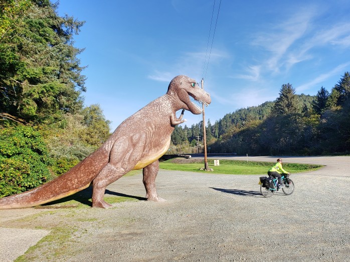
Our last day in Oregon started with a brisk morning. We left Humbug Mountain State Park and were soon at Prehistoric Gardens. Around 11, we came to the town of Gold Beach and stocked up on groceries. We had about an 800 ft climb ahead so we decided to wait to take lunch at the top at the scenic viewpoint. After a tough climb, we enjoyed our picnic lunch. During lunch, a family of six joined us at the overlook. We started chatting and learned that they were traveling by bike from Quebec to Mexico and onward to Cuba. The kids ages ranged from 9-15, each had their own bike and gear. Pretty awesome stuff.
After lunch, we kept on trucking staying shore side for the majority of the day. When we got to Brookings, we indulged ourselves with a motel, chips, and bad TV leaving less than 10 miles to the California state line.
Overall, Oregon was dreamy. We biked 350 miles in a week and loved all of the State Parks, Recreation Areas, scenic viewpoints, and beaches. I feel as though Oregon might take the cake for most scenic section of the 101. But onward to California 🚴♀️🌎🚴♂️

We are Bekah and Sean enjoying this beautiful planet one bit of Infinite Geography at a time. Follow our life in motion here or on Instagram.
Highway 101 West Coast Bike Tour – Seattle, Washington to Astoria, Oregon


Day 1 – 14.2 Miles
We put our boxed bikes on the overnight ferry and headed towards Juneau. In the morning, we arrived about an hour later than expected but still managed to make it just in time to check the bikes and board our flight to Seattle.

Upon arrival in Seattle, we headed to baggage claim to grab the bikes, found a quiet corner, and started assembling the bikes that our friend Nora helped us box up just two days prior. Thankfully, we managed to get the bikes together ourselves, a grand achievement in my book.

The next step was to boldly take to the busy Seattle streets as if I knew what I was doing. We attached the bags, strapped on helmets, and were off. Since we had a long travel day, we brought ourselves to the Seattle ferry terminal about 14 miles from the airport. Cars buzzed around us as we carefully meandered the busy downtown area, but in about an hours time, we had arrived at the ferry. We boarded with a big bicycle gang and were off towards Bainbridge where we’d spend the night in a cushy suite.

Day 2 – 43.6 Miles
We woke up well rested and had a few morning errands to take care of before hitting the road. Our friend, Caleb, recently moved to Seattle and wanted to accompany us out of the city. We met up with him and began our ride. Our destination for the night was Port Townsend for accommodations at a friend’s parent’s house.

Leaving Bainbridge was mostly highway riding though we did a few cuts through neighborhoods and back roads. The fauna of the rainforest surrounded us – big ferns, blankets of moss, towering trees. We took a lunch break after about 30 miles of riding and said goodbye to Caleb before continuing north.
Nearing Port Townsend, we stopped at a roadside farm stand full of fresh, local veggies and Washington made products. We loaded up and headed to the house for a super cozy stay on the farm. (Thanks again, Keely!)
Day 3 – 75.6 Miles
We started our day pretty early leaving Port Townsend and heading west around the Olympic Pennisnula. It was cloudy, but dry. Soon, we linked up with Highway 101 and began riding on the shoulder. Not too far into this ride, we realized there was an adjacent bike path called the Olympic Discovery Trail. We switched to the paved bike path, grateful for a dedicated lane away from traffic. A quick google search informed me that the trail stretches nearly 100 miles west to Forks where the 101 heads south. Score.

We stayed on the Olympic Discovery Trail (ODT) all day stopping in Sequim for lunch and a quick stop in Port Angeles to take in the scenery. For most of the day, the trail was paved and very well maintained. It was a series of small hills but nothing too difficult despite some short steep sections.


Our friend Dan had mentioned a free stealth campsite on the shores of Lake Crescent. We weren’t sure we would make the 75 miles earlier in the day, but with only about 12 left to go at 5:00 pm we thought we could make it.
Leaving the tiny town of Joyce, we started relentlessly climbing up and up at a slow and steady pace. At some point, the trail turned from a road onto the “Olympic Discovery Trail Adventure Route” for a short stretch. This section of the ODT is single track designed for hikers and mountain bikers. Knowing it was a short section, however, we gave it a try.
I have no experience mountain biking, so this 2 mile section filled me with doubt and anxiety as I meandered rocks, roots, divots all while next to a pretty big cliff drop off on my right side. I couldn’t have been happier when those two miles were over. The trail opened up to a wide gravel road and sent us downhill at a fairly steep grade.
Our final 6 miles were mostly flat gravel road with a final section that was footpath and bike path only around the beautiful Lake Crescent. As the sun was setting, we found Dan’s secret stealth campsite and setup for the night, exhausted and proud of our big day.

Day 4 – 53.2 Miles
We started riding at about 8:00 am continuing on the ODT. We rode the trail nearly 30 miles until we rejoined the 101 about 10 miles east of Forks. We got to town at about lunch time and stopped for a rest.

My energy level was pretty low, so I researched a campsite near town. The app iOverlander has been super helpful finding campsites along this journey. We found a spot for $5 on some private land about 15 miles out of town and headed there for the night. We put our money in the honor box and setup camp right on the shore of the Hoh River.

Day 5 – 80.6 Miles
We got a slow start as the temperature was around 40° to start out the day. Even though you’re doing physical activity on a bike, the cold weather freezes your toes until your pedaling with blocks of ice instead of feet. We began our ride, taking breaks along the way to thaw.

We rode in and out of Olympic National Park and Forest enjoying the coastal temperate rainforest flora. Soon, we got our first glimpse of the Pacific Ocean at Ruby Beach.
The 101 does not stay coastal for very long in Washington and soon we followed the highway inland. We knew that there weren’t many towns throughout this stretch, so we rode long segments without many breaks. The scenery changed once we exited the forest to patches of trees mixed with bald spots. This area is dominated by the logging industry. It wasn’t particularly scenic so we just settled into some podcasts and peddled the day away over very mild terrain. We stopped after 80 miles at a stealth campsite outside of Hoquiam.

Day 6 – 50.7 Miles
This was a particularly brisk morning. We packed up camp but felt pretty unmotivated to ride in the cold. Since we were just outside of a town, we rode until we found a spot for coffee and dawdled around until it was warm enough to be on our way.
While killing time, I check the website Warm Showers (think couchsurfers for cyclists) to see if there were any hosts for the night within a good distance. We found a lovely couple who lived on a farm in Bay Center and put out a message to see if they could accommodate us that evening.
We stopped at a grocery store in Aberdeen for lunch and food for dinner. In the mean time, Paige had messaged me welcoming us to her farm for the evening. We took off from Aberdeen excited for our first Warm Showers experience.
Leaving town we encountered the biggest hills of the trip thus far, every hill top seemed to be the bottom of the next hill. After several hours of climbing at about a 5 mph pace, we took a break in the small town of Raymond leaving 15 miles to our host’s house.
At about 5:30, we arrived at Paige and Hugh’s farm and were warmly welcomed into their home. We met all six of their friendly dogs and were shown to the trailer where we would spend the night warm and dry. We spent several hours chatting and swapping stories before heading to bed.
Day 7 – 29.1 Miles
In the morning, we only had about 30 miles ahead of us to get to Astoria where two of our best friends live. After breakfast and many thank yous, we headed out down the 101. After a lunch break, we arrived at the Washington side of the 4 mile bridge that spans the Columbia River. We had heard the bridge is narrow, has no bike lane, and traffic whizzes by at 55mph. I was pretty anxious about this crossing to say the least.
We decided to take a break at the rest stop before the bridge. Out of nowhere, our previous night’s host said hello. Hugh had just crossed the bridge in his big pickup truck and quickly offered to drive us across the bridge.
We weren’t really sure how to feel about the offer. On one hand we wanted to ride the 101, that’s kinda the name of the game. On the other, I’d like to finish the trip alive and well. After some hemming and hawing, we ultimately decided to take the ride and play it safe. Once we were in the truck and on the bridge, we realized we made the right call. There’s no room for bikes on this bridge, and while we probably would’ve made it over safely, the amount of anxiety and stress I would’ve been under during this section was thankfully avoided.
We thanked Hugh once more for all of his help and entered Bikes and Beyond to get our bikes tuned up for the many miles ahead. After a few moments, my dear friend, Cassidy, entered the bike shop. We left our bikes with the mechanic and headed to her house excited for a few days of relaxing and catching up ahead of us.
We are Bekah and Sean embarking on our first long distance bike ride down the west coast. Follow along the journey here or on Instagram.
Rim to Rim to Rim: Double Crossing the Grand Canyon in a Day

After completing the Arizona Trail and hitching to Phoenix, we still couldn’t shake the idea of attempting a double crossing of the Grand Canyon. When else would we be back here and in such great physical shape? Once we picked up our van, we started driving back to Grand Canyon National Park mentally preparing ourselves for the behemoth day ahead. We got our hiking snacks together and decided it would be easiest to camp at an AZT trailhead just outside the park boundaries. We drove up to Grandview Tower where we had been just days before and found a flat spot to sleep for the night. We were happy to run into fellow hiker Snakefarm and were eager to share a little trail magic. By 8:00, our bags were ready, and we were laying down nervous and excited for our big day.
Rim to Rim to Rim: Double Crossing the Grand Canyon
2:15 am – I hear Sean’s alarm go off in the van. The three of us woke up hastily and started getting ready for the day. We then drove about 25 minutes into the park, leaving our van at the visitor center.
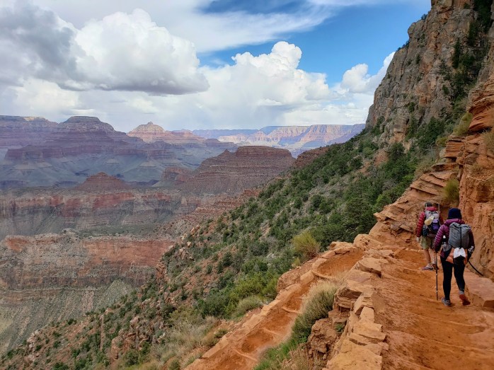
3:00 am – It was time to walk. Unfortunately, there’s no public parking at the South Kaibab trailhead, so we began our day hiking the rim trail 2 miles to where the South Kaibab begins its descent into the canyon.
3:45 am – We arrived at the South Kaibab trailhead lit only by the nearly full moon and the beams of our headlamps. By moonlight, we could just barely see into the canyon we had traversed just days before. We set a quick pace and began switchback after switchback, staircase after staircase descending deeper and deeper into the canyon in darkness. From the trailhead, it’s over 5000 ft of elevation and 7 miles to the Colorado River.
5:30 am – Dawn broke allowing us to put the headlamps away and take in the beauty of the canyon once more. A group of five runners passed us, also attempting a double crossing.

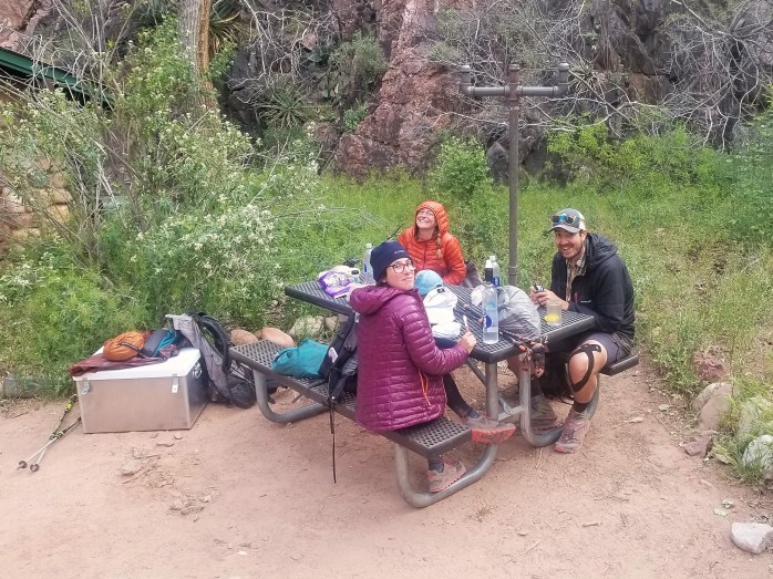
6:07 am – We reached the bottom of the Grand Canyon and crossed the Colorado River for our first time that day. Soon after, we reached Bright Angel campground and took a quick break to shed layers, eat a snack, and fill up water.

6:30 am – It was time to begin our first ascent up the canyon to the North Rim via the North Kaibab trail. This trail is 14.8 miles and over 7000 ft of elevation change from Bright Angel campground. We followed the trail the first six miles adjacent to Bright Angel creek through a slot canyon which gently slopes uphill. The next 9 miles is where the climbing steepens consisting of switchbacks and staircases until you reach the rim. Over the next four and a half hours, our pace only increased as we steadily climbed up the North Rim. I fell behind the guys who were flying at speeds I simply could not compete with, but that didn’t stop me from trying. During this climb, we continued to see and pass everyone else heading up, including many runners. “They’re flying! I’m trying to catch ’em,” I commented to a runner as he let me pass. “You’re flying,” he confirmed. Our pace held at over 3 mph, maybe even reaching 3.5 mph, while we climbed powered by caffeine and adrenaline.
11:00 am – The guys reached the top.
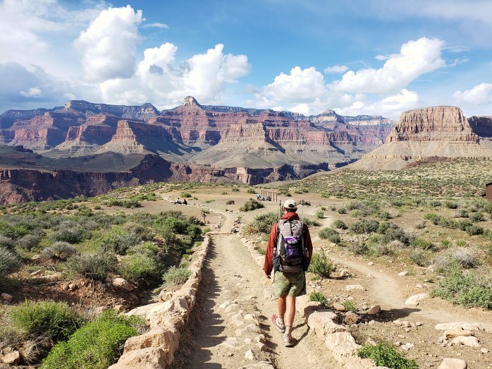
11:04 am – I join them. We were halfway done with our day – 8 hours, 23.4 miles, and over 7,000 ft of elevation change. There isn’t much of a view from the North Kaibab trailhead, so we headed down about a half mile to take a lunch break.

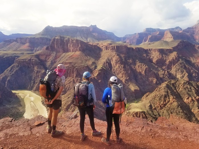
11:20 am – We took our lunch at Coconino Lookout giving us an incredible view of Mount Humphreys far in the distance and our destination, the South Rim, seeming oh so far away. We scarfed bagels and avocados and loaded our pockets with snacks for the long descent in front of us.


11:55 am – We begin our long downhill haul back to Bright Angel making a brief stop at Manzanita campground to refill our water. We hit over 3 mph as we descended at times using gravity to turn our walk into a run. We enjoyed the change of scenery as we took in the canyon heading the opposite direction.


4:20 pm – We finished our descent and took another quick break to fill up on water and refill our snack pockets. We had just 7 miles left of our 45.5 total miles and one massive climb left to get back to the South Rim. I could feel the tiredness setting in, but I was mostly too excited to let it get me down. Could’ve been the caffeine Mio I added to my water, who knows.

4:40 pm – It was time for the final ascent, the last section of this double crossing. The sun hit me as I began to climb up, spreading the fatigue to my increasingly heavy feet. The guys got ahead of me, but never too far out of sight. We retraced our steps up and up, doing mini celebrations after completing switchbacks and staircases. I did my best to continue a steady pace, not wanting to give into the fatigue… not that I really had a choice anyway. My personal goal I had set was to be done by 8 and not to have to use my headlamp, and boy was I determined to make those goals happen.


6:34 pm – The sun was setting as we entered a plateau, and the South Rim came into view. This was it. The final push and this crazy endeavor would be complete. We were so close!

7:00 pm – The sun had set. The horizon still had traces of yellow and orange while the red rock glowed vibrant pinks and oranges. The nearly full moon rose over the east side of the canyon.

7:30 pm – It was mostly dark by this point, but I knew I was closing in on the final half mile of my day. I refused to reach for the headlamp.

7:35 pm – The guys’ celebratory screams made their way to my ears. They had reached the top.
7:45 pm – We cheered together as I emerged from the canyon. The mix of excitement and fatigue left me in a dreamlike state. My personal record had been topped. We had completed 45.5 miles over 12,000 ft of elevation gain in 16 hours and 45 minutes.
8:00 pm – A kind ranger offered Sean a ride from the South Kaibab trailhead to the visitor center to pick up our van saving us the 2 miles of the rim trail to the parking lot. We got back in the van fueled by adrenaline and disbelief at our athletic achievement.
Now, it was finally time to say goodbye to the beautiful state of Arizona and head back east. 800 miles of the AZT was a feat for sure, but I gotta say, I’m pretty damn proud of this double crossing. Despite the quantity of miles I’ve hiked, I still really don’t consider myself an athlete. But now, I proved something to myself and reached a new level of athleticism I didn’t know I had in me.
Thruhiking the Arizona Trail: Flagstaff to Utah

From Flagstaff in the snow around Mount Humphrey’s to the bottom of the Grand Canyon and, at last, reaching the northern terminus, this final section in Arizona had a little bit of everything. Here’s our trail recap of the final 250 miles of the Arizona Trail…
Day 25. After our nero + zero combo in Flagstaff, we resumed hiking towards Mount Humphrey. It was a beautiful day with easy trail, that is until we hit the snow. Suddenly we found ourselves slowed down around 1 mile per hour walking across a trail buried in snow, post holing at times up to our waist. The snow lasted about 6 miles, 6 very slow and long miles. We were elated to drop down in elevation enough to resume hiking a dirt trail. The trail turned into a gravel road, and we were able to make up some time. 33.2 Miles.

Day 26. The wind picked up overnight and continued on throughout the day. As the sun was rising, we noticed ominous clouds growing bigger, the temperature dropping, and the wind steadily increasing. After our mid morning break, we walked on a series of dirt roads the wind becoming a downright nuisance. Then the snowflakes started falling, and we were suddenly in white out conditions walking as fast as possible to keep warm. The cold distracted us from keeping good track of our turns which brought me to my most annoying moment of the AZT – going 1.5 miles in the wrong direction and turning around to return to trail with the wind strong enough to push me over blowing directly in my face. We put in 35.6 trail miles and 3 extra off trail miles on this very annoying day.


Day 27. We had 28 miles to get to the town of Tusayan just south of the Grand Canyon. About halfway through the day, we arrived at Grandview Firetower for our first glimpse of the canyon we would hike through the following day. After a quick break, we pushed on to Tusayan feeling good about completing 28 miles by 3 PM. We decided to get a fancy hotel for the night, excited for our trip into the canyon the next day.
Day 28. Woohoo the long awaited Grand Canyon was here!! We hiked the 6 miles into the park and arranged our backcountry permits so we could spend the night at the bottom. The AZT takes the South Kaibab trail down about 6 miles and 5000 ft across the Colorado River to Bright Angel Campground. From Bright Angel, it’s 13.5 miles up 7000 ft to the North Rim via the North Kaibab trail. We wanted to maximize our time in such an epic spot, so we were thrilled that the park is so accommodating to AZT hikers. Any other tourist would have to wait a couple days for a walk in permit, but AZT hikes are eligible for a “stock site” camping permit the day they walk in (space permitting). We got out permit and resupply, then made our way down the 5000 ft into the canyon.


My jaw dropped as we descended further and further, audibly wow-ing my way down. The Grand Canyon is one thing to see from the rim, but an entirely different experience to see from inside. Its size and depth are unimaginable, the views completely unbelievable. Around every corner, the sights changed as the canyon was exposed in different ways. This was one of my favorite days of hiking to date. We ended our 15.5 mile day near the Colorado River at the bottom of the Grand freaking Canyon.


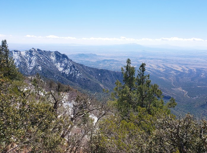
Day 29. 33.9 Miles. We started our morning just as day was breaking. We usually start a little earlier, but didn’t want to miss the views as we made our way up the canyon. The first 6 miles of walking were only moderately inclined which made for a very enjoyable walk as we gazed up at the canyon walls surrounding us. The next 7.5 miles were considerably steeper, but being a National Park, the trail was immaculate. We actually quite enjoyed the long, steady climb up the canyon, still in awe of the views surrounding us. As we neared the North Rim, the South Rim came back into view with Mount Humphreys in the distance. By 11 am, we made it out of the canyon to the snow covered North Rim feeling proud of our quick pace up such a massive climb.


At 9000 ft, the North Rim and Arizona Trail were completely buried under snow. The adjacent road, however, is plowed until the park boundary, so from the perfect trail in the Grand Canyon, we started a very long road walk. At the park boundary, the plowed section ended, and we spent the next couple hours walking on top of snow.


After two very slow and annoying hours, the road resumed being plowed. We took a dinner break in the middle of the closed highway scooping water from the snowmelt trickling down the highway and wondered if we’d be camping on snow covered ground that night. Knowing there was a small general store ahead still closed for the season, I made a lofty, hopeful prediction that the owners would be there doing preseason inventory and would let us sleep inside.
We approached the store an hour later as the sun was setting and the cold was getting serious. As the store came into view, we immediately noticed the truck in the driveway and people carrying boxes. Though the store wouldnt open for another month, the owners had arrived that day to start putting some things in order. We asked if they knew of any camping nearby not covered in snow, and they immediately offered to let us sleep in the store overnight. Nailed it! Hallelujah.
Day 30. We resumed our long highway walk, hitting nearly 4 miles per hour on our second to last day. We had 30 miles of road walk before we would hike our final 27 miles of actual trail to complete the AZT. The day was uneventful as we pushed our pace to put this fairly boring road walk behind us. The morning turned to afternoon as we came to the end of the road closure at Jacob Lake. As we approached the lodge / cafe, a couple cyclists struck up a conversation offering up congratulations for being nearly done. They were a local couple and quickly offered the number of a couple of trail angels in nearby Kabab. We thanked them and went inside to slam French fries and soda. Within the hour, we had a ride setup for us the following day from the northern terminus. We resumed our walk, finally returning to dirt trail and camped for our final night on the AZT. 36.9 Miles.
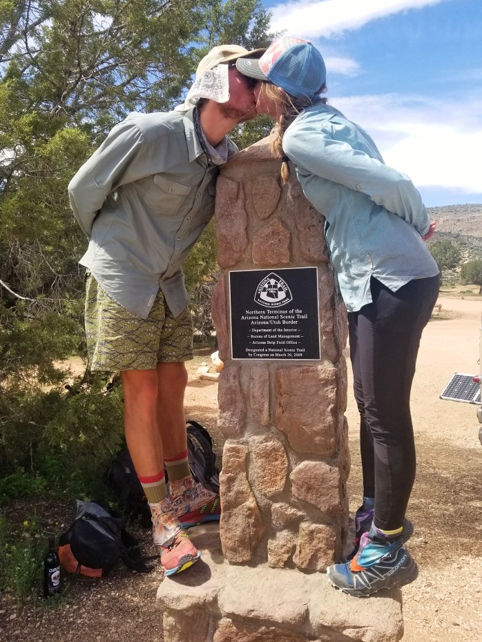
Day 31. Our final 20.3 Miles began a little later than usual. Our ride was scheduled for 2 PM giving us ample time to walk the mostly flat and downhill miles. We took a couple of snack breaks along the way, reminiscing about our month on trail and dreaming up our next adventure. About 5 miles from the state line, we crossed paths with a Hayduke hiker. One Gallon was happy to chat with some hikers as he’d been a little lonely out on the Hayduke. It didn’t take us much time to realize we were talking to a hiking superstar. At maybe 60 years old, One Gallon is using the Hayduke as a warm up for his upcoming PCT thruhike. It will be his fourth time completing the trail which will also complete his Quad Triple Crown. So that’s the AT, PCT, and CDT FOUR. TIMES. EACH. He’s probably the most accomplished and humble hiker I’ve ever met. After gabbing for a few minutes, we parted ways and eagerly scurried to the northern terminus.
As we neared UT, we descended into a campsite near the Antelope Canyon trailhead (famously “The Wave”). The red rock was vibrant against a bright blue sky. We found ourselves a little sad we weren’t continuing north through Utah to discover all the secrets of nature that state holds. We counted down our final three miles as we walked, and suddenly, the terminus was in sight. We were done with another trail, another adventure.


While celebrating our finish, we were approached by 2 men who volunteered checking permits for nearby Antelope Canyon. They gave their congratulations and quickly offered beers for now and a bottle of wine for later. Awesome. Lynn arrived shortly, also with beers. 😎. Not too long after, she drove us to Kanab about an hour away. We stopped for groceries before she brought us to her house were the bottom floor had been dubbed “Chateau Relaxo” which was a hiker’s dream come true. Lynn and her husband Richard were true angels. We were so grateful for a place to stay, clean up, and for letting us use the kitchen! The kindness of strangers will never cease to amaze me.
The next day it was time to begin making our way back to our van in Phoenix about 6 hours away. Luckily, it only took two hitches, and three of us arrived in Phoenix just before midnight. (Thanks Maya and Felix!!)

Days before when climbing out of the Grand Canyon, our group had commented about how seemingly easy that climb had been and how “doable” a double crossing seemed. With the physical ability and geographic proximity, should we just go for it?
The idea had been planted in our minds and started to take root. We just couldn’t shake the desire for the athletic challenge and to revisit the breathtaking scenery inside the Grand Canyon. So, for whatever reason, we picked up our van and immediately returned to the National Park we had been in just days before…
Full Grand Canyon >< Double Crossing >< story coming very soon!!
We are Bekah and Sean (Micro and Bigfoot), and we just finished a thruhike of the Arizona trail! Follow our updates here or on Instagram.
Thruhiking the Arizona Trail – Superior to Flagstaff

We are having a blast hiking the incredibly beautiful Arizona Trail! We’ve been from the desert floor to alpine mountain tops and back again and have completed about 570 miles of nearly 800 miles in 23 days. Here’s our week 3 breakdown…
Day 14. A very sweet trail angel drove us from our hotel to the trailhead early in the morning after our much needed zero in Superior. We put in 26.9 miles climbing from the desert floor into the Superstition Wilderness.

Day 15. We got an early start and didn’t take much of a break for about 18 miles to Roosevelt Lake Marina. Somehow french fries and beer were already calling our names. Gusha and Hyrobics picked up their packages with enough resupply for the next 120ish miles to our next stop in Pine. Our hastily made resupply didn’t show – probably because I didn’t make one for Roosevelt Lake 🙄. Nice. So, we unexpectedly started hitchhiking to Globe nearly 25 miles away. Luckily, finding a ride didn’t take too much time, and we suddenly found ourselves inside a full size grocery store and made our hungry dreams come true. We ate, resupplied, and quickly got a ride back to trail prepared for the long stretch ahead. Crisis averted. 22.5 Miles.


Day 16. We spent almost this entire day climbing into the Four Peaks Wilderness. It was a trying and beautiful 31.5 Miles.


Day 17. Another long day that took all of our strength to hike 30.3 miles. At one point, I found myself frustrated facing the climb ahead. Then I quickly realized I didn’t have to go to work today, I get to climb a mountain, and even listen to my favorite tunes while doing so. Life is good.

Day 18. Yet another difficult day of climbing and navigating a trail cluttered with rocks. Our feet were screaming after 32.7 miles.

Day 19. We woke even earlier than usual to hike the 16.8 miles to Pine. We spent several hours attempting to dodge the rocks as we made our way into town. We arrived at the trailhead at 11 am stoked to check out the local brewery. After an Arizona Trail Ale, a trail angel came and picked us up, stopped by the grocery store, and took us back to his house. Ray and Julie provided a hiker’s paradise – showers, laundry, a place to chill, and homemade wine!! We spent several hours getting clean and tasting various wines, thrilled to be off our feet. We decided to walk back to the trailhead for an early start the next morning.

Day 20. The section before and after Pine was surrounded by, well, pine trees. We were noticing the changes that Northern Arizona was bringing. The temperatures dropped and the mornings became especially chilly. We were glad we made it back to the trailhead the night before so we could get a full 32.8 miles in. Thankfully, the trail was less rocky than before.

Day 21. The trail meandered through the pine forest with little elevation gain or loss. We were on track for a bigger day than usual, but missed a turn before lunch. Lucky us, we went about 2 miles in the wrong direction and backtracked with our heads held low. We managed 32.2 actual trail miles, though we probably hiked 36 that day.

Day 22. We had one more big day before our much dreamed about break in Flagstaff. The trail was again very easy with little elevation change and few obstacles. Most of the day we managed more than our usual 3 mph pace. We put in 34.5 miles leaving just a short 10 miles left to town.

Day 23. We started our day in near freezing temps walking quickly towards town. The AZT splits to an urban route that walks directly into town. After our quick, cold 10 mile walk, we were elated to arrive in a full service city and immediately began indulging in all the goodies town has to offer.

It’s hard to believe we’ve completed 570 trail miles already with just over 200 to go. I’ve been a mess of mixed emotions – some relief, some disbelief that this adventure is already coming to an end. I’m stoked for the Grand Canyon right around the corner, but unbelievably sad to say goodbye to my friends again.
But ready or not, here we go. Here’s to the final 200 miles of the AZT!

We are Sean and Bekah (Bigfoot and Micro) enjoying this adventure we call life out on the Arizona Trail with our friends Grant (Gusha @plantgrant) and Ashlyn (Hyrobics @ashybarne). Follow our story here or on Instagram.
Thruhiking the Arizona Trail: Mexico to Superior

Well, I usually try to break these posts up into smaller pieces, but I haven’t had signal or wifi or time, so I’m gonna do my best to keep this 300 mile post brief.
Holy cow, WOWZA, the Arizona Trail is a banger. Nonstop jaw dropping views. Pristine trail. Fascinating plant life. Dazzling displays of color at dawn and dusk. Millions of wildflowers.
From desert floor to alpine forest, the AZT truly has it all. Let me show you…

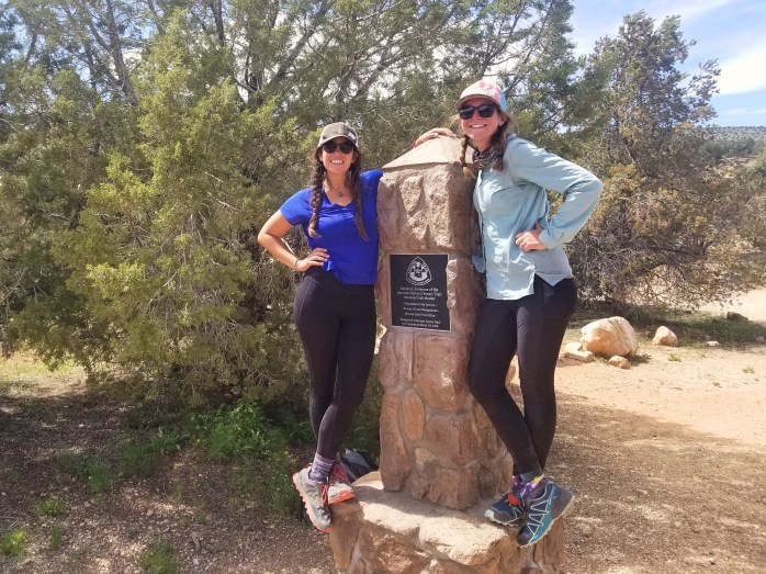
The AZT begins near the tiny town of Sierra Vista. We had a kind trail angel that took our group to the trailhead (thanks Dar!!). From the parking lot, we hiked 2 miles southbound to tap the monument at the Mexico / USA border.

Day 1. From the border, the AZT begins with an immediate demanding push nearly 3000 ft up Miller’s Peak. We managed 23 miles through sand and snow with about 4500ft of elevation gain on day 1.


Day 2. We pushed 29.8 miles through the tiny town of Patagonia. We resupplied and hiked out avoiding a town vortex.

Day 3. 23.8 Miles. This day included a bunch of ridge walking and a super steep climb. We were all feeling pretty sore, so we decided to keep the day short by our standards.


Day 4 began with a stellar sunrise that took our breath away. We hiked 26.5 miles past innumerable prickly pear cacti setting ourselves up for a nero the next day to give our weary bodies a little rest.

Day 5. We took a much needed nero in Tucson doing mostly nothing. It was glorious.
Day 6. We got an earlier start from our day off and headed toward Mt Mica in Saguaro National Park. We would’ve liked to hike further than 19.9 miles, but the national park requires permits to camp within its boundaries. We skipped the permits, camped at the park boundary, and decided to hike the 17 miles through the park the following day.


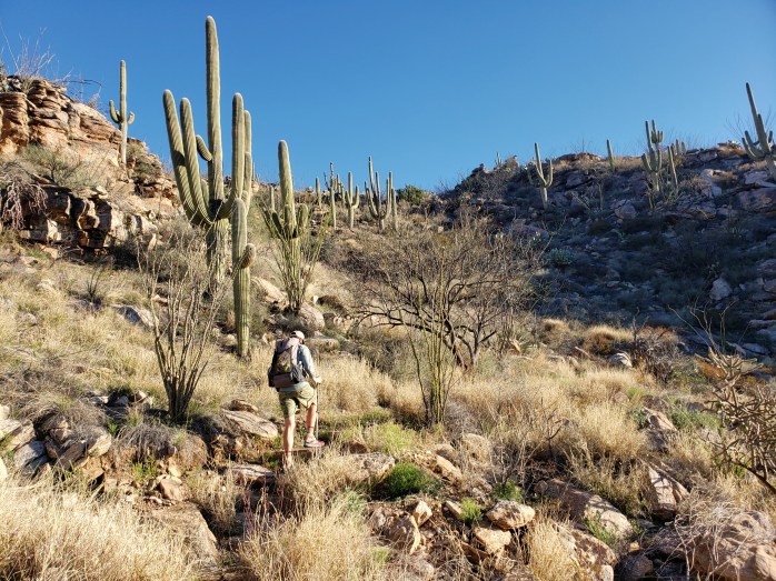
Day 7. We woke very early (as per usual) to begin a big day which included 5000 feet from the desert floor to the alpine forest on top of Mount Micah. National Park trails always seem to be flawless. We were in awe hiking through countless saguaro cacti and reaching the peak with towering pine trees. We managed 28.9 miles.

Day 8. As if day 7 wasn’t challenging enough, day 8 brought even more elevation gain and at a steeper grade. We spent the day climbing while the sun barreled down on us. I truly experienced some of the steepest climbing I’ve ever done. We were proud of our 28.4 miles and celebrated by sleeping in the bathrooms on top of Mount Lemmon.


Day 9. We strided 13.5 miles down Mt Lemmon towards the tiny town of Oracle dreaming of a shower and hotel for the night. We made a call on the way down only to find out the hotel was booked. The owner, Marnee, was still unbelievably kind to us and offered us a ride to and from the trailhead, rides to resupply, and even showers. After a couple hours in town, we returned to the trailhead and completed a 20 mile day.
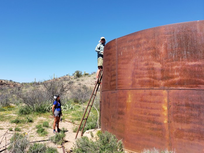
Day 10. Leaving Oracle, the next nearly 100 miles were across the desert floor with little elevation change. We set our sites on a 30 mile day, ending at a trailhead where a rumored trail angel would be. After seeing multiple rattlesnakes throughout the day, we were excited to see Sequoia’s trailer fully stocked with beer, water, and soda. As evening approached, he offered to cook us a delicious vegan spaghetti dinner. We were so grateful for this oasis in the desert.
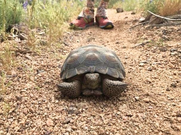
Day 11. From Freeman road trailhead, we pushed 31.6 miles across more desert floor. We saw countless wildflowers, an unnerving amount of rattlesnakes, 2 Gila monsters (!!), and even a Sonoran tortoise in the middle of the trail.


Day 12. We crushed 34.2 miles into the town of Superior. After about 13 miles, we entered a stunning canyon with views that blew my mind around every corner. This was probably my favorite day on trail so far.


Woohoo we survived our first 12 days and 300 out of 800 miles. We’re feeling only slightly worn, but mostly enthused, delighted by this incredible trail. What a dream to be hiking with such a killer group of individuals crushing miles, reveling in their glory, blessed, blissed, and eternally grateful. How we manage to pull it off always astounds us. Here’s to the next 500 miles that we’re told gets … better? (Um..how??)

We are Bekah and Sean (Micro and Bigfoot), currently hiking the Arizona Trail with our friends Ashlynn (Hyrobics @ashybarne) and Grant (Gusha @plantgrant) pictured above with a new friend, Hiker Joe. We are all triple crowners and all vegan (!!) and have declared the name #FKTeam. Follow here or on Instagram.
What to Expect from a NOLS Wilderness First Responder (WFR) Course

This February, Sean and I decided to expand our outdoor education by taking a 9 day Wilderness First Responder (WFR, commonly called Woofer) course accredited by the internationally recognized National Outdoor Leadership School (NOLS). Although not required by our upcoming guide jobs in Alaska this summer (!!), we wanted to expand our knowledge and get ourselves ready in case future jobs have a WFR requirement.
I started this course with zero education in the medical world. And although this course just scratches the surface of medicine, I learned a lot.
Here’s what to expect from a WFR course…

You’ll learn how to do a patient assessment.
The patient assessment is the foundation of this course, and it begins on Day 1. Our instructors introduced us to the Patient Assessment Triangle explaining each segment in fuller detail as the course went on. Patient Assessments include the following:
- Scene safety and size up
- Airway, breathing, and circulation tests
- Decision on spinal injury or disability
- Exposing chief complaint
- Head to toe examination
- Taking vital signs
- Getting a sample and pertinent medical history
- Creating a problem list and plan of action
- Noting interventions and treatments
- Continuous monitoring of the patient until transfer of care has occurred


You’ll take part in many scenarios, sometimes as a WFR and other times as a patient.
The class was split to about half lecture and half scenarios. These scenarios had us practicing our patient assessments in a hands on manner.


You’ll spend about 40% of the time outside, no matter what the weather brings.
February in North Carolina brought some pretty regular rainy days which didn’t stop us from doing some muddy scenarios. Come prepared with the proper layers to be outside.

You’ll learn how to speak a little medical language.
There is somewhat of a standard for how medical professionals communicate to one another. We learned a bunch of medical acronyms and shorthand helpful when transferring care to the next stage of treatment.

You’ll learn backcountry specific patient management techniques. And what requires backcountry evacuation.
A Wilderness First Responder can use some techniques in the backcountry that an urban first responder wouldn’t do. For example, a WFR may perform traction in line and create a splint for a broken bone to assist in safely removing a patient from the backcountry. In an urban environment, traction in line would be saved for a hospital setting. Each illness or injury we discussed also included evacuation guidelines.

You’ll learn how to react to potential dangers in the backcountry.
What should you do in a lightning storm? What are the signs and symptoms of altitude sickness? What do you do for a snake bite? The WFR course answers all of these questions among many others.

You’ll learn how to use the contents of your backpack for medical emergencies.
Got a base layer and two backpacks? We can make a collar and stabilize the head and spine. A base layer and a jacket can become a sling and swath. A stick and shirt can be used as a tourniquet.

You’ll spend about $800 and 9-10 days in class and leave with WFR, CPR, and Epinephrine injection certifications good for 2 years.
I graduated college 6 years ago, so it had been awhile since I spent several hours in a classroom setting. Class was somewhat intense and quickly covered a lot of topics. Courses are 9 or 10 days. Ours was from 8-5 every day with two evening sessions. The course is offered basically year round all around the US with several international opportunities as well. We opted for the course in Cullowhee, North Carolina, due to proximity and time availability. When picking out our course, we noticed that tuition in the US is pretty consistantly at $775. Many locations offer on site housing for an additional fee. Most of our classmates stayed on site while we were lucky to have a friend in the area who hosted us (thanks Katie!!).
If you’re currently in college, you can grab 3 semester credits for this course. (I’m not certain if extra fees apply, be sure to check). If you’re in the medical field, you can get continuing education credits for this course.
The WFR, CPR, and Epinephrine certs are good for two years from the day that you complete the course. NOLS offers a WFR re-cert course that’s 3 days and about $220. You are eligible to take this course when your WFR is close to expiring and up to a year after the cert is expired. If you wait until after a year past your WFR cert expires, you’re required to take the entire 9/10 day course over again.
You’ll take a written and practical exam at the end of the course.
The practical exam is pass / fail and consists of successfully completing a thorough patient assessment with a partner. The written exam requires a 70% or above to pass. If you fail either test, there is a second chance test option to be taken at a later date.

You’ll want to bring what you’d typically have for an outdoor excursion.
After enrolling, we were sent a list of mandatory gear which included a watch, a daypack, and a few other miscellaneous items. We were encouraged to bring what we’d typically have in a backcountry setting. I recommend bringing whatever your standard setup is so that you’re able to practice with your gear you would tend to have on hand.
Ultimately, you’ll learn how to properly respond.
Again, I went into this course with zero medical knowledge. With over 8000 miles of backpacking experience, I really didn’t know what I’d do if one of us had an accident or came across someone else in trouble. My confidence and peace of mind has exponentially increased in a backcountry setting.
If you’re outdoor enthusiast like myself and especially if you participate in more extreme outdoor activities like white water rafting, climbing, or mountain biking, I highly recommend the WFR course to sharpen your skills and boost your resume. If you’re looking into jobs in the outdoor industry, the WFR cert is a common requirement and can only help in the application process.

We are Bekah and Sean, new WFRs and Triple Crowners. Follow our life in motion here!
Powered by Plants – Vegan Backpacking on a Thruhike

Is it possible to thruhike vegan?
ABSOLUTELY 100%!!!
Since adopting a vegan lifestyle in 2017, my husband and I have hiked nearly 4000 miles on a plant based diet including about 500 miles on the Colorado Trail (CT), over 2500 on the Continental Divide Trail (CDT), 800 miles on the Arizona Trail (AZT), and we have 1200 miles on the Pacific Northwest Trail (PNT) coming up this year! As with most aspects of a vegan lifestyle, it’s not the most convenient way of traveling, yet it is far from impossible. On the contrary, veganism and backpacking can very much coexist.
There are actually quite a lot of vegan backpacking food options that are lightweight, shelf stable, and nutritionally dense making them ideal for backpacking. So, if you’re wondering how to take your vegan lifestyle to the trail, look no further!
Here’s how we maintain a vegan diet while backpacking and a list of our favorite vegan backpacking food.
(Note: Be sure to always check labels of products for ingredient lists. Also, the list below has some items that contain palm oil which we typically avoid at home but we do eat sometimes on trail.)

Our Favorite Vegan Backpacking Food
Breakfasts
- Clif / Lara / Granola / Protein Bars (some flavors are vegan, others are not; check labels)
- Nuts
- Unfrosted Poptarts
- JJ’s Fruit Pies
- Instant Oatmeal (fine with hot or cold water)
Lunch / Snacks
- Wraps – Avocado / Spinach / Dehydrated Hummus / Chips / Tortilla
- Peanut Butter
- Homemade Granola Pouches – Granola / Chia Seeds / Vegan Protein Powder / Peanut Butter / Dried Fruit / Water
- Fritos, Potato Chips, Doritos (Purple Package “Sweet + Spicy Chili” are Vegan!!)
- Corn Nuts – Barbecue, Ranch, Chile Limon, and Original – all vegan!
- Snyder’s of Hanover Pretzel Pieces – Hot Buffalo Wing or Jalepeno flavors
- Peanut Butter filled Pretzel Nuggets
- Lenny & Larry’s Complete Cookies
- Nuts – all kinds, every day, lots and lots
- Trail Mix – usually make our own blend, be careful to avoid milk chocolate in premade mixes
- Triscuits, Wheat Thins, Ritz and other crackers
- Oreo’s!! (with peanut butter on top 🤤)
- Candy – Skittles / Sour Patch Kids
- Dark Chocolate Bars (as long as it’s not too hot outside!)

Dinner
- Homemade Dehydrated Meals – Lentil Marinara, White Bean Mac and “Cheese,” Chili, etc. (click here for our tutorial)
- Rice Sides – Spanish Rice Flavor, Red Beans & Rice Flavor
- Top Ramen Brand – Soy Sauce Flavor*
- Other Ramen w/o seasoning packet and add seasoning of choice*
- Dehydrated Refried Beans*
- Dehydrated Hummus or Bean Dip in a wrap, with crackers, or chips*
- Instant Mashed Potatoes (check labels to avoid milk ingredients)*
- Peanut Butter wraps*
- Couscous*
* = food that can be prepared stoveless
Mail Drops vs Resupplying As You Go
Many people setup mail drops for a thruhike, particularly when you do not anticipate having many options for resupply in a small town. A mail drop is a package full of food that you send yourself or someone sends you from home. We used maildrops for the CT and CDT that contained our homemade dinners and a few snacks that we bought in bulk. We always had to go to the grocery store (or gas station if that was all that was available) to “top off” our mail drops with extra snacks that are generally available anywhere (like nuts, chips, peanut butter, etc.).
So, are mail drops necessary for a vegan thruhike?
The answer to this question depends on what sort of grocery store while be available and how comfortable you are with eating a lot of the same food. We hiked with another vegan this year on the CDT who has about 8000 miles and 7 years under his belt as a vegan. Gusha (check out his Instagram here) made very few drop boxes and hiked stoveless. Yeah, he hardcore. So, I wouldn’t consider either mail drops or a stove necessary to a vegan thruhike, but they do make the hike a little more “comfortable.”
Note: I wrote a couple articles about backpacking food while on an omnivore diet for the Pacific Crest Trail. The first outlines our food strategy and the second describes how that strategy played out. Clink the links for the comparison.
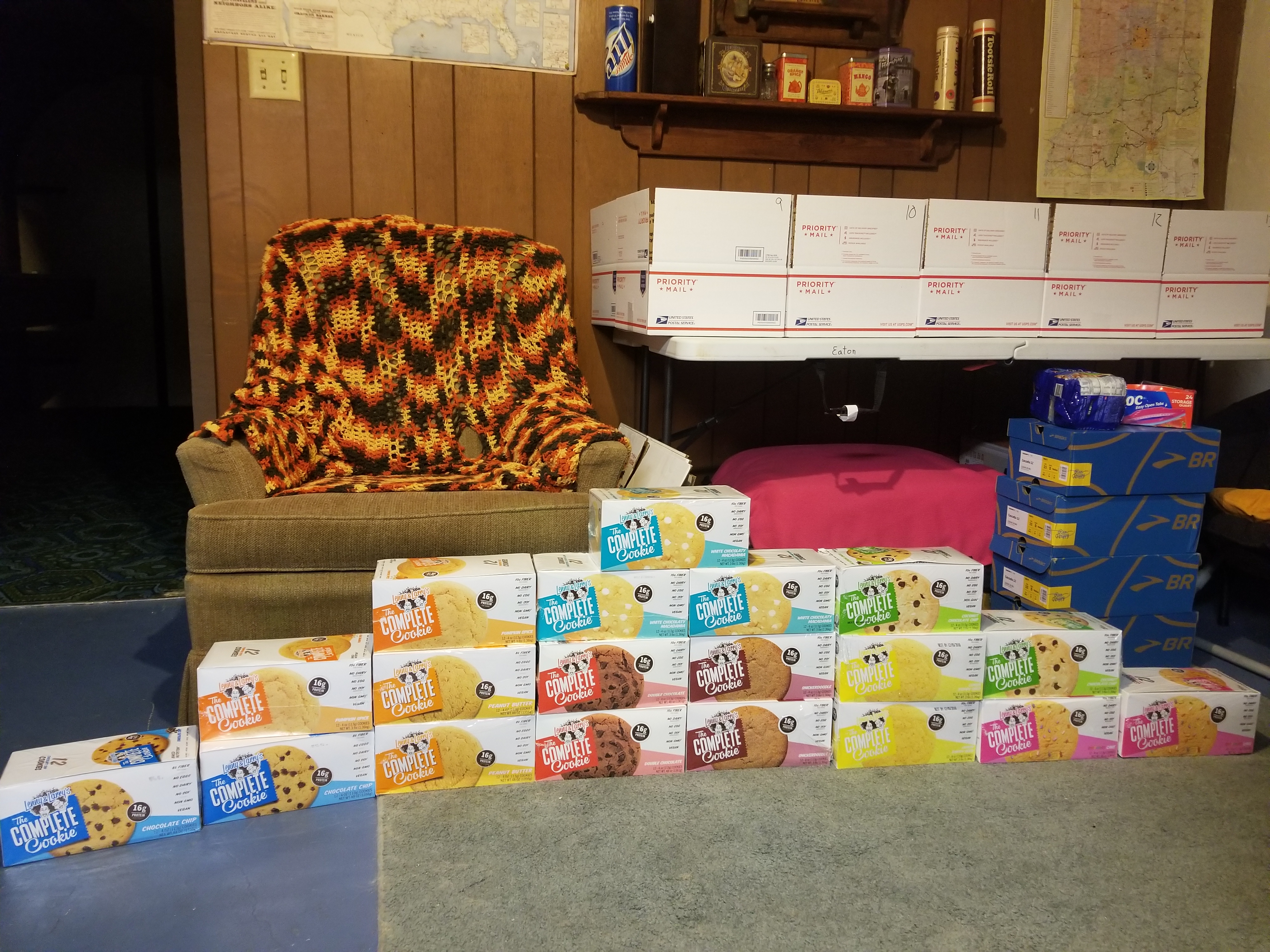
Tips for Creating Mail Drops
Whether vegan or not, mail drops can be handy but need to be created carefully.
- Don’t Make Too Many Boxes
- There’s no need to plan every town stop in advance. Making fewer boxes allows your plans to be more fluid.
- You won’t want that food once you return to the “real world.” Just make enough boxes for the most remote stops
- Be aware of the day of the week when planning your drops.
- Post offices have limited weekend hours, and some tiny towns have limited hours throughout the week. Pay attention when planning your town arrival date.
- Some hotels and businesses will hold packages for hikers which can be helpful in avoiding the weekend and holiday post office closures. Be sure to call ahead to verify whether it’s okay to send boxes to businesses.
- Don’t over pack your boxes.
- Food is heavy! Once you’re on the trail, you will get the hang of getting just the right amount of food for the distance you’re traveling. We carry 1-2 lbs of food per day per person.
- Most towns have “hiker boxes” full of food from overpacked mail drops. We made our boxes with just the dinners and hard to find snacks knowing that other snacks could be found easily in town.
- Add some variety!
- If all of your boxes are the same, you will certainly get tired of the food and likely ditch a bunch of food in the hiker box. Mix it up!

Vegan Homemade Dehydrated Backpacking Meals
If making dehydrated meals at home to include in mail drops, check out our tutorial and recipe ideas here. As a forewarning, this is a time consuming project that will need to be started months in advance if you are tackling a multi-month thruhike. If you are heading into the backcountry for a week or less, you might want to consider making your own meals as they are considerably more nutritionally dense compared to Ramen noodles and Rice Sides. We enjoyed our homemade meals, but we did notice that they are typically heavier than alternatives.
Stoveless Vegan Backpacking
Our hiking buddy, Gusha (founder of Nashville Pack), made his entire CDT trek (and other thruhikes) stoveless. He used an empty, clean peanut butter jar as his bowl which allowed him to cold soak his dinners. He would stop about a half hour before dinner, soak his food, and continue hiking. Most nights, he had cold soaked Ramen noodles (Top Ramen: Soy Sauce Flavor). Other times, he would cold soak refried beans or just add water to couscous or instant mashed potatoes (check label for milk ingredients).
Although hot food adds a level of comfort to the backcountry, the weight of the pot, stove, and fuel can be shed by going stoveless. It’s not for everyone, but those counting ounces may consider cutting out the hot meal. We actually went stoveless for the 800 mile Arizona Trail and intend to hike the 1200 mile Pacific Northwest Trail stoveless this year too!

In Town
When we got to town, we were mostly craving fresh fruits and vegetables. While you can usually find something (like fries) at a restaurant, the best bang for our buck was always at the grocery store. Even better when there’s a nearby town park to loiter in.
Our favorite grocery store finds were…
- Bagels / Sandwiches / Wraps + Hummus / Avocado / Veggies
- Fruit – Cherries, Strawberries, Bananas, Apples, Oranges
- Premade Salad Kits w/ Dressing (check ingredients) + Avocado
- Chips + Salsa
- Crackers / Chips / Veggies + Hummus
- Deli Case Salads
- Cereal + Almond Milk
- Non Dairy Ice Cream
- Meals to Cook
- Penne + Marinara + Vegan Sausage + Spinach
- Lentils + BBQ Sauce / Manwich + Pickles + Mustard + Buns / Wraps
- Can of Beans + Burrito Toppings + Tortillas
Vegan Backpacking Gear
If you apply veganism beyond your diet, you’ll want to pay attention to some of the gear you take into the backcountry.
- Look for synthetic sleeping bags and jackets, instead of down
- Use synthetic socks and shirts, not wool
- Avoid leather (not commonly found in backpacking gear anyway)
Vegan Backpacking Overall
It might take a little more time and attention, but backpacking distances great and small can absolutely be done on a vegan diet. In fact, I’d wager that I had more nutritionally dense food and even more protein while carefully considering my vegan diet than I did on an omnivore diet while I hiked the Appalachian Trail and Pacific Crest Trail.
Do you have a favorite vegan backpacking food for the trail that I missed? Let us know in the comments! We are Sean and Bekah, or BigFoot and Micro, new triple crowners and proud to have 4000+ miles under our belts as vegans. Follow along on Facebook and Instagram as we continue our plant based travel journey. 🍒🥑🥜🍄
