
Colorado Trail – 104 Miles from Denver to Breckenridge

Over 8 Days, we hiked 104 miles from Waterton Canyon outside of Denver to the resort town of Breckenridge on the Colorado Trail and are enjoying every mile! Check out our experience on Segments 1 through 6 on the trail!

Day 1 – 8.1 Miles
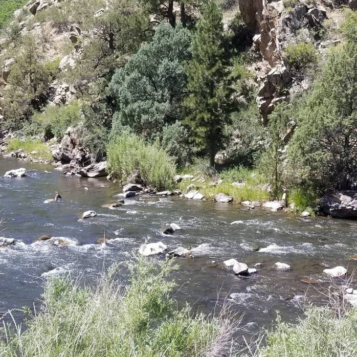
The Northern Terminus of the Colorado Trail (CT) is in Waterton Canyon just outside of Littleton, CO. At 5515′, this is the lowest elevation of the entire trail. The trail winds six miles through this beautiful canyon, and we continued two miles further to camp near a creek. In early July, the sun was out in full force hitting 95 degrees with zero shade. Bring plenty of water, a hat, and sunscreen! Keep your eye open for bighorn sheep. We caught a family of four crossing the ricer and climbing up the canyon.
Day 2 – 13.2 Miles
Leaving the creek, we hiked a dry 8 miles to the next water source, the South Platte River. We spent a long afternoon enjoying the river, soaking our feet, and stocking up for a long 14 mile stretch without water. A good rule of thumb is to bring 1 Liter of water per every 4-5 miles of hiking for drinking water. Any water for cooking and cleaning needs to be added to this number. We left with 4 Liters per person to be on the safe side.

Day 3 – 14.7 Miles
We woke up early to make it to the next water source and enjoyed a leisurely afternoon resting by a creek and exploring a nearby cave! We started to see lots of cyclists out sharing the trail as well as hikers. The terrain continues to grow more and more beautiful and less exposed.

Day 4 – 11.5 Miles (Bailey)
We hiked an early four miles to a road crossing to get to our first small resupply in the tiny town of Bailey (mile 40.5). Bailey has about 5 businesses of use to hikers – a grill, diner, Chinese restaurant, gas station with convenience store, and 2 dispensaries. Oh, Colorado. We successfully ate a vegan breakfast at a diner (who knew that could be done) and did our light resupply at the gas station. We waited out the near daily afternoon rainfall and hitched back to the trail.
After our town stop, we encountered beautiful aspen forests whose knots make it feel like your being watched. Then, we began our toughest climb yet, a grueling 3000 feet over 7 miles, only getting steeper near the summit. We finished our climb proud of our work and camped at 10,656 feet above sea level.
Day 5 – 17 Miles
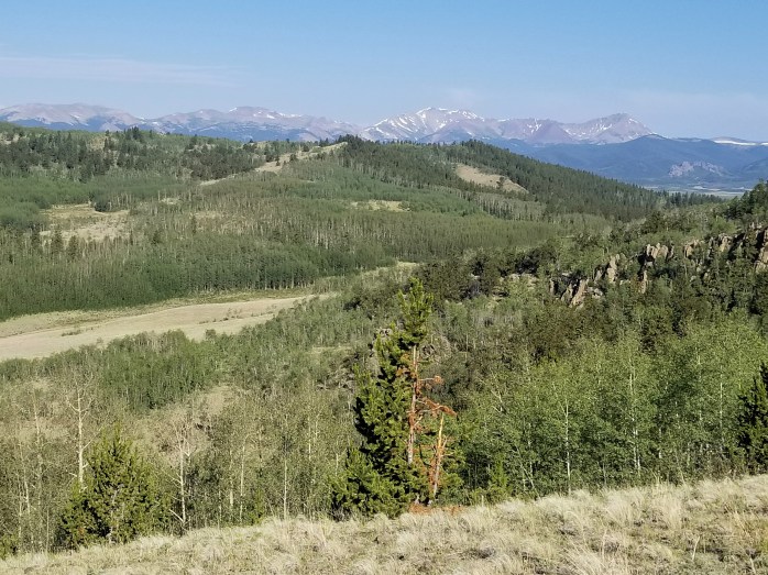
We were thankful the following day did not include any crazy climbs or descents and were able to hike 17 miles through Pike National Forest. The day began in the meadows of Lost Creek Wilderness where we enjoyed following cows down the trail and tons of gorgeous wildflowers.

Day 6 – 13.2 Miles
We awoke early from our campsite near a creek and hiked about 6 miles to stunning 360 degree views of nearby Kenosha Pass. This trail seems to get more and more beautiful as we hike! We skipped the town stop of Jefferson / Fairplay (mile 71.7) and continued into the forest.
We found a great camping area near a creek and settled in for our lunch break. The clouds looked like an afternoon rain so we decided to pitch our poles, tent footprint, and rain fly and waited out the storm. We were happy with our decisions as the rain came down for nearly two hours – enough time to listen to a String Cheese Incident show and take a light nap 🙂 . After our break, we continued a few more miles to camp very happy that we decided to stay dry.

Day 7 – 20.1 Miles
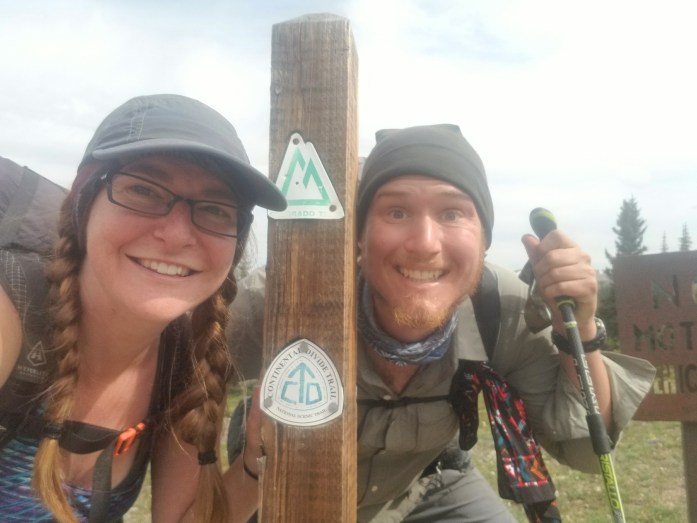
We broke camp early and started hiking our way up Georgia Pass. Wow, Colorado. At the top, we took a few quick pictures, but pressed on to get out of the wind. Soon after the pass, we saw our first Continental Divide Trail (CDT) crest as the CT and CDT coincide for about 235 miles. As aspiring triple crowners, our hearts were soaring upon first glance of the crest. See you next year, CDT!

We meandered down from the pass and took our afternoon break by a creek. Since we were anticipating dry camping, we decided to make our cooked meal for lunch instead of dinner. Though it was delicious, it did not help with our steep 1000 foot afternoon climb. After the pass, we found a campsite with an amazing view just six miles outside of our first town stop, Breckenridge. We got our tent pitched just in time for the rain to start falling which it continued to do until the morning. Thankfully, our tent kept us and our things perfectly dry.
Day 8 – 6.3 Miles
In the morning, we packed up our wet tent and made our way down the mountain into Breckenridge. About halfway through our morning hike, we spotted a moose with two calves only ten feet from the trail. Startled, one calf took off into the woods, the other stayed by mom, and mom (over 7 ft tall!) was on defense. We scurried by knowing momma moose could charge us if she wanted to. No time for pictures.
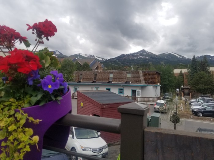
We made it to the highway around 10 am and were stoked that the trail was right by a free bus ride into town. No hitchhiking necessary. Ahh, Breckenridge, what an ideal trail town! We splurged on a private hotel room, enjoyed the Continental Divide Winery Tasting Room, Thai food, and vegan pizza from Piante Pizzeria.
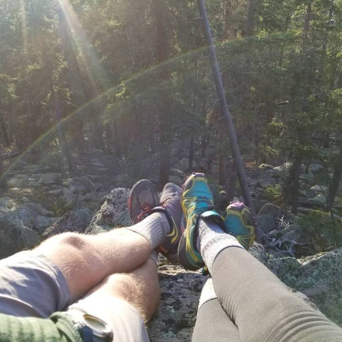
104 miles down, 382 left! So far, so good. We are totally in love with this trail and new adventure!! Check out a few more pictures below!
Let’s Connect!
Instagram.com/infinitegeography

Pingback: Colorado Trail 2017 – Infinite Geography