
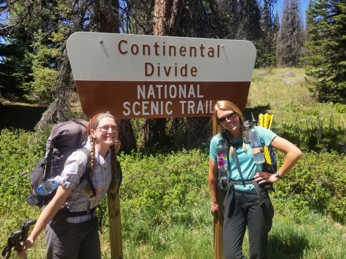
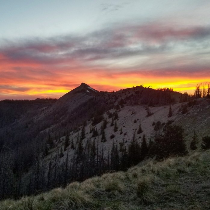
Thruhiking the Conti D: An Overview of the Continental Divide Trail

CDT 2018 Overview
Our Stats
Mexico – Canada, Northbound
April 25 – August 18
Total Miles Walked – 2530.5
116 Days
12 0-Mile Days
Miles Per Day Average – 21.8
Miles Per Day Average w/o 0’s – 24.3
Most Miles in 1 Day – 40.1
Most Miles in 7 Consecutive Days – 220.7, 31.5 Miles Per Day Average
Most Miles in 30 Consecutive Days – 803.9, 26.8 Miles Per Day Average
Choose Your Own Adventure
The Continental Divide Trail Coalition lists the “official” mileage at 3100 miles from the Crazy Cook monument at the Mexico – New Mexico border to the Waterton Lakes monument at the Montana – Canada border. The “official” trail is what is designated as the Continental Divide National Scenic Trail (CDNST) and is federally funded. We used the Guthook Guide App this year on trail which puts the CDNST at 3014 miles.
So, why did we “only” hike 2530?
Unlike the Appalachian Trail (AT) and Pacific Crest Trail (PCT), the Continental Divide Trail (CDT) has many alternates one can take that will still get you from Mexico to Canada or vice versa. There are a number of reasons to take alternates along the way like more favorable trail towns and distance between resupply, different scenery, trail conditions, weather, distance between water sources, or perhaps because one route is just plain shorter. From what we can tell, hardly anyone hikes the “official” route the entire way. Most hikers will choose alternates for whatever reason and that’s just a part of the CDT that distinguishes it from the other trails that make up the Triple Crown.
As always, Hike Your Own Hike! Choose your alternates and don’t let anyone guilt you into one way over another. It’s pretty cool that everyone’s CDT hike will be unique.
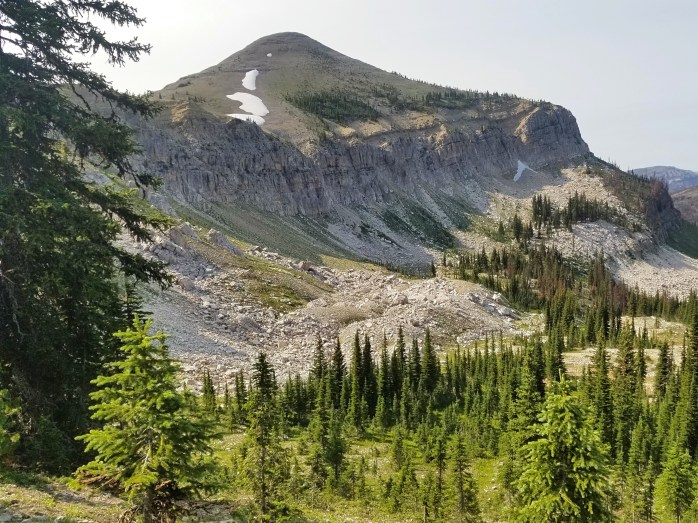
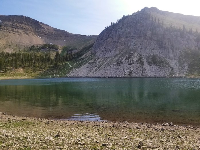
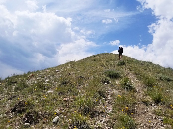
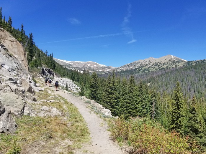
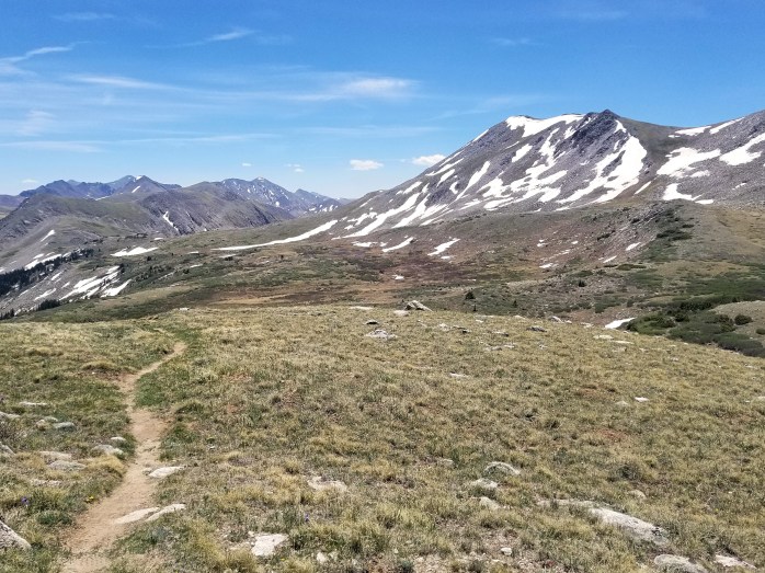
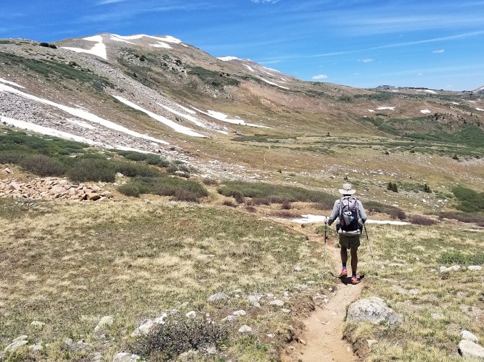
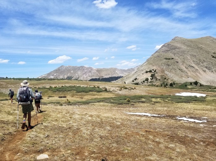
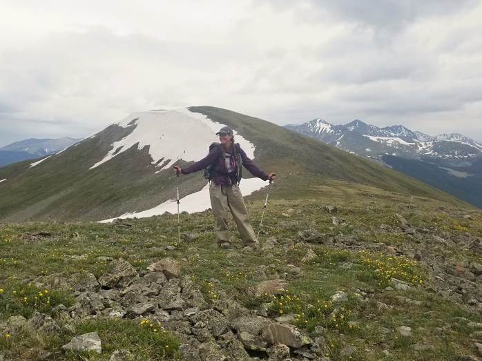
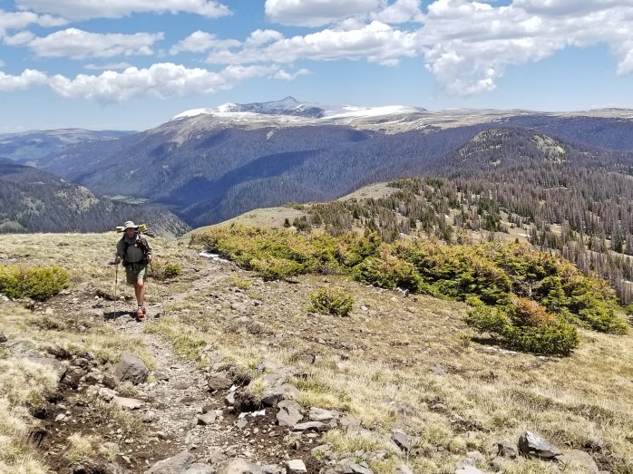
Geographic Highlights
Here’s a short list of my favorite places on the CDT. Click the link to each one to see more pics and read the stories.
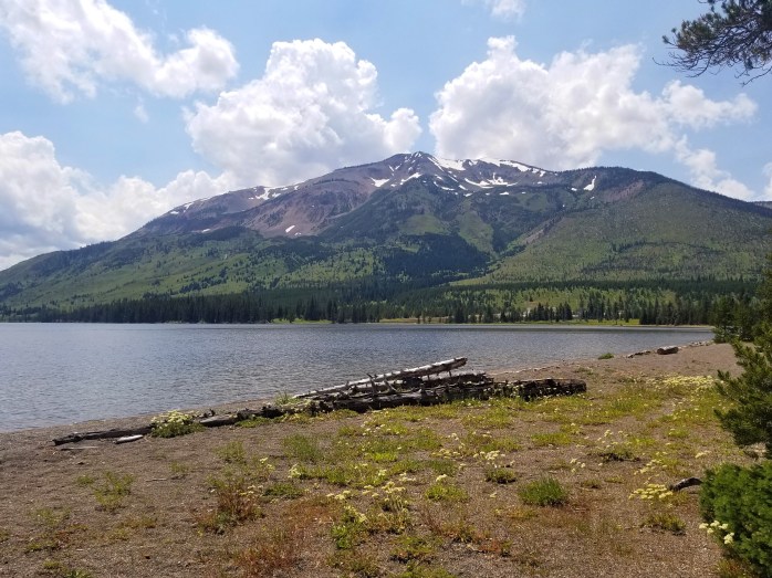
- New Mexico
- Colorado
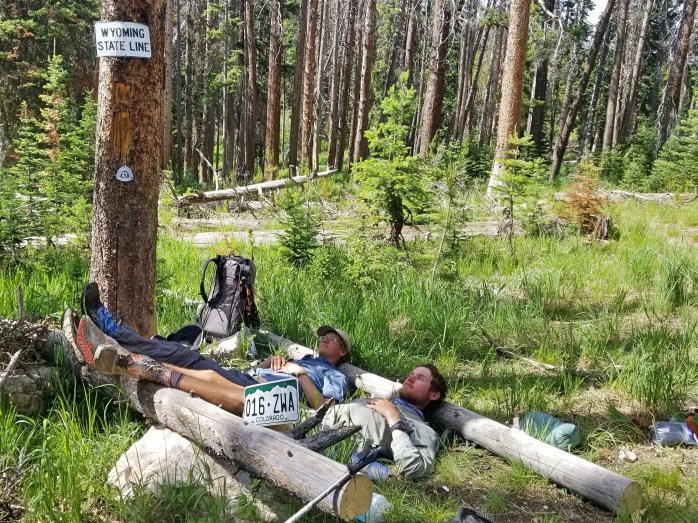
- Wyoming
- Montana


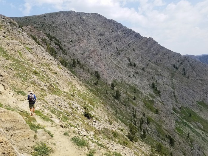
![Fotor_153150459358532[1]](https://i0.wp.com/infinitegeography.com/wp-content/uploads/2018/07/fotor_1531504593585321.jpg?w=462&h=347&ssl=1 "Fotor_153150459358532[1]")
![Fotor_153150474363658[1]](https://i0.wp.com/infinitegeography.com/wp-content/uploads/2018/07/fotor_1531504743636581.jpg?w=345&h=259&ssl=1 "Fotor_153150474363658[1]")


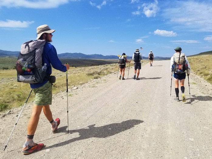
Road Walking – It’s Part of It
If you’re thinking about a CDT thruhike, just go ahead and swallow this pill now – you’ll be doing a lot of road walking. I would estimate that 20-25% of the CDT is on a road which can be anything from a forest service road to full on highway shoulder. Sometimes these stretches of road can be a short couple miles connecting single track. Other times, you can just settle in for 20 miles (or about 7 hours) of road walking down a highway. This is another big distinguishing factor from the AT and PCT which have very little road walking.

Trail Towns and Resupply
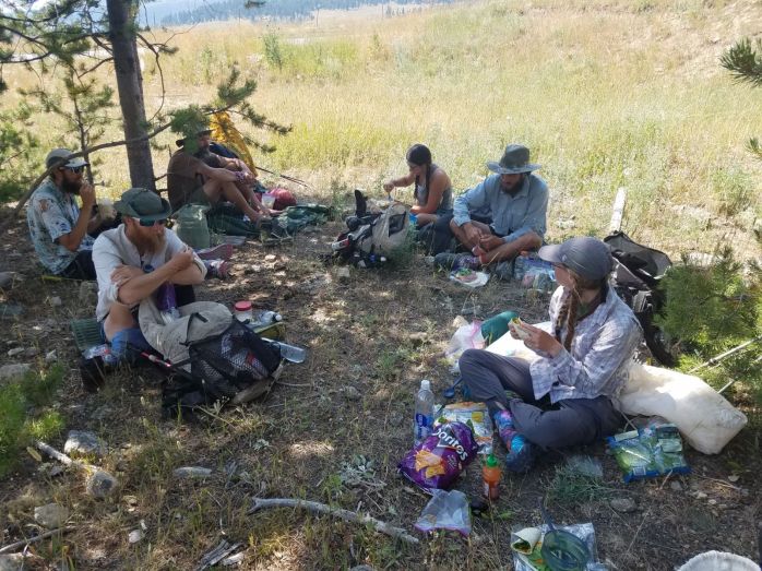
Compared to the AT and PCT, the CDT is considerably more remote meaning that, on average, the stretches between resupply are longer and the towns you come to are smaller. Our longest stretch between resupplies was 168 miles – our longest to date, but most of the stretches were 100-120 miles. Many of the trail towns only had a post office, diner, motel, and a small grocery store. The majority of the land along the CDT is ranching land meaning the culture is a little… lacking. I did appreciate that the CDT brings you right into town about half of the time so we didn’t have to hitchhike as often for resupply. Most of the trail towns weren’t much, but there were a few small cities that I very much enjoyed – Salida, CO; Breckenridge, CO; Steamboat Springs, CO; and Helena, MT.
Many people ask if they should stage drop boxes for a thruhike. While drop boxes can be awesome when the alternative is resupplying at a gas station, there are only a couple times when they would be “necessary.” In fact, I think you could thruhike the CDT without any drop boxes if you don’t mind the occasional limited gas station options. We relied on resupply drop boxes that our “Home Base Manager” sent out to us upon request in order to accommodate our vegan diet a little easier. Our friend, Gusha, also hiked on a vegan diet and only sent himself a couple of boxes to the most remote locations. Long story short, drop boxes can be nice but are far from necessary – even if you’re on a strict diet.
(For anyone interested in tips for backpacking on vegan diet – stay tuned! I’ll update this article as soon as I get that one published.
Edit: Click here to check out how we managed our vegan diet while thruhiking )

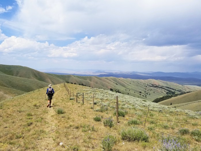
Environmental Extremes
The CDT and the PCT have similar structure in terms of environment – a large southern desert portion, a long central stretch above 10,000 ft, and beautiful alpine areas in the north. The varying environments produce their own distinct challenges such as water scarcity, snow covered trail, and exposure to sun, wind, and storms. Each challenge will test a hiker’s patience at a minimum and, at the maximum, could lead to loss of limb or life. When travelling in the backcountry, it is important to know what the trail conditions are and to be prepared for the situation. Know where your water sources are and if they are dependable. Wear long sleeves, a sun hat, and carry sunscreen where needed. Get down to lower elevations during a storm. Carry and use crampons and an ice ax where necessary. Wait to cross swollen rivers or streams until another person shows up. Mother Nature is considerably more powerful than you – and she doesn’t care if you live or die.
Facebook is actually a really good resource for thruhikers. Each trail has an associated group for that year – Continental Divide Trail Class of 2018, for example. It is a great place to ask questions, connect with other hikers, and keep up to date on trail conditions.


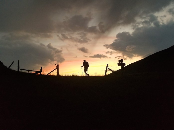
It’s Not All Awesome
With a motto like “Embrace the Brutality” the CDT is no cookie-cutter trail, but more like a series of trials testing your will and patience. We experienced sun exposure on the ridgeline for days on end, hours upon hours of nonstop wind, steep climbs coming out of nowhere, lots of bushwhacking and way finding, and, of course, getting lost. Oh yeah, and I think I mentioned the road walking. While I truly value my experience on the CDT, I’ll admit that there’s a lot of “filler” in between the “good stuff.”
Overall
The CDT is not for everyone. While we met a couple of first time thruhikers, most of the other hikers we met were experienced with at least one other trail. Although it can be done – I do not recommend the CDT as your first thruhike. The environmental extremes, road walking, and at times “boring” scenery is a physical and mental test for experienced hikers, let alone first timers.
We do, however, consider our time on the CDT perhaps our biggest adventure. The fact that “anything goes” on the CDT kept us on our toes. We appreciated hiking with other experienced hikers and truly enjoyed connecting with like minded backpackers. We’ve been off trail for four weeks, and we’re already missing it like crazy.
The Triple Crown is in the bag, but I doubt we’re done hiking.
What’s next?
Sky’s the limit.

We are Sean and Bekah (or BigFoot and Micro), new Triple Crowners with over 8000 miles of backpacking under our belts. We’ve dedicated the last five years of our lives to making our travel dreams come true. Connect with us on Instagram to follow our next adventure, learn some tips and tricks, and begin a travel path of your own.

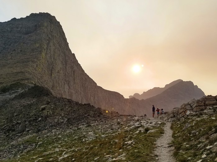
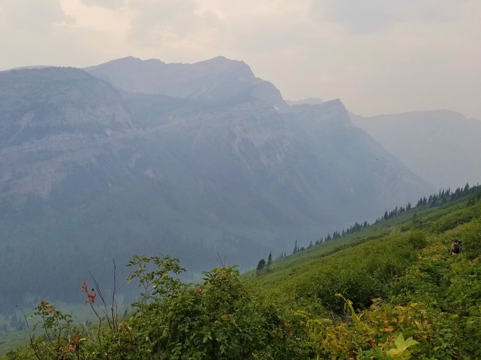
Bob Marshall. Glacier. Canada – Finishing the Continental Divide Trail

As a group of five, we left the tiny town of Augusta, MT, with one week and just over 200 miles to Canada. We picked up the trail from Benchmark Ranch and began walking through the Bob Marshall Wilderness. We started later than usual but still put in 22 miles ending near the Chinese Wall.


The next day we continued on through the Bob. We began to notice more and more smoke in the air as we moved north. We walked 33.6 miles with tons of climbing.
We were all getting a little anxious for the end of the trail so we pushed for a 36 mile day. At this point, we were just 15 miles from our last town stop in East Glacier.

We woke up early for our short day of 15 miles. Before noon, we arrived in East Glacier. We had noticed the smoke filled skies and weren’t surprised to find out that part of Glacier National Park was closed. Thankfully for us, the fires were on the west side of the park and the CDT was still open. However, the closure pushed many more people to the east side of the park causing competition for back country permits required for the park.

Gusher’s friends DK and Turk met us in East Glacier to complete the final 100 miles to the border meaning we needed two permits to accommodate our group of 7. The three of them went ahead to get a head start and setup the permits. Meanwhile, BigFoot, Hyrobics, Gasket, and I got a room in East Glacier for our final town night before finishing the trail.
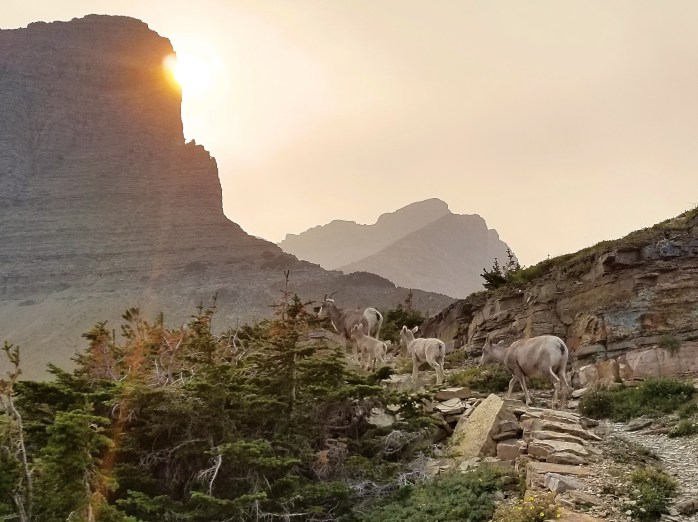
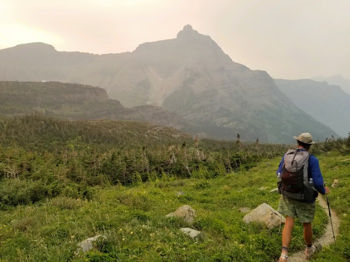
The following morning, the four of us hit the trail around 7:45, a late start considering we had 35 miles to hike to join the rest of our group. We began our morning hitting the National Park boundary after just a few miles. Once in the park, we were soon greeted by a half dozen big horn sheep on a morning stroll.


We could tell immediately that Glacier NP was a magical place with incredible features all around us. The smoke hanging in the air, however, was somewhat of a buzzkill. We called the views the “low def” version. We will absolutely be back to enjoy the high def version one of these days. Still, we were so, so grateful that the fire hadn’t stopped us from reaching the terminus.

After our first big pass, we arrived at Two Medicine and ate a quick lunch. We still had 25 miles and two 2000+ foot passes to climb. Onward and upward we went, first 2400 feet over Pitamakan Pass with incredible views of glacial lakes at the top. We took a break around 4:00 pm still with about 14 miles and one more big pass to go.


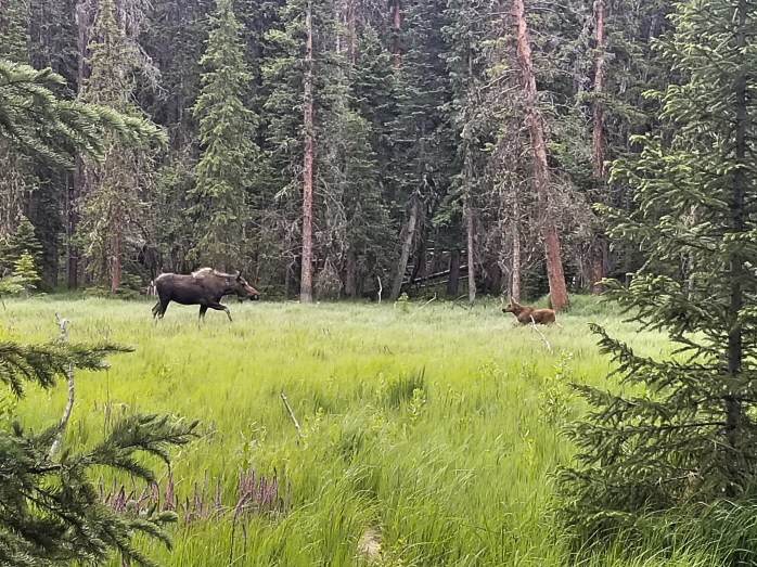
We eventually started our final climb up Triple Divide Pass. Here, watershed is divided three ways – North towards the Arctic Ocean, West to the Pacific Ocean, and East to the Atlantic Ocean. On our way up, we spotted what would be the first of many 1000 foot waterfalls cascading down the mountain. I found myself in the back of the group hiking the pass taking pictures through the smoke. At one point, I turned a corner and was a mere five feet away from a group of four big horn sheep, two adults and two babies. They stared at me for a few minutes so I got out of their way, but then they decided to head northbound up the mountain. I was elated to see them so close up.


I joined my friends at the top of the pass, and we began our long hike downhill still about 8 miles from the rest of our group. We stopped to make a quick dinner and resumed hiking as the sun was setting. We hiked on now with headlamps in a tight group trying to make as much noise as possible to avoid surprising a grizzly. Sean turned a corner with a gasp, I was sure there was a bear. Instead, a huge bull moose greeted us not entirely thrilled with our presence. We gave him plenty of room, but he stayed where he was. We eventually decided to bushwhack off trail giving him lots of room. We still had a couple miles to camp, and we continued being loud. Suddenly, we saw two eyes reflecting in the light of our headlamps. We all stopped and stared as the shining eyes stared back. Bear? We walked slowly in a stare-off with the animal. Eventually, we realized it was another moose, and it let us pass by. Finally, we arrived at the campsite where Gusha, DK, and Turk awaited us. Our long 36 mile day was over.
We awoke early the next morning with only 2 big passes ahead of us and 30 miles to complete for the day. Although 30 will never be an easy day, we felt like we had all the time in the world and took many more breaks than we had been accustomed to. It was really hitting us that we would be done with this trail and heading to our respective homes in just two days.


Although still clouded by smoke, the views were unbelievable. We finished our day at Many Glacier and stayed at the campsite complete with a restaurant, general store, and flushing toilets. Fancy.


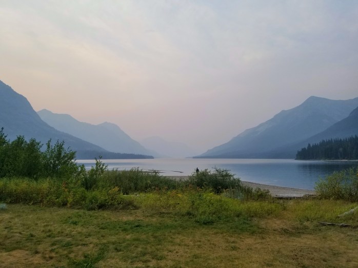
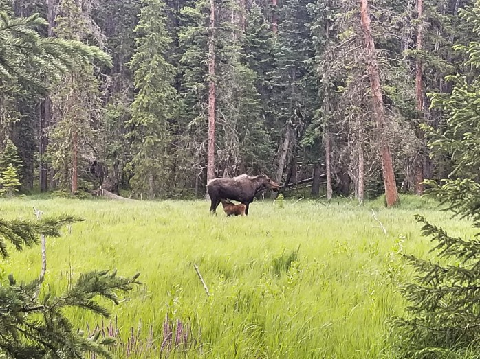
We began our final full day of hiking with a delicious breakfast and coffee. We hit the trail around 8:30 greeted by another massive moose. From here we had just 30 miles to walk to our last campsite at Waterton Lakes just 4.5 miles from the terminus. We spent our day reminiscing over the past four months – the smiles, the miles, the laughs, and hard times.


At about 3:00, we started our final pass, nearly 2000 ft over 4.5 miles. Hyrobics and I turned on Jesus Christ Superstar Live at the same time and we let John Legend and Sara Bareilles sing us to the top of the pass. We were stunned to finish our final climb and elated that it really was all downhill to Canada from this point.
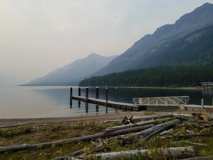
A couple hours later, we arrived at Waterton Lakes campsite complete with a pavilion, boat dock, flushing toilets, and hiker shelters. The group stayed up late excited and somewhat in disbelief that this journey on the CDT and the Triple Crown was coming to an end.
It was still dark when we all awoke in the morning. We hiked the final 4.5 to the terminus nearly at a run. Gasket got ahead of the group (now 9 people) – I think actually running. From the distance, we heard a loud yell. He had arrived, and we were just moments from joining him. Suddenly, we were all at the monument screaming, congratulating and hugging each other, even a few tears were shed.

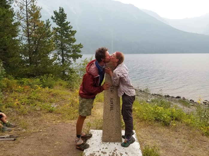

We spent nearly an hour at the monument taking pics, drinking Irish coffee, and taking it all in. The journey of over 7000 miles was somehow over. After our celebration, we still had another 4.5 miles to town. Eventually, it was time to get out of the woods and return to civilization.


Once in Canada, we stopped by the Visitor Center to take care of immigration which was just a phone call to alert the Canadian government that we had arrived. Next, we headed to get some breakfast and figure out how to get back to East Glacier where we had reserved a rental car. Over breakfast, we mentioned to our waiter that we were all looking for a ride. Suddenly, another waiter heard our $200 offer for the ride, and he was happy to oblige after his shift was over. He had an RV that would accommodate all 9 of us. Score!!! At nearly 6:30 pm, we were back state side at East Glacier. Five of us piled into the rental car and said our sad goodbyes to the rest of the group. About 15 hours later after perhaps the most uncomfortable ride of our lives, we arrived in Denver where we split to go to our respective homes.
It’s still hard to believe it’s all over – a journey of over 7,000 miles has come to an end. Stay tuned for some trail reflection and triple crown overviews and highlights in the next week.
We just finished the Continental Divide Trail and with it the Triple Crown of Hiking. Check us out on Instagram to follow the next adventure.
Rise and Grind – 300 Montana Miles in 10 Days on the CDT

Our group came into Darby exhausted after our 220 mile week. We talked ourselves into a zero day pretty easily and spent the day resting and eating. After a couple hours waiting for a ride, we managed to get ourselves back to the trail head with a 100 mile stretch ahead of us to get to our next stop in Anaconda.

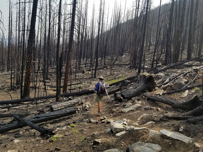
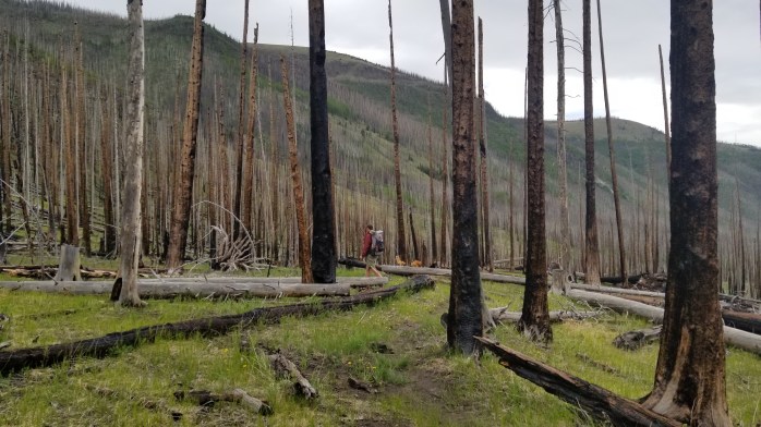
We began this stretch through about 20 miles of burn section from a previous fire. The sky was hazy from a current fire in the area, though far enough away to not concern our hike. We managed to put in 25 miles even with a noon start.
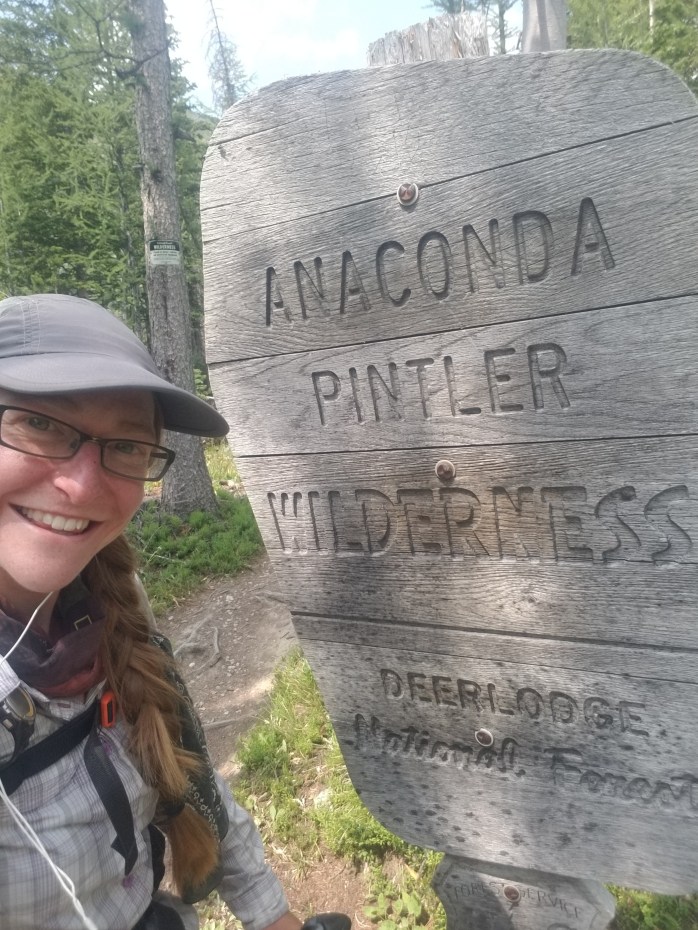
The next day we entered the Pintler Wilderness Area grateful to be under the shade of the trees. The trail took on the familiar pattern of repetitive high passes one after the other, but the climbing didn’t stop us from logging 35 miles.
We woke up 40 miles from Anaconda which included about 10 miles of highway walk directly into town. Our day progressed steadily, and we soon realized we could arrive in town that evening.

We pushed all day taking minimal breaks in an effort to achieve that goal. We hit the pavement at about 5:30 and stomped our way into town at 9. We hit the grocery store and headed to the local park where they welcome hikers to stay in a shelter and shower at the pool.

In the morning, we all gathered our resupply for the 80 miles ahead to Helena. No zero days this time. We began our long road walk out of town under the blistering sun. We left pavement after crossing the I-90 and continued on dirt roads for the rest of the day. A nearby ranch worker, Boston, welcomed us to his picnic table and offered us ice cold water, a real treat on this hot day. We logged nearly 29 miles for the day before going to sleep.
The next day was fairly uneventful, a mix of dirt roads and single track trail. We managed to put in 39 miles leaving just under 12 to get to Helena.
We woke up a little later than we usually would on a town day to a chilly morning. I was unamused by all the blowdowns cluttering my path, but we still arrived at the highway before noon.

When we arrived, we found ourselves in the middle of a construction zone which included a pilot car releasing one lane at a time. After some unsuccessful hitch attempts, the pilot truck offered us a ride down the pass to the end of the construction zone. We took the sketchy ride in the back of the flat bed construction truck about 6 miles down the pass. Not too long after, we got a ride the rest of the way to town and began enjoying our town day with lots of food and even a brewery stop.
The next morning, a local trail angel picked all seven of us up at our hotel and took us to the pass. We were all loaded down with 120 miles worth of food. We logged 27 miles that day leaving town.

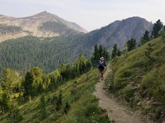
The trail had become an exposed rollercoaster, and we were riding the ridge mile after mile under the blistering sun with 10-15 mile water carries sprinkled in. I could feel my morale sinking as I climbed to the top of one mountain just to see the next two climbs spilled out in front of me. We managed a 38 mile frustrating day.

Of course, the next day was more of the same – constantly climbing and fully exposed. The minutes slowly turned into hours. I realized this is one of my least favorite forms of walking. I mean, exposed ridge is cool to an extent, but this many miles felt like torture. We must’ve climbed over 6000 ft that day “only” getting in 31 miles.

We had only 27 more to get us to Benchmark Ranch where we would hitch to the small town of Augusta. This day we finally came off the ridge and came under the canopy of the forest. Well, except the burned areas. We were now approaching the boundary of the Bob Marshall Wilderness. We arrived at Benchmark around 2:30 and spent an hour trying to hitch on the extremely remote gravel road to town. We were so grateful to grab a ride for five to the town an hour away.

We arrived in Augusta thrilled for food, showers, and rest. We calculated our miles since Darby in disbelief. We had walked just over 300 miles in the past 10 days including two town stops.
Even more shocking?
We’re less than 250 miles from Canada – and we’ll be there in a week.
Stay tuned for our last chapter of the CDT and our Triple Crown of Hiking as we near the Canadian border. Follow here or Instagram.
7 Days. 221 Miles. Hiking the ID / MT Ridge on the CDT.

When we arrived in Lima, MT, after our Yellowstone adventure, our group of six was exhausted. We awoke in our hotel and immediately began tossing around the idea of a zero. It didn’t take much convincing for all six of us to be on board – let the zero begin!! There wasn’t much in the tiny town, but internet, food, and a public swimming pool were enough to keep us hikers fully satisfied.
The next morning Hyrobics brought me coffee in bed and BigFoot got me a perfect gift – headphones!! We hit the trail on my 29th birthday aiming to hike 29 miles.
We took off first walking a dirt road for a few miles next to I-15, then we began riding the ridge that separates ID and MT for miles and miles. This wasn’t really the easy birthday hike I had envisioned, yet we pushed on until it was just getting too dark to see. Despite getting my butt kicked, I couldn’t have been happier to have shared my birthday with friends surrounded by beautiful scenery.
We woke early the next morning, as per usual, and began another challenging day. The sun exposure and never ending mountain climbing didn’t stop us from logging 31.8 miles.


With the tiny town of Leadore, cold pop, and a bag of chips on our minds, the group, which was now seven deep, continued slogging up and down the ridge. We pushed hard that day to get as close to town as we could completing 33.5 miles just after the sun had set.
Sean and I woke up early to hike the 4.5 miles to the road where we would hitch to town. Our guide noted the severe lack of traffic on this road in the middle of nowhere, so we were ecstatic when we saw a car approaching on the road when we arrived at the pass. We got a ride right away and got to town before the shops had even opened. Luckily, we ran into other hikers who let us shower in their hotel room and loiter until we could resupply. Our friends who we camped with the previous night still hadn’t made it to town. We didn’t see them until 10:00 am after they had waited over two hours for their ride to town. Apparently we picked the right day to get up early.
By noon it was time to get back to it. The group – that was now ten deep!! – hopped in a truck bed and went back to the pass. Soon, we were walking single file under trees ecstatic for the cool shade. We managed to walk 20 miles before calling it quits still getting in 25 miles for the day – not bad with a 5 hour town stop.
We got an excellent start the following morning beginning at 5:40. For whatever reason, we felt really good all day even with a 18 mile water carry. We pushed on, and with 32 miles done by 6:00 pm, we aimed to complete our first ever 40 mile day. What I once considered out of my capacity came into fruition by 9:45. In disbelief, we setup camp 40 miles away from where we had started our morning.


We celebrated by sleeping in a bit and got to walking around 7. Gradually, the scenery had been changing, and we were happy to feel like we were back in mountains and forest once more. We logged 33.8 miles leaving 27.5 more to town.

We were all feeling pretty beat up from the grueling week we had just put ourselves through. Of course, this last day included three unfairly steep climbs that took every ounce of my will to conquer. We prevailed, but with every bit of energy drained.

Luck struck again as a car approached a at the same time I emerged from the woods. We were then on our way to Darby with our food dreams in reach. We split a room with Gusha thrilled with our accomplishments over the past week – 221 miles in seven days, a 31.5 mile average seven days in a row.
We’ve definitely got Canada on our minds with about 550 miles to the border. We’ve exceeded our expectations and pushed our abilities further than we even knew possible partly due to our growing strength but also partly because of the incredible group of hikers that keep us encouraged and motivated. I couldn’t be happier to be hiking in a group – a first for us – as they continue to push my abilities and keep me laughing despite the pain.
Here’s to the final chapter! Follow us here or Instagram as we finish up our hike from Mexico to Canada on the Continental Divide Trail.
“You Dropped Your Rainbow” – Enjoying Iconic Yellowstone on the CDT

After 165 miles in 6 days through some of my all time favorite hiking in the Wind River Range, we took a much needed (and deserved!) double zero in Dubois, WY, at our friend Tabi’s house. (Thanks again, Tabi!!) We were on the verge of taking a third zero day, but our group somewhat reluctantly made it back to the trail that afternoon.
We still managed to get in a 20 mile day with a 12:30 start, a break at Brooks Lake Lodge, and a nearly impassable river ford. The guys crossed first and, like true gentleman, stayed in the river as Hyrobics and I crossed just in case we got swept. This crossing took all of my strength as the water was about waste deep and incredibly swift. I nearly cried tears of joy when I reached the other side. This was definitely the max depth and strength of crossing I can handle. Once we were all safely across, we used the adrenaline rush to power us up the mountain.

The following day, we hiked 29 miles putting us just south of the Yellowstone National Park boundary. Camping in the park requires backcountry permits which we planned on getting in person the next day at Grants Village about 28 miles away.


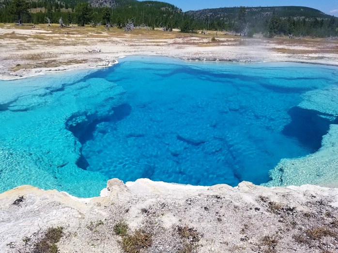
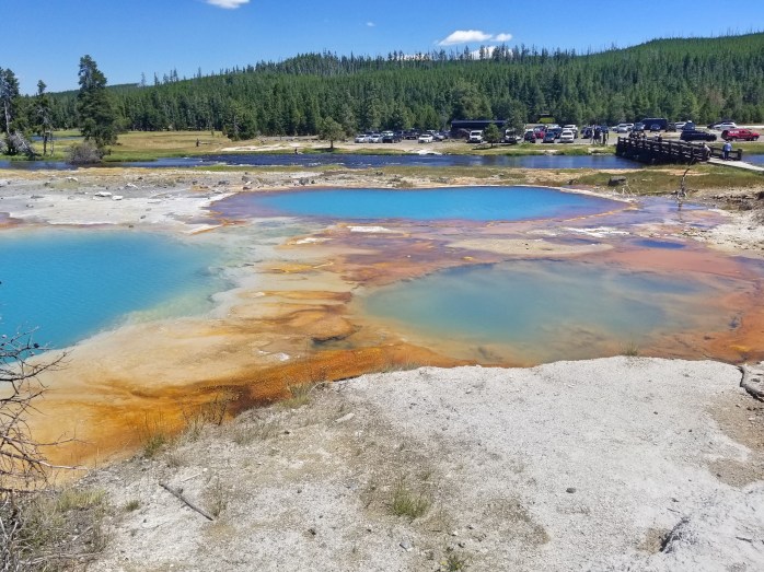
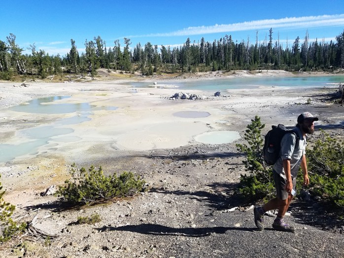
We entered Yellowstone that morning appreciating the well designed and maintained trail. Later that afternoon, we walked the shore of Heart Lake and started passing steaming hot springs and bubbling geysers.

We arrived at the main road through the park in the early evening and wondered how long it would take for our large and growing group to get a hitch six miles to Grant Village. Gusha had found a ride immediately leaving six of us to find another ride. Within seconds, a RV pulled over with room for all of us. Score!
We reunited with Gusha at Grants Village who had hitched with a park employee. She offered the group free camping for the night and the following night if desired giving us the ability to bypass permits. The next morning, we opted for a road walk through the park ending at Old Faithful Village. We finished 20 miles by 2:00 leaving the rest of the day to eat, people watch, and gaze at geysers.


Though unsurprised by the amount of people, we were still a little shocked to be a part of such a large crowd. Tourists poured in all day by the bus load phones at the ready to see the iconic geyser. The historic inn buzzed with people from all over the country and the world.
At about 6:00, our group hitched back to Grants Village for the evening with our gracious hostess. In the morning, we caught a ride with the Old Faithful postmaster back over to where we had left off. We spent our morning watching Old Faithful blast offs, devouring the breakfast buffet, and trying to find our motivation to hike.

By early afternoon, we made our way from the village down the paved walkway meandering through colorful geysers. Yellowstone quickly became one of my favorite National Parks with countless features requiring minimal effort to enjoy.
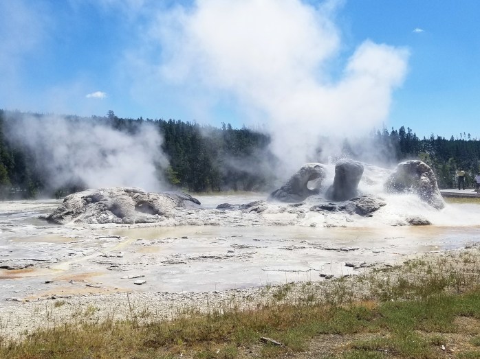


We took our time through the first couple miles passing geological wonders created by the super volcano under the earth’s crust. We were amazed that this section was actually part of the CDT. There’s so much more to Yellowstone than just Old Faithful…


We were somewhat sad to leave the colorful geysers behind, but on we went down the trail. We hiked the afternoon away coming to another state line crossing and then the Yellowstone boundary. Another state and landmark were now south of us.
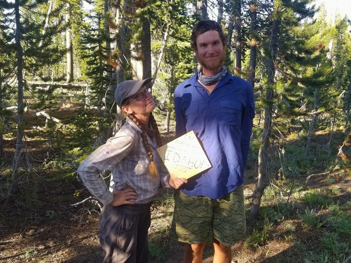
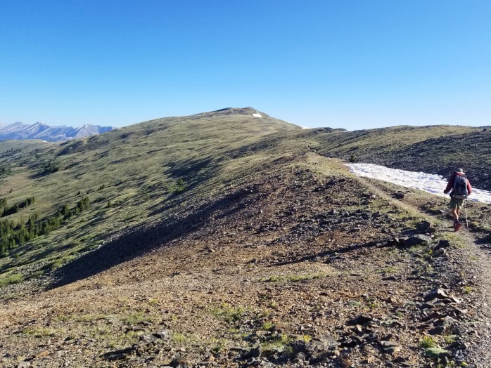
Somehow our group of five stayed together for all of Wyoming, the longest we’ve ever hiked in a group. We continued on into Idaho consistently pushing about 30 miles each day no matter what the terrain. We’re all getting exhausted, yet still trying to encourage each other and ourselves down the trail. With just two states and about 800 miles to Canada, we truly have the end in site, the triple crown nearly in our hands.
For some reason, a bible verse from my childhood has been ringing in my head. I’ll leave you with a few words from 2nd Timothy…
2 Timothy 4:6-8
New International Version (NIV)
“6 – For I am already being poured out like a drink offering, and the time for my departure is near. 7 – I have fought the good fight, I have finished the race, I have kept the faith. 8 – Now there is in store for me the crown of righteousness, which the Lord, the righteous Judge, will award to me on that day—and not only to me, but also to all who have longed for his appearing. ”
Follow us here or Instagram as we continue hiking from Mexico to Canada on the Continental Divide Trail.
From the Great Basin to the Wind River Range: Experiencing Wonderful Wyoming

After 12 morning miles through the desert, we arrived in the small city of Rawlins, WY eager for a little R&R after the 150 mile stretch from Steamboat Springs. We lucked into a very early check-in with our friend, Foundation, went to the grocery store and didn’t leave the hotel room for the following 24 hours. It was awesome.
When morning came, we put off our departure back into the Great Basin. We were about 120 miles from the tiny town of South Pass City were our next resupply was waiting for us. On our way out of town we caught up with three other thruhikers – Hyrobics, Gasket, and Gusha, and we were easily talked into $1 beers at a local bar. After a few rounds, the six of us decided to head out of town and get a few evening miles in. After 12 miles, we called it for the night near a spring.
![Fotor_153150286543169[1]](https://infinitegeography.com/wp-content/uploads/2018/07/fotor_1531502865431691.jpg?w=698&h=524)
Nah so much out here.
![Fotor_153150309905548[1]](https://infinitegeography.com/wp-content/uploads/2018/07/fotor_1531503099055481.jpg?w=698)
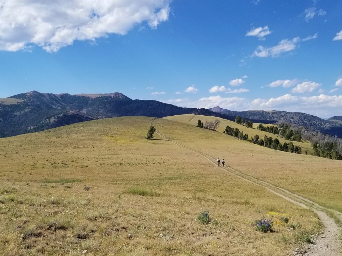
We were the first to head out of camp as the sun was rising the following morning, but the group wasn’t too far behind. Since the water sources are 10-15 miles apart in this section, all six of us traversed the basin more or less together spreading apart while walking but rejoining at the few springs available. There was no shade and little in terms of scenery other than sand, sagebrush, cows, and endless amounts of sunshine. We all decided to push hard to put the basin behind us.
![Fotor_153149872936078[1]](https://infinitegeography.com/wp-content/uploads/2018/07/fotor_1531498729360781.jpg?w=698&h=524)
![Fotor_153091368940096[1]](https://infinitegeography.com/wp-content/uploads/2018/07/fotor_1530913689400961.jpg?w=698&h=524)
A beautiful end to a 36 Mile Day – Our Personal Record!!
Three days melted into what seemed like one very long day as we walked through this very barren stretch of land. We hiked just over 100 miles in the three days after we left Rawlins and arrived in Atlantic City just 4 miles away from South Pass City. We spent the night in the tiny town of Atlantic City where the town was preparing for South Pass City’s annual Gold Rush Days festival. This year was additionally South Pass City’s sesquicentennial (150 year anniversary) and all 50 people that live in Atlantic City were buzzing. We joined a small group of locals at a bar that had a tee pee outside and a group of kids shooting off fireworks. We were given permission to sleep in the tee pee and slept despite the fireworks (some of them VERY low) that were being shot off just 6 feet away.
![Fotor_153151103839838[1]](https://infinitegeography.com/wp-content/uploads/2018/07/fotor_1531511038398381.jpg?w=698&h=524)
Foundation, Gusha, and BigFoot lead the way.
In the morning, we hiked the four miles to South Pass City and began waiting a couple of hours for the business to open that had our resupply box. During our wait, a local trail angel that knew Gasket offered us showers and morning beers. Not a bad way to start the day. (Thank you, Sandy!!) Soon we were able to get our box, but we realized that neither small town had much in the way of groceries to add to our resupply. We were 165 miles from our next stop in Dubois, and we definitely didn’t have enough food to make it that far. Soon we all decided that we’d have to sacrifice this day of hiking to go to the much larger town of Lander about 35 miles away. We hiked about four miles to the highway and caught a ride to town.
![Fotor_153149880459564[1]](https://infinitegeography.com/wp-content/uploads/2018/07/fotor_1531498804595641.jpg?w=698)
Once in town, food dreams came true and the day flew by. Half of the group got a room for the night, and we were fairly easy to persuade to stay too. We got all our chores done, packed 6 days of food away, and enjoyed a night’s sleep inside for once. In the morning, we hitched back to the trail and were happy to arrive by 8:30 am with our packs fully loaded. Our friend, Tabi, lives in Dubois and graciously offered us accommodations. We had been dreaming about this stop for miles now and were very eager for a zero day knowing this 165 miles would be trying.
We hiked out from the highway still in the Basin, however, we were approaching the mountains we had been seeing in the distance for days. Soon, more and more trees surrounded us and streams and creeks were everywhere. We were thrilled to be leaving the desert once again and head to higher ground. We only brought enough food to hike for 6 days meaning each day needed to be at least 27 miles. We put in a good 28 from town and retreated to our tent quickly as a new trial encroached – mosquitoes.
![Fotor_153149901229786[1]](https://infinitegeography.com/wp-content/uploads/2018/07/fotor_1531499012297861.jpg?w=698&h=931)
We were glad to wake up in the forest that morning though the mosquitoes were very quick to find us. We decided to head out of camp with Foundation and Gusha on a popular CDT alternate – the Cirque du Towers – adding a little extra climbing to our day. After a little bushwhacking to find the trail, we took off into a beautiful meadow and began hiking up to a high pass. We were all blown away by this new contrasting environment from the previous 100+ miles of hiking. I had several moments of disbelief as a gazed at the scenery surrounding me. We had made it into the highly anticipated Wind River range, and we were far from disappointed.
![Fotor_153149920265054[1]](https://infinitegeography.com/wp-content/uploads/2018/07/fotor_1531499202650541.jpg?w=698&h=932)
![Fotor_153149942687927[1]](https://infinitegeography.com/wp-content/uploads/2018/07/fotor_1531499426879271.jpg?w=698&h=524)
![Fotor_153149956216714[1]](https://infinitegeography.com/wp-content/uploads/2018/07/fotor_1531499562167141.jpg?w=698&h=524)
![Fotor_153142718739324[1]](https://infinitegeography.com/wp-content/uploads/2018/07/fotor_1531427187393241.jpg?w=698&h=524)
Sean and I found ourselves pretty beat after the first pass and decided to make our way back to the CDT route on gentler terrain. We still managed to put in 27.6 miles before pitching our tent for the night exhausted.
![Fotor_153150292584362[1]](https://infinitegeography.com/wp-content/uploads/2018/07/fotor_1531502925843621.jpg?w=698&h=524)
![Fotor_153150450236226[1]](https://infinitegeography.com/wp-content/uploads/2018/07/fotor_1531504502362261.jpg?w=698&h=524)
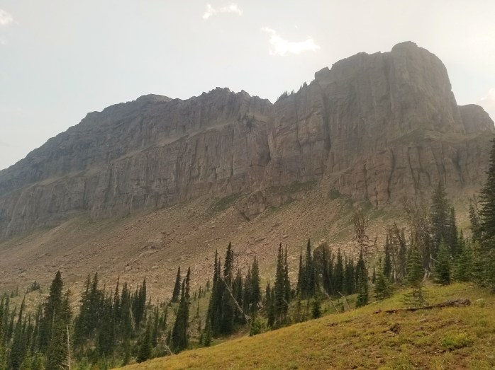
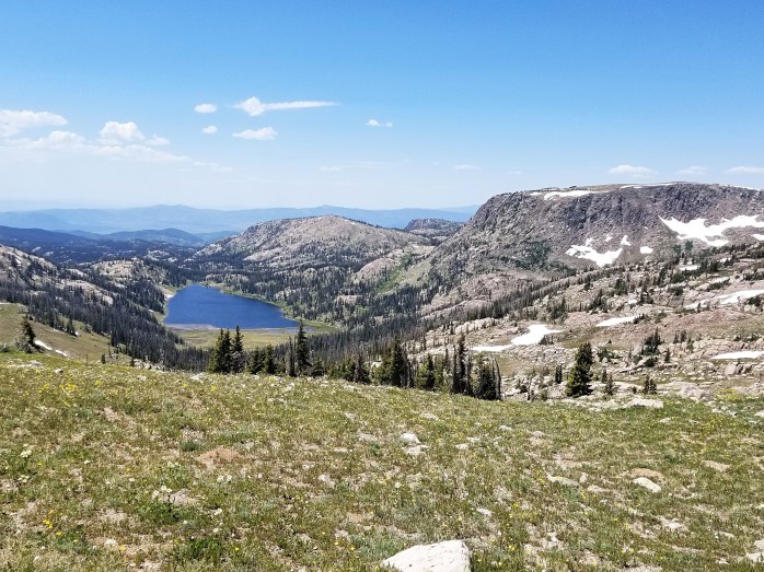
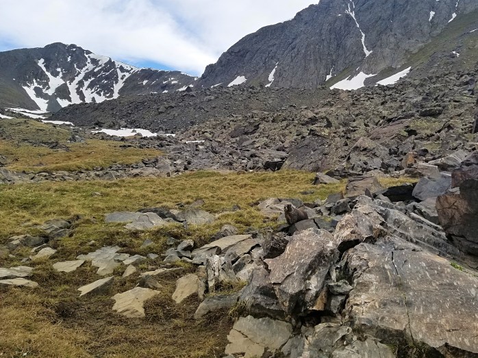
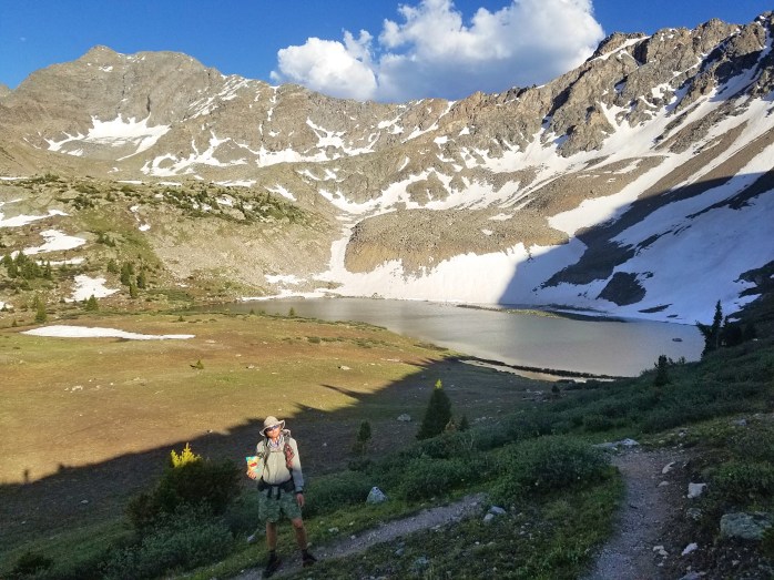
The next day we continued on through the Winds which left us completely speechless. The views here are rivaled by that of the High Sierra, and only those who have been there can really understand the gravity of such a comparison. In this country’s wilderness areas are truly where the greatest treasures are hidden. Bridger Wilderness Area quickly became one of my favorites I’ve been lucky enough to see – mountains bursting with crystal clear water gathered in jewel toned glacial lakes; 100 ft waterfalls cascading majestically down mountains; cliffs climbing to the sky like spires on cathedrals; millions of wildflowers in a myriad of colors. It was clear that we were walking through a sanctuary, a temple, a divine and holy place.
![Fotor_153149978540172[1]](https://infinitegeography.com/wp-content/uploads/2018/07/fotor_1531499785401721.jpg?w=698&h=524)
![Fotor_153149998929472[1]](https://infinitegeography.com/wp-content/uploads/2018/07/fotor_1531499989294721.jpg?w=698&h=524)
![Fotor_153150016187773[1]](https://infinitegeography.com/wp-content/uploads/2018/07/fotor_1531500161877731.jpg?w=698&h=524)
Though the terrain challenged us, the reward was completely worth the effort. We pushed on day after day and mile after mile simply in awe and disbelief. Our biggest trial became the mosquitoes that were easily some of the worst I’ve ever seen – and I’ve been to the Amazon. Thankfully, we came prepared with bug spray and head nets, and we fared far better than some miserable hikers who were quite literally being eaten alive.
![Fotor_153150003744114[1]](https://infinitegeography.com/wp-content/uploads/2018/07/fotor_1531500037441141.jpg?w=698&h=524)
![Fotor_153150024472373[1]](https://infinitegeography.com/wp-content/uploads/2018/07/fotor_1531500244723731.jpg?w=698&h=524)
![Fotor_153150032004761[1]](https://infinitegeography.com/wp-content/uploads/2018/07/fotor_1531500320047611.jpg?w=698&h=524)
![Fotor_153150056485516[1]](https://infinitegeography.com/wp-content/uploads/2018/07/fotor_1531500564855161.jpg?w=698&h=524)
As the days went by and we neared town, our energy clearly waned. This was our longest stretch of backpacking ever without a resupply in between which meant carefully rationing our precious food supply. We are both completely ravenous at this point of the hike with food occupying about 90% of our thoughts.
![Fotor_153150076956634[1]](https://infinitegeography.com/wp-content/uploads/2018/07/fotor_1531500769566341.jpg?w=698&h=524)
![Fotor_153150041909596[1]](https://infinitegeography.com/wp-content/uploads/2018/07/fotor_1531500419095961.jpg?w=698&h=524)
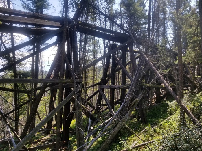
I’m always curious what happened here and how long ago…
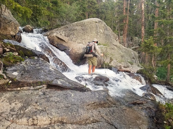
Another new challenge of this section is the water crossing and frequent fords across streams, creeks, and rivers. It seems as though the fords are spaced apart just so that my feet get almost dry in between each one. Though most of the currents have been mellow, some creeks have been just shy of my waist line basically maxing out my abilities to cross without swimming. As such, our feet stayed wet for the better part of this stretch and we got the joy of putting on our wet socks and shoes every morning.
![Fotor_153150201689197[1]](https://infinitegeography.com/wp-content/uploads/2018/07/fotor_1531502016891971.jpg?w=698&h=524)
![Resized_20180710_083553_4557[1]](https://infinitegeography.com/wp-content/uploads/2018/07/resized_20180710_083553_45571.jpg?w=698&h=524)
![Fotor_153150282957583[1]](https://infinitegeography.com/wp-content/uploads/2018/07/fotor_1531502829575831.jpg?w=698&h=523)
![Fotor_153150091837329[1]](https://infinitegeography.com/wp-content/uploads/2018/07/fotor_1531500918373291.jpg?w=698&h=931)
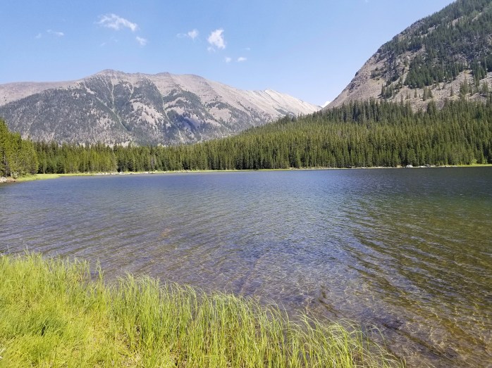
Our final stretch in Bridger Wildnerness area brought us by Green River which we followed down for several miles and several thousand feet of elevation to the Green River Lakes. We were saddened to put this incredible section of trail behind us, yet eager for the rest and food that town promised ahead.
![Fotor_153150474363658[1]](https://infinitegeography.com/wp-content/uploads/2018/07/fotor_1531504743636581.jpg?w=698&h=524)
![Fotor_153150459358532[1]](https://infinitegeography.com/wp-content/uploads/2018/07/fotor_1531504593585321.jpg?w=698)
We camped near Green River Lake and exited the wilderness area the next morning. We pushed back to back 30 mile days to get us as close to town as possible leaving a half day to get us into Dubois. In the morning, we were halted by a herd of cows moving towards us on the trail. Luckily, a cowboy came by on horseback and directed us over to him putting himself between us and the herd. He explained that he and 5 other cowboys were moving 250 cows today into the meadows and another couple hundred over the next few days. We chatted with the cowboy for about 20 minutes while the cows moved slowly by.
After our delay, we finished our day walking quickly – desperately – to the highway to hitch to town. Though we had seen some unbelievable sights, our bodies were craving rest, relaxation, and calories. I continue to be impressed by the athletic accomplishments we’ve achieved on this trail, far surpassing our expectations. But, I sincerely hope there aren’t any more 165 mile stretches on this hike, unless I can ride this guy…
![Resized_20180712_122900_875[1]](https://infinitegeography.com/wp-content/uploads/2018/07/resized_20180712_122900_8751.jpg?w=698&h=524)
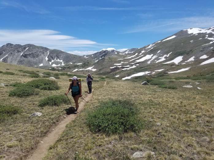
Changing Landscapes: Colorado into Wyoming on the CDT

After our back to back 30s to get to Breckenridge and with ominous clouds looming in the sky, we made the easy decision to take our first zero since Chama. We had a perfect day off that mostly consisted of lounging around while keeping dry from the rain and even got to grab beers with our friend Ella we met at Togwotee Mountain Lodge. We resupplied for a five day stretch to get us to Grand Lake over 130 miles north. Our next resupply was already heading to the Grand Lake post office which closed Friday at 4 and didn’t open until Monday morning giving us 5 days to complete the stretch.
We left early Monday morning with clear skies grateful for the free bus that took us back to the trailhead. That evening, we split off from the Colorado Trail and continued north on the CDT while the CT headed east towards Denver. As soon as the trails split, the CDT resumed its guessing game for navigation and inconsistent grade. We tore up a mountain and were up on a ridge for the night.


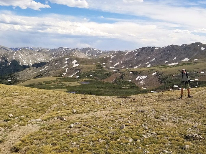
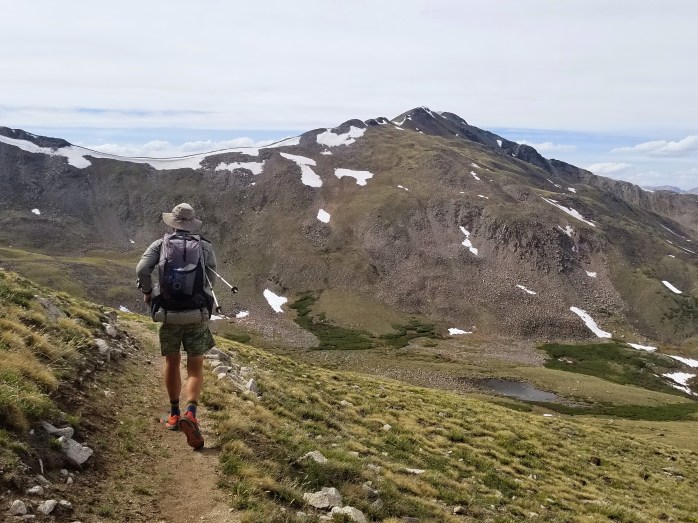
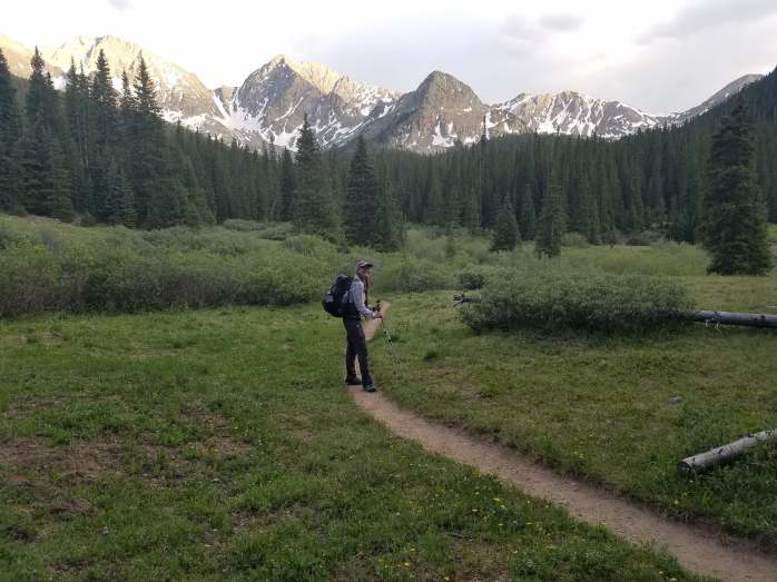
The next day, we had a few miles to walk to the trailhead to begin the ascent up over 14,000 feet to the summit of Gray’s Peak. We assumed we would begin the climb in the morning with hopes of being at the summit around noon. Those few miles proved far more difficult than anticipated as we hiked on a knife edge, sheer dropoffs on both sides. It was already passed noon when we finished this rough section and clouds continued to come and go in the sky. We knew summit attempts should be made in the morning as unexpected weather can arrive in the afternoon. With safety in mind, we made the decision to skip Gray’s and walk the highway around the mountain. This very long day came to an end at the I-70 where we picked the CDT back up and setup camp not caring about the cars within ear shot.


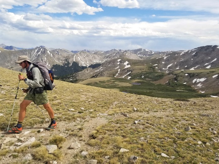
In the morning, we were unsurprised to begin a few thousand feet of climbing over the mountains, pass after pass. We reached another ridge, another knife edge where the wind harassed us until we started a descent. The next day followed in a similar fashion – so. much. climbing. – rewarding us with unparalleled views for all of our hard work. Part of me knew that this beautiful section was coming to an end, and to a degree, I was ready to escape this tiresome routine.


Thursday really tried my patience as we awoke to wind berating our tent at 5:00 am. We broke down camp and were on our way. It wasn’t long before we were climbing again, totally exposed, the cold wind completely relentless. Frustrating hours and miles passed with the same wind cutting through me the entire way.

We finally retreated under treeline late that afternoon overjoyed with the trail as it meandered gently through the forest. On a break, we met fellow hiker, Foundation, who had just returned to the trail from a side trip to the festival Sonic Bloom. That night, we told him we were on a mad dash to town the next day in order to arrive before the post office closed. The three of us broke camp quickly the next morning and began our 21 mile hike into Grand Lake.

We happily flew down the trail, stopping for very little. The entire 21 miles was gently sloping downward winding through the woods. I was elated! We made it to Grand Lake before 2:00 happy to have completed our challenge. We began our necessary town chores, stopped for beers, and got cozy at the Shadow Cliff Hostel for the night. I was so impressed with this beautiful hostel, all wood interior, large comfy lounge areas, and a gorgeous view of the lake all just off the trail and right outside Rocky Mountain National Park.
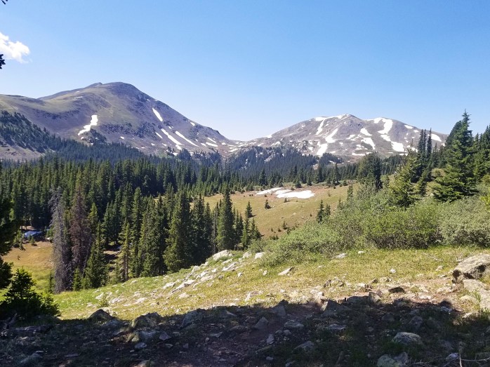
Morning came early, and after downing cup after cup of coffee, the three of us resumed hiking. We skirted through Rocky Mountain NP spotting 14 moose over the course of three days. We left Grand Lake with about 80 miles to the final town stop in Colorado at Steamboat Springs.
Thankfully we weren’t in any time constraints, but we still put in three good days to get there. The trail continued to climb up mountains but with a softer approach. We could tell this chapter was coming to a close.


Monday morning we had 25 miles left to walk to the highway where we would hitch into Steamboat, the final 12 miles down a different paved highway. We stopped for very little and pounded pavement for hours before arriving at the spot to hitch. We were very proud to have finished 25 miles by 2:00 pm and stuck our eager thumbs out for a ride. Within minutes, we were in a truck on our way to town. Our driver dropped us off at a Qdoba where we inhaled burritos and made plans for the night. We relished in town and prepared for a long 150 mile stretch to Rawlins, WY.
With our packs full to the brim, we left Steamboat and headed back to the trail with a generous ride from an AT section hiker. Through this stretch, we pushed 28-32 miles per day noting the changing terrain as the mountains began to roll, the sand became more abundant, and the vegetation started to remind us of New Mexico. After a few days of walking, we hit the Colorado / Wyoming border bringing this chapter to an official close.

We still had about 100 miles of walking to do before we hit the I-80 and the town of Rawlins, WY. We were about 40 miles away from town when we hit a gravel road, and the rain started falling from the sky. We were entirely exposed as the wind and rain whipped around us causing us to walk that much faster. We didn’t stop for anything until the rain subsided, and we sat in a ditch to eat lunch. Gratefully, the sun emerged and we continued our walk dry.


We were less than 15 miles from town and about to make camp when a couple in a truck stopped to chat. They were quick to offer beers and whiskey which we gratefully accepted in a dream like state. After our roadside chat, we strolled down the road just a little further and pitched our tents.

The following morning, we had just a few hours of walking to our first town stop in Wyoming. We made it before 10:00 a.m. and were stoked to get a super early check in after this long stretch from Steamboat. We are thrilled to have New Mexico and Colorado complete and are so excited to see what the rest of this beautiful and challenging trail has in store for us.

We have officially hit our halfway point on the CDT with about 1400 miles to go to Canada!! Follow us here or Instagram as we continue north on the Conti D.
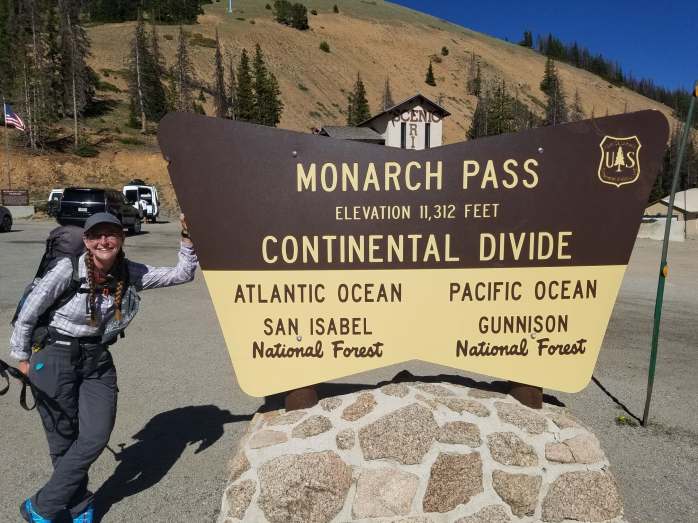
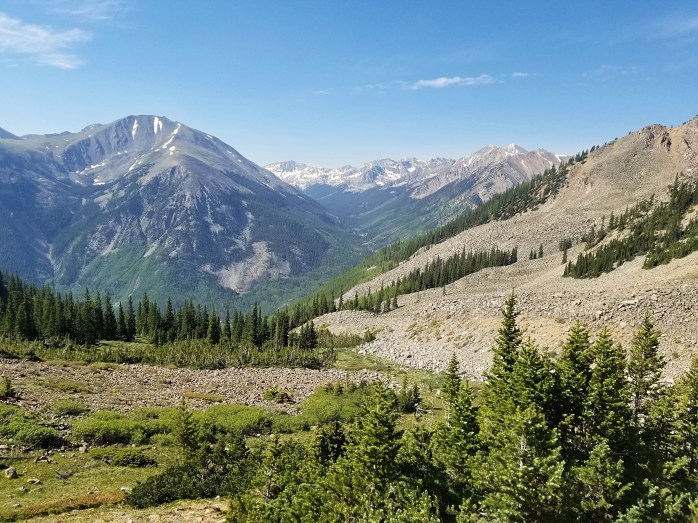
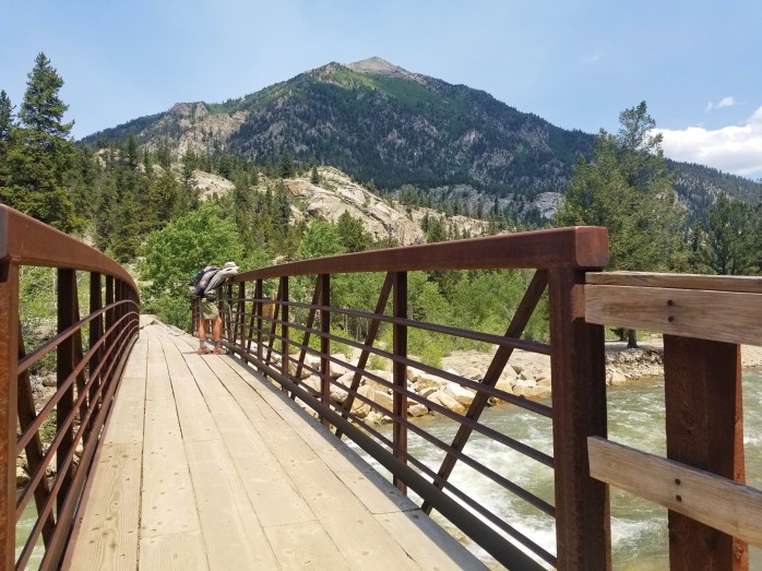
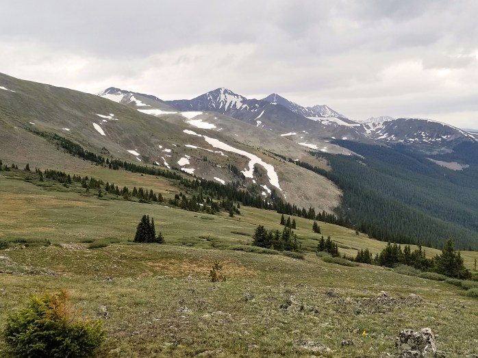
Through Colorado’s Collegiates – Salida to Breckenridge on the CDT

It was hard to leave Salida, especially with a hiker party going on at a brewery, but we got a ride back to Monarch Pass with local Trail Angel Tom and hit the trail. We made it about 9 miles down the trail logging a 15 mile day with a 7 hour town stop in between complete with food, resupply, shower, laundry, and writing my last blog. Boom.
We were excited for this stretch through the Collegiate mountains. Last year on the Colorado Trail, we took the lower Collegiate East route. This time, we took the high route and were oh so glad we did.
May I present Colorado’s Collegiates…
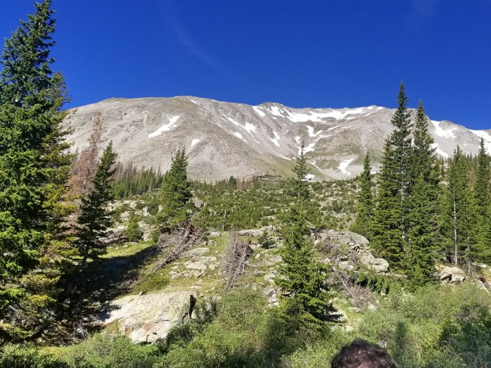


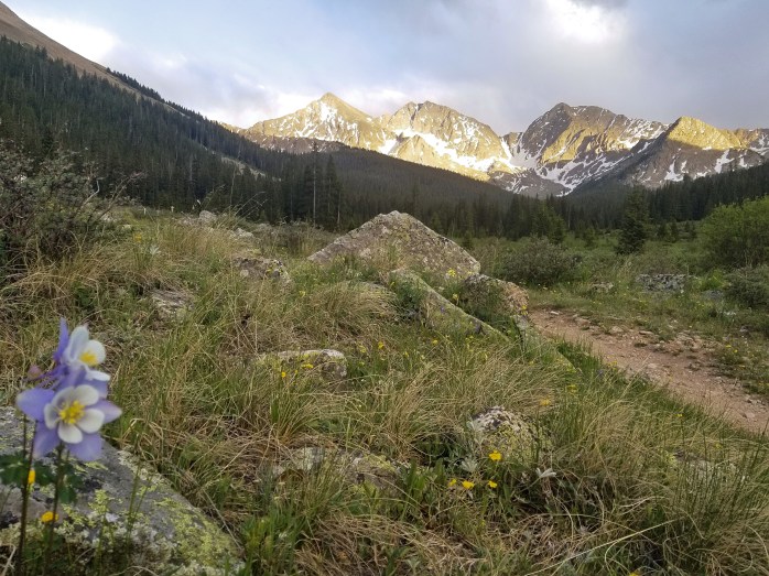
The weather was absolutely perfect, we couldn’t have asked for a better couple of days to take in this mind blowing section. This is quite the ideal year to hike the CDT as we’ve dealt with very minimal snow pack. The Collegiates could be virtually impassable in a typical snow year in June. We were also stoked to see green trees again unlike the dying forests in Southern Colorado affected by beetle kill.

Each day through this section brought incredible views and intense challenges as we were climbing 5000-6000 feet per day through pass after pass.
We found a perfect camping spot after a long day. I guess the pika were glad we chose to camp by their rock fort. They attacked like thieves in the night stealing one of my brand new socks from my vestibule as well as chewing off ALL FOUR of our trekking pole handle straps. 😒


Our next day was another huge challenge, but oh so rewarding. The Collegiate Wilderness has quickly become one of my favorite sections of hiking despite all the hard work.

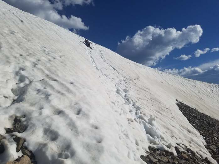
Our final steep climb of the day brought us to Lake Ann Pass. Snow greeted us as we reached the top, and we made a sketchy crossing following the footsteps of our forefathers down a ladder like stair step down the snow.


We made camp after coming down from the pass. I sincerely can’t wait to come back here and bring some friends. We were blown away.

The next morning, we had one final pass to climb – a mere 2400 ft in 2 miles over Hope(less) Pass. A few miles later we walked into the tiny town of Twin Lakes and left the Collegiates behind us.


We killed a little time in town before heading back into the woods. We camped 65 miles from Highway 9 to Breckenridge and wondered if we could accomplish the stretch in just two days. Well – ready, set, go!!
Sean led the way breaking camp at 5 am both days, and we pushed to see what we could do skirting Mt. Elbert and Mt. Massive on our first day. We were proud we accomplished our biggest day on the CDT – 32.5 Miles – but were unsure if we could do another 31.5 miles the next day including two huge climbs.

We woke up early once again knowing if we could make our goal town dreams would come true. We hiked 17 miles by 12:30 and arrived at Copper Mountain resort. The weather broke as we sat and enjoyed tall coffees. After our break, we put on our rain gear and set out for our next big climb and 16 more miles to town.
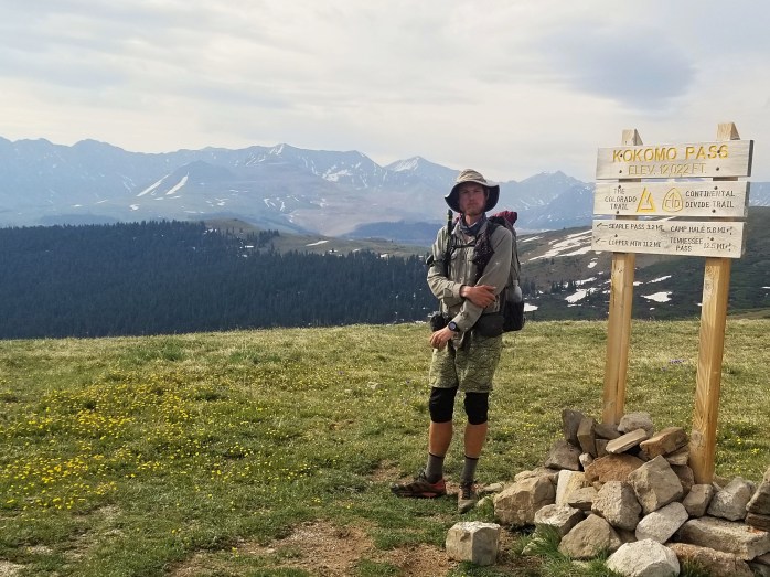

We were so thankful the weather held up as we pushed ourselves up and over a mountain dreaming about Breckenridge – particularly the vegan pizzeria we enjoyed last year as we passed through on the Colorado Trail. We made it – exhausted and excited – to the highway at about 8:20 giving us 40 minutes to make pizza dreams come true at Piante Pizzeria. We were so stoked to get a hitch just in time. We grabbed our pie and headed to our cozy room proud of the 65 miles we had traveled in a mere two days.

Follow here or Instagram as we continue our hike on the CDT from Mexico to Canada!!
Exploring Colorful Colorado: Chama to Salida on the CDT

After four days off in Chama, Katie’s blistered feet were finally feeling good enough to walk. We were thrilled to begin our hike in Colorado. Trail Angel Ralph was nice enough to give us a ride to the trail, and we were on our way.

We hiked about 16 miles from the trail head and made camp for the night preparing for the storms in the next day’s forecast. We left from camp early to an eerie colored sky. We only hiked two miles before the sky opened up hitting us with ice pellets. Sean made the quick call to pitch the tent we had just packed up. At 12,000 ft, weather is completely unpredictable and unforgiving. We waited in the tent cat napping while anticipating the storm to break at any moment. Ice, hail, and rain took their turns pounding our tent as we waited thankful to be dry. Noon came and went. Then two. Then four.
At about 4:30, the clouds slightly broke giving us a brief moment to exit the tent. We hit the sides of the tent to release the icey buildup. We debated packing up to move on, but didn’t trust the look of the clouds still lingering in the sky. We made our dinner just in time before the rain started again. We retreated back to our tent knowing we weren’t going anywhere for the night. We struggled to sleep through the night considering our long idle day, but we were grateful to be dry and ready to hike the next day.
When we awoke, there wasn’t a cloud in the sky. We were overjoyed to be surrounded by mountains and eager to be on our way. But as always, if it’s not one thing slowing you down, it’s another. Today was our first day to deal with what snow still remained in the mountains. Frankly, we picked one of the lowest snow years on record for Southern Colorado, so I shouldn’t complain. But I’m just not that into snow. We hiked all day crossing occasional snow fields and trying to enjoy the spectacular views. The sun was setting just as we arrived at camp completely exhausted from our 23 mile day.


The next morning was much the same, climbing between 10 and 12,000 ft with occasional snow fields. We didn’t use the microspikes we had purchased, but maybe I should have. A couple passes had me hoping I wouldn’t be found dead at the bottom spikes in pack. Of course, we made it through unscathed.
We decided to pass on the opportunity to head to Pagosa Springs as we had already elected to take the lower Creede alternate. We had two big days ahead of us before we would walk into the small mountain town. Thankfully, the snow passes were behind us as we headed northward. However, challenges still presented themselves as the alternate route was littered with blow downs. We tried to navigate what little trail there was tearing up our beat up shoes and leaving our gaiters in shreds. Thankfully, the blow downs only lasted a couple miles before a real trail emerged, and we were on our way.
We pushed hard to get into Creede trying to make up for our long days off in Chama. We impressed ourselves by completing 22 miles by 2:00 and celebrated at a local bar with $1 pints.
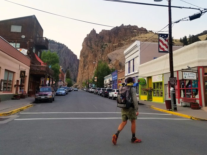
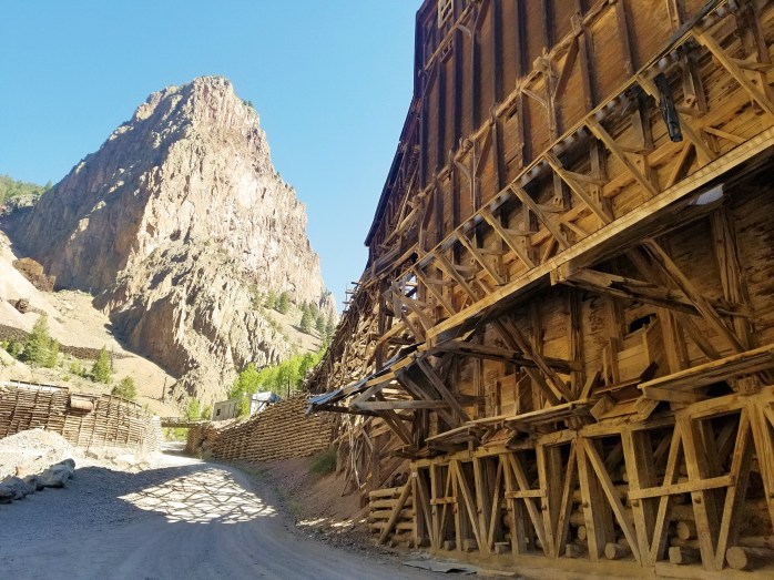
As the sun was setting, we headed out of Creede looking for a place to pitch our tent. We passed a friendly couple sitting in their garage and asked if they knew where we could set up camp. Instantly, they offered us a beer and a place to sleep in their mountain vacation home. So awesome!!

Todd and Jodi were the most incredible unsuspecting trail angels. They welcomed us into their home, provided showers, and even took us for our first ATV ride. The next morning, we rejoined the official CDT route at San Luis Pass. We were now back in familiar territory as the CDT and Colorado Trail coincide at this point. We walked on remembering our 2016 Colorado Trail adventure.
On this last push into Salida, we worked really hard to up our daily walking average with the hopes of possibly finishing the trail in early September. We’ve been trying to hike 25-30 miles per day and get in and out of towns and avoid the vortex. Like today in Salida – showers, laundry, resupply, food, and this blog all done in four hours! Off we go 👣🌲🗻🌎

We’re about 800 miles done with nearly 2000 to go! Follow us on our walk from Mexico to Canada on the Continental Divide Trail here or Instagram.
Endless Wide Open Spaces: Pie Town to Chama on the CDT

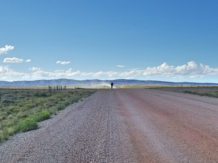
We left the Toaster House in Pie Town and headed out into the New Mexican abyss for another stretch of hiking towards Grants. Our bags were loaded down with extra water as we took off into the nothingness that exists in central New Mexico. Several times I wondered if I was on some sort of treadmill as the scenery seemed to go by without changing as we walked endless miles of gravel road.

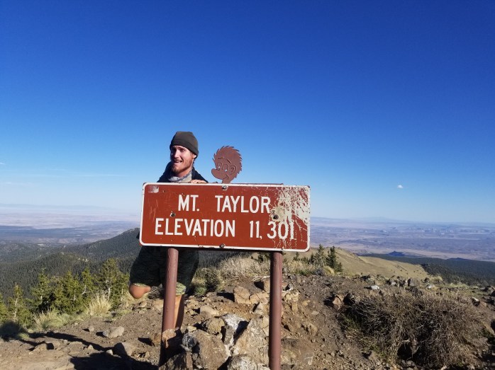
We enjoyed a zero day in Grants and prepared for another stretch – this time with an actual mountain involved!! We decided to take the Mt Taylor Summit alternate to get a view from the top.
We were happy to finally have a change of scenery on the mountain, but the views were short lived. We continued north of the mountain drifting through wide open spaces and not much else.


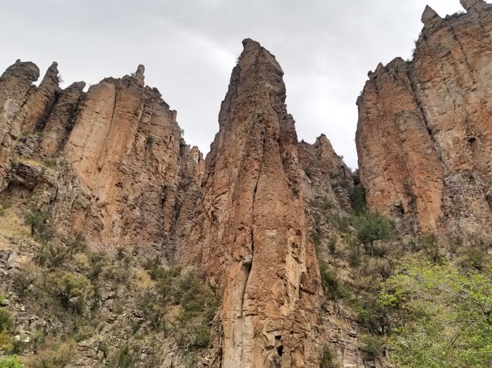
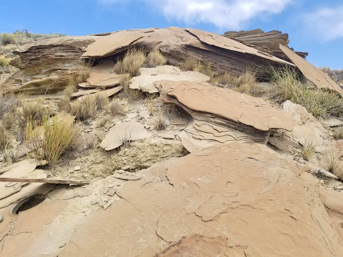
Miles and days blended together as we continued northward on the CDT. Just when we were about to die from a mix of dehydration and boredom, we were glad to see a slight change in the landscape. After so many miles across the top of the mesa, we began a descent into a colorful canyon full of fascinating rock formations and an endless supply of sand.


We were happy to arrive in the small town of Cuba after this 100ish mile stretch of mostly nothingness. While New Mexico does have so much beauty to offer, it’s kind of strung together with miles of wide open spaces in between. We intended to hike out of Cuba that day, but our friends convinced us otherwise. We were really glad we decided to stay as the afternoon brought a strong storm complete with hail and rain all through the night. We happily spent the night in yet another cheap motel enjoying food and beers before our last 150 mile stretch to the Colorado / New Mexico state line.
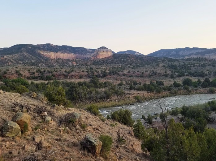
The next day we left Cuba and were in shock as we climbed up a mountain and into a meadow complete with streams and trees. After weeks of 20 mile water carries from cow trough to cow trough, a flowing stream and green grass seemed like paradise. We were both somewhat shocked and overjoyed with our new surroundings.


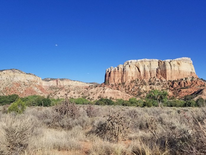
We descended from the mountain sadly leaving the meadow behind and continued towards the Ghost Ranch. We decided in Cuba to split up the 150 miles with a quick stop at the Ghost Ranch, a nearby tourist attraction complete with dinosaur bones, an exhibit on former resident Georgia O’Keefe, and a beautiful landscape featured in films like 3:10 to Yuma, City Slickers, and Wild, Wild West. Although we’d been discussing increasing our daily walking average, we walked towards the Ghost Ranch considering a brief stop in Santa Fe a mere two hours away via bus.
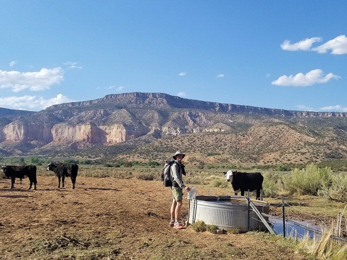


When we arrived at the Ghost Ranch the next morning, we were torn by our ambitions to hike and our desire to soak in all that cities have to offer. Unsurprisingly, we decided to catch the bus towards Santa Fe for the night. As luck would have it, we caught a ride from a like minded traveler directly from the Ghost Ranch to Santa Fe saving us a couple hours of bus rides. We got into Celeste’s car with broad smiles and were delighted at her suggestion to hop into the nearby reservoir for a quick swim.


Our evening in Santa Fe felt like it was over as soon as it began. The next morning proved somewhat of a struggle as we all tried to make our way back to the trail via bus, missing our first bus, then being vortexed into REI. We didn’t make it back to Española until about 4:00 pm and weren’t too keen on waiting for the bus to the Ghost Ranch for nearly two hours. We were so thrilled when Diane let us climb into her truck for the final stretch of the adventure back to the trail. We made it back with daylight to burn so we hiked on down the trail only 90 miles away from Colorado.


We decided to try to make up for our slacking off by pushing two 30s and a 26 mile day to get us just past the Colorado state line to a highway where we could hitch to the nearby town of Chama, NM. We were pleasantly surprised with our abilities to accomplish such big mile days back to back. Suddenly the long stretch across the desert floor where this journey began seemed so far away. The landscape had totally changed, and now grass and pine trees replaced sand and cacti.

I reflected on the miles south of me to the Mexican border grateful for the experience to discover yet another state on foot. And while I’m thankful for the experience, I am quite pleased to have New Mexico and this long desert section behind me. To Colorado… and beyond!!!

Miles Walked – 617
Number of Days – 33
Biggest Day – 30 Miles
Number of 0 Days – 2
Daily Average – 18.7 Miles
Daily Average w/o 0s – 19.9
Follow us here or Instagram as we continue hiking the CDT to Canada!!
