
Pacific Northwest Trail Section 3 – Bonners Ferry, ID TO Northport, WA

We’re out on a thruhike of the 1200 mile Pacific Northwest Trail (PNT) as part of a group of six hardcore hikers. Read our experience getting our collective butts kicked on the rugged and challenging PNT in Section 3.
Click here to read Section 1 or Section 2.

Day 12 – 27.9 Miles / +9600 ft elevation gain
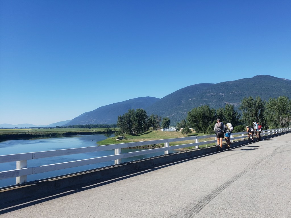
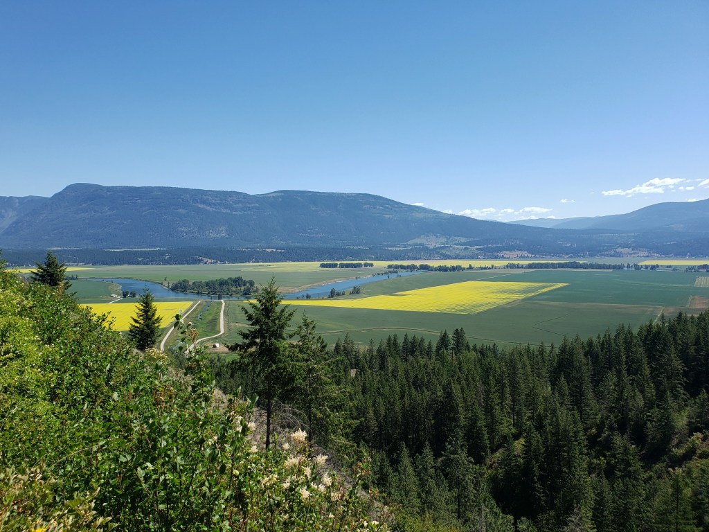
After a much needed zero day in Bonners Ferry, we started trying to hitch a ride about 15 miles back to trail at 5:30 am. About an hour later, we found a ride for all six of us with Ashlyn and I pretzeled into the trunk. By 7:00, we started our 10 mile mostly flat road walk through colorful alfalfa and canola fields. We had learned of an unprecedented and historic heatwave on our day off and felt the temperature rising as we approached single track. Around 10:30, it was time to start one of our biggest climbs we have encountered thus far on the PNT. Our endless climb, of course, coincided with a burn area providing zero shade for us as we melted our way up the trail. Oh, and there were no listed water sources on the way up, so we carried 3-4 liters each and did our best to ration. Sweat poured and temperatures rose as we gained the ridge. Exhausted, we took our lunch in the smallest sliver of shade we could find.


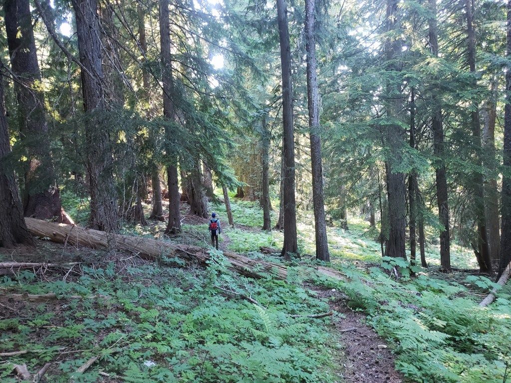
By late afternoon, we were finally in intact forest. Even at 7000 ft, the temperature had to be above 90°. We had our eyes on the goal of getting to Long Mountain Lake for a quick dip to cool down and refill our water bottles. The lake was about .3 mile and 400 ft downhill and off trail, but the extra effort was so worth it. At the lake trail intersection, we beelined down, the impossibly blue lake drawing us like moths to the flame. We found a perfect rocky spot to jump in the freezing cold water, absolutely elated. Relief engulfed us as we plunged into the water.
We finished the rest of the evening with – surprise – a little more climbing. We were stunned to learn we had climbed 9600 ft in only 18 miles.


Day 13 – 19.5 Miles / +6000 ft elevation gain
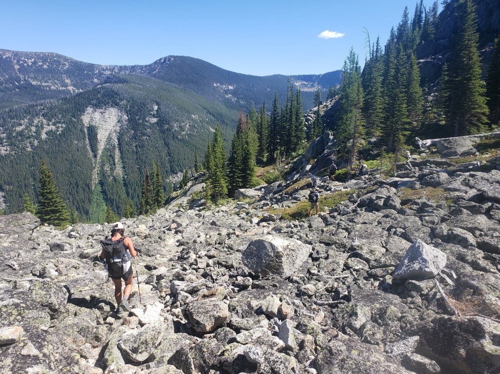
We awoke knowing we had a big day ahead of us. We were just a couple miles shy of the beginning of an 8-mile bushwhack (ie literally no trail for 8 miles). There were two options: Lion’s Creek Bushwhack straight down into a valley and a climb back up the other side, or the Lion’s Head Bushwhack, bushwhack and rock scrambling following the ridge. We decided to take the high route, preferring rock scrambling and views to the bushwhack in the valley. We knew we were in for a tough day in either direction.


We started the bushwhack section around 7:00 am. We were in thick forest filled with towering and fallen pine trees and thick willow, blueberry, and huckleberry bushes. Movement was slow as we navigated through, trying to pick the path of least resistance. After our first mile and hour of this, we branched off towards the high route.
Bushwhacking is a slow sport, a test of will and patience. As the hours and miles dragged on, it became apparent that I was failing the test. As we followed the loosely defined route, we began a series of ups and downs that included sections of exposed rock slabs, bushwhacking through the forest, rock scrambling, and a Class 3 sketchy descent. Ankles twisted, hikers fell, screams were released. The sun beamed down on us, temperatures rising to the mid 90s adding yet another challenge to this demanding section. Water sources were truly up in the air through the bushwhack, and we were grateful for any trickle we could find.
We could see Lookout Mountain Lookout far ahead in the distance sitting atop Lookout Mountain, our destination that would end this bushwhack nonsense and where the PNT returns to trail. As morning became afternoon, the Lookout seemed just as far away as it had been hours before as though we hadn’t moved any closer. By lunch at 1:30, we had made it about 70% of the way through, and we were all looking pretty haggard – cut and bruised legs, torn shirts, pants, and shoes, a snapped trekking pole, a little less sparkle in our eyes. After our lunch break, we only had a short stretch left through the bushes, then we exited to rock scrambling up the ridgeline as we approached the Lookout.
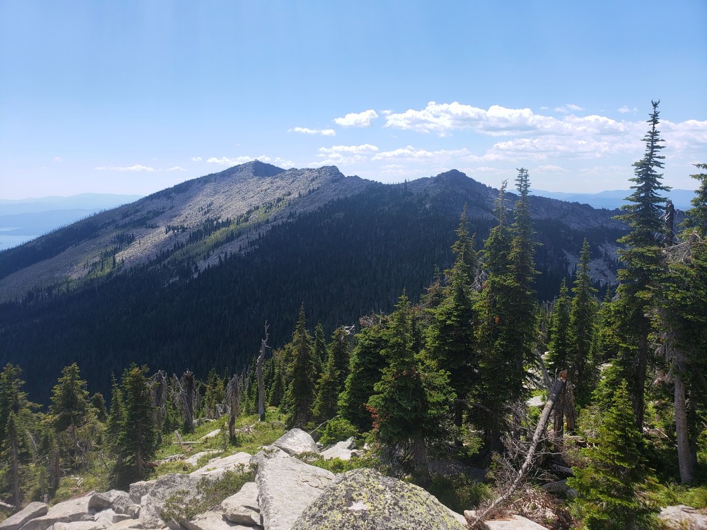
Around 3:30, we finally reached our destination drenched in sweat and utterly exhausted. We took a long break in the shade, trying to enjoy the views that we couldn’t appreciate during the trek. We all agreed this had been one of the most difficult days on “trail” any of us had ever experienced. I didn’t take many pictures. I didn’t want to remember.


We left the Lookout overjoyed to return to a steady walking pace on trail. Though the trail was lovely and well graded, I was still ready to be done for the day, but I knew we still had work to do. The trail headed downhill towards Priest Lake, and the temperatures rose as we walked. The heat was relentless even through the evening hours. We were all craving a swim, and considered going a half mile off trail towards a beach. We decided to stick to trail and not add extra miles, and we were handsomely rewarded with a large campsite right next to a creek. Bags were dropped, clothes were stripped, and we all cooled ourselves in the flowing creek in disbelief. The longest 20 mile day of our lives with +6000 ft of gain across treacherous terrain was over.
Day 14 – 30.5 Miles / +4500 ft elevation gain
Our morning began early as we did our best to get some miles in before the heat became unbearable. Our forecast indicated today’s highs would be around 108°. The trail was gentle to us after yesterday’s trials – soft dirt trail covered in pine needles wound through an old growth forest adjacent to Upper Priest Lake. The morning sun cast soft beams of light through the trees and the smell of pine filled the air. Our morning was light and dreamy – an intense difference from the previous day.


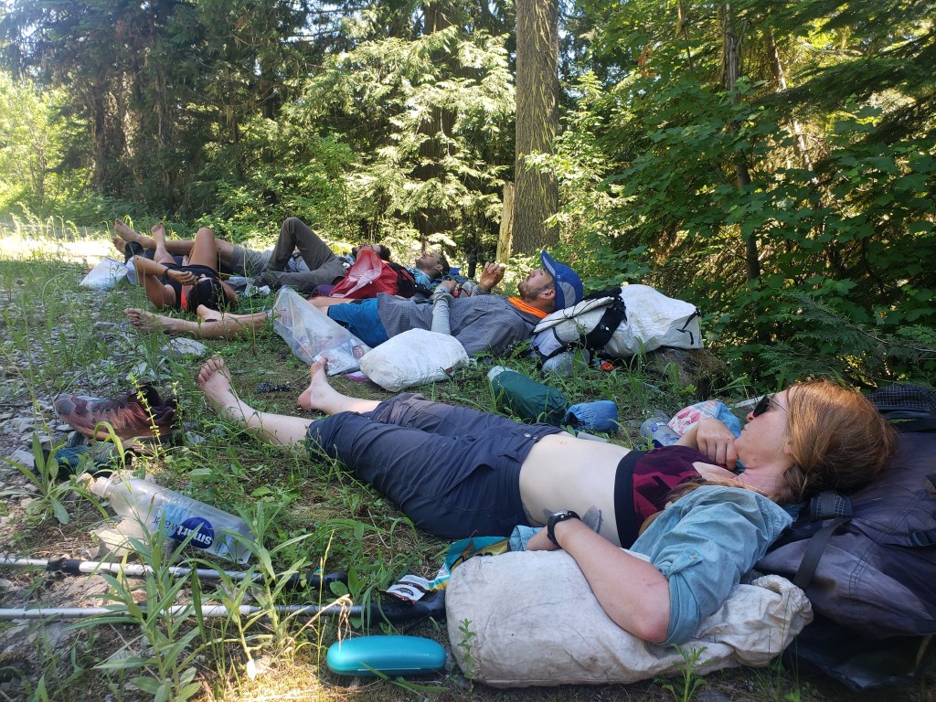
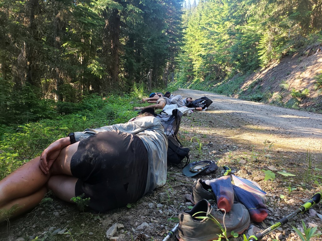
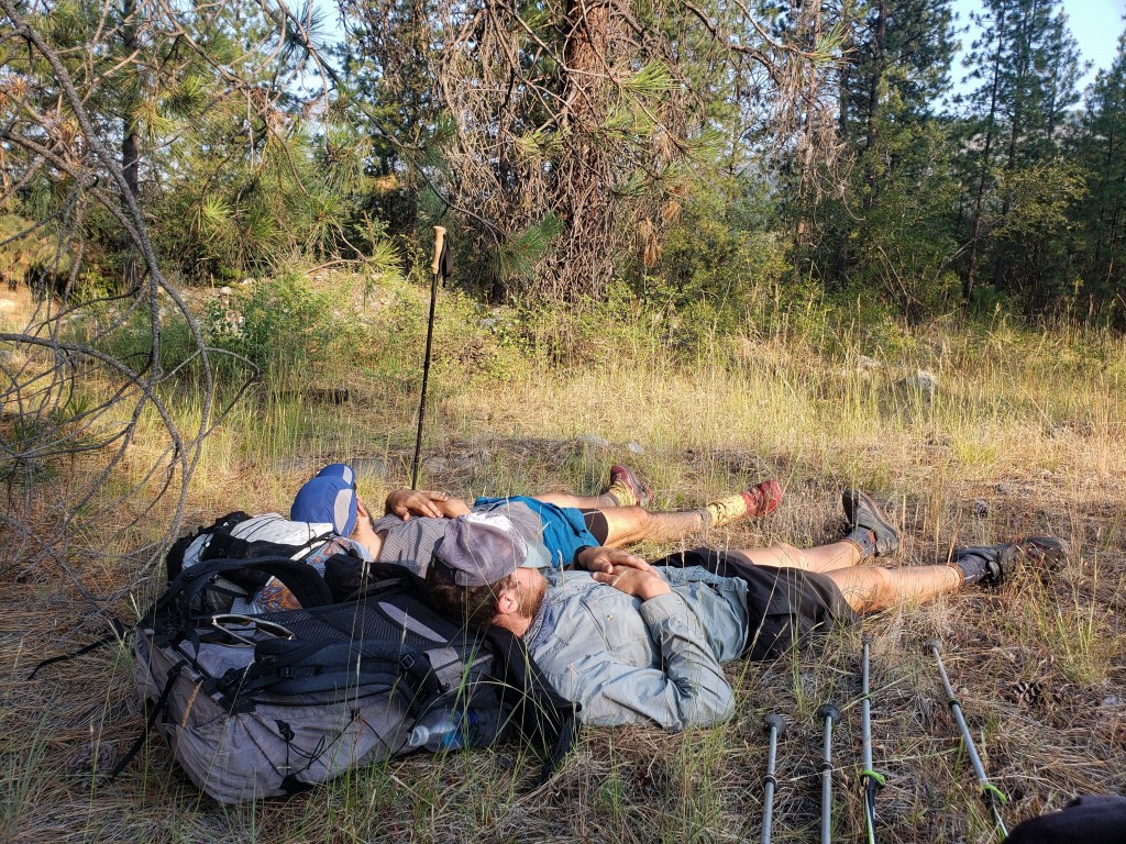
Soon, we exited the woods and began a long walk on forest service roads. Considering the heat was forecasted in the triple digits, we opted to take the road walk over the ridge walk. By 11:00, the walking was already becoming unbearable. We stopped a little after noon for a mid-day siesta to beat the heat. What is usually an hour max for lunch became a 3 hour nap. Leaving the shade felt impossible. At about 3:30, we started moving up the road only to refill water and stop again 2 miles later. At about 5:30, we deemed it possible to walk and got into a groove road walking until about 10:30 pm. We only let ourselves sleep for a few hours knowing the early morning hours would allow us to escape the afternoon heat as we headed into the town of Metaline Falls.
Day 15 – 11 Miles / +400 ft elevation gain
We resumed hiking after a short rest at 4:30 am and continued down the forest service road. The walk was easy, but our minds were preoccupied with escaping the heat in town. Around 9:00, we stumbled into a cafe and locked in our plan to take at least one day off in nearby Ione. We also finalized plans with a couple of Trail Angels who were stoked to drive up to Metaline Falls to feed us!!
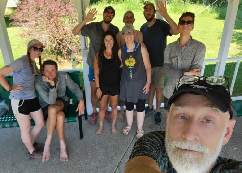
At lunch time, April and Randy arrived with a cooler full of cold drinks, snacks, salad, and rice and stir fry veggies to grill! Their kindness and generosity was unbelievable and couldn’t have come at a better time. After lunch, we lounged in the grass and took turns splashing ice water on each other as we enjoyed the conversation and digested the food coma. Around 3:30, we said goodbye to our Trail Angels (who had driven nearly 2 hours to bless us) and hitched a ride to Ione. At 4:00, the temperature still read 108° and the same was predicted for the following day. Our two bedroom air conditioned apartment in Ione was a God send.
Days 16 – 17 – 0 Miles
While we typically wouldn’t have taken a double zero in the first three weeks, we were relieved to escape the heat in a quirky small town motel that featured an ideal two bedroom apartment for six weary hikers. We had a full kitchen, a grocery store across the street, and swimming access in the river a block away. It was the oasis we needed.


Day 18 – 29.7 Miles / +6600 ft elevation gain
After two full days of rest, we all felt like a million bucks as we hitched back to Metaline Falls to resume hiking. Our morning was spent hiking dirt forest service roads up to Abercrombie Mountain trailhead. We switched to single track and followed the trail just shy of Abercrombie summit. The intense heat had broken, and we relished being surrounded by towering pine trees at a higher elevation. In the late afternoon, we switched back to walking dirt roads which eventually turned to pavement. We camped for the night next to a pond infested with mosquitoes.


Day 19 – 21.1 Miles / +2500 ft elevation gain
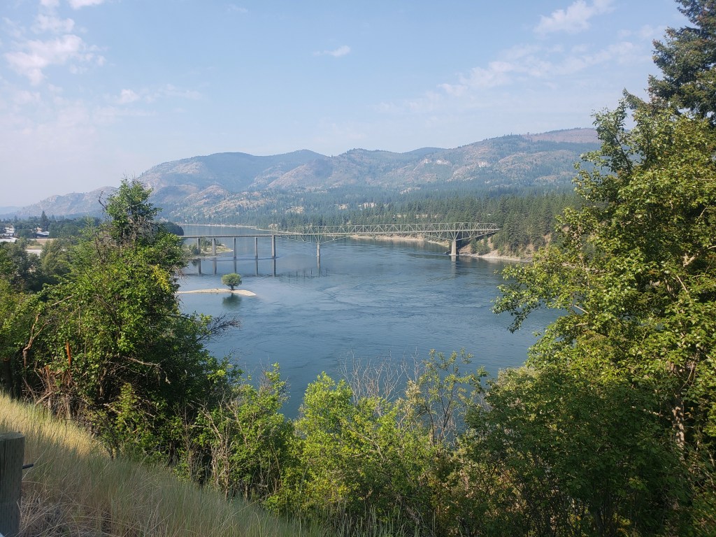
In an effort to escape the bugs and get to town a little quicker, we left camp early and started pounding the 16 miles of pavement that would take us to the tiny town of Northport. Walking pavement is never that fun, but the miles peeled off as we walked the road adjacent to the Columbia River. By 10:30, we had made it to the tiny town of Northport. Temps were soaring in the 90s, so we spent the day swimming and lounging by the Columbia. Around 6:00, we pulled ourselves away from town and hiked about 6 miles of dirt road to camp.

Pacific Northwest Trail Section 3 – Overall Experience
Woof.
Wow, this section had some insanely trying obstacles and challenges in and of itself without the heatwave adding another layer of difficulty. Leaving Bonners Ferry, our first day of this section featured over 9000 ft of climbing, a majority of which was done through a burn area with no shade while temperatures exceeded 100°F. The following day, we all agreed, was one of our most challenging days of our hiking careers as we bushwhacked 8 miles at 1 mile per hour. We exited that stretch with torn clothing and shoes, a snapped trekking pole, cuts, bruises, and sweat drenched clothing. After the bushwhack, we were treated to a lovely section of easy trail though old growth forest as we walked by Upper Priest Lake. The magic ended as we headed towards miles upon miles of forest service roads, taking long afternoon siestas in an attempt to survive the heat.
Our trail magic in Metaline Falls and rest in Ione was incredible and desperately needed. Leaving Metaline Falls, I personally felt the best I’ve felt on this trail – no foot pain or blisters, caught up on sleep, and maintaining a faster hiking pace. Hanging out by the Columbia was delightful, but the town of Northport left much to be desired with a tiny grocery store and a lackluster resupply. Mostly, I’m just glad the heat has broken, and we’re able to breathe again.
PNT Cumulative Stats
- 19 total days
- 3 0-mile days
- 388.6 total miles
- +73,700 ft total elevation gain
- Average Daily Movement (w/o 0 mile days)
- 24.3 miles
- 4600 ft elevation gain
More from the PNT
We’re hiking the 1200 mile Pacific Northwest Trail westbound from Glacier National Park to the Washington coast with a group of hardcore hikers. Follow along here, on Instagram, or Facebook.

Pingback: Pacific Northwest Trail Sections 4 + 5 – Northport, WA to Cold Springs, WA – Infinite Geography
The Mighty Bushwhackers!!!
So proud of you guys on this adventure. I can’t believe how many challenges y’all are overcoming together. So glad you’ve got a solid crew to lean on, vent to, laugh with, and conquer this trail with.
We love following the journey with you guys!
Send it, BAY-BEEEEEE!!!
💜
Sometimes you just have to send it 😎 miss you, thanks for reading 💜💜
I’m terrible at bushwhacking. I’m impressed as all get out that y’all willingly did that. The only bushwhack I’ve tackled is the route west of Swan Lake (to FR 500, SW of Republic WA). I tried to brush it out a bit last summer; I imagine that by now it’s all grown right back.
Pingback: Pacific Northwest Trail Section 6 – The Pasayten Wilderness – Infinite Geography