
Pacific Northwest Trail Section 1 – GLACIER National Park to Eureka, MT

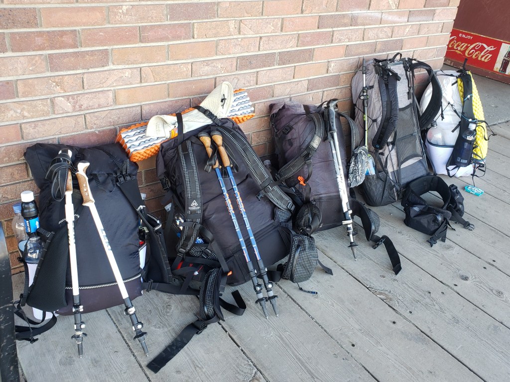
After riding 2200 miles of the Western Wildlands Route on our bicycles, we stashed our bikes in Missoula (thank you Bicycle Hangar!!), bussed to Whitefish, and met up with the gang in Glacier National Park to begin a 1200 mile westbound thruhike of the Pacific Northwest Trail. This remote and rugged trail hugs the Canadian border traversing from Glacier in Montana out to the Pacific coast of Washington. Here’s our experience from our first footsteps on Section 1 of the Pacific Northwest Trail (PNT).

Day 1 – 13.2 Miles / +1100 ft elevation gain
Sean and I boarded the amtrak in West Glacier heading towards East Glacier and quickly found our friends on board. We were a group of seven, eager to reunite and do the thing we’re best at once again. We had secured the necessary backcountry camping permits required in the national park and everyone’s logistics put us all together on the train. The last piece of the puzzle would be a hitch to Chief Mountain trailhead about 2 hours north of East Glacier. We began the search for a hitch immediately and almost instantly found a ride for all 7 of us about 20 minutes up the rode. We exited hitch number 1 and waited less than 5 minutes for hitch number 2 to pull over. The guys climbed in the truck bed while Ash and I got the joy of spending the next two hours reading assigned Bible verses outloud while our driver focused more on his crazy journal than the road. We snuck some pictures for proof. Hitching is most certainly part of the adventure.


After what seemed like an eternity, we arrived safely at Chief Mountain trailhead and the beginning of our 1200 journey. We snapped some pics, tried to shake the experience of doom and gloom preached by the Seventh Day Adventist, and headed down the dreamy trail. We were in some disbelief how easy it was to get a hitch and that we had all day to casually walk 13 miles.
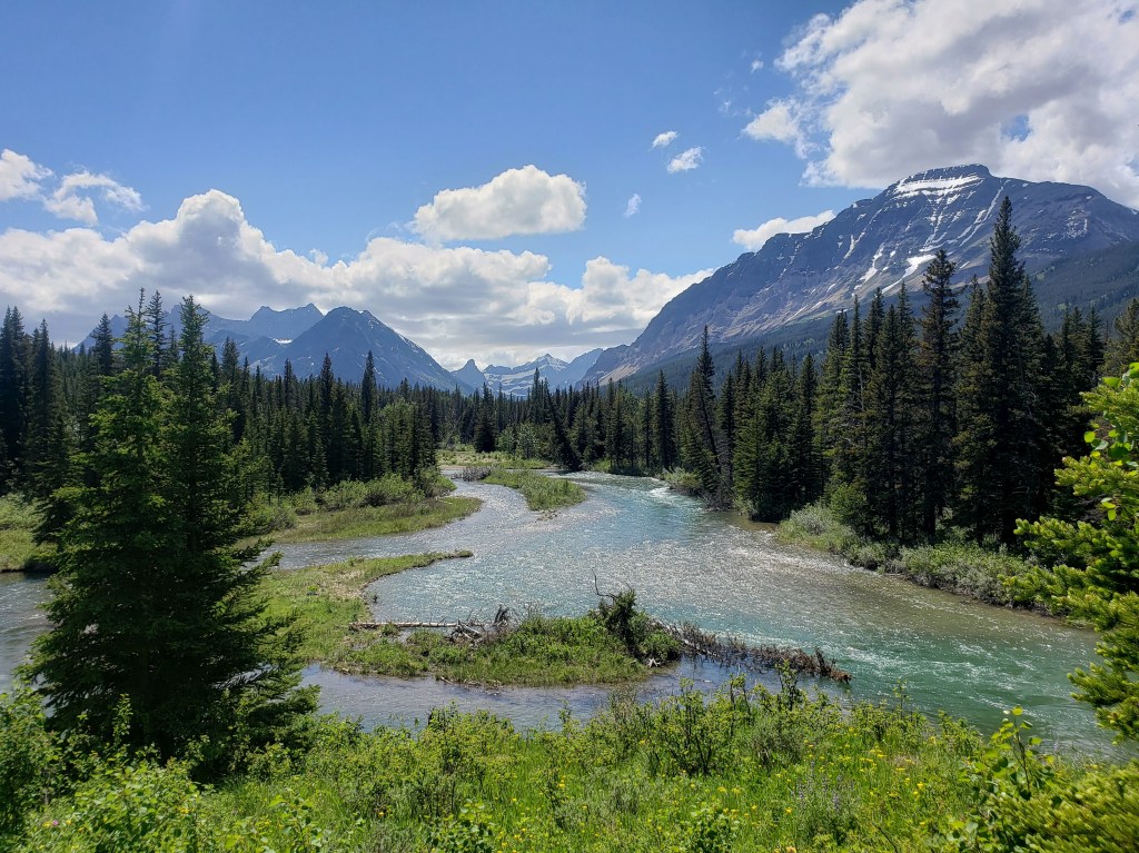
We walked through meadows soaking up the sites, amazed to be back in Glacier together near where we finished our long journey on the Continental Divide Trail in 2018. We made a stop for snacks at Crosley Lake and arrived at our designated campsite at Mokowanis Junction just in time for a drizzle to start. We scarfed dinner under trees, pitched tents, and drifted to sleep as rain leaked from the sky.


Day 2- 27 Miles / +5700 ft elevation gain
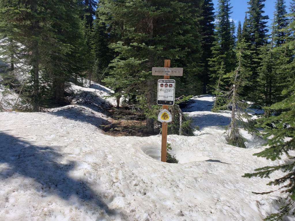
We left camp around 5:30 thankful that the rain had passed. We knew we had a big day ahead of us with 2 huge passes and over 27 miles to get us to our next designated campsite. We were anticipating some snow in the passes that would surely slow us down as well. The rangers that gave our group the permit did so reluctantly, fearful that we wouldn’t be able to navigate the snow or push that many miles. We were on a mission.
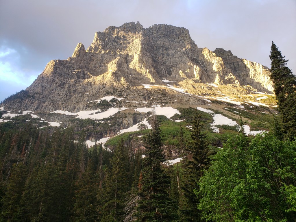
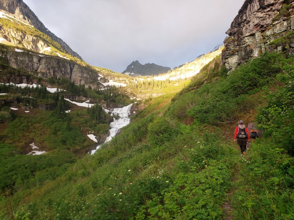
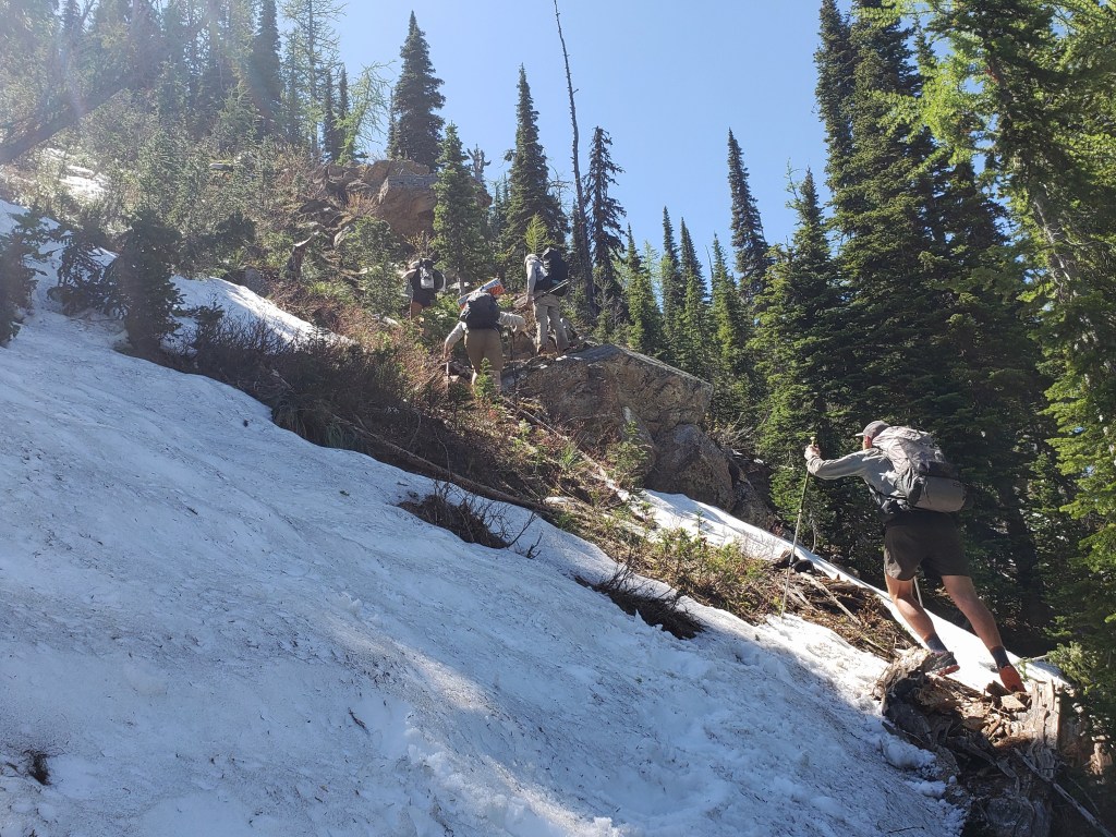
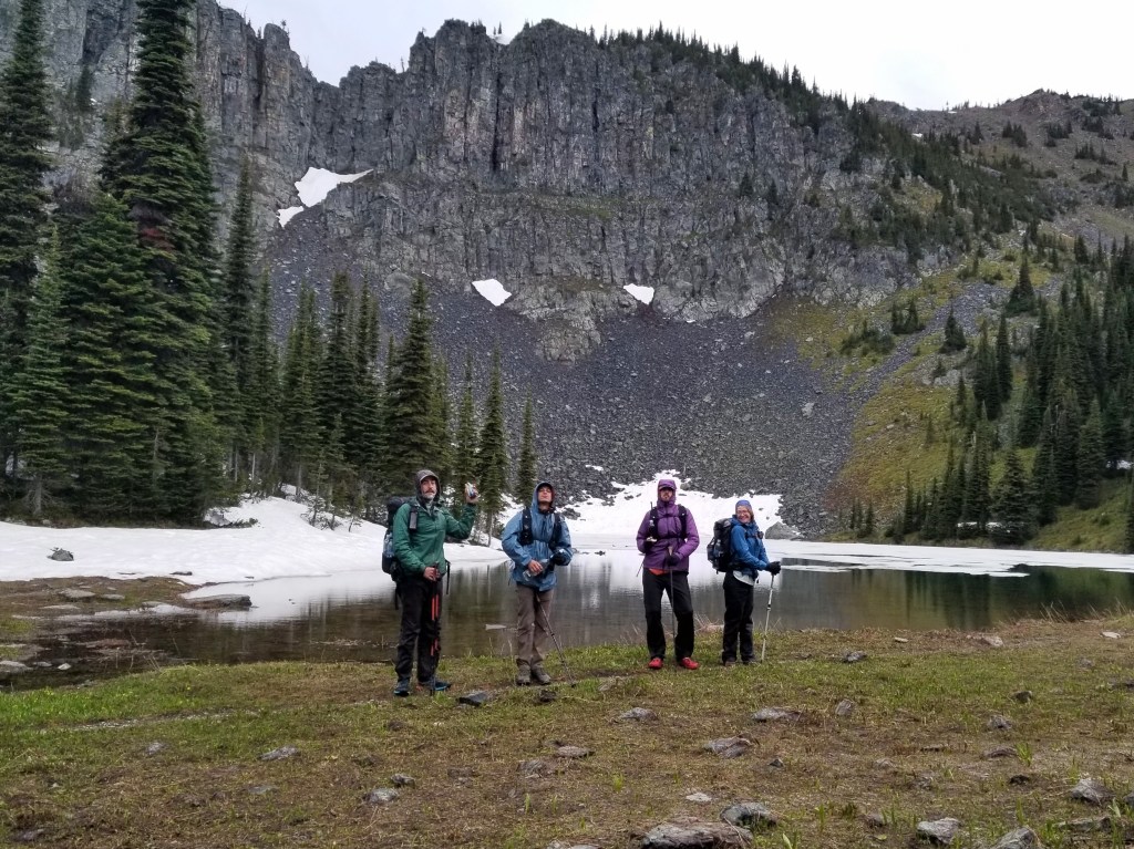
The climb up Stoney Indian Pass began immediately up 2500 ft in about 4.5 miles. We cruised through the first two and hit snow for the remaining 2.5 to the summit. Our focus was divided between the task at hand and the unbelievable views. We watched the sun illuminate the cliffs, sparkle off the high alpine lakes, and dazzle the waterfalls emitting a myriad of colors. Soon enough, all of our focus was poured into navigating the snow covered pass. Eventually, after many ice cold creek crossings and guestimating the path of least resistance, we reached the top of Stoney Indian Pass and took a quick break to take in the views before descending the other side.


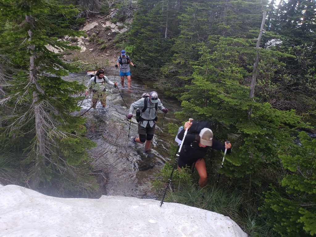


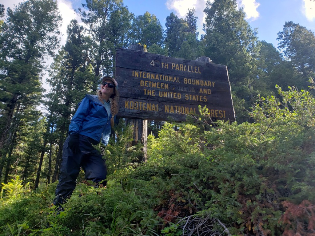
With a lot more mileage and another big pass ahead of us, we tried to keep any breaks short and started our descent down the pass. We created our own route over snow covered terrain eventually winding our way around Stoney Indian Lake where trail began to emerge from the snow. Suddenly, we were walking trail at a quick pace through the forest. Mosquitos found us quickly during our break which we shortened to escape them. The trail turned north and converged with the CDT. Not too long after the junction, we ran into two hikers heading our way. They told us they weren’t able to pass Waterton River due to a bridge being out and had to turn around. The river was about 5 miles down the trail, and we had too many questions to turn back without checking it out for ourselves. We walked down the trail knowing we might have to retrace our steps.
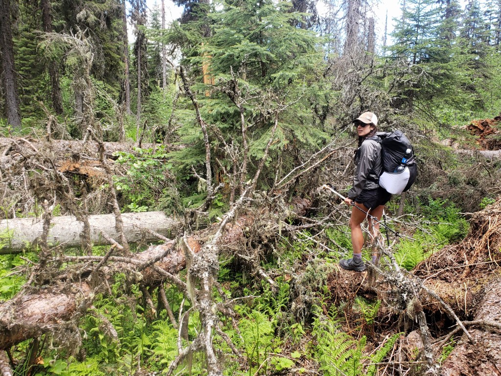
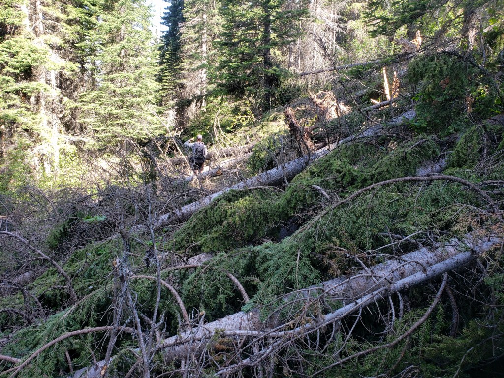
The next five miles we anticipated would be simple, but we quickly ran into a section of blow downs obstructing our path. Our pace slowed as we did our best to find a route on the buried trail spending at least 2.5 hours to traverse 5 miles.
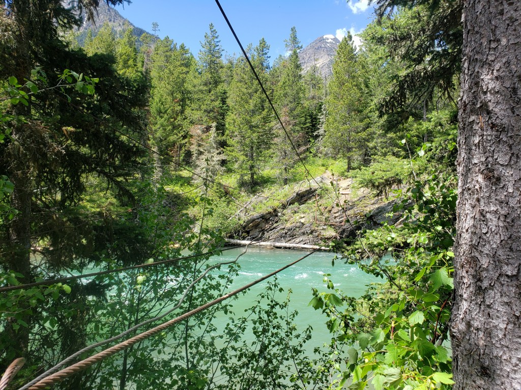
We arrived at Waterton Lakes just before 1:00 hungry and tired from fighting down trees. We had a lovely and relaxing lunch break as we enjoyed the incredible views of Waterton Lakes that stretches across the US / Canadian border. After lunch, we left to discover what this river crossing was all about.

Initially, the trail brought us to the horse ford path which neither horse nor human could safely cross at this time of year. The river roared downstream at an impossible rate draining the snowmelt from the towering peaks above. Next, we walked a short path to see the bridge. As warned, the bridge was dissassembled. Four suspension cables were in place spanning the rushing river, but the wooden planks were neatly stacked on our side of the shore. We inspected the cables, but the thought of crossing them without ropes or harnesses just wasn’t going to happen.

We trudged on upstream towards Rainbow Falls, our last hope that something upstream might be fordable or that there was another bridge. This effort, too, was unfruitful. We did a final inspection of where Waterton River drains into Upper Waterton Lake, checking if the crossing was swimmable. However, the thought of jumping into freezing water and swimming hard across the river opening with a full pack seemed risky. With heavy hearts, we turned around and headed back the way we came knowing we were up against five miles of blow downs and a snowy pass.
We spent the afternoon and evening retracing our steps. No one was happy about the circumstances, but we did our best to keep our moods in check and tackle the task at hand. Truly, I felt a little let down by the rangers as a bridge out is probably something to tell hikers. I was warned about ten times to bring an ice axe and crampons, neither of which was going to help me cross that river, but no one mentioned the bridge. After a very long day, we returned to Mokowanis Junction camp around 10:00 pm totally wiped.

Day 3 – 13.2 miles / +1500 ft elevation gain
We woke up early for an easy hike back to Chief Mountain trailhead. Our next objective was to get to Polebridge – somehow – and continue west from there on the PNT. The hike was over before noon, and we started trying to piece together the plan. Thankfully, we meet Yeti an 83 year old hiker who has logged over 35,000 miles of long distance hiking. He agreed to take 4 of us to East Glacier. The remaining 3 hitched a ride quickly, and we all met up there. We resupplied, snacked, and enjoyed Yeti’s wild stories of hiking. He then agreed to take 4 of us an additional 2 hours around the park to Polebridge. Woohoo!! Again 3 others hitched, and by 6:00 pm we were all somehow in Polebridge able to restart hiking the following day. The trail provides.

Day 4 – 28.4 Miles / +6100 ft elevation gain
Sean and I had a moody start to our day fueled by the physical and mental exhaustion from the experience in the park coupled with a lack of sleep. Nevertheless, we began walking about a 15 mile road walk out of Polebridge and into the forest. Almost immediately, the single track was covered with snow, our group being the first to lay the tracks. Our pace slowed as we climbed up the mountain eventually hitting the ridgeline, and we continued to ride the ridge. The ridge ride remained patchy with some sections of dirt followed by snow covered sections. The day presented all sorts of fun obstacles – snow, wet feet, blow downs, and sketchy scrambles. We did our best to end the day early, finding a section of trail that was clear of snow and dry by 8:00 pm.

Day 5 – 30 Miles / +6600 ft elevation gain
Day 5 – 30 Miles / +6600 ft elevation gain
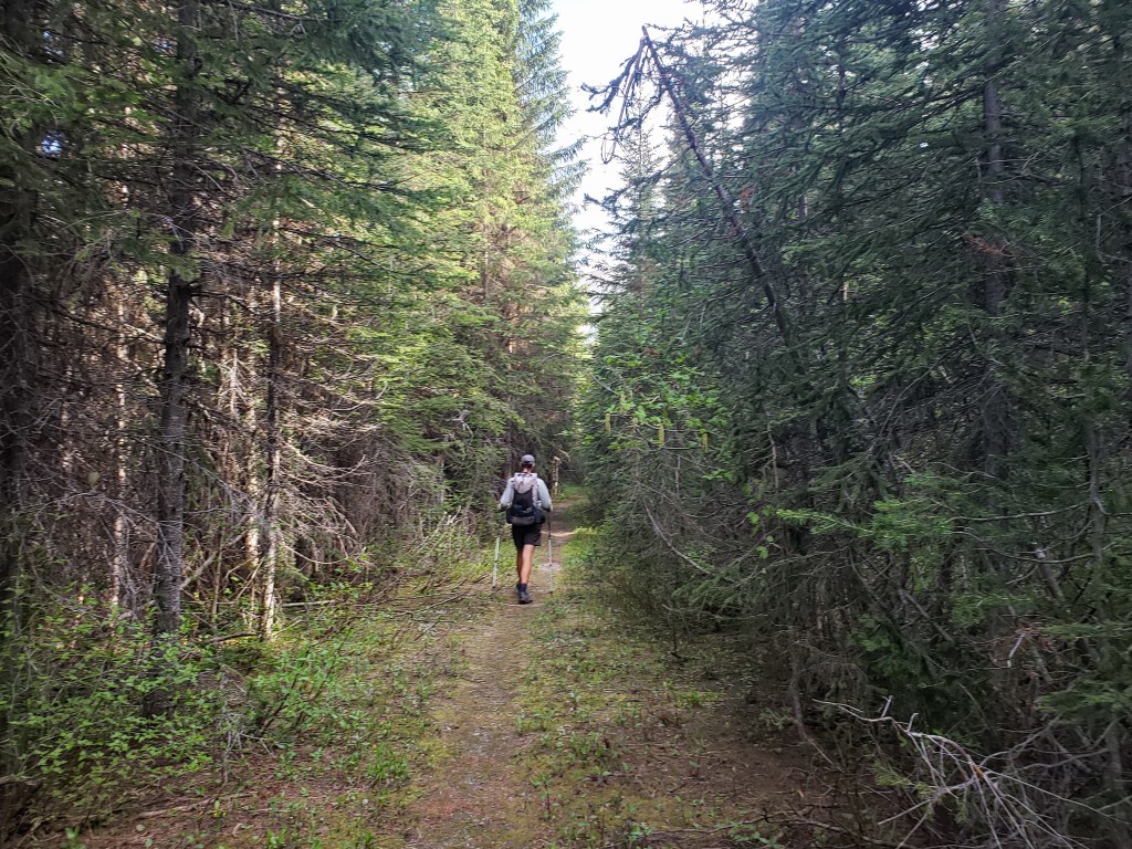
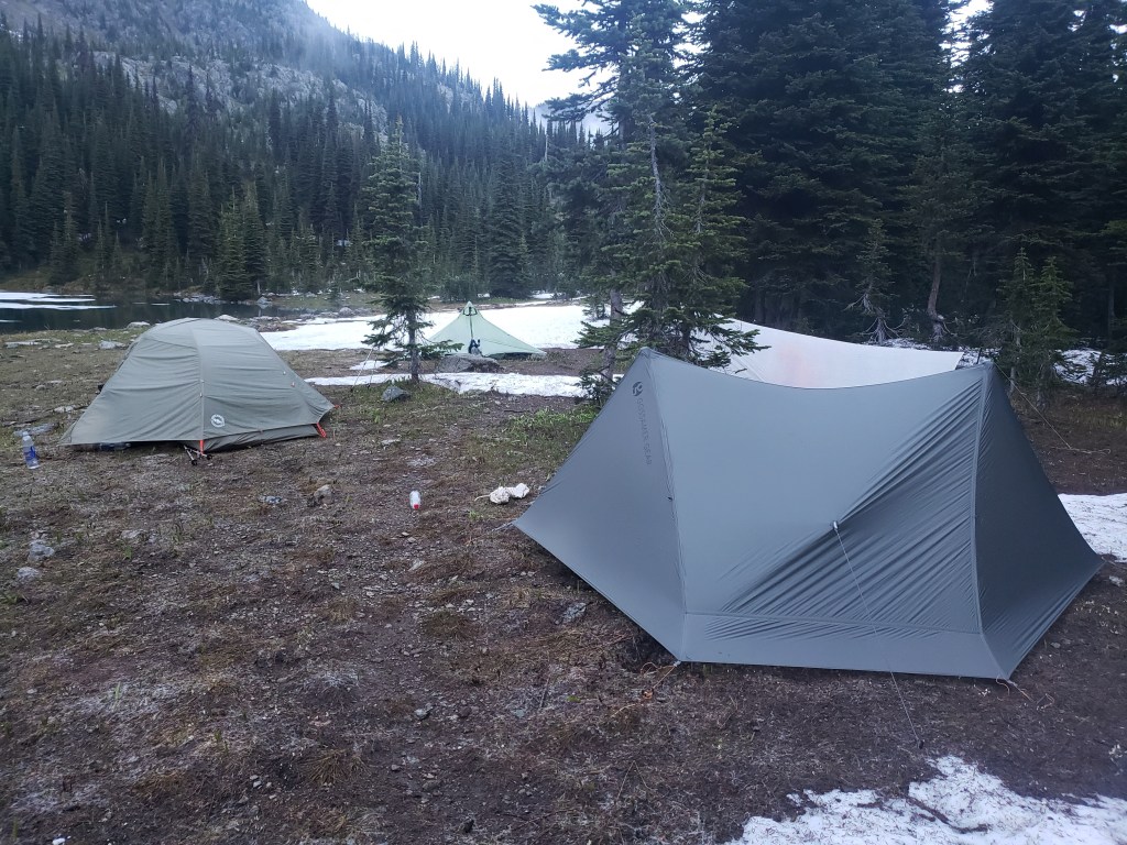
Our morning began with continuing the ridge ride until we finally came down into the forest. After miles of snow, we were stoked to see a well graded dirt trail. The hours passed and miles ticked by. In the afternoon, we did a big climb. By this point, I was starting to notice the blisters forming on my feet, but I continued to push through the pain. The clouds in the sky cast an ominous tone, and we prayed (literally) to stay dry until we got to camp. The temperature dropped as we climbed, but thankfully only a few drops leaked from the sky. We were eager for our day to be over, but the final 3 mile push to camp was tedious as we climbed up slippery snow covered trail. We arrived at Blue Sky Lake exhausted but proud of our first 30 mile day on the PNT.

Day 6 – 18.3 Miles/ +1100 ft elevation gain
Day 6 – 18.3 Miles/ +1100 ft elevation gain
We woke up eager to get to town. The morning was chilly, but the hiking was thankfully pretty easy. We spent the first few miles navigating a little snow, and then descended into the woods down perfectly graded dirt trail. Eventually, the trail met dirt road and the final 8 or so miles was a mix of dirt and paved road into town. My blisters were causing some serious pain, and I took to a light jog stance in order to cope. By mid afternoon, we were elated to arrive in Eureka, MT to get some rest and heal our wounds.


Pacific Northwest Trail Section 1 – Overall Experience
Glacier National Park to Eureka, MT – 131.9 Miles
Going into Glacier is always a treat – waterfalls, mountains in your face, sparkling high alpine lakes. It’s a dreamy place to be. We were definitely disappointed that we couldn’t cross Waterton River, but we’re happy that we made smart and safe decisions.
So far, the PNT has been a mixed bag of trying obstacles and a bit of nice trail. We’ve dubbed it as the “say your prayers” or “there will be blood” trail. We’re pushing hard and hurting ourselves, so that’s cool. I think it’s been worth it.
PNT Cumulative Stats
- 6 Days
- 0 0-Mile Days
- 131.9 Miles
- 22,100 ft elevation gain
- Average Daily Movement
- 22 miles / day
- 3700 ft elevation gain
We’re hiking the 1200 mile Pacific Northwest Trail from Glacier to the Washington coast with a group of hardcore hikers. Follow along here, on Instagram, or Facebook.

Greetings from the flatlands!
I read that Washington state is in the midst of a record-setting heat wave. Are you experiencing any of that? Or are you up high enough that you don’t notice? What about fire risk?
Hello from the flatlands!
I read that Washington state is having record heat. Are you experiencing any of that? Or are you in enough elevation there’s no effect? What about fires?
Yep, we’re here for it. Taking a day or two off to try to escape the heat 🥵
Pingback: Pacific Northwest Trail Section 2 – Eureka, MT to BONNERS Ferry, ID – Infinite Geography
Your pictures are amazing! I love your writing style, too. I’m looking forward to the upcoming entries.
Aww that’s so sweet! Thank you!! New post coming soon!
Pingback: Pacific Northwest Trail Section 3 – Bonners Ferry, ID TO Northport, WA – Infinite Geography
Pingback: Pacific Northwest Trail Sections 4 + 5 – Northport, WA to Cold Springs, WA – Infinite Geography
Pingback: Pacific Northwest Trail Section 6 – The Pasayten Wilderness – Infinite Geography