
Summer of Summits: Mt Princeton & Mt Antero

This summer we’re attempting to summit as many 14,000+ ft mountains in CO as possible, and we’re reaching the trailheads by bike! Join us on our Summer of Summits.
Day 24 – 19 miles by bike / +2200 ft elevation gain; 13 miles hiking / +5400 ft elevation gain
The day began with a 9 mile bike ride with about 1000 ft of elevation gain to Mt. Princeton trailhead. The lower trailhead has a big parking lot where many people begin the long hike up Mt. Princeton. If you have a high clearance vehicle with 4 wheel drive, you can drive up the mountain quite a ways and safe yourself about half the walk. The road was far too steep and rocky for our touring bikes, so our hike began just past the parking lot.
We had a perfect Colorado Bluebird Sky to begin the day as we walked up the gravel road. From the lot, it’s 6.65 miles each way with 5400 feet of elevation gain to the summit. Considering this was a road, the walk was fairly easy, and we kept a steady pace. Eventually, we came to a trail and exited the road just 2 miles from the summit.
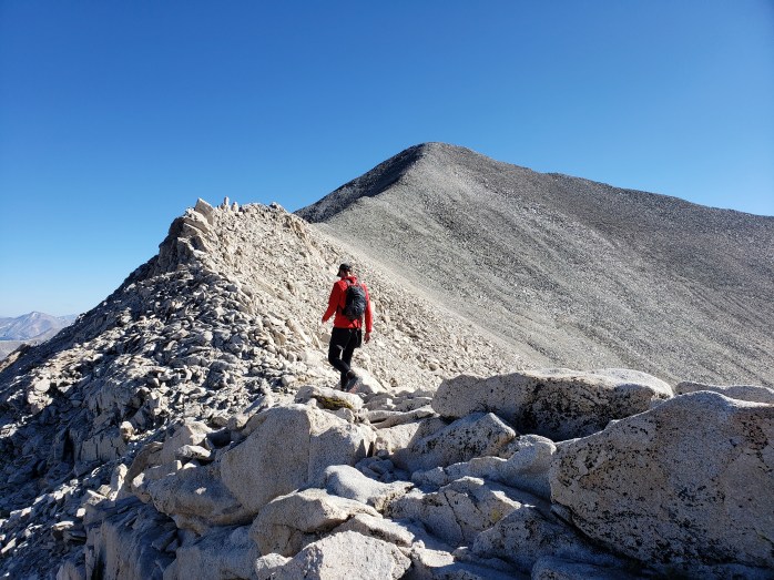
Almost immediately, we rounded a corner where we were finally able to see the summit, the remaining couple miles, and the 2200 ft of climbing ahead. The trail wound through boulder fields and eventually up a series of switchbacks leading to the ridge. We passed a couple small groups of hikers, but overall saw less than a dozen others throughout the whole hike.


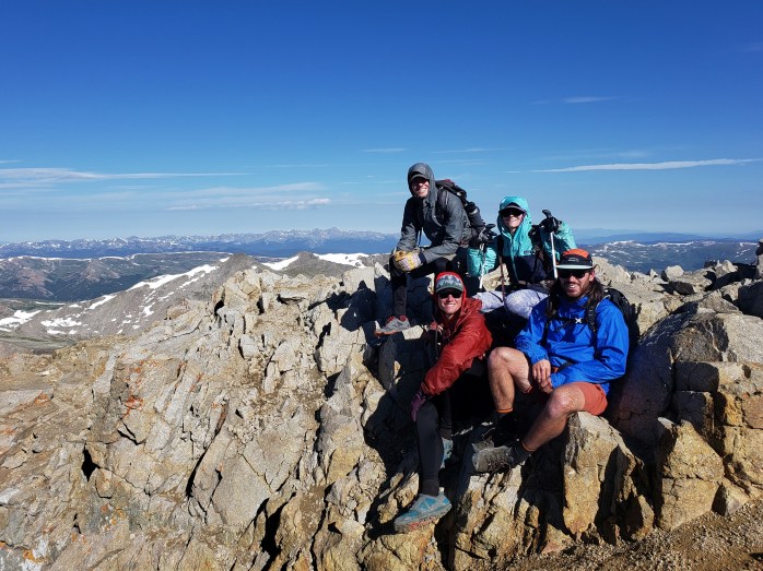
During the final ascent, we followed a faint trail through loose rock and dirt, picked over a few more boulders, and made it to the summit about 4 hours after we started.

From the summit, we noted a few peaks we had already climbed and Mount Antero to the south, our next peak. Our time was short spent as our hungry bellies pushed us back to our bikes.


Once we left the ridgeline and boulder fields, it wasn’t long before we were back on the road. With our minds on lunch, we kept a steady jog down the evenly graded road. It took us just about 2.5 hours to return to the bikes and carbo-load.
The day’s work wasn’t quite done. Our next job was riding to the Mt. Antero trailhead 10 miles away with 1200 ft of elevation gain. After a late lunch, we rolled towards our next destination. We passed the Mt Princeton hot springs and continued up a county road passing the Colorado Trail along the way.
At about 6:00 pm, we reached the ATV road that led up Mt. Antero. We did a little searching for a stealth campsite and set an early alarm for the ascent.
Day 25 – 16 miles hiking / +5200 ft elevation gain
Our hike began just before 6:00 am. Mt. Antero boasts the highest trail system in the US for Off Highway Vehicles (OHVs). The road up Mt Antero can be driven up over 13,000 ft and less than a mile from the summit. We saw all sorts of high clearance vehicles, ATVs, and side by sides driving the trail system. If you’re into this type of outdoor recreation, look no further than the Mt Antero trails.

Our climb was an easy one, walking creekside the majority of the time below treeline and enjoying easy switchbacks above treeline. The higher we went, the more magnificent the views of the surrounding mountains became.


Eventually we came to the end of the OHV road and the trail to the summit. The trail basically just followed the ridge until we did a couple of switchbacks through some loose rocks to the top.

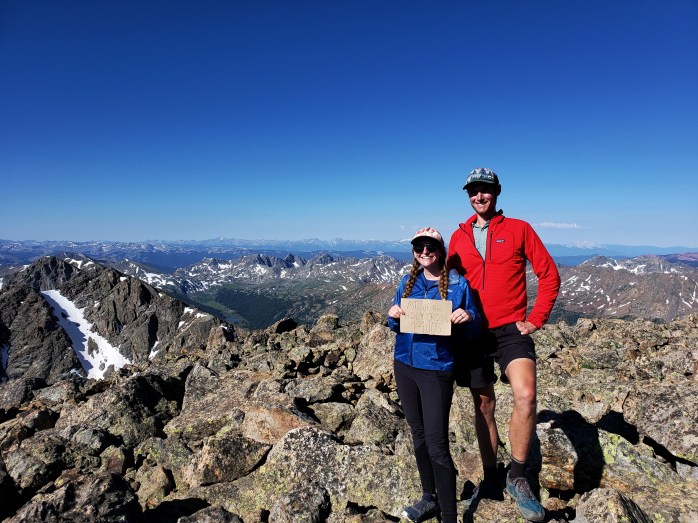
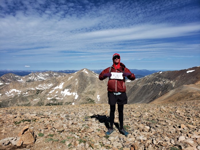
The atmosphere at 14,000+ ft isn’t always the most welcoming, but Mt Antero had a pleasant summit this day, and we lingered longer than usual. After thirty minutes of enjoying our 19th summit, we headed back towards the bikes.

We descended the ridge and returned to the road in no time. The walk down was brisk with a few interruptions to let vehicles pass on the narrow road.


At about 1:45, we made it back to the lower trailhead. The 16 miles and 5200 ft of elevation gain took just about 8 hours to complete. Next, we rode a couple of miles to the Colorado Trail walk in campsite. Signs marked the campsite “Closed – no fees / no services” but also included a sign that said “day use and camping ok.” We setup camp stoked for the day ahead.
Day 26 – 27 miles by bike / +200 ft elevation gain, 2700 ft elevation loss 😎
We leisurely woke up and packed the bikes knowing we had an easy day ahead. Salida was just 27 miles away with 2700 ft of elevation loss! We cruised for about an hour and a half into town where town treats and a zero day awaited!!!

If you’re keeping track…
576 Miles by Bike / +48,600 ft elevation gain
146 Miles Hiking / +58,800 ft elevation gain
19 – 14,000+ ft Summits
- Mt Princeton & Mt Antero
- Mt Harvard, Mt Columbia, & Mt Yale
- Mount Sherman
- Mount Massive & Mount Elbert
- Mount of the Holy Cross
- Mt Democrat, Mt Cameron, Mt Lincoln, and (not) Mt Bross
- Quandary Peak
- Torreys and Grays Peaks
- Mount Bierstadt
- Mount Evans
- Long’s Peak
We are Bekah and Sean, out on an adventure to summit as many CO 14ers as possible this summer and reaching them via bicycle! Follow along here or on Instagram as we complete our Summer of Summits.
Summer of Summits: Mt Harvard, Mt Columbia, & Mt Yale

This summer we’re attempting to summit as many 14,000+ ft mountains in CO as possible, and we’re reaching the trailheads by bike! Join us on our Summer of Summits.
Day 21 – 39 miles biking / +1700 ft elevation gain
After Mount Sherman, we headed south to our next group of summits in the Collegiate Peaks. The ride was sunny and pleasant with incredible views the entire way. Highway 24 between Leadville and Highway 82 has basically no shoulder. I was glad it was a weekday as I’m sure the weekend would have brought more traffic. Most cars were patient and passed safely, but we still had a few trucks pulling fifth wheels willing to gamble with our lives while they impatiently, unsafely passed us. Thankfully, south of Highway 82 there was a wide shoulder, and our ride became that much sweeter.
Our final 5 miles to North Cottonwood Creek trailhead was, as usual, unpaved and steep. The rough road wore me out quickly, and I had to push more than I’d like to admit. Though, Sean (as always), effortlessly led the way. After about an hour of struggling, I made it to camp. We ate an early dinner and got inside the tent just as the rain started for the night.
Day 22 – 20 miles hiking / +7500 ft elevation gain
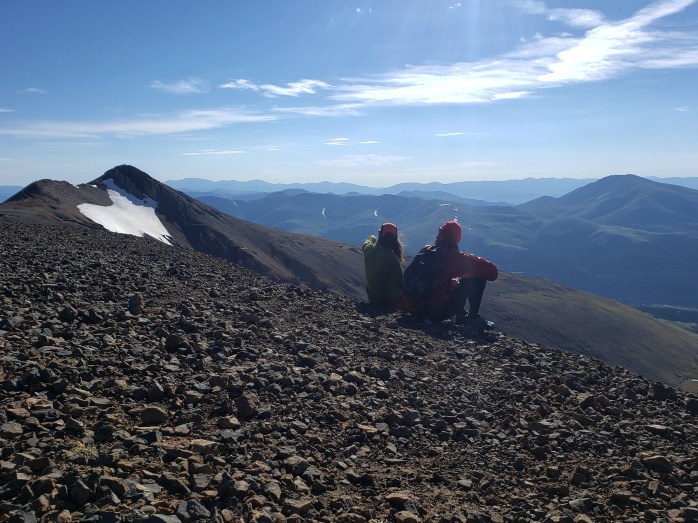
With rain and storms in the forecast, we woke up at 1:30 am for a 2:00 am start. We had a big day ahead of us as we were trying to tackle two summits and get back below treeline before the weather turned sour. We began our hike by the light of our headlamps and soon were in the Collegiate Peaks Wilderness area. After 4 miles, we came to a fork in the trail – the left trail heading towards Mount Harvard summit and the right to Mount Columbia. We decided to head for Mount Harvard first.
Not long after the split, we were above treeline heading up an invisible mountain while clouds came and went overhead. Most of the trail was pretty nice, but the final mile to the summit was considerably steeper with some boulder climbing and challenging way finding in the dark. During the final half hour, the sun shown its light just enough to illuminate our path to the summit. The homestretch involved busting a few creative moves over large boulders.


Just before 6:00 as I joined Sean at the top, the sunrise exploded in color, and I audibly “wowed” my final few steps. With an uncertain forecast, my sense of urgency competed with my sense of awe as I was witnessing one of the most surreal sunrises of my life.


Eventually, we pulled ourselves away from the summit and headed down nearly 3000 ft over 3 miles to get back down to the Mount Columbia spur trail. All Trails lists a route connecting the ridge between the two mountains, but commitment and exposure were two things we didn’t want to gamble with so we took the longer route. At 7:30, we started our second big climb of the day.


The trail immediately tore up the side of the mountain in a series of switchbacks and stair steps. The first third boasted a wide, beautifully crafted trail that we were able to cruise through quickly. The second third turned much steeper with loose dirt and rock which took considerably more caution to traverse.

The last section was walking ridgeline to the summit – or what turned out to be a series of about five false summits before the actual summit appeared. As we neared the actual summit of Mount Columbia, clouds started to surround us. Just passed 9:00 we made it to summit #2 of the day about 3 hours after we had left Mount Harvard summit. Our time at the top was very brief before we turned around and bolted for treeline.


After descending the ridgeline, we were back below the clouds. The remaining walk was pretty quick, and at about 10:40 we made it back to safety in the trees. Clouds filled the sky, but no rain, thunder, or lightning had started. We walked the 4 miles of approach trail through the woods back to our campsite at the trailhead pleased with our day’s accomplishments. And ready for lunch!!

At 12:15, we returned to camp 10 hours and 15 minutes after we started. Our hardest day of hiking so far was done. No more than a half hour had passed at camp before we heard thunder crack, and the rain began. Thankfully, all we had to do was rest for tomorrow’s 14er, Mount Yale.
Day 23 – 10 miles hiking / +5000 ft of elevation gain; 8 miles by bike downhill
The alarm rang at 2:00. I rejoiced when Sean hit the snooze. A few minutes later, snooze again. Neither of us were getting up. Sean turned the alarm off. I was so stoked! We slept until 5:30 and finally pulled ourselves out of the tent. It was actually really nice to be able to see without our headlights. We packed up the bikes and left North Cottonwood Trailhead and headed for Silver Creek Trailhead a mile and a half down the road. This trailhead gives access to the Colorado Trail (Collegiate East route). We locked up the bikes and headed southbound on the CT to the spur trail to Mt Yale.
We enjoyed the pleasant, but steep trail up the saddle and reminisced on our 2017 Colorado Trail thruhike. After 3 miles on the CT meandering through the wilderness, we went west on the spur trail up Mt Yale’s east ridge. This route is a less traveled way to summit the mountain, but made the most sense to our route since the trailhead was so close to Mt Harvard and Mt Columbia.
After we left the CT, we headed above treeline and got a spectacular view of the mountain ahead. As we approached Mt Yale, it became obvious that our route would be tearing straight up the ridge.


The two miles and 2300 ft of elevation gain from the spur trail was an adventure following a faint trail through boulder fields and up loose rock and dirt.


We had amazing weather on the way up and enjoyed the spectacular views noting Harvard, Columbia, and Princeton and could even pick out Pike’s Peak far on the eastern horizon.

We didn’t spend much time at the summit before we headed back down. As we picked our way from rock to rock, clouds moved in on the surrounding peaks. We were happy to make it back to the CT where the hike became much easier and our pace considerably quicker. We returned to the bikes just as a light rain began. We waited it out for a few minutes, then made the ride into Buena Vista for resupply. 17 summits done! On to the next…
If you’re keeping track…
530 Miles by Bike / +46,200 ft elevation gain
117 Miles Hiking / +48,200 ft elevation gain
17 – 14,000+ ft Summits
- Mt Harvard, Mt Columbia, Mt Yale
- Mount Sherman
- Mount Massive & Mount Elbert
- Mount of the Holy Cross
- Mt Democrat, Mt Cameron, Mt Lincoln, and (not) Mt Bross
- Quandary Peak
- Torreys and Grays Peaks
- Mount Bierstadt
- Mount Evans
- Long’s Peak
We are Bekah and Sean, out on an adventure to summit as many CO 14ers as possible this summer and reaching them via bicycle! Follow along here or on Instagram as we complete our Summer of Summits.
Summer of Summits: Mount Sherman

This summer we’re attempting to summit as many 14,000+ ft mountains in CO as possible, and we’re reaching the trailheads by bike! Join us on our Summer of Summits.
Day 20 – 18 miles biking / +2000 ft elevation gain; 4 miles hiking / +2100 ft elevation gain
While in Leadville, I started reviewing our itinerary and noticed I somehow missed a 14er in the plan!! Thankfully, it was simple to add in. Another day, and we would’ve ridden right by it!! Bonus: it was one of the easiest ones so far.
We left Leadville early and headed towards Iowa Gulch Trailhead to hike Mount Sherman. The more popular route is accessed on the other side of the mountain closer to Fairplay, CO, but thankfully this error in planning was easily resolved. The trailhead was just 9 miles away and about half the climbing we got to do by bike. The first 4 miles followed the paved Mineral Belt bike path heading southeast of the city. The sun was just starting to rise as we wound through the path lined with historical relics from the mining days of the mid 1800s. The bike path took us to a county road, and the climb got a little steeper. The final three miles to the trailhead were on a gravel road. The ride was steep and slow, but passable. The nine miles took about an hour and forty minutes, and then it was time to hike.


So far, this was our shortest hike both in distance and elevation gain. Clouds hung in the air as we made our way up the mountain. I immediately noticed the myriad of wildflowers in the valley. The living bouquets colored the somewhat dreary landscape and added a smile to my face.

Soon, the trail picked through rocks as we aimed for the saddle between Mount Sherman and Mount Sheridan. The previous day’s rain made the steep trail a little easier to walk than what surely would’ve been a slower trek over loose dirt and gravel.


An hour in, we were already half way done. At the saddle, the trail from Fairplay coincided with our trail as it aimed for the summit. We took a short break and headed up into the cloud.


Occasional gusts of wind revealed the beautiful valley below, but eventually we were totally socked in. The trail had countless false summits, and with the fog, it was hard to guess where the actual summit was. At 8:40, we made it to the top where a small group of hikers were gathered.

There weren’t any views to take in, so after our obligatory selfie, we headed back down the mountain. The clouds continued to shift in the wind.


By the time we were back at the trailhead, we could actually see the summit as the clouds temporarily split.


We grabbed the bikes, happy to have summited our 14th 14er! Back on the bike path with a little more daylight, we enjoyed the historical mining relics once more.
Onto the next!


If you’re keeping track…
479 Miles by Bike / +44,500 ft elevation gain
87 Miles Hiking / +35,700 ft elevation gain
14 – 14,000+ ft Summits
- Mount Sherman
- Mount Massive & Mount Elbert
- Mount of the Holy Cross
- Mt Democrat, Mt Cameron, Mt Lincoln, and (not) Mt Bross
- Quandary Peak
- Torreys and Grays Peaks
- Mount Bierstadt
- Mount Evans
- Long’s Peak
We are Bekah and Sean, out on an adventure to summit as many CO 14ers as possible this summer and reaching them via bicycle! Follow along here or on Instagram as we complete our Summer of Summits.
Summer of Summits: Mount Massive & Mount Elbert

This summer we’re attempting to summit as many 14,000+ ft mountains in CO as possible, and we’re reaching the trailheads by bike! Join us on our Summer of Summits.
Day 16 – 12 miles by bike / +600 ft elevation gain
After a tough day summiting Mount of the Holy Cross and riding 35 miles to Leadville, we needed to catch up on rest and took a short day. The next trailhead was only 12 miles away so we took our time leaving town. Around 2, we were about to set out when the rain started. We waited around until about 3:30, and it let up. Our ride out of town was pleasant and thankfully not too difficult. The first 6 miles we coasted downhill until we came to a county road. We were glad to still be on pavement as we battled a crazy headwind. As we got closer to the mountains, the pavement ended but so did the wind. The final 4 miles were a gently graded, packed dirt road with a few obstacles but nowhere near as challenging as several other trailhead access roads we’ve encountered. All in all, we were glad to be heading back to the woods and excited to be in a familiar area as we approached the Mount Massive and Mount Elbert trailheads.
The Colorado Trail / Continental Divide Trail pass right through these trailheads and skirt the summits of these mountains. It was amusing to camp back in the same spot we had twice before during our thruhikes. We set up camp and enjoyed chatting with Worm, a CT hiker we had met last year on the Arizona Trail. We set an early alarm and prepared for our 12th summit, Mt. Massive.

Day 17 – 13 Miles hiking / +4500 ft elevation gain
The alarm rang at 3:00 am, and we prepared our day packs. By 3:45 we were walking the Colorado Trail up to the spur trail for Mount Massive summit. With the light of our headlamps, we wound through Aspen groves and towering pine trees. Around 5:20, we exited the forest now above treeline as the sun was starting to peak above the mountains.


Up and up we went, though the trail was very well graded and generally pleasant. As we neared the saddle towards the home stretch, we could see wind whipping clouds on the other side of the mountain.

We did a little simple rock scrambling to reach the summit at 7:30. Only a few others shared the summit with us, but with clouds looming, we didn’t linger long. As the sun shown through the translucent clouds, full circle rainbows could be spotted in the valley. We scurried off the summit and back down to the sunny side of the mountain.


As we went down, a dozen other hikers were making their way up. We were happy the trail wasn’t too crowded as we were heading down towards the forest and our camp that was already set up.


We returned at 10:30, 6 hours and 45 minutes after we started. The rest of the day was spent resting and snacking as we prepared for our next 14er, Mount Elbert, which is reached by the same trailhead.

Day 18 – 9 miles hiking / +4500 ft elevation gain; 12 miles by bike / +700 ft elevation gain
In town, we saw the day’s forecast that predicted morning storms so we decided to start our climb earlier than usual. What better way to celebrate my birthday than beginning our climb of Colorado’s tallest peak, Mount Elbert, at 2:10 am! Once again, we walked the Colorado Trail / Continental Divide Trail until we reached the spur to the summit. Unlike the Mount Massive trail, the trail towards Mount Elbert started climbing right away instead of meandering through the woods. Up we climbed through the trees by the light of our headlamps. It took an hour and a half to get above treeline where we noticed the sky was still overcast. Storms above treeline are risky business, still we kept climbing hoping for the best. The trail kept going up and up the invisible mountain, though we were both grateful for the lack of stair steps that seem to exhaust us more than a graded trail. Occasional sprinkles of rain sputtered from the sky, but thankfully didn’t last. At 5:20, we reached the summit. The sun was just starting to rise above the horizon in a glow of magnificent of color.


Considering the fickle weather, we snapped our pics quickly and began our descent. As we walked down the mountain, the sunrise continued to impress us with a dazzling display of color. Neon oranges and pinks exploded from the horizon melting into cotton candy hues in the surrounding wispy clouds. We passed a couple dozen hikers making their ascent, pleased with our decision to start extra early. To the north, Mount Massive was completely socked in with clouds creating a feeling of instability in the sky.


We were pleased to get below treeline, and by 7:40 we returned to camp. We immediately broke everything down and packed up the bikes. We backtracked the 12 miles to Leadville where we spent the day treating ourselves to town luxuries and rest. Like you should on your birthday 🥳

If you’re keeping track…
461 Miles by Bike / +42,500 ft elevation gain
83 Miles Hiking / +33,600 ft elevation gain
13 – 14,000+ ft Summits
- Mount Massive & Mount Elbert
- Mount of the Holy Cross
- Mt Democrat, Mt Cameron, Mt Lincoln, and (not) Mt Bross
- Quandary Peak
- Torreys and Grays Peaks
- Mount Bierstadt
- Mount Evans
- Long’s Peak
We are Bekah and Sean, out on an adventure to summit as many CO 14ers as possible this summer and reaching them via bicycle! Follow along here or on Instagram as we complete our Summer of Summits.
Summer of Summits: Mount of the Holy Cross

This summer we’re attempting to summit as many 14,000+ ft mountains in CO as possible, and we’re reaching the trailheads by bike! Join us on our Summer of Summits.
Day 13 – 0 Miles by Bike / 0 Miles Hiking
Yep, we took our first Zero Day of the trip. Sean’s bike needed a new spoke, so we took the excuse for a day off in Frisco. It was a much needed amazing day of movies, snacks, and rest.
Day 14 – 48 miles by bike / +4300 ft elevation gain
With Big Red’s spoke fixed, we we began our 45 mile ride from Frisco towards Half Moon Trailhead and our next 14er, Mount of the Holy Cross. Once again, we enjoyed riding on Colorado’s bike paths adjacent to I-70. The first 14 miles we’re fairly slow as we climbed nearly 1600 ft up Vail Pass. The effort was rewarded when we crested the pass and started gliding down towards Vail Village. We effortlessly cruised 15 miles down 2500 feet in about a half hour. Sean noticed his brakes were shot, so we checked around Vail Village to see if any bike mechanics were available. As luck would have it, we found someone to check out the bikes. Sean needed new brake pads and a new rear rotor. Brakes are important! An hour and a half later, Big Red was actually ready to ride again. We left Vail Village around 4 pm and cruised the next 10 miles on pavement.

The final 8.5 miles were on a chunky dirt road with 2300 ft of elevation gain. Yikes. We began around 5 and started our slow ride up to camp.

Halfmoon Campground is closed this year due to COVID-19, but dispersed camping is permitted along the road at least a half mile away from the trailhead. It was a slow and steady ride with plenty of potholes, partially buried rocks, and stretches of washboard that left us exhausted despite the fact that we had just taken a zero day. It took nearly two and half hours to get the 8.5 miles to our dispersed campsite. We smashed some food and set a 3:30 am alarm for our hike the next day.
Day 15 – 10 miles hiking / +5500 ft elevation gain; 35 miles of biking / +3100 ft elevation gain
We got up early and rode the half mile to the trailhead, and began our ascent at 4:30. Mount of the Holy Cross trail is a bit longer than most of the others we’ve hiked with 5500 ft of elevation gain over 10 miles. Initially, the trail rises 1400 ft, then loses 700 ft, then finally climbs 3400 ft to the summit. Despite the tough terrain, we were happy to be in a wilderness area with very few people.

As the sun rose, we got magnificent views of Mount of the Holy Cross and the surrounding mountains. Once we got above treeline, the trail turned into a never-ending staircase winding through a boulder field.

We took it slow and steady seeing only a handful of people along the way. The final stretch was spent picking our way through boulders, but at about 8:40, we finally made the summit.

The views were gorgeous, and we were able to distinguish some 14ers we had climbed and others in our future. We especially enjoyed seeing the Maroon Bells and the peaks in the Aspen area after having spent our winter there.


After snacks and a short break, we started the long walk back to the bikes down the boulder field, the never-ending stairs, and finally up and over the wooded trail and back down to the trailhead. It was truly one of the prettiest hikes we have done so far, but also the most exhausting.


At 12:30, we exited the trail and went back to camp. We were wiped, but still had 45 miles of riding ahead of us planned to the next trailhead. We ate a little lunch, packed up camp, and began riding the 8.5 miles downhill to the highway. It took about an hour of riding the brakes and dodging obstacles until we were back to pavement. Then, the uphill battle began.
Immediately, the highway led 1000 ft up over 4 miles. This slow and steady took almost an hour in the burning sun. After the pass, we crossed Red Cliff Bridge and continued on.

We had hoped for some significant downhill cruising after pumping the pass, but no such luck. Although we got a couple “free miles,” Tennessee Pass was next with another 2000 ft of elevation to gain. The familiarity of the area set in, and we smiled as we saw where the Colorado Trail / Continental Divide Trail crossed Highway 24 on its way over Kokomo Pass to Copper Mountain.
We took lots of breaks, but both felt like we were hitting a wall. We realized that aiming for another trailhead and hiking a 14er the next day might be out of reach. We reset our goal to Leadville which was still a challenge considering the work we had already done that day.
After Tennessee Pass, we were thrilled to get some relief cruising about 4 miles gently downhill leaving only 3.5 miles left to Leadville climbing slightly into the highest incorporated city in North America at 10,152 ft. We were so grateful to find a room and slept like babies having completed our biggest day of the trip.
Now, onward through the Sawatch Range.
If you’re keeping track…
437 Miles by Bike / +41,200 ft elevation gain
61 Miles Hiking / +24,600 ft elevation gain
11 – 14,000+ ft Summits
- Mt of the Holy Cross
- Mt Democrat, Mt Cameron, Mt Lincoln, and (not) Mt Bross
- Quandary Peak
- Torreys and Grays Peaks
- Mount Bierstadt
- Mount Evans
- Long’s Peak
We are Bekah and Sean, out on an adventure to summit as many CO 14ers as possible this summer and reaching them via bicycle! Follow along here or on Instagram as we complete our Summer of Summits.
Summer of Summits: Mt Democrat, Mt Cameron, Mt Lincoln, and Mt Bross

This summer we’re attempting to summit as many 14,000+ ft mountains in CO as possible, and we’re reaching the trailheads by bike! Join us on our Summer of Summits.
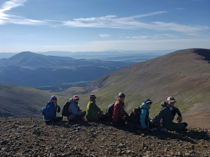
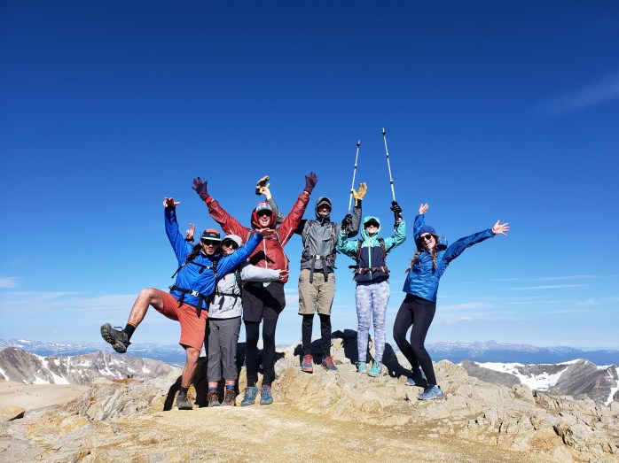
After finishing Quandary Peak, we rode up and over Hoosier Pass, then 6 miles and 1600 ft up a rough gravel road to Kite Lake Trailhead. I was wiped from a long day and ended up pushing my bike the final half mile where I was greeted by the best: my dear friends Becca, Kyle, Trevor and with Trevor’s friend, Christina we were a Krusty Krew of 6. It was so awesome to spend the night camping with friends despite some rain showers. Kite Lake was gorgeous and the beers Bex and Kyle brought hit the spot. We set our 4 am alarms excited for our 4 peak traverse in the morning.
Day 12 – 7 miles of hiking / +3300 ft elevation gain; 32 miles of biking / +1200 ft elevation gain
We got up at 4 and started getting ready for the day. The clouds had all cleared and the sky sparkled with stars. The milky way lit up the sky in a stunning display. By 5:15, the gang was all ready, and we set off on our hike. It was a Saturday, and there were dozens of headlamps gleaming up on the ridge. Kite Lake Trailhead is at about 12,000 ft so the longest elevation gain is “only” 2,293 ft. We headed up and decided to work our way clockwise around the 4 peaks. The trail was well graded and easy to follow though the altitude will always be a challenge. Once we hit the saddle between Mount Democrat and Mount Cameron, we headed towards Mount Democrat as the first in our circuit.

Eventually we were just ants in a line of hundreds of hikers coming and going from Mount Democrat. Just an hour and a half after our hike began, we were already on our first summit. The wind cut through us so after a few pics, we scurried back down to the saddle. Onward to summit number 2.

Up we climbed towards the summit of Mount Cameron winding through big rocks though still no scrambling required. The higher we climbed, the stronger the icy wind was. From summit to summit took less than an hour. We enjoyed a nice break on top of Mount Cameron taking in the views and smashing snacks. The effects of the altitude seemed to ease as our bodies adjusted. In the distance we could see our next two summits. Next up, Mount Lincoln.

Mount Lincoln was just a stone’s throw away. We took off for what became my favorite summit of the day. In just a few minutes, we were celebrating on top of yet another summit!


We came down Mount Lincoln and headed towards Mount Bross. Thankfully, the trail was finally shielded from the wind. Mount Bross lay just a short walk away before we would make our final descent The summit of Mount Bross is privately owned. Signs along the way mark the summit as “no legal access” with the trail just skirting the top. We definitely did not illegally go up to the summit.

After not going to the summit, we headed down Mount Bross back towards our campsite at Kite Lake. The steep descent proved some of the most challenging terrain of the day with a steep pitch and loose dirt and scree. The line of hikers above and below us moved slowly and carefully as not to disrupt the rocks and send them tumbling down on top of fellow hikers. Thankfully everyone around us was patient and cautious, and we made our way safely. After a couple miles winding through rocks, we finally made it back to camp about 5 and a half hours after we started for a total of 7 miles and 3,300 ft of climbing.

After a bit of relaxing at camp, we broke everything down and said our goodbyes to our friends. Watching them drive away looked a lot easier than the bike ride ahead of us. While the ride down the gravel road was considerably easier than the ride up, it was by no means easy. We rode our brakes dodging those same potholes and rocks, our entire bodies jiggling while passing over the stretches of washboard.
Once off the gravel road, we had to ride 6 miles and 1200 ft back over Hoosier Pass. From the top, we glided 2600 ft down over 21 miles to the town of Frisco. Sean realized he had a broken spoke on his back wheel so we had to wait it out to get some maintenance done. I’ll take the excuse for a full zero day, then it’s back to it!!

If you’re keeping track…
354 Miles by Bike / +33,800 ft elevation gain
51 Miles Hiking / +19,100 ft elevation gain
10 – 14,000+ ft Summits
- Mt Democrat, Mt Cameron, Mt Lincoln, and (not) Mt Bross
- Quandary Peak
- Torreys and Grays Peaks
- Mount Bierstadt
- Mount Evans
- Long’s Peak
We are Bekah and Sean, out on an adventure to summit as many CO 14ers as possible this summer and reaching them via bicycle! Follow along here or on Instagram as we complete our Summer of Summits.
Summer of Summits: Quandary Peak

This summer we’re attempting to summit as many 14,000+ ft mountains in CO as possible, and we’re reaching the trailheads by bike! Join us on our Summer of Summits.
Day 10 – 35 miles by bike / +3200 ft. elevation gain
We packed up camp from the Grays / Torreys trailhead and headed towards our next 14er, Quandary Peak. We decided to aim for Breckenridge for the night about 35 miles away.
The first ten miles was a slog through Loveland Ski Area then 2200 ft up and over Loveland Pass. At the top, crowds gathered on various hiking trails with stunning views in every direction. Then, we got to do the fun part: cruising down 2700 ft over 9 miles. Sean sped ahead of me as my comfort level is around 35 mph max on my bike.

Once we hit Keystone Resort, we were able to get off the highway as Summit County is linked by bike paths! Breckenridge was just 17 miles away with another climb of about 1000 ft. We were stoked to do all of that on a safe bike path and not worry about cars rushing past us.
Breckenridge is a special town for us after getting engaged just outside of town a few years ago while thruhiking the Colorado Trail. First stop, one of our favorite restaurants in all the land, Piante Pizza. We splurged on the entirely plant based menu. Omnivore or vegan, I promise you’ll love their ‘za. We settled in for the night in a swanky room and got ready for a big day ahead.

Day 11 – 21 miles by bike / +3600 ft elevation gain; 7 miles hiking / +3300 ft elevation gain
We woke early and started our pre-workout to a 14er. We had 8 miles to ride with 1300 ft of elevation to gain. It took us just over an hour to get to Quandary Peak trailhead. It was a Friday at about 8:00 am when we arrived, and the lot was already packed with cars. We hit the trail at about 8:15.

The climb began immediately, first lots of steps winding through the forest. It didn’t take too long for us to get above treeline and to start passing groups of people. As we ascended, the views became more magnificent and the crowds more dense. I suppose I shouldn’t have been so surprised, but we just couldn’t believe how many people were out on the trail. 300+ is a good guess all stuffed between 3.5 miles of trail between trailhead and summit.


Still, up we went, about 3300 ft total before we hit the summit passing lots of people and a few mountain goats along the way. From the top, we could see Grays and Torreys north of us and many more peaks to the west and south that we will be standing on in the upcoming weeks.


After a brief stop at the summit, we started our descent back down to the bikes. At about 12:30, we arrived back down in the still crowded parking area. We switched back into our biking outfits and began another short stretch of biking to our next Trailhead.

First, we had 2.5 miles up 700 ft to get us to Hoosier Pass. After the obligatory photo, we cruised down 6 miles and nearly 1200 ft through the tiny town of Alma.

Once we got to town, the remaining 6 miles to our camp was on gravel with 1600 ft of climbing. It was a super slow go that took maybe 2 hours dodging potholes, large partially buried rocks, and washboard grooves.
When we got to Kite Lake Trailhead, we were joined by some very special friends who’d be joining us for our next set of 14ers!!
If you’re keeping track…
322 Miles by Bike / +32,600 ft elevation gain
44 Miles Hiking / +15,800 ft elevation gain
6 – 14,000+ ft Summits
- Quandary Peak
- Torreys and Grays Peaks
- Mount Bierstadt
- Mount Evans
- Long’s Peak
We are Bekah and Sean, out on an adventure to summit as many CO 14ers as possible this summer and reaching them via bicycle! Follow along here or on Instagram as we complete our Summer of Summits.
Summer of Summits: Torreys and Grays Peaks

This summer we’re attempting to summit as many 14,000+ ft mountains in CO as possible, and we’re reaching the trailheads by bike! Join us on our Summer of Summits.
Day 8 (cont.) – 8 miles by bike / +1500 ft elevation gain
After summiting Mount Bierstadt in the morning, we cruised down Guanella Pass back into Georgetown. Our next summits were pretty close. We had some lunch and resupplied for the next day’s climb up Grays Peak (14,270′) and Torreys Peak (14,267′).
The trailhead was just 8 miles away with about 1500 ft of climbing most of which was on a bike path just on the other side of the barrier for I-70. It took us just about an hour to reach the “2 wheel drive” trailhead. The “4 wheel drive” trailhead is an additional 3 miles down a rocky dirt road with 1500 more feet of elevation gain. We checked out the road and quickly realized it might be more work to push the bikes up than to just walk up. We found a campsite near the 2 wheel drive trailhead and got ready for our climb in the morning.
Day 9 – 14.5 miles of hiking / +4800 ft elevation gain
We took off from our campsite just before 5 with about an hour to walk down the road until we reached the actual trailhead. Car after car passed us as we walked by the light of our headlamps. As we arrived, the parking area was packed and large groups were making their way towards Grays and Torreys. This was on a Wednesday – I’d hate to see it on a weekend.
Soon, we were on our way up and up the incredibly nice trail. Just over an hour from Denver, Grays and Torreys are some of the most popular 14ers. The trail is nicely graded, well maintained, and the summits require no scrambling. We saw families, children, and plenty of dogs out peak bagging along with us.

The valley leading to the peaks was absolutely stunning dotted with thousands of wildflowers. The trail eventually came to a fork, right for Torreys and left for Grays. We chose to do Torreys first.


As we neared the saddle between the peaks, the icy wind picked up and cut through us. It took us just about 3 hours from the actual trailhead to reach our first summit of the day. We meandered our way to the top and took in the incredible views of the Front Range to the east and the Ten Mile Range to the west. We found a spot just below the summit blocked from the wind and took a quick break.


Shortly, we started our descent from Torreys Peak and headed back to the saddle to ascend Grays. It was a bit steeper but probably took less than 45 minutes from the top of one summit to the other. We took our pics quickly as the icy wind continued to berate us and then began our long downward hike.


With the sun illuminating our surroundings, the valley looked even more magnificent as we headed down. We took our time making our way back to camp happy to have peaks #4 and #5 in the bag.

If you’re keeping track…
266 Miles by Bike / +25,800 ft elevation gain
37 Miles Hiking / +12,500 ft elevation gain
5 – 14,000+ ft Summits
- Torreys and Grays Peaks
- Mount Bierstadt
- Mount Evans
- Long’s Peak
We are Bekah and Sean, out on an adventure to summit as many CO 14ers as possible this summer and reaching them via bicycle! Follow along here or on Instagram as we complete our Summer of Summits.
Summer of Summits: Mount Evans to Mount Bierstadt

This summer we’re attempting to summit as many 14,000+ ft mountains in CO as possible, and we’re reaching the trailheads by bike! Join us on our Summer of Summits.
Day 7 – 24 Miles by bike / +4300 ft elevation gain
We left Idaho Springs on our bikes heading towards our third 14er, Mount Bierstadt. In the first 11 miles, we had a steady incline and climbed about 1000 ft to the town of Georgetown right next to I-70. We got some lunch and started our second half of the day – 13 more miles and 3300 ft of climbing to Guenella Pass. We kept a steady 3-5 mph all the way up for about 3.5 hours until finally we were above treeline and had reached the pass. We made camp for the night just as a small storm was rolling through. We set an early alarm for summiting Mt Bierstadt in the morning.


Day 8 – 8 miles hiking / +2700 ft elevation ; 12 Miles by bike 3400 ft elevation loss
We got up at 4:00, packed up our bikes, and prepared to ride to the trailhead about 2 miles away. The lot was full of cars, and we could see hikers already making their ascent.
Mt Bierstadt is considered one of the “easier” 14ers which was fine by us. With such a close proximity to Denver, the trail is a popular one, very defined, and well maintained. We began our climb up 2720 ft over 4 miles at 5:30 am.

Even on a Tuesday, the trail was very busy with people of all skill levels looking to bag a 14er. First, the trail wound through thick bushes, and soon we saw a big, black moose! He didn’t seem to like me trying to take his picture, so I scurried along.

Next, the trail climbed wooden and stone steps up and up. I think the altitude above 13,000 ft will always be a challenge for me. Every few steps and I needed a little moment to catch my breath.
The last section of trail to the summit was through a big boulder field well marked with cairns. From the trailhead, it took us about 2 hours to the summit. Mount Evans, which we had just summited by bicycle, was to the east, Gray’s and Torreys to the west, and what we’re guessing was Long’s way in the distance to the north. The temperature at the summit was probably around 45° and the wind made it feel that much cooler. After taking a couple pictures, we soon started our descent. The round trip was just shy of 8 miles, and it took us right at 4 hours.


To get to our next trailhead, we had to descend the 3300 ft on our bikes down Guenella Pass and back into Georgetown.
Onward to the next one!
If you’re keeping track…
258 Miles by Bike / +24,300 ft of elevation gain
22.5 Miles Hiking / +7700 ft elevation gain
3 – 14,000+ ft Summits
- Mount Bierstadt
- Mount Evans
- Long’s Peak
We are Bekah and Sean, out on an adventure to summit as many CO 14ers as possible this summer and reaching them via bicycle! Follow along here or on Instagram as we complete our Summer of Summits.
Summer of Summits: Long’s Peak to Mount Evans

This summer we’re attempting to summit as many 14,000+ ft mountains in CO as possible, and we’re reaching the trailheads by bike! Join us on our Summer of Summits.
Day 4 – 60 miles by bike / +6000 ft elevation gain
We took our sweet time waking up after summiting Long’s Peak. Once we were packed up, we headed south down Highways 7 then 72 towards our next 14er, Mount Evans. We decided to head to Idaho Springs and get our first hotel room so we could soak our tired muscles.
The first half of the day was spent riding towards Nederland to get some lunch and groceries. Although I’m sure we did some downhill riding, it felt like a never-ending uphill climb totaling around 2500 ft of elevation gain. After our lunch break, the climbing began again, another 2000+ ft up. After what felt like an eternity, we crested the top of the hill and enjoyed coasting down into the tiny town of Black Hawk. We only had 12 miles and 1400 ft of climbing left until we could ride into Idaho Springs.
Black Hawk is a tricky little town though. At one point, cycling through was illegal. This has since been reversed by the CO Supreme Court, however, cycling south from Black Hawk still proved complicated.
We headed towards the central parkway, the most direct route south up some agonising steep hills. We were about to join the parkway when we noticed a “no bikes” sign. I checked Google maps which suggested an alternate route. Up we went towards the abandoned mining town of Nevadaville where the pavement turned to gravel.

We lost signal, and our directions, and pieced together a route around Bald Mountain. It was definitely an adventure dodging big rocks and uneven surface that turned fun when we finished climbing. Good thing we upgraded our tires! Finally, we reconnected to the recommended route and coasted down to Idaho Springs where our hotel awaited.


Day 5 – 14 Miles by bike / +3500 ft elevation gain
Ahead was Mt Evans which is totally paved to the top making it a unique 14er we could summit by bike. From Idaho Springs, it’s about 28 miles with 7000 ft of climbing. We decided split the slog into two days. We headed out from Idaho Springs around 11:00 am keeping a steady pace between 4-7 mph. Slow and steady was the name of the game. The views on the way up only got better as we went. We listened to tunes and set it in a low gear for about 4 hours.

Around 3:00, we made it to Echo Lake which was buzzing with people. We took a rest, then headed up Mt Evans road. Due to covid, Mt Evans road is closed to vehicles this year, creating a cyclists dream come true. We found a stealth campsite and settled in for the night.


Day 6 – 42 Miles / 3500 ft elevation gain / 7000 ft elevation loss
We woke up around 7 and continued our slog. The early morning views were outstanding as most of the ride was above treeline.

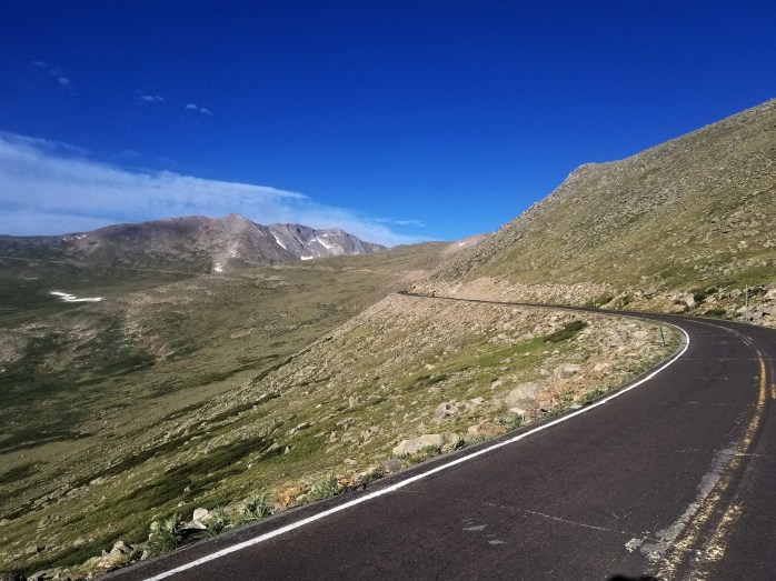

We spent about 2.5 hours traveling 14 miles and gaining over 3500 ft of elevation. The seemingly never ending switchbacks finally ceased just shy of Mt Evans summit where about a dozen other cyclists were taking in the views proud of our accomplishment. We hiked less than a quarter mile to get to the official summit at 14,271 ft. excited to have summited our second CO 14er.


After soaking in the summit, we had the joy of cruising 28 miles back into Idaho Springs with the first 14 being vehicle free. The first half of the road had some rough pavement leaving me wondering how road bikes were cruising so quickly!

The second half was super smooth, and we glided down the mountain back to town. Onto the next 14er!
If you’re keeping track…
220 Miles by Bike / +20,000 ft of elevation gain
14.5 Miles Hiking / +5000 ft elevation gain
2 – 14,000+ ft Summit
We are Bekah and Sean, out on an adventure to summit as many CO 14ers as possible this summer and reaching them via bicycle! Follow along here or on Instagram as we complete our Summer of Summits.
