
Summer of Summits: Mt Democrat, Mt Cameron, Mt Lincoln, and Mt Bross

This summer we’re attempting to summit as many 14,000+ ft mountains in CO as possible, and we’re reaching the trailheads by bike! Join us on our Summer of Summits.
After finishing Quandary Peak, we rode up and over Hoosier Pass, then 6 miles and 1600 ft up a rough gravel road to Kite Lake Trailhead. I was wiped from a long day and ended up pushing my bike the final half mile where I was greeted by the best: my dear friends Becca, Kyle, Trevor and with Trevor’s friend, Christina we were a Krusty Krew of 6. It was so awesome to spend the night camping with friends despite some rain showers. Kite Lake was gorgeous and the beers Bex and Kyle brought hit the spot. We set our 4 am alarms excited for our 4 peak traverse in the morning.
Day 12 – 7 miles of hiking / +3300 ft elevation gain; 32 miles of biking / +1200 ft elevation gain
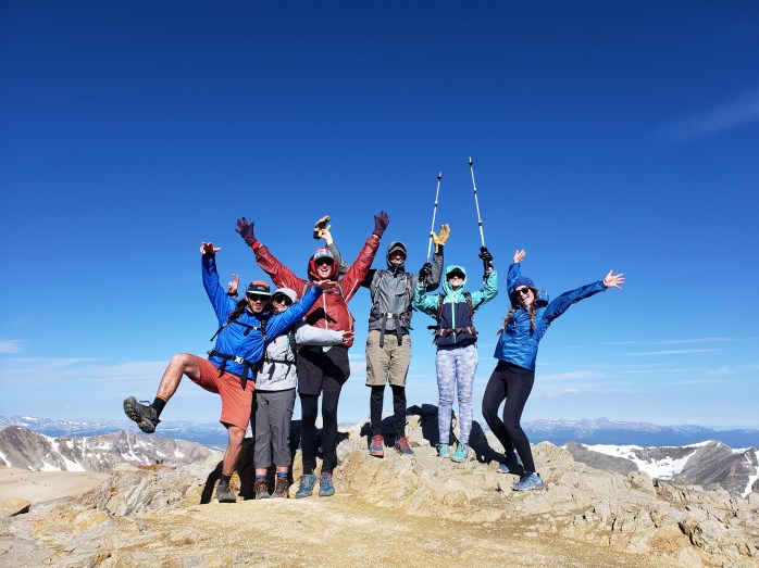
We got up at 4 and started getting ready for the day. The clouds had all cleared and the sky sparkled with stars. The milky way lit up the sky in a stunning display. By 5:15, the gang was all ready, and we set off on our hike. It was a Saturday, and there were dozens of headlamps gleaming up on the ridge. Kite Lake Trailhead is at about 12,000 ft so the longest elevation gain is “only” 2,293 ft. We headed up and decided to work our way clockwise around the 4 peaks. The trail was well graded and easy to follow though the altitude will always be a challenge. Once we hit the saddle between Mount Democrat and Mount Cameron, we headed towards Mount Democrat as the first in our circuit.

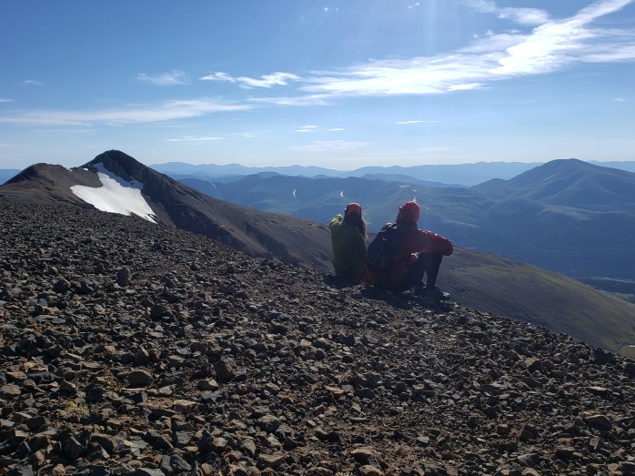
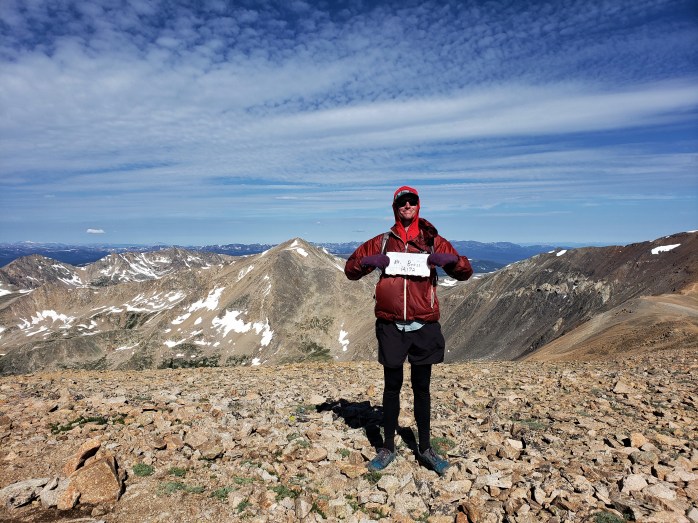
Eventually we were just ants in a line of hundreds of hikers coming and going from Mount Democrat. Just an hour and a half after our hike began, we were already on our first summit. The wind cut through us so after a few pics, we scurried back down to the saddle. Onward to summit number 2.

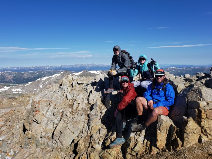
Up we climbed towards the summit of Mount Cameron winding through big rocks though still no scrambling required. The higher we climbed, the stronger the icy wind was. From summit to summit took less than an hour. We enjoyed a nice break on top of Mount Cameron taking in the views and smashing snacks. The effects of the altitude seemed to ease as our bodies adjusted. In the distance we could see our next two summits. Next up, Mount Lincoln.

Mount Lincoln was just a stone’s throw away. We took off for what became my favorite summit of the day. In just a few minutes, we were celebrating on top of yet another summit!


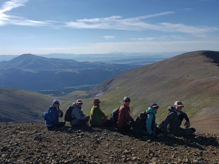
We came down Mount Lincoln and headed towards Mount Bross. Thankfully, the trail was finally shielded from the wind. Mount Bross lay just a short walk away before we would make our final descent The summit of Mount Bross is privately owned. Signs along the way mark the summit as “no legal access” with the trail just skirting the top. We definitely did not illegally go up to the summit.

After not going to the summit, we headed down Mount Bross back towards our campsite at Kite Lake. The steep descent proved some of the most challenging terrain of the day with a steep pitch and loose dirt and scree. The line of hikers above and below us moved slowly and carefully as not to disrupt the rocks and send them tumbling down on top of fellow hikers. Thankfully everyone around us was patient and cautious, and we made our way safely. After a couple miles winding through rocks, we finally made it back to camp about 5 and a half hours after we started for a total of 7 miles and 3,300 ft of climbing.

After a bit of relaxing at camp, we broke everything down and said our goodbyes to our friends. Watching them drive away looked a lot easier than the bike ride ahead of us. While the ride down the gravel road was considerably easier than the ride up, it was by no means easy. We rode our brakes dodging those same potholes and rocks, our entire bodies jiggling while passing over the stretches of washboard.
Once off the gravel road, we had to ride 6 miles and 1200 ft back over Hoosier Pass. From the top, we glided 2600 ft down over 21 miles to the town of Frisco. Sean realized he had a broken spoke on his back wheel so we had to wait it out to get some maintenance done. I’ll take the excuse for a full zero day, then it’s back to it!!

If you’re keeping track…
354 Miles by Bike / +33,800 ft elevation gain
51 Miles Hiking / +19,100 ft elevation gain
10 – 14,000+ ft Summits
- Mt Democrat, Mt Cameron, Mt Lincoln, and (not) Mt Bross
- Quandary Peak
- Torreys and Grays Peaks
- Mount Bierstadt
- Mount Evans
- Long’s Peak
We are Bekah and Sean, out on an adventure to summit as many CO 14ers as possible this summer and reaching them via bicycle! Follow along here or on Instagram as we complete our Summer of Summits.

Pingback: Summer of Summits: Mount of the Holy Cross – Infinite Geography
Pingback: Summer of Summits: Mount Massive & Mount Elbert – Infinite Geography
Pingback: Summer of Summits: Mount Sherman – Infinite Geography
Pingback: Summer of Summits: Mt Harvard, Mt Columbia, & Mt Yale – Infinite Geography
Pingback: Summer of Summits: Mt Princeton & Mt Antero – Infinite Geography
Pingback: Summer of Summits: Mt. Shavano & Tabeguache Peak – Infinite Geography
Pingback: Summer of Summits: Huron Peak, Missouri Mtn, Mount Oxford & Mount Belford – Infinite Geography
Pingback: Summer of Summits: La Plata Peak – Infinite Geography
Pingback: Summer of Summits: Castle & Conundrum Peaks – Infinite Geography
Pingback: Summer of Summits: Maroon Bells & Pyramid Peak – Infinite Geography
Pingback: Summer of Summits: Snowmass Mountain – Infinite Geography
Pingback: Summer of Summits: Capitol Peak – Infinite Geography
Pingback: Summer of Summits: Carbondale to Denver – Infinite Geography