
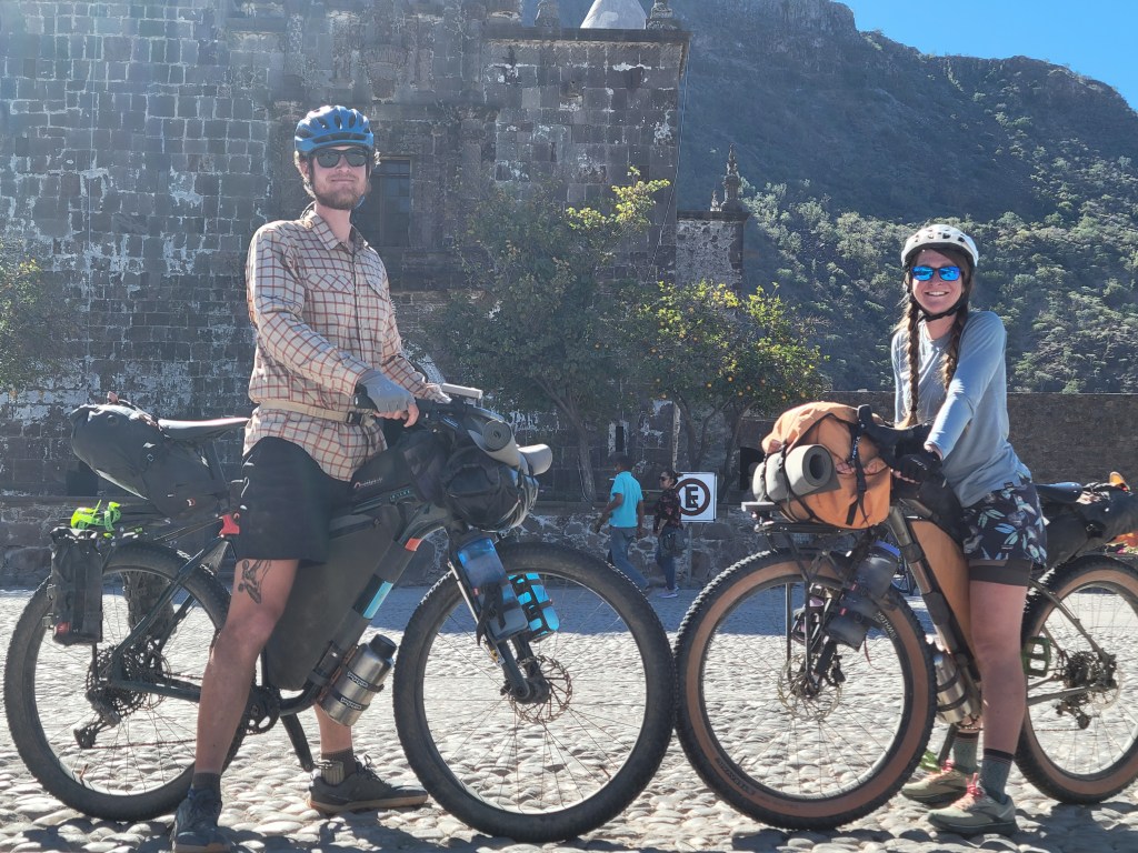
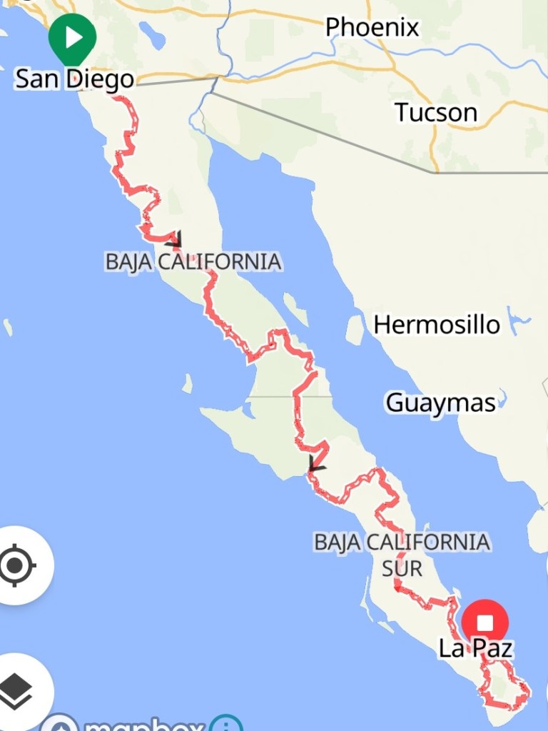
Baja Divide: Ciudad Constitución to San José del Cabo

We’re back at it on the bikes – this time ~1700 miles on gravel as we traverse Mexico’s Baja Penninsula from San Diego, CA to San Jose del Cabo, Baja California Sur.

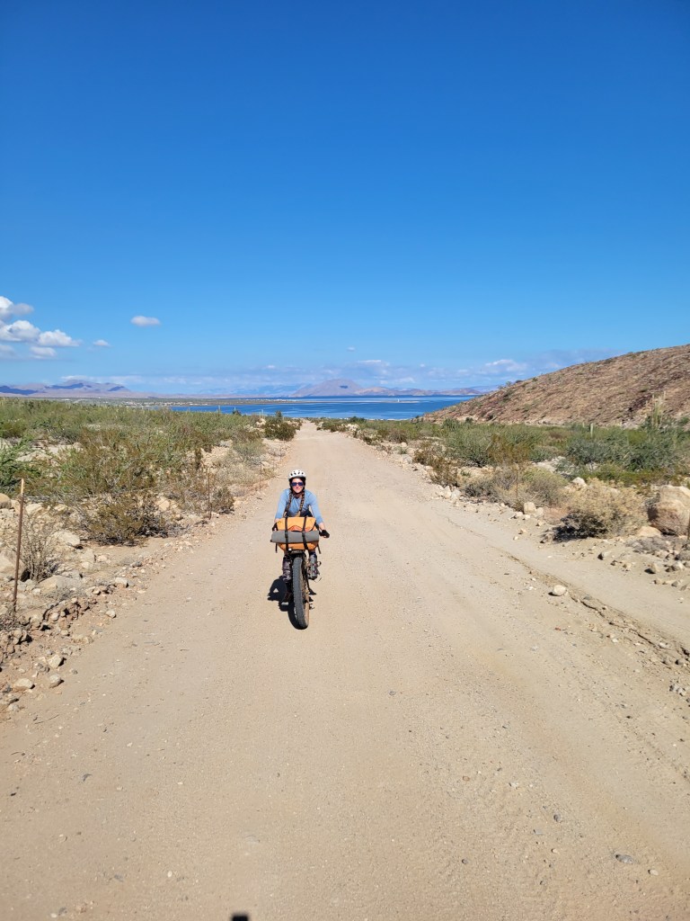
Day 35 – 51.6 Miles / +1424 ft gain
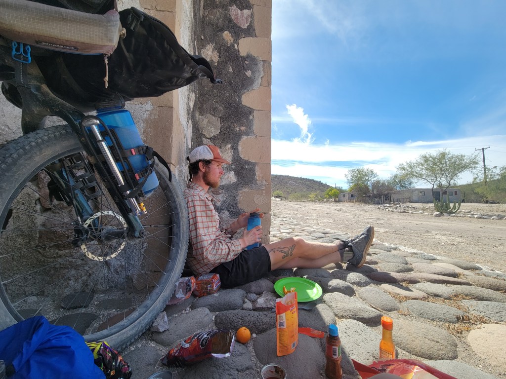
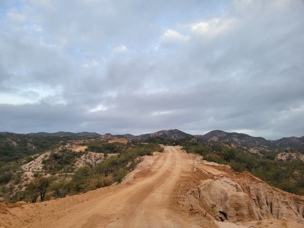
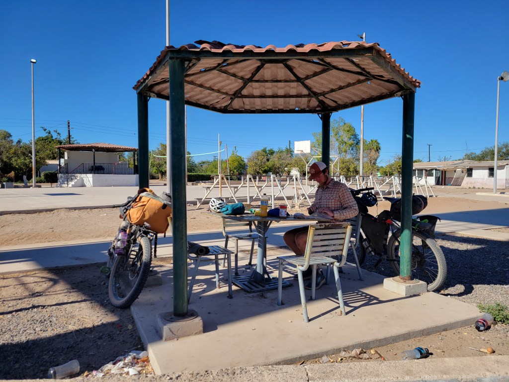
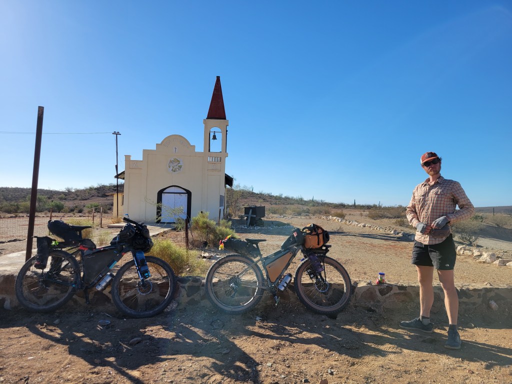
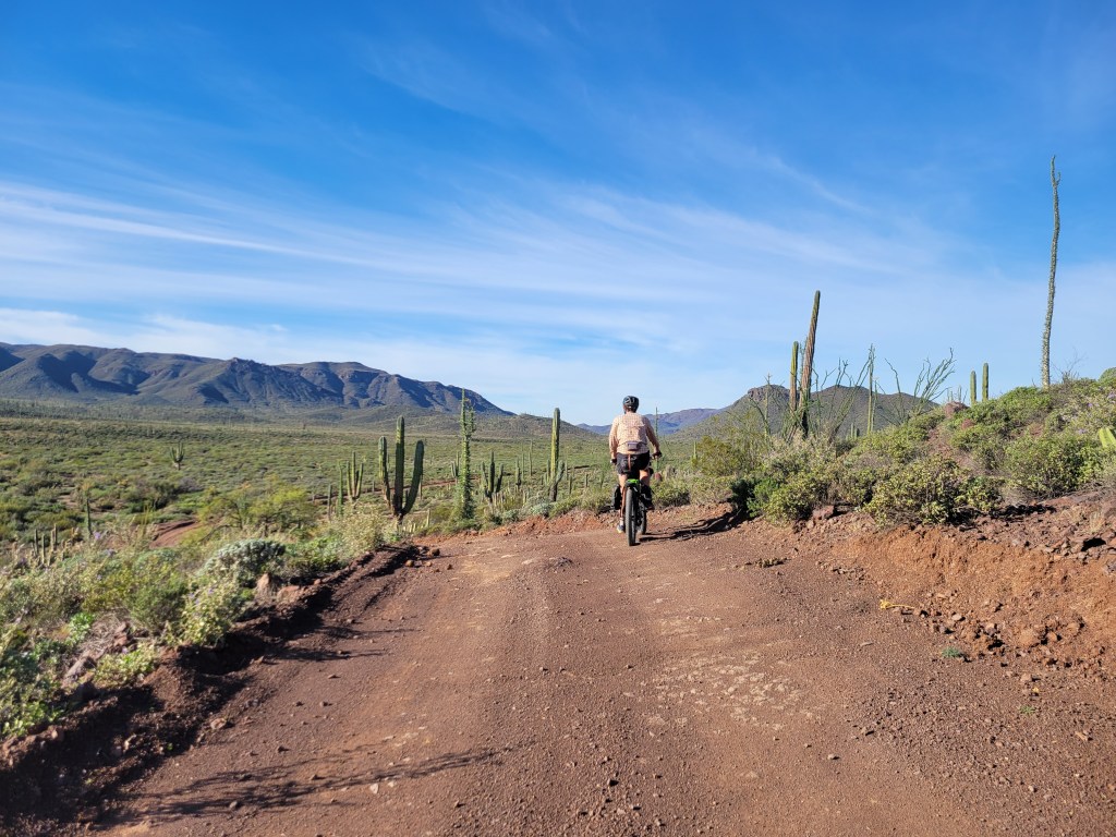
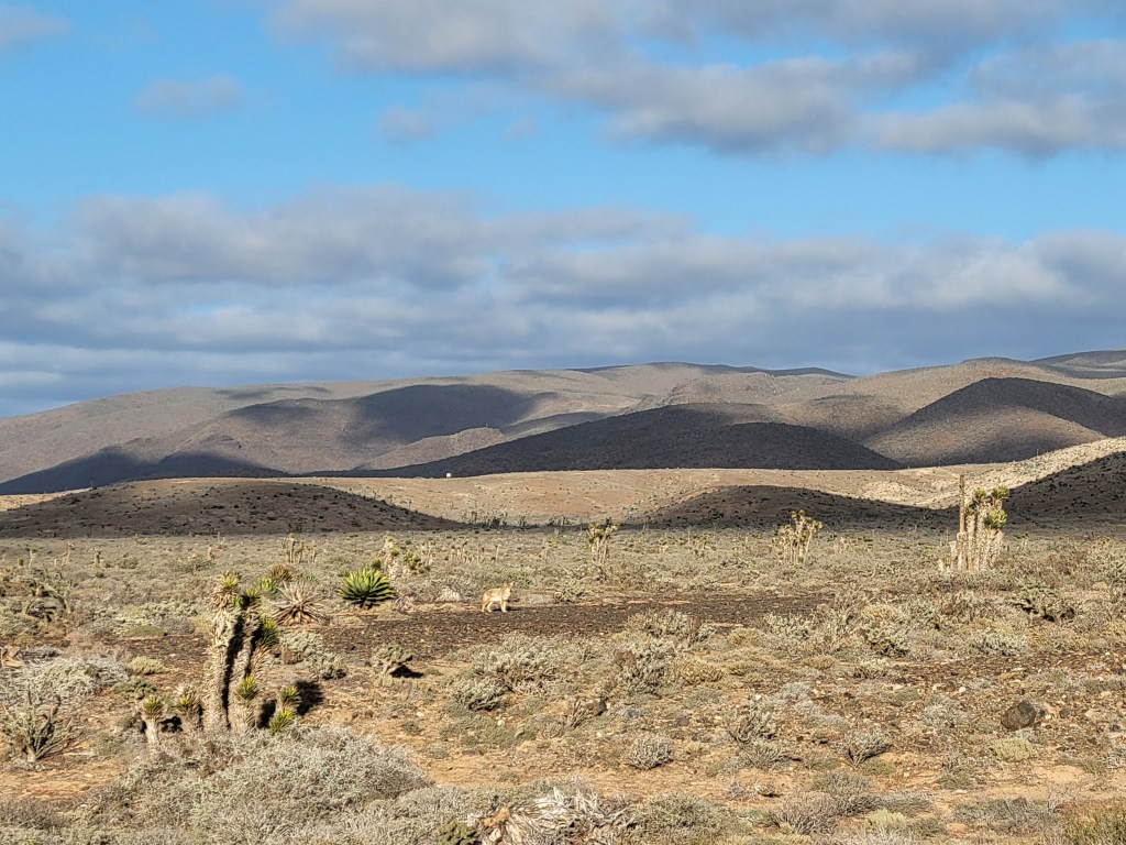
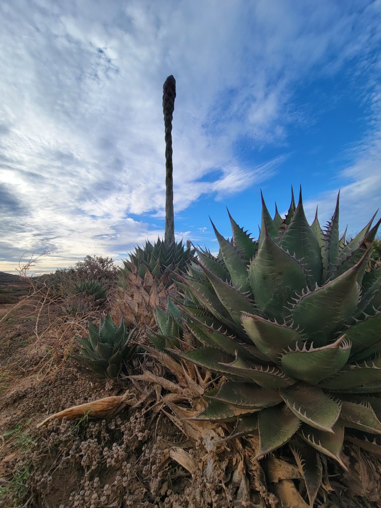
After a comfortable night’s sleep in Constitución, we packed up and left early on another long section as we headed towards La Paz. As you leave Ciudad Constitución, the route heads out from the city towards a massive dump that is frequently on fire. We opted for an alternate route to bypass the dump adding a couple extra highway miles then turning on a different dirt road before rejoining the route. The alt included a long stretch of sand and washboard, but what else is new. Before lunch, we rejoined the route and headed into the tiny town of San Luis Gonzaga. We ate lunch outside yet another Mision from the 1700s and pedaled on under the blazing sun. The further we traveled from Constitución, the more interesting the landscape became but we agreed that this was our hottest stretch so far hitting low to mid 80s. We pedaled while dreaming of Gatorade.

Day 36 – 45.0 Miles / +4914 ft gain
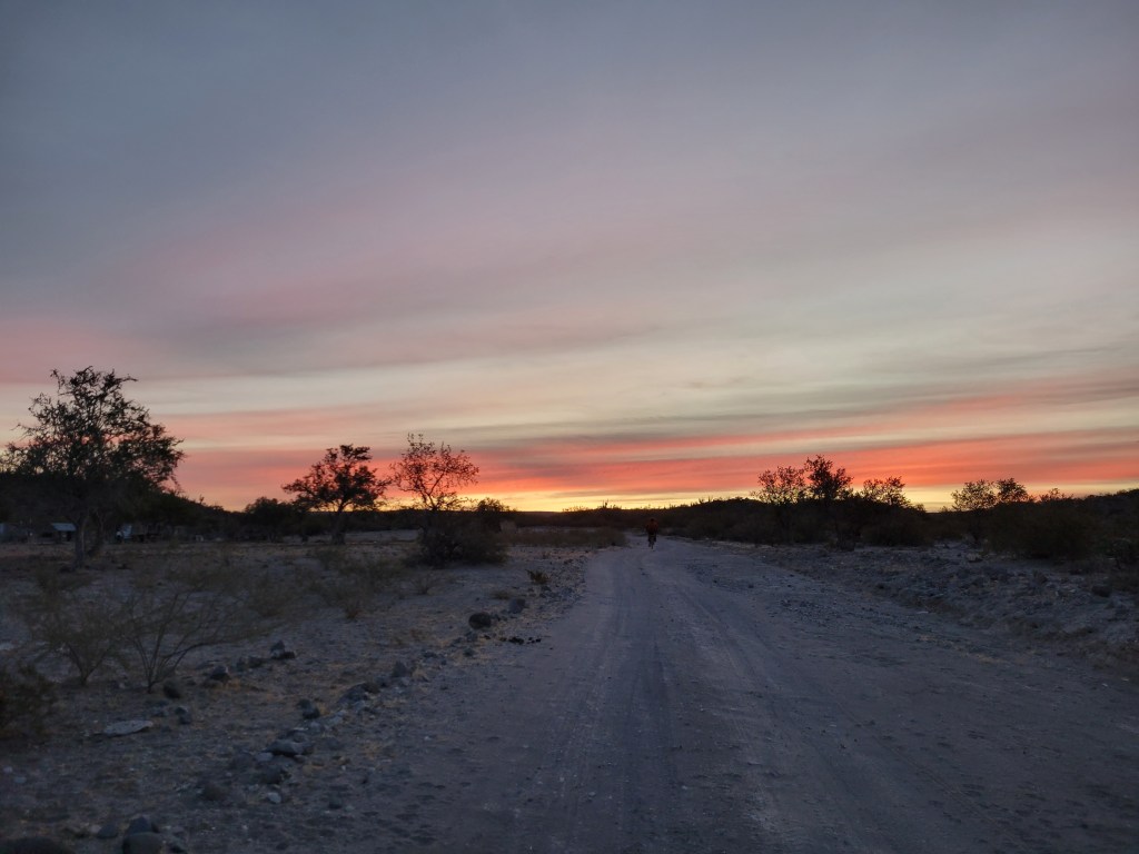
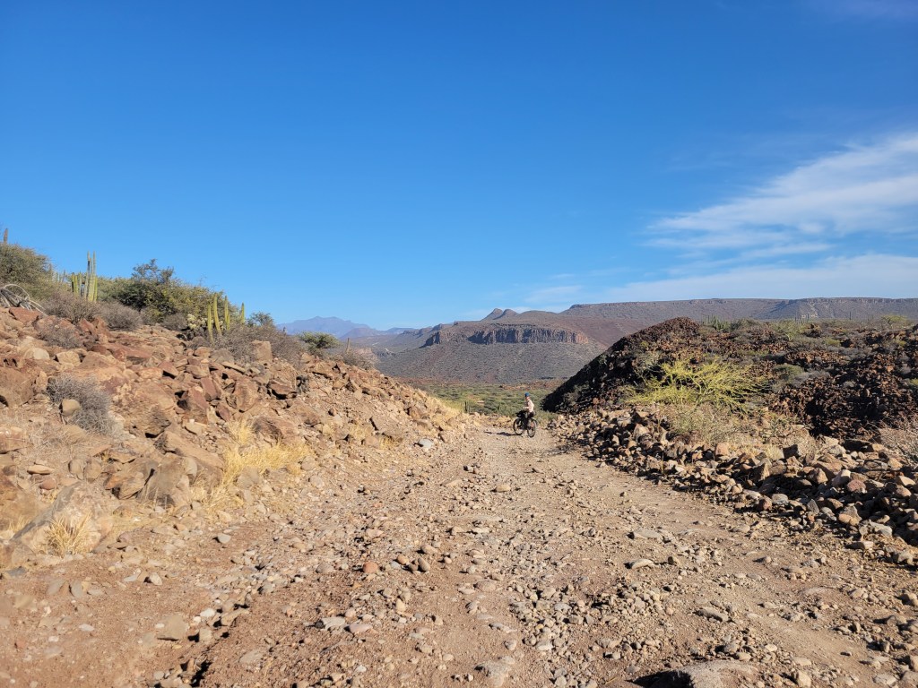
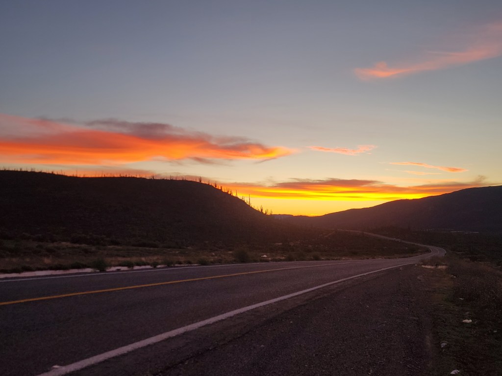
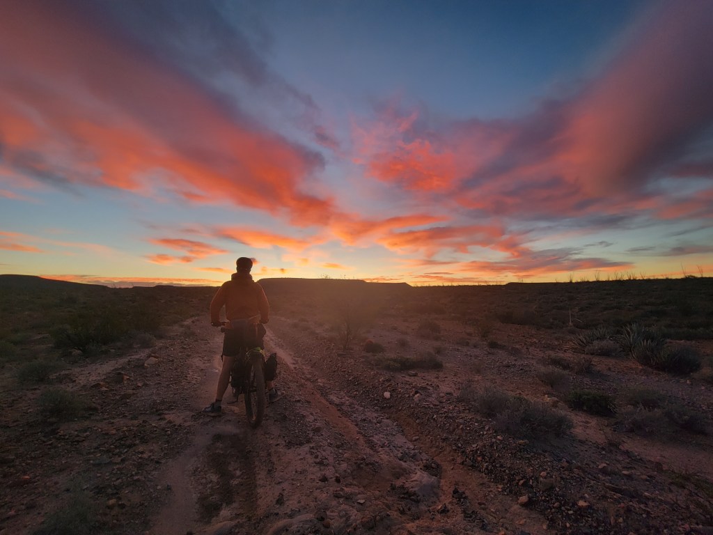
We awoke to a stunning sunrise and continued a mostly uphill climb. We began following a creek uphill through a canyon, though it was clear the creek was lower than usual. We anticipated the ability to collect and filter water from natural sources, but most of the pools were occupied by herds of cows or goats.
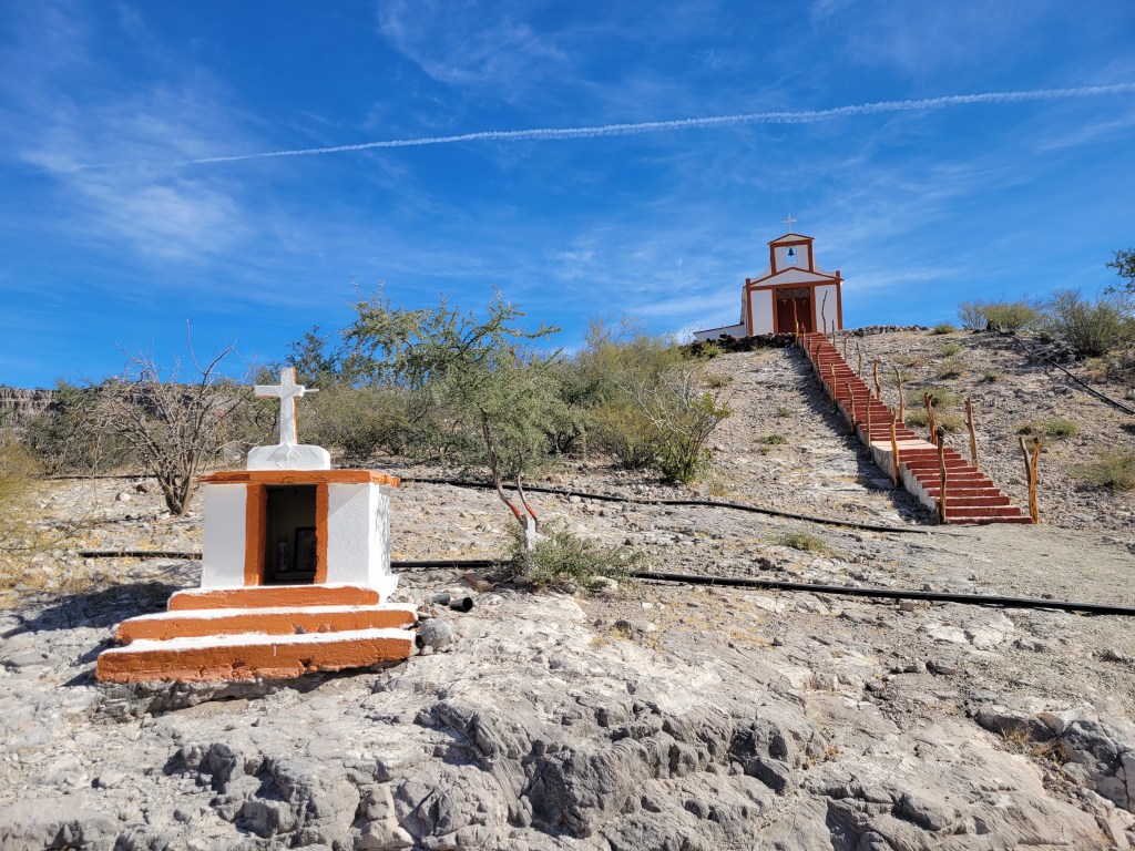
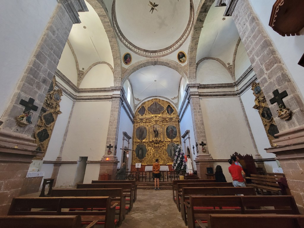
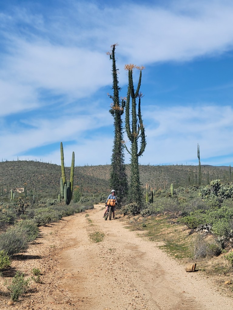
We passed another little town, with another beautiful church, and a sign welcoming Baja Dividers. We took a little second breakfast break drinking coffee and refilling our water. As we climbed out of the town, we noticed a biker on our heels. Miro, who we met in Cataviña, had finally caught us. His trip was ending in La Paz the following day so after a short chat, he continued clearly on a mission.

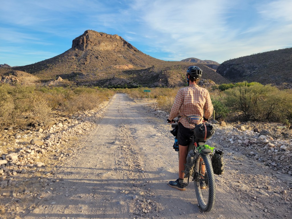
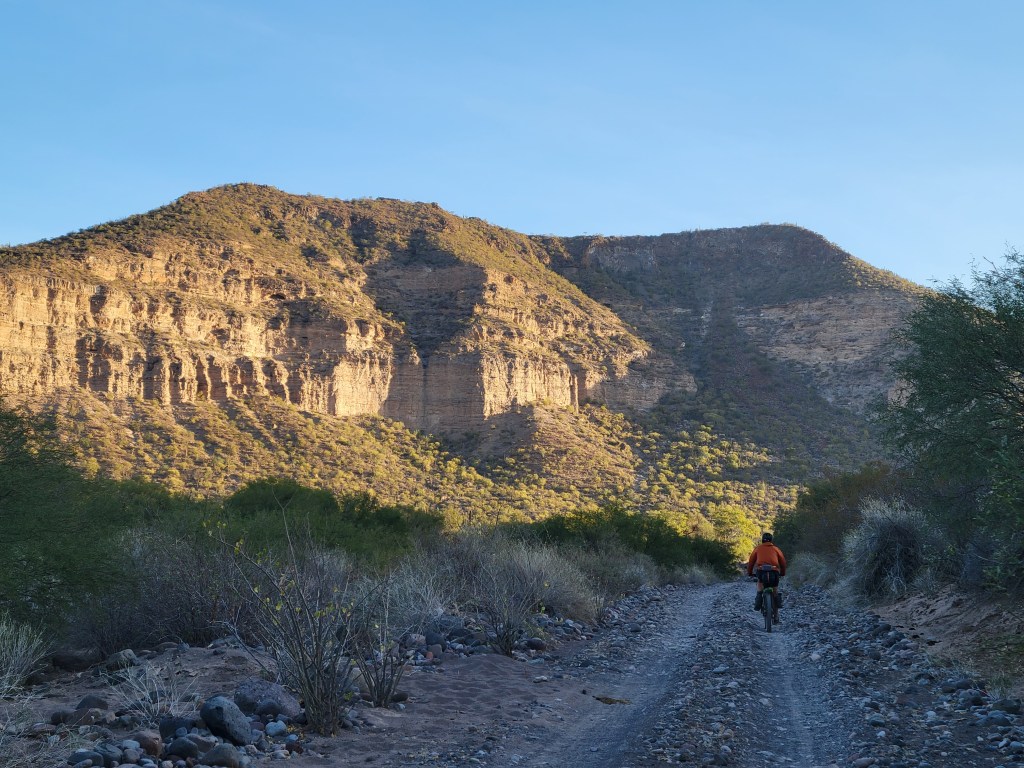
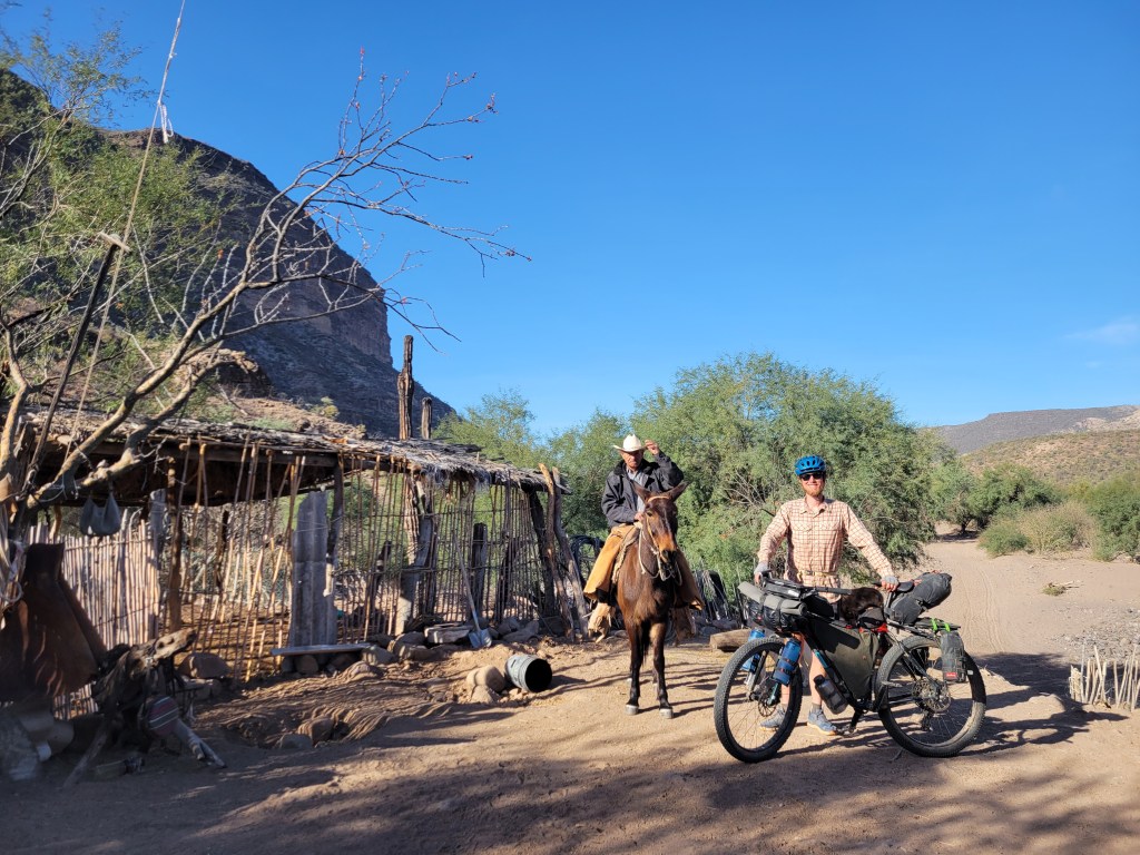
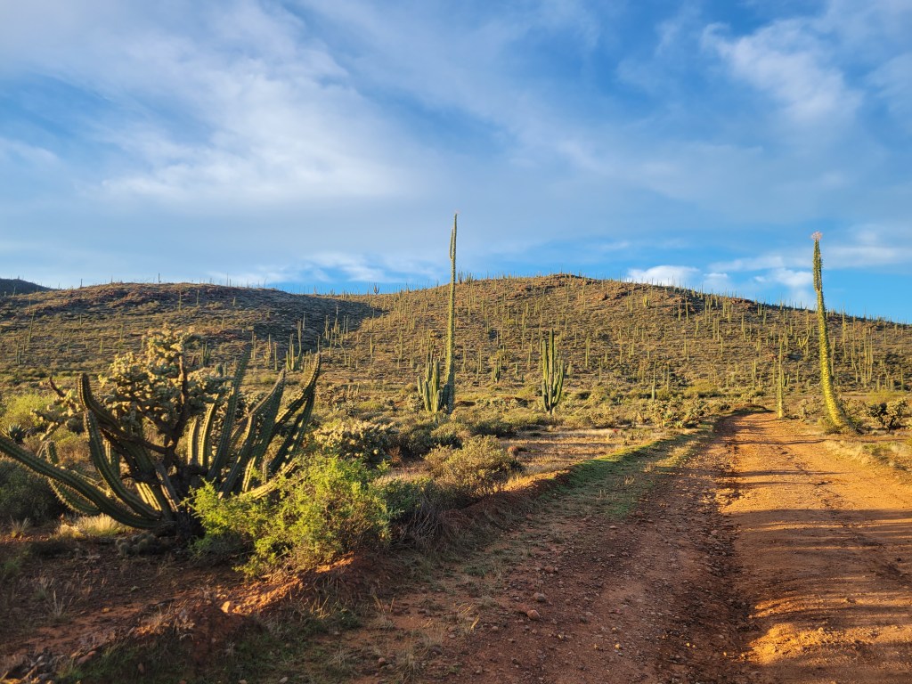
After we crested a small pass, a massive canyon sprawled out in front of us, and we descended with incredible views. At the bottom of the canyon, we found a small town and set out looking for water. We were told this town had a small store so we headed down a dead end road hoping to get a bit more water and a cold drink. As we passed a ranch, a donkey locked eyes with us, and the chase was on. The donkey giddily chased us which inspired a bit of fear and hilarity. We sped up but to no avail. He continued the chase until his big head was resting on Sean’s seat post bag. As we do when dogs chase us, I decided to stop. This happy little donkey just continued to nudge me excitedly. I decided to continue riding and the donkey clicked his heels with excitement, resuming the chase. We got to the end of the dead end road and saw a man who we asked about a store, but there was no store here. He indicated one a few miles further down the route. He also laughed at the donkey situation and held the silly guy back when we turned around to backtrack to the route.


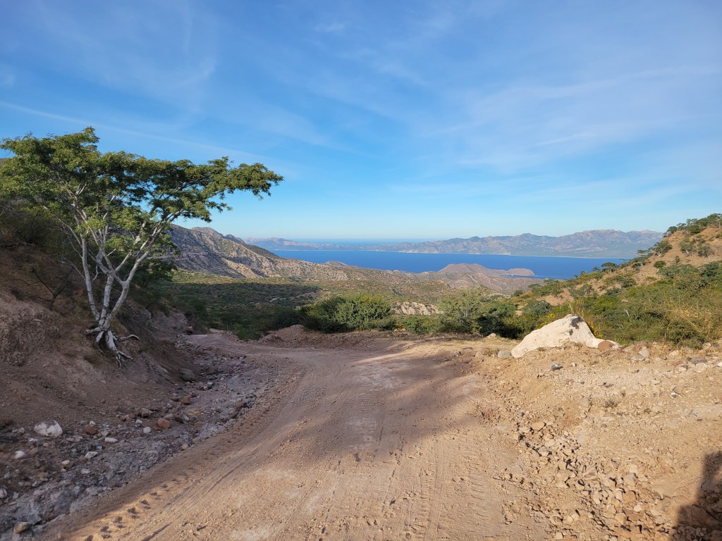
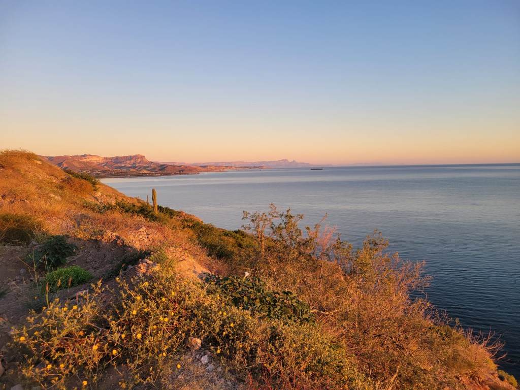
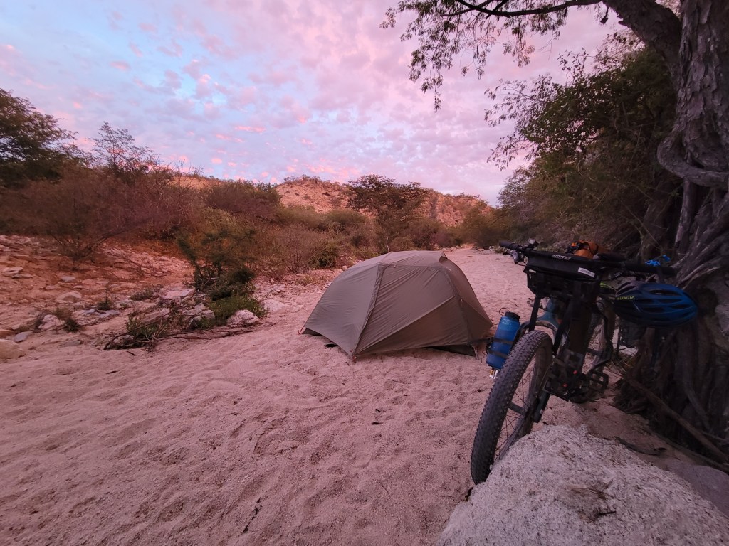
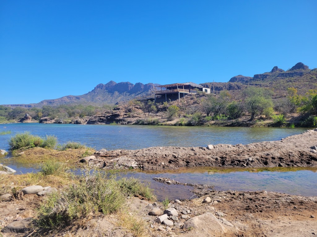
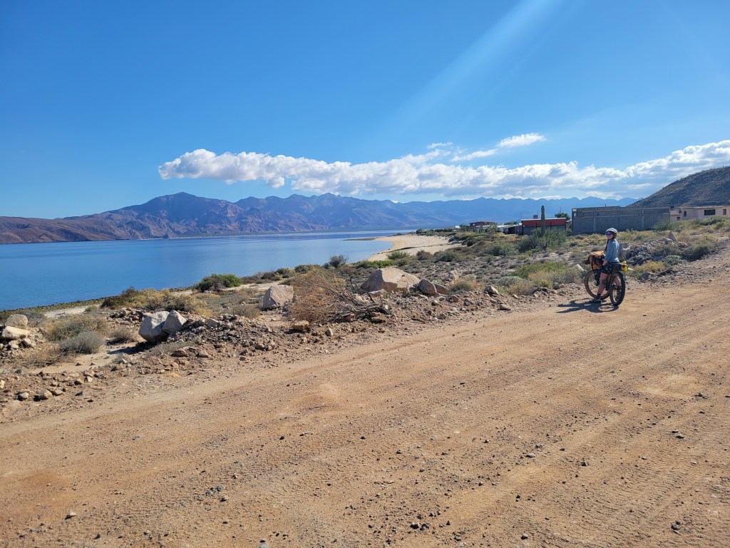
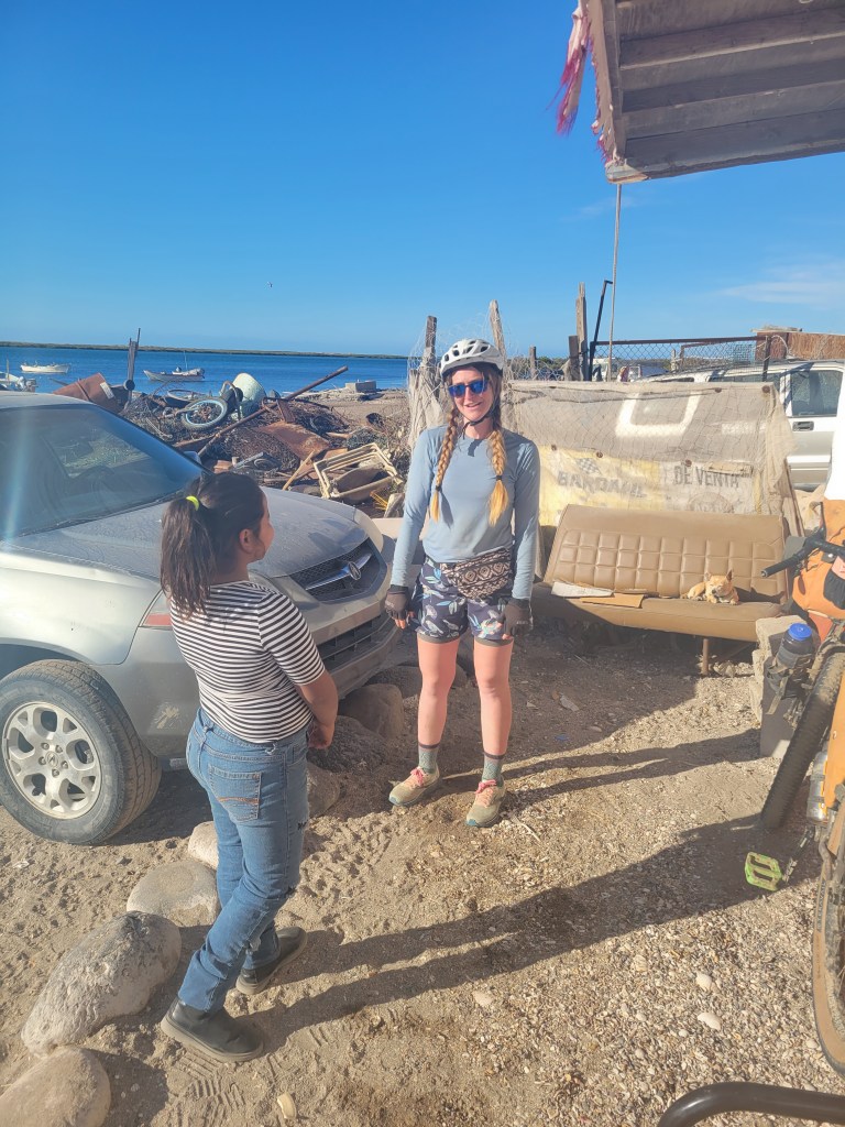
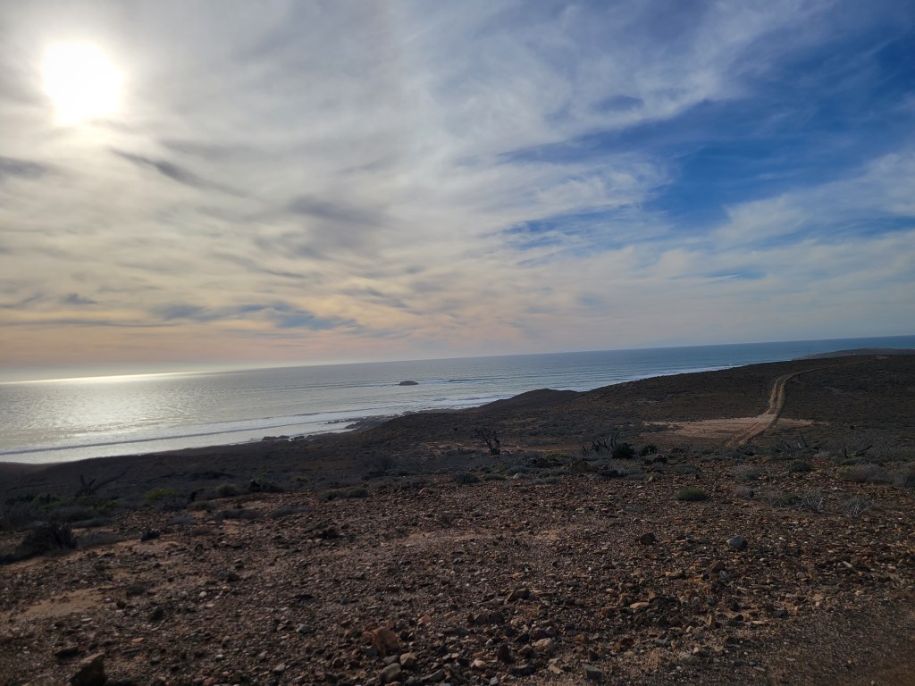
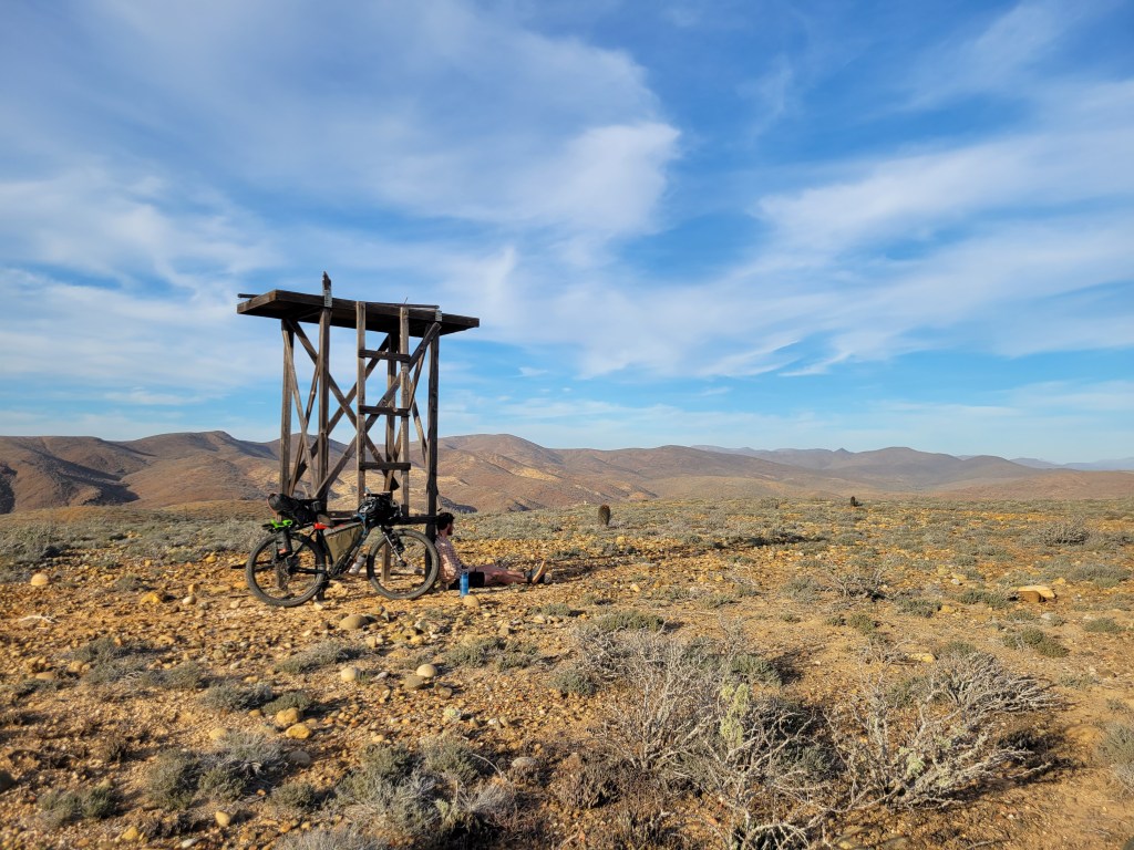
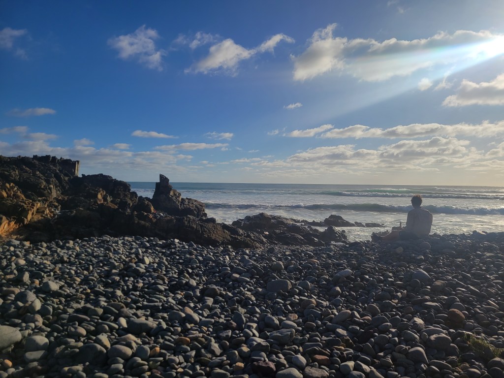
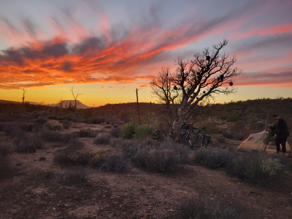
After lunch, we resumed riding uphill all afternoon surrounded by stunning canyon walls. Finally, we reached the top of the final pass and could see the Sea of Cortez in the distance. We began a very steep descent to sea level – over 2000 ft in 4 miles – some of which I walked down. At the bottom, we decided to travel 1 mile north off route to the little fishing village of San Evanaristo with 1 restaurant / store which also had cabanas for rent. Since the sun was setting, we opted for a cabana for the evening after a tiring and eventful day.


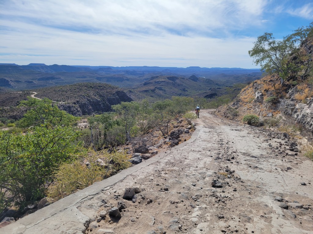
Day 37 – 47.7 Miles / +2809 ft gain
We rode off at sunrise into a roller coaster ride of hills with the coast to our left and colorful canyon walls to our right. The day took on a repetition of being at sea level and then up a few hundred feet into the hills. Throughout this trip, we’ve noticed that hilltops with steep roads are roughly paved with concrete to keep drivers from careening into ditches. As I was slowly descending a steep hill, my tires skidded and I was suddenly pointed in the direction of a ravine. Everything happened so quickly – skid, aiming toward a 15 ft drop off, “Oh shit,” – and ended just as fast. When my front tire went over the edge, the handlebars spun locking the drop bar over the top tube with my wheel at a 90° angle. I tipped over with my bike but remained upright, in a shift from sitting on the saddle to sitting on the ground. As I sat there, I couldn’t stop expressing my gratitude for not getting hurt realizing this could have been a serious accident. My legs were jello as I stood up, walked my bke down the remaining concrete, and rode down the rest of the way to catch up.
Sean was a couple minutes ahead, already stopped and waiting for me. I explained the delay, he inspected the bike, and we kept rolling. Lucky break.
The rest of the day followed the pattern, and we enjoyed lunch on the beach with a cold drink from a little tienda. Late afternoon, the route was directly coast adjacent and I noticed activity in the water. Dolphins! A bunch of them! We pedaled lightly while watching a couple dozen dolphins playing, even jumping out of the water. We ended our ride for the day in a small town near to a local mine and found a stealth site on the outskirts of town.

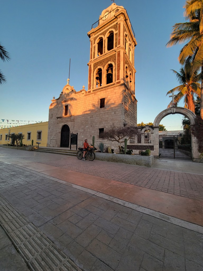
Day 38 – 36.7 Miles / +1306 ft gain
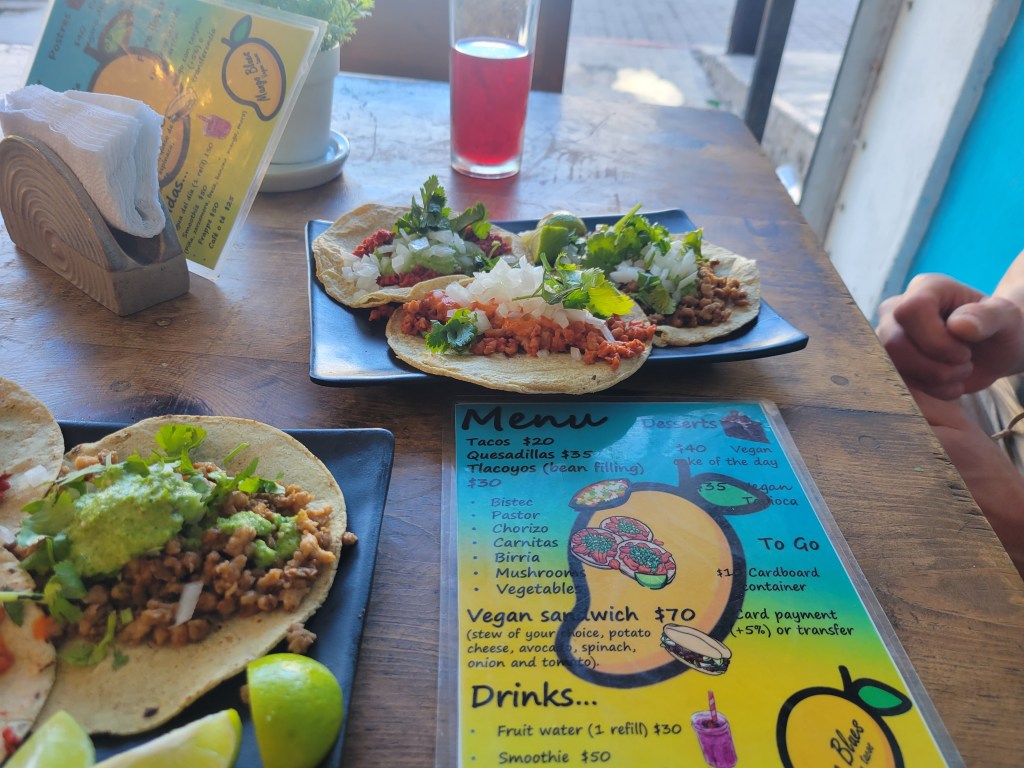
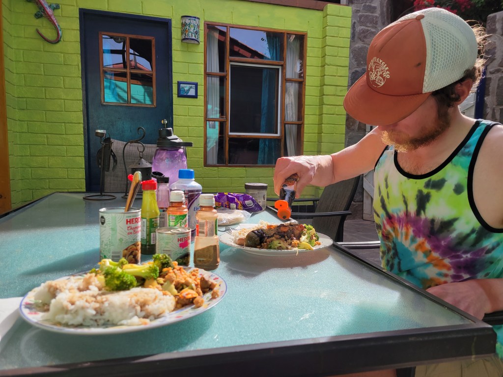
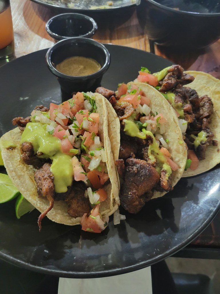
We had ended our ride the previous day where the dirt ended and the pavement began as we entered the bustling city of La Paz. Greg and Regina, some Midwestern van lifers we met in San Ignacio, graciously offered us a place to stay with them, and we were eager to get clean and relax. We arrived in town after 36 easy miles around 10:00 am giving us a full day to enjoy something other than biking. We found a vegan taco stand, cheap laundry service, delicious cocktails, but mostly truly enjoyed getting to know new friends both, human and canine!


Day 39 – 36.9 Miles / +4265 ft gain
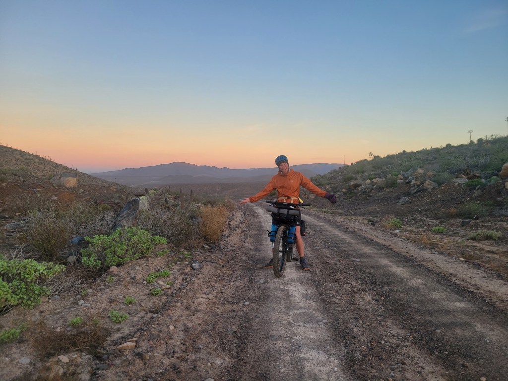
Clean, refreshed, and ready to wrap it up, we headed out for our final stretch of the route at 10 am. We left La Paz on pavement for the first half of the day climbing slowly from sea level to over 2000 ft. We were happy to make it to the top of the pass and resume riding on dirt. The route was an amazing flowy rollercoaster invoking all of the “I love bikes” feelies. In the late afternoon, we came across a small tienda and our recurring dream of an ice cold Gatorade on a hot day came true.


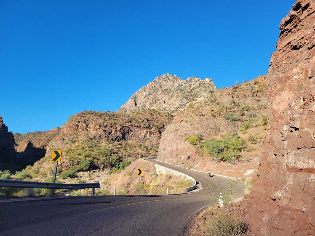
Day 40 – 42.2 Miles / +2650 ft gain
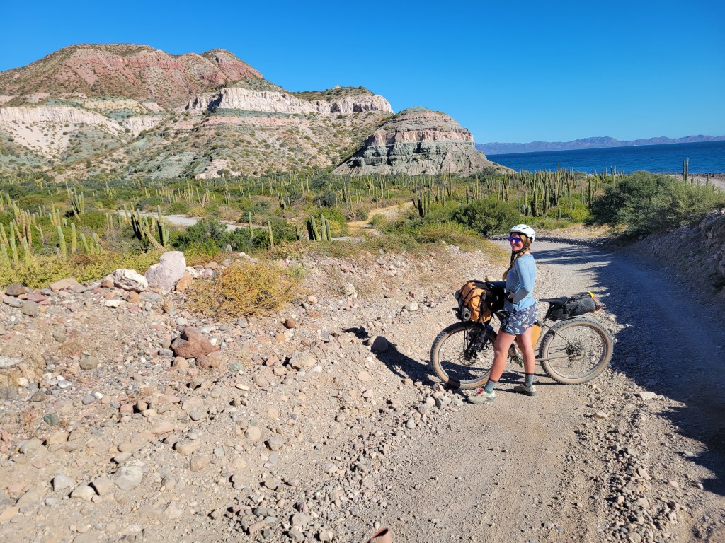
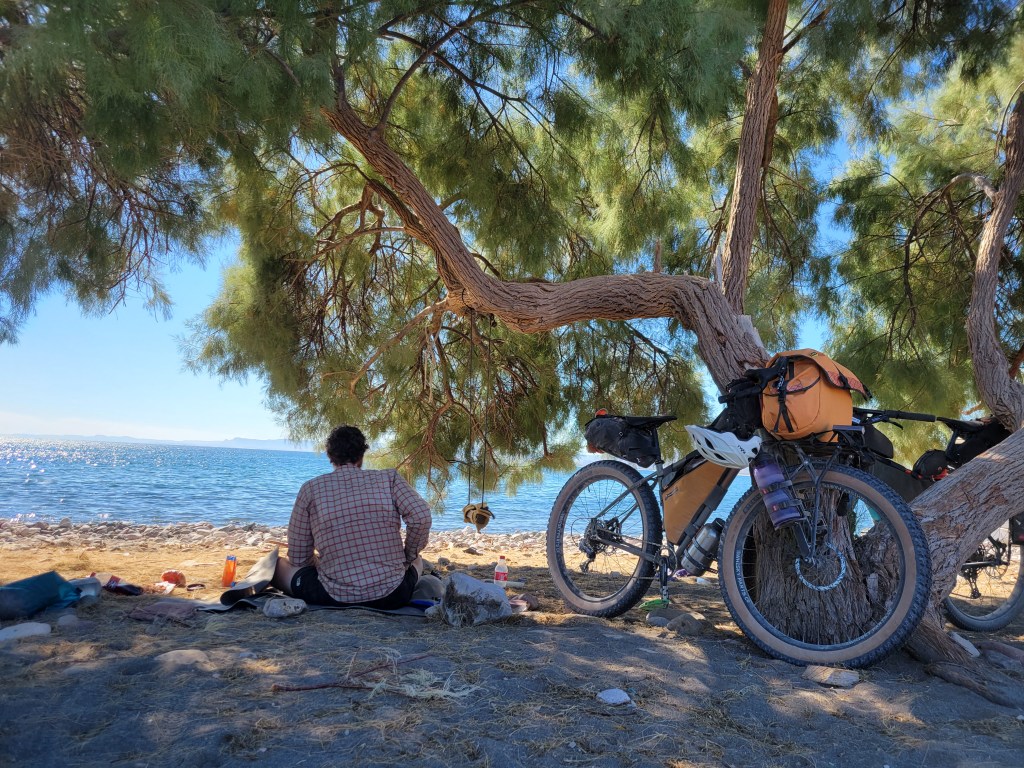
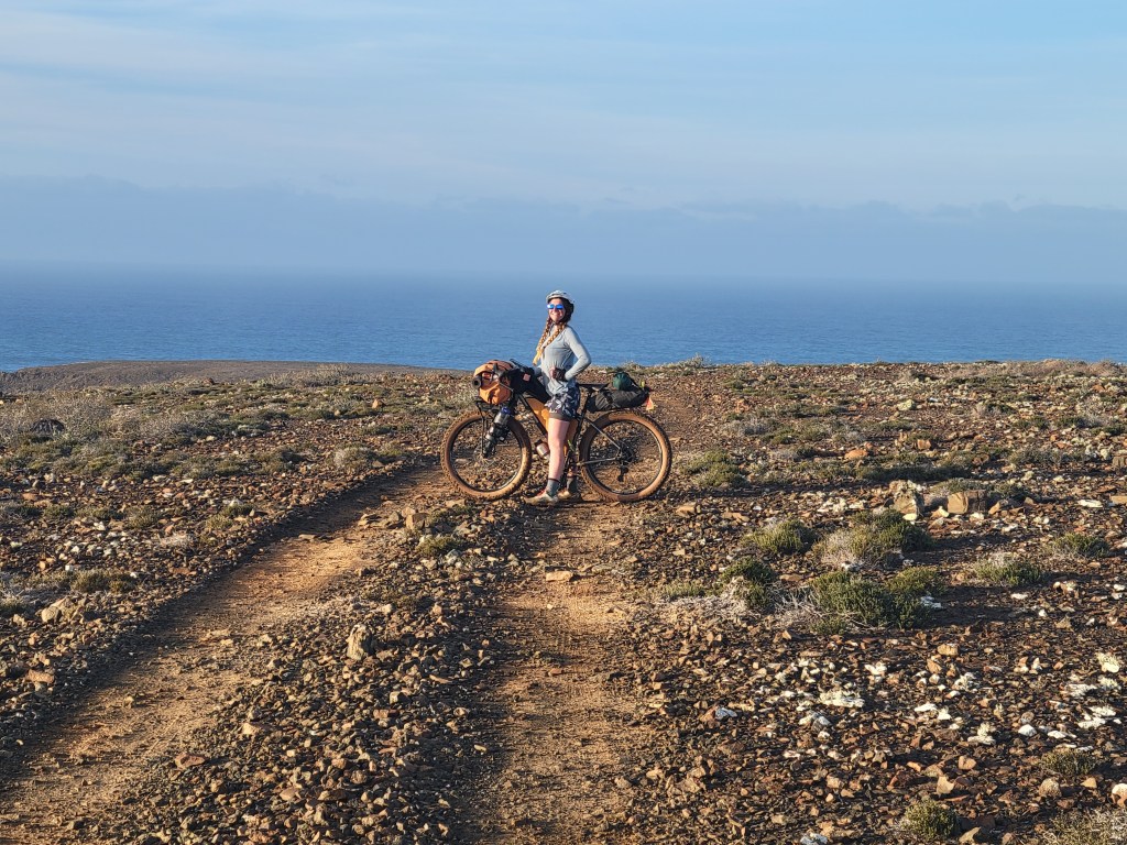
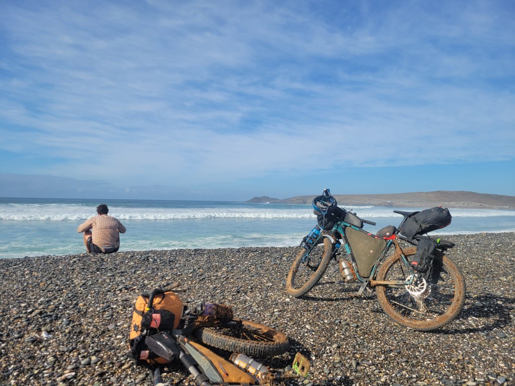
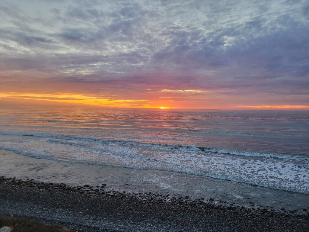
Our morning began with an explosion of color as the sun rose. We had a mostly easy descent with a couple sandy sections and ended back on pavement for a short stretch. When we passed through town, we couldn’t resist hot coffee. After probably too long of a break, we rolled down a couple more paved miles before breaking off onto dirt. The route climbed a pass through the hills and took us out to the sea, climbing and descending a series of rocky cliffs as we wound along the coast. Temperatures soared as we biked along. Eventually, we found ourselves staring at a perfect and empty sandy beach and without saying anything, both of us were drawn in like a moth to the flame. We quickly switched to swim attire, a moment of pure bliss.


Somehow we managed to pull ourselves away and continue riding, coming to a small town about an hour later. We grabbed cold drinks and had a little picnic on another beach. We started to notice more and more developments, fancy homes, resorts, and vacationers as we were getting near Los Cabos. Sean mentioned out loud how awesome it would be if someone invited us in the for the evening. Within 2 minutes, a couple in a truck behind us asked if we were on the Divide and if we needed a place to crash. Woah.
We eagerly accepted the offer and biked a couple miles further to Leisl and Will’s house. They graciously gave us a room for the night, a cold beer welcome, and access to their car to get groceries! We couldn’t believe their generosity – what a gift!!
Day 41 – 49.6 Miles / +3396 ft gain
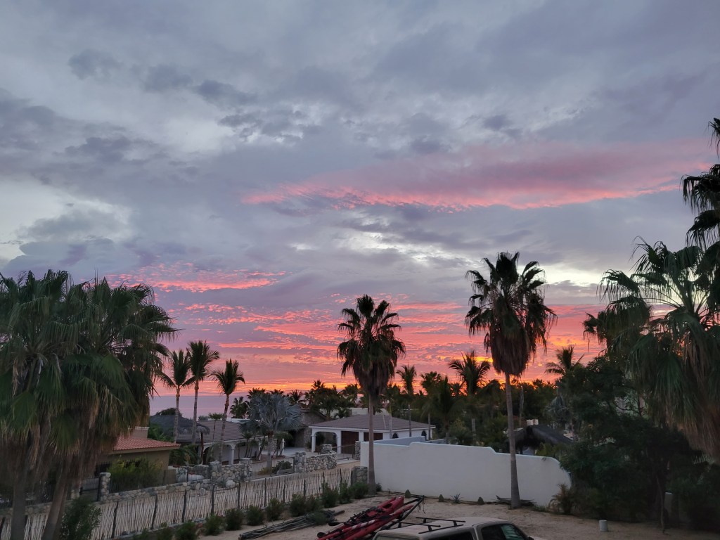
Will brought us hot coffee to start our day as we watched another mesmerizing sunrise. We hit it by 7:30. The route was mostly easy and quick as we followed a road near the coast. Around lunch time we entered Cabo Pulmo National Park, a protected marine wildlife sanctuary known for whale watching, snorkeling, and diving. We found a perfect spot to have our lunch as we gazed into the sea. Almost immediately, we saw whale spouts. As we casually ate our lunch, we continued to see dozens of spouts and a few jumping whales as well. What a treat.

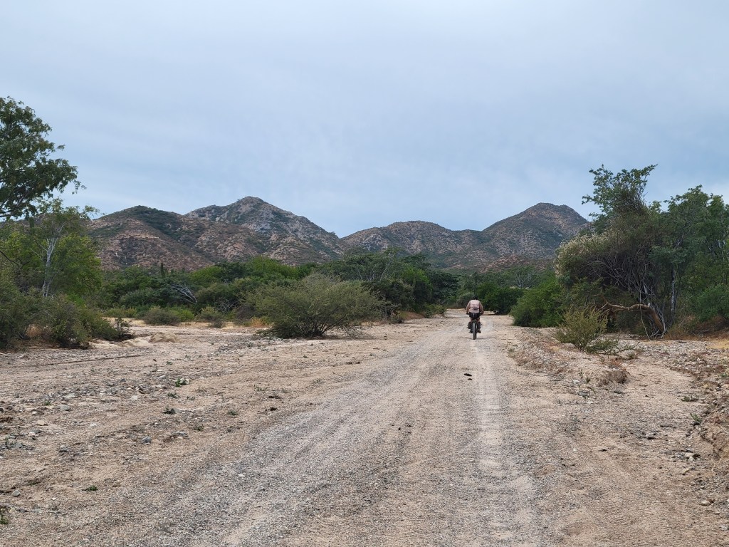
After lunch, we had a few more coastal miles before our route headed west into the mountains for our final climb. When we turned off the main road, the route became a trudge through deep sand. It ain’t over til it’s over I guess. We were 40 miles from the finish line walking into the longest stretch of hike a bike we’d experienced as we pushed our bikes 4 miles through soft sand. After a couple hours of pushing gently uphill through sand, we finally hit packed road again. The route continued mostly uphill with pretty spectacular views as we delighted in being in the mountains one last time.
Day 42 – 29.9 Miles / +2280 ft gain
Another morning, another amazing sunrise. It was hard to believe we made it to our final day of riding just 30 miles away from the finish line. Our morning was spectacular in every way as we followed the spine of the ridge. Eventually we crested our final pass, and the downward ride to San Jose del Cabo began. We floated downhill, coasting in delight. As powerlines came into view, the road widened and improved indicating the end of our rise was nearing. We said goodbye to the Baja Divide Route and started navigating city streets toward our Airbnb leaving us a couple days to celebrate, relax, and figure out how to get these bikes ready for flying home.


Ciudad Constitución to San José del Cabo
- 8 days of riding
- 339.8 miles ridden
- 42.5 miles / day average
- +23044 ft elevation gain
- +2881 ft elevation gain / day average
Total Stats
- 38 Days Riding + 4 0-Mile Days
- 1712.7 miles ridden
- 45.1 miles / day average (without 0s)
- 40.8 miles / day average (with 0s)
- +107,544 ft elevation gain
- +2830 ft gain / day average (without 0s)

We are stoked and honored to have completed the Baja Divide! Check out our overview of the whole trip here (coming soon!)
Baja Divide: Mulegé to Ciudad Constitución

We’re back at it on the bikes – this time ~1600 miles on gravel as we traverse Mexico’s Baja Penninsula from San Diego, CA to San Jose del Cabo, Baja California Sur.


Day 29 – 0 Miles
After a long push into Mulegé, we were more than ready to take a day off of riding. We were thrilled that we lucked into a great place at Clementine’s that had a full kitchen and free on-site laundry. We spent the day lounging, eating, doing chores, and resupplying for the next big stretch.

Day 30 – 56.2 miles / +4230 ft gain
We left Mulegé after dawdling a bit drinking hot coffee and hit the highway. This section of the actual Baja Divide Route encourages you to hire an unsuspecting fisherman to take you across Bahía Concepción to ride off pavement and rejoin the highway later. Alternatively, you can take the highway out of town. Not wanting to mess with the unknown boat project and expense, we decided to opt for the highway and headed south. The riding was a rollercoaster series of hills that continuously took us adjacent to several beautiful beaches. This combined with mellow traffic felt like we made a good choice. In the late afternoon, we met back up with the route and turned west on a gravel road back into the mountains.


Day 31 – 50.7 miles / +5251 ft gain
We began before sunrise on slow grind mostly uphill. The hours ticked faster than the miles were accumulating. After cresting a small pass, we looked down into what I dubbed Monument Valley of the Baja. After our descent, we wound into a tiny town to refill our water. We were starting to realize we weren’t moving as fast as expected as we looked into our food bags. Our dwindling supply of pesos wasn’t going to help us remedy the situation as most of these tiny tiendas don’t accept cards. With a little more water, we pushed on – literally – as we climbed out of the valley.
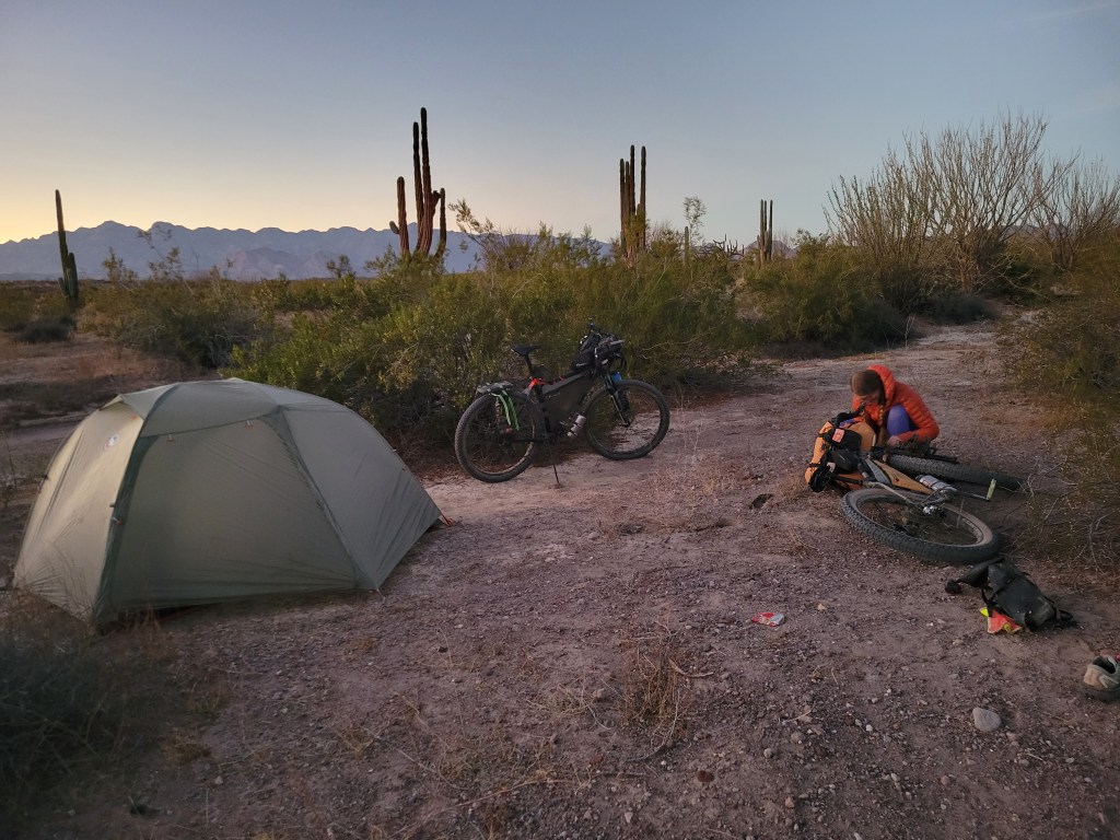
The following hours were spent between 4-5 mph as we baked under the Mexican sun alternating pushing through sand or rock filled roads with intermittent riding and climbing. In the late afternoon, we descended into a valley surprised to see a grove of palm trees. As we entered the tiny town of San Jose de Comondu, we relished in the cool air and shade of the palms. We went to the local tienda for water and to see what if any other snacks might be available and watched the local young boys playing with their bikes trying to clear a small jump made in the mud. We refilled, grabbed some extra peanuts, and kept moving. Another steep ascent brought us out of the oasis and back into the arid desert through a herd of goats. We scanned the area for a suitable camp as the sun was fading and lucked into a sandy spot amidst a continuous pile of lava rock. We set up camp and went to bed as the stars shown brilliantly above.


Day 32 – 40.6 miles / +3181 ft gain
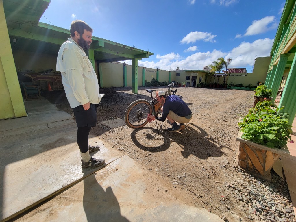
We started riding before sunrise and continued our slow go. We pushed up a wicked ascent filled with loose rocks as mid-morning approached. Sean’s bike needed some immediate attention as the brakes seemed to continously engage. We stopped so he could diagnose the issue and replace the brake pads, thankfully having the skills, parts, and tools to fix the issue. By this time, we knew we weren’t going to make it to Constitución with the resupply we planned and began to determine we needed to ride 20 miles off-route to the town of Loreto. We weren’t thrilled to add 40 miles to our ride, but as the decision was made, we both felt relief from the pace we’d been trying to push. Almost instantly we additionally noticed how beautiful our surroundings were and were glad to feel like we could enjoy them again.


After lunch, we found our turn – left to Loreto or right to continue towards Constitución. We turned left and headed off route, thankful for pavement and moving faster than 5 mph.
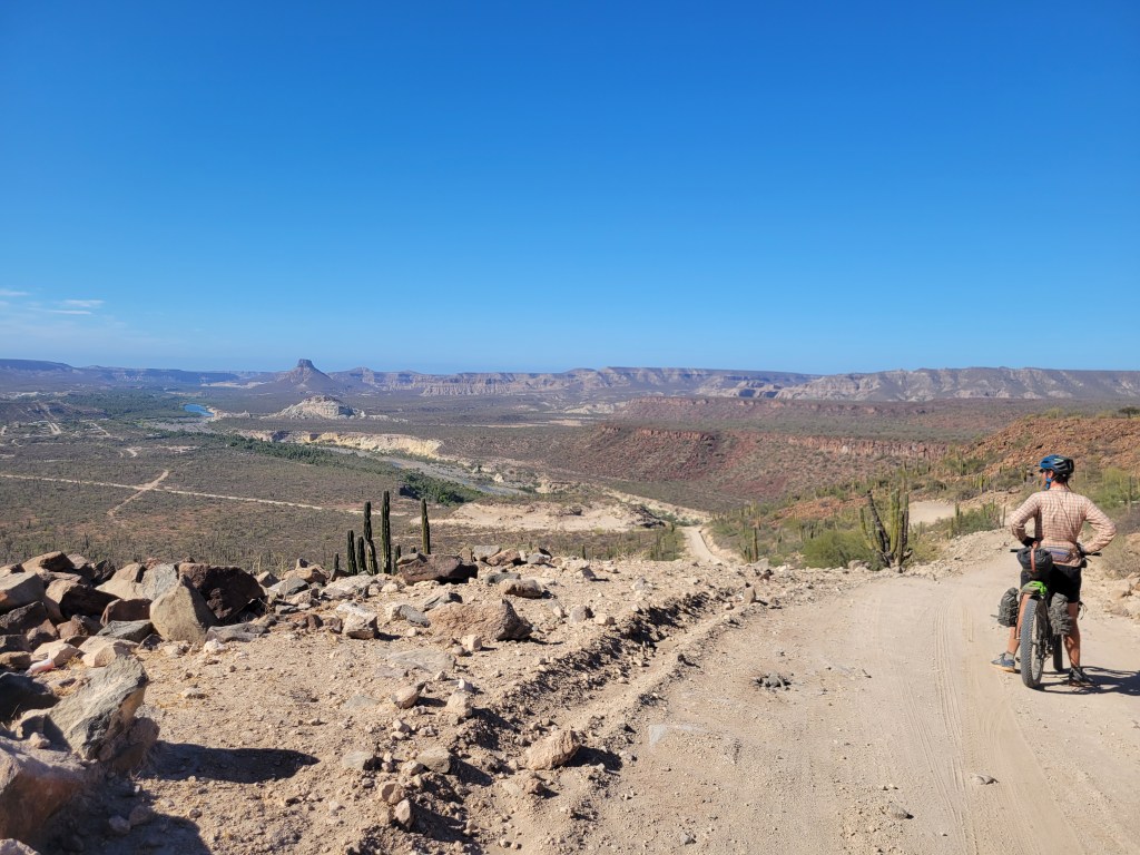
The off-route ride was a series of ascents and descents until we hit a final pass with the Sea of Cortez far in the distance. From this point, we cascaded over 2000 ft in about 15 miles with a roller coaster type finish that brought us into town. It was a stunning ride that left us a little anxious for the uphill version the following morning.
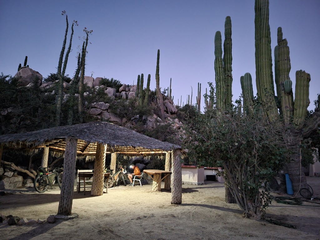
In the city, we were pleased to find a comfy hostel with kitchen access and a full grocery store nearby. We were actually quite charmed by the city and had an unexpected and enjoyable evening.

Day 33 – 54.2 miles / +4200 ft gain
We left town a little hesitantly as we could’ve easily enjoyed a day off. We left at 7:00 to retrace the 20 miles and rejoin the route with a proper resupply. As we began our ascent, we were quickly reminded that this is the type 2 fun we enjoy – a slow, steady uphill ride in a gorgeous setting. The miles ticked by as we continued uphill, distracted by the beauty of the canyon and the shrinking Sea of Cortez in the background.

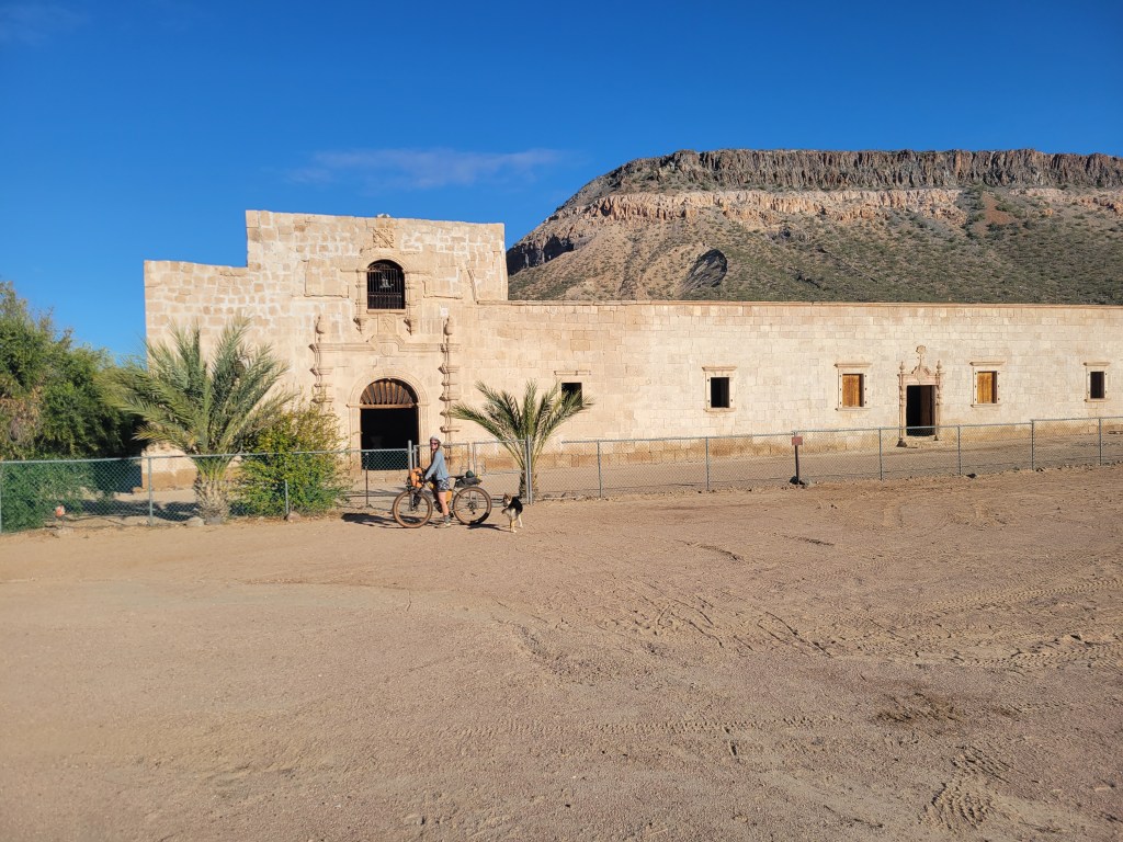
It took us about two and a half hours to rejoin the route and an additional 20 minutes to roll into the tiny tourist town of San Javier, another Spanish mission site. We didn’t really need much, but decided to check out the store in town and were shocked to find a well stocked mini mart. I dared ask – acepta tarjetas? (do you accept cards?) to which the attendant said Sí.
So we actually didn’t have to go to Loreto. And could’ve resupplied here. Oof.
We were both a little stunned but agreed that we had enjoyed our detour to Loreto. Que será, será.

We had some coffee at a little restaurant and resumed our ride which turned back to gravel and away from the tourist zone. The route turned pretty rideable at a reasonable pace as we cruised into the desert.

Day 34 – 53.3 miles / +662 ft gain
Our morning ride was pretty cruisy (a rarity) as we headed towards the city. As we gently descended, we noticed the temperature gain. By mid morning, we were baking under the sun. The views were pretty meh as we neared our first little town of Ley Federal de Aguas Numero Uno, a real name of a real town. We headed to a local park to have a second breakfast.
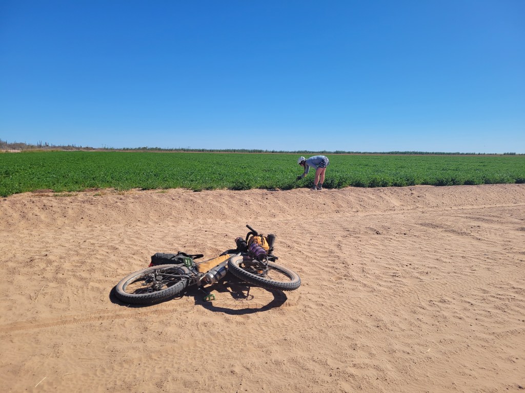
After a bit of loitering, we resumed riding. Our guide indicated “winding through citrus groves” which was true for about 1 mile out of 25. The other miles were sandy and washboarded which provided a pretty meh ride, but surely enough, we made it to Ciudad Constitución at last. We meandered to a cheap room by a big grocery store, stoked to find a microwave. Sometimes it’s the little things.
Mulegé to Ciudad Constitución
- 5 Days of Riding + 1 0 Mile Day
- 255 Miles Ridden
- 51 ave miles / day (without zero day)
- 42.5 ave miles / day (with zero day)
- +17,524 ft Elevation gain
- 3504 Ave elevation gain / day (without zero)
Total Stats
- 30 Days Riding + 4 0-Mile Days
- 1372.9 miles ridden
- 45.7 miles / day average (without 0s)
- 40.3 miles / day average (with 0s)
- +84,500 ft elevation gain
- +2816 ft gain / day average (without 0s)
Baja Divide: Bahía de los Ángeles to Mugelé

We’re back at it on the bikes – this time ~1600 miles on gravel as we traverse Mexico’s Baja Penninsula from San Diego, CA to San Jose del Cabo, Baja California Sur.


Day 22 – 30.7 Miles / +1430 ft gain
We awoke in Bahía de los Ángeles still needing to finish a few chores before we left. We’ve been having a hard time finding places to wash our laundry, so we couldn’t pass up the opportunity and dropped off our laundry early. In the meantime, we resupplied for the next stretch and got the bikes ready. It was about 11:30 when we headed back out on bikes. The pavement ended almost immediately, and we were back grinding gravel. The route slowly climbed from sea level as we wound back into the desert.
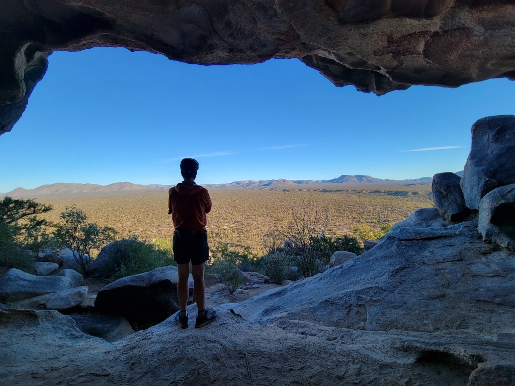
In the mid-afternoon, a truck passed us and checked that we were doing ok and offered a cold beer. Sure! We chatted with Alex and McKenzie for a few minutes as they shared their experience road-tripping through Baja. They also informed us of some cave paintings ahead on our route which left us intrigued but a little unsure of exactly where to find them.We continued rolling and ended our day after our 30 mile “half day” ride.
Day 23 – 62.8 Miles / +3843 ft gain
This day was brought to us by the letter S.
S is for Sand.
Our morning was brisk but beautiful as we took off from camp at sunrise. A short climb up and over brought us back to sea level and a beautiful bay on the Sea of Cortez.

We kept pedaling but were greeted shortly by deep sand that required us to push our bikes. A continuous and rather annoying pattern broke out of riding the bikes and pushing the bikes and riding the bikes and pushing the bikes while our shoes filled with buckets of sand. We lowered our tire pressure which made a significant difference yet there were still sections we had to walk through.

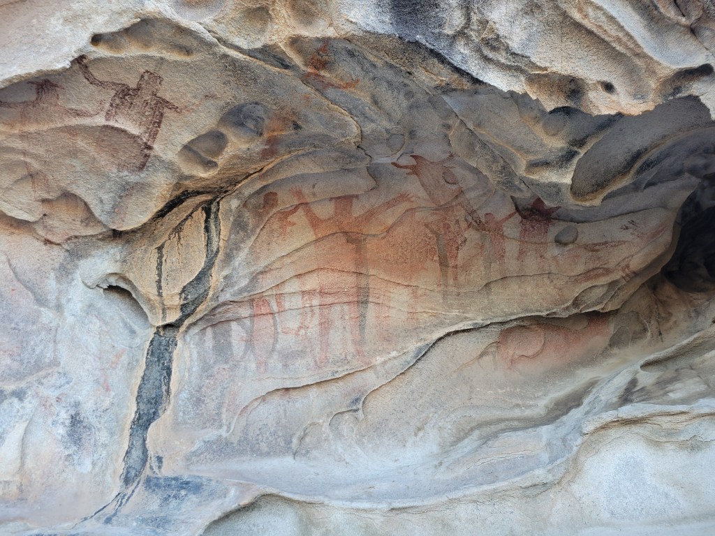
Just before lunch, we passed two truck campers eager to chat with us about our journey. I asked if they knew about any cave paintings ahead and they were quick to offer some direction. We peered at a map and had a decent understanding of where to find this unmarked turn toward a cave. We even saw their photos which really got me set on trying to figure out this side quest. We said our goodbyes and pedaled on.

After lunch, a big ascent began under the blazing sun. Though challenging, we were grateful to be slightly pulled out of the sandbox and onto a harder rocky surface as we sweated our way uphill.

As we crested the pass, we began gliding downhill only to return to deep sand. Eventually, we crossed a fork in the road and took a turn off route to Rancho Escondido to fill up on water. The guide mentioned that the stop was off route, but we weren’t super stoked to learn it was 2 miles off through the sand box. Oof. We arrived at the ranch and restocked our waters and chatted with the lovely family there, but needed to make it brief and continue on our way. The slog resumed.
We got back to the route at 2:30 PM with 70 ish miles to Vizacino, our next resupply. We had planned to be in town the next evening, so we pressed on. The sandy slog continued. Around 4:30 we were already pretty drained as we looked up towards our next pass. Slowly we gained elevation through persistent sand. As we neared the top, the pitch was so steep that a short stretch was roughly paved so cars didn’t slip down the mountain. The top of the pass provided some cool scenery and rolling hills as the sun set. With about 15 miles to go to Rancho Piedra Blanca, we decided to turn on the headlights and ride under the starlit sky. On the other side of the pass, we were greeted with a howling headwind but decided to still try to make it to the ranch provided we didn’t return to a solely sandy slog. Thankfully, the road remained firm and the stars were sparkling as we counted down the miles in the wind to the ranch. We were warmly greeted at Rancho Piedra Blanca and shown a perfect covered spot to pitch our tent for 100 pesos complete with restrooms, electricity, wifi, and cold Tecates. We cheers-ed our longest, struggly 63 mile day and fell fast asleep.
Day 24 – 50.3 Miles / +1545 ft gain
We packed up and hit it by sunrise. We were told the road improves from this point but found our relentless sand replaced with washboard. And some sand. Though still challenging, it was a bit more rideable.
I still had these cave paintings on my mind so I started looking for the geographical cues that I saw on the map including a big mesa on my left, the named “Cerro Colorado” labeled on my route to the right, and crossing a creek bed just before the turnout. When all three cues were aligned, I started scouring for a well-used unmarked turnout on my left and found one. I convinced Sean to take the gamble, and we timed our side-quest so we weren’t aimlessly wandering around the desert. About 3/4 mile bike ride on a nice firm road dead ended to a footpath, exactly as indicated by our instructions. We started in on a mostly uphill hike leaving the bikes a little ways off the road. Within about 5 minutes of walking, we could see the cave etched into the mesa and a little further could start to see the paintings. Bingo! We spent a few minutes gazing at the cave paintings and the surrounding view before we retraced our way back to the route. In total, it took 40 minutes away from the ride which was totally worth it.

We continued riding the washboard and a little sand though the route continued to improve. We took a short snack break at the tiny town of El Arco and pressed on.
Our guide indicated more deep sand for approximately 10 miles between El Arco and Vizcano, so we mentally prepared for the slog. While we did find some sandy patches, it honestly wasn’t as bad as the previous day. The road worsened but then improved when we were just a few miles from the city of Vizcaíno. As the road improved the miles ticked by, and we were suddenly on the edge of town. The Baja Divide route hit highway Mex 1, and we found a viable hotel at the intersection with a nearby grocery store for 550 pesos for the night at Hotel Martitha. We looked no further and settled in for showers, food, and a good night’s sleep.
Day 25 – 68 Miles / +2001 ft gain
We headed out of town on a bit of dirt road surrounding the city skirting the local dump and eventually the route led back to Mex 1. We cruised down the highway for around 20 miles before heading off on a dirt road that was basically flat and endless. The route guide had described this section as pretty sandy and lackluster and… well that was true. We spent several hours between pushing and riding through deep sand without much of anything interesting scenery wise.

We were pretty bored and frustrated by mid-afternoon when we hit a short stretch of pavement about 25 miles from the next town of San Ignacio. A quick glance of the map indicated the road led back to Mex 1 and into town. The choice was pretty easy to divert from the Baja route and create our own adventure, opting to actually ride our bikes instead of pushing them. Since the sun sets so early this time of year, we put ourselves in a race against the clock to get to town before we would be highway riding in the dark, essentially trading one challenge for another.

My energy was about zapped halfway through pounding pavement, but we still had about 15 miles to get to town. We put our heads down and pedaled on through the rolling hills. We rolled into San Ignacio exhausted after 68 miles as night fell. Playing “ok, where are we staying” is one of my least favorite games especially when I’m exhausted. We turned down 1 hotel and settled on another that was… decent.
Day 26 – 60.3 Miles / +1396 ft gain
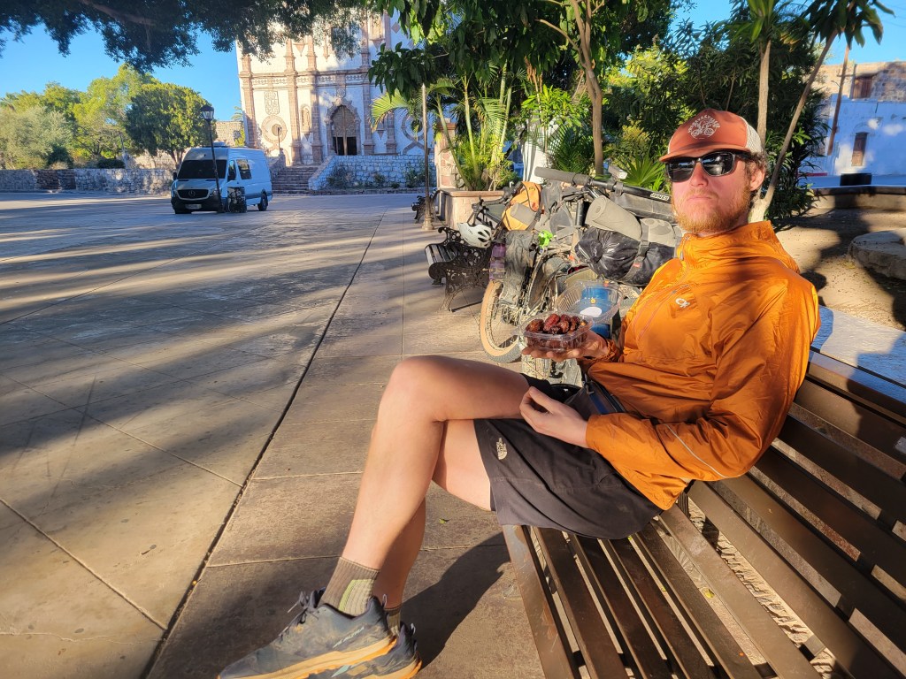
We slept in a little, packed up, and biked over to the tourist area of town with a large plaza adjacent to the Mision church that was built in the 1700s. The ride was incredibly pleasant as we rode under palm trees and near the lagoon in the San Ignacio oasis. We parked in the plaza and spent a relaxing morning drinking coffee and enjoying the locally grown dates! While we passed time, we saw several van-lifers and got acquainted with a like minded couple – Regina and Greg. After a brief walk inside the church, we packed up and started to make our way down the route.

From San Ignacio, we continued on pavement gradually descending nearly 2000 ft over 30 miles. Immediately leaving town, we were back in the desert which became more and more barren as we neared San Ignacio Bay. Eventually we resumed riding on gravel roads and reached the coast.
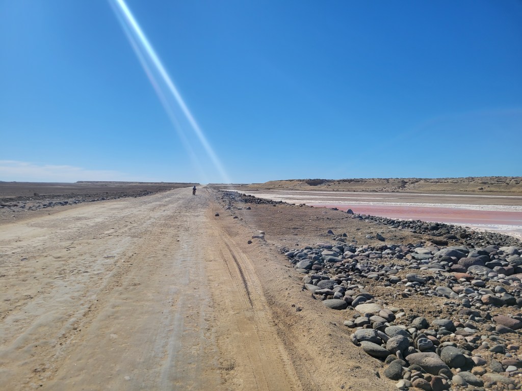
After passing multiple tiny coastal villages, we found ourselves crossing dry lake beds in a very strange and empty landscape. A tailwind propelled us through this uninspiring landscape which provided easy but pretty boring miles. Even with a late start, we still managed 60 miles. We camped in a sand pit near the dry lake bed, eager to move on from this section of riding.
Day 27 – 59.4 Miles / +2261ft gain
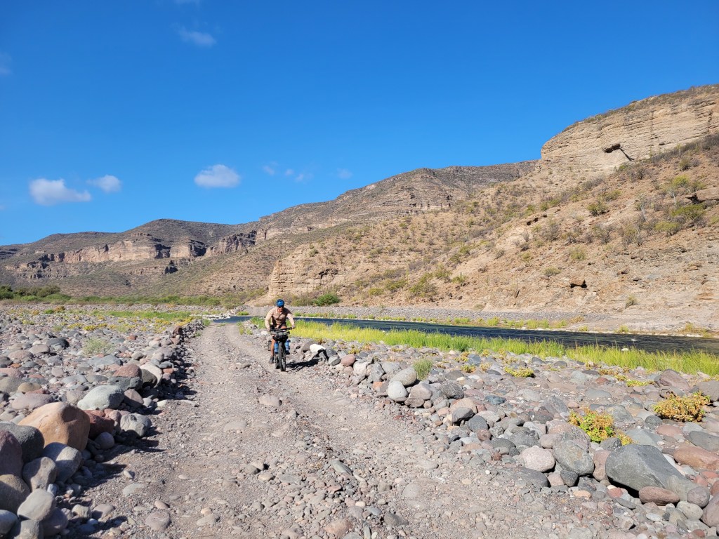
We resumed our ride in dry lake beds until we accidentally managed to hit an old sandy road route. We trudged through over a mile, pushing the bikes through deep sand, frustrated that we had missed a turn to stay within the fast moving lake bed. After a bit of bushwhacking, we returned to the hard lake bed route and continued. We eventually came to the tiny fishing village of El Datíl to resupply for the next 90 miles. We found 2 tiny stores which were a little sad for a 2 day resupply and were told there was a third. We did a couple of confused laps around the town asking for directions to the store. Thankfully a young girl befriended us and led us on foot to the store, hidden between 2 cargo trailers without any signs. After fully resupplying, we took off for a few more miles whizzing through the lake beds and eventually leaving the coast and heading up through rocky and sandy terrain.
We eventually hit a wider gravel road which seemed to be a more commonly used. Not too long after, we made a turn by a stream which would lead into a canyon and to our next town, Mulegé.

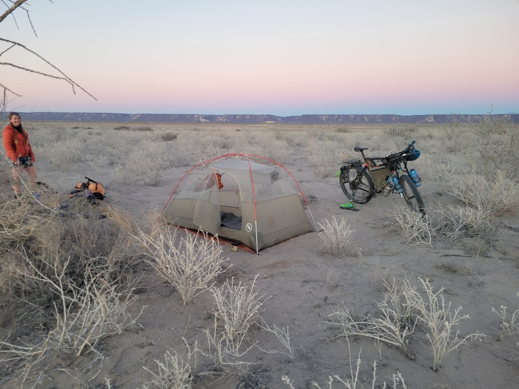
This particular road had storm damage a few years back, but looked like it was in slightly better repair than our guide indicated. The route was rideable but littered in chunky rocks, creating a slow bumpy ride. About 8 miles in, we were pleasantly surprised to see a ranch welcoming bikers with meals, snacks, water, and beers for sale. We popped in for a quick visit and continued on our way. After a couple more hours bumping along, we called it for the night and found a soft spot in the sand to camp.


Day 28 – 52.4 Miles / +2581 ft gain
We began riding at sunrise, a slow and steady slog with a stunning canyon as a backdrop. We maintained a 4 – 5 mph pace. Around 9:00 AM, we came across a rancher welcoming us to his home. We were grateful for a short stop for hot coffee, but we had many miles to cover on our way to Mulegé.

We went back to it, slow and steady, this time adding in maybe a dozen stream crossings. For the most part we kept our feet dry but time was ticking and the miles… weren’t.

Around 2:00, we crested our high point for the day which began a roller coaster series of riding with incredibly steep descents and ascents all amongst some remarkable canyon scenery as the backdrop. From here, we had about 20 miles remaining to Mulugé.

The scenery was some of our favorite within the route as we cascaded through the canyon. My energy levels were dwindling and, to some degree, the canyon became never ending as if it had swallowed me for good. I was somewhat relieved to have the steep walls open up and resume a more steady pace. Dont worry – a strong headwind, deep sand, and washboard were there to make sure I didn’t go too fast.
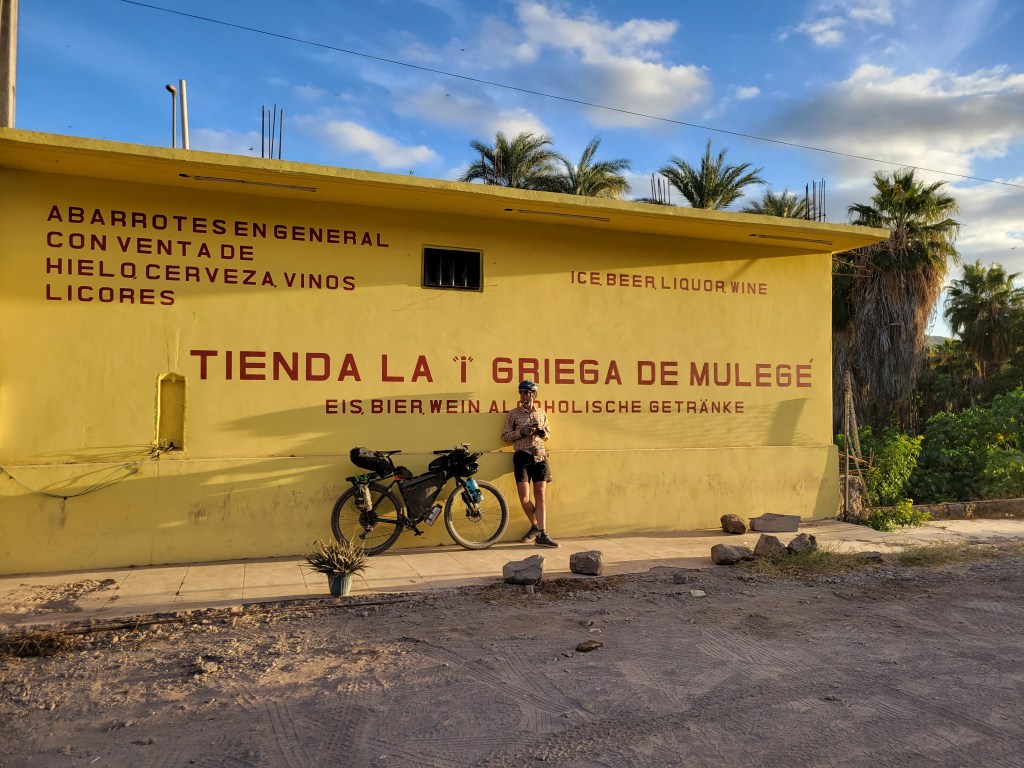
In the early evening, dirt turned to pavement as we entered the outskirts of Mulegé, the orange groves welcoming us back to the Sea of Cortez. We meandered through neighborhoods and eventually to the heart of this oasis in the desert. Palm trees lined the river that opens up to the sea. We checked out one hotel where the price was right, but was a little… lacking. We decided to load up on food for the evening and continue our search. We were extra lucky to stumble upon Clementine’s which was somewhere between a hostel and hotel with 4 private rooms and access to a large communal kitchen. Big bonus – we were the only ones staying for the night! Stoked on our find, we had a perfect night cooking food and planning out our last couple weeks of the trip.

Bahía de los Ángeles to Mulegé
- 7 Days Riding
- 383.9 miles ridden
- 54.8 miles / day average
- +15,057 ft gain
- +2151 ft gain / day average
Total Stats
- 25 Days Riding + 3 0-Mile Days
- 1117.9 miles ridden
- 44.7 miles / day average (without 0s)
- 39.9 miles / day average (with 0s)
- +66,976 ft elevation gain
- +2,679 ft gain / day average (without 0s)
Baja Divide: Vicente Guerrero to Bajia de los Angeles

Day 10 – 29 Miles / +1645 ft gain
We arrived in Vicente Guerrero knowing there was an inch of rain in the forecast. This much rain can saturate the usually dusty roads creating a thick mud which resembles sticky peanut butter. The mud will quickly accumulate on the tires and immobilize the bike. We really didn’t have an option other than to wait for the rain to fall and then the roads to dry.
We realized there was another town 29 miles away on what the guide called “mellow dirt roads” (a phrase never used in this route), so we decided to try to make gains before the rains and push to San Quintin.
As described, the route was mellow as we passed acres of farmland which we learned is where Driscoll berries are grown. By noon, we had made it to San Quintin. As luck would have it, we stumbled upon Hotel Real del Cora which was 600 pesos / night for an adequate space to wait it all out. As nightfall came, so did the storms, and we watched the downpour from the comfort of our room.

Days 11 – 13 – 0 Miles
We spent 3 0-mile days doing a whole lot of nothing. About an inch of rain fell within 12 hours, but then the sun resumed shining and drying out our route. Jeffrey, who we met at the border, caught us in San Quintin. Not much to say about these days other than watching movies, internetting hard, and being antsy in our pantsies to keep riding.


Day 14 🎄 – 38.8 Miles / +2562 ft gain
We were more than ready to resume riding, so we headed out on Christmas morning. Our route took us out towards the Pacific coast on a ride through the salt flats. We saw a few avoidable puddles, but overall the route was rideable. Eventually we arrived at Mision Hotel right on the beach. Here we filled up on water for the next 65 miles and started riding directly on the beach.


Next the route took to the hills as we slowly ascended through miles of dirt roads through acres of tightly packed cacti. Eventually we saw some standing water and thick mud we did our best to dodge. We each took a turn riding through mud we shouldn’t have. Thankfully we were able to clean it off and keep moving, but it was a clear sign that we definitely made the right choice by waiting. Several times we had to dismount to walk around mud puddles playing a weaving maze game through all the cacti.

As we gained elevation, the flora changed to a bit more shrubbery than solely stabby plants, though we did spot our first several cardon cacti. We ended the night by a bog as the frogs sung us to sleep.

Day 15 – 45.1 Miles / +4090 ft gain
Our day began with a hike a bike uphill. A lot of the morning was spent with short stretches of riding followed by hike a bike. We crested a hill to find 2 abandoned bikes with no riders in sight. A quick inspection indicated their bikes were clogged with mud indicating the riders had no choice but to walk out about 30 miles towards the highway. We rode downhill pondering their impossible decision.

A super steep stretch filled with boulders brought us to the high point for the day. We were a little discouraged that we had only covered 17 miles by 11:30 am, so we kept our break short and pressed on. We had another half mile or so of hike a bike, but thankfully the terrain changed to rideable.

Slowly more and more cirios trees dotted the landscape accompanied by giant cardon cacti creating a whimsical backdrop for our ride. We were nothing but joyful to be cruising at a gentle downward slope. At one point I caught myself singing the Mario star power theme as I glided through the desert.


After lunch, we resumed our ride with some rolling hills on a wide desert road. We pulled over for an oncoming truck who slowed down. “Quiren cervezas?” Now that’s some Spanish I do know. Giddy, we had a road beer and pressed on. Another truck passed about 15 minutes later and handed us each a Gaterade.

Around 4:00, we arrived at the intersection with the highway and a roadside truck stop. Our route guide indicated a small store and restaurant, but what we found was a picnic table and a nice man with a few cold drinks for sale. We sat outside and ate our dinner, and he offered to let us camp there for the night. We graciously accepted and went to bed pleased with our 45 mile day.
Day 16 – 45.2 Miles / +2425 ft gain
We began our day at sunrise with a brief 6 mile stretch down the highway. We resumed riding on dirt with a little confusion about where the route was headed. A nice gentleman saw our struggle and pointed us in the right direction, assuring us it was ok to pass through the private property sign.
The road was chunky but relatively flat with a few pointless ups-and-downs (PUDs). Most of our day was spent with little elevation change as we crossed a wide valley between mountain ranges.


Day 17 – 19.7 Miles / +975 ft gain
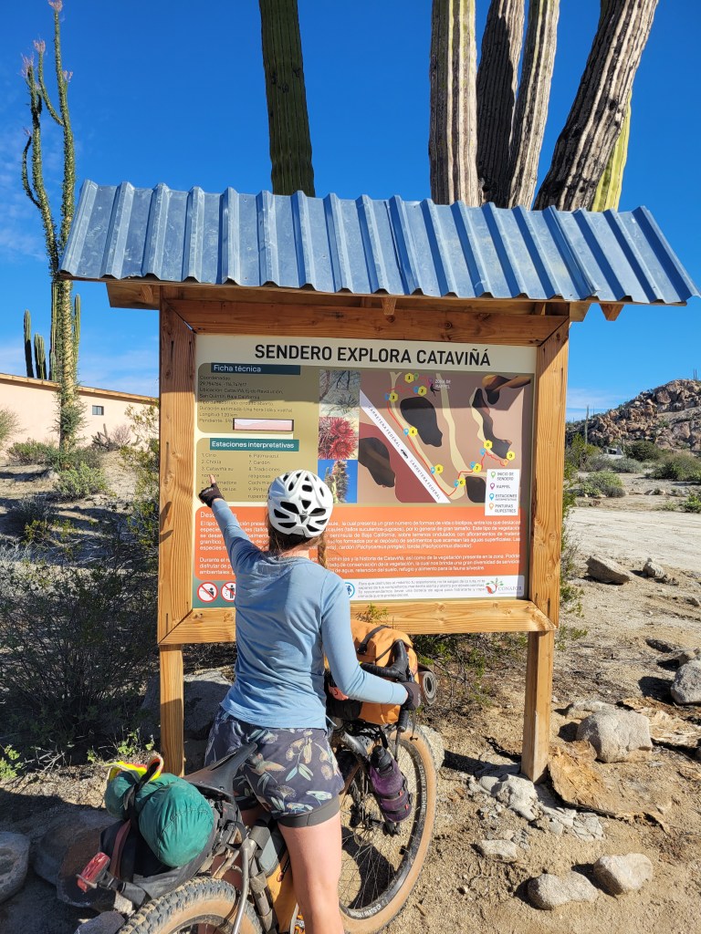
The first few miles were littered with rocks creating a slow and bumpy ride. Suddenly, we crested a pass, and our route turned into a pleasant ride surrounded by the various cacti biosphere and rounded boulders. We weren’t quite ready for our backcountry ride to be over when we arrived at the highway 6 miles north of Cataviña. The off route resupply was essential for the next section so we headed to town. We decided to spend the night in a hotel to clean up our gear and get ready for the next section which included 126 miles between water sources, the longest dry stretch of the trip. We loaded up each of our bikes with 11 liters of water and 2 full days of food + a few extra snacks for the ride.


Day 18 – 58.4 Miles / +3802 ft gain
At sunrise, we began retracing the 6 highway miles back to the route. We hit the dirt and happily resumed our ride through the fascinating flaura specific to the region. We were both giddy with those “I love bikes” feelies as we glided through the desert. We came upon a shaded picnic area and made some cold instant coffee to drink with cookies excited that we had already covered 22 miles by 9:30.
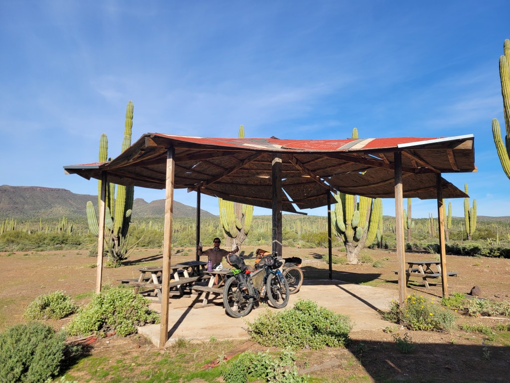
We continued our ride and found another picnic area at 11:00 am and decided to take an early lunch, pleased with 35 miles complete. After our break, we resumed riding towards the coast. The route diminished into more of the rule of the Baja than the exception we had experienced earlier. We enjoyed a break on the beach and then set off on a series of steep and rocky ascents and decents. We found a campsite tucked near a grove of Joshua trees and settled in for the night pleased to have covered 58 miles.


Day 19 – 51.5 Miles / +2763 ft gain
Our day began with an explosion of color at sunrise as we rode near the coast. Our ride was a series of stretches of coastline followed by ascents to plateaus on bluffs, then back to the coast as we followed a series of surfbreaks known as the Seven Sisters.
At one point, we saw that our route was totally flooded. We searched for an alternate route which led us into deep mud coating our bikes, shoes, and morale. We probably spent an hour navigating a half mile of terrain. Que será será.


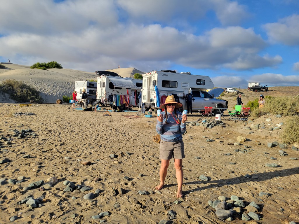
After scraping as much peanut butter mud off of our bikes as possible, we resumed riding the same pattern of bluffs and beach decents. After a break for lunch, we turned onto a new road and were suddenly riding a consistent pace. We gleefully flew down the wide gravel road passing increasing numbers of vehicles. Late in the afternoon, we came across a sandy dune with around 40 vehicles so we stopped by to check out the scene. We found dozens of surfers enjoying their winter holiday camping and catching waves. Kristin spotted us and greeted us with coconut water, a perfect refreshment for our ride. After a break we rode for a few more miles and called it a day.
Day 20 – 55.4 Miles / +2634 ft gain
We continued following a wide road out of camp towards Santa Rosallalita with some sections of washboard, erosion, and chunky rocks. It was a great feeling to have 20 miles done by about 9:00 as we entered town. The surf village had 1 restaurant who made us a vegan version of chilaquiles (breakfast nachos) which we ate while staring at the surfers. As we left town, we passed a final group of surfers and enjoyed about a 10 mile stretch of mostly mellow riding coast adjacent.


After a quick snack break, we headed east towards the hills on a super chunky road. It was a mostly rideable 7 mile stretch, but holy heck. We reached the highway and headed shortly northbound towards the small town of Rosarito for a 1 day resupply before continuing on our route. Leaving town, the road was washboarded but the landscape was awe inspiring as cirios trees reappeared with a backdrop of square top mountains in the distance.

Day 21 – 44.7 Miles / +2166 ft gain
We took off at sunrise under a mostly cloud covered sky towards Mision San Borja. This church was built in the 1600s in the middle of the desert near a spring. We ran into a couple from Utah on a road trip through Baja and also met Angel, the Mision caretaker. With the clouds looming, we decided to make our stop brief as we wished to reach Bahia de Los Angeles before the rain.
The road varied from chunky rocks to deep patches of sand and some washboard, but was almost all rideable with the beautiful cacti biosphere in front of a mountainous backdrop. We crested a pass and began a downhill ride towards a highway that would lead to town. At 12:15 we hit the highway leaving only 12 miles to go. The final 8 miles were all downhill as we sped joyfully into town. At last we got our first glimpse of the Sea of Cortez. We were enjoying beer with incredible views in the early afternoon still logging nearly 45 miles for the day. We tucked ourselves into a hotel before the rain hit, which was thankfully short lived. Somehow we’re nearly halfway through this incredible ride.

Vicente Guerrero to Bahia de Los Angeles
- 8 Days Riding + 3 0-Mile Days
- Miles Ridden – 387.8
- Miles / day average (without 0s) – 43.1
- +23062 ft gain
- +2562 ft gain / day average (without 0s)
Total Stats
- 18 days of riding + 3 0-mile days
- 734 miles ridden
- 40.8 miles / day average (without 0s)
- 34.9 miles / day average (with 0s)
- +51919 ft elevation gain
- +2884 ft gain / day average (without 0s)
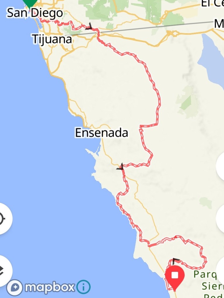
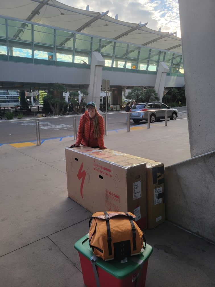
Baja Divide: San Diego to Vicente Guerrero

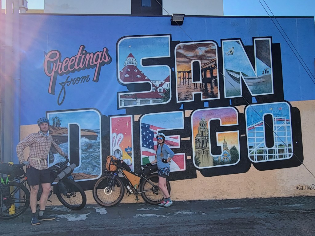
We’re back at it on the bikes – this time ~1600 miles on gravel as we traverse Mexico’s Baja Penninsula from San Diego, CA to Cabo San Lucas, Baja California Sur.
Day 1 – 28.9 Miles / +1458 ft gain
Bikes were built. Accessories and gear were attached. There was nothing left to do except start riding away from our hotel in San Diego. We took our time making it through the city which turned to suburbs and into the nearby town of Chula Vista. Taking into account an early sunset of about 4:30 pm, we realized we needed a plan as camping isn’t much of an option in the urban sprawl and near the border. We opted for a shorter day and stayed in an AirBnB on the outskirts of Chula Vista.

Day 2 – 34.9 Miles / +4998 ft gain
We left the AirBnB at 7:00 am and began with a short section of single track around Lower Otay Lake before rejoining pavement. A 9 mile highway ride brought us to the base of our first major climb up and over Otay Mountain on a gravel road. We took a couple hours to climb the 2600 ft over 6 long miles taking a break at the top to see views of the lake and the Pacific Ocean in the background.

After a quick snack, it was a joy to descend the other side of the mountain. What we didn’t realize is that our climbing was only halfway done for the day. We continued through the backcountry for awhile noticing lots of trash and clothing in particular, speculating about those who had journeyed through these mountains. Eventually, we hit pavement and resumed climbing, a relentless slog as our final miles in the US. The highway curved up the mountain with little shoulder as cars whizzed by and my energy evaporated leaving me questioning my abilities for this trip. As my doubts arose, so did the final turnoff to coast downhill 2 miles towards the Mexican border. The border agents were nothing but friendly and helped us figure out the process of filling out the tourist visa permit, paying the fee, and getting our 180-day visa into Mexico. During all this, we met another cyclist, Jeffrey, also tackling the Baja Divide.
With our passports stamped, we rolled into the nearby Hotel Tecate and got a room for 600 pesos (~$35) for the night. To my surprise, there was a fully vegan restaurant a couple blocks away – what a treat! After dinner, we grabbed food for a 2 day stretch into the Mexican backcountry.

Day 3 – 31.7 Miles / +3561 ft gain
We awoke before 6 am and strolled to find our morning coffee. Success! By 7 am, we rolled out of the room for our 10 mile stretch through and outside of the city mostly on pavement.

We arrived at the final store before heading out for 60 miles of riding without resupply available for food or water. We grabbed a final cup of coffee and packed our 8 liters of water and 2 days of food to get us to Ojos Negros. We started rolling and finally hit dirt. I turned to Sean and said, “Well, here goes nothing.”
It took no time at all to be totally alone in the Mexican backcountry riding up and down dirt roads in a valley surrounded by mountains. Much like BLM land of the American west, we saw the occasional ranch, herd of cows, and horses. As we climbed out of the valley, we had a few short stretches of pushing our bike but nothing was wiping the grin of our faces as we were so joyful to back at it. At 4:30 pm, we found our campsite for the evening and settled in for the long night.


Day 4 – 46.8 Miles / +2926 ft gain
We woke up at the base of a climb, well-rested and eager to ride. We passed several ranches along the way with some very curious dogs chasing us. We quickly learned stopping is the best way to end the chase. Thankfully, this time the dogs were nice and let us pass.

We continued a slow ascent up to a high valley and eventually passed through a grove of towering pine trees near the high point of the entire route. After cresting 4800 ft, we began a long 20 mile descent cruising down over 2400 ft.
The cruise down was zippy and well-graded. Eventually we hit a stretch of deep sand as we coasted into the tiny town of Ojos Negros. The Baja Divide is always keeping things interesting, and now I can add sand surfing to my skills repertoire. Gliding over the sand had a similar feeling to skiing. A bit of speed and shifting my weight back helped me glide smoothly over the sand for a few miles.
We arrived in Ojos Negros mid-afternoon and decided to grab a cheap motel room again for 600 pesos.

Day 5 – 44.0 Miles / +3298 ft gain
We left the room early after peanut butter & oreo tortillas and instant coffee. It was a brisk morning so we were happy when we started doing a little climbing. The morning was beautiful and fairly simple riding. We were excited to reach the high point where the remainder of the day would be a downhill coast to Uruapan. We were correct about the downhill part, but not so much about the coast part. The first descent from the top was remarkably steep with deep trenches littered with loose fist-sized rocks. I attempted to ride some short stretches and got knocked off my bike pretty quickly, thankful to have only sustained 1 small bruise. We took a break for lunch after what appeared to be the steepest descent which dropped 800 ft in a mere 1.5 miles.

After lunch, the grade mellowed a bit, but I still found the terrain challenging and a lil scary. I rode what I could and walked when I needed to. Next to Mexican jail, a Mexican hospital is the last place I want to end up. The descent went on and on as I did my best to keep up and face my fears. As we got closer to town, we began a series of steep hills up and over which quickly zapped my remaining energy. I laughed at my thoughts of an “easy downhill coast” I had dreamt about earlier which was a good reminder in managing expectations on this route.
The sun had started to set as we entered the little town of Uruapan. We were surrounded by fields, farm, and vineyards in the heart of Mexican wine country. We grabbed some snacks from a small tienda, including some local olives, and headed towards the hot springs in town. Speaking of managing expectations…
We thought we’d be getting into some sort of pool, but what we found was a row of shower shacks. Inside each stall was a 2 foot tub with an overhead shower. You could plug the tub with a pvc pipe and fill it up as you shower. Not what I expected, but still felt amazing. They also had a row of washing machines so we decided to do our laundry there which was another adventure in traveling and humility as I tried to navigate working a laundry machine which you have to manually fill and drain yourself in broken Spanish. While waiting for our laundry, we were befriended by Gustavo who asked where we were planning to stay that night. His cousin Jaime lived very nearby and offered us his garage to camp in. He left and returned 40 minutes later so we could follow his truck over to Jaime’s. He set us up in the garage and even provided an electric kettle with a coffee setup for the morning. Thank you, Gustavo & Jaime!!

Day 6 – 37.9 Miles / +2711 ft gain
We woke up early to a brisk morning, grateful for hot coffee and to be inside a shelter which definitely kept us warmer than being outside. We had heard Jeffrey, who we met at the border, and a couple other cyclists camped at the hot springs so we rode over to see them. After a little chat, we headed out on a small stretch of highway before returning to dirt roads. The grade was a bit steep, but the road was well maintained which made for a smooth ride. After a bit of climbing, we were rewarded with the mellowest descent thus far as we cruised down a wide gravel road without obstacles. What a gift.

We took a lunch break and peddled on knowing we would see the ocean soon. After a few twists and turns, we got our first glimpse of the Pacific. As we neared the coast, the road quality dissipated a bit which led to a few hike a bike sections, though most were short lived. The cool sea air breeze was amazing as we rode adjacent to the coast.


We were pleasantly surprised to realize we were just a couple miles from the next town of Erendira, a small fishing village. We decided to stay at another 600 peso motel and call it a day.

Day 7 – 45.6 Miles / +3074 ft gain
We headed out from the room early and went for a search for hot coffee before leaving town. No such luck this time. The views were lovely and the riding peaceful as we paralleled the coast. As we headed towards the hills, the riding got a lot less smooth with many steep hills and sections of pushing the bikes.

Eventually, we hit a relatively smooth gravel road that linked to a paved highway into Colonet. We got a couple days worth of food that would take us the 90 miles to Vicente Guerrero. After town, we returned to dirt and stopped for lunch. Another 10 miles down the road, we found the tiny village of Benito Jaurez with a little tienda. This was our last opportunity for water for the next 30 miles. We took a short break for a snack at the tienda and headed out of town. The first few miles had some very deep sand some of which we could surf, some of which we had to push through. Next we encountered some rare, shallow stream crossings as we navigated through the mountains. It took a little searching, but we eventually found a viable campsite tucked into the bushes. Since our days are ending early, we caught an episode of “You Made It Weird” before heading to sleep.


Day 8 – 33.2 Miles / +4501 ft gain
We were riding by 6:30 am crossing a couple more streams before a steeper incline began. There was a distinct turn where the road shifted from rideable to nah on rugged 4 x 4 tracks. From this point, we faced a gauntlet of challenges beyond every turn – rocks, erosion, sand, steep hills – maybe 2 or 3 of those at once. 17 miles took us about 4 hours to complete.


We arrived at Rancho Coyote almost out of water. The site has cabins and advertises some provisions and water for sale. When we arrived, no one was there. We ate our lunch at a picnic table hoping someone would arrive, but still no one. Rancho Meling was only 5 miles away, but we were a bit apprehensive about the distance considering the difficult terrain we had just traversed. With no water, we decided to take the chance and push on to Rancho Meling.
The ride between the ranches was the nectar of the gods in terms of terrain – a gentle downhill slope on a wide gravel road. We were giddy as we glided mile after easy coasting mile. We arrived at Rancho Meling and were warmly greeted. We stayed for a snack and a little coffee and got our water bottles filled for the remaining 50 miles to town.

Almost immediately we resumed traversing nearly impossible terrain. It seemed like each daunting hike a bike uphill push was rewarded with a steep sudden death descent (aka more hike a bike for me). We were exhausted, yet we pushed on (literally). Eventually, we left the 4 x 4 tracks at about 4:00 and turned onto a rideable road. Not long after, we looked for a campsite before the sunset. Somehow we managed to squeeze 4500 ft of climbing into this 33 mile day, and we were wiped from what I consider our most challenging day so far.
Day 9 – 43.2 Miles / +2330 ft gain
We got our earliest start yet at 6:15 and began a little bit if riding with our headlights. It didn’t take long for dawn to break. We were happy to find the dirt road rideable as we descended the mountain. We hit a short stretch of pavement that passed through a tiny town. I noticed a tienda, and we pulled over for hot coffee and cookies – woohoo!
After our break, we had a short climb over a mountain, then resumed a long descent. The terrain was mostly rideable and gave me a good opportunity to practice my mountain biking skills. We hit a couple miles of single track before riding through a small village which led to the highway.


We had a few highway miles to traverse before we cruised the coastline on our way to Vicente Guerrero. Thankfully, we found a large dirt shoulder adjacent to the highway so we just stayed in the dirt instead of riding on the busy road. On the coast, we took our lunch break, then road on to the city. Vicente Guerrero is the largest town we’ve seen since Tacate and boasts a great bike shop. We stopped in the bike shop to sign the Baja map and grabbed a room for the night. With rain in the forecast we needed to make a plan. Not only is riding in the rain unpleasant, the rain can turn the dirt to clay which can be 100% unrideable. We got a room at the Mission Inn which was both the most expensive and most modern room we’ve seen so far.

Total Stats
- 9 days of riding
- 346.2 miles
- 38.5 miles / day average
- 28,857 ft total gain
- 3,206 ft gain per day average

Work and Travel: Life as a Bicycle Tour Guide in Alaska

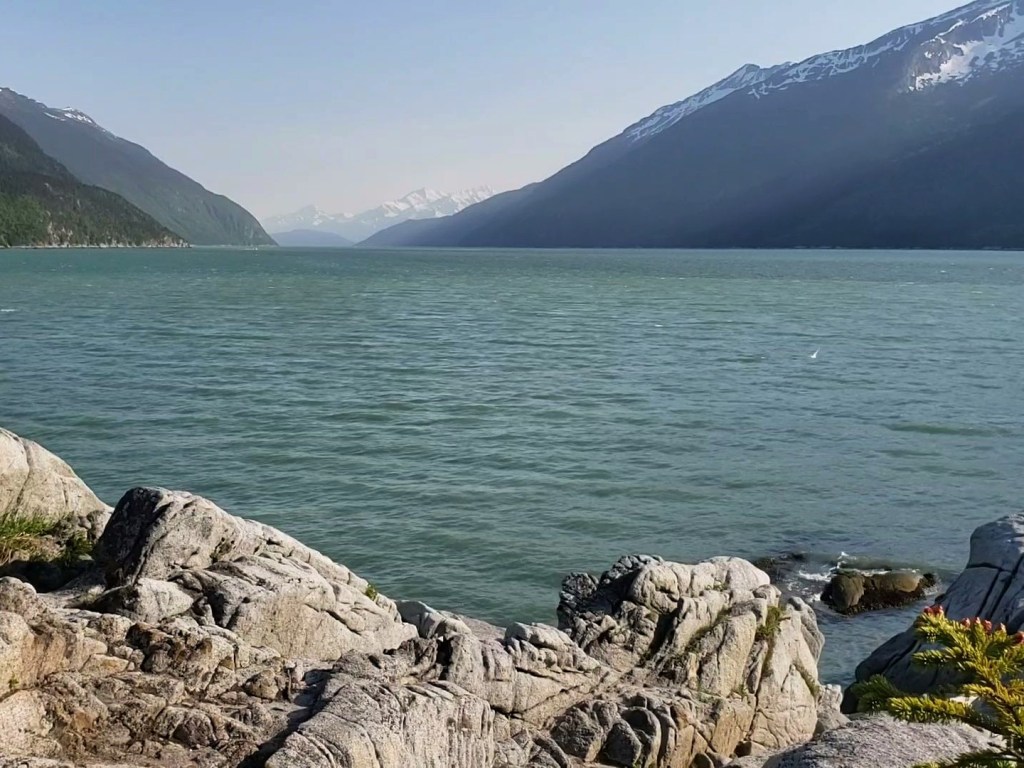
A month has already flown by here in Southeast Alaska, specifically Skagway, where I’ll be living until late September. After completing the Arizona Trail in mid April, we drove home to Indiana just in time to fly to Juneau and catch the ferry to Skagway. Travelling through the Lynn Canal, my mind was soaring while I digested the views – snow-capped mountains in all directions, sunshine beginning before 5 am and lasting until 10 pm, a sparkling channel mirroring all of this greatness. After six hours on the ferry from Juneau, we arrived in Skagway where we’ll both be experiencing life as a bicycle tour guide in Alaska, our home for the summer.


Skagway was built in the late 1800’s as part of the Klondike Gold Rush. The cute little town is dotted with historical sites, restaurants, and lots of gift shops connected by board walks and have building fronts that look like they are still in 1898. Of course, that’s on purpose, in fact required by the National Park Service who maintains the “downtown” strip on Broadway Street as part of Klondike Gold Rush National Historical Park to transport us back in time. Skagway was created by the gold rush and survives because of tourism, specifically cruise ships. Most cruises begin in Seattle or Vancouver stopping in Ketchikan and Juneau before stopping here in Skagway. Every evening, the cruise ships and all the tourists head for their next destination, possibly Glacier Bay, Sitka, or beyond to Seward where tourists can take land excursions to Anchorage, Denali, or Fairbanks.

Because the Lynn Canal is extraordinarily deep – one of the deepest fjords in the world – massive cruise ships can pull right up to town bringing thousands of visitors from all around the globe on a daily basis. Our little town has a summer population of about 2500 including many “seasonal locals,” like myself, which goes down to between 500-800 in the winter months. On our maximum capacity days, four cruise ships can dock and can bring over 15,000 people into town. Once here, shore excursions are abundant.

I intend on writing several articles about my time here in Skagway, but today I wanted to focus on the shore excursion I know the most about – bicycle tours. Getting the job (via Coolworks.com) was somewhat of a dream come true, and I am thrilled to be working for Sockeye Cycle Company. I’m pretty stoked to have my first job in the outdoor industry, and Alaska is quickly surpassing even my wildest dreams in terms of its beauty and abundant plant and wildlife. On top of that, Sockeye has impressed me as a company with their rigorous training, high standards of education for all guides, and commitment to sustainability and environmental awareness.
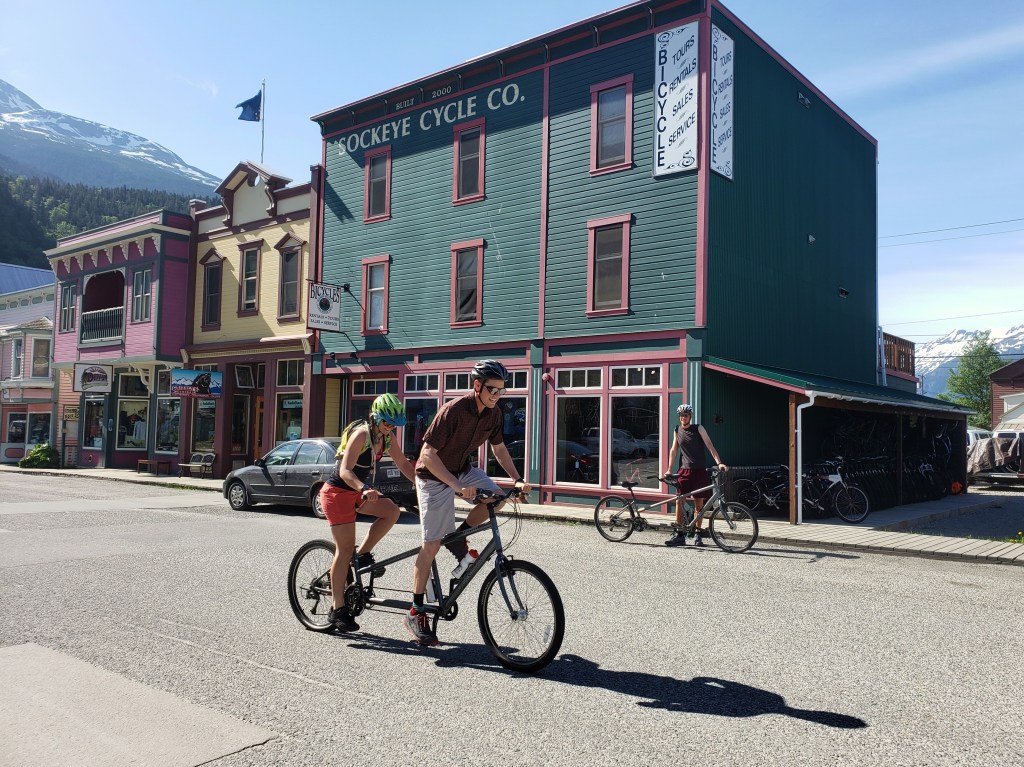
Sockeye Cycle Company has been in business for 31 years and has shops in Skagway and nearby Haines. Both locations host tours, bike rentals, and shops for retail and repair. Here in Skagway, we offer four different day tours for guests to choose from: Train & Bike Tour, Klondike Bike Tour, Triple Adventure, or Rain Forest Tour. The bike portion is the same for the Train & Bike and Klondike tour, but the Train & Bike includes riding the scenic White Pass and Yukon Route train to the summit to begin the ride. I’ll group these together as Klondike Tour. Similarly, the Triple Adventure and the Rain Forest Tour biking portion is the same, but the Triple Adventure includes a hike on the Chilkoot Trail and a float trip down the Taiya River with our friends from Skagway Float. These are grouped below as Rain Forest Tour.
Klondike Tour
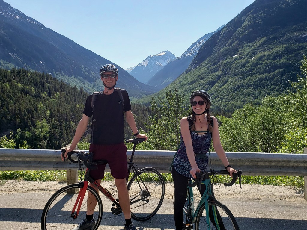
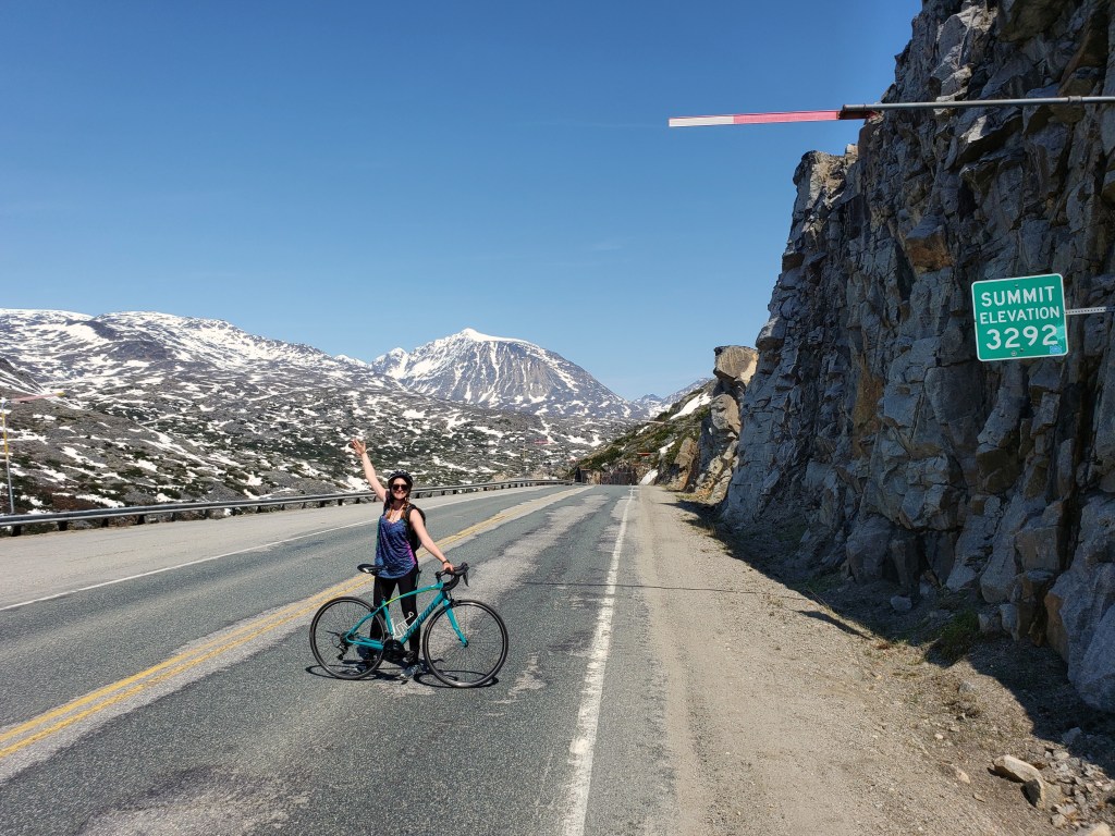
Whether you take the train up or get picked up in town, the bike tour begins at 3292 feet at the summit of White Pass. This historic pass marks the physical boundary for the USA and Canada. During the Gold Rush, stampeders came from Skagway hauling nearly 2,000 lbs of goods as per Canadian requirement. The White Pass Trail stretched 45 miles from town over the pass to Lake Bennett in the Yukon Territory. It took them 3-4 months to make this passage as they would shuttle their goods from cache point to cache point hiking the entire trail 40 or more times. From Lake Bennett, they had to build a boat and travel over 500 miles of river to Dawson City where the gold actually was. This path was too brutal for most, fatal for many, and overall a big bust for the large majority. Most of those that actually made it to Dawson City were too late and less than 1% of the 100,000+ stampeders struck it rich.

Once everyone is situated on bikes and the safety speeches are spieled, the downhill tour begins. The 15 mile tour has several stops along the way to take in the majestic scenery that envelops you. We keep our eyes peeled for possible wildlife sightings – bears, doll sheep, marmots, porcupines. I’ve seen guests nearly brought to tears taking in the razor edged mountains in the distance, the gushing waterfalls, and even glaciers peeking through the glacially carved valleys. As we wind down the pass, we can see the adjacent railroad tracks and some remnants of a former trail from the gold rush era. We explain the hydroelectric system Skagway depends on for electricity, the glacial silt suspended in the cloudy Skagway River, the changes in climate zone as we descend…

The large majority of the ride is downhill coasting with little need to pedal. As we get back to town, it’s a leisurely flat ride as we make our way back to the bike shop and the ships and bay come back into view. Basically, if you can ride a bike, you can manage taking this stunning tour.
Rain Forest Tour
The Rain Forest or Triple Adventure tour begins with a 20 minute drive from Skagway to the historic town site of Dyea. Back in the gold rush days, Skagway and Dyea competed for business and both had their own trails that converged at Lake Bennett. The White Pass Trail began in Skagway and the Chilkoot Trail originated in Dyea. The Chilkoot Trail, once a trading route for the indigenous Tlingit natives, is a 33 mile path and much steeper than the White Pass Trail. Today, the Chilkoot is now a recreational trail managed by both the National Park Service and Parks Canada.
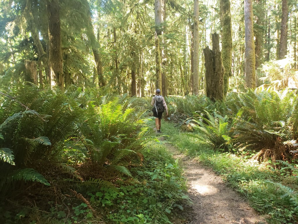
After a gorgeous drive around Naku Bay and the Taiya Inlet, the bike ride begins at the Chilkoot Trailhead. We leisurely ride on a dirt road through tall Sitka Spruce trees and Western Hemlocks observing the moss covered forest floor. The Tongass National Forest, the USA’s largest, is part of the world’s largest intact coastal temperate rain forest stretching from Southeast Alaska all the way down to California’s Redwoods. We make several stops along the way to point out plant life including the trees and moss, lichen, wildflowers, and some edible plants.

We continue our ride through the historic Dyea townsite. What was once a city of about 10,000 is now almost fully reclaimed by the Tongass. The National Park Service has established gravel paths that were once the former town streets. Many informational signs with photographs from the gold rush line the paths and give insight to what was once there.
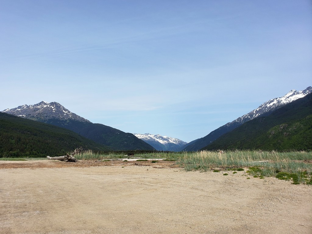
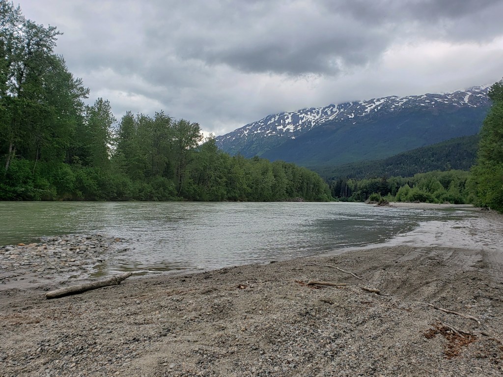
Our final stop is out on the Taiya Flats where the trees open up to the northern most point of the Lynn Canal. On a clear day, you can see the Chilkoot Valley behind you where the Chilkoot Trail would go off into the mountains, the pass out of sight. In front of you is the Lynn Canal with the snow capped Chilkat mountain range far in the distance. The flats see a huge change between high and low tide which actually occurs twice a day. Typically, dozens of seagulls are out and a few Arctic Terns and Bald Eagles will dot the sky as well.
The season has just started really picking up since it began in May. We’re beginning to see more cruise ships and a lot more people, but our first month was relatively slow giving us plenty of time to explore the town and the many outdoor opportunities that are here in Skagway. We’ve really enjoyed trail running on the Dewey Lakes trail system and hiking up the steep AB Mountain. A quick 5 minute bike ride will bring us to the shore where we can watch for seals, interesting birds, and the occasional whale sighting (though I’ve yet to see any myself).
In short, I’ve found myself a pretty great job in an outdoor playground here in Southeast Alaska, and it’s quickly winning my heart. If you’re cruising to Skagway or Haines this summer, check out CycleAlaska.com to book a day tour! Sockeye also offers extended multi-day tours for those coming up that have a little more time to spend in the area.
Southeast Alaska is truly magical, one of the last wild places on the planet. You’ve got to see it to believe it. And, in my humble opinion, there’s no better way to see it than by bike!

Have you ever had a seasonal job or are you looking to get into the seasonal lifestyle? Drop your comments below! We’d love to hear from you!
We are long distance hikers and current bicycle tour guides living our best life in Skagway, Alaska. Follow along here, on Facebook, and Instagram as we continue living a life in motion and discovering the Infinite Geography of this incredible planet.
Pacific Northwest Trail Sections 9 & 10 – Olympic National Park

We’re wrapping up a westbound thruhike of the ~1200 mile Pacific Northwest Trail (PNT) as part of a group of six lean, tan superheroes. Read our experience hiking through Olympic National Park from the high mountain passes to the 60 mile beach walk to finish our thruhike at Cape Alava.
Day 46 – 26 Miles / +9400 ft elevation gain
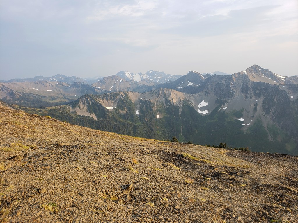
We woke up on the side of a forest service road with just a couple miles of dirt road ahead of us until we reached single track. After over a hundred miles of “urban hiking” in section 8, we were ecstatic to reach a trailhead and resume walking on dirt. Of course, the trail shot straight up, but we didn’t mind. A steep climb into the Olympics was welcome.
We spent a beautiful day hiking a series of climbs and descents noticing more and more people as we hiked. Our final climb of the day was up Marmot Pass which gave us incredible views of the surrounding mountains. As we began our descent, we noticed a picture perfect campsite with room for just one tent. This was only one of the few nights the whole crew didn’t camp together, but this campsite was too good to walk away from.


Day 47 – 24.2 Miles / +9300 ft elevation gain
In the morning, we caught up with the crew a couple miles down trail and experienced one of our only rainy mornings of the thruhike. Thankfully, the rain was short lived as we climbed up another pass. At the top, we took our morning break in awe of our surroundings. Suddenly, I spotted movement on the ridge in front of us, and we got to watch a bear scale the mountain and saunter along. In a nearby valley, Sean spotted a second bear from the same vantage point. We left the pass in high spirits and continued on.
During the descent, we crossed the official Olympic National Park boundary which requires us to preplan our campsites for permits. As a group, we decided to slow down a little to really soak in our final section of trail which meant we could have a little more leisure time throughout the day.
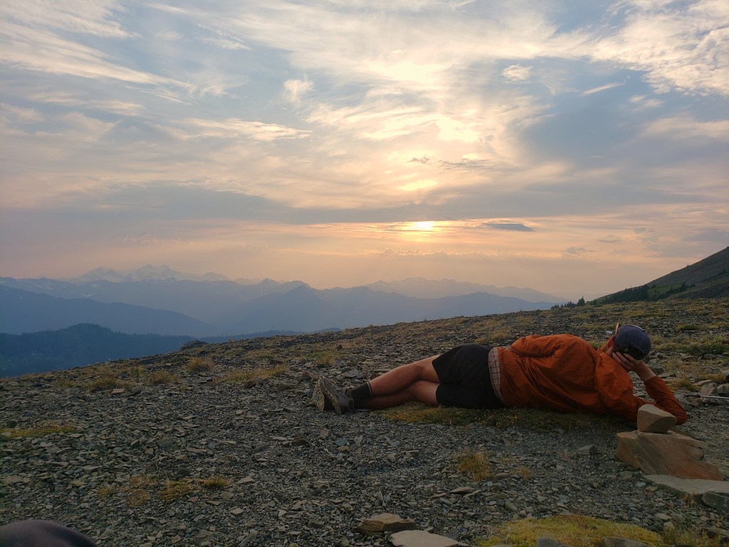
As we approached Hayden Pass, we decided to follow an alternate route that would keep us up higher and take us to Hurricane Ridge so we could hitch to Port Angeles for resupply. We took the alternate trail towards Lost Pass where we immediately started climbing up 1200 ft in 0.7 miles, one of the steepest sets of switchbacks I’d ever seen. After a short flat-ish section, we gained another 1000 ft in a mile bringing us to the top of Cameron Pass. From the top, we got our first good look at Mt Olympus and its glaciated peak. We lingered for a bit of the sunset before a steep descent into camp.

Day 48 – 17.8 Miles / +5600 ft elevation gain
We awoke with a short day ahead of us as we aimed for the Hurricane Ridge Visitor Center to get a ride to Port Angeles. We saw Gusha washing his shorts in a nearby stream. Apparently, he had an overnight visitor. He awoke in the night to find his stuff ravaged through and shiny eyes staring him in the face. After our bear sightings the day before, panic struck. It didn’t take long to realize, though, that it was a deer standing over him. The deer had stolen his hiking shorts and was enjoying a salty treat. In his underwear and headlamp, he chased the deer until he relinquished the shorts while the rest of us slept through what would have been a hilarious event to witness.
We had two big steep climbs to conquer before we reached an eight mile stretch of dirt road. First up, 2000 ft of gain in a mile and half. After a short break at the top, we headed down to start the next pass. In between, a gorgeous small lake called to us for a quick skinny dip to cool off. We were immediately sweating bullets again as we climbed the next one – 1500 ft of gain in a mile and a half. We had incredible views from the ridge but did notice a little haze from wildfires far south from us. A couple miles later, we made it to Obstruction Point trailhead and the remainder of our day was on dirt road heading towards the visitor center. Just as I arrived at the parking lot, the group had managed to get us all a ride. I hopped into the middle of the sardine pile in the back of a pickup truck as we spent the 20 mile ride trying to make each other as comfortable as possible. We decided to stay in town for the night to clean up and take care of our remaining Olympic NP permits the next morning.


Day 49 – 20 Miles / +3500 ft elevation gain
We headed to the ranger station on the outskirts of town to arrange our permits for the final few nights of the hike. The ranger who assisted us was incredibly kind, patient, and knowledgeable about what we would need to do. As we approached the coast, it was imperative that we make a plan that would accommodate the tide charts as certain sections were only passable at low tide. With a plan hatched and permits in hand, we started hitching. It only took a few minutes to get a ride up Hurricane Ridge, and we continued on our way.
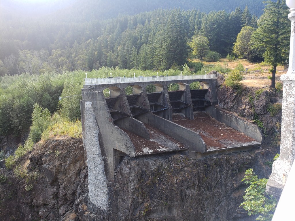
We started our 20 mile day at noon with a long stretch of sweeping downhill switchbacks that ended on gravel road adjacent to the Elwha River. We stopped to check out the 210 foot tall Glines Canyon Dam which was removed in 2011. Two sides of the dam remain, but it no longer crosses the Elwha. We started a gradual climb up a gravel road and spent the final two miles on a beautiful wide trail which brought us to Olympic Hot Springs. It was dark when we arrived, but we still wanted to go for a dip. The six of us found a natural pool hotter than any hot spring I’d ever been in to take a quick, relaxing soak. What a way to end the day.


Day 50 – 28.1 Miles / +9200 ft elevation gain
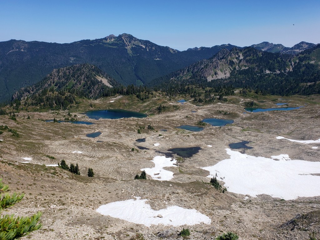
We woke early and started climbing right away. We knew this would be our last real day of climbing and big mountain views before we headed to sea level for the remainder of the hike. Our first climb up Appleton Pass was considerably less steep than what we had conquered in the last few days but seemed to take forever to reach the top. We did a quick descent, then headed up our next big climb which gave us incredible views of Mount Olympus and its glaciers as well as several glimmering lakes in the Seven Lakes Basin area. We took a long break before our hike resumed on the ridge. Before we knew it, we started a huge descent and said goodbye to the high mountain passes. We camped in Hyak Shelter for the night reminded of our days as baby hikers on the Appalachian Trail.


Day 51 – 23.7 Miles / +3000 ft elevation gain
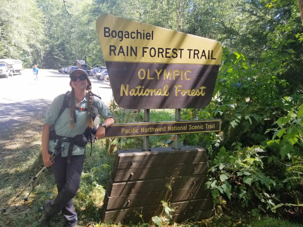
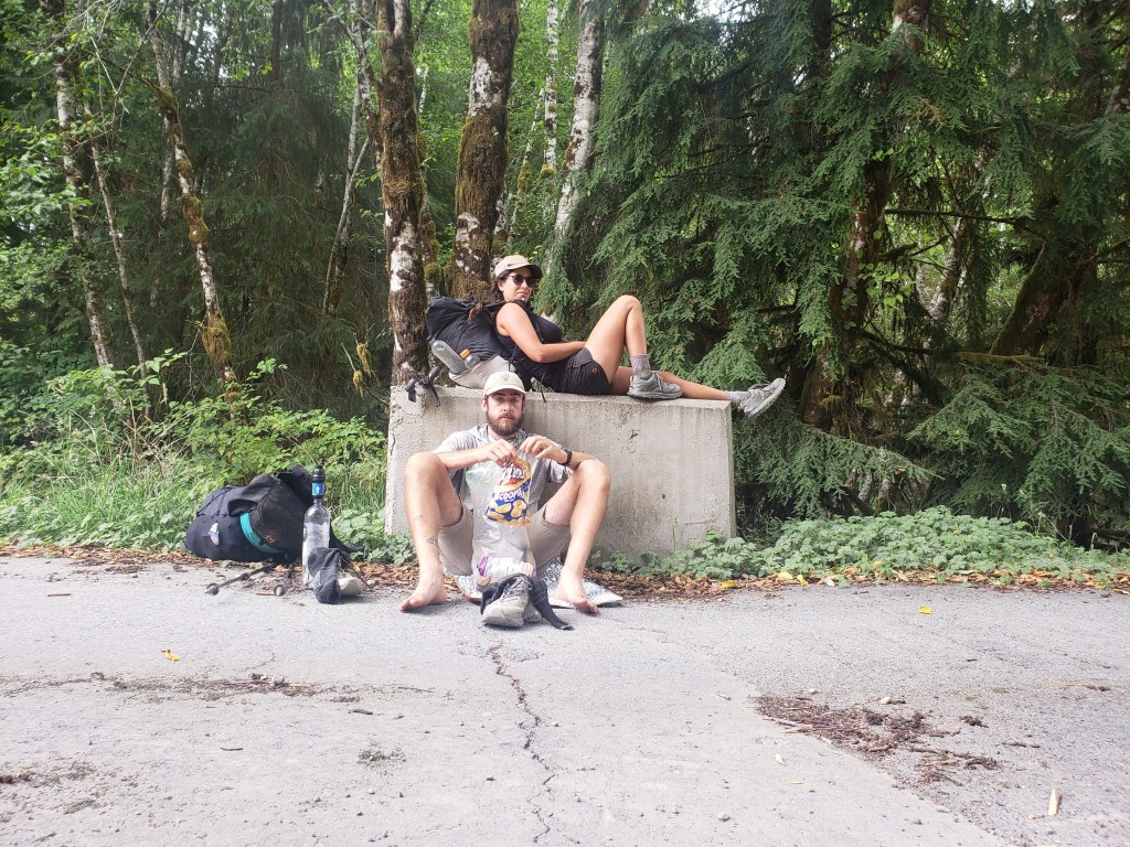
We had a beautiful morning in the lush forest and enjoyed the ferns, mushrooms, and moss that decorated the forest floor. Our walk was simple and pleasant as we briefly exited the national park boundary. In the afternoon, we walked gravel road until we hit the 101. From here, we hitched a few miles to Forks for our final resupply. After a bit of town loitering, we made it back to the trail at Bogachiel State Park where the friendly ranger let us camp in the day use shelter. Our lucky streak continued when a couple of PCT long section hikers and trail angels dropped off beers for our evening. Hot showers, town food, and beers are likely the best way to start the final section to the terminus.

Day 52 – 23.3 Miles / +2100 ft elevation gain
We woke up knowing our day was limited to where the PNT reached the Hoh River at the Pacific Ocean. Right past the Hoh, the trail walks along a beach lined by cliffs. The only time it is able to be crossed is at low tide giving us a window between 4:00 – 6:00 am to get out of there. Therefore, we planned to camp right before the crossing and get up extra early to tackle the challenge the next day.
We just had 23 miles ahead of us with relatively little climbing. We got a later start than usual and walked a couple miles on the highway before heading down gravel logging roads. The sky remained overcast all day with a couple intermittent rain drops. Mostly, the walking was uneventful and a little dull as we eagerly anticipated the next day on the beach.
A sprinkle of rain started as we walked adjacent to the Hoh River and reached a trailhead by the national park boundary. We found a lovely campsite in the trees and went to bed early.


Day 53 – 28.5 Miles / +2000 ft elevation gain
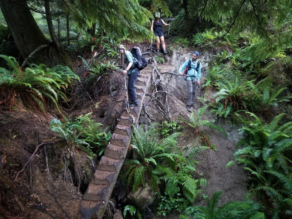
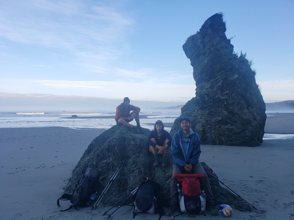
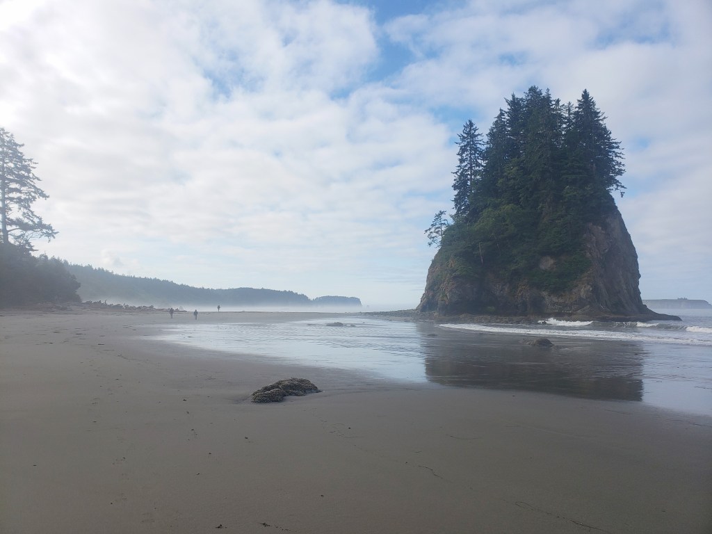
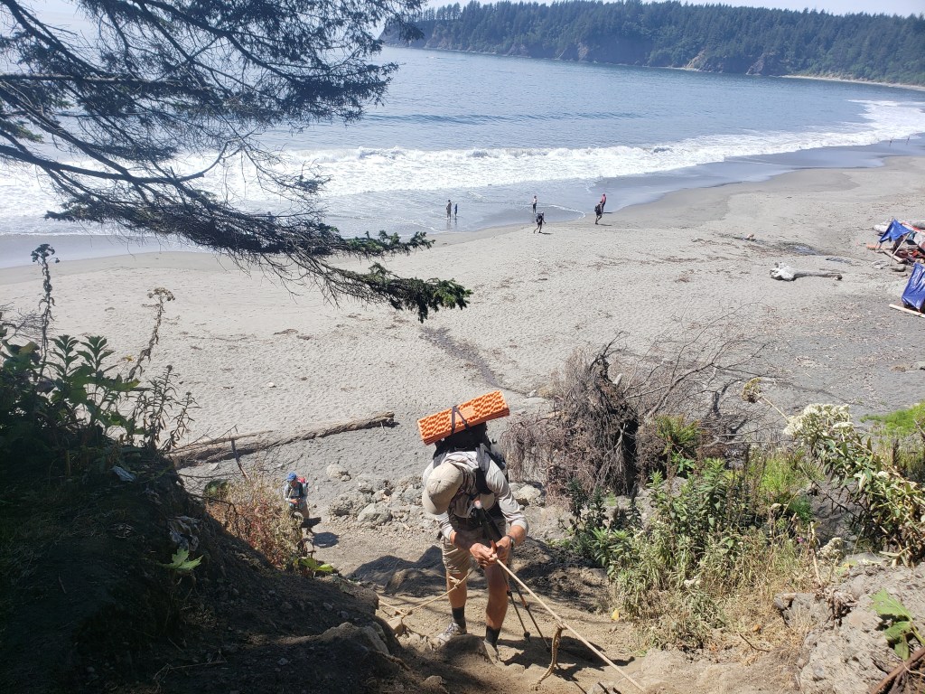
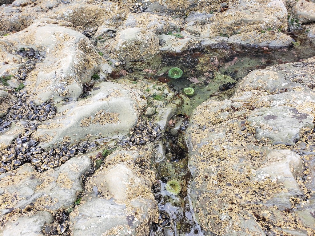
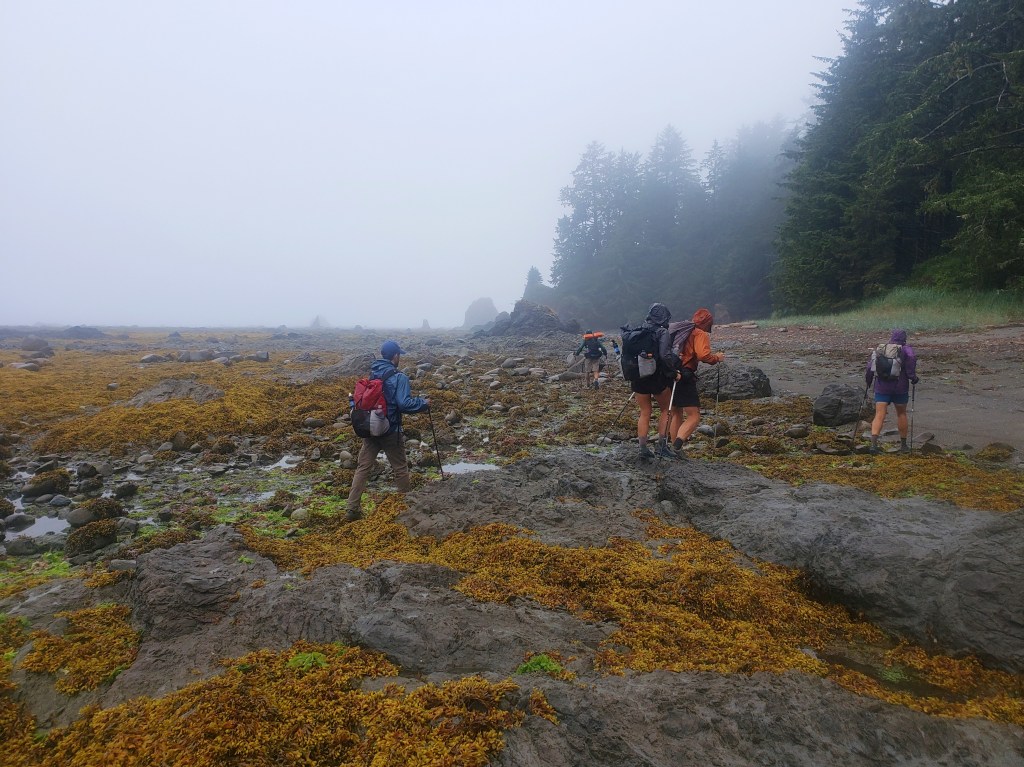
In a slight drizzle, we packed up camp and were ready to hike at 4:00 am by the light of our headlamps. Within a mile, we were on the shore of the Pacific Ocean amazed we had walked here from the Continental Divide. We gazed at the cliff walls to our right and an endless ocean to our left. I shuddered to think about the tide coming in. We made a strict no man left behind policy as we rock hopped and climbed over driftwood. At one point, I chose a slightly different direction thinking it would be a little easier to navigate the obstacles. As I climbed over piles of driftwood, I smelled something foul at my feet. Suddenly, I saw bones and realized I had climbed into a decaying whale carcass. Though no tissue remained, the huge bones were a giveaway. I looked up to notice my group getting further away from me. In a slight panic, adrenaline kicked in and I started hopping driftwood like hurtles attempting to escape the smell of decay and the prospect of being separated. Thankfully, I was quickly back in line. We continued to cross slippery rocks and gaze into tide pools filled with anemones, sea urchins, and star fish. The beach finally came to an end with a big bluff and a rope assist for the steep climb putting the sketchy tidal crossing behind us.
Our morning turned to afternoon all in a similar fashion – a stretch of beach walk followed by a short steep climb into a stretch of rainforest. Several ropes helped assist our climbs and descents from the bluff. High tide came in at 1, so we timed our lunch accordingly so we could safely return to the beach.

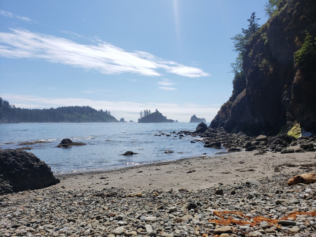

In the afternoon, we walked into the tiny Quileute Native community of La Push where we loitered at a convenience store, then headed down to the marina to try to hitch a boat ride. The official PNT route crosses the Quillayute River via boat, but there isn’t a public ferry. The option is to find a nice local fisherman to putt you across, or walk 4 miles on highway around. We arrived hopeful, but didn’t find anyone right away. Thankfully within about 10 minutes, a couple of curious fisherman volunteered to take us the five minute ride across. We offered them some cash for their help, but they refused. We thanked them for saving us an hour and a half of walking, and continued on our way up the beach.
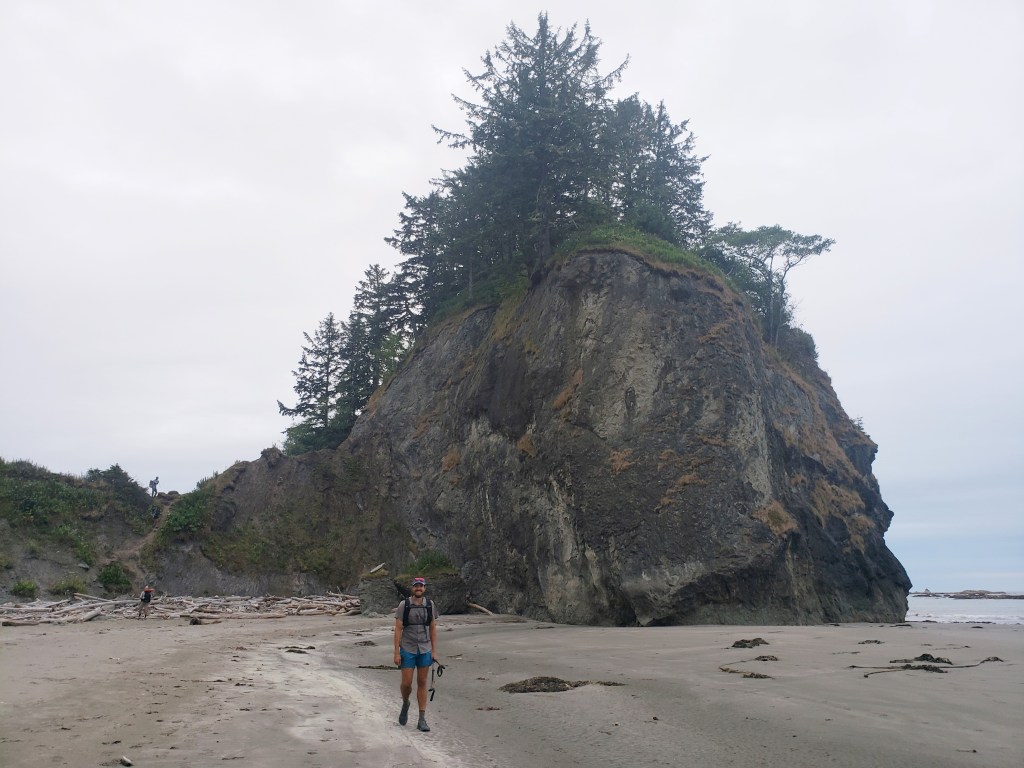
We weren’t surprised to see lots of people out on the beach near Hole-in-the-wall camp, a popular destination for weekenders and whale watchers on a Friday night. We continued on, trying to keep our final day as short as possible knowing there was rain in the forecast. We arrived at Norwegian Memorial Camp after some slow rocky miles and setup our final campsite of the journey. Rain started to fall just as we went to bed.


Day 54 – 15.3 Miles / mostly flat
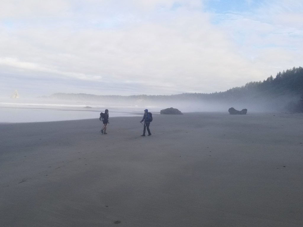
It was just past 4:00 am as we set out on our final 12 miles to Cape Alava, the western most point in Washington and the western terminus to the PNT. As anticipated the rain drizzled on us as we walked. Thankfully, the tide was low and wouldn’t interfere with our day. It was somewhat of a dreary morning, but thankfully wasn’t too chilly or windy. The rocky miles were slow, and we didn’t bother rock hopping. It was pointless to try to stay dry, so we just walked straight through the puddles. Most of us took more than one fall on the slippery rocks as we made our way. I was stoked to see intermittent stretches of sand ahead of us as the rocks were making my feet throb. At one point, I looked up to see what I thought was Gusha and Philly insanely far ahead. I looked again – it must be other hikers. Nope, that’s a bear on a morning beach walk. The crew got to witness the black bear enjoying his morning stroll without a care in the world for us.
As the morning hours ticked away, we took a final morning break as a group with just three miles to go. The walk seemed over in an instant, and we all grouped up to walk the final .1 to Cape Alava together. Not gonna lie, Cape Alava is really nothing special – another beach with a large rock. No monument or really anything denoting the Pacific Northwest Trail. Just a rock and six wet, haggard hikers rejoicing that the journey was over.
All the moisture prevented me from using my touchscreen too much, so I just have a few pictures. But I’ll never forget that moment of being done after battling intense heat, bushwhacks, long road walks, and extreme climbs. After a few pictures, we headed east towards the forest for our extra 3 bonus miles to the trailhead.
An hour later, we were officially done walking, another thruhike in the books. We found ourselves in the middle of absolutely nowhere with the gang. Thankfully, there was a little camp store with coffee and beer which we enjoyed while trying to hitch a ride. With very little traffic, it took about 2 hours to find a ride. We spent our last few minutes together appropriately on the side of the road as “The Six” before splitting up to go on with our lives. As we departed ways, I found myself in a state a shock to say goodbye to our four friends we had spent every minute of the last 54 days with. We literally knew every time each other pooped, what thinking, how feeling, and what doing. It was a terrible way to say goodbye, and I regretted not booking a hiker rehab Airbnb somewhere to spend a last night together.
It took Sean and I two hitches to get back to society at Port Angeles. We grabbed some food and made a sign for Olympia hoping for one ride to get us the 2+ hours drive to visit our friend before flying away back to our van. Within 10 minutes of hitching with the sign, we were super lucky that James and Cheri (I hope I’m remembering those names right!) thought we looked normal enough to pickup and offered us a ride all the way to Olympia. They had just returned from backpacking in the park and were overly nice. The trail provides!! We spent a couple nights in Olympia hosted by our friends Natalie and Josh before Natalie drove us to SeaTac way early in the morning cause she is a dope friend.
Now, let’s get back to that van we’ve been dreaming about…


Pacific Northwest Trail Sections 9 & 10 – Overall Experience
Wow, Olympic National Park is a backpacker’s dream. It truly has all the natural features you could want – endless mountain views, glaciated peaks, temperature rainforest flora and fauna, plentiful wildlife citings, sandy beaches, fun rope assisted climbs, and sweeping ocean vistas. Dealing with permits and designated camping puts limits on daily mileage, which isn’t too big of a deal, but isn’t the standard hike till you drop game plan that we’re used to abiding by. Nevertheless, we simply had a blast through these sections from busting our butts on the steep high mountain passes to timing our beach crossings with the tide. We got lucky with the ranger in Port Angeles who was incredibly knowledgeable and helped us plot out the days on the beach. Olympic National Park is clearly a trail highlight and finishing the PNT with a 60 mile coastal walk was the most unique finish to a trail possible.
PNT Cumulative Stats
- 54 Total Days
- 5 0-mile Days
- 1180.5 Miles
- 231,700 ft elevation gain
- Average Daily Movement (w/o 0-mile days)
- 24.1 Miles
- 4700 ft elevation gain
Click here for more stories from the PNT.

Pacific Northwest Trail Section 8 – Puget Sound

We’re out on a thruhike of the ~1200 mile Pacific Northwest Trail (PNT) westbound as part of a group of six lean, tan superheroes. Read our experience of “urban hiking” on the PNT in Section 8 around Puget Sound.

Day 40 – 32 Miles / +6800 ft elevation gain
For my 32nd birthday, my friends agreed to hike 32 miles by my side. We awoke at Pioneer Camp and started the day with birthday blowdowns leaving us with some fresh birthday blood. Woohoo! After a handful of slow miles and a creek ford, we ended up on logging roads and began what would become our longest stretch of road walking yet as we began hiking towards and eventually across Puget Sound. The day was pretty uneventful. Not necessarily the most exciting miles I’ve ever hiked, but easy gravel road walking is a good second choice. Ashlyn being the sweetest thing that she is packed me out dehydrated refried beans for dinner, a true trail delicacy. As our day came to an end, we got our first glimpse of the Sound and those feels of “damn we’ve walked a long way” started to set in. A lovely sunset and camping in close quarters put a lovely cap on our 32 for 32.
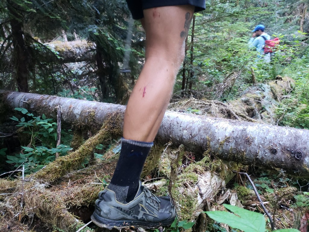
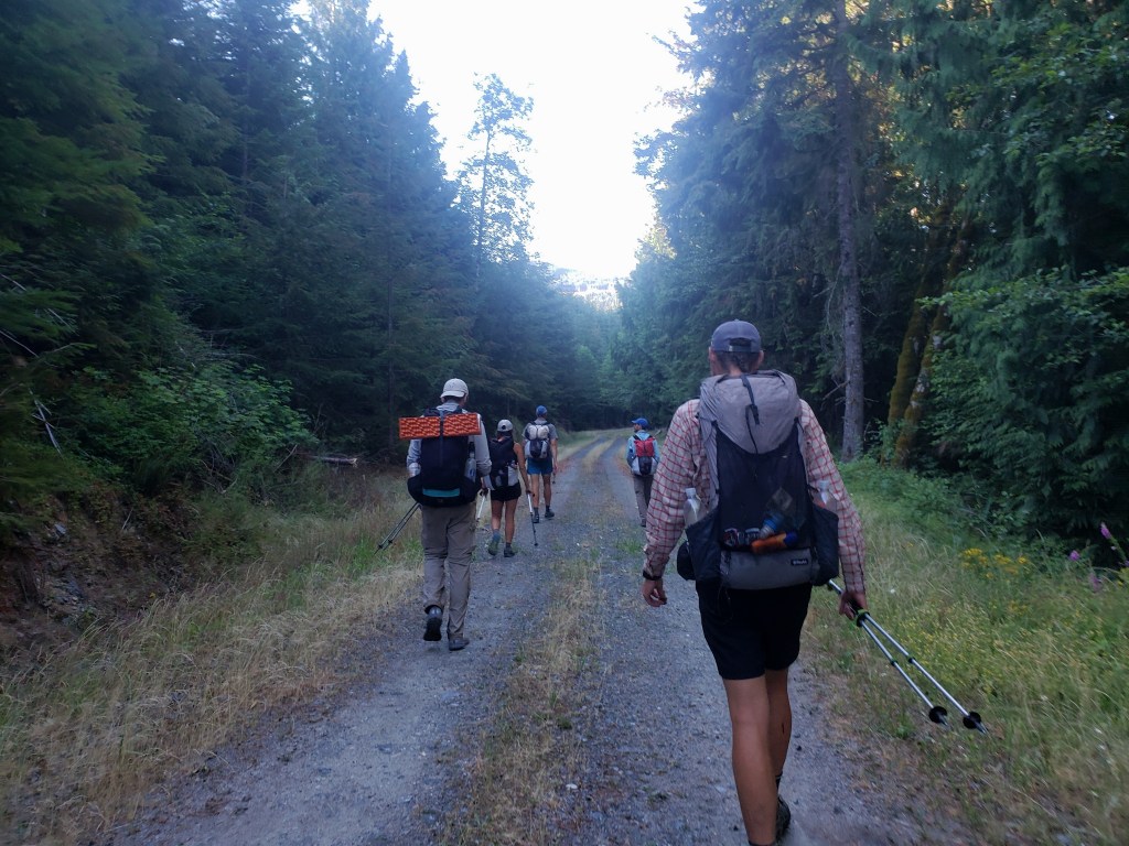
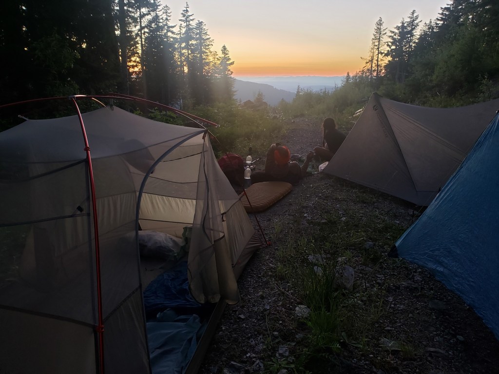
Day 41 – 25.9 Miles / +1300 ft elevation gain
We left camp knowing we’d be walking roads all day. The comments in the Guthook App indicated there was a lovely trail angel couple near the tiny town of Alger we would be walking through towards the end of the day. Nathaniel gave Mary a call, and she was quick to offer us camping in her yard on a lake. We made our plan to end our day at their house.
In the late morning, the logging roads ended, and our pavement walk began. Sean had mentioned the pain from his shin splints over the past few days, though he mostly suffered silently. It became quickly apparent that the pavement walk was only going to make this problem worse. Nevertheless, he pushed on in an impressive act of shear grit. Mid day, the route brought us to a small local bar where we enjoyed beers and fried food. From there, a few quick miles crossing the I-5 corridor brought us to Mary and Mark’s beautiful home on Lake Samish. Upon arrival, we were greeted with warmth and kindness and a tray of appetizers and cold beers. Mary had clearly gone out of her way to accommodate our vegan diet and spoiled us rotten. For dinner, she made us stir fried veggies with tofu and rice, then she made homemade cookies that were to die for. As we sat on their porch at sunset, we wondered what we had done to deserve such kindness. The treats were made even sweeter by the fact that Mary and Mark (and family!) were so genuine and down to earth. Our conversations were relaxed and easy – they felt like old friends. We went to bed with happy hearts and tummies.

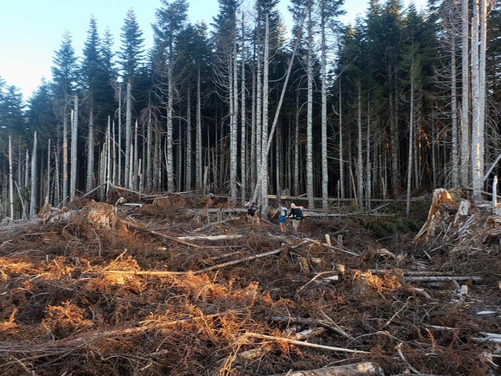
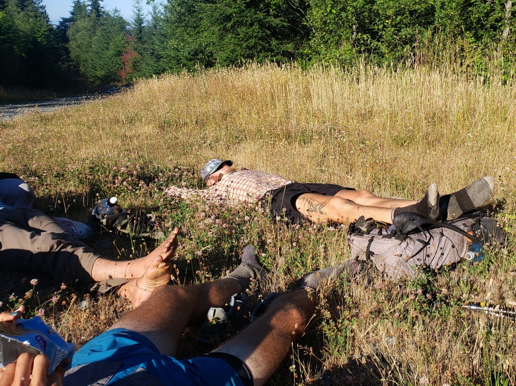
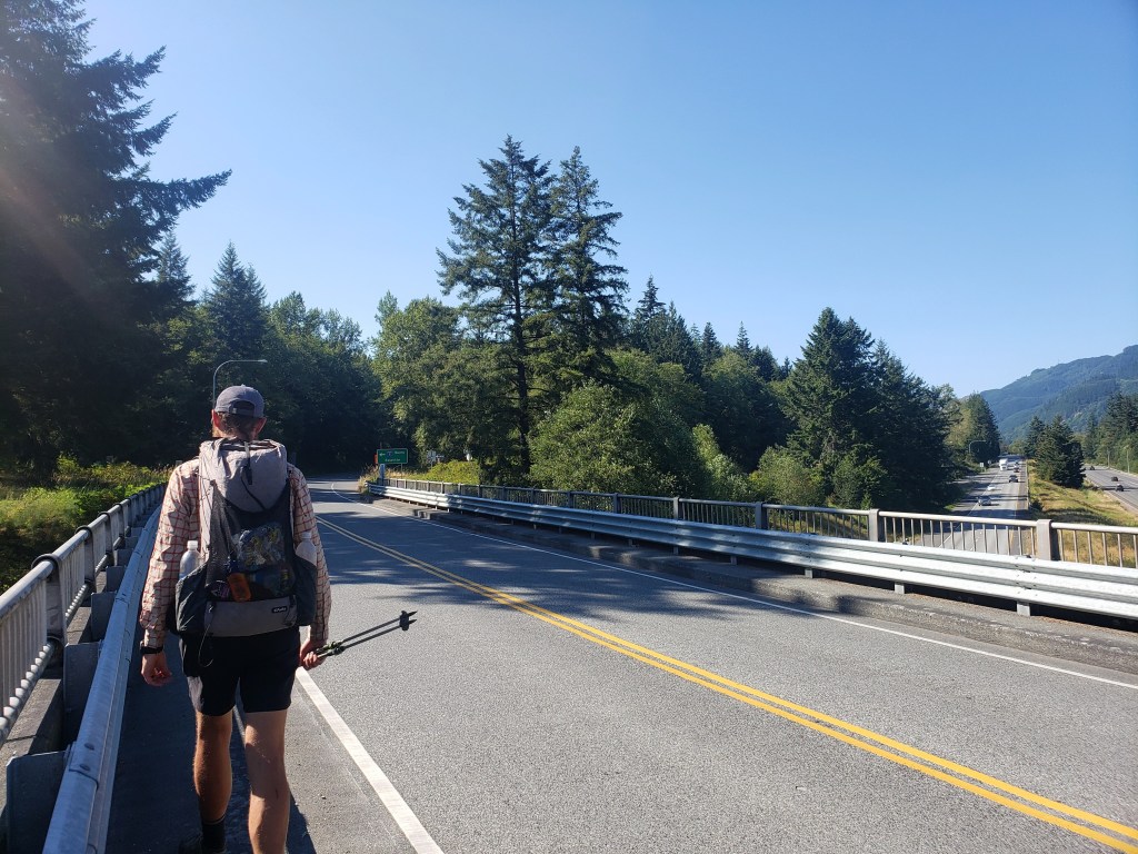


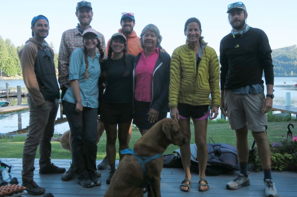
Day 42 – 23.4 Miles / +3100 ft elevation gain
We woke up early to Mary making us a bagels and avocado, vegan banana bread, lots of fresh fruit, and lattes (!!). So truly spoiled. We reluctantly started another day of road walking west and south. A few miles past her house, we did enjoy a short bit of single track through a beautiful forest. By lunch time, we were back to pounding pavement down a highway thankfully with a large shoulder. The Guthook guide again mentioned an epic trail angel named Marc who was more than happy to help out hikers. Marc seemed happy to hear from his first group of the season, and we arranged for him to pick us up down the route.
As we passed the tiny town of Edison, the local brewery was calling our name for a quick stop at the watering hole. Soon our walk continued, and I was grateful to have phone service to pass the time and a few miles chatting with friends. The route included a short stretch on a gravel nature path around an inlet which eventually led to Highway 20. Here, Marc had agreed to pick us up, and soon we were off.
Marc and his girlfriend Diane arrived at the meetup spot just on time and whisked us away a short drive to his house and “Marc’s Way Cool Barn.” The aptly named barn has been converted to a proper man cave with a full kitchen, couches, tv, and full bathroom. He showed us around and let us have the run of the place instructing us to help ourselves to anything we saw and get showered up before we got in the hot tub. Hot. Tub. He even got a call from a friend who dropped off some locally caught Dungeness crab which he eagerly shared with the 1 omnivore of the group (aka Beef Lips). Marc shared some fun stories with us about his motorcycle travel and legends of the Way Cool Barn. Our night ended with a dip in the hot tub at sunset once again in disbelief at our circumstances. As we were going to bed, we noticed yet another trail angel listed in our guide…


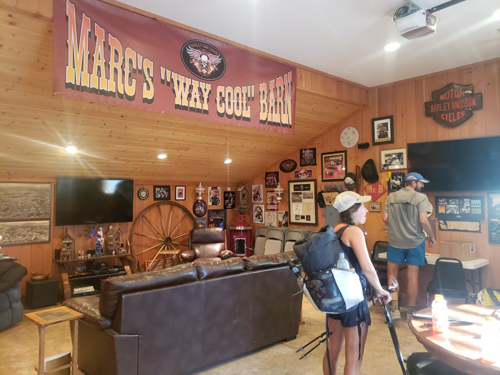
Day 43 – 23 Miles / +1000 ft elevation gain
Marc dropped us off right where we had left the route on busy Highway 20. As we exited the car, Sean noticed his hip belt buckle had broken, and the buckle needed replacing. The broken gear was nearly too much to handle on top of the shin splints. I did my best to pull us along as our friends took off ahead of us. It wasn’t our best morning, and the busy road walking didn’t help. I cranked the tunes loud and sang my heart out as cars whizzed by. We followed any road that would take us off the busy highway, but at times the highway walk was inevitable. North of Deception Pass State Park, the realization of how dangerous this walk was set in. We approached the park on a windy single lane highway with virtually no shoulder jumping into the ditch when oversized vehicles rushed by. As we rounded blind spot corners, I truly wondered whether this was with it.


Sean and I left the state park with our only goal being to make it to Oak Harbor to hopefully find a replacement buckle. Thankfully, the shoulder widened, and the walk felt considerably less risky as we watched and heard big fighter jets in training at the nearby Navy base. We got a call from the group indicating that trail angels Rebecca and John would be happy to host us for the night, and John would pick us up and return us to the spot we left off in the morning. I know we’d just been spoiled rotten by trail magic the last two nights, but this day – we needed it. We arrived in Oak Harbor with just a few minutes for me to thankfully find a replacement belt buckle kit, and for Sean to grab a couple MOD pizzas. Our group reunited in John’s truck as we headed to our third trail angel’s house in three days.
Rebecca and John, owners of the Happy House, are proud trail angels and were so happy to help us. They welcomed us into their home eagerly with dinner, drinks, and insight on the permits needed through Olympic National Park. We were stunned when Rebecca offered her sewing machine and our group pack guru Gusha (founder of Nashville Pack) quickly and expertly repaired Sean’s pack. Hallelujah. Our night ended for the second night in a row in a hot tub.
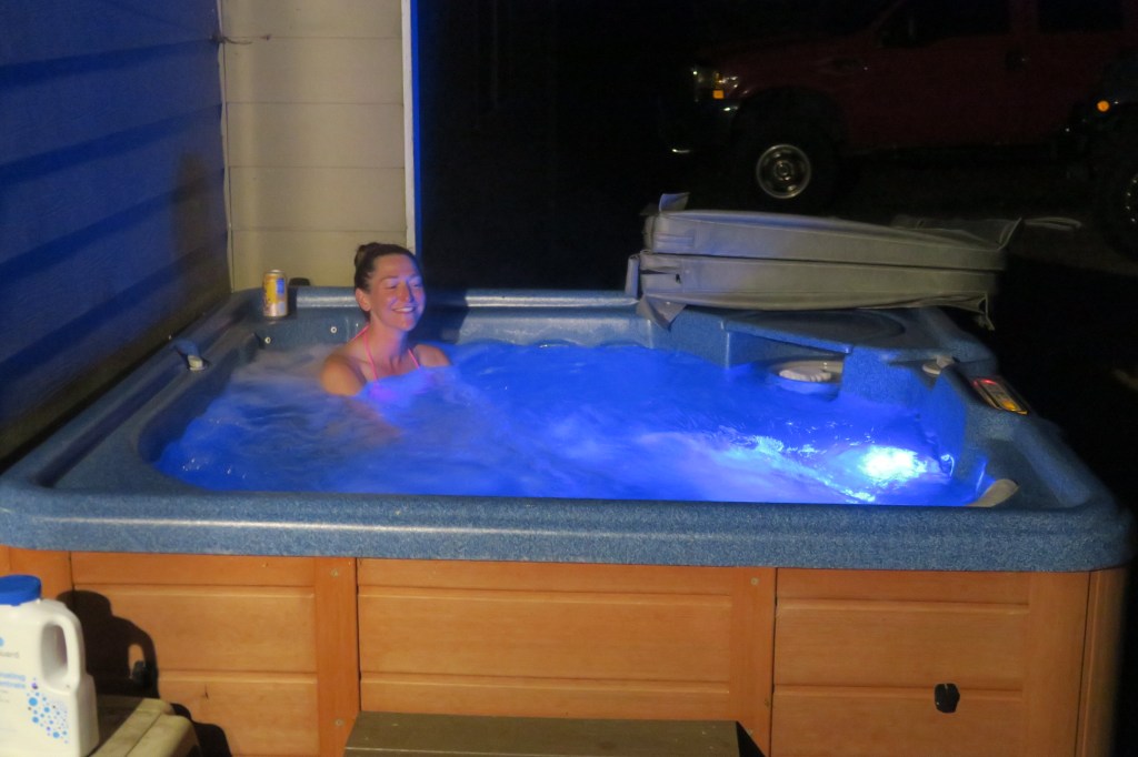
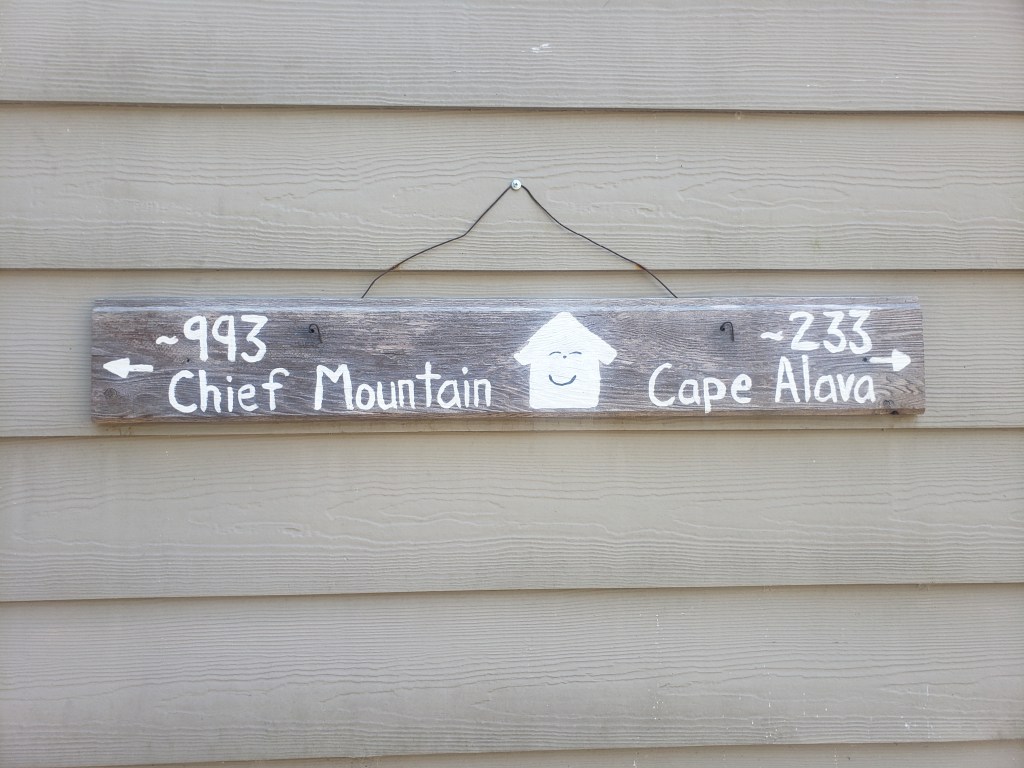
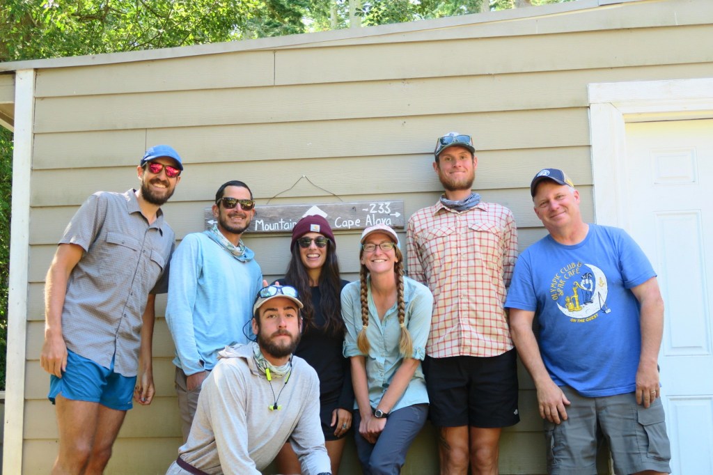
Day 44 – 16 Miles / mostly flat
After endless coffee, John bought us back to the places we had left the route, and we resumed road walking. We set ourselves up for an easy day aiming for the 6:15 ferry from Fort Casey to Port Townsend. After hours of road walking, we eventually arrived at the beach for a brief walk on the Sound as we headed towards the ferry. Our easiest westbound miles were upon us as we boarded the ferry and relaxed as we headed to Port Townsend on the Olympic Peninsula. The horizon line of the Olympics had been teasing us for days as we dreamed of our return to single track and hard pushes up big mountains.
Arriving in Port Townsend, Sean and I broke from the group to meet up with the bike-iest people we know, Sophie and Dan, for a quick catch up over dinner. We were sad our meeting was so brief as we walked away towards Lys and Dan’s house. Yep, our fourth night with a trail angel. This time, a couple of legends and bikepacking pioneers. They regularly host bike travelers via Warmshowers.org and occasional hikers like ourselves. They gave us run of the place upstairs while a few cyclists made themselves comfortable downstairs.


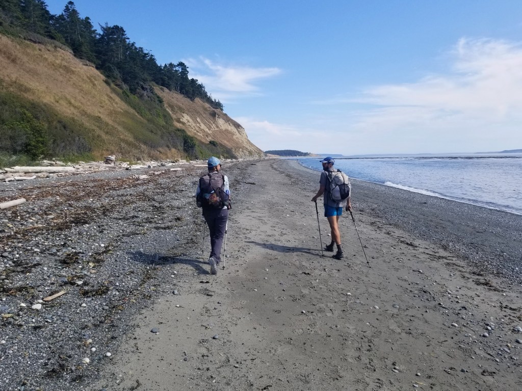


Day 45 – 24.2 Miles / +3100 ft elevation gain
Coffee and conversation with Dan made for a delightful morning as we were enthralled by his stories of bike touring Alaska to Argentina in the 70s over the course of three years. Eventually, we reluctantly resumed hiking knowing we had just one big day of road walking left.

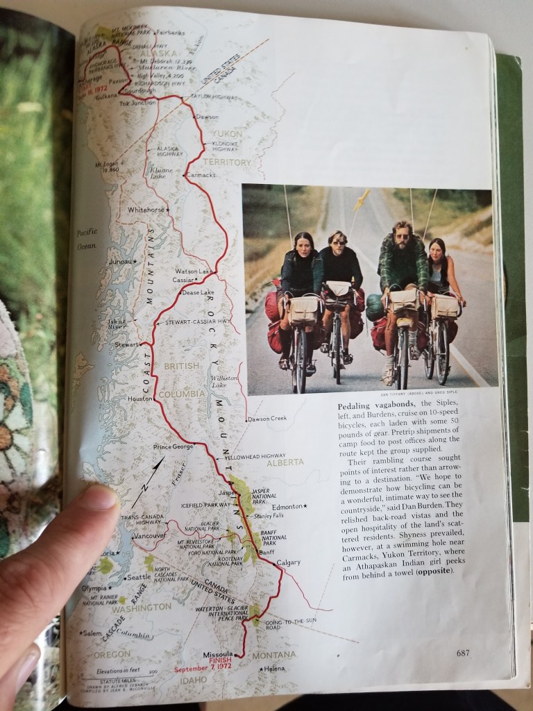
The first part of our day was on a series of gravel recreational trails, but eventually we were forced back into Highway 20. Once again, we walked towards oncoming traffic on little to no shoulder while cars streamed by. Occasionally, we moved into the ditch as semis rushed passed. At one point, a very kind and concerned woman pulled over and insisted we hop in the back of her truck. We refused, foolishly, and walked on. After six anxious miles, we reached the intersection of highways 20 and 101 safely, grabbed some soda from a local restaurant, and ambled on down a side road which soon turned to gravel. We rejoiced knowing the huge “urban hiking” section of the PNT was behind us with the Olympics in all their glory ahead. Of course, in true PNT fashion, the series of dirt roads ahead of us required a bit of bush whacking through stinging nettles. Despite the struggle, it felt right sleeping on the side of a forest service road.


Pacific Northwest Trail Section 8 – Overall Experience
Wow, well let’s start with the walking. It just wasn’t that awesome. This section was almost all road walking as we made our way west and south heading to Fort Casey to catch the ferry across Puget Sound to the Olympic Peninsula. Road walking on pavement is especially hard on the feet and joints, not to mention dangerous and dull. It took a lot of will to not hitch through this section as we were informed that many (probably most) do. Suffering through an injury during this section was especially rough for Sean, and I admire his grit and commitment to the grind. We are pretty stoked to have this section behind us and head into the mountains where we belong.
The obvious silver lining of the urban hike was our great fortune with complete strangers who hosted us 4 nights in a row. We remain astounded by their generosity and kindness which included meals, showers, laundry, multiple hot tubs, help repairing gear, rides, and great conversation. Without their blessings, I truly don’t know if we would have walked this entire section. Thank you from the bottom of our hearts for your kindness!!
PNT Cumulative Stats
- 45 Total Days
- 5 0-mile Days
- 973.6 Miles
- 187,600 ft elevation gain
- Average Daily Movement (w/o 0-mile days)
- 24.3 Miles
- 4700 ft elevation gain
Click here for more stories from the PNT.
We’re thruhiking the Pacific Northwest Trail westbound from Glacier National Park to the Washington coast with a group of hardcore hiker friends. Follow along here, on Instagram, or Facebook.
Pacific Northwest Trail Section 7 – The North Cascades

We’re out on a thruhike of the 1200 mile Pacific Northwest Trail (PNT) westbound as part of a group of six lean, tan superheroes. Read our experience getting our collective butts kicked on the rugged and challenging PNT in Section 7 through the North Cascades.

Day 33 – 19 Miles / +5600 ft elevation gain
After an incredible night’s sleep nestled in the pine trees, we resumed our walk around Ross Lake heading towards the resort to pick up our resupply box. The trail wound through moss covered forest giving us occasional glimpses of the lake. I took a moment to slow down and enjoy some of the easiest miles we’d seen on the PNT. Eventually, we came to a gravel road and walked across Ross Dam. Soon after, we arrived at Ross Lake Resort, one of the only floating resorts in the United States. We eagerly grabbed our resupply boxes and sorted out what we would hike with to get us to Concrete and what we were able to eat right then. The incredibly kind staff let us spend the afternoon loitering on the docks, taking in the views, and even spoiled us with some trail magic treats.
After nearly 8 hours of casual lounging by the lake, we packed up our bags and continued west about 10 miles for a relatively easy day. The entire stretch of trail was through old growth forest with little elevation change. As the soft evening light poured through the towering trees, we found our campsite just outside of the boundary to North Cascades National Park.


Day 34 – 29.7 Miles – +10900 ft elevation gain
With an early start, we resumed our walk through old growth forest decorated with ferns and dripping with moss. It wasn’t too long into our day that the major climbs began. We were thankful that the trail was well made and only a few big blow downs got in our way. Still, the grade of the climb took our breath away in every sense of the phrase. I craned my neck at the seemingly impossible switchbacks in front of me while I sweated my way to the top. Just after noon, we arrived at the top of Whatcom Pass to reap the reward of all of the hard work.
Endless views of mountain ridges surrounded us, but the real star of the show was the Challenger Glacier. We took a long lunch feeling little in the presence of the massive hanging glacier. As hard as it was to pull ourselves away, we knew we still had work to do. We began a big descent down the other side of Whatcom Pass and continued down the PNT. In the late afternoon, we got the fun treat of getting pulled across the river in a cable car. Our final challenge of the day was another big climb up Hannegan Pass, again impossibly steep, which left our shirts drenched in sweat as we finally arrived to camp completely wiped from 10,000 feet of climbing throughout the day. Just before camp, we exited the official boundary to North Cascades NP.
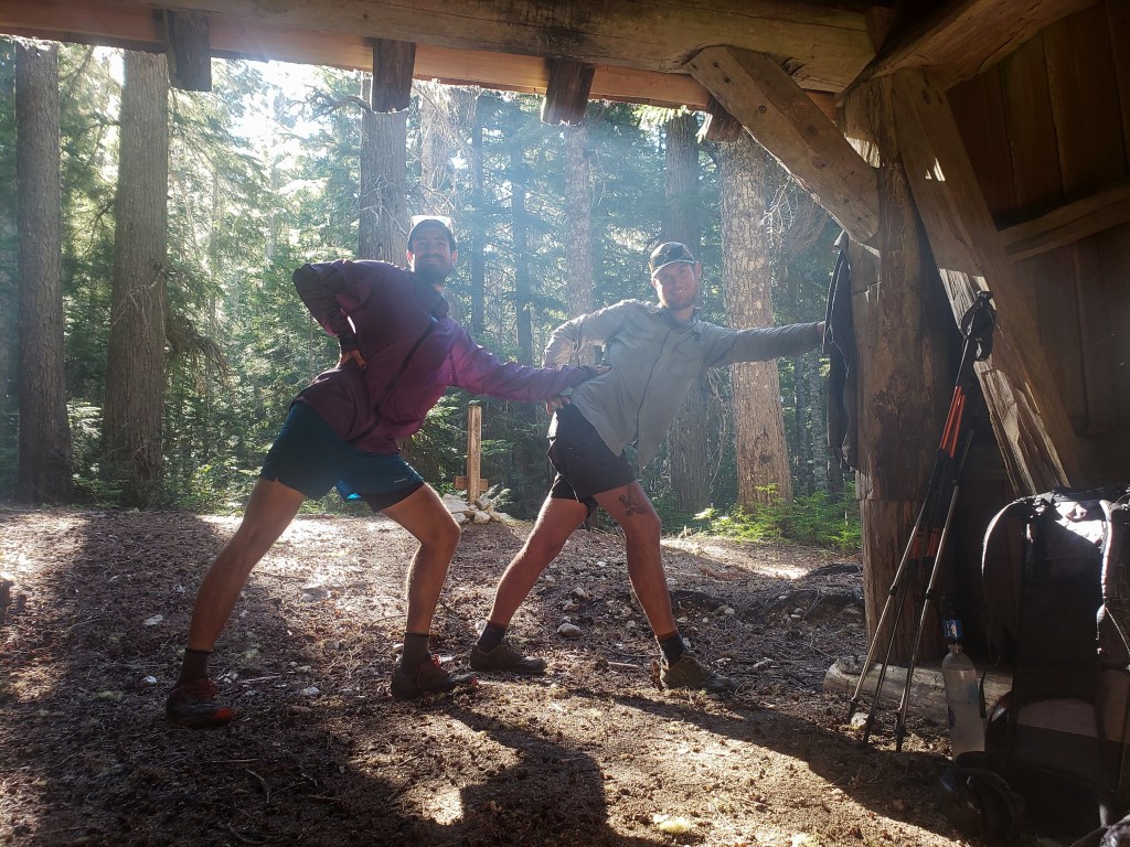
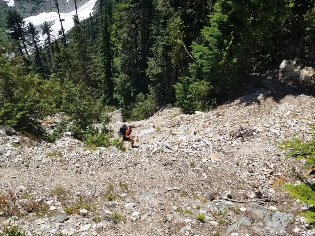


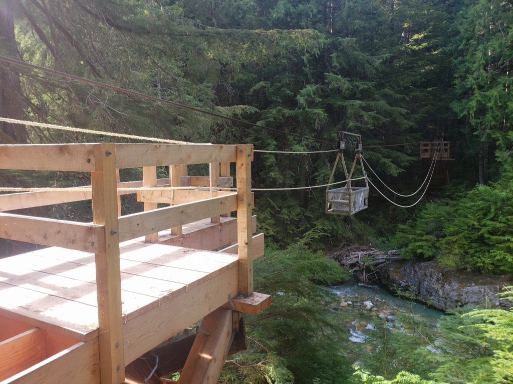


Day 35 – 28.5 Miles – +6000 ft elevation gain
Our morning began with a beautiful descent down Hannegan Pass which eventually ended at a trailhead on a dirt road. After a considerable stretch of single track, we weren’t surprised to resume road walking. We spent a couple hours on dirt before exiting onto pavement as we walked the shoulder up Mount Shuksan towards the Mount Baker Ski Area. We plugged in our tunes and did our best to ignore the endless traffic rushing by on the windy road. Just after noon, we arrived at the ski area and enjoyed views from the base.
We reluctantly resumed walking a couple hours later and were grateful to walk down a trail towards Swift Creek. The views of Mount Shuksan and Mount Baker couldn’t be beat, but the overgrown trail underfoot led to slow miles and more tripping than I’d like to admit. We were thrilled to reach the creek and escape the overgrown trail and the insane amount of biting flies that had been keeping us company. We expected to have to ford the creek, so it was a wonderful surprise when we found a large log bridge and kept our feet dry. The PNT exited the Mount Baker Wilderness Area onto decommissioned forest service roads which put us just a few minutes from Mount Baker Hot Springs. It was an easy decision to end the evening with a quick soak before camp.
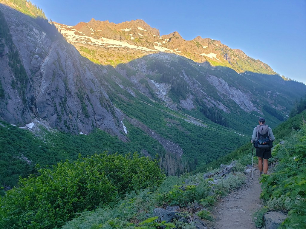


Day 36 – 9 Miles – 0 ft elevation gain
We set ourselves up for an easy 9 mile day road walking forest service roads near Baker Lake. It had been a week since our last shower and town day, and we all looked (and smelled) a little worse for wear. Around 9:00, we made it to our road crossing where we could hitch to nearby Concrete. In 2 hitches, we all arrived in town. Food was scarfed down immediately, but there was no lodging available. Despite wanting to stay close to trail, we decided to head to Mount Vernon on the I-5 corridor. We managed to find a ride for all 6 of us fairly quickly to get us 45 minutes away with a sweet Christian couple traveling in their converted bus. After our thank yous and a brief prayer, we parted ways eager to revel in 2 glorious zero mile days
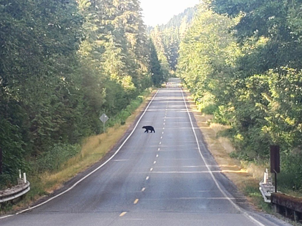
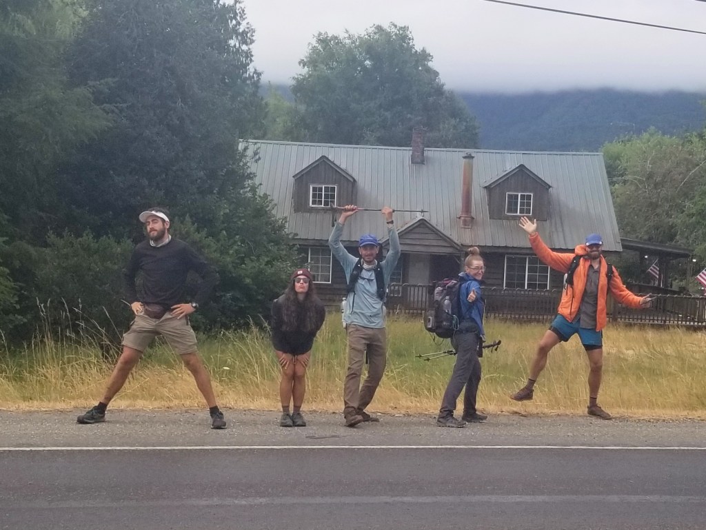

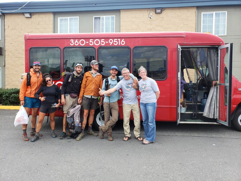
Day 37 – 38 – 0 miles
After 250 miles from Oroville, we were desperate to take a real break from the trail. We spent 2 wonderful 0-mile days resting, eating, and doing our best to replace or repair broken gear items. We were thrilled to have our longest stretch between towns behind us as we prepared to set out on the final third of the journey.

Day 39 – 20.4 Miles / +6800 ft elevation gain
Through a series of bus connections and a hitch, we made our way back to trail right where we had left off. Our first nine miles was gradually up forest service roads until we suddenly hit a trailhead swarmed with cars and people. From here, mountaineers can reach the route to summit Mount Baker, a popular weekend trip. We continued climbing towards Bell Pass taking in incredible views of the towering volcano. Past Bell Pass, the crowds thinned to pretty much just us as we continued on the PNT. We ended our relatively easy 20 mile day at Pioneer Camp. This isn’t the official end of Section 7, but I feel like it should be as we left the North Cascades and beautiful Mount Baker behind us.
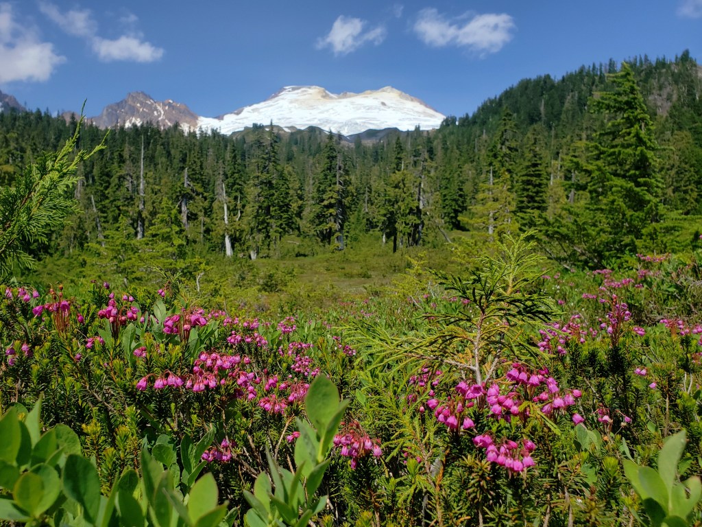

Pacific Northwest Trail Section 7 – Overall Experience
Section 7 began when we left the Pasayten Wilderness Area and headed directly into the Ross Lake National Recreation Area followed by North Cascades National Park. This is easily one of the best parts of the PNT featuring out of this world views of endless ridgelines, massive glaciers, craggy peaks, old growth forest, and an array of colorful wildflowers. Truly, a hiker’s dream come true. The price of all this beauty? Insane amounts of climbing each day and a heavy pack loaded with food to get you through the wilderness which turned out to be a pretty fair trade.
The trail 15 miles in either direction around Ross Lake couldn’t have been nicer as we wound through old growth forest in awe of the giants that surrounded us. At Ross Lake Resort, we were treated to trail magic and graciously given a spot to lounge in with a spectacular view. Entering North Cascades National Park was where the hard work resumed, but the pay off made it all worth it. Outside of the park boundary, we returned to road walking in exchange for lounging at the ski area with big views of Mount Shuksan and Mount Baker. We even got a dip in some hot springs during this section. Overall – much work, much reward.
PNT Cumulative Stats
- 39 Total Days
- 5 0-mile Days
- 829.1 Miles
- 172,300 ft elevation gain
- Average Daily Movement (w/o 0-mile days)
- 24.4 Miles
- 5000 ft elevation gain
Click here for more stories from the PNT.
We’re hiking the 1200 mile Pacific Northwest Trail westbound from Glacier National Park to the Washington coast with a group of hardcore hiker friends. Follow along here, on Instagram, or Facebook.
Pacific Northwest Trail Section 6 – The Pasayten Wilderness

We’re out on a thruhike of the 1200 mile Pacific Northwest Trail (PNT) westbound as part of a group of six lean, tan superheroes. Read our experience getting our collective butts kicked on the rugged and challenging PNT in Section 6 through the Pasayten Wilderness Area.

Day 29 – 31.1 Miles / +8800 ft elevation gain
Our day began 24 miles west of Oroville as we continued our long stretch of road walking. Our packs were loaded with 4.5 days of food as we began a long day of climbing. Our first 13 miles included over 6000 ft of elevation gain and was mostly done on dirt forest service roads. Sweat poured as the sun beamed down on us. At Cold Springs trailhead, we officially ended Section 5 and started Section 6. We were thrilled to enter the forest on a winding dirt path after hundreds of miles of mostly road walking. Another big vertical push brought us hiking past a PNT trail crew who we were able to say our thank yous to. Shortly after seeing them, we entered the Pasayten Wilderness area, one of the country’s largest wilderness areas spanning over 500,000 acres. Despite our heavy packs and long day of climbing, we were elated to feel like we were back in the mountains.
After an eternity of climbing, it seemed like the dry high desert of Eastern Washington was a world away, and we were surrounded by craggy peaks across open meadows filled with countless colorful wildflowers. We frolicked our way through sunset arriving at a campsite in the pine trees just as it was getting too dark to see.


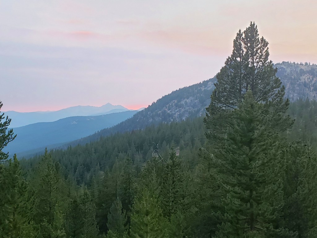
Day 30 – 31.6 Miles / 7000 ft elevation gain
We had a stunning start to the day walking among tall trees in the quiet and stillness only mornings can bring. The miles and hours ticked by as we wound our way around Cathedral Peak, an aptly named impressive mountain with thousands of feet of exposed vertical rock wall. We took a serene break at Cathedral Pass to take it all in.
As noon approached, we headed down from the pass eventually leaving intact forest and entering a burn area where we spent the majority of the rest of our day. Just before sunset, we walked on a grassy bald with incredible views of the surrounding peaks. To the south, smoke filled the air as a forest fire was currently ablaze. We stopped to camp unable to leave the view which led to an awkward night of sleeping on the side of hill.

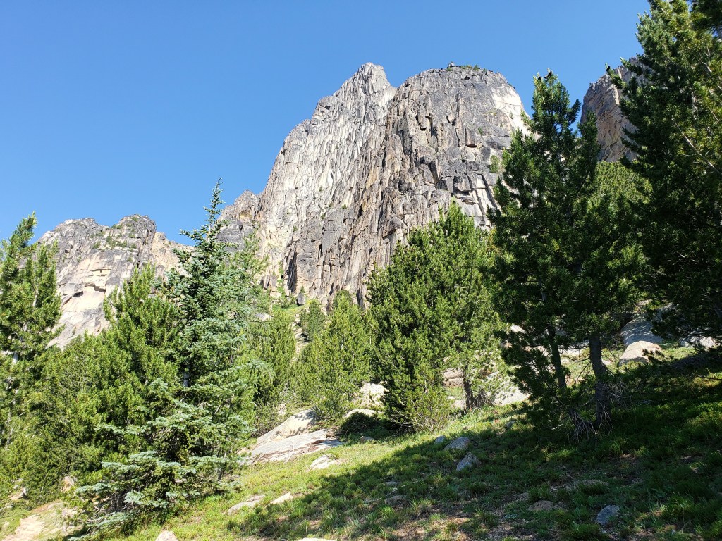


Day 31 – 29.1 Miles / +6000 ft elevation gain
After a sleepless night, we resumed walking through a burn area in cool temps. Since the heatwave and low elevations of Eastern Washington, we had forgotten what it was like to feel chilly. We didn’t make it too far before we started battling blow downs. The pace slowed significantly as the blow down shuffle began. We lunged, heaved, crawled – “dodged, ducked, dipped, dived, and dodged.” This went on all morning until about 2 in the afternoon when the blow downs finally decreased, and we joyfully reentered intact forest. As evening approached, we intersected with the world’s nicest made and well kept trail for the next 10 miles as it coincided with the PNT. We all had a moment of reflection as we walked down the Pacific Crest Trail which everyone in the group has traversed from Mexico to Canada. We were in awe of the incredible views, the memories, the impossible lack of obstacles, and wide rock swept single track. We ended our day at a PCT campsite with a handful of aspiring thruhikers just begining their southbound journey to Mexico.


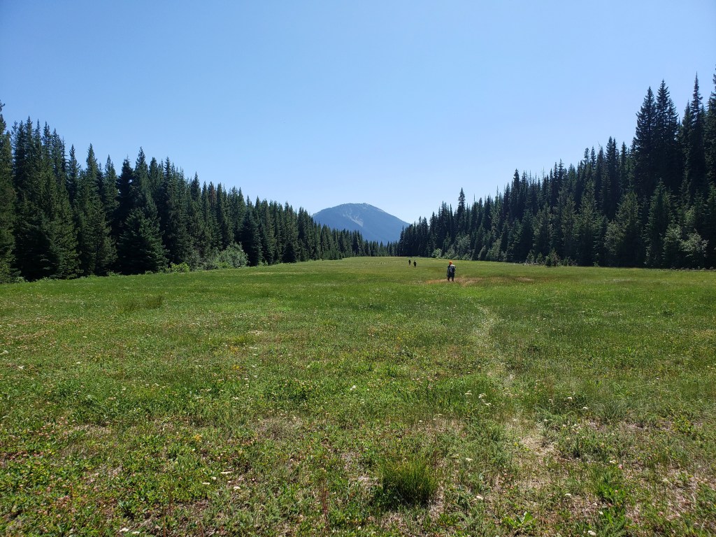


Day 32 – 30.9 Miles / +7500 ft elevation gain
Our short stretch on the PCT was over before we knew it and we, of course, immediately started hopping blow downs. The morning provided the Pacific Northwest mood we had been seeking. Fog draped the towering pine trees and clung to the mountains providing intermittent views as the wind whipped around the surrounding peaks. Around noon we reached the top of Devil’s Dome. Most of the fog had lifted exposing endless ridgelines and views of hanging glaciers on Jack Mountain. After lunch, we descended the mountain into forest leaving the views from the ridge and the Pasayten Wilderness behind and beginning a seemingly endless series of switchbacks down to Ross Lake. We knew we were in for an easy end to the day when we entered Ross Lake National Recreation Area, marking the end of Section 6, as the PNT hugged the lake shore for about 23 miles. We left about 9 easy miles for us to walk in the morning to Ross Lake Resort.

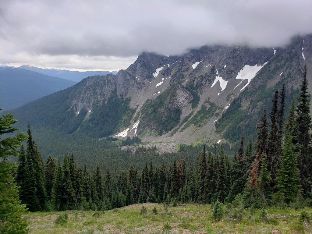


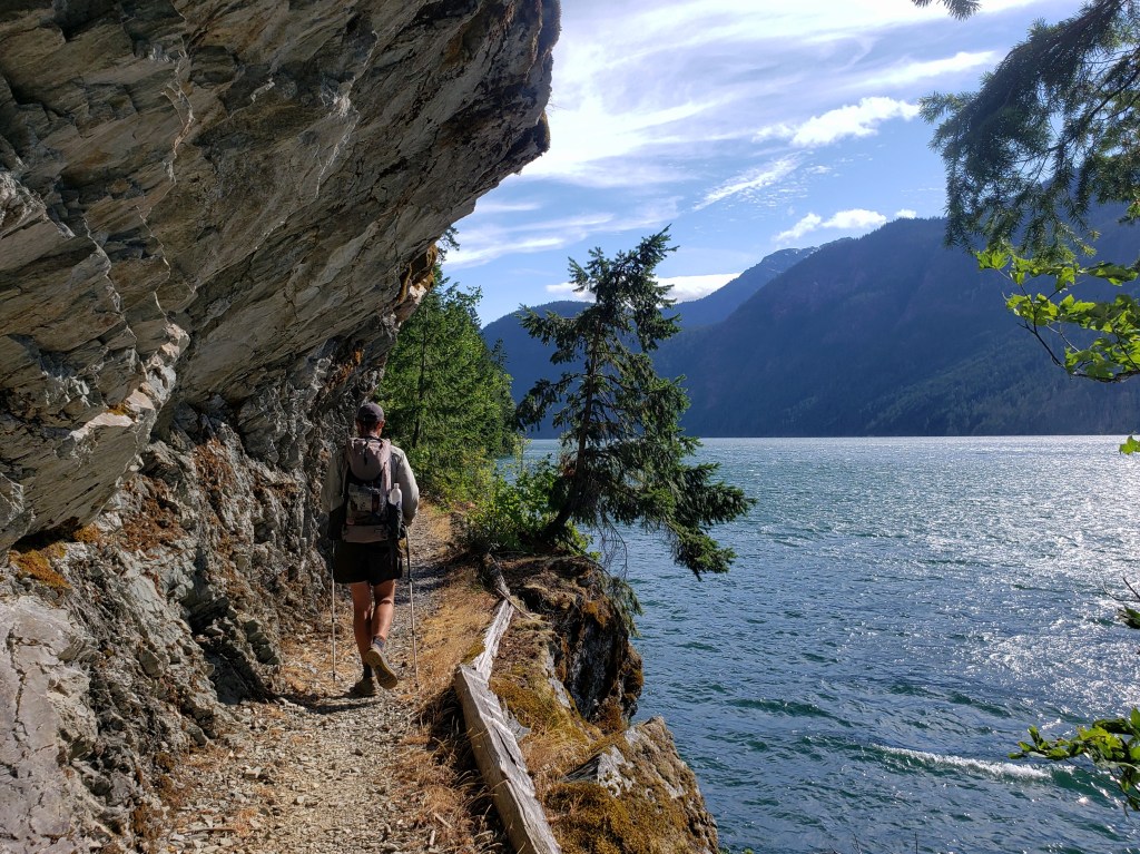


Pacific Northwest Trail Section 6 – Overall Experience
After a couple hundred miles of mostly walking on roads, we were elated to walk a trail into a wilderness area. The Pasayten was definitely a trail highlight with incredible views of the North Cascades, millions of vibrant wildflowers, sparkling alpine lakes, and hanging glaciers. The only real downside was that maybe 30-40% of the stretch was done through a burn area. The burn did provide views of the surrounding mountains that wouldn’t have been seen otherwise, but it also contained hundreds (thousands?) of blow downs to climb over and set an eerie mood. With each gust of wind, the trees swayed precariously, and we all heard crashes in the distance. As was no surprise, the biting flies and mosquitoes were thick through the wilderness area in mid-July.
PNT Cumulative Stats
- 32 total days
- 3 0-mile days
- 722.5 total miles
- +143,000 ft total elevation gain
- Average Daily Movement (w/o 0 mile days)
- 24.9 miles
- +4900 ft elevation gain
More from the PNT
- Section 1: Glacier National Park to Eureka, MT
- Section 2: Eureka, MT to Bonners Ferry, ID
- Section 3: Bonners Ferry, ID to Northport, WA
- Sections 4 & 5: Northport, WA to Cold Springs, WA
We’re hiking the 1200 mile Pacific Northwest Trail westbound from Glacier National Park to the Washington coast with a group of hardcore hiker friends. Follow along here, on Instagram, or Facebook.
