
Done with the Desert

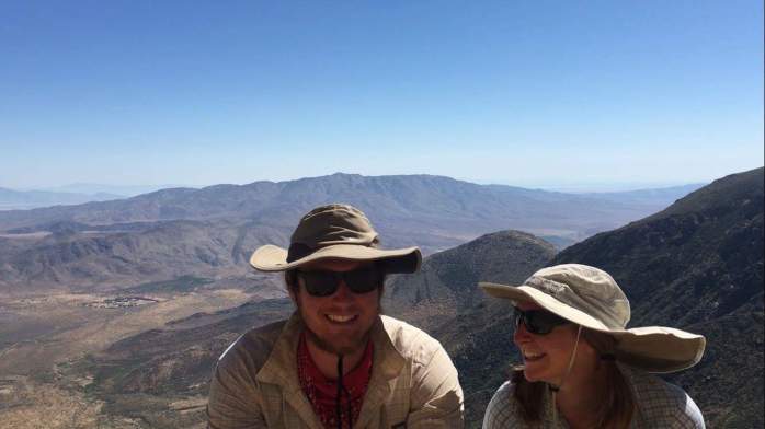
After traveling from Seattle to Los Angeles via plane, Los Angeles to Bakersfield via rental car, and, finally, Bakersfield to Tehachapi via bus, the last leg of the trip brought us from Tehachapi to the PCT trail crossing at Highway 58 with a lift from a local trail angel. We were once again standing among hundreds of windmills in the Mojave desert precisely where we had stood nearly 4 months earlier. We took off around 6:30 pm wanting to walk into the night to avoid the hot sun.

The sun set nearly an hour later, and we were quickly reminded that we’re not that into night hiking. We managed to walk about 8 miles before we made camp and quickly fell asleep. I awoke in the morning almost expecting the desert landscapes that surrounded me to melt away. But, they were real. We were really back in the hot, dry desert that couldn’t have be more different than the North Cascades that surrounded us just a few days before. Our next few days felt like we were hiking in a dream or a memory. Little occupied my mind. I walked on trying to entertain myself, pushing away thoughts of the clock and miles.

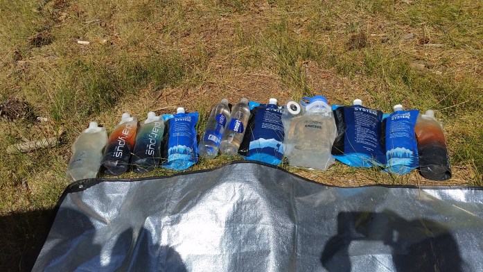
The 136 miles between Highway 58 and Kennedy Meadows are the driest of the entire PCT. Lucky us!! We broke down our hiking segments as distances between water sources:
Highway 58 – Golden Oaks Spring 17 Miles
Golden Oaks Spring – Robin Bird Spring 18 Miles
Robin Bird Spring – Landers Meadow Spring 6 Miles
Landers Meadow Spring – Walker Pass 43 Miles (!!)
Walker Pass – Chimney Creek Camp 29 Miles
Chimney Creek Camp – Kennedy Meadows 19 Miles
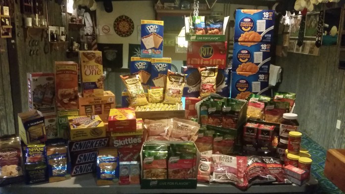
The PCT water report indicated that these sources *should be* reliable, and even though some were down to a drip, all came through for us. During hiker season, it is likely that there were water caches between the larger dry gaps, but particularly at this time of year, it was unwise to count on any caches being active. Between sources, we carried 1 liter per every 5 miles anticipated walking and decided to make no-cook dinners.

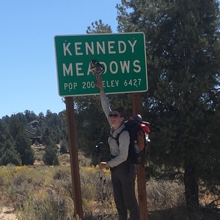
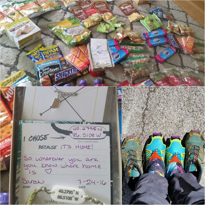
After 6 very long, dry, and windy days, we arrived at Kennedy Meadows, the gateway to the High Sierra. For thru-hikers, reaching KM is a momentous occasion where you celebrate completing the desert and potentially receive a gear change to prepare you for the highest altitudes on the trail. This time of year meant that KM was empty of the 50+ hikers that come through every day during May and June. In fact, we had the whole place basically to ourselves. We spent several hours eating food, cleaning up, and resupplying at the general store before we took off once more.
Wowed by Washington

We were far too comfortable in our hotel room at Snoqualmie Pass to check out. We had completed nearly 250 miles in the 11 days we had been in Washington and had another 250 to complete to touch the Canadian border. Although we were doing our best to make good time, the lure of the hotel room proved too strong. We flipped a coin and tails won – zero day it is!
And after lots of food, beers, and hours of tv, the zero day was over before we knew it. At about noon the following day, we were back to it. Initially it’s always difficult to pull yourself away from the comforts of town, but as soon as we were back on a ridge line with incredible views, we felt like we were exactly where we belonged.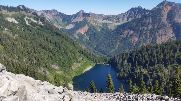

We had three days of food with us that would get us to the tiny town of Skykomish where a mail drop awaited. We kept our average around 25 miles / day climbing up and down mountains, passing waterfalls, and eating handfuls of ripe huckleberries.

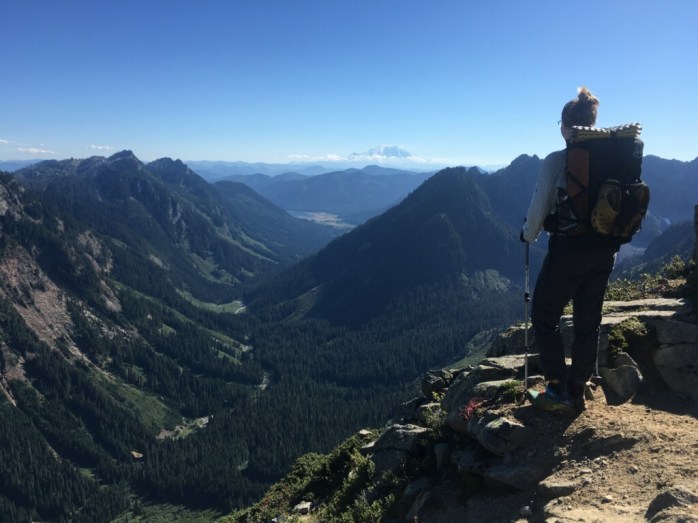
Mt. Rainier continued to shrink behind us as we moved north and another prominent mountain came into view. We stared in awe of the giant peak when, suddenly, the sound of falling rocks filled the air. Seemingly out of nowhere, football sized rocks came tumbling down the mountain above us, bounced on the trail just feet in front of Sean, and continued down the mountain. Thankfully, it was only a half dozen rocks, but it left us a little shocked. We continued walking with “what ifs” floating inside our heads.
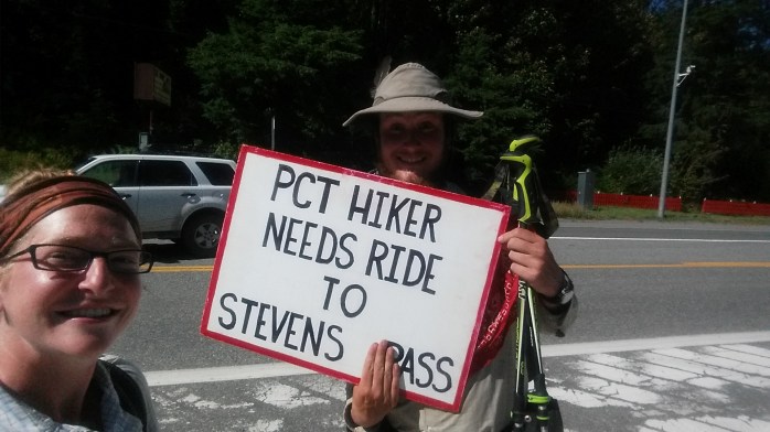
On a Thursday morning, we arrived at Steven’s Pass and walked straight through the ski resort. We came to Highway 2 and stuck out our thumbs to get a ride to nearby Skykomish. A family quickly picked us up and drove us into town where breakfast awaited.
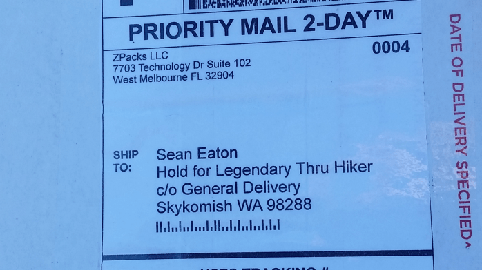
After eating, we walked to the post office to retrieve our packages. This mail drop would get us to our final stop in Mazama just 60 miles from the Canadian border. Also awaiting us at the post office were two tent pole segments for our Big Agnes Copper Spur to replace our cracked ones as well as a brand new pack from ZPacks. Sean’s Arc Blast frame wasn’t exactly arcing anymore, and ZPacks immediately offered to send a replacement pack. Thank you Big Agnes and ZPacks for the amazing customer service!!

After about 6 hours of binging on food and the internet, we headed back to Steven’s Pass and continued north on the PCT. We noticed some haze on the horizon, but thankfully, there was no news of nearby wildfires. Last year, many thru-hikers were unable to hike a majority of Washington due to fires. So far, we were in the clear and very grateful.
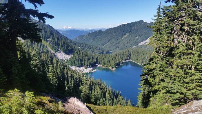
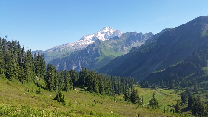
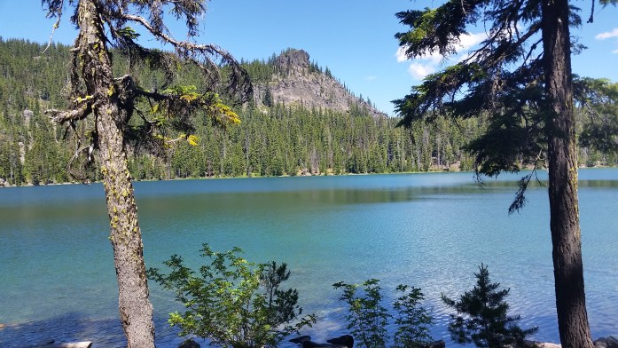
As we walked, the prominent mountain we had been noticing grew larger and larger. We finally learned the mountain’s name as we entered Glacier Peak Wilderness on a beautiful Saturday morning. Towering above 10,000 ft, Glacier Peak is the most remote of the 5 Washington volcanoes and also has more active glaciers than any other place in the lower 48. The PCT traverses 60 beautiful miles through the wilderness area boasting stunning views of the mountain and the countless craggy peaks that surround it. We ended our Saturday at Mica Lake, a crystal clear glacial lake and our favorite campsite yet, and awoke to a breathtaking sunrise the next morning.


By late Tuesday afternoon, we had completed the stretch through Glacier Peak Wilderness, entered North Cascades National Park, and arrived at Rainy Pass on Highway 20. Within a half hour, we were picked up by a couple of young travelers much like ourselves and headed into nearby Mazama to get our resupply package for our final stretch in Washington.

We indulged on food and beers from the general store in the tiny town and decided to check out the nearby hiker haven hosted by Ravensong, the first female to ever thruhike the PCT. Unfortunately, she wasn’t there that evening, but another host was, and the bunk house was still open.
We returned to Rainy Pass the following morning and were now only 60 trail miles from the U.S. / Canadian border. Since we decided not to go into Manning Park in Canada, we had an additional 30 miles to hike southbound after reaching the monument to return to Hart’s Pass Campground. Here, we would hope to catch a ride back to society.
From Rainy Pass, we hiked nearly 25 miles despite our late morning start. Our day ended climbing switchback after switchback into the sunset, and we slept happily on top of a mountain.
We came and went from Hart’s Pass the following morning knowing the next 30 miles would be walked both northbound and southbound. In some ways, I lamented that this wasn’t the end of our journey. Truly, Washington was a symphony and here we were in the grand finale marching towards the finish line. I continued to remind myself that this wasn’t, however, our finish line – that in about a week we would be standing in Southern California on Highway 58 between Tehachapi and Mojave. That we had 140 miles of bone dry desert from there until Kennedy Meadows. And from KM, an additional 450 miles through the High Sierra in King’s Canyon, Sequoia, and Yosemite National Parks, around Lake Tahoe, and finally back to I-80. As I walked through the North Cascades, it was truly equal parts dread for the desert and excitement for everything else. I wanted to be done, yet I yearned for the Sierra. Those 590 miles had been hanging over my head since the day we decided to skip them. And they most certainly would not go undone.
I walked on taking in the surrounding landscape, appreciating the shade from the tall trees I knew weren’t going to exist in the desert section that awaited me. I sang praises for the incredible weather we had been blessed with for the entire 500 mile stretch in Washington, something I knew we wouldn’t have experienced in a straight northbound hike. I reminisced on our virtually private tour of the PCT as we were consistently ahead of the hiker “bubble.” I remembered how short the section of snow was outside of Truckee. And though we still had nearly 600 miles ahead when we finally reached the border, I couldn’t help but smile and give thanks for this incredible journey.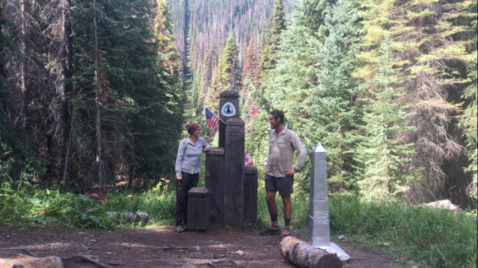

We spent about an hour at the monument taking photos and eating snacks, and for the first time on the PCT, we walked southbound for the 30 miles back to Hart’s Pass. That night, we camped at a site leaving 16 miles for the following day. Our overly used Pocket Rocket stove had been working very slowly due to corrosion, so I asked another hiker if we could borrow theirs to cook. They were happy to help us out. After returning their stove, another man approached, told us he was finishing the Washington section tomorrow, and gave us his barely used Snow Peak stove. We were stunned. Thanks for the trail magic, sir, and congratulations on finishing your section!!
Our final day of hiking in Washington arrived, and we set out for the 16 miles to Hart’s Pass. The sky looked like rain, but never opened up on us. Since we entered Washington on August 3, we had only seen two days of light drizzle with the only weather disappointment being socked in on Goat’s Rocks. Otherwise, it was nothing but sunshine and blue sky. We made it back to Hart’s Pass totally dry despite the ominous clouds.
It took about 15 minutes for us to get picked up. Alan was enjoying a long weekend in the National Park and was heading back to his home in Bellingham. We asked for a ride to nearby Mazama where we intended to hitch a ride to Mount Vernon (where Highway 20 meets the I-5) or all the way to Seattle if we got really lucky. After hearing our story, Alan offered us the ride to Mount Vernon. Not only were we grateful to have found a ride so quickly, Alan was incredibly kind and very knowledgeable about the area. In fact, we had once again found ourselves in the company of very accomplished athlete. Specifically, Alan was a former guide on Denali (North America’s tallest mountain) and had guided trips on Aconcagua (South America’s tallest mountain) and Kilimanjaro (Africa’s tallest mountain). During the three hour drive, Alan pointed out some of his favorite hiking spots in the area and shared his climbing stories from the Pacific Northwest and beyond. Thanks for your help, Alan!! It was such a pleasure meeting you!
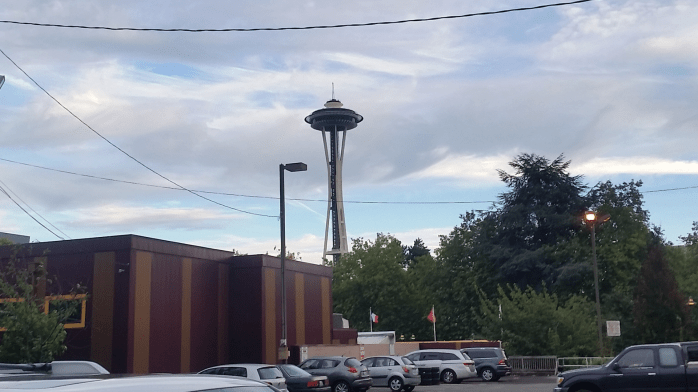
Alan dropped us off at the Mount Vernon Amtrak station, and we were thrilled to spot a brewery right next door. We walked over and ordered beers and huge plates of barbeque while researching our options to get back to southern California. We booked a train to Seattle that left within two hours and two nights in a Seattle hotel.

We left the brewery with smiling, rosy cheeks and full bellies and waited on the platform at the closed station for our 8:07 train. We weren’t surprised when the train was running late, it is Amtrak after all. But when a northbound train pulled up to the tracks at 8:40, we started asking questions. Another would-be passenger told us there were coal protesters blocking the tracks just south of Bellingham blocking both our southbound train and the northbound train sitting at the station. Well, at least there’s a brewery nearby. We walked back over and ordered another beer while we waited. We were fighting exhaustion, but had no real options but to wait and dream about the empty hotel room in Seattle. The friendly bartenders let us sit at the bar after closing, and we returned to the platform at 10:30. The northbound train was still right were we’d left it. I called Amtrak, and they gave me an 11:00 ETA explaining that the protesters had built some sort of structure over the tracks which had to be removed by crane. I correctly assumed the ETA wasn’t going to happen. I called again at 11:15, 11:50, and 12:30 each time getting a new ETA that didn’t come through. I was told that Amtrak was looking for buses to pick us up, but to no avail. I set up my sleeping bag on a bench, and Sean blew up his Thermarest on the platform. Many passengers had exited the northbound train by this point with family or friends picking them up, but we didn’t have that option. Eventually, I opened my eyes enough to see the northbound train start to move southbound. Huh? Then, a freight train came into view moving northbound. I made another call, got yet another ETA, and fell back asleep. At 4 am, I heard the horn of another train and wouldn’t you know, train 517 heading southbound to Seattle was approaching the platform. We both sleepily began packing up our bags, but noticed the train wasn’t slowing down. I panicked and ran to the side of the tracks waving my arms like a crazy person. I was totally shocked to see the train come to a stop just before it was passed the platform.
“I can’t believe you’re still here” the conductor said.
“We had nowhere else to go!”
So at just after 4, we boarded our 8:07, two hour train to Seattle. We arrived at our hotel just before 7 am completely exhausted.
From Seattle we started researching our options to get back to Bakersfield, CA where local transit would get us back to the PCT. All along, we were intending on taking the Amtrak from Seattle to Bakersfield, but…yeah, fuck that. That route included an Amtrak to Sacramento, switching to a bus, then switching to another train for $125 each and a total of 30 hours of traveling IF everything was on time. I interneted my options and found a 4 hour flight from Seattle to LA for $110 each and a 24 hour rental car to be returned in Bakersfield for $60 with a total of about 7 hours of travel depending on LA traffic. Well, that decision was a no brainer.
After a zero day in Seattle, we boarded our plane and found ourselves stuck in insane traffic outside LA. Big surprise, I know. Our two hour drive became a four hour drive, but we were thrilled when our day of traveling came to an end in Bakersfield.
And here we are. Enjoying the last bits of air conditioning before we begin our final 600 miles through desert heat and then, finally, through the High Sierra. By the end of next month, we’ll have completed the entire Pacific Crest Trail.
Striding from Sisters to Snoqualmie

It was late morning when we returned to the trail in the heart of Deschutes National Forest. The excitement of completing half of the Pacific Crest Trail had worn off and the uncertainty of the second half weighed on me. Were Sean’s shin splints healed or just temporarily feeling better? Do we really have another 1300 miles in us? Just how important is finishing the trail in one season?
But, of course, we resumed walking, and thankfully many of those doubts were quickly put to rest. Over the next four days, we kept our mileage around 20 / day and, to his surprise, the pain in his legs no longer was an issue.
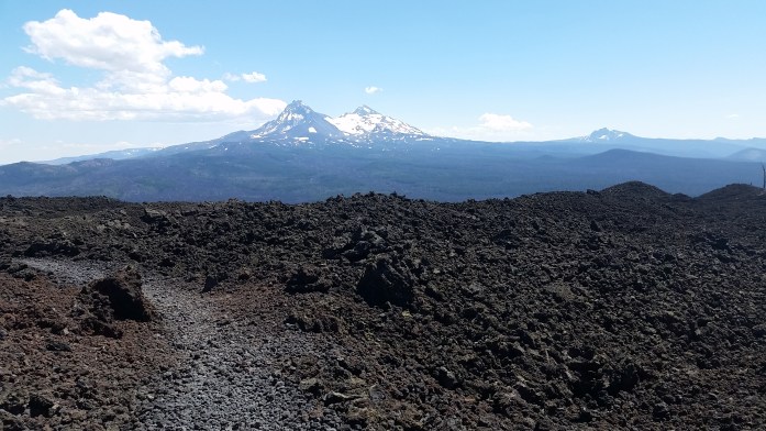
And it truly didn’t take long to remember why we do what we do. Oregon is overflowing with natural gems and attracts outdoor enthusiasts from miles away. We weren’t surprised to see an increase of section hikers and weekend-ers as we entered the Three Sisters Wilderness on a Friday.

We awoke Saturday morning to perfect weather, and I decided to make coffee to kick off my 27th birthday. We began walking around 7 with only 17 miles ahead to McKenzie Pass and a highway that led to Sisters, OR.

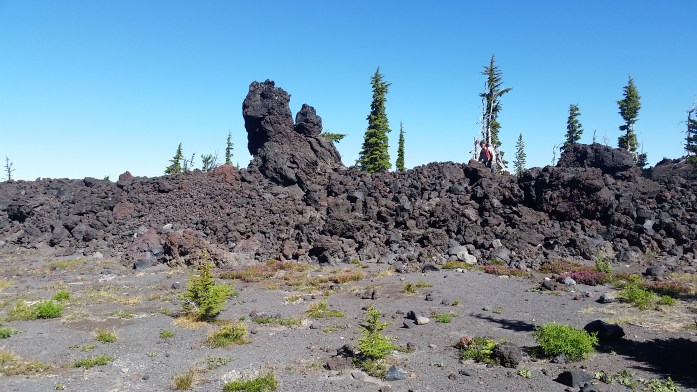


We were stoked to exit the above lava field around 2 and immediately stuck out our thumbs to snag a 20 minute ride to nearby Sisters. Thankfully, there was a parking lot and observatory near the trailhead and tourists were coming and going. We quickly found a ride in the back of a pickup and soon were in the small tourist town of Sisters in bumper to bumper traffic. We thanked our ride and continued down the main strip of shops and restaurants on foot.

Morning came all too quickly, and our AirBnB host made us a delightful breakfast. We thanked Paul for the hospitality and went to the grocery store to resupply for the next stretch. We decided to get 6 days of food to get us all the way to Cascade Locks at the Colombia River Gorge where we were getting picked up to visit Portland.
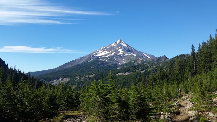
Over the next six days, we kept a steady 25 mile / day average and even had three unexpected trail magic dinners. The first was at Big Lake Youth Camp where the staff was over the top accommodating to thru-hikers. The second was put on by a former thru-hiker, and he had hotdogs, chili, salad, and sodas at a trailhead campsite! The third was at Olallie Lake where a nacho bar awaited us. And this section was oh so beautiful nearing and passing Mt Jefferson and then on to Mt Hood.


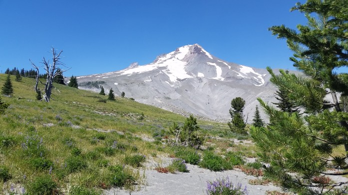

From Timberline Lodge, it was about fifty miles to Cascade Locks, and we were very excited for our couple days off in Portland. For the last stretch, we decided to take the Eagle Creek Trail, a very popular alternate to the PCT, to see waterfall after waterfall as we neared Cascade Locks.
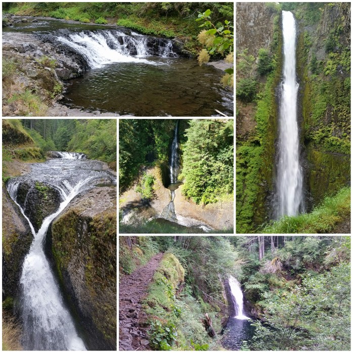
We continued walking, taking in all the views as we passed day hiker after day hiker. We estimated crossing at least 150 people if not more. The trail eventually ended at a parking area, and we walked the remaining 2 miles into Cascade Locks.

Our friend, Colin, joined us in Cascade Locks and brought us into Portland where we stayed with him and Amanda for the next two days. They had been babysitting our van since April, and it was strange to suddenly have our own wheels again. And clothes made of cotton! I even had birthday presents at their apartment from my family just waiting for me to open.
We thoroughly enjoyed our time off by making big breakfasts and bloody Mary’s, scoring great deals at happy hour, and just eating all the yummy food Portland has to offer. I freaking love that city.

Our days off were over before we knew it, and Amanda drove us back to Cascade Locks. Now it was on to Washington.
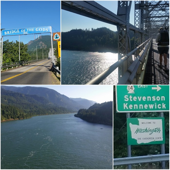
Despite our near 600 mile gap we skipped in central California, it was still quite momentous to cross the Bridge of the Gods and enter Washington. We were 500 miles from Canada and began yet another section of the PCT. I was immediately impressed with the views of Mt Hood to the south, Mt St Helens to the west, and Mt Adams to the east.

We really hit our stride in Washington and were keeping a consistent 25 mile average. We soon came to the tiny town of Trout Lake at the base of Mt Adams where we had a hot dinner and breakfast and did a small resupply for the next stretch. We left town after breakfast and resumed walking in the fog for the day. Thankfully, the clouds parted just as we were leaving Mt Adams.


Well, on we walked through drizzle and fog as we approached Goat Rocks Wilderness, a Washington highlight. We hoped as we walked that the fog would lift so that we could see the unique rock formations and the surrounding mountains. But, unfortunately, we were totally socked in from the precarious ridge line we were walking. We got very occasional glimpses of the area, but this is a section I’d really like to rehike one day.


That evening, we arrived at White Pass, a small ski area a half mile from the trail. We intended to pick up our resupply box and eat some heat lamp food at the convenience store but were bummed when we arrived to a closed store. Sigh. We pitched our tent at a stealth site behind the store and ate a very “bottom of the food bag” type dinner.
Morning came and we binged on coffee while we sorted our resupply package. We packed up our four days of food that would get us to Snoqualmie Pass and were back at it. Of course, today there was beautiful weather which made me resent yesterday’s clouds that covered Goat Rocks, but I did my best to put those feelings to rest and enjoy the day.
The next day was picture perfect as well providing excellent views in Mt Rainier National Park. After our first two hours of hiking, we approached a parking area, and you should’ve heard the excitement in Sean’s voice as he proclaimed “Toilets!” when they came into view. We took a pit stop and scored some leftover French toast, scrambled eggs, and cantaloupe from a Boy Scout Troop that was heading into the woods.


We set our eyes on a 28.5 mile day hoping that the sky would remain clear. After this long but rewarding hike, we arrived at Mark Urich snowmobile cabin that was backed up to a large meadow. We cooked food while watching the sunset and enjoyed seeing two moose chase each other through the tall grass. I set a 12:30 alarm before heading to bed hoping I’d be able to wake up to see the meteor shower. We shared Oreos and stargazed for only a half hour before returning to the tent, but we couldn’t pass up the chance to see the Perseid meteor shower in the middle of nowhere Washington.


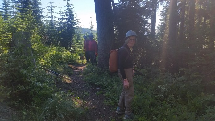
We were now within 45 miles of Snoqualmie Pass and were motivated by the hotel room we had booked from the woods.We set out for a 27 mile day leaving 18 miles to get us there. We noticed the trail looked freshly groomed, then turned the corner to see a large group of volunteer trail maintainers, the true angels of the trail, hard at work on a hot day. We said very humble thank yous as we passed hoping these people felt the depth of our gratitude. Soon we came to a dirt road crossing where a sign invited us to lunch! We walked through the camp, which I correctly guessed was the maintainers, and the friendly camp chef began making us stacked deli sandwiches. I don’t remember the last time a sandwich made me that happy. She explained to us that the group was on a four day trip with tools and food provided by the Pacific Crest Trail Association (PCTA).
The next day we were excited for a “short” 18 mile day where our dreams of food, beer, and a comfy bed would come true. By 3, we had arrived in Snoqualmie Pass.

In the past 10 days, we have completed nearly half of Washington leaving us 250 miles to Canada and an additional 590 miles left in California to officially complete the Pacific Crest Trail.
So if you’re keeping track, that’s 1800 done and 850 to go!!!

“How Is It Out There?” – The Emotional Roller Coaster of the PCT

Here’s our story from over 200 miles of Southern to Central Oregon on the Pacific Crest Trail. We’ve noticed recently that people keep asking us “How is it out there?”
How is it out there?
Chuckle.
Read on…

It was the 4th of July when we reached the California / Oregon state line and were welcomed by Pinnacle. Pinnacle, hiker and author of Oregon Backroads Guide to the Pacific Crest Trail, had an Independence Day picnic all set up just waiting for hungry hikers to pass through. Hotdogs, watermelon, chips, and beers were just what we needed to celebrate the holiday. Thanks for the warm welcome, Pinnacle!!
Once passed the state line, we noticed almost instantly why some hikers refer to Oregon as the “moving sidewalk.” For nearly 500 miles, the PCT is truly gentle to its hikers and is full of incredible sites along the way. Our first major Oregon landmark we were anticipating was Crater Lake 130 miles north. We were expecting a resupply package at the national park and decided to make a lofty goal of reaching Crater Lake within five days despite the fact that it had been 2 weeks and over 350 miles since our last zero.
Well, on we went for the next few days walking practically every minute of daylight. We were pretty proud ourselves for our back to back 30+ mile days and were confident we could reach Crater Lake by Saturday to snag our resupply package.

It was about 9 pm when we ended a 34 mile day still leaving 35 more to the park. We camped near a spring that had a serious mosquito infestation with several other campers. It seemed we woke 2 older men when we arrived to the campsite, but they didn’t seem too upset. The conversation quickly turned to tomorrow’s forecast of all day rain. Joy.
Now, we haven’t seen much rain on the PCT. And by not much, I mean we have dealt with walking in the rain twice this entire trail, both of which were in Southern California. I can already hear the AT hikers telling me to suck it up, but, ugh… walking in the rain is something I just don’t get used to.
Well, morning came and we were awoken by rain pitter-pattering on our tent. We waited a little longer than usual to start packing up, hoping for a break in the weather that didn’t come. Time to get this wet show on the road.
On we walked through the clouds and the cold drizzle. We guessed the temperature was around 45 degrees, and we weren’t interested in stopping for anything – not food, not water, nothing. We just kept walking all day, hoping and pleading with the clouds to break. I tried to entertain my mind with any thought other than how cold I was and how badly I just wanted to stop and crawl back into my dry clothes and warm sleeping bag. I started listing things I was thankful for – it’s only drizzling and not a down pour, it’s not that windy, the rain is creating an incredible forest fragrance…
I felt my frustration weighing me down as we continued to climb a thin ridgeline up and up. Ugh, I didn’t want to go up. I didn’t want it to get any colder or be exposed to the wind on top of the mountain. Why are we still going up?
I checked our guide on my phone, a joyous activity when you are using wet fingers on a wet screen. We still had several hundred feet to climb up Devil’s Peak. Sigh. It was about 1:00, and we stood in the rain to eat granola bars and drink some water. So far, we had traveled about 12 wet miles without stopping to eat or drink. Yeah, probably not the smartest, but when the word “hypothermia” continues to cross your mind, your priorities somewhat shift.
On we trudged up the mountain, trying to keep our patience. I was thrilled when I saw the trail winding towards a pass between two peaks, knowing we would begin our descent to slightly warmer temperatures. But my heart sank and I stopped in my tracks when the trail turned the corner as it wound to the other side and I saw that it was buried under snow. Slippery, cold, wet snow. Siggghhhh.
Sean led the way and I followed his big footprints. Thankfully, other hikers ahead of us had created a trail in the snow making the navigation much simpler. It was a slow go, but the snow section was, gratefully, short. I was relieved to see a dirt trail resume, and we continued down the mountain.
The drizzle and gloom continued, but on we walked through the afternoon. It came to our attention that we had each only drank about a half liter of water all day so we stopped to correct that. It was also then that we realized we had already passed the most convenient water sources leaving only one between where we were and the park that was still about 15 miles away. From this point, it was another 3 miles to the spring and an additional half mile down a side trail. Well, one more hour of walking anyway.
We arrived at the side trail for Jack Spring and noticed the abundant camping spots at the intersection. We also saw a note at the intersection stating the spring was still flowing. Well, that’s positive.
We left for Jack Spring from the PCT around 5:00. A half mile for us is typically a 10 minute walk on the dot. But, of course, not this time. Not this time when we were wet, cold, frustrated, dehydrated, and hungry. This time the side trail seemingly disappeared when the PCT was out of site. My guide GPS had the spring itself marked, but the trail to the spring was a mystery covered with fallen trees and branches. We tried and failed miserably to locate this damn spring while my GPS kept bouncing us around. We climbed limb after limb, bushwacking our way to some unknown dot on the screen of my phone. The irony of searching for water while it was raining really weighed on my spirits.
5:30 came and went.
5:50.
6:00. I couldn’t fathom why we hadn’t found it. What little was left of our patience was expiring. We were exhausted. I could feel tears welling up in my throat, but I choked them down. The mountain doesn’t care if you cry. The rain will continue, the blowdowns still need navigated, you most certainly still need water.
6:10. The blue GPS dot of us was nearing the pinned point on the map at a sloth’s pace.
6:20. Ok, I’m just about on it.
6:23. “It says I’m on it.” Our eyes were scanning the gloomy forest and our ears strained to hear trickling water beyond the rain drops.
6:27. Where the actual f*@k is this spring!!??!
6:30 An HOUR AND A HALF after breaking from the PCT, we locate Jack f’ing Spring. I hate you, Jack.
At about 6:50, we got back to the campsite and began the chores. Thank the heavens getting back to the PCT proved far easier. By then, we were both starving, but – WOULDN’T YOU KNOW IT – the rain decided to pick up. I started heating some water in an attempt to make mac n cheese while the rain fell down on me. When the shivering started, it just didn’t stop. Sean did his best to pop the tent and keep the inside dry. Suddenly, I recalled having 4 oatmeal packages and an instant mashed potato. No backpacker food is worth hypothermia.
I handed Sean the instant dinner and made my way into the tent for the night. It was then an obstacle course of keeping the wet things separate from the dry things, escaping the damp tent floor on our NeoAir rafts, and hoping the rainfly does its job. But, at last, we were finally back in our tent – our haven – mostly dry and warm. I looked at my soppy wet hiking clothes knowing I would be putting them on the following morning. Sigh.
Morning came and the cold wet clothes were just as awesome as you’d expect. We were now 12 miles away from Crater Lake and nothing was slowing us down. We checked for cell service a few times in an attempt to connect with a friend that lives in the area. She knew we were coming through, but no concrete plans had been made. I thankfully got a signal and let Missy know an approximate arrival time to the park having no idea what her schedule was.
We, seriously, booked those 12 miles in slightly under 4 hours without considering stopping. We were just about to the highway, when suddenly Sean turned to his right, clearly excited. Our friend, Missy, had surprised us with big hugs, food, beer, and a whole day to spend with us. It felt like a dream, and most certainly was a miracle.
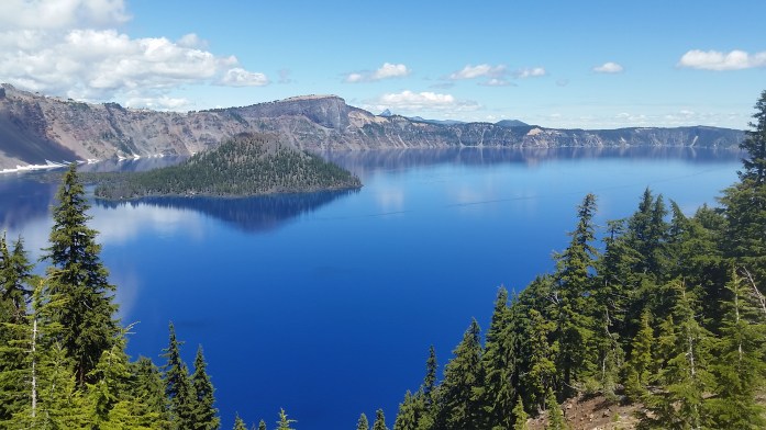
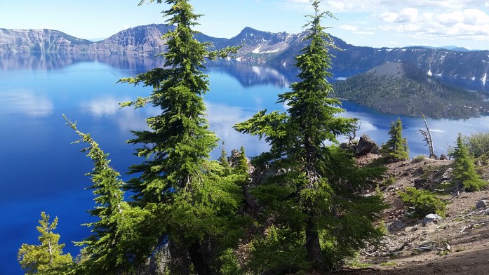
After our much needed rest and recuperation with our dear friend, we returned to the trail once more. I was thrilled to have perfect weather as we entered Crater Lake National Park. And, truly, this is one of the most beautiful places I’ve been lucky enough to visit. I swear, you’ve never seen the color blue until you’ve seen Crater Lake.
It wasn’t too many miles after the park, however, that Sean began noticing pain from his right shin. As the days and miles went by, the pain continued to grow. It became clear quickly that he needed to get off trail, but when you’re in the middle of the woods, you still have to tough it out to an exit point.

We checked our guide and learned that he would have to hike about 35 miles to get to the nearest highway. And that highway could get us to Bend. And from Bend we could make it to Phish??
A few of our very close friends were currently traveling across the country to see two nights of Phish at the Gorge Amphitheater, one of the most beautiful and unique venues in the world. Well, we needed to get off the trail anyway, so why not go on a hitchhiking adventure to the show?
The next two days were somewhat of a struggle as Sean battled the pain in his leg using ibuprofen and snow stuffed in his sock as treatment. But, we excitedly got to Highway 58, and stuck out our thumbs to the many passing cars. We were right in the heart of the Deschutes National Forest being eyeballed by curious families in trucks, SUVs, and RVs with all of their outdoor rec toys in tow.
It took an hour and a half, but suddenly a lady in an SUV pulled over for us. Trish was heading to Bend and had just commented to herself that she was bored and wished she could pick up some hitchhikers or something…
Step 1 – made it to Bend!! Trish took us to a cheap motel with nearby restaurants, grocery stores, and even a thrift store. We instantly took to the internet searching Craigslist, Facebook, and Phish forums looking for our 6 hour ride to The Gorge. We sent some emails and posted our story, but we went to bed without a plan for the next day.
About 9 am Friday morning, we got a response. We explained our story to Davin whose friend had bailed on accompanying him. And just like that, we had a ride and even scored a good deal on tickets via Craigslist. At 11:30, we began the 6 hour ride which would get us there just before the show started at 7. MAGIC!!!
The next two days were full of fun, connecting with our recently engaged best friends, and enjoying a truly incredible space – not to mention lots of groovy tunes and smiles for miles and miles and miles…


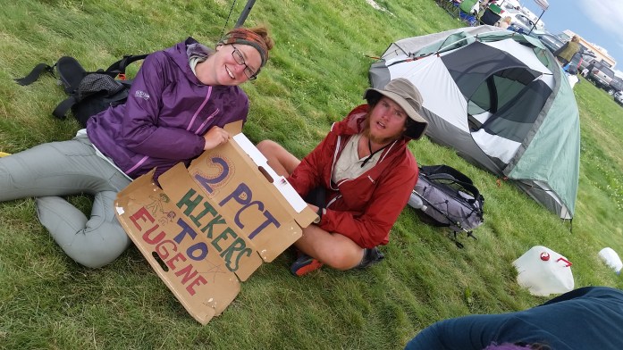
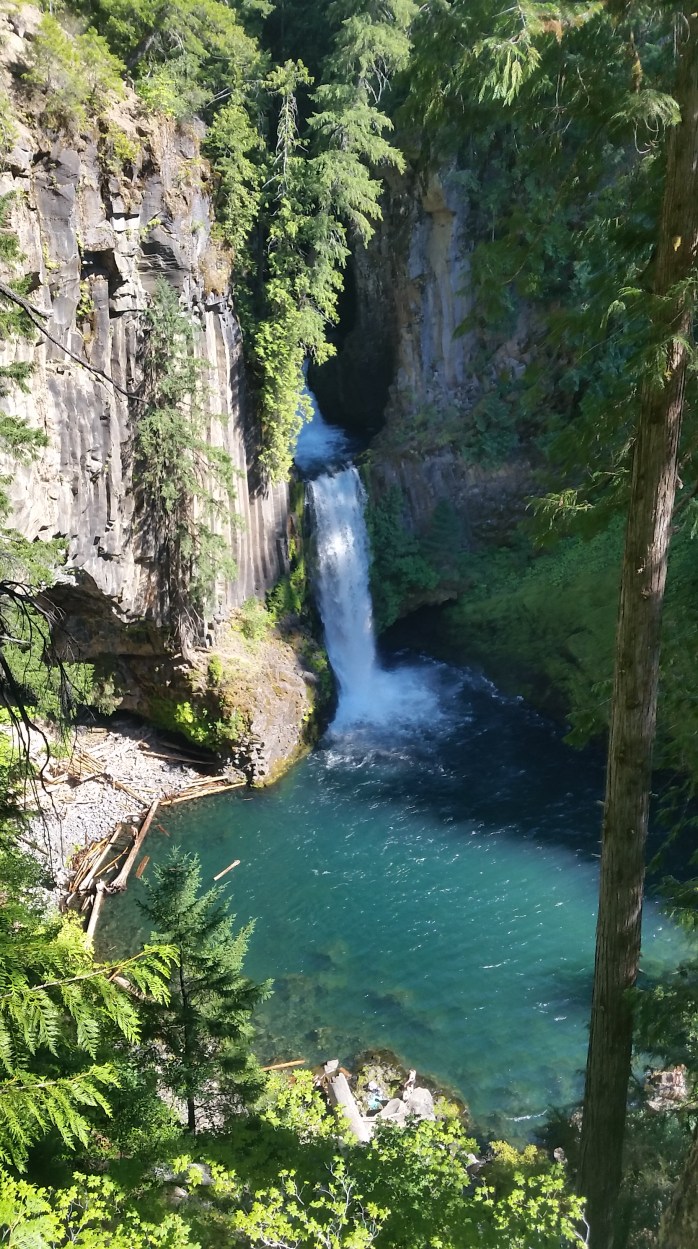
After the blissful weekend, we easily caught a ride to Eugene where it was slightly more convenient to get back to the trail. We checked into a motel and very unexpectedly decided to take 4 additional zero days and let Sean’s leg heal. Our friend, Pat, was in the Eugene area and returned us to the PCT after exploring Umpqua Hot Springs, several waterfalls, and dinner and breakfast on the lake.
It had been a week since we had stood in that same spot with outstretched thumbs. Our much needed rest and recharge was over, and it was time to get back to the task in front of us. What a way to celebrate being halfway done with the PCT!
So… how is it out there?
It’s unbelievably beautiful, buggy, spontaneous, hot, rainy, frustrating, painful, magical, difficult, blissful, smelly, soul crushing, inspiring, long, wet, cold, interesting, hellish, unpredictable, boring, slippery, dusty, breathtaking, snowy, muddy, tough, sunny, repetitive, windy, dirty. It’s all that and so much more, simultaneously, and can bring you the highest highs and crushing lows. That’s how it is out there. Yet somehow, we manage to keep walking.
Well… 1325 more (fill in the blank) miles to go.
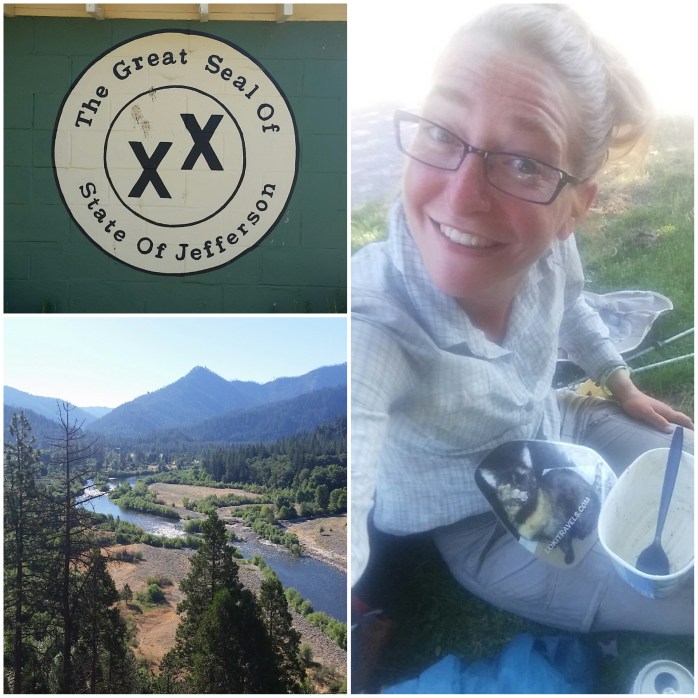
Northern California on the Pacific Crest Trail

We left Chester, CA after our unexpected double zero at an amazing trail angel’s house (thanks again and again Sean and Kari!!) and headed towards Lassen Volcanic National Park. We took the short side trail to Terminal Geyser once inside the park and saw our first (huge!!) bear shortly after from the PCT.

Soon, we found ourselves in Old Station and stopped to pick up a mail drop from the post office. After breakfast, we resumed hiking and were headed towards Hat Creek Rim. Though it is quite a beautiful walk, Hat Creek Rim is the longest stretch on the PCT (outside of the desert) without water – 29 long, dry miles to be exact. It was hot leaving Old Station, but we knew it wasn’t as hot as the hikers in the bubble would experience in about six weeks.
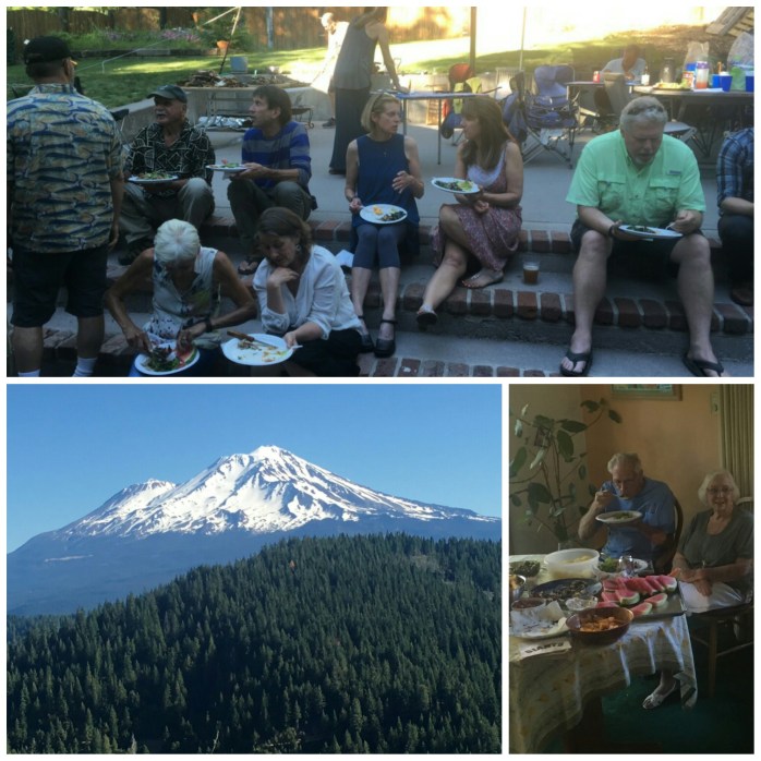
With packs fully loaded with food and water, we began walking. Once on the rim, the concerns of water and the heat melted away as we were completely distracted with the amazing views. Behind us, we could still see Mt Lassen shrinking slightly as we walked, and in front of us was Mt Shasta in all her glory. I couldn’t help but stop and take in both of these massive and oh so beautiful volcanoes from the same vantage point. It was a remarkable place to be on the summer solstice.

And much to our delight, there was more eye candy essentially right around the corner. Two days after the Hat Creek Rim walk, we found ourselves in Burney Falls State Park. Not only were the falls exceptional, the park itself was one of the nicest state parks I’ve ever visited. And to top it all off, it was new shoes day!! Our new shoes had been delivered to the general store (thanks, always, Mike and Jo), and we tossed our beaten up first pair that had traveled over 800 trail miles.

With fresh shoes on our feet, we continued north on the PCT towards our next stop in Mount Shasta City. Over the next few days, we neared the 14,000 ft snow capped volcano, each view somehow better than the last.

It was a Friday morning when we set out to complete our first 30 mile day. At 1:00, we were half way done and came to Ash Camp on the McCloud River. We walked through the camp and were greeted by some friendly strangers. Soon, a man motioned us over to his truck where he and a group were gearing up for the afternoon fly fishing on the river.
Craig, owner of Shasta Trout, quickly introduced himself and started handing us snacks, fresh fruit, and beer! We were already blown away by this generous trail magic, but he had one more gift for us.
“Tomorrow is my 30th anniversary party and, if you’ll be in Mount Shasta, please join us. We’re roasting a whole lamb and making pisco sours. Here’s my card and address.”
My jaw dropped. I assured him we’d be in town and told him not to be surprised when we stopped by. He said, “See you tomorrow!” and continued with his group down the river.

Sean and I sat under a bridge to enjoy our treats and dreamt about the party we would attend the next day. Once again, we were stunned with how perfect our timing was and in disbelief at the kindness of total strangers.
We woke early the next day and hiked the remaining 15 miles to the I-5. Mount Shasta City was about 15 miles down the interstate, and it took us about 2 hours to find a ride. But, thankfully, a kind young pilot in training picked us up in his freshly purchased VW van and got us into town. We did our town chores as quickly as possible then walked to Craig’s house.
Upon arrival, the sidewalk chalk guided us to the backyard where we were greeted with curious smiles.
“Uh, Craig! There’s a couple hikers here,” a guest called inside.
“Oh, yeah, I invited them!”
Craig’s wife, Jerry, warmly welcomed us and quickly offered us beers and showers which we gratefully accepted. We munched on appetizers while the lamb finished roasting chatting with Craig and Jerry’s friends and family. Soon, Craig made pisco sours that took me right back to Peru where I first tried the cocktail.
It was very obvious that this was a special and intimate gathering. Almost all of the people present were outdoor enthusiasts and athletes – some present or former Shasta guides, fishermen, rock climbers – and they truly treated us like family.
In traveling, it’s very rare and precious to feel the warmth of family and the comforts of home. Though, of course, this was not my family and I am thousands of miles away from home, the love of this family radiated and was shared with Sean and I. Sure, the food and drinks were a literal dream come true, but the kindness of these people, their generosity, and inspiring stories will truly never be forgotten.
As the evening wound down, Craig’s friend, Peter, offered us his guest room for the night and a ride back to the trail in the morning. We left the party with hugs and so many thank yous and made our way to Peter’s. We spent the next few hours chatting and sampling his homemade infused vodkas before falling asleep in a cozy bed.
In the morning, Peter took us to a seriously delicious diner for breakfast, and then we returned to the trail. The guests from the party were all gushing about our next section of the trail, and we soon saw why. Climbing up Castle Crags (though slightly difficult from the previous night’s drinks) was quite a treat.

A couple days later it was time for another resupply, and we came to a highway crossing about noon on a Tuesday. We were anticipating an “in and out” town stop hopefully lasting no longer than four hours. After two hours of trying to hitchhike into town, we realized this might be a more difficult endeavor than we imagined.
Eventually, a truck pulled over and offered us a ride halfway into the small town of Etna leaving us at the tiny town of Callahan. About 15 minutes later, another truck stopped and got us the rest of the way into Etna. All said and done, it was about 3 hours from highway to town. And as soon as we arrived, we started to wonder how long it would take to get back to the trail.
We ate some mediocre food at a local restaurant, resupplied, and made our way back to the highway to attempt to get back. We waited for awhile and were soon offered a ride halfway back to Callahan.
We sat at the closed general store, smiling and sticking our thumbs out to the very few cars that passed. The sun was starting to set, and we knew better than to try to hitch after dark. A couple locals approached and offered us some lawn space for our tent. Well, that was helpful. We decided to give up for the evening and hoped we could get back to the trail as soon as possible in the morning.

But, there wasn’t much traffic at 6:00, 7:00, or 8:00 a.m. By 8:30, I knew it was time to start walking the remaining 10 miles back to the trail. We would be back to the trail by noon if we walked and who knew how long if we sat and, essentially, pouted.
Frustrated, we began walking the miles that didn’t count towards the 2650 mile goal. The few cars that passed weren’t interested in giving us a lift up the mountain until we were about 3 miles from our destination. I’m sure she saw the desperation in my eyes, and I couldn’t have been happier that she saved us another hour of walking. It was 11:30 when we returned to the spot we had left 23.5 hours earlier. Heavy sigh.
We did our best to keep our cool, ate some food at the trail head, and, finally, continued down the PCT. Our moods quickly shifted as the woods calmed our frustrations, the endorphins from the exercise kicked in, and the views were truly picture perfect.

From this point, it could’ve been a great day, but as late afternoon hit, my new shoes suddenly seemed too small and both heels rubbed with every step. I trudged on through the pain, leaving the back of both heels raw by the end of the day. Sigghhhh.
Well, the foot damage was done, but thankfully the next few days didn’t cause further pain. The blisters were already hardening to calluses proving once more that every time you feel your weakest, you’re actually getting stronger.
Over the next few days, we hiked our way to Seiad Valley, the final stop in California before entering Oregon. We picked up our expected resupply package and decided to stay at the RV Park for the night. After breakfast the next morning, we were back to it.
Two days later, on the 4th of July, we crossed the state line, and we were in Oregon. And just after, Pinnacle, author and former PCT Hiker, had holiday trail magic set up – hotdogs, chips, watermelon, and beers!!
As with the trail, and life in general, thru-hiking will always have its ups and downs, its highs and lows, its challenges and rewards.
With the Sierra Shuffle, we still have 590 PCT miles of California to complete from Tehachapi to Truckee. But the state line marked 1100 miles completed in southern and northern California. Now to see what’s in store in Oregon!
From Sand to Snow – Doing the Sierra Shuffle on the PCT

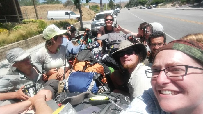
After two days off trail in Los Angeles, our friend Anna drove us back to Agua Dulce. We said our thank yous and goodbyes and entered “Hiker Heaven,” the Sauffley’s home, where they provide water, showers, laundry, and tent space for hikers. We weren’t surprised to see a couple dozen hikers already there upon arrival. We decided we would wait out the heat of the day and resume hiking later that afternoon. As we relaxed, hikers continued to roll in. We learned that a couple nights prior, Hiker Heaven had hosted over 100 thru-hikers, a new record. We realized we were right in the middle of a huge hiker bubble that stretched a couple hundred miles north to Kennedy Meadows. And everyone was talking about their plan for the Sierra section ahead.
This year, fortunately for draught stricken California, the Sierra range received quite a bit of snow. For PCT hikers, however, this becomes a logistical issue. A few hikers bought ice axes and crampons or microspikes and continued marching north to Canada crossing sketchy 13,000 ft icy passes, navigating an invisible trail, hoping not to need their self arrest tools.
But most hikers, ourselves included, weren’t interested in traversing 300 – 400 miles of snow pack. So what are the other options?
1. Wait it out. For snow melt, every day counts. Some hikers went home, to a friend’s, to Vegas or L.A., or slowed their pace to wait for enough snow melt for safer passage.
2. Skip the Sierra Range and pick up the trail elsewhere. There would be infinite options for picking up the trail, except that hundreds of miles of trail are also buried in snow pack in northern California, Oregon, and Washington. Thus, the choices are a bit limited but still plenty.
From Agua Dulce to Hiker Town, we evaluated and considered our options asking ourselves what we wanted out of our PCT experience, what our definition of a successful thru-hike was, and if we really wanted to be in the hiker “bubble” for the entirety of the trip.
After a night in Hiker Town (a totally bizarre hiker haven) watching hiker after hiker roll through, our decision was becoming apparent – we wanted out of the bubble and we didn’t want to pass through the Sierra covered in snow. Skipping the Sierra now would give us solitude on the trail, better weather in Washington, and considerably less sketchy high passes and water crossings in the Sierra. The decision was made. We were going to leapfrog the Sierra Range.

The next thing to decide was where to pick up the trail and how to get there. After a bit of research, it seemed there was still snow pack up to the Tahoe area and then again in Oregon, leaving about a 500 mile stretch of northern California with minimal snow cover. We put our sights on Truckee just north of I-80 where the trail would be under 9,000 ft.
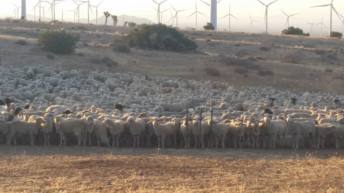
We left Hiker Town with a plan made, a car rented, and a room booked in Tehachapi 50 miles ahead. During this stretch, we walked along the Los Angeles aquaduct, through the country’s largest wind farm, and in some of the highest temperatures we’ve seen yet.
We arrived in Tehachapi and fulfilled our food and beer dreams. We met up with the couple that had booked the car and discussed the next day’s travel plans. But they suddenly changed their minds. They really wanted to complete the desert section and stick to a true northbound hike. Well, I guess we would continue north on foot.
After our night’s stay at the hotel (which was totally booked with partying hikers), we went to Burger King for breakfast intending to hike out in the early evening. Inside, another hiker overheard our conversation concerning the skip. Mike interjected and informed us that he was picking up a car in a couple hours and was skipping the Sierra. He invited us to join and gave us his number.
We returned to the hotel completely undecided about what to do. After cleaning our gear and going back and forth, we returned to our original decision and took Mike up on his offer. Within two hours, we began the six hour drive to South Lake Tahoe. The next day, Mike drove us to Truckee and dropped us off at the I-80 rest stop that has a spur trail to the PCT. In a seven hour drive, we skipped 590 miles of the Pacific Crest Trail.
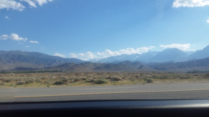
Our new environment was different in every way from the desert we left in Tehachapi. Here, it was slightly chilly, the trail was made of dirt, and water was plentiful.
And it didn’t take too long to find snow. A lot of it. Goodbye sand, hello snow. We did our best using the GPS and our Guthook App to navigate the buried PCT. For the first 15 miles, the trail was completely covered by 3-8 ft of snowpack. It took us all day to travel 9 slippery miles and half of the next day to complete the next 6. We were frustrated and cold, hoping to reach something a bit more navigable.
We quite literally went from this…
http://youtu.be/f4AkupKdpvM
to this…
http://youtu.be/bJnWP5ZVgAo
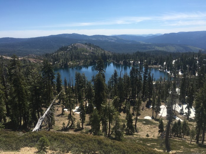
Eventually, and oh so happily, the snow receded and dirt trail presented itself. Once a steady stride became possible, we took off increasing our mileage a little every day and enjoying the solitude and beauty in northern California.

Since the skip, we have only seen about a dozen hikers in the 170 miles we’ve walked north of the I-80. This includes several leapfroggers and flipfloppers as well as 3 brave hikers who trekked the snow covered Sierra.

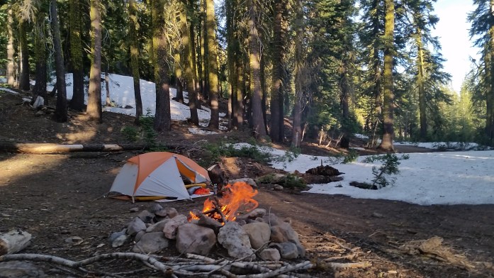
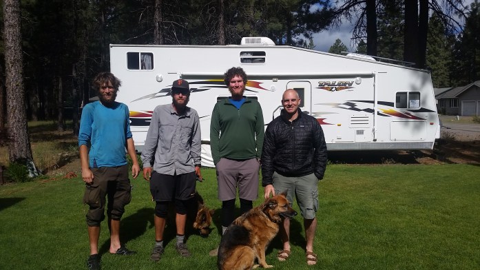
Last night, we made a last minute decision to come into the town of Chester and get a room for the evening to dodge the forecasted snow and 22° low. At the highway to town, someone had left a note offering rides to and from town. We texted him, but quickly got a hitch and let him know the ride was no longer needed. He texted back and offered us a place to stay in his trailer.
Hmm… what do you do when a stranger texts you to stay in his trailer? Well, in the real world, you don’t say “Wow, really!? Can you pick us up at the grocery store??” But, we’re in the hiking world now, so that’s exactly what we did.
Our host was quick to arrive and brought us back to his comfortable home where we were warmly greeted by his family. They offered us cookies, showers, laundry, and beer!!
We put our bags in his cozy camper trailer that could probably sleep 10 and were soon joined by two other hikers. They had both trekked through the Sierra. One of the hikers was an especially rare breed. His mission this year was to complete the Appalachian Trail, the Pacific Crest Trail, and the Continental Divide Trail back to back known as the Calender Triple Crown. If (when) he finishes the PCT and CDT, he will be about the sixth person to ever complete the 8,000 miles in one year. As aspiring triple crowners ourselves, it was an honor to get to spend some time with Legend. Even better, our trail angel took us to a microbrewey to chat about our journeys over beers. Good luck, Legend! We are rooting for you!!! (Check out more about his story here.)
Tomorrow, after today’s zero, we will head out from Chester continuing north. Yesterday, we passed the PCT half way mark meaning we have 1325 more miles to walk to the Canadian border. From there, the plan is to hitch our way back to society and take a train from Seattle to Bakersfield, just 20 miles from Tehachapi where we left off. Instead of ending in Canada, our hike will finish after hiking through the Sierra Range, Yosemite, South Lake Tahoe, and finally Truckee. Will I have walked from Mexico to Canada? No. But I will walk the entire PCT from May 6 until late September on my own terms.
Here’s few more pictures…


I Should’ve Written a Blog Today

I should’ve written a blog today as I typically do on my days off from hiking, but words seemed to have (mostly) escaped me.
I should’ve written a blog today, but there was no drama or injury, no internal struggles, setbacks, or “exciting news” to report.
I should’ve written a blog today, but how many times can you say the words beautiful, stunning, and amazing? How many times can you be in awe and speechless?
I should’ve written a blog today, but the word grateful is much too small to describe the extent of my thanks to the many friends and strangers that bless our trips.
I should’ve written a blog today, but sometimes it seems my life is but a dream, an occasional heaven, as if I’ve died and my memory of “the accident” is completely lacking…
I should’ve written a blog today, but I never thought a love like ours could exist, let alone that I could experience it and write about it.
I should’ve written a blog today…
Because this shit is cheesy.
Miles 250-450 of the Pacific Crest Trail…


Life on the PCT: Cowboy Camping, Dealing with Fire Closures, and Our First Zero Day


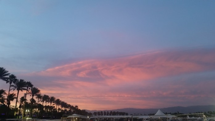
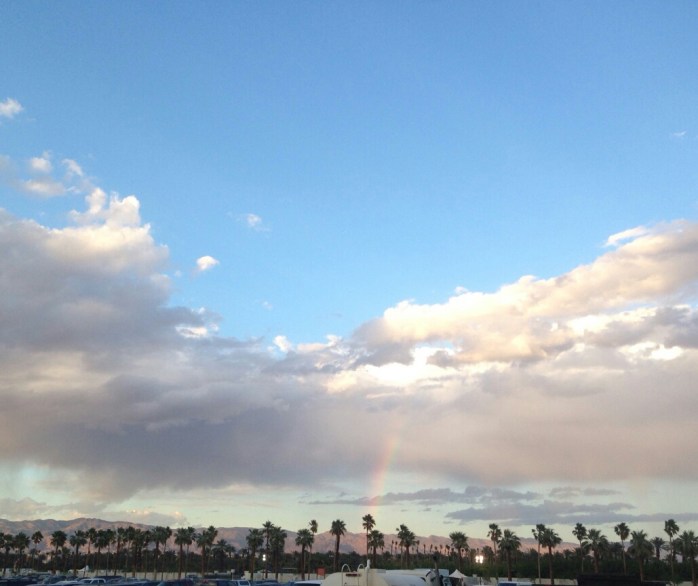
Hello from Big Bear, CA on my first “zero” day since we started the trail May 6. In just 12 days, we have traveled 250 trail miles and have fallen totally and completely in love with the Pacific Crest Trail. As if the first 100 miles weren’t beautiful enough (seriously, click the link for some gorgeous photos), the next 150 have continued to amaze me with contrasting terrain, interesting plants, and unbelievable sunrises and sunsets.
Trail life is the same as it always will be… wake up at sunrise, pack up camp, walk, walk, walk, walk, walk, shemennana, walk, walk, walk, walk, walk, blah blah blah blah, walk, walk, walk, walk, walk…

 New to us on this trip is the concept of “cowboy camping” aka sleeping under the stars on the ground without a tent. Currently in our newly adopted ultralight fashion, we are only carrying our tent poles, ground cloth, rain fly, and a reflective tarp. (We will get the tent body itself shipped to us at a future date to protect us from bugs.) When it’s not too chilly and rain is unlikely, we have really been enjoying cowboy camping in some beautiful spots. Ya know, like in canyons between mountains or on the side of a cliff….

Another first for us during the last 150 miles is dealing with trail closures due to fire damage. The first occurrence happened between Highway 74 (mile 152) and Idyllwild (mile 179). Though only a 15 mile stretch of trail was closed, many people skip the whole 27 miles due to convenience. However, through this gap, there is an alternate hiking route which is part trail and part road. We decided to do half of the alternate and hitch a ride for the road walk. Skipping trail really isn’t our jam, but in these cases you gotta do what you gotta do.
 After enjoying a delicious lunch and pitcher of beer in Idyllwild, we started to make our way back towards the trail. I guess I didn’t read my Guthook App (our guidebook) thoroughly enough to realize what our return to trail options were. Once we started walking out of town, it was obvious we took the tough route. Most hikers take a ride from town to a nearby park and take a short side trail to the PCT. We, however, decided to walk the 3000 ft ascent from town to Taquitz Peak which was at least a 10 mile endeavor. When we reached 7000 ft, we decided we’d save the rest of the climb for the morning and return to the PCT the next day.
 Though the climb was the toughest the PCT has presented us so far, we were glad with our choice to hoof it back to the trail. After the morning climb, we rejoined the PCT and continued up San Jacinto peak, the largest in southern California at 10,600 feet. The PCT skirts the summit at about 9000 ft, and we decided to skip the additional 3 miles and 1600 feet of climbing to the very top. It was such a pretty day looking back on Tahquitz Peak, enjoying the tall pine trees, and taking in the views above the clouds.

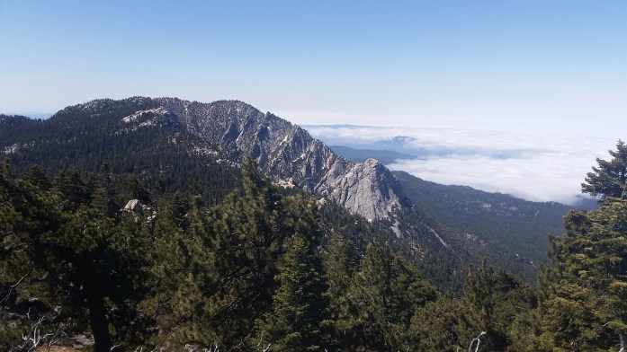

Eventually, the trail began to wind around to the opposite side of the mountain. Our views shifted from the forrest above Idyllwild to the desert of Coachella Valley 8000 ft below. For us, it was quite a unique perspective. During the month of April while working Coachella, we looked at San Jacinto peak longingly not necessarily knowing we would be up on the ridge a month later.
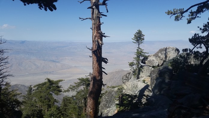
The descent was nearly 20 miles and 8000 ft down to the desert floor below. As we descended, the temperature rose and the massive pine trees that surrounded us earlier were replaced with cacti once more. We cowboy camped for the night about half way down the mountain leaving 14 miles to Interstate 10.

Our morning began at sunrise, and we worked our way down San Jacinto, the summit shrinking as we walked. From this distance, one wouldn’t know about the alpine forrest above despite the incredible size of the trees. The ridges began to collapse upon each other turning a 3D trail into a 2D image. Finally, we hit the desert floor trudging through soft sand that subtracted half a step from each one you took.

We were excited to hit the 10 knowing an In n Out Burger was 7 miles down the interstate, but not thrilled to deal with another fire closure. There are 57 trail miles between the I-10 and Big Bear. Within that stretch, 16 miles of the PCT are actually closed from a devastating wildfire in 2013. Unfortunately, the I-10 and Highway 38 are the only viable roads to get around the closure meaning you skip at least 45 miles of trail if not all 57. (45 if you have control over your ride situation so you can pick up exactly where the fire closure opens on the 38. 57 if you hitch directly to Big Bear and pick up the trail there.)

We’ve heard all sorts of stories about what’s actually going on with this closure. We’ve been told it’s not open from rangers, then heard that some hikers are still passing through. Thankfully, there is a hiker haven right after the I-10 where Ziggy and The Bear host hikers and help you figure out your way to Big Bear in a car, a bus, or on foot if you want to do some road walking.
Before we made it to Ziggy’s, we were spotted on the road by Legend with a truck full of hikers. He quickly offered us a ride to the In and Out and made our trail dreams come true. After lunch and a delightful exchange of conversation with Legend, we returned to Ziggy’s to figure out our ride situation. The shuttle leaving right away was already full so it looked like we would have to wait around to take a short shuttle to a bus that would arrive in Big Bear around 7 pm. That wasn’t our favorite option, but the whole beggars choosers thing. We waited around until an older couple entered offering rides to Big Bear. We jumped on the opportunity with one other hiker, and I couldn’t be happier that we did.

What a very lucky ride we got with Ken and Marcia Powers. Not only are they Triple Crowners (hikers who have completed the AT, PCT, and CDT), they have also hiked thousands more miles including the American Discovery Trail (over 5,000 miles) east to west across the USA and many, many other hiking trails around the country. At a minimum, they have each hiked over 15,000 miles and probably much more than that. They had met all of our hiking heroes and were themselves hiking celebrities. They were on there way to Big Bear on one of their last nights together before Marcia would begin another PCT thru-hike. Check out gottwalk.com (sometime soon, site is under construction!) to see their full story. I was truly dazzled, not only by their accomplishments, but by their kind hearts, generosity, and what they’ve given back to the trails. Maybe one day we’ll come back and hike those 43 miles, but the experience of meeting Ken and Marcia was truly a treat.

We arrived in Big Bear about 5 and were greeted by a familiar face. While working Coachella, I met Alicia, a Vermonter, who currently lives in Big Bear. She warmly invited us to stay in her home when we passed through, and we were happy to take our first zero day after 12 consecutive days of hiking in such a comfortable home. I almost forgot how nice it is to be clean and what clean socks feel like…

Today, we enjoyed food, beers, and the company of an amazing artistic couple that so graciously welcomed us into their home. Tomorrow, we’ll pick the trail back up where the fire closure opens and continue our way north feeling clean, fed, and totally refreshed. Life in motion continues.
The First 100 Miles of the Pacific Crest Trail

It’s all coming back, it’s all coming back to me now…
 The pack weight, the soreness, the “hiker hobble,” the hunger, the smell, the complete exhaustion, the spam wraps and tuna tacos (topped with CheezIts, of course) and the complete and total joy of being enveloped in the best scenery nature has to offer.
Despite all the familiar pains and tedious tasks that come with thru-hiking, I still feel like I’m falling in love all over again. Over the past few days, it’s like we’ve been walking through a painting, and time is measured in miles once more.

It’s been seven days since my amazing friend, Lauren, drove us from her home in San Diego and dropped us off right at the Mexico border near the small town of Campo, CA. Since then, we’ve hiked 109 miles to Warner Springs.
We left Campo last Friday in a slight drizzle meanwhile carrying far too much water. Our new ultralight backpacks were reaching
an uncomfortable state with 7 L water and 5 days of food pushing the load capacity of 35 lbs. I guess we over prepared for the 20 mile dry stretch to the next water source, but we’d rather be safe than sorry. As we walked, we quickly started noticing differences from our last thru-hike.
I’m sure I’ll write a more formal “Appalachian Trail vs. Pacific Crest Trail” article at a later date, but my mind can’t help but compare the two. So far, the most notable differences are the relaxed grade of the trail itself and the views, views, views. See for yourself…


Over the first two days, we experienced a lot of cloud cover, some rain, and even a little hail which was a bit of a surprise when you’re expecting a full blown desert. But we’ve noticed a big change in weather and environment as we climb up and down the mountains.

While we are loving the steady grade of the trail and the beautiful views, the new challenges so far have been water and exposure. Since we began the trail seven days ago, we’ve already walked through two 20 mile stretches without water meaning we are carrying more water than was ever necessary on the AT. We’re still figuring out exactly the right amount to carry. A good rule of thumb is 1 L per 4-5 miles of walking. With water weighing in at 2.2 lbs per liter, no one wants to carry too much. Of course, carrying too little could lead to emergency situations.

Exposure is our second biggest challenge. While the lack of shade provides incredible views, the sun pours down on us heavily. Surprise, surprise it’s pretty freakin hot in the desert. But we came prepared in our delightfully nerdy outfits that mostly cover us from head to toe..

One of the biggest changes we made for this hike was going ultralight with our gear. It was definitely an inve$tment, but had been totally worth it so far. The physical difference a lightweight pack can make is incredible. (Check out our full gear list here.)
Despite some of the struggles, we are moving right along and are really feeling the groove of life on the trail once more. I guess I’ll just let the pictures tell the story this time. Bottom line, it’s beautiful, hot, sweaty, smelly, and really the only place I want to be.
Here’s to another 2550 miles on the PCT!


A Unique Pre-Trail Experience in Coachella Valley

Well, today is the big day. We’ll take our first of a million steps down the Pacific Crest Trail beginning right at the US / Mexico border. All the logistics are done, the bags are packed, and we’re as ready as we’re going to be. We spent last night in San Diego hosted by amazing friends (thanks Lauren and Cody!) enjoying the last bit of tv, comfy couches, and precious nectar from the beer lords. Today, a new life begins…again.
It’s been six weeks since we left Stratton Mtn Resort in Southern Vermont where we spent our winter working at a ski resort. As sometimes happens in the seasonal jobs world, we got an interesting job offer from my head chef that would take us about as far across the country as possible, coincidentally extremely close to the southern terminus of the Pacific Crest Trail. While we were in Vermont, we set everything up to be in Indio, CA working catering for one of the world’s largest music festivals – Coachella. All said and done with load in, two weekends of Coachella, one weekend of Stagecoach (a large country music festival at the same site), and load out, we lived and worked in Indio a full month.
We arrived by plane to San Diego April 4 after driving across the country from Vermont to Portland, OR with a quick week in Indiana to prepare for the drive, the job, and the thru-hike as well as spend some time with all the people we love. To say we were busy is a dramatic understatement.
After our drive out west, we spent 5 relaxing days in Portland enjoying the new arrival of dry spring weather with another couple from Indiana that has agreed to babysit our minivan until we finish the trail. Parting from the van via plane to San Diego, I realized we would essentially be walking back to it. Woof.

When we landed in San Diego, we quickly snagged our rental car and starting driving east into the mountains. I rode along somewhat shocked at the contrast of the Green Mountains we had left 2500 miles away just 2 weeks ago. After nearly 3 hours, we had arrived in the desert of Coachella Valley .
We went straight to the festival site and met up with Jimmy who had the keys to our employee house for the month. Jimmy introduced us to the owners and bosses who would be leading the team through the long road ahead. We left site and killed a couple hours at a local brewery. We eventually checked into our home for the month, a polished four bedroom that was decked from floor to ceiling in Pier 1 decorations including oversized chess pieces, dozens of sequined towels, and beaded pillows. We quickly snagged a room knowing that in the next few days more people would arrive to share the space. This four bedroom would house 8 adults for the month, all of whom had worked at Stratton Mountain Resort this winter.
We had one day off to get adjusted, then we hit the ground running on site. From day one, we were working 12 hour shifts which would soon increase to 16 hours.
Our employer, TaDa Catering, has been working with Golden Voice, the producers of Coachella and Stagecoach, for many years. At the festival, it’s TaDa’s job to feed the producers, staff, artists, and special guests breakfast, lunch, and dinner. There are even overnight shifts to feed those working around the clock. It’s a pretty serious operation.

The week and a half preceding the festival was pretty slow which gave us a chance to adjust to the long hours, desert heat, and the flow of a new job. This was actually my first catering gig, but with years and years of food and beverage experience, I caught on quick.
As preproduction days rolled by, the festival grounds steadily changed. Suddenly, empty fields had massive stages, fences separated parking lots, and light and art fixtures decorated our large lounge. Coachella Weekend 1 was approaching.
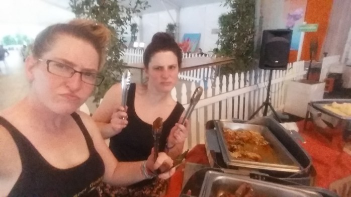
Once the staff got acquainted enough with the demands of the new job, we really worked as a machine. When the show weekend hit, it was all hands on deck and everyone needed to be firing at full speed. We served nearly 1300 for breakfast, 2000 for lunch, and 2000 for dinner Friday, Saturday, and Sunday of the event. After each long 16 hour day, the idea of attending the festival seemed like a joke. We barely had time for one beer before it was time to sleep and do it all over again.

But it was hard not to be proud of the product. Owner, Shellelyn, has some of the highest standards in the industry, and she gets incredible results. Additionally, Head Chef Mike is a culinary wizard. It’s one thing to make incredible food for one service at a restaurant. It’s another to cook for 2000 three times a day in a mobile outdoor kitchen in the desert. From the quality and taste of the food, to the presentation, decor, and use of color, TaDa is truly magical and left me totally “wow”-ed.

Coachella Weekend 1 came and left, and we all finally got a day off. We returned to work with a slower pace knowing what was waiting for us on the weekend. Though it was another brutal weekend, Coachella Weekend 2 went by quickly. By this point, all of the house and our co-workers were feeling the effects of 70-80 hour weeks, desert heat, and a severe lack of sleep. With Coachella behind us, we had one more show weekend of Stagecoach to conquer that would have significantly fewer people to serve.
We did our best to hide our haggard appearance and tried to smile through the remaining 10 days. By this point, my life had become a cruel version of Groundhog Day. Get up, greet the same people, drink obscene amounts of coffee, serve all three meals, go home, have one beer, get very little sleep, repeat. We were all ready to be done.

After the days slowly peeled off, the time finally came to leave Coachella Valley. I had been coaching myself all month that finishing the job meant heading virtually directly to the trail. I actively reminded myself of the long road ahead.
On Wednesday morning, all the housemates went our separate ways happy to be done and pleased with our financial boost. Sean and I drove back to San Diego where we met up with our friend Lauren who would drive us to the trail two days later.

Currently, we’re PCT bound nervous excited for the 5 months ahead. Keep following along for trail updates. Catch you on the flippity flop.
