
Summer of Summits: La Plata Peak

Day 33 – 27 miles biking / 1500+ ft elevation gain
Camping at the same spot 3 nights in a row was glamorous, but it was time to move on. From Missouri Gulch Trailhead, we had a 27 mile ride ahead of us to La Plata Trailhead. We rode the bumpy dirt road 8 miles back to Highway 24 and a few miles later we headed west on Highway 82. About 6 miles up 82, we came to the tiny and familiar town of Twin Lakes. The Twin Lakes General Store barely had what we needed for a couple days, but we managed to make it work just as we had for a resupply while hiking the Continental Divide Trail a couple years prior.
After snacking and resupplying, we continued riding another 10 beautiful miles to the trailhead. There was limited dispersed camping available, but thankfully we found a spot and setup camp.
Day 34 – 10 miles hiking / +4400 ft elevation gain; 4 miles biking / 600+ ft elevation gain
In the morning, we let the alarm lapse a little, packed up our bikes, and started walking at 6:40. We began our hike winding through aspen groves and up rock and dirt stairs. Above treeline, magnificent views of the surrounding mountains were revealed though we still couldn’t tell which was La Plata Peak.
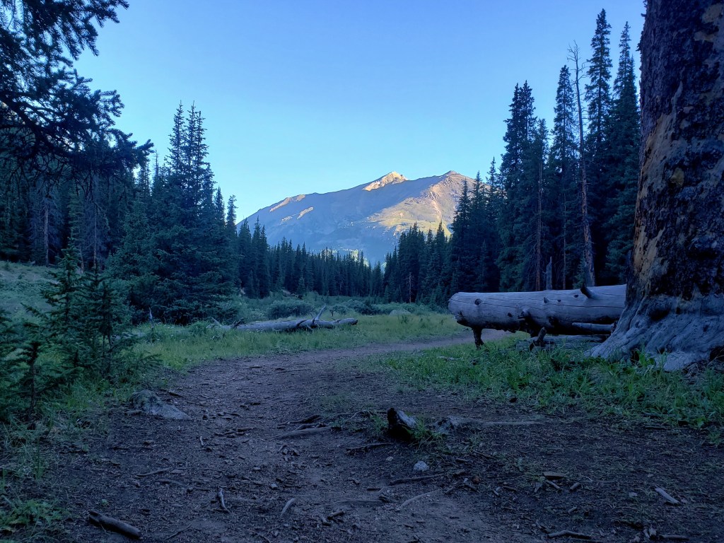

Next we climbed a set of short steep switchbacks passing a few hikers along the way. Once we made it to ridgeline, the remaining hike was mostly a rock scramble to the summit.
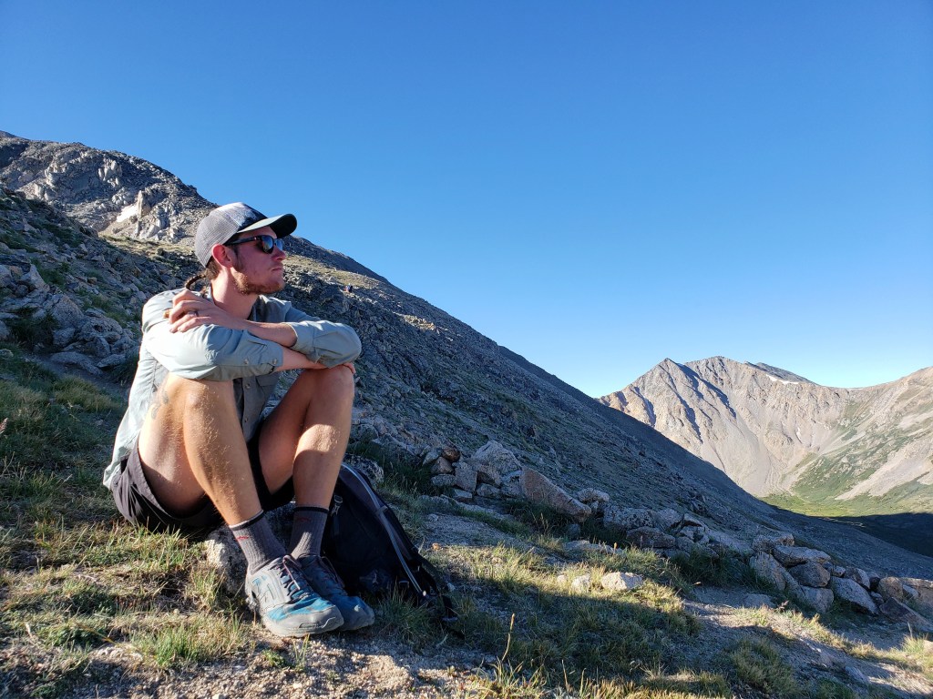
The secret is out about La Plata Peak. It’s a gorgeous, well maintained trail with little technical skills needed to summit. It was a Sunday, so we weren’t surprised to be sharing the trail with maybe 50 others. The trail was well marked and well worn, and many cairns along the way made navigating simple. As we neared the summit, the views of the Sawatch and Elk Ranges were astounding. We made it to the summit at 9:30 just about 3 hours after we started.

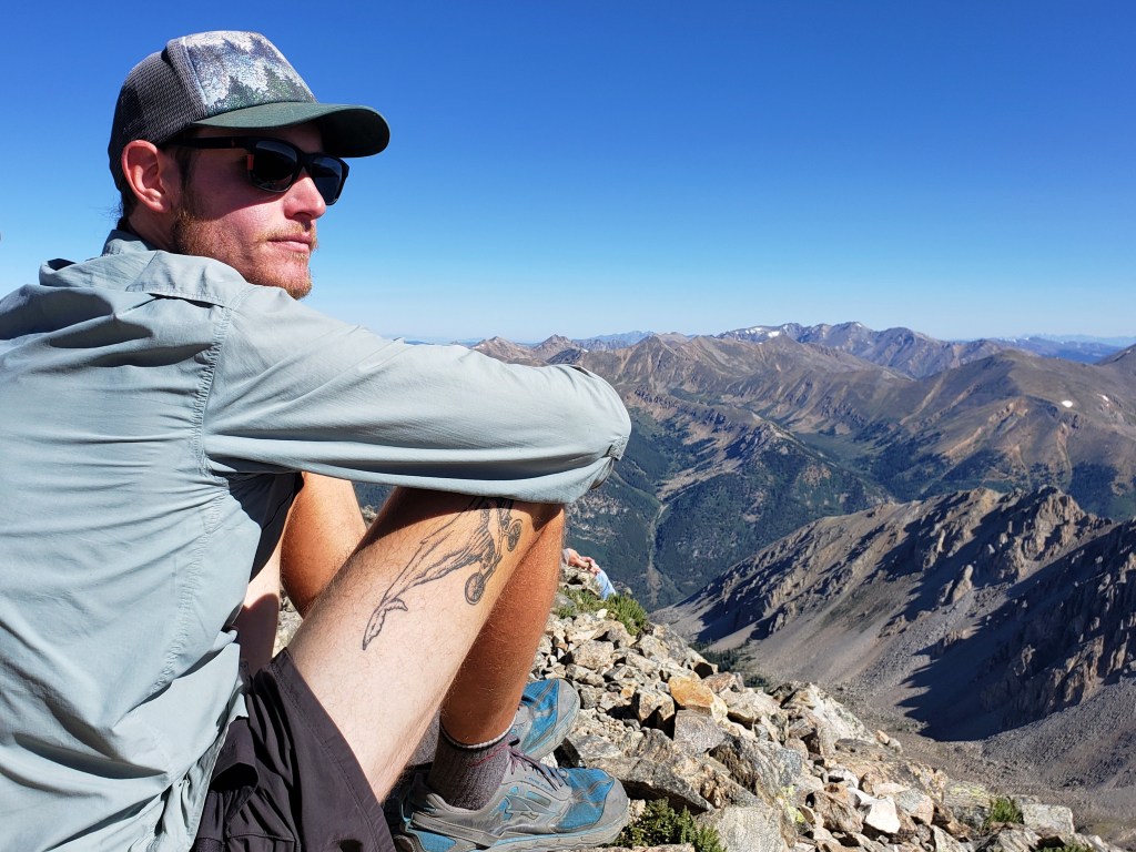

With just a short bike ride ahead, we had plenty of time to linger at the summit. It was a perfect bluebird day, and I was delighted that the wind was calm. After about a half hour enjoying the summit, we retraced our steps back down the mountain returning to camp at about 12:30.


We ate our lunch eagerly and decided to take a little rest and listen to a podcast. Around 3:30, we hopped on the bikes and rode for about 4.5 miles up the highway putting us 5 miles away from the top of Independence Pass.

Just before the highway got super steep, we found a trailhead in one of the road’s switchbacks with a picture perfect camping spot. We got plenty of rest and were looking forward to the following day’s ride to Aspen!

If you’re keeping track…
683 Miles by Bike / +54,800 ft elevation gain
183 Miles Hiking / +75,200 ft elevation gain
26 – 14,000+ ft Summits
- Huron Peak, Missouri Mtn, Mt Oxford, & Mt Belford
- Mt Shavano & Tabeguache Peak
- Mt Princeton & Mt Antero
- Mt Harvard, Mt Columbia, & Mt Yale
- Mount Sherman
- Mount Massive & Mount Elbert
- Mount of the Holy Cross
- Mt Democrat, Mt Cameron, Mt Lincoln, and (not) Mt Bross
- Quandary Peak
- Torreys and Grays Peaks
- Mount Bierstadt
- Mount Evans
- Long’s Peak
We are Bekah and Sean, out on an adventure to summit as many CO 14ers as possible this summer and reaching them via bicycle! Follow along her or on Instagram as we complete our Summer of Summits.

Pingback: Summer of Summits: Castle & Conundrum Peaks – Infinite Geography
Pingback: Summer of Summits: Maroon Bells & Pyramid Peak – Infinite Geography
Pingback: Summer of Summits: Snowmass Mountain – Infinite Geography
Pingback: Summer of Summits: Capitol Peak – Infinite Geography
Pingback: Summer of Summits: Carbondale to Denver – Infinite Geography