
Summer of Summits: Maroon Bells & Pyramid Peak

Day 37 – 10 miles biking / +500 ft elevation gain
After completing Castle and Conundrum Peaks, we were stoked for a day off. We spent our day eating a lot of food, catching up with friends, and mostly not working out even though we did ride 10 miles round trip.
Day 38 – 21 miles biking / +1800 ft elevation gain; 2 miles hiking / +600 ft elevation gain
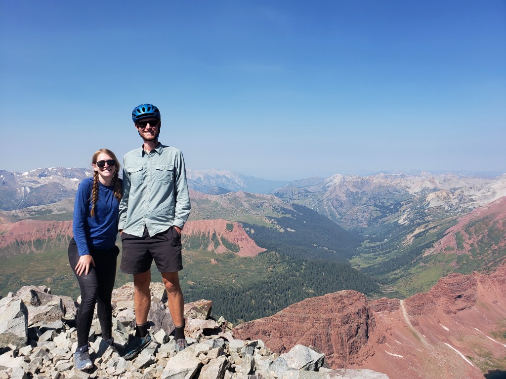
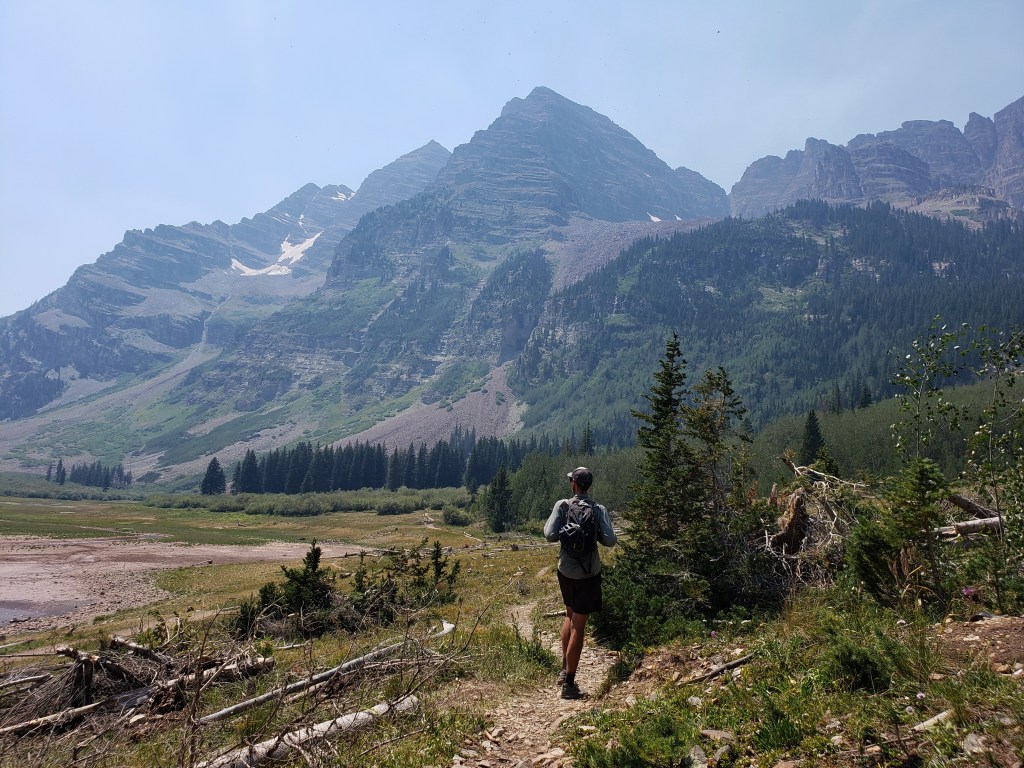
In the morning we readied ourselves for the long weekend ahead. We had mailed ourselves our larger backpacks to hike into the Maroon Bells wilderness area to tackle three major summits – Maroon Peak, North Maroon Peak, and Pyramid Peak.
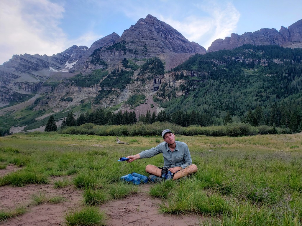
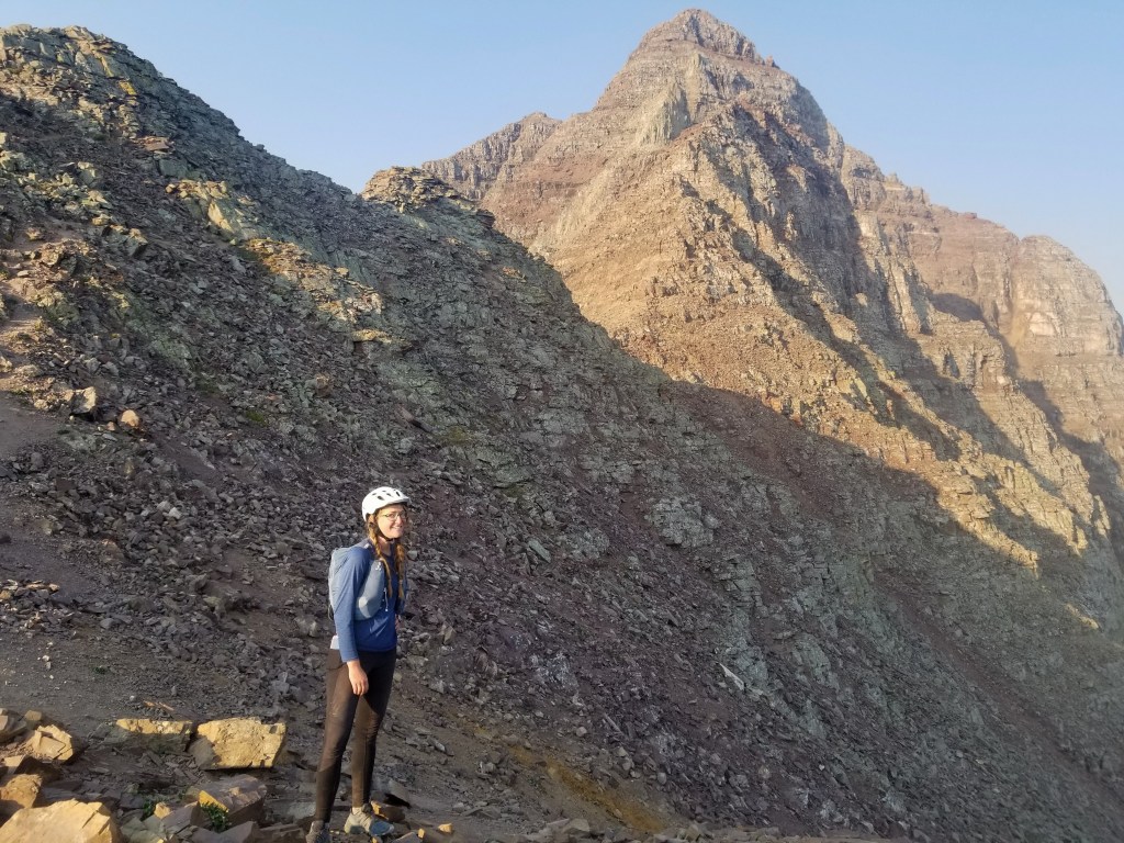
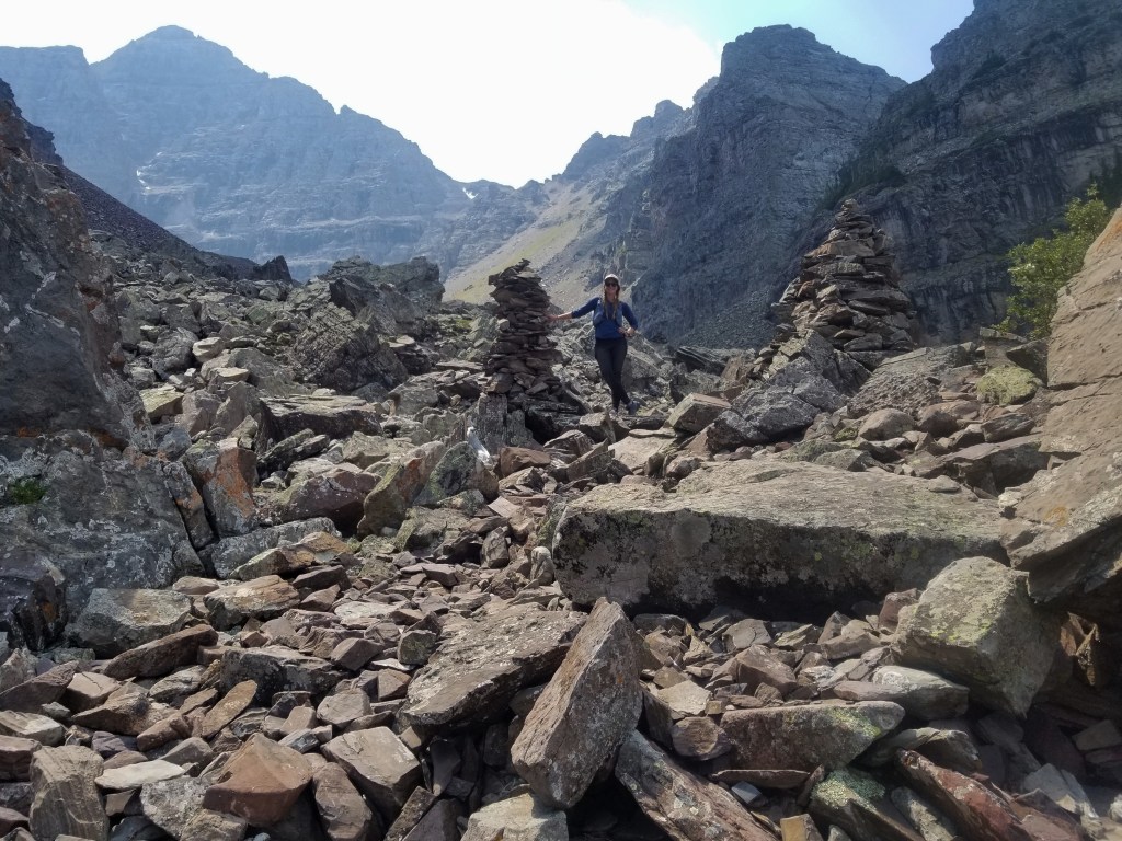
Late afternoon, we took off on bikes up to Maroon Lake, switched our gear into our backpacks, and hiked the brief 2 miles to Crater Lake. At Crater Lake, we found a perfect campsite in the woods that we would call home for the next three nights.


Day 39 – 7 miles hiking / +4200 ft elevation gain
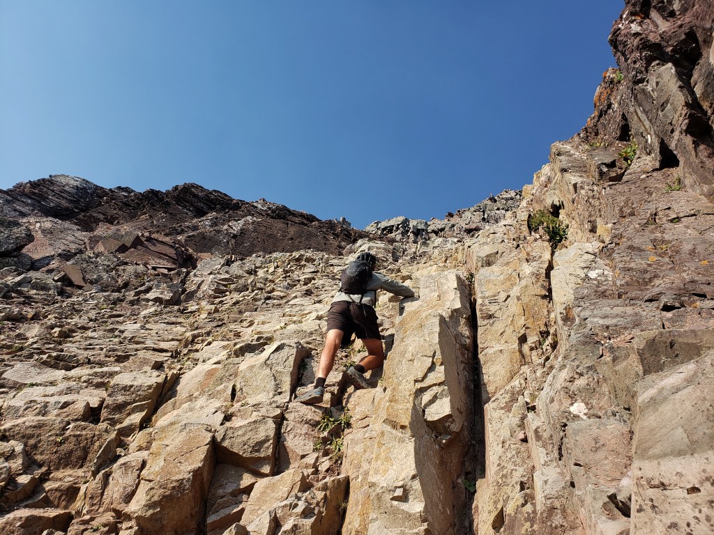
The first of the three peaks was the tallest, longest hike, and lowest class. If you didn’t know, climbs are rated from Class 1 – 5, then climbers use 5.1, 5.2, etc to describe the steepness of the pitch. In terms of hiking, a Class 1 is a walk up. Class 2 usually has boulder scrambles with some exposure. Class 3 involves busting some creative moves with significant exposure and an increase in the chance of fatal mistakes. Class 4 is just shy of needing ropes. Maroon Peak is a Class 3 route with plenty of exposure, somewhat challenging route finding, and high rockfall potential. If you’re not ok with heights, none of these peaks are for you.
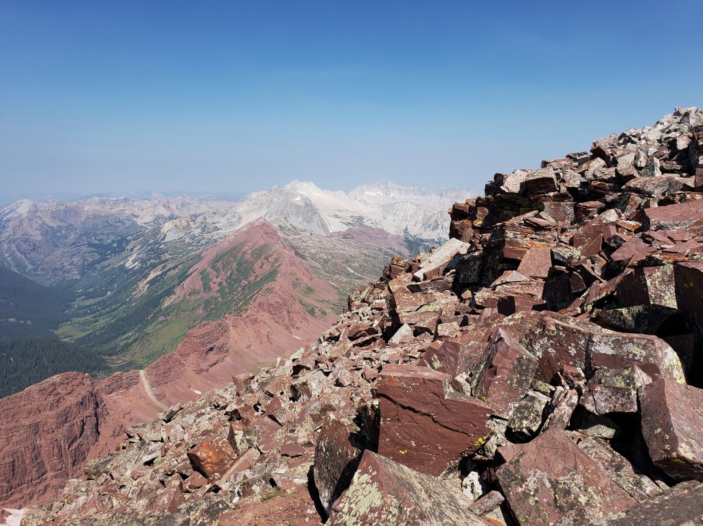
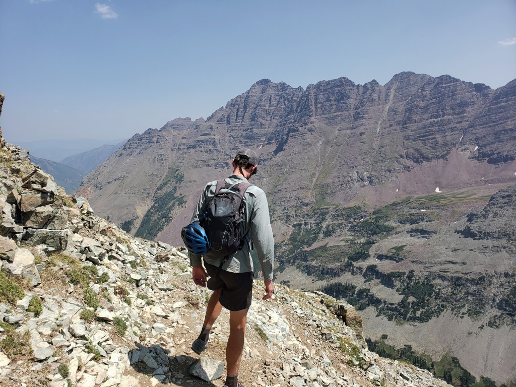
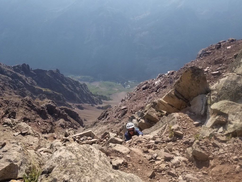
We began from our camp at Crater Lake at 5:20 walking for about 40 minutes in the dark before sunrise. As we began our long uphill ascent, the trail was solely comprised of loose gravel and dirt making for a slow go. Just before 9, we reached the ridge where 14ers.com warns that the difficult portion of the hike begins within the final 1000 ft to the summit.
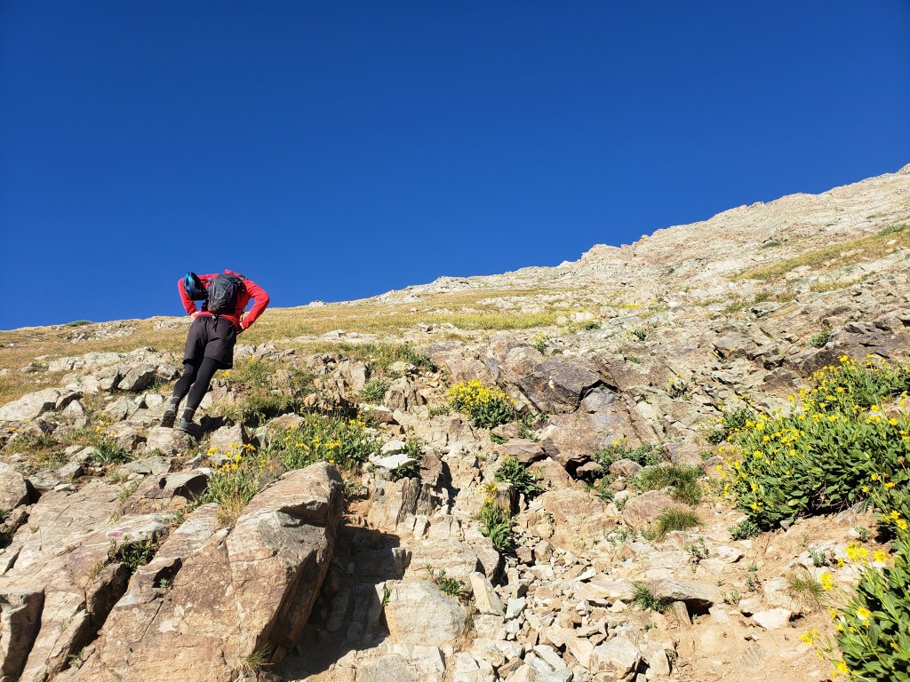


We worked our way around narrow ledges following cairns through slots and winding our way across rocks. The steepest and scariest part of the traverse was crossing two gullies full of loose rocks in a range of sizes. Each step was calculated, tested, and deliberate, and still it felt like the entire gully could collapse at anytime sending us along with it.


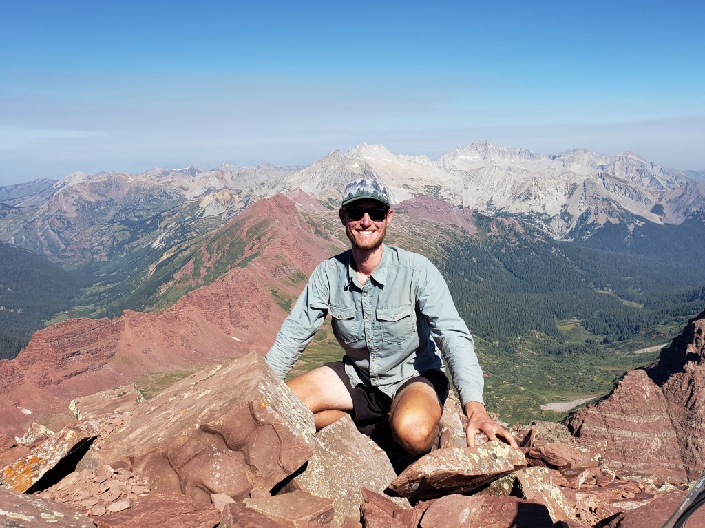
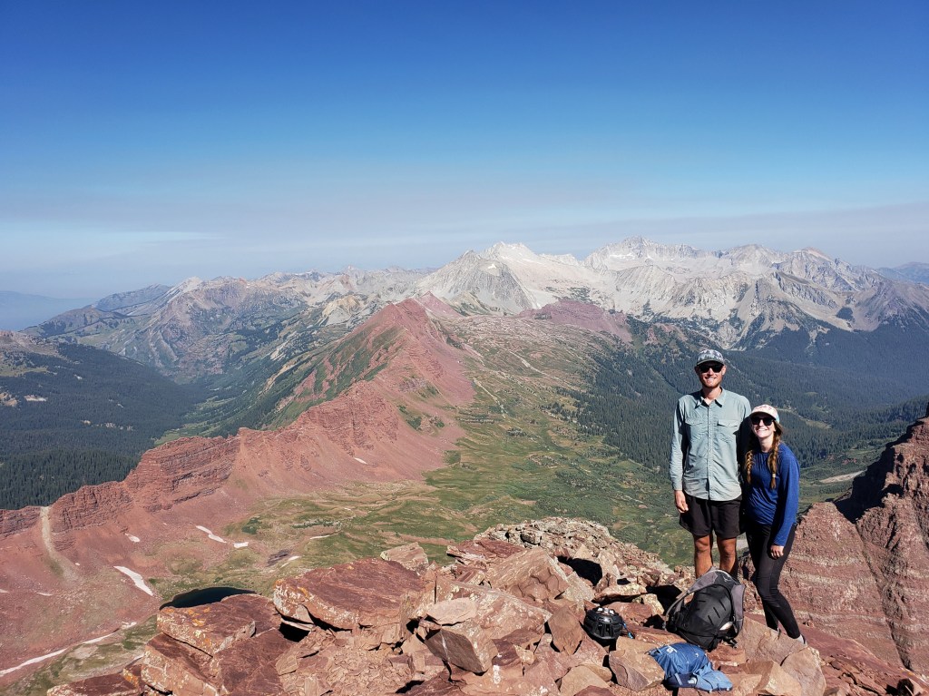
We carefully made it across gully 1 which only led to gully 2. After slowly and safely crossing, we began climbing a steep pitch to the “wide gully” which was thankfully less steep. After a few more creative moves, we were at the summit.


The views were surreal. The valleys below were a striking contrast of green and red with Capitol Peak and Snowmass glittering silver in the distance. Two women shared the summit with us, the only other hikers we had seen throughout the day. The haze from the Grizzly Creek Fire in Glenwood Springs was noticeable in the air, but thankfully didn’t deter too much from our enjoyment. After about 30 minutes at the summit, we began the long hike down.
We descended from the summit, slowly crossed the temperamental gullies, and dropped below the ridge. We were happy to be back on safer territory, but the remaining hike was no easy walk. Ahead of us was several thousand feet of steep downhill walking on slick dirt with essentially nothing to grip. Both of us fell at least three times during the tedious walk.
About 9 and a half hours after we started, we finally returned to camp. We enjoyed food, podcasts, and sleep until our next big ascent the following day.
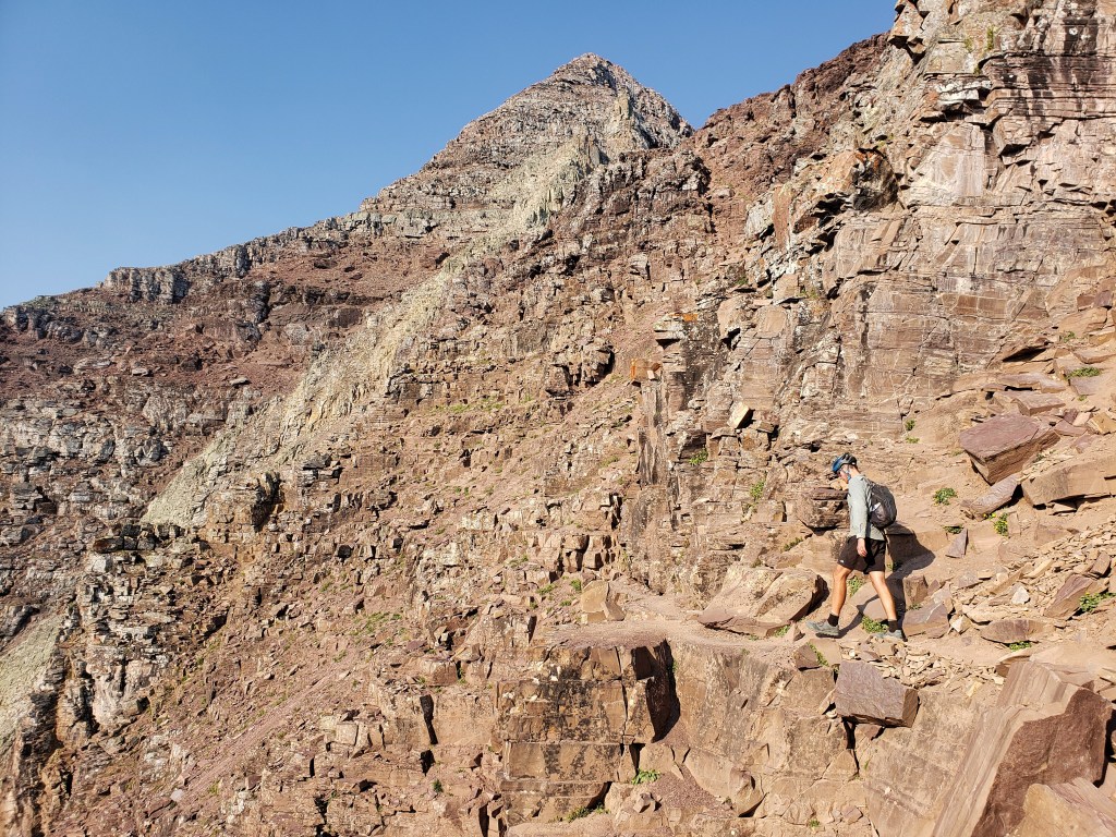
Day 40 – 6 miles hiking / +4000 ft elevation gain
We began our first Class 4 at 5 am. I was feeling a mix of nerves and anxiety about the climb ahead knowing the challenges of yesterday’s summit. Still, up we went grateful that the trail wasn’t just slick dirt like the Maroon Peak trail. As the sun rose, the sky was considerably thicker with smoke noticeable in sight and breath.


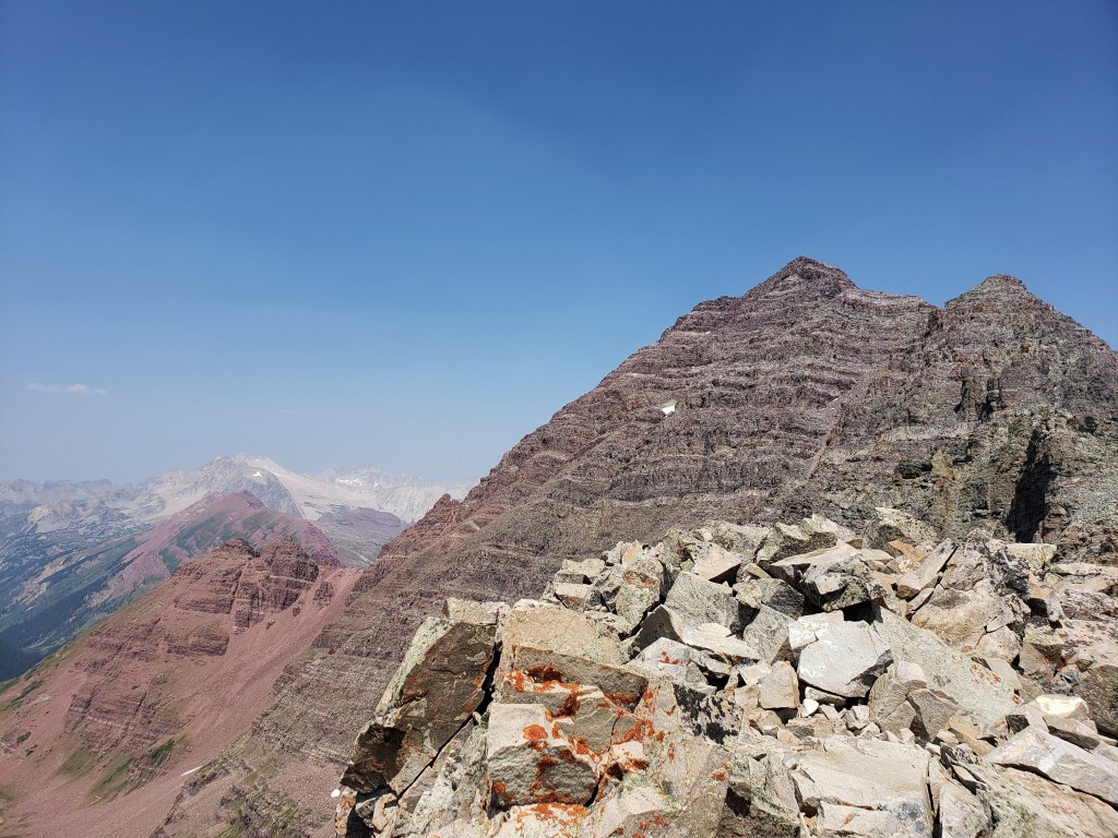
The first challenge of the hike was crossing the rock glacier. There wasn’t much elevation change through this section, but it still required concentration as we crossed uneven boulders. Once through the rock glacier, we returned to trail and continued our way up. As we rounded a corner, we got a great look at North Maroon as well as South Maroon we had summited yesterday. We could see hikers on South Maroon and suddenly a big puff of smoke arose from the summit. Confused, but with no immediate answers, we pressed on.


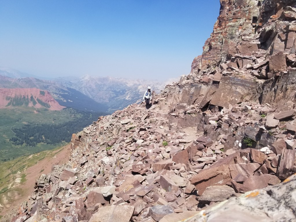
We headed into our first gully which was plenty steep and had some loose rock, but nothing compared to yesterday’s hike. After 600 ft ascent, we exited the gully, rounded some narrow ledges, and entered gully #2. Up we went, slowly and carefully on loose rock and slick gravel traversing a significantly steeper 600 ft.

Once we exited the gully, the remaining route was Class 3 and 4 moves climbing steep walls with narrow ledges, occasionally searching for hand and foot holds while clinging to a rock wall. At times, I surprised myself with upper body strength I didn’t know I had.


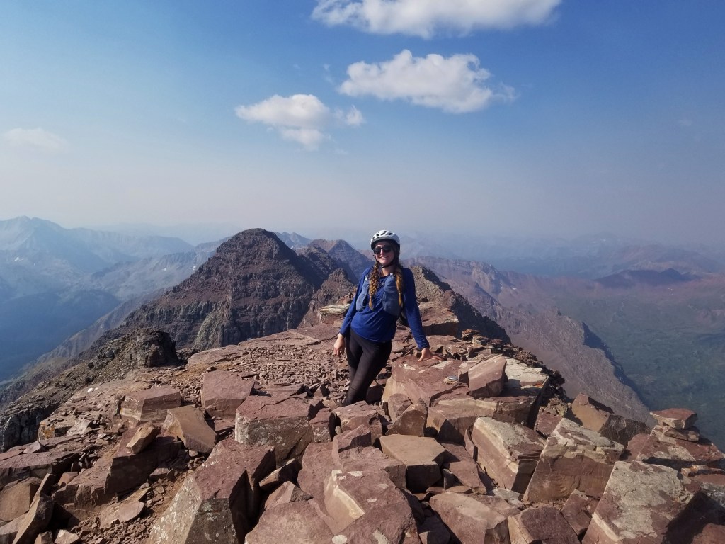
At the summit, a group of four men greeted us as they had just completed the Class 5 traverse from South Maroon to North Maroon. Assuming they were the ones we spotted earlier, we inquired about the puff of smoke. They informed us that one of their brothers had passed 10 years ago on that very traverse, and the smoke we had seen was them spreading his ashes on the mountain.

The group soon left, and we enjoyed the summit for a few minutes. Truthfully, the hike had been tough, and I questioned my abilities for tomorrow’s acsent of Pyramid Peak which was described as an even more difficult climb. Not long after we had spoken our doubts, two other hikers joined us on the summit. One hiker had already done Pyramid and reassured us that since we had done these peaks, Pyramid was within our grasp.
With a little confidence boost, we headed down the mountain. The climbing section was slow and steady, followed by the steep gullies. Thankfully, it was quicker than descending South Maroon, but the entire hike still took just shy of 9 hours.


Day 41 – 6 miles hiking / +4000 ft elevation gain; 11 miles biking downhill
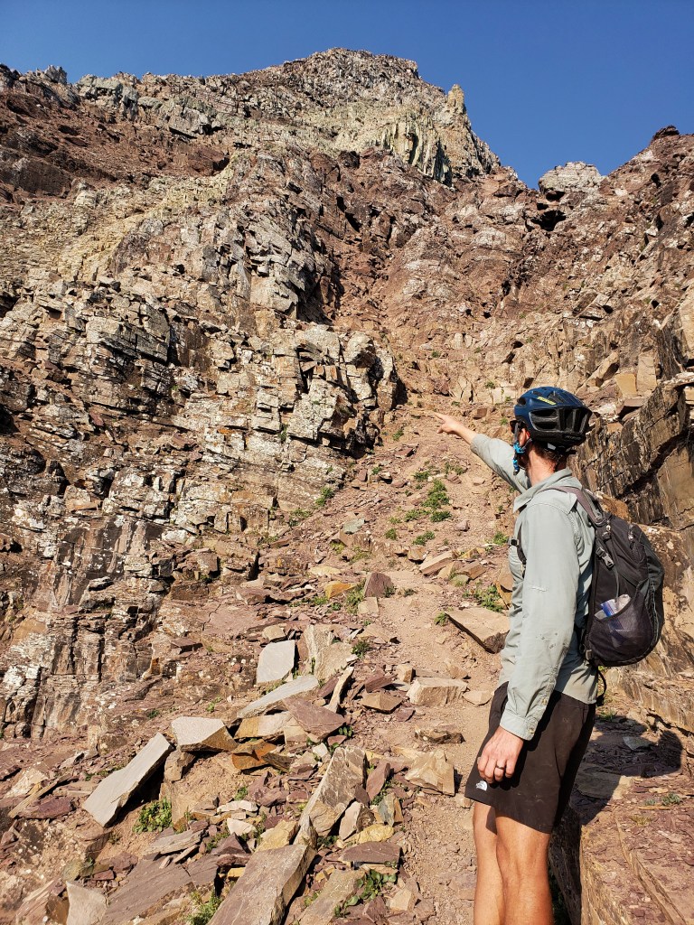
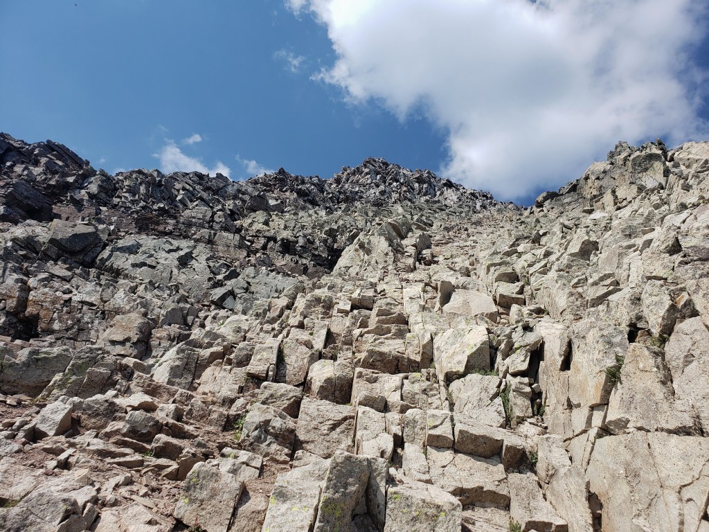
We woke at 4 am, broke down camp, and hiked all of our stuff to the spur trail of Pyramid Peak which was a little closer to the parking area. We stashed our bags in the woods and began the hike up Pyramid with our day packs. The trail began as an uphill hike on a defined trail with plenty of stair steps. As the sun rose, we made it to “the gates,” large cairns that framed our first views of the summit and welcomed us to another much larger rock glacier.


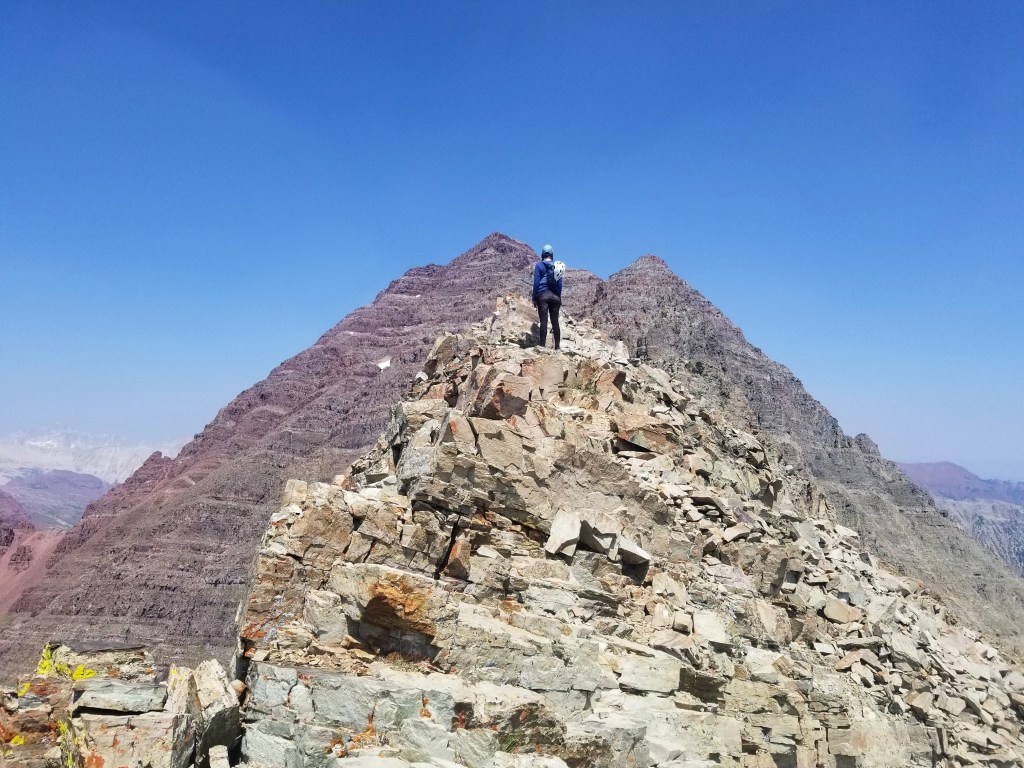
We spent about an hour boulder hopping until we reached a steep slope that would take us to the ridge. The slope was, not surprisingly, super slick and full of loose rocks. Another hour passed, and we found ourselves on the ridge greeted by a couple of mountain goats. Sean studied the route from 14ers.com and declared that we just had some narrow ledges and 1000 ft of complex climbing to go!


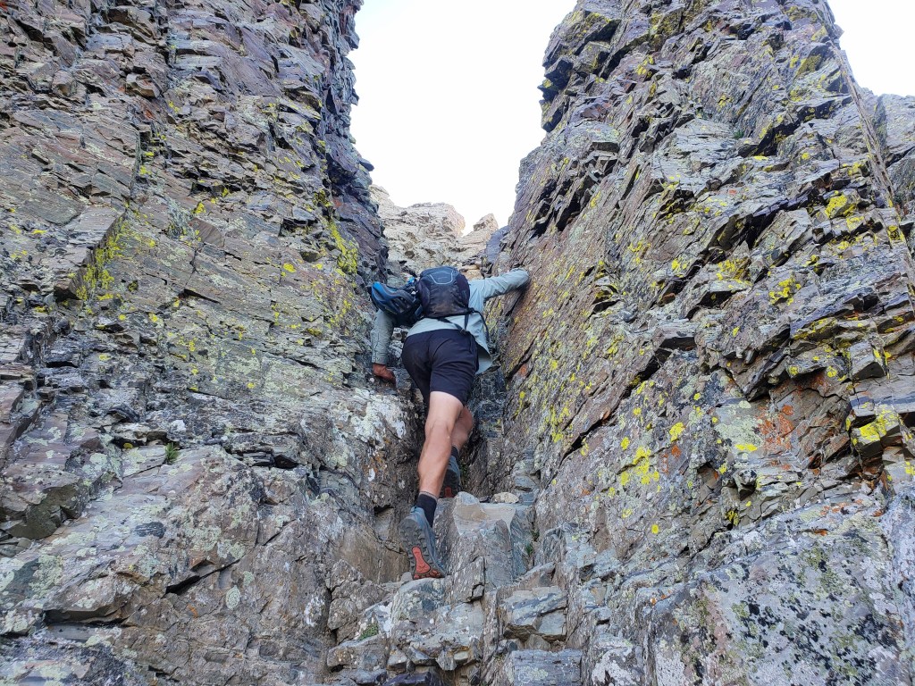
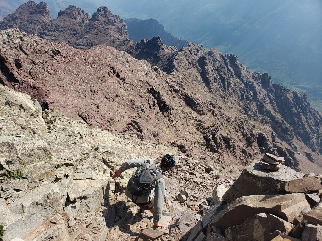
After a short break, we began the difficult section of the hike. First, narrow ledges took us around the mountain. One ledge even had a nice size gap in it we had to jump over. After clinging to the mountain while shimmying along the ledge, we reached the infamous “green wall.” The steep wall looked intimidating, but I was pleased to find that the wall had plenty of hand and foot holds. I did my best to focus on the task at hand and absolutely not look down. After a few hundred feet of climbing, we exited the green wall. It was a great feeling to stand on two feet, but I questioned how going down would be.

At this point, we were about 500 ft below the summit and still had some Class 3/4 climbing ahead. The climb was mostly chunky walls with ledges in between. It was difficult, but I was pleased with my abilities as the summit came into sight. Moments later, we reached the summit stoked that we had successfully completed the Class 4 route.


The views of Maroon Bells from Pyramid were amazing! Looking at the peaks it was hard to believe we had stood on those summits days before. We spent a little more time than usual at the summit, then began the traverse down.
First, we came down the rock bands which were surprisingly simple. When we reached the green wall, I was definitely nervous, but as we descended we found it was actually really easy to navigate. Next, we skirted the ledges and were once again greeted by mountain goats when we returned to the saddle. What took us 2 hours to ascend only took 1 hour to descend.

Going down the steep slope and crossing the boulder field was slow and tedious, and we rejoiced when we reached the gates. Once back on an actual trail, the feelings of accomplishment set in. We were elated that we had successfully summited all 3 challenging peaks.

Once we reached our backpacks, we walked down the trail to the parking area, ate lunch, and packed our bikes. The all downhill cruise to town was the cherry on top of such an incredible day. Despite our fears going into the hike, Pyramid Peak became one of our favorite 14ers we had done so far!

If you’re keeping track…
779 Miles Biking / +81,000 ft elevation gain
216 Miles Hiking / +93,000 ft elevation gain
31 – 14,000+ ft Summits
- Maroon Peak, North Maroon Peak, & Pyramid Peak
- Castle & Conundrum Peaks
- La Plata Peak
- Huron Peak, Missouri Mtn, Mt Oxford, & Mt Belford
- Mt Shavano & Tabeguache Peak
- Mt Princeton & Mt Antero
- Mt Harvard, Mt Columbia, & Mt Yale
- Mount Sherman
- Mount Massive & Mount Elbert
- Mount of the Holy Cross
- Mt Democrat, Mt Cameron, Mt Lincoln, and (not) Mt Bross
- Quandary Peak
- Torreys and Grays Peaks
- Mount Bierstadt
- Mount Evans
- Long’s Peak
We are Bekah and Sean, out on an adventure to summit as many CO 14ers as possible this summer and reaching them via bicycle! Follow along here or on Instagram as we complete our Summer of Summits.

Pingback: Summer of Summits: Snowmass Mountain – Infinite Geography
Pingback: Summer of Summits: Capitol Peak – Infinite Geography
Pingback: Summer of Summits: Carbondale to Denver – Infinite Geography