
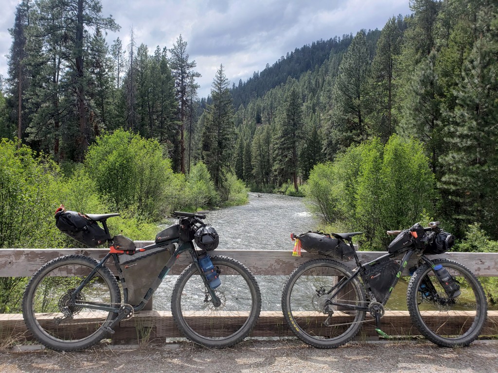
Pacific Northwest Trail Sections 4 + 5 – Northport, WA to Cold Springs, WA

In mid-June 2021, we set off from Glacier National Park westbound heading towards the Washington coast on the ~1200 mile Pacific Northwest Trail (PNT) with a group of the most hardcore hikers we know. Check out our experience in Section 4 and Section 5 of the PNT through the Kettle River Range and Okanogan Highlands.
(Links to previous sections at the end of this post.)

Day 20 – 29.9 Miles / +6000 ft elevation gain
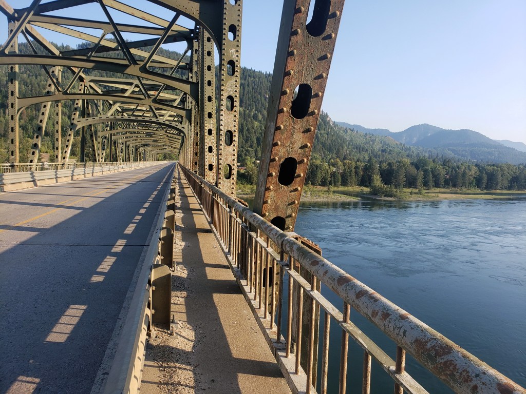
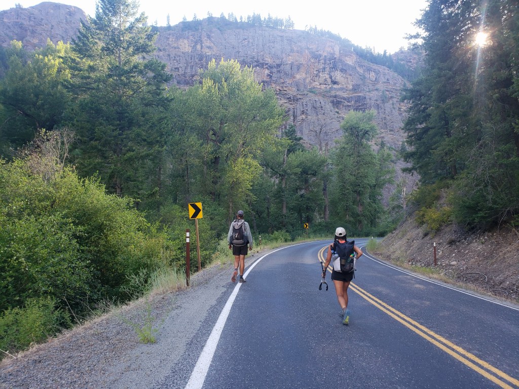
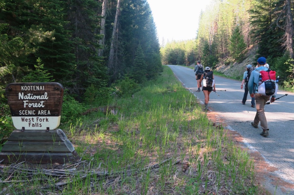
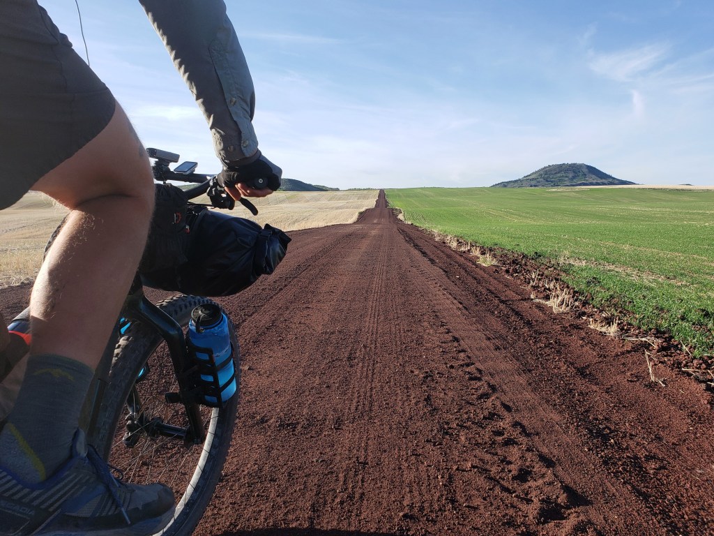
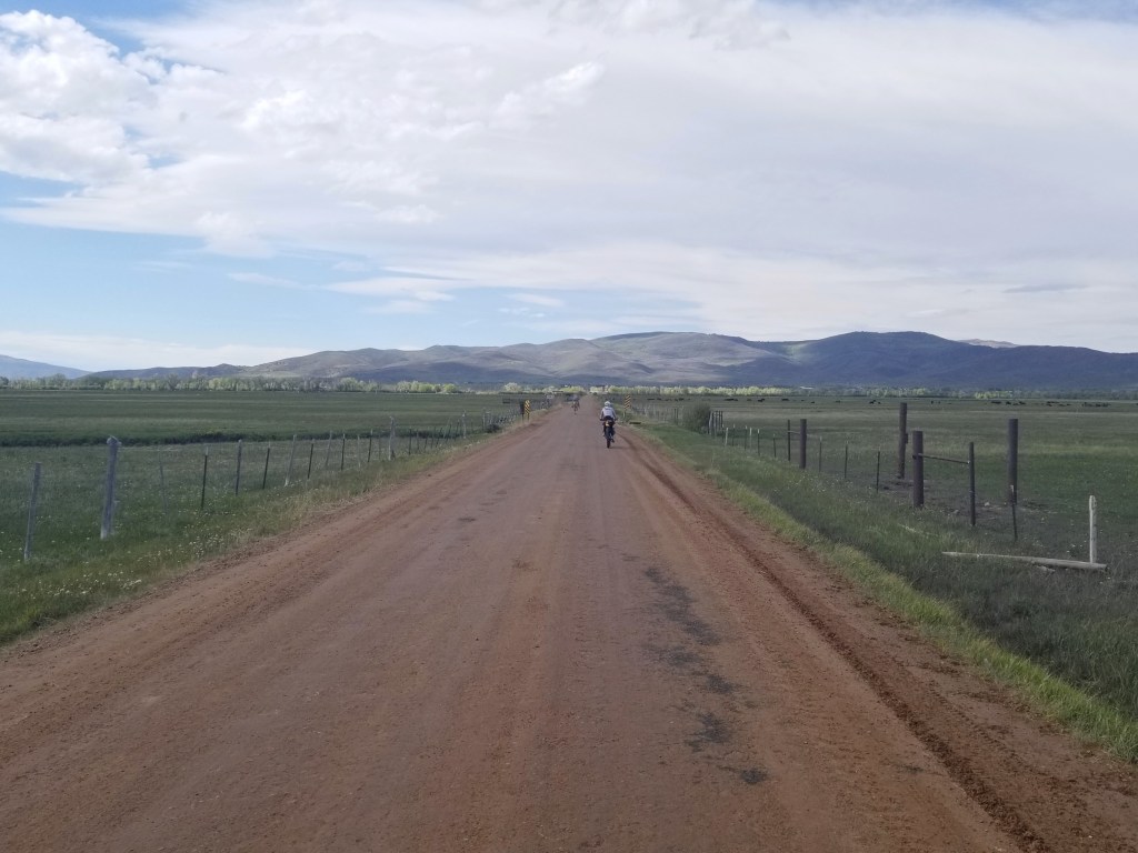
We started Section 4 when we left Northport and crossed the Columbia River in the evening on day 19. We ended the day about 6 miles out of town at a developed campground and got up early in the morning to begin a long road walk. Leading up to this campsite, we had walked about a 30 mile stretch of road. From the campground, we still had over 30 miles of road walking ahead of us until we would resume hiking on trail.
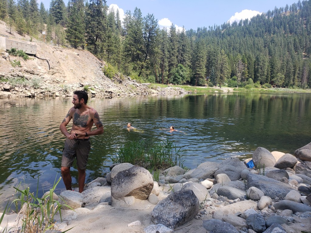
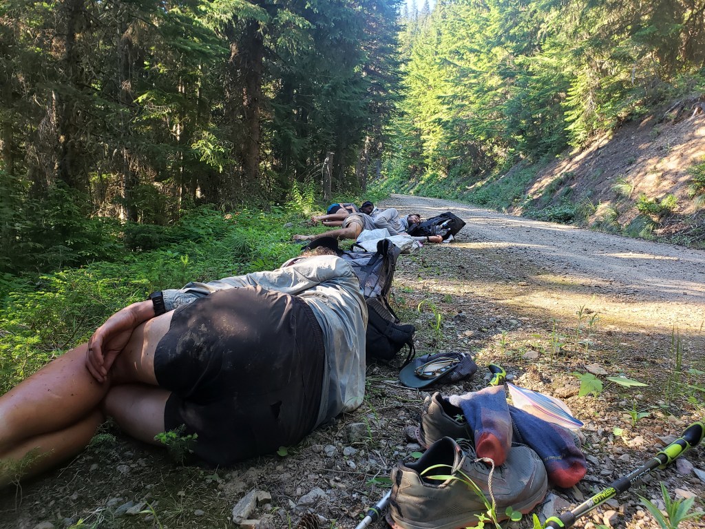
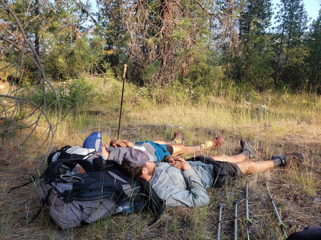
We had a lovely 4th of July morning as we walked forest service roads adjacent to a creek. The cool temps faded as morning became noon and the sun beamed down on us. By about 1:00, we had already walked 22 miles and stopped at the Kettle River to swim and siesta. We knew the temperature was pushing triple digits and hiking seemed impossible. We laid around until about 5:00 when we deemed it possible to walk. We sauntered down the road and found a spot to camp by 9:00.
Day 21 – 32 Miles / +8900 ft elevation gain
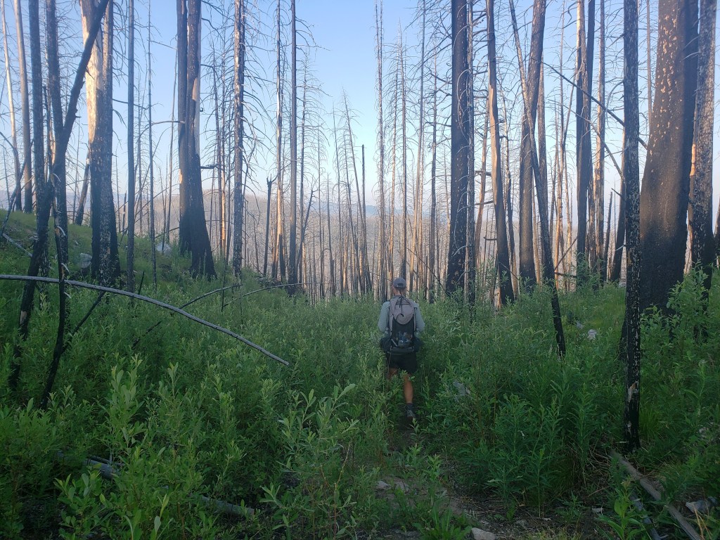
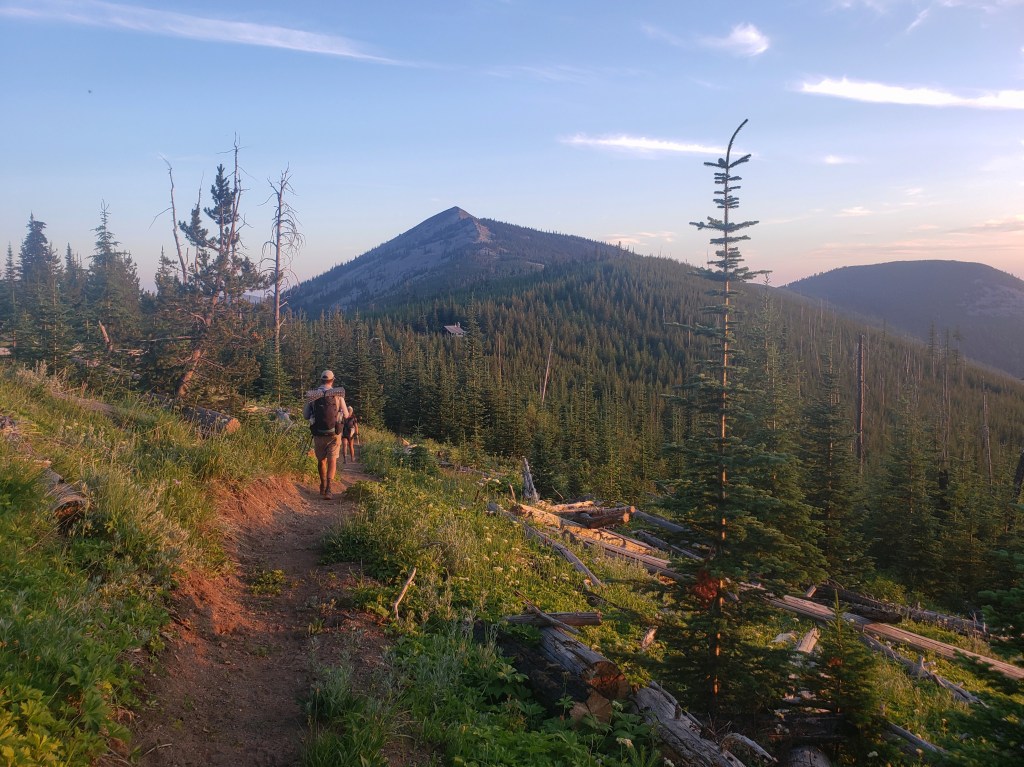
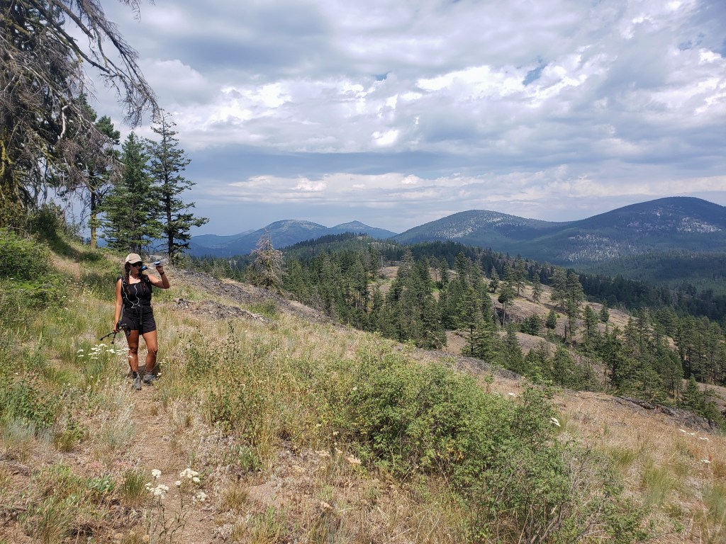
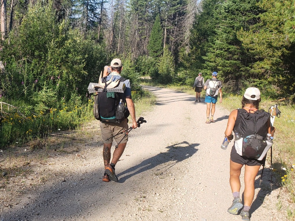
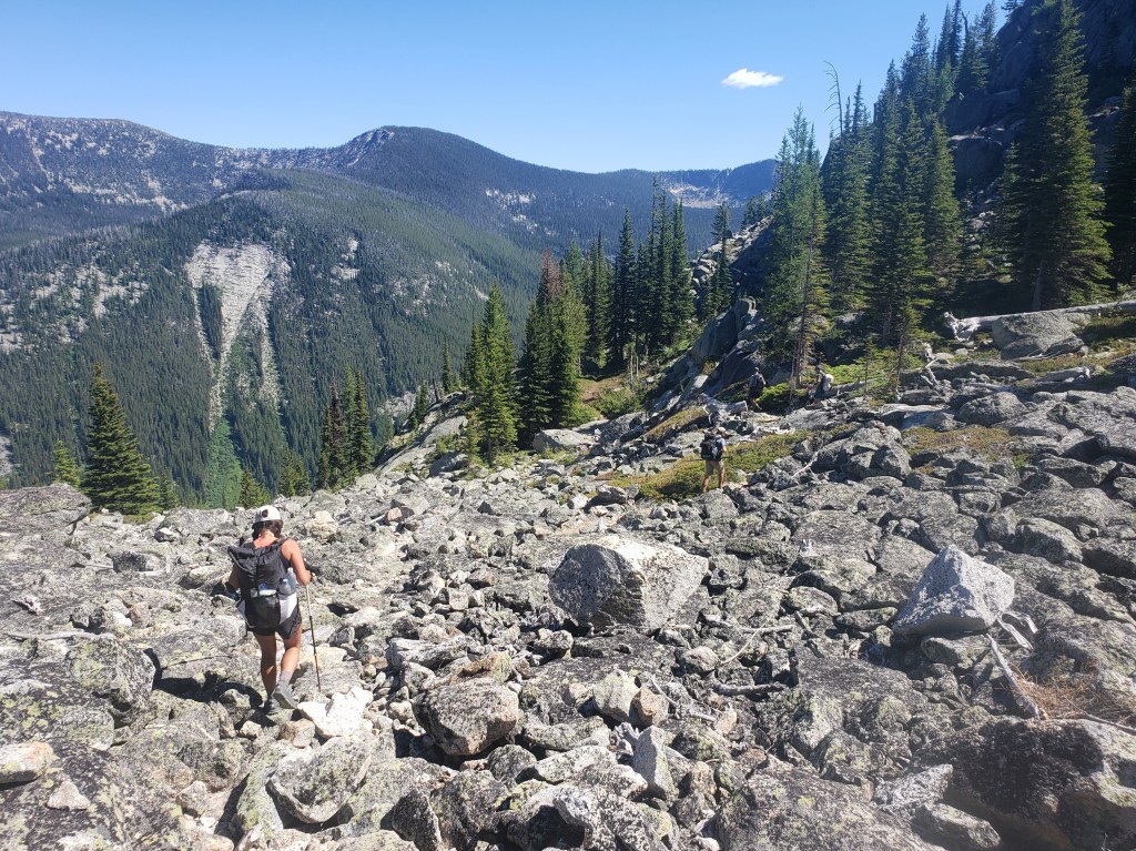
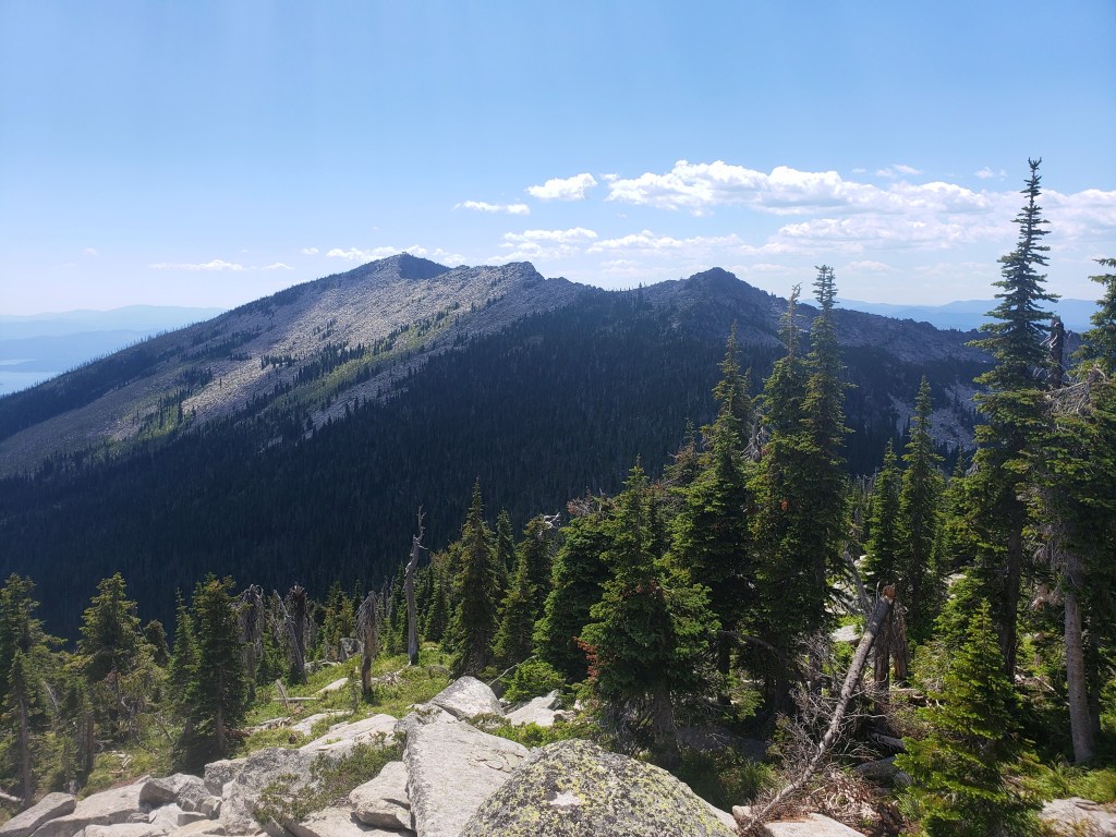
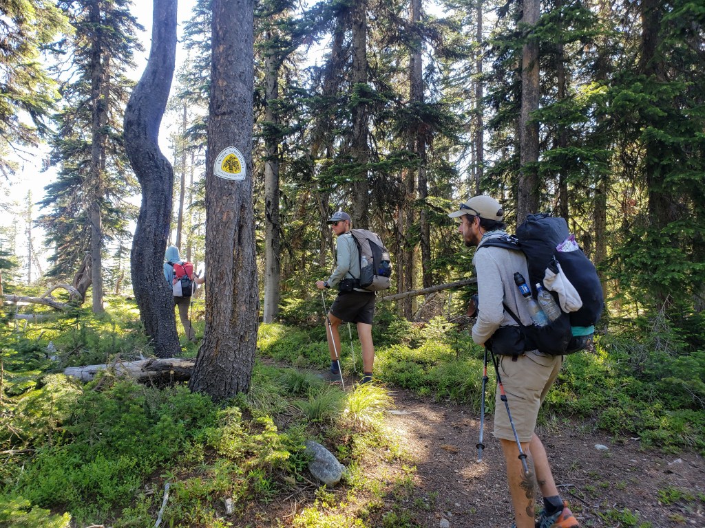
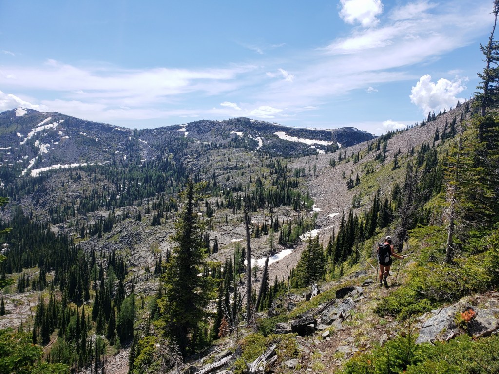
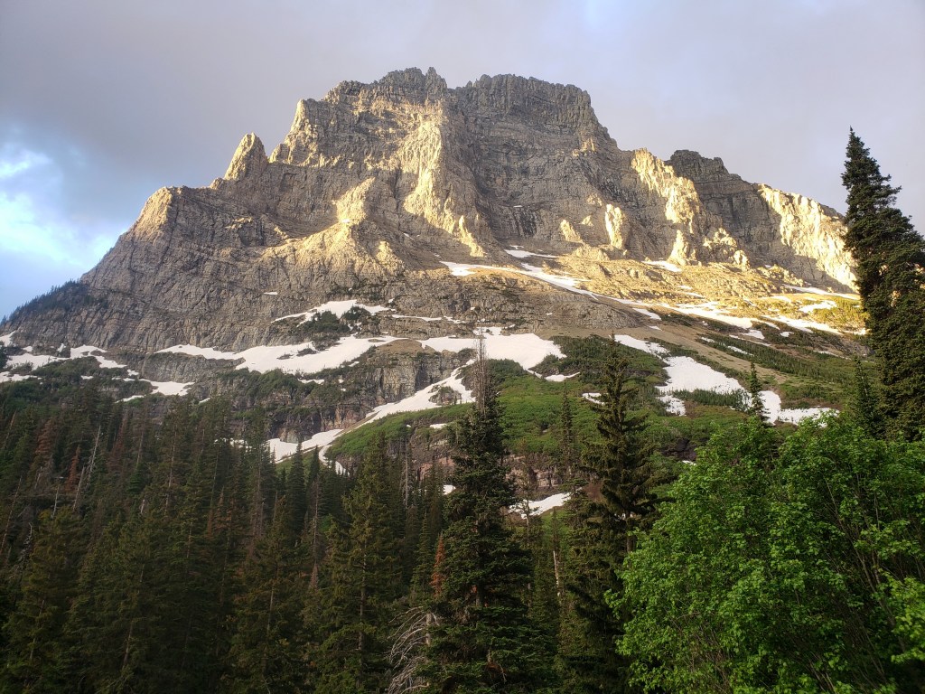
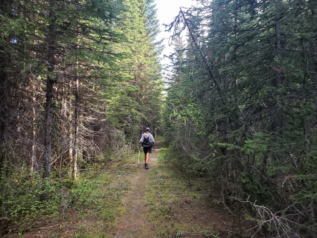
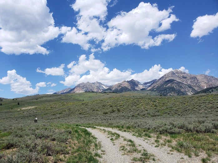
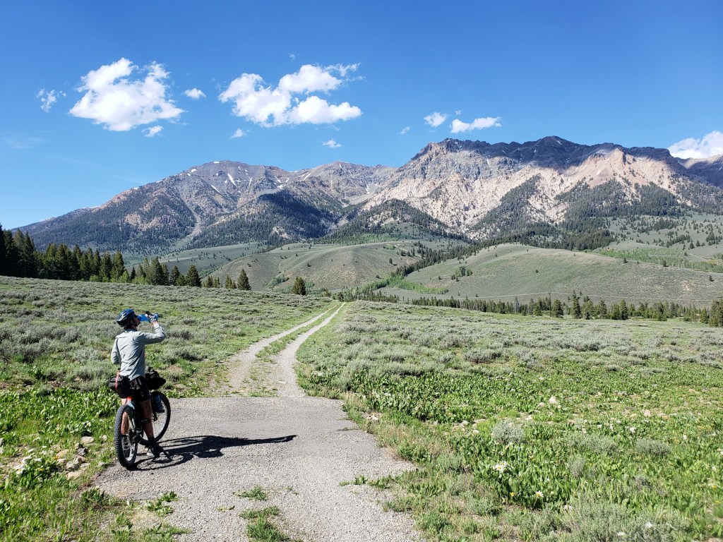
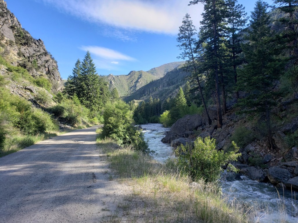
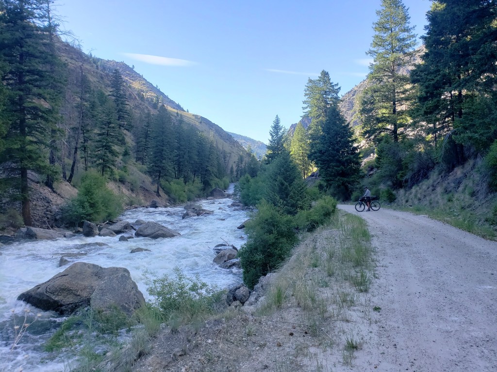
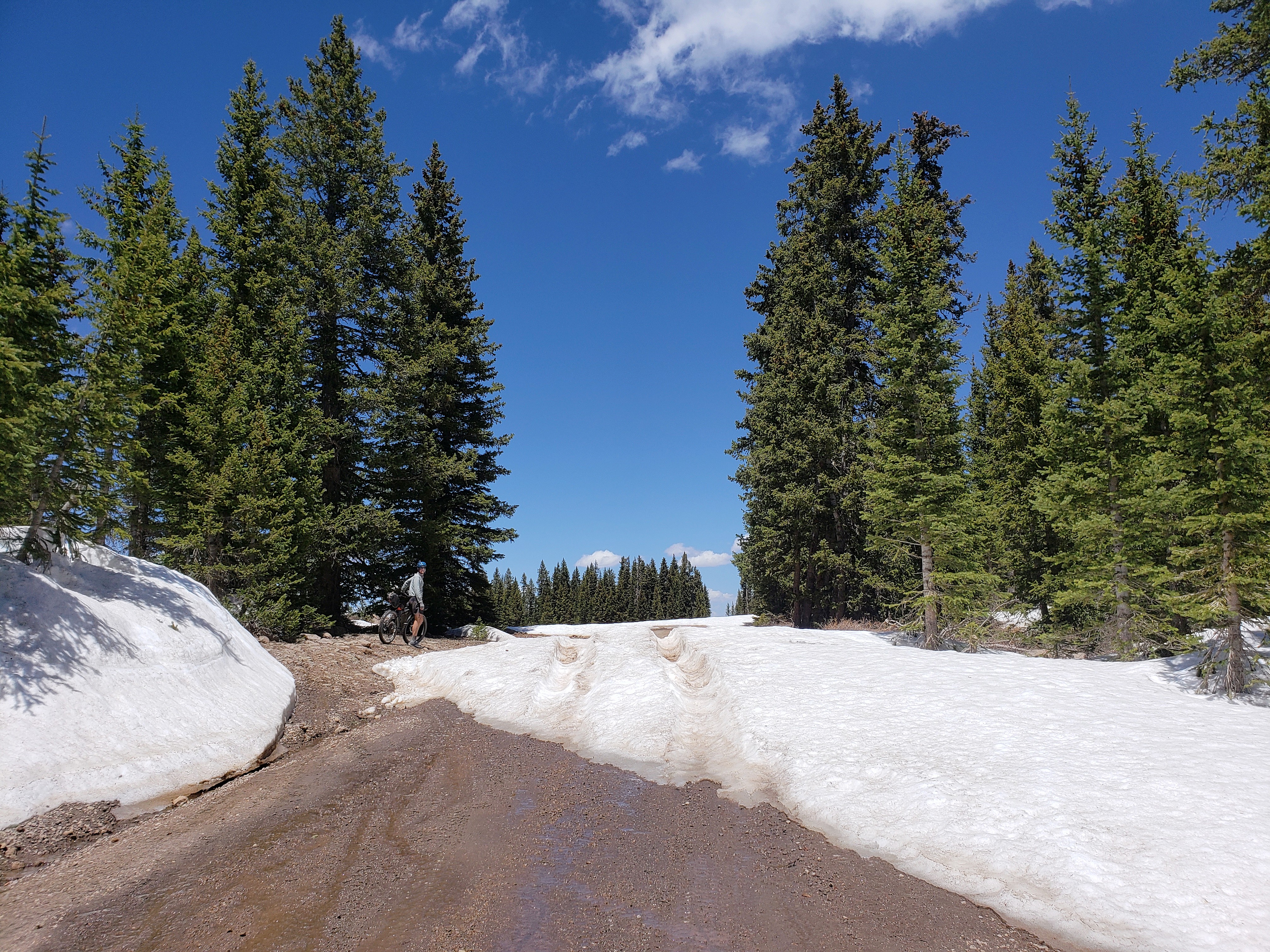
Our morning began early, and we resumed road walking a mix of dirt and overgrown decommissioned forest service roads. After a total of about 60 miles of road walking over the past couple days, we were excited to reach single track despite being in a burn area. The Pacific Northwest Trail coincides for a stretch with the Kettle Crest National Recreation Trail on the east side of Republic. We welcomed the overcast sky and temperatures in the high 70s as we walked through the burn area which provided no shade. In the late afternoon, we finally walked into intact forest as we rode the ridge with incredible views of the Kettle River Range.

Day 22 – 11.2 Miles / +2900 ft elevation gain
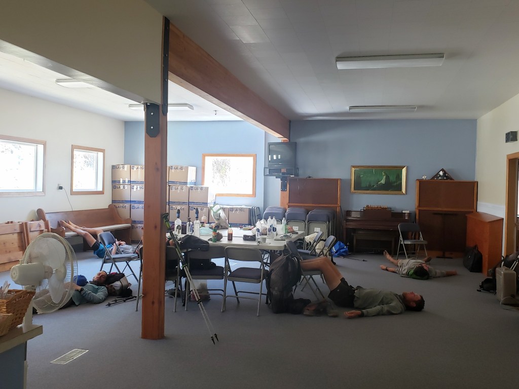
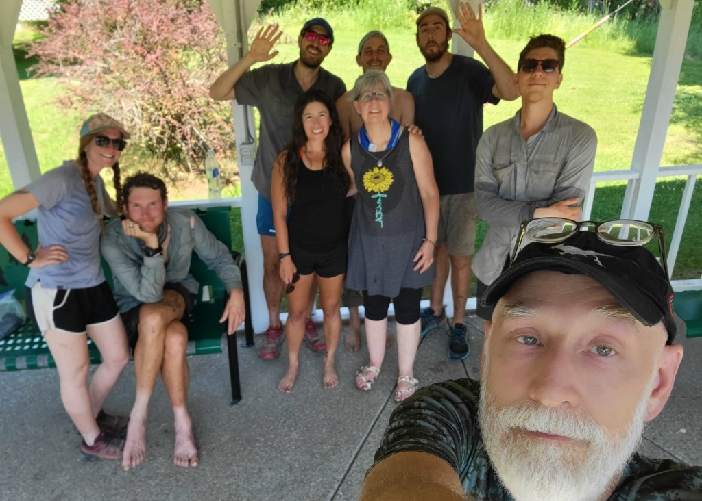
In the morning, we were just 7 trail miles from the highway where we would hitch to Republic. Sean and I waited a little over an hour for a ride, but still joined our friends in town by 10:30. It was considerably warmer in town than up in the mountains, and we spent the day tending to our chores, loitering, and waiting out the heat.
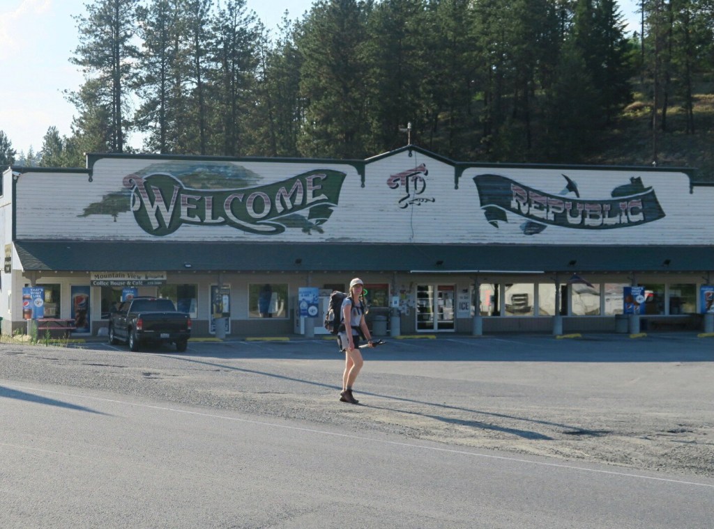

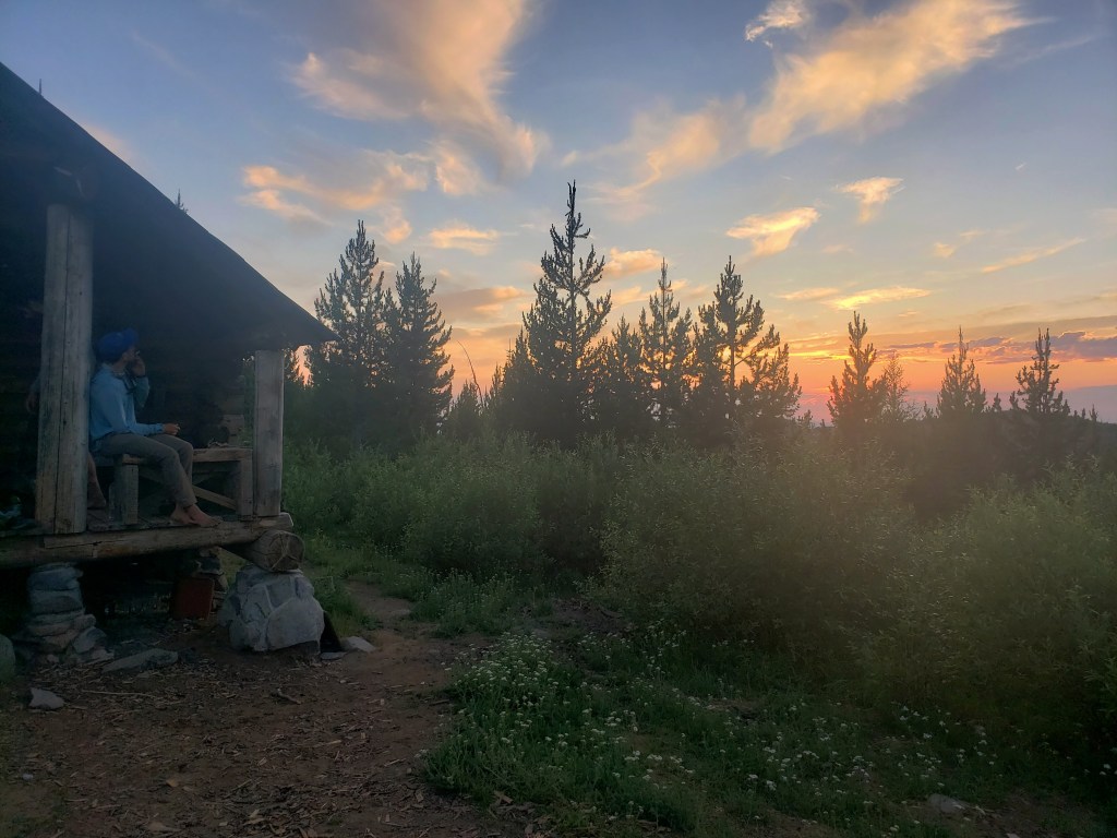
The PNT makes a large semi circle around Republic giving hikers the opportunity to access the town from the east, south, and west sides. We resupplied for 60 miles which would take us from the highway crossing east of town to the third access west of town. We heard of a backcountry USFS cabin that was just 4 trail miles past the highway crossing, so we booked it and headed there for the evening. The cabin had a huge porch with chairs, cots inside, and a propane stove. Compared to our standard night, this was glamping and we were stoked.

Day 23 – 31.2 Miles / +7300 ft elevation gain
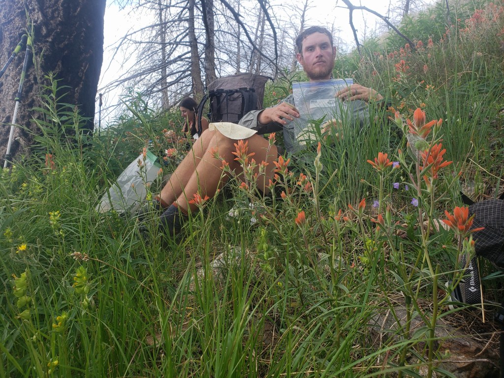
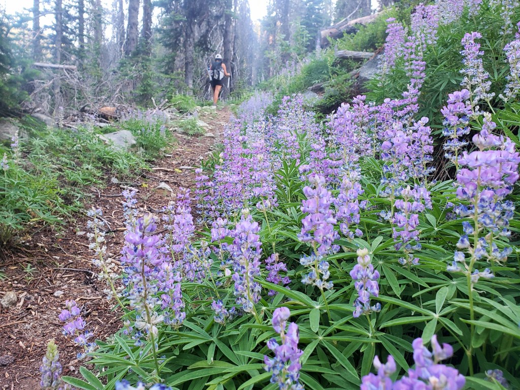
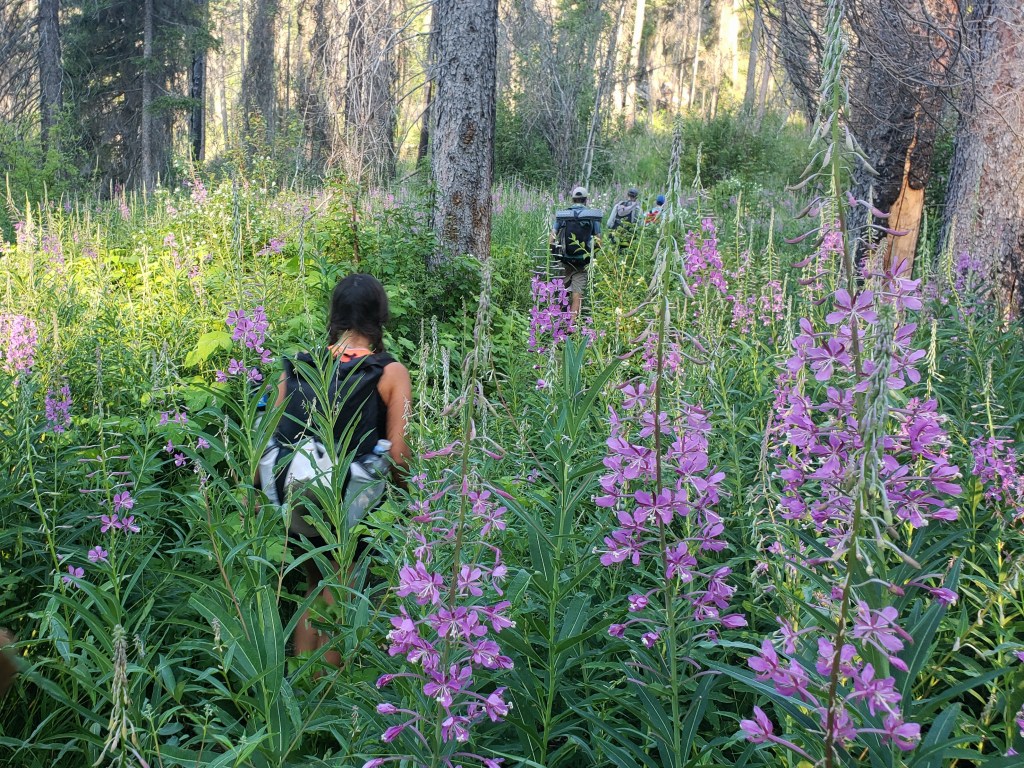
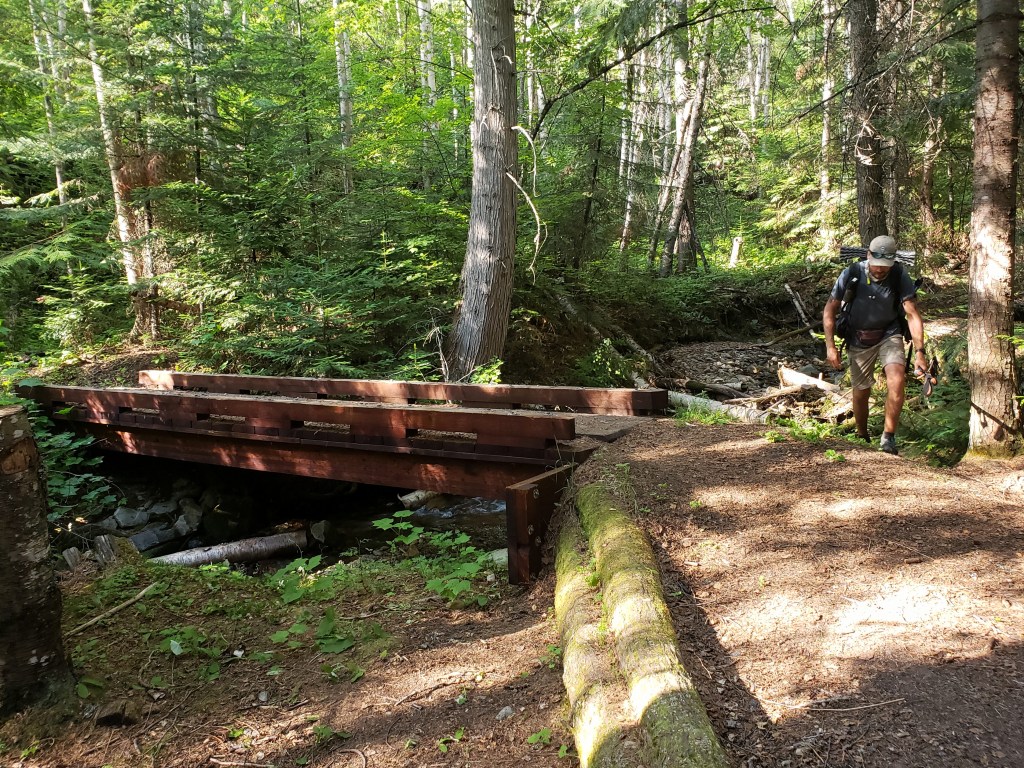
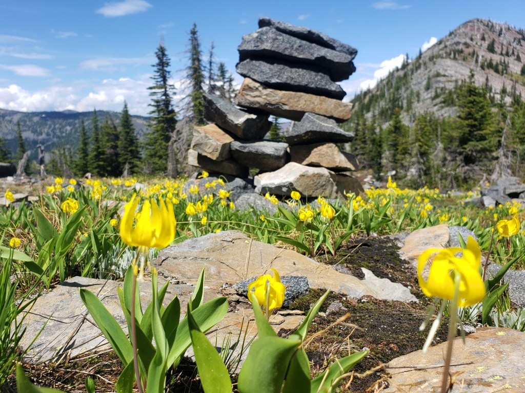
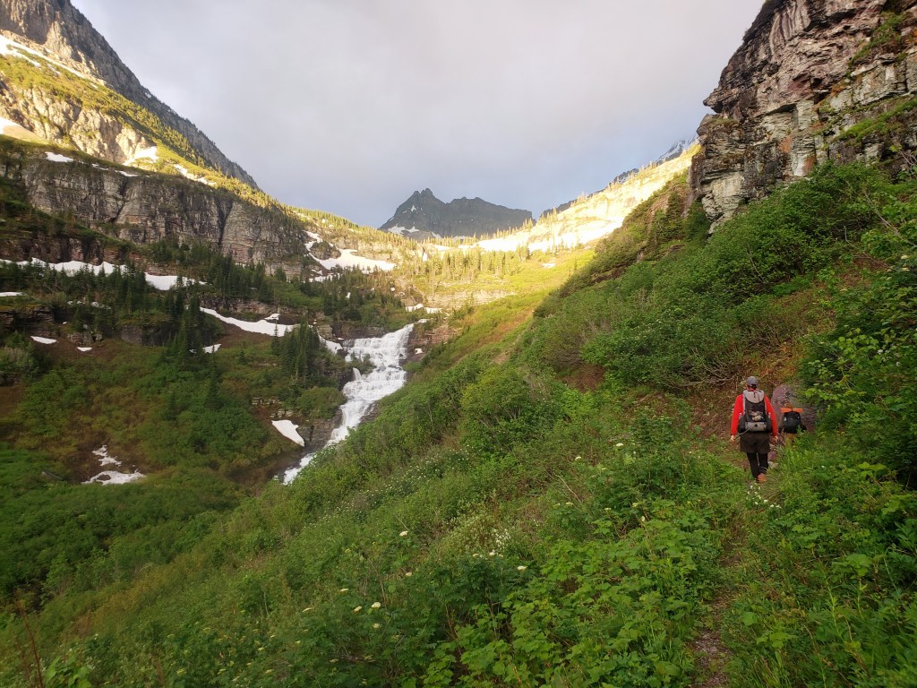
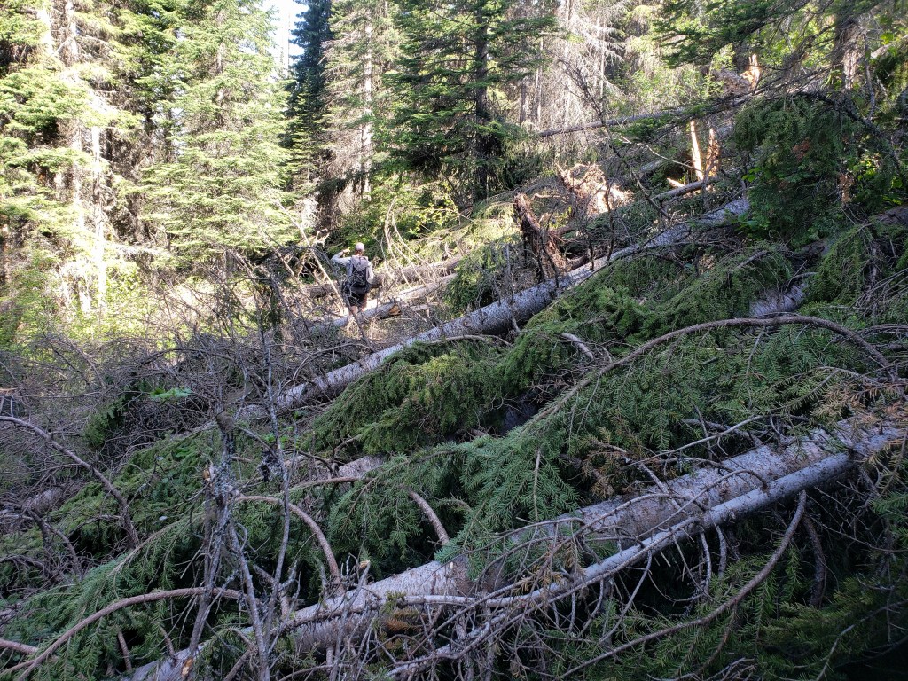
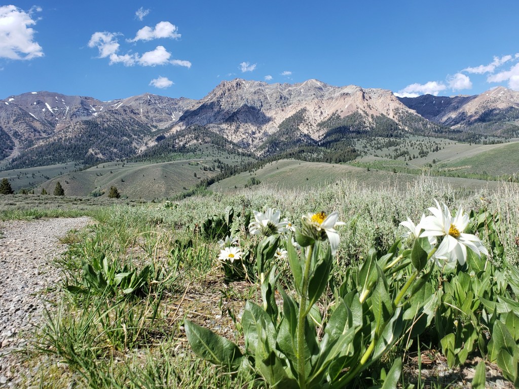
We started our day sipping coffee while watching the sunrise from the cabin porch, then headed out. The PNT continued to coincide with the Kettle Crest trail for a few miles, providing us some of the nicest section of hiking we had seen thus far. The sky and the ground mimicked each other with soft orange and pink clouds above and mirrored wildflowers below. Our dreamy morning suddenly became a bushwhack as the PNT diverted from the Kettle Crest and connected to a forest service road. Thankfully, it was only a short stretch of wayfinding.


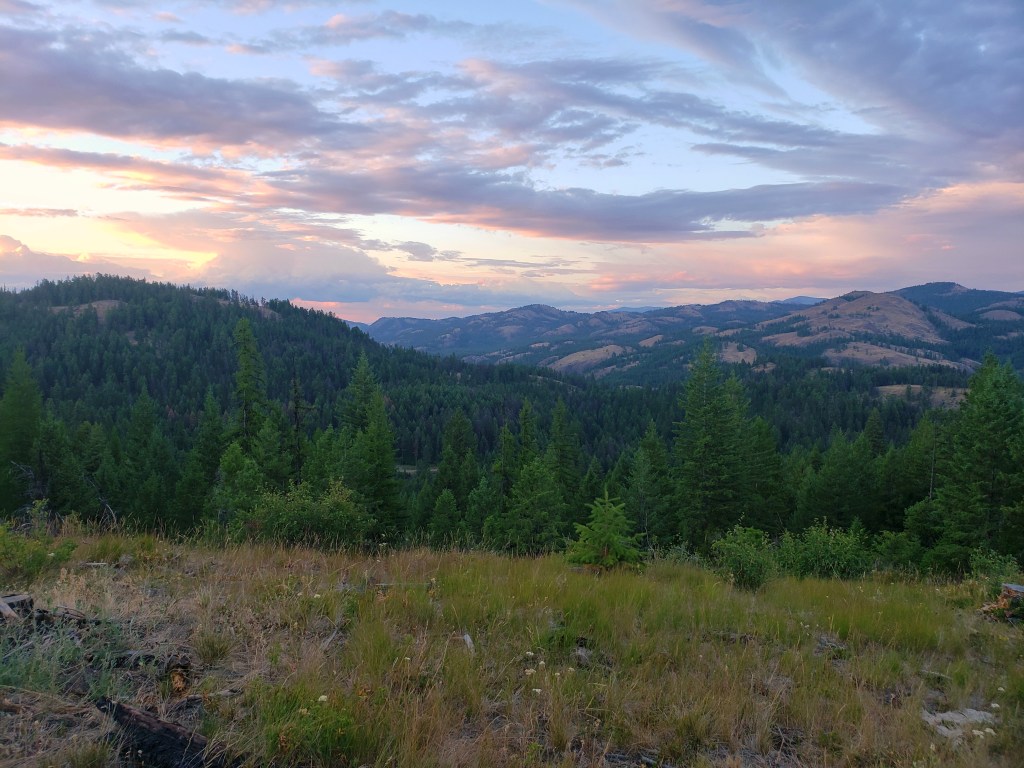
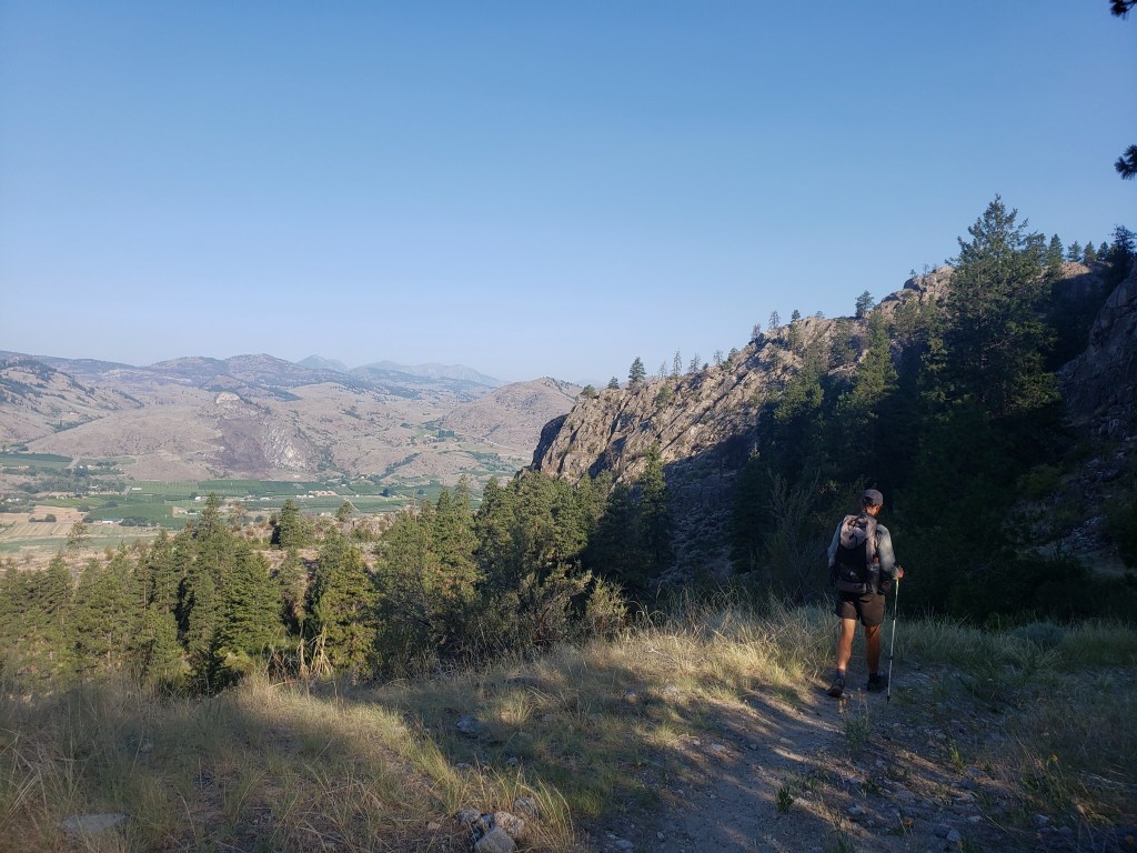
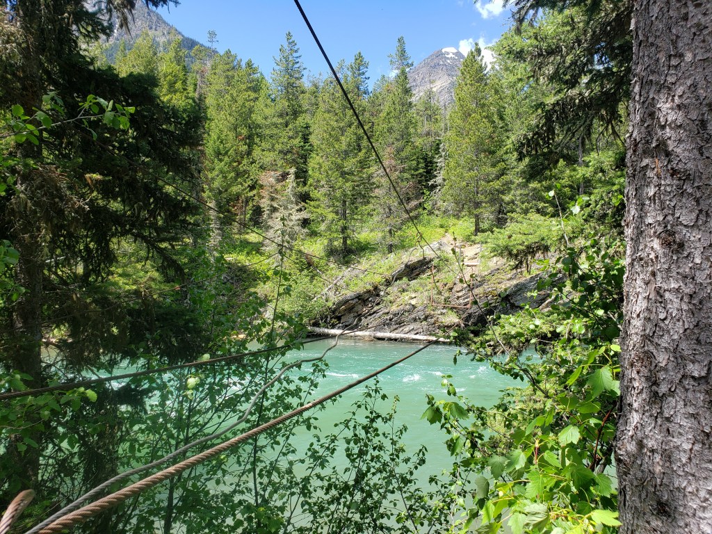
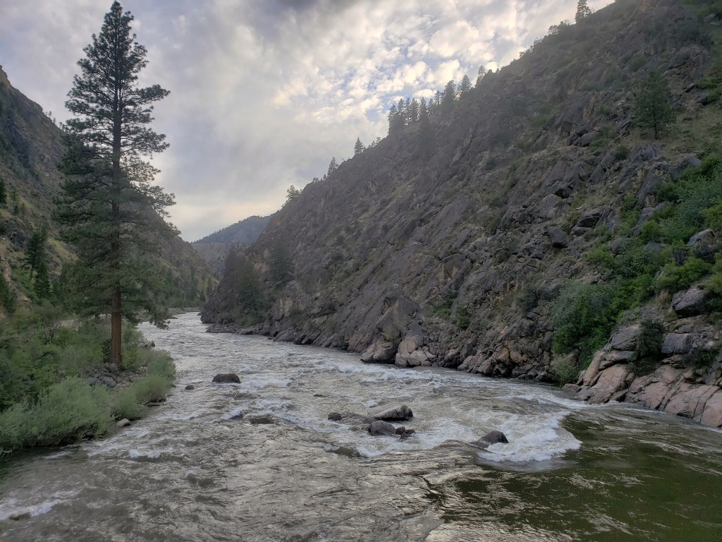
In the afternoon, we enjoyed another stretch of single track as we wound our way down a ridge. We noticed fewer trees and larger piles of dust as we descended confirming were in some of the driest sections of Washington that the PNT traverses. Suddenly, we started following a massive canyon wall downhill, a delightful surprise. Eventually, the trail ended, and we walked a bit of pavement to a developed campsite for dinner. Knowing town was about 28 trail miles away, we decided to walk a bit further to cut down on the next day’s work. After our final uphill climb for the day, we came to an overlook with a magnificent sunset on display. We were mezmorized. Leaving seemed unnecessary and ungrateful.


Day 24 – 23.9 Miles / +2800 ft elevation gain
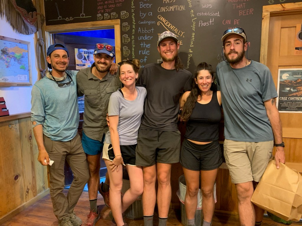
We awoke early, eager to get our hiking done and head back into the comforts of town. The majority of the day was spent walking forest service roads with a short 1.5 mile section of bushwhacking. We kept the breaks short and the pace speedy. Around 2:00, we had finished 24 miles and stuck out our thumbs for a ride back to Republic where showers, food, and a microbrewery awaited.

Day 25 – 21.4 Miles / +4300 ft elevation gain
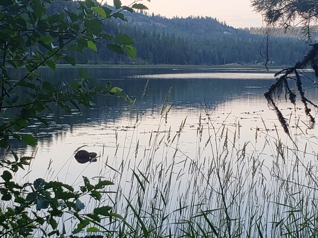
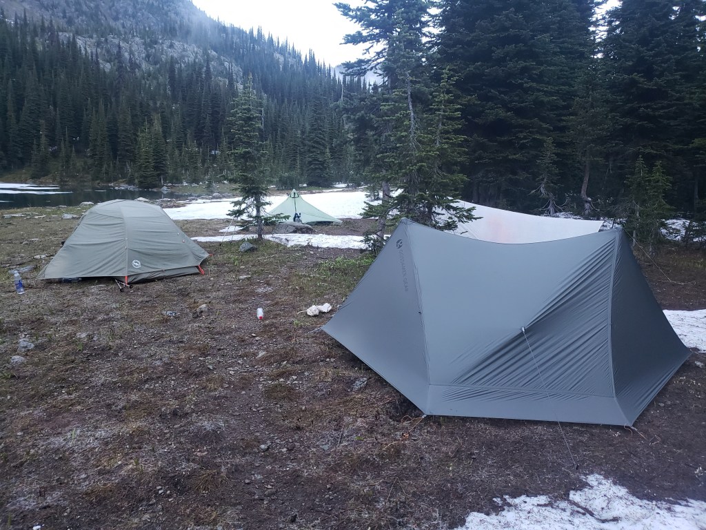
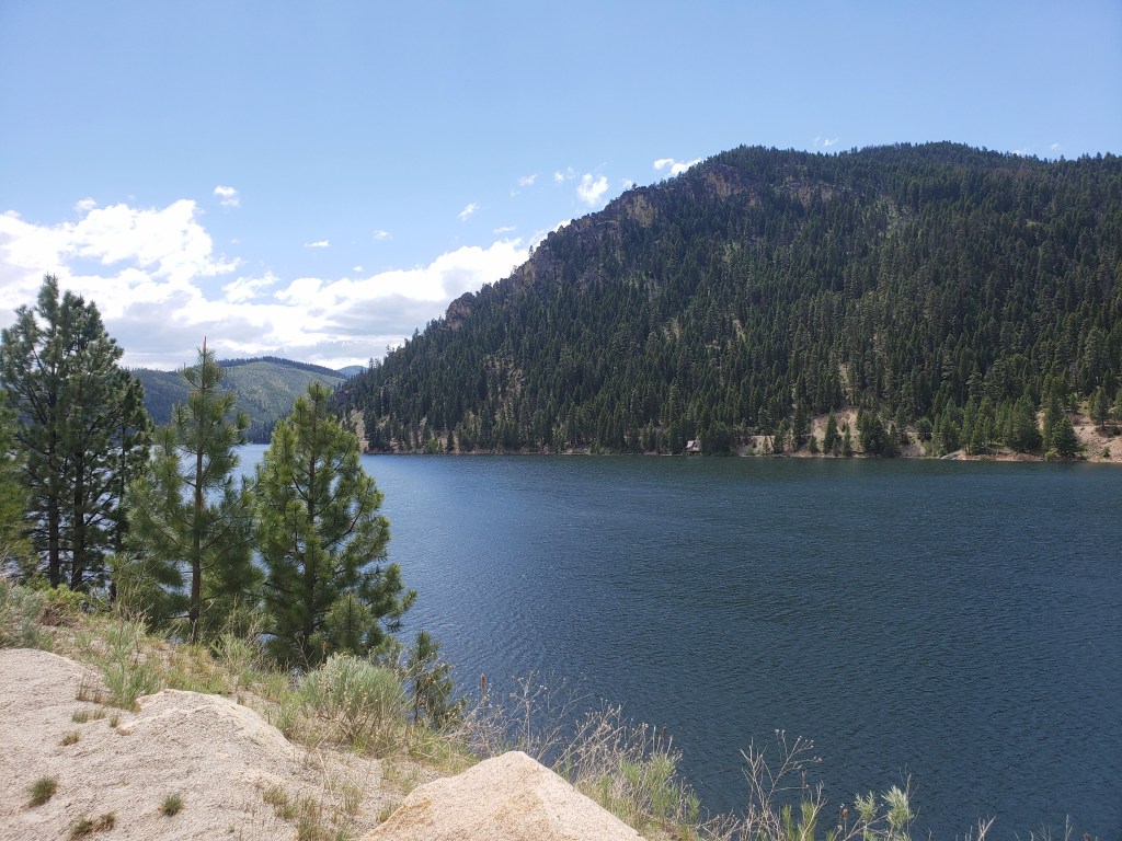
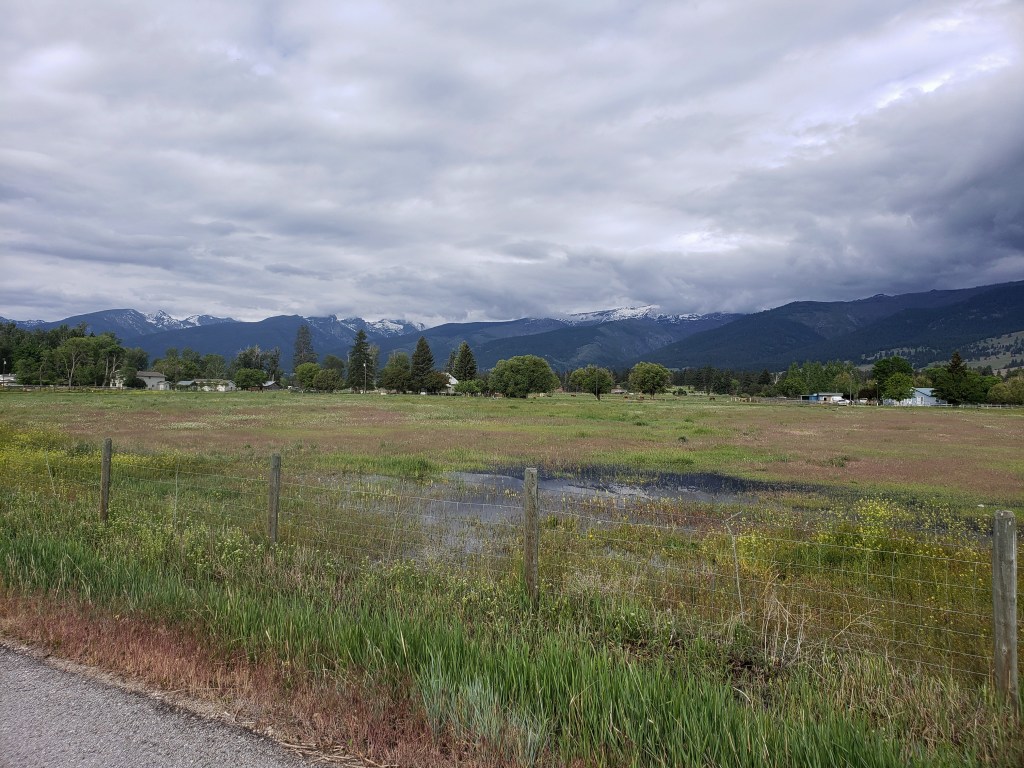
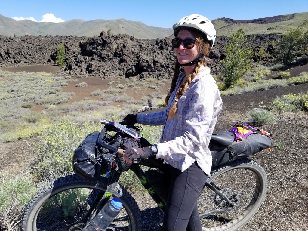
Leaving Republic for the second time marked the end of Section 4 and the beginning of Section 5 into the Okanogan Highlands. We knew we had a challenging stretch ahead of us through Sections 6 and 7, so we had breakfast in town and set ourselves up for an easy 21 mile day. We returned to the PNT on single track and busted out a steep climb, but that was most of the hard work for the day. Eventually, we were back on forest service roads for the majority of the walking. In the evening, we arrived at Lake Bonaparte. Our friends dipped in the resort restaurant while we watched several beavers swim and splash in the lake.
Day 26 – 28.4 Miles / +5400 ft elevation gain
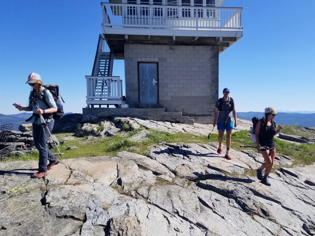
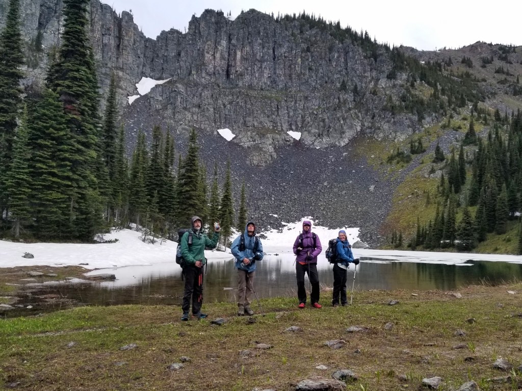
We got an early start and began the day with a big climb up Mt Bonaparte. The walk was well graded and pleasant as we watched the color filled sky at sunrise above Lake Bonaparte. The gang got ahead of us and decided to check out the lookout tower at the summit. We continued on our way, running into a trail crew on the walk down working on the PNT which coincided with their winter cross country ski trails. They welcomed us as the first PNT hikers they had seen this season and offered us cherries and nectarines. We walked a few more miles to the tiny community of Havillah where the local church invited hikers to fill up on water and relax inside. We knew we didn’t have too many more miles to do after the church and most of them would be on a road, so we made the easy decision to take an afternoon nap in the air conditioned church. Around 3:30, we continued on our way aiming to get less than 10 miles from Oroville. Shortly after we resumed walking, a woman stopped her car and started handing us each a Gatorade and a big bag of cherries to share. Dreams do come true. We finished our walk around 8:00 with incredible views of the valley below us excited to just have 9 miles to do the following day.


Day 27 – 9.2 Miles / +700 ft elevation gain
Somehow a 6:00 am start is us sleeping in. We settled into an easy groove as we headed the 9 miles into Oroville. Our walk was easy as we headed downhill and eventually to a highway directly into town. We arrived by 9:30 and were excited to have the rest of the day off in town.
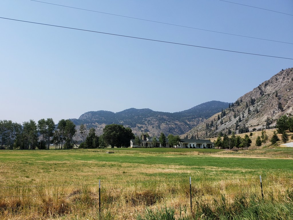
Leaving Oroville, we knew we had a 160 mile food carry until we would pick up our next resupply box at Ross Lake. Gusha and I started scheming to see if there was any possible way to make it easier on ourselves. We came up with a plan to get a ride 24 miles up trail and hike back east bound back into the town of Oroville. The entire 24 miles was a road walk, and it would certainly be under full sun exposure in the 90s. We went to Pastime Brewery for a round of beers and secured a ride in the morning with a friendly local happy to help us out.

Day 28 – 24 Miles / +1700 ft elevation gain
Our new friend Frazier arrived at our hotel for a 9:00 am pickup, and we headed 24 miles down the road. We hopped out with light packs and headed eastbound down the pavement that would lead us back to Oroville. The walking was easy, and everyone was in the mood to walk fast and return to our air conditioned room. After a couple hours, we wound our way around beautiful Lake Palmer and were called over to have lemonade and cookies on a local’s porch. We said our thank yous trying to keep our break short and continued pounding pavement. The sun was relentless and the pavement radiated heat as we walked. We took a quick break around 3:00 to get out of the sun by the Similkameen River, but didn’t linger too long. Around 4:20, Frazier drove by in his truck with cold water which was the perfect motivation to get to town faster. Our pace was upwards of 3.5 mph as we pushed back to our cozy motel room. At 5:40 we returned to Oroville thrilled our scheme worked out and the 24 mile road walk was behind us.


Pacific Northwest Trail Sections 4 + 5 – Overall Experience
222.8 Miles / +40000 ft elevation gain
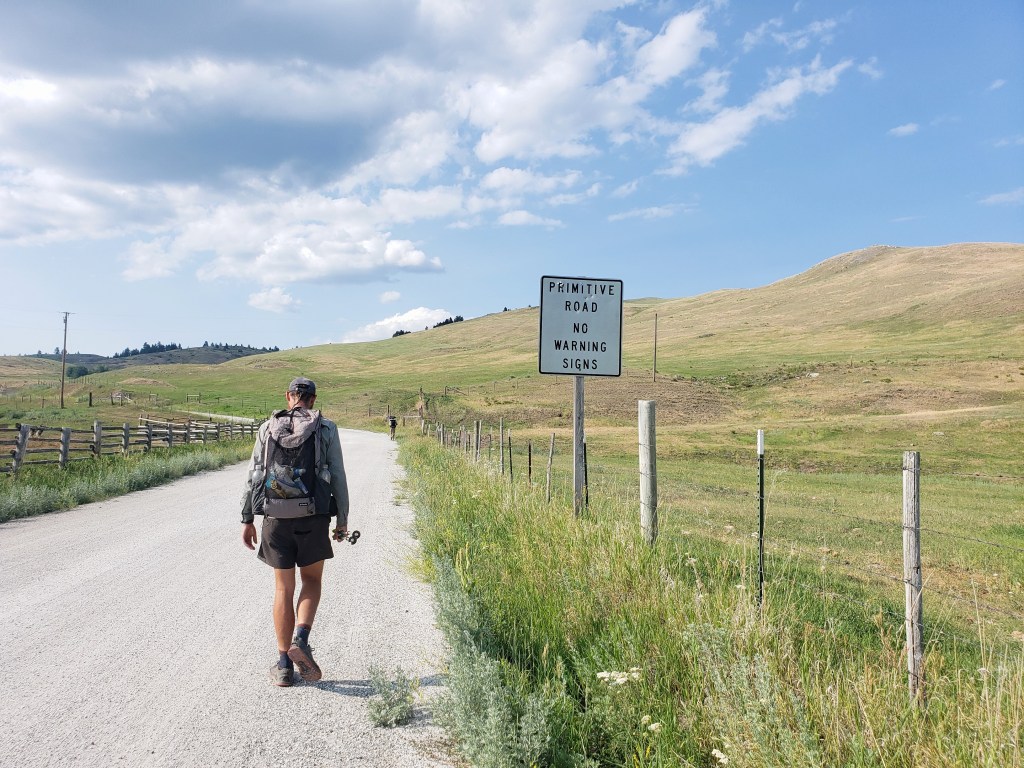
For the first time on this trail, I feel like I can say Sections 4 + 5 didn’t have any significant challenges like the previous sections have had. Sections 4 + 5 did, however, have the highest percentage of road walking. Nearly 70% of both sections was a road walk, mostly gravel forest service roads with occasional stretches of pavement. It also included several short bushwhacks and a large burn area. The entire region is markedly dry and arid with high desert features. We noticed more dust, fewer water sources, and abundant sunshine.
Double town access to Republic was definitely a win with town amenities on either end and a short resupply carry in between. Republic was a warm, welcoming trail town with everything we needed condensed into a small town center. We left Republic with another short stretch to Oroville. I don’t really mind the roadwalks, so I consider Sections 4 +5 a nice change of pace from the relentless climbs and major bushwhacks we’ve done in previous sections. But, I am looking forward to getting out of the lower dry elevations and heading west into the North Cascades.
After about 500 miles on any thruhike, I finally start to feel strong. This trail has been no different. The blisters and foot pain I felt at the beginning have faded, and my average walking speed has increased. My PNT experience thus far has seriously increased my tolerance for bull shit, and it’s getting easier to roll with the punches this trail continues to throw at us. Thinking back, maybe I enjoyed sections 4 + 5 so much because they weren’t overly demanding.
PNT Cumulative Stats
- 28 total days
- 3 0-mile days
- 599.8 total miles
- +113,700 ft total elevation gain
- Average Daily Movement (w/o 0 mile days)
- 24 miles
- +4500 ft elevation gain
More from the PNT
- Section 1 – Glacier National Park to Eureka, MT
- Section 2 – Eureka, MT to Bonners Ferry, ID
- Section 3 – Bonners Ferry, ID to Northport, WA
We’re hiking the ~1200 mile Pacific Northwest Trail westbound from Glacier National Park to the Washington coast with a group of hardcore hiker friends. Follow along here, on Instagram, or Facebook.
Pacific Northwest Trail Section 3 – Bonners Ferry, ID TO Northport, WA

We’re out on a thruhike of the 1200 mile Pacific Northwest Trail (PNT) as part of a group of six hardcore hikers. Read our experience getting our collective butts kicked on the rugged and challenging PNT in Section 3.
Click here to read Section 1 or Section 2.
Day 12 – 27.9 Miles / +9600 ft elevation gain
After a much needed zero day in Bonners Ferry, we started trying to hitch a ride about 15 miles back to trail at 5:30 am. About an hour later, we found a ride for all six of us with Ashlyn and I pretzeled into the trunk. By 7:00, we started our 10 mile mostly flat road walk through colorful alfalfa and canola fields. We had learned of an unprecedented and historic heatwave on our day off and felt the temperature rising as we approached single track. Around 10:30, it was time to start one of our biggest climbs we have encountered thus far on the PNT. Our endless climb, of course, coincided with a burn area providing zero shade for us as we melted our way up the trail. Oh, and there were no listed water sources on the way up, so we carried 3-4 liters each and did our best to ration. Sweat poured and temperatures rose as we gained the ridge. Exhausted, we took our lunch in the smallest sliver of shade we could find.


By late afternoon, we were finally in intact forest. Even at 7000 ft, the temperature had to be above 90°. We had our eyes on the goal of getting to Long Mountain Lake for a quick dip to cool down and refill our water bottles. The lake was about .3 mile and 400 ft downhill and off trail, but the extra effort was so worth it. At the lake trail intersection, we beelined down, the impossibly blue lake drawing us like moths to the flame. We found a perfect rocky spot to jump in the freezing cold water, absolutely elated. Relief engulfed us as we plunged into the water.
We finished the rest of the evening with – surprise – a little more climbing. We were stunned to learn we had climbed 9600 ft in only 18 miles.


Day 13 – 19.5 Miles / +6000 ft elevation gain
We awoke knowing we had a big day ahead of us. We were just a couple miles shy of the beginning of an 8-mile bushwhack (ie literally no trail for 8 miles). There were two options: Lion’s Creek Bushwhack straight down into a valley and a climb back up the other side, or the Lion’s Head Bushwhack, bushwhack and rock scrambling following the ridge. We decided to take the high route, preferring rock scrambling and views to the bushwhack in the valley. We knew we were in for a tough day in either direction.


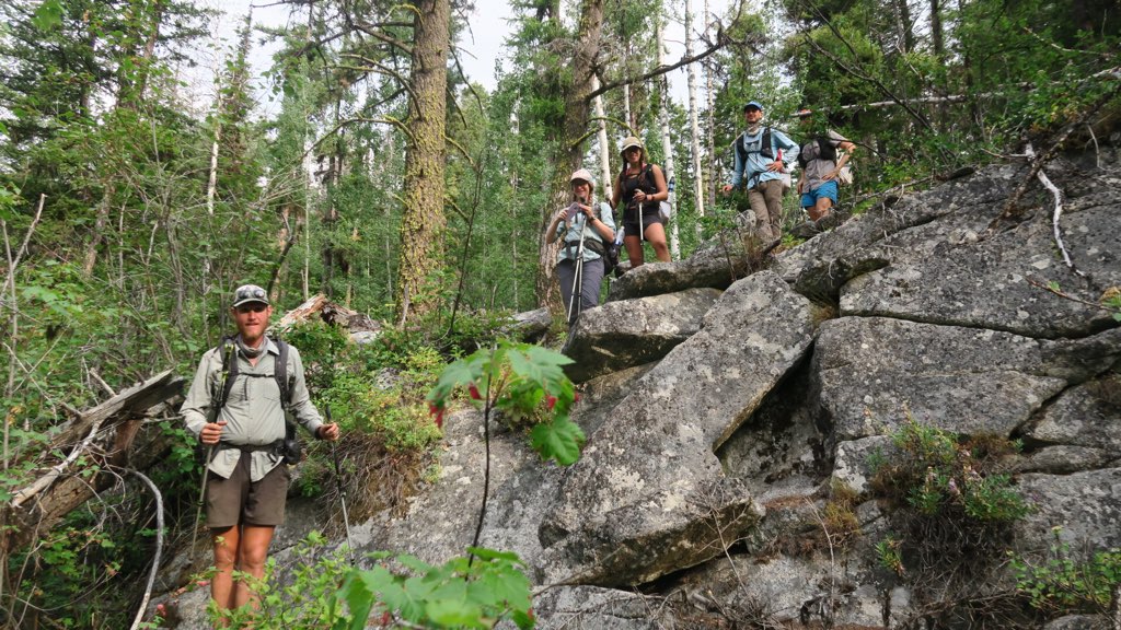
We started the bushwhack section around 7:00 am. We were in thick forest filled with towering and fallen pine trees and thick willow, blueberry, and huckleberry bushes. Movement was slow as we navigated through, trying to pick the path of least resistance. After our first mile and hour of this, we branched off towards the high route.
Bushwhacking is a slow sport, a test of will and patience. As the hours and miles dragged on, it became apparent that I was failing the test. As we followed the loosely defined route, we began a series of ups and downs that included sections of exposed rock slabs, bushwhacking through the forest, rock scrambling, and a Class 3 sketchy descent. Ankles twisted, hikers fell, screams were released. The sun beamed down on us, temperatures rising to the mid 90s adding yet another challenge to this demanding section. Water sources were truly up in the air through the bushwhack, and we were grateful for any trickle we could find.
We could see Lookout Mountain Lookout far ahead in the distance sitting atop Lookout Mountain, our destination that would end this bushwhack nonsense and where the PNT returns to trail. As morning became afternoon, the Lookout seemed just as far away as it had been hours before as though we hadn’t moved any closer. By lunch at 1:30, we had made it about 70% of the way through, and we were all looking pretty haggard – cut and bruised legs, torn shirts, pants, and shoes, a snapped trekking pole, a little less sparkle in our eyes. After our lunch break, we only had a short stretch left through the bushes, then we exited to rock scrambling up the ridgeline as we approached the Lookout.
Around 3:30, we finally reached our destination drenched in sweat and utterly exhausted. We took a long break in the shade, trying to enjoy the views that we couldn’t appreciate during the trek. We all agreed this had been one of the most difficult days on “trail” any of us had ever experienced. I didn’t take many pictures. I didn’t want to remember.


We left the Lookout overjoyed to return to a steady walking pace on trail. Though the trail was lovely and well graded, I was still ready to be done for the day, but I knew we still had work to do. The trail headed downhill towards Priest Lake, and the temperatures rose as we walked. The heat was relentless even through the evening hours. We were all craving a swim, and considered going a half mile off trail towards a beach. We decided to stick to trail and not add extra miles, and we were handsomely rewarded with a large campsite right next to a creek. Bags were dropped, clothes were stripped, and we all cooled ourselves in the flowing creek in disbelief. The longest 20 mile day of our lives with +6000 ft of gain across treacherous terrain was over.
Day 14 – 30.5 Miles / +4500 ft elevation gain
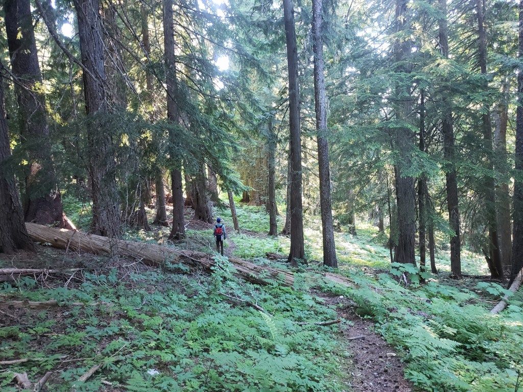
Our morning began early as we did our best to get some miles in before the heat became unbearable. Our forecast indicated today’s highs would be around 108°. The trail was gentle to us after yesterday’s trials – soft dirt trail covered in pine needles wound through an old growth forest adjacent to Upper Priest Lake. The morning sun cast soft beams of light through the trees and the smell of pine filled the air. Our morning was light and dreamy – an intense difference from the previous day.


Soon, we exited the woods and began a long walk on forest service roads. Considering the heat was forecasted in the triple digits, we opted to take the road walk over the ridge walk. By 11:00, the walking was already becoming unbearable. We stopped a little after noon for a mid-day siesta to beat the heat. What is usually an hour max for lunch became a 3 hour nap. Leaving the shade felt impossible. At about 3:30, we started moving up the road only to refill water and stop again 2 miles later. At about 5:30, we deemed it possible to walk and got into a groove road walking until about 10:30 pm. We only let ourselves sleep for a few hours knowing the early morning hours would allow us to escape the afternoon heat as we headed into the town of Metaline Falls.
Day 15 – 11 Miles / +400 ft elevation gain
We resumed hiking after a short rest at 4:30 am and continued down the forest service road. The walk was easy, but our minds were preoccupied with escaping the heat in town. Around 9:00, we stumbled into a cafe and locked in our plan to take at least one day off in nearby Ione. We also finalized plans with a couple of Trail Angels who were stoked to drive up to Metaline Falls to feed us!!
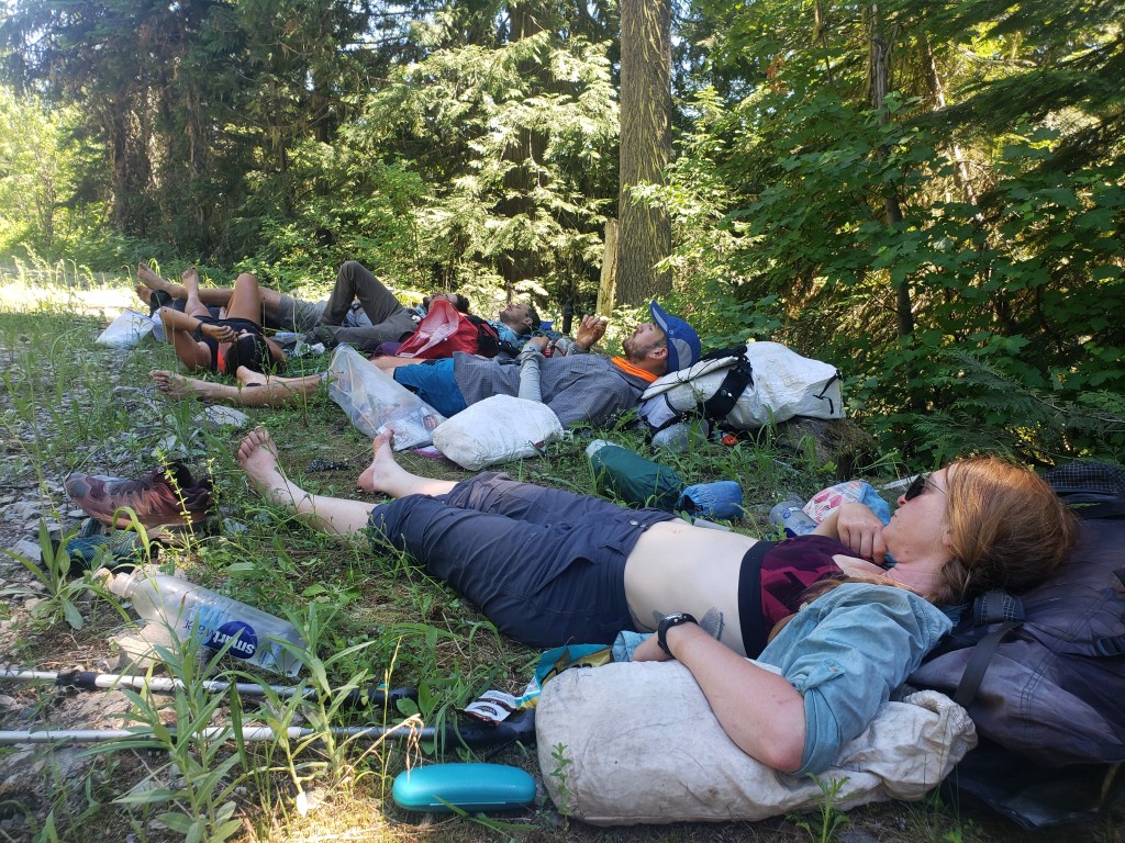
At lunch time, April and Randy arrived with a cooler full of cold drinks, snacks, salad, and rice and stir fry veggies to grill! Their kindness and generosity was unbelievable and couldn’t have come at a better time. After lunch, we lounged in the grass and took turns splashing ice water on each other as we enjoyed the conversation and digested the food coma. Around 3:30, we said goodbye to our Trail Angels (who had driven nearly 2 hours to bless us) and hitched a ride to Ione. At 4:00, the temperature still read 108° and the same was predicted for the following day. Our two bedroom air conditioned apartment in Ione was a God send.
Days 16 – 17 – 0 Miles
While we typically wouldn’t have taken a double zero in the first three weeks, we were relieved to escape the heat in a quirky small town motel that featured an ideal two bedroom apartment for six weary hikers. We had a full kitchen, a grocery store across the street, and swimming access in the river a block away. It was the oasis we needed.


Day 18 – 29.7 Miles / +6600 ft elevation gain
After two full days of rest, we all felt like a million bucks as we hitched back to Metaline Falls to resume hiking. Our morning was spent hiking dirt forest service roads up to Abercrombie Mountain trailhead. We switched to single track and followed the trail just shy of Abercrombie summit. The intense heat had broken, and we relished being surrounded by towering pine trees at a higher elevation. In the late afternoon, we switched back to walking dirt roads which eventually turned to pavement. We camped for the night next to a pond infested with mosquitoes.


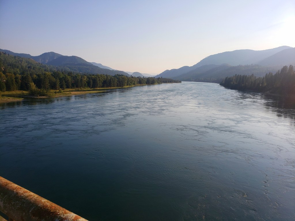
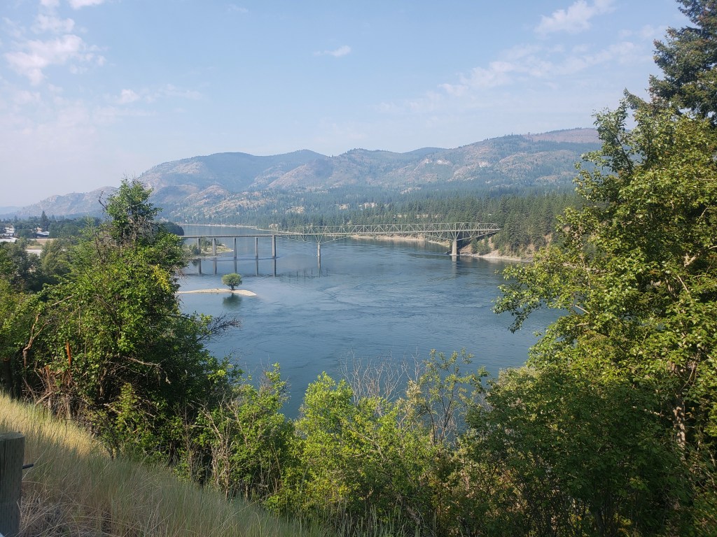
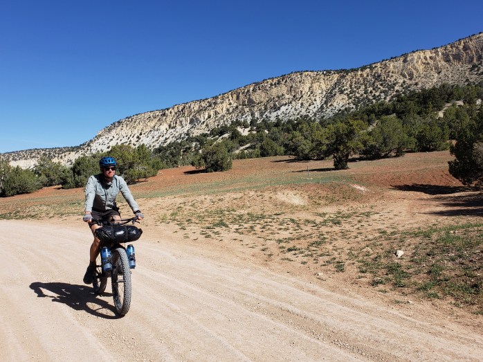
Day 19 – 21.1 Miles / +2500 ft elevation gain
In an effort to escape the bugs and get to town a little quicker, we left camp early and started pounding the 16 miles of pavement that would take us to the tiny town of Northport. Walking pavement is never that fun, but the miles peeled off as we walked the road adjacent to the Columbia River. By 10:30, we had made it to the tiny town of Northport. Temps were soaring in the 90s, so we spent the day swimming and lounging by the Columbia. Around 6:00, we pulled ourselves away from town and hiked about 6 miles of dirt road to camp.

Pacific Northwest Trail Section 3 – Overall Experience
Woof.
Wow, this section had some insanely trying obstacles and challenges in and of itself without the heatwave adding another layer of difficulty. Leaving Bonners Ferry, our first day of this section featured over 9000 ft of climbing, a majority of which was done through a burn area with no shade while temperatures exceeded 100°F. The following day, we all agreed, was one of our most challenging days of our hiking careers as we bushwhacked 8 miles at 1 mile per hour. We exited that stretch with torn clothing and shoes, a snapped trekking pole, cuts, bruises, and sweat drenched clothing. After the bushwhack, we were treated to a lovely section of easy trail though old growth forest as we walked by Upper Priest Lake. The magic ended as we headed towards miles upon miles of forest service roads, taking long afternoon siestas in an attempt to survive the heat.
Our trail magic in Metaline Falls and rest in Ione was incredible and desperately needed. Leaving Metaline Falls, I personally felt the best I’ve felt on this trail – no foot pain or blisters, caught up on sleep, and maintaining a faster hiking pace. Hanging out by the Columbia was delightful, but the town of Northport left much to be desired with a tiny grocery store and a lackluster resupply. Mostly, I’m just glad the heat has broken, and we’re able to breathe again.
PNT Cumulative Stats
- 19 total days
- 3 0-mile days
- 388.6 total miles
- +73,700 ft total elevation gain
- Average Daily Movement (w/o 0 mile days)
- 24.3 miles
- 4600 ft elevation gain
More from the PNT
We’re hiking the 1200 mile Pacific Northwest Trail westbound from Glacier National Park to the Washington coast with a group of hardcore hikers. Follow along here, on Instagram, or Facebook.
Pacific Northwest Trail Section 2 – Eureka, MT to BONNERS Ferry, ID

We’re out on a thruhike of the 1200 mile Pacific Northwest Trail (PNT) as part of a group of six experienced hikers. Read our experience getting our collective butts kicked on the rugged and challenging PNT in Section 2.
Day 7 – 162.8 – 29.6 Miles / +5400 ft elevation gain
With properly taped feet, we left Eureka, MT, and continued west on the PNT. Our first 16 miles of the day was road walking, a mix of dirt and pavement. Road became trail after crossing the Kootenai River, and we started a steep 4000 ft climb immediately. It was a steamy afternoon which left us drenched in sweat as we climbed up the appropriately named Thirsty Mountain and approached the lookout tower. We took a quick break to dry off and enjoy the views and continued a few more miles to camp. Just before heading to bed, a black bear walked by near our camp, but thankfully it spooked easily once it heard us.


Day 8 – 30.9 Miles / +6900 ft elevation gain
Glancing at the elevation profile, I thought we were in for a light day. But I was seriously mistaking. We walked the trail winding through the forest following the ridge, a series of climbs and descents. Sean and I lagged behind the group, and I became frustrated at our relatively slow pace closer to 2 miles per hour than 3. We took our lunch at Vernal Falls, a couple of the guys taking a dip in a swimming hole in an attempt to fight the steamy weather.
After lunch, we began a huge climb that started in overgrown bushes and continued up into a burn area with no shade to cover the blazing sun. We climbed while sweat poured down our bodies. It took about 2 hours to climb over the mountain and halfway down the other side until we could find some shade. We were all pretty beat with all the climbing and temps around 90°, but we walked on grateful for the cool forest. Soon, we exited the trail for a road, and began our evening walk on dirt forest service roads. We stopped for a quick swim in another creek and continued to camp on the side of the road, tired from another long hot day.
Day 9 – 29.7 Miles / +6900 ft elevation gain
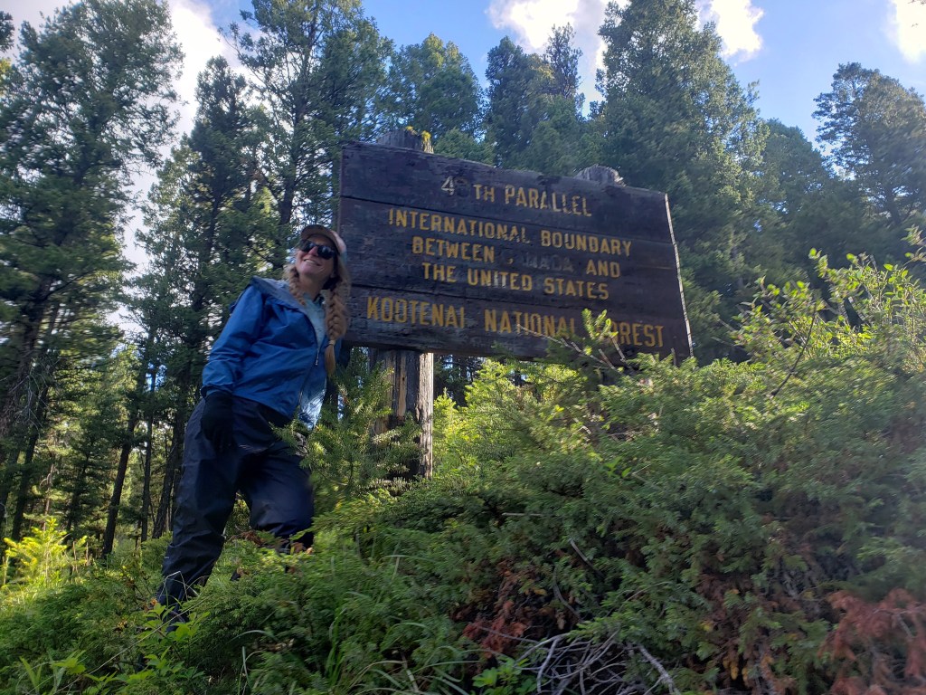
We had about 12 miles of road walking in the morning, followed by single track in the afternoon and evening. Philly and Gusha started their day a couple miles ahead of the rest of us, and we spent the day on their heels. They’d leave us time stamps at intersections carved into the dirt or small patches of snow which made for a fun game. The day featured more big climbs which actually came with some pretty incredible views and a lovely display of wildflowers. Towards the end of the day, our group spotted two bears that ran away from us quick when they noticed our presence. Just before camp, we crossed into Idaho from Montana, and we went to bed tired and eager to head to town the next day.
Day 10 – 25.4 Miles / +4400 ft elevation gain
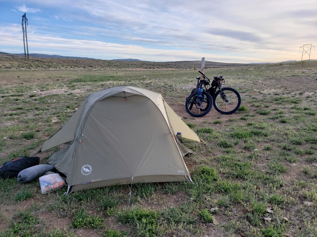
Overnight, a little rain fell from the sky. It was mostly dry in the morning, but ominous clouds filled the sky. We started a big descent that lead down into the valley with rain intermittently falling in us. I spotted another black bear as we came down the mountain, again running away from us quickly. We crossed the Moyie River which brought us to our last big climb before town. We started a steep 3500 ft climb up and over a mountain switchback after switchback, a seemingly endless ascent. The sky had cleared by this point, leaving us drenched with sweat instead of rain. Finally, we started heading downhill and just had 1 more obstacle between us and town – a mile of bushwhacking connecting two trails. We spent about 40 minutes climbing over and around down trees, creating a path through the woods. Our final stretch was dirt road walk to a highway where we waited about an hour on the sleepy road for a ride to Bonners Ferry. With an aggressive start to a challenging trail, we all were excited to take our first day off and catch up on sleep.


Day 11 – 0 Miles
With painful feet, we arrived in Bonners Ferry eager for a day off to rest and take care of a few errands. The gang was kept busy relaxing, eating, and trying to take care of problems with gear and shoes. We were only able to get one night in a motel room, and the next day we were given permission to loiter in the motel’s outdoor seating area and camp on their property (thanks, Ed!). Not an ideal zero day, but restful nonetheless. It was in Bonners Ferry we read the news that an unprecedented and historic heatwave was approaching as we took off on Section 3.
Pacific Northwest Trail Section 2 – Overall Experience
Whew, this was another tough section of the PNT. We had our first significant distance of road walk which is easy walking but somewhat boring and tough on the feet. Each day we faced steep long climbs while the temps hovered around 90° without any wind. The climbs tended to coincide with burn areas so much of the effort was done without any shade. However, we were rewarded with an amazing display of wildflowers and a nice section of views from a ridgeline. During a couple stretches, we faced 10-12 mile water carries which weighed down our packs and expended more effort. After 10 aggressive first days on trail, we deemed a zero day in Bonners Ferry necessary.
PNT Cumulative Stats
- 11 Days
- 1 0-Mile Day
- 248.8 Miles
- +45,700 ft elevation gain
- Average Daily Movement (w/o 0-mile days)
- 24.9 Miles
- +4570 ft elevation gain
More from the PNT
We’re hiking the 1200 mile Pacific Northwest Trail from Glacier to the Washington coast with a group of hardcore hikers. Follow along here, on Instagram, or Facebook.
Pacific Northwest Trail Section 1 – GLACIER National Park to Eureka, MT

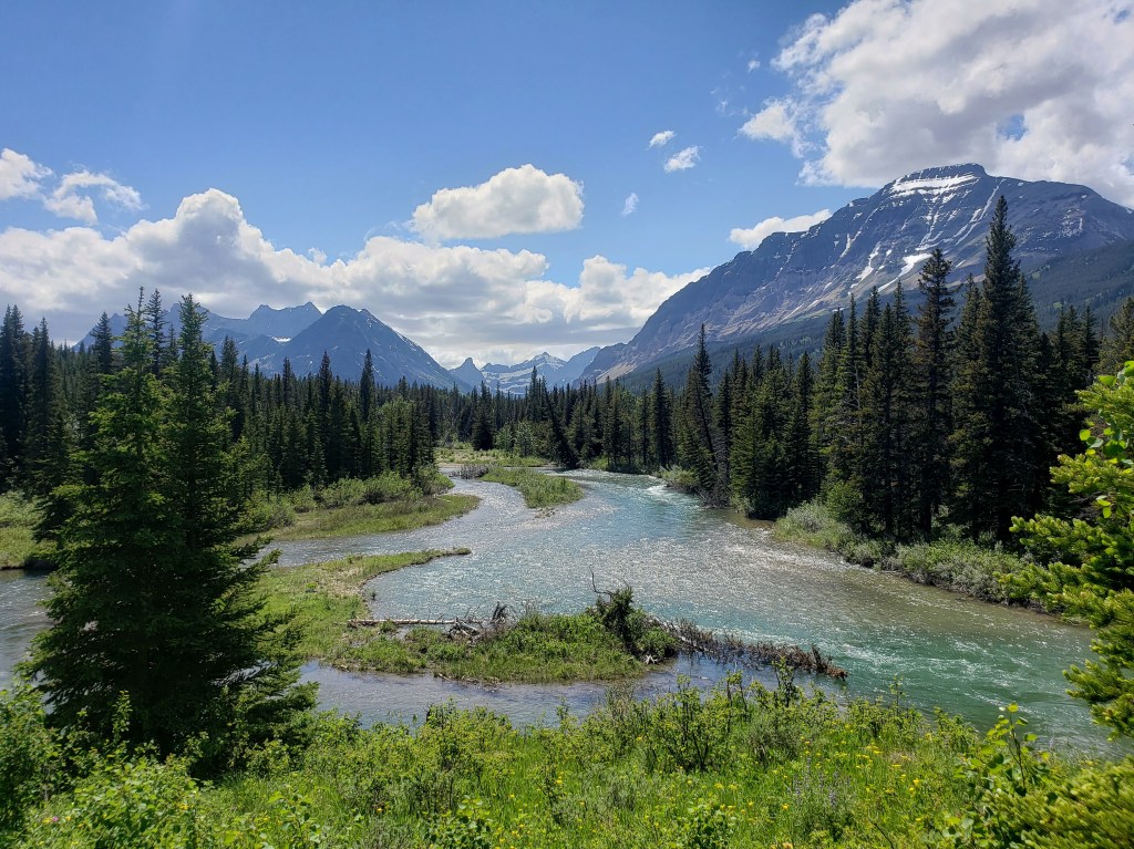
After riding 2200 miles of the Western Wildlands Route on our bicycles, we stashed our bikes in Missoula (thank you Bicycle Hangar!!), bussed to Whitefish, and met up with the gang in Glacier National Park to begin a 1200 mile westbound thruhike of the Pacific Northwest Trail. This remote and rugged trail hugs the Canadian border traversing from Glacier in Montana out to the Pacific coast of Washington. Here’s our experience from our first footsteps on Section 1 of the Pacific Northwest Trail (PNT).

Day 1 – 13.2 Miles / +1100 ft elevation gain
Sean and I boarded the amtrak in West Glacier heading towards East Glacier and quickly found our friends on board. We were a group of seven, eager to reunite and do the thing we’re best at once again. We had secured the necessary backcountry camping permits required in the national park and everyone’s logistics put us all together on the train. The last piece of the puzzle would be a hitch to Chief Mountain trailhead about 2 hours north of East Glacier. We began the search for a hitch immediately and almost instantly found a ride for all 7 of us about 20 minutes up the rode. We exited hitch number 1 and waited less than 5 minutes for hitch number 2 to pull over. The guys climbed in the truck bed while Ash and I got the joy of spending the next two hours reading assigned Bible verses outloud while our driver focused more on his crazy journal than the road. We snuck some pictures for proof. Hitching is most certainly part of the adventure.


After what seemed like an eternity, we arrived safely at Chief Mountain trailhead and the beginning of our 1200 journey. We snapped some pics, tried to shake the experience of doom and gloom preached by the Seventh Day Adventist, and headed down the dreamy trail. We were in some disbelief how easy it was to get a hitch and that we had all day to casually walk 13 miles.
We walked through meadows soaking up the sites, amazed to be back in Glacier together near where we finished our long journey on the Continental Divide Trail in 2018. We made a stop for snacks at Crosley Lake and arrived at our designated campsite at Mokowanis Junction just in time for a drizzle to start. We scarfed dinner under trees, pitched tents, and drifted to sleep as rain leaked from the sky.


Day 2- 27 Miles / +5700 ft elevation gain
We left camp around 5:30 thankful that the rain had passed. We knew we had a big day ahead of us with 2 huge passes and over 27 miles to get us to our next designated campsite. We were anticipating some snow in the passes that would surely slow us down as well. The rangers that gave our group the permit did so reluctantly, fearful that we wouldn’t be able to navigate the snow or push that many miles. We were on a mission.
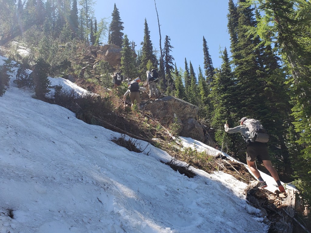
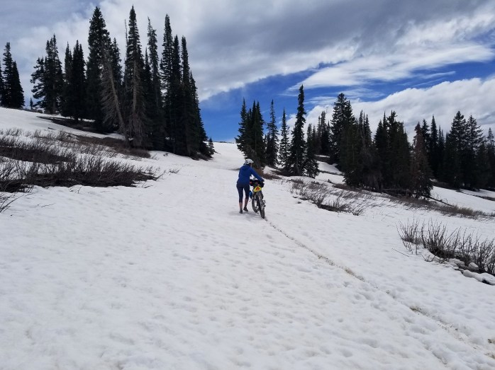
The climb up Stoney Indian Pass began immediately up 2500 ft in about 4.5 miles. We cruised through the first two and hit snow for the remaining 2.5 to the summit. Our focus was divided between the task at hand and the unbelievable views. We watched the sun illuminate the cliffs, sparkle off the high alpine lakes, and dazzle the waterfalls emitting a myriad of colors. Soon enough, all of our focus was poured into navigating the snow covered pass. Eventually, after many ice cold creek crossings and guestimating the path of least resistance, we reached the top of Stoney Indian Pass and took a quick break to take in the views before descending the other side.


With a lot more mileage and another big pass ahead of us, we tried to keep any breaks short and started our descent down the pass. We created our own route over snow covered terrain eventually winding our way around Stoney Indian Lake where trail began to emerge from the snow. Suddenly, we were walking trail at a quick pace through the forest. Mosquitos found us quickly during our break which we shortened to escape them. The trail turned north and converged with the CDT. Not too long after the junction, we ran into two hikers heading our way. They told us they weren’t able to pass Waterton River due to a bridge being out and had to turn around. The river was about 5 miles down the trail, and we had too many questions to turn back without checking it out for ourselves. We walked down the trail knowing we might have to retrace our steps.
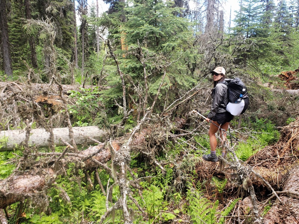
The next five miles we anticipated would be simple, but we quickly ran into a section of blow downs obstructing our path. Our pace slowed as we did our best to find a route on the buried trail spending at least 2.5 hours to traverse 5 miles.
We arrived at Waterton Lakes just before 1:00 hungry and tired from fighting down trees. We had a lovely and relaxing lunch break as we enjoyed the incredible views of Waterton Lakes that stretches across the US / Canadian border. After lunch, we left to discover what this river crossing was all about.

Initially, the trail brought us to the horse ford path which neither horse nor human could safely cross at this time of year. The river roared downstream at an impossible rate draining the snowmelt from the towering peaks above. Next, we walked a short path to see the bridge. As warned, the bridge was dissassembled. Four suspension cables were in place spanning the rushing river, but the wooden planks were neatly stacked on our side of the shore. We inspected the cables, but the thought of crossing them without ropes or harnesses just wasn’t going to happen.

We trudged on upstream towards Rainbow Falls, our last hope that something upstream might be fordable or that there was another bridge. This effort, too, was unfruitful. We did a final inspection of where Waterton River drains into Upper Waterton Lake, checking if the crossing was swimmable. However, the thought of jumping into freezing water and swimming hard across the river opening with a full pack seemed risky. With heavy hearts, we turned around and headed back the way we came knowing we were up against five miles of blow downs and a snowy pass.
We spent the afternoon and evening retracing our steps. No one was happy about the circumstances, but we did our best to keep our moods in check and tackle the task at hand. Truly, I felt a little let down by the rangers as a bridge out is probably something to tell hikers. I was warned about ten times to bring an ice axe and crampons, neither of which was going to help me cross that river, but no one mentioned the bridge. After a very long day, we returned to Mokowanis Junction camp around 10:00 pm totally wiped.

Day 3 – 13.2 miles / +1500 ft elevation gain
We woke up early for an easy hike back to Chief Mountain trailhead. Our next objective was to get to Polebridge – somehow – and continue west from there on the PNT. The hike was over before noon, and we started trying to piece together the plan. Thankfully, we meet Yeti an 83 year old hiker who has logged over 35,000 miles of long distance hiking. He agreed to take 4 of us to East Glacier. The remaining 3 hitched a ride quickly, and we all met up there. We resupplied, snacked, and enjoyed Yeti’s wild stories of hiking. He then agreed to take 4 of us an additional 2 hours around the park to Polebridge. Woohoo!! Again 3 others hitched, and by 6:00 pm we were all somehow in Polebridge able to restart hiking the following day. The trail provides.

Day 4 – 28.4 Miles / +6100 ft elevation gain
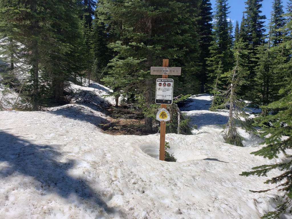
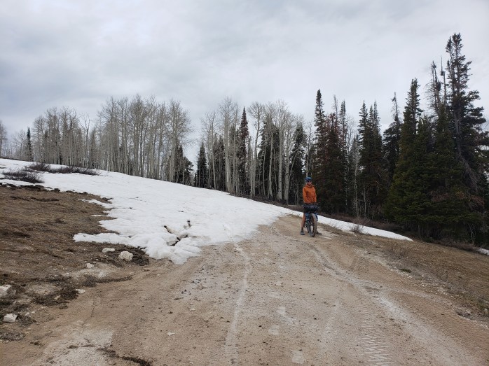
Sean and I had a moody start to our day fueled by the physical and mental exhaustion from the experience in the park coupled with a lack of sleep. Nevertheless, we began walking about a 15 mile road walk out of Polebridge and into the forest. Almost immediately, the single track was covered with snow, our group being the first to lay the tracks. Our pace slowed as we climbed up the mountain eventually hitting the ridgeline, and we continued to ride the ridge. The ridge ride remained patchy with some sections of dirt followed by snow covered sections. The day presented all sorts of fun obstacles – snow, wet feet, blow downs, and sketchy scrambles. We did our best to end the day early, finding a section of trail that was clear of snow and dry by 8:00 pm.

Day 5 – 30 Miles / +6600 ft elevation gain
Day 5 – 30 Miles / +6600 ft elevation gain
Our morning began with continuing the ridge ride until we finally came down into the forest. After miles of snow, we were stoked to see a well graded dirt trail. The hours passed and miles ticked by. In the afternoon, we did a big climb. By this point, I was starting to notice the blisters forming on my feet, but I continued to push through the pain. The clouds in the sky cast an ominous tone, and we prayed (literally) to stay dry until we got to camp. The temperature dropped as we climbed, but thankfully only a few drops leaked from the sky. We were eager for our day to be over, but the final 3 mile push to camp was tedious as we climbed up slippery snow covered trail. We arrived at Blue Sky Lake exhausted but proud of our first 30 mile day on the PNT.

Day 6 – 18.3 Miles/ +1100 ft elevation gain
Day 6 – 18.3 Miles/ +1100 ft elevation gain
We woke up eager to get to town. The morning was chilly, but the hiking was thankfully pretty easy. We spent the first few miles navigating a little snow, and then descended into the woods down perfectly graded dirt trail. Eventually, the trail met dirt road and the final 8 or so miles was a mix of dirt and paved road into town. My blisters were causing some serious pain, and I took to a light jog stance in order to cope. By mid afternoon, we were elated to arrive in Eureka, MT to get some rest and heal our wounds.


Pacific Northwest Trail Section 1 – Overall Experience
Glacier National Park to Eureka, MT – 131.9 Miles
Going into Glacier is always a treat – waterfalls, mountains in your face, sparkling high alpine lakes. It’s a dreamy place to be. We were definitely disappointed that we couldn’t cross Waterton River, but we’re happy that we made smart and safe decisions.
So far, the PNT has been a mixed bag of trying obstacles and a bit of nice trail. We’ve dubbed it as the “say your prayers” or “there will be blood” trail. We’re pushing hard and hurting ourselves, so that’s cool. I think it’s been worth it.
PNT Cumulative Stats
- 6 Days
- 0 0-Mile Days
- 131.9 Miles
- 22,100 ft elevation gain
- Average Daily Movement
- 22 miles / day
- 3700 ft elevation gain
We’re hiking the 1200 mile Pacific Northwest Trail from Glacier to the Washington coast with a group of hardcore hikers. Follow along here, on Instagram, or Facebook.
Western Wildlands Route Segment 3 – Hailey, ID to Darby, MT

We’ve come a long way from the wall at the Mexican / Arizona border! Check out our experience riding Segment 3 northbound on the Western Wildlands Route (WWR).

Day 38 – 28.2 Miles / +2100 ft elevation gain
We woke up in our room in Ketchum and headed to Backwoods Mountains Sports as soon as it opened eager to get the busted tire replaced and continue riding. The bike mechanics were super friendly, helpful, and eager to get us back on the road. They didn’t have a 29 x 3″ tire, but thankfully a 29 x 2.6″ would do the trick. After a couple hours, we returned to the shop and my bike was ready to go. Sean noticed his brakes were getting pretty weak, so he had the mechanics replace the brake pads which they were able to do on the spot. By 1:00 in the afternoon, our bikes were both ready to continue north.
With a late start, we decided to make it a short day. Just out of town, the route followed a bike path that turned from pavement to dirt. We meandered through several official USFS campgrounds adjacent to the Big Wood River and even stopped for an afternoon nap riverside. After crossing the arid Idaho basin, we were elated to get into the forest with incredible views of the Sawtooth mountains. We ended our short day near Galena Lodge near miles and miles of mountain biking trails.

Day 39 – 69.6 Miles / +4100 ft elevation gain
After a chilly night, we weren’t too eager to start the morning. Eventually we started pedaling, happy that our day began with a big climb to warm us up. Mountains towered above us as we rode through the valley towards the tiny town of Stanley. We got a small resupply at the little general store and followed the Salmon River out of town. After about 15 miles of highway, we turned onto Yankee Fork Road which became gravel almost immediately.
This area was mined in the late 1800s and early 1900s and is littered with history. Along the side of the road were big piles of rocks known as “dredge tailings.” About 6 miles in we saw the massive dredge that has been sitting there unused for about 70 years. We also passed through a few remnants of Bonanza and Custer City, now ghost towns, once populated by miners and families over a century ago.


Day 40 – 30.4 Miles / +2700 ft elevation gain
We were once again happy to start our day with a big climb to shake the morning chill. We followed the Yankee Fork up the pass and then a series of other creeks down the other side. As we descended, we exited the forest into a dry space full of sage brush under abundant sunshine. Soon enough, we were on pavement heading into the little town of Challis.
Our time on the WWR was starting to run out, and our end point was on the horizon. We came to the realization that we actually needed to slow down a little bit, so we took advantage of the opportunity to stay in town. We chose one of the rustic motels and enjoyed a night in a bed out of the wind.

Day 41 – 88.2 Miles / +5900 ft elevation gain
We began our morning with coffee and an aptly named “mountain of hash browns.” (I mean, when in Idaho, eat potatoes, right?) Then, headed out for the first climb of the day. On a dirt road, we climbed up and up with a super steep section near the top that required us to push our bikes. We glided down the other side which led to the second big climb of the day. This one was longer, but thankfully considerably less steep. As we reached the pass, we looked at the guide and realized we had a nearly 45 mile stretch ahead of us that was downhill and flat. The grade near the top required no pedaling. We spent the afternoon and early evening following Panther Creek downstream to where it meets the Salmon River. As we neared the Salmon, cliffs towered overhead as we went through a canyon. The final 10 miles of the day we followed the river to an official USFS campground putting a beautiful end to an incredible day of bike riding.

Day 42 – 68.4 Miles / +5700 ft elevation gain
We woke early with a 5000 ft climb immediately ahead of us. In some ways it was bittersweet as we knew it was our last big climb of the WWR for now. We spent all morning climbing up and up mostly through a burn area. Though the land was scarred, the fallen trees created clearings that allowed us to see the surrounding mountains. Around noon, we reached the top and started gliding down the other side.
Big clouds rolled in and a little rain leaked from the sky. We did our best to keep our lunch break short and continued on our way. The river we were following soon met Painted Rocks Lake, and we exited dirt for pavement as we rode around Painted Rocks State Park. We watched as clouds moved overhead, unsure what would happen. Our ride remained on pavement as we took a side route to the town of Darby which we visited on our Continental Divide Trail thruhike in 2018. Around 5:00, we made it to Darby and stayed at an RV park for the night.
Day 43 – 61 Miles / +600 ft elevation gain
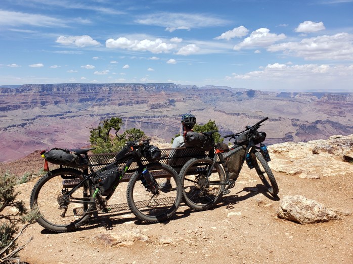
Darby would be our exit point from the WWR for now. When planning this trip, we knew we had adventure number 2 with a specific date we had to be there to meet up with friends. North Idaho and Montana are incredibly sparsely populated with only a handful of cities. Missoula is 60 miles straight north of Darby, so we made that our destination to switch from biking to hiking.
We woke up early in Darby knowing we had about a 50% chance of rain. 15 miles north, we went through the town of Hamilton (where we obviously cued up the Hamilton soundtrack) and noticed a paved bike path adjacent to the highway. We were stoked to get off the highway shoulder and have a buffer between us and the cars going 70+ mph. We cruised down the bike path through a few towns as the clouds clung to the mountain tops and chased us north.
Around 2:00, we arrived to our motel in Missoula proud of our 2200 miles of bike riding that brought us there. The next day we watched the rain pour as we sat dry and cozy in our room.
We spent the following two days tying up lose ends as we prepared for our summer hike! We picked up our backpacks that were shipped to us, stored our bikes at The Bicycle Hangar (an incredibly kind and supportive bike shop in Missoula), and got ourselves ready to start a new adventure on foot. We’ll be back for the bikes and the WWR in a couple months, but until then, follow along here as we return to our roots and tackle another long distance hike.
Western Wildlands Route Segment 3 – Overall Experience
Wow, this segment was beautiful! We were so happy to return to the mountains after a dry and hot stretch through Southern Idaho. This segment had one of the longest food carries of the WWR at about 160 miles, but water was everywhere. Thankfully, the weather held for us in early June with temps in the 70s in the day at maybe dipping into the high 40s at night.
WWR Cumulative Stats
- 43 Days
- 8 0-Mile Days
- 2204.5 Miles
- 127,100 ft elevation gain
- Average daily movement (w/o 0 mile days)
- 63 miles per day
- 3600 ft elevation gain per day
(miles and elevation gain tracked with Strava)
More from the Western Wildlands Route
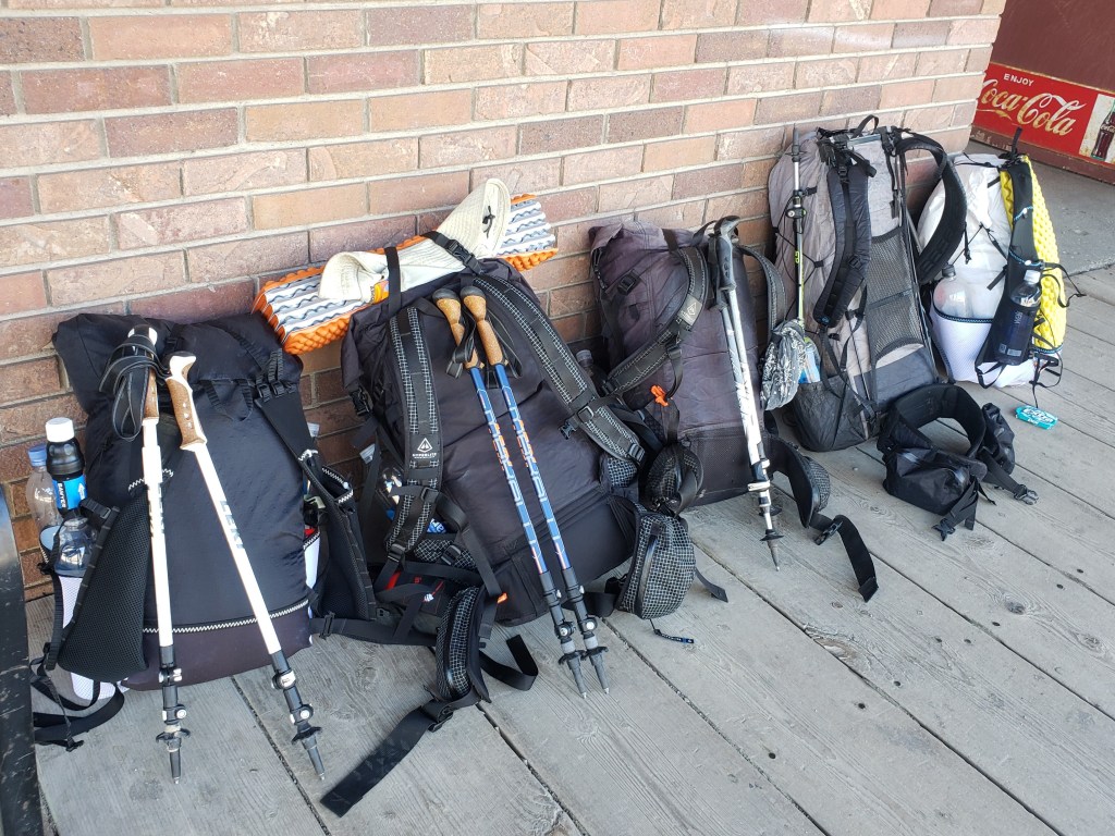
Gear List for Bikepacking the Western Wildlands Route

The Western Wildlands Route (WWR) is a cross country route stretching from the Mexican / Arizona border over 2700 miles north to the Montana / Canadian border. The WWR is 80% unpaved consisting of mostly dirt roads and 4×4 tracks and passes through 4 states on the way – Arizona, Utah, Idaho, and Montana. The route can be traversed either direction, but since we started in late April, we took off from the Mexican border and headed north. Check out more details about the Western Wildlands Route on BikepackingRoots.org
Click here to read our experience on the WWR.

Our bikes and gear list for bikepacking the Western Wildlands Route (WWR)
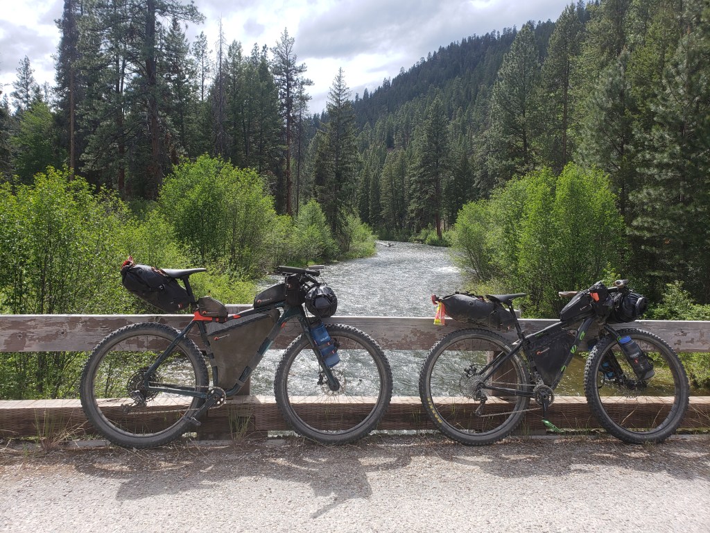
Sean’s Bike – Salsa Mukluk XL

Bike Modifications
- Handlebar – Jones H-Bar® Butted 2.5 Loop Aluminum
- New Wheel Build – 29″ diameter, 3″ tires
- New Rotors – 180 mm rotor (previously 160 mm)
- Saddle – Brooks Cambium 17 (C17)
Bike Bags and Accessories
- Seatpost Bag – Revelate Designs Spinelock 16 L
- Frame Bag – Bedrock Bags Custom Frame Bag
- Top Tube Bags – Bedrock Bags Dakota Tank Bag and Kayenta Rear Tank Bag
- Handlebar Stash Bag – Revelate Designs Mountain Feedbag
- Handlebar Roll Bag – Salsa Cycles Anything Cradle + Salsa Cycles EXP 15 L Dry Bag
- Fork Cage – 2 x Salsa Anything Cage
- Bike Speedometer / Odometer
- Rechargable Headlight
- Rear Taillight


Bekah’s Bike – Salsa Beargrease M
Bike Modifications
- Handlebar – Jones H-Bar® Butted Loop Aluminum
- New Wheel Build – 29″ diameter, 3″ tires
- New Rotors – 180 mm rotor (previously 160 mm)
- Saddle – Brooks Cambium 17 (C17) Carved
- Grips – Ergon GC1 Cork Grips
Bike Bags and Accessories
- Seatpost Bag – Revelate Designs Spinelock 10 L
- Frame Bag – Bedrock Bags Custom Frame Bag
- Handlebar Stash Bags – 2 x Revelate Designs Mountain Feedbag
- Handlebar Roll Bag – Salsa Cycles EXP Series Anything Cradle + Salsa Cycles EXP 15 L Dry Bag
- Top Tube Bag – Revelate Designs Gas Tank
- Fork Cage – 2 x Salsa Anything Cage
- Fork Mounts – K-Lite 3D-printed Cage Adapter
- Phone Mount
- Rechargable Headlight
- Rear Taillight


Camping items
(unless otherwise noted, we are each carrying one of the following)
- Sleeping bag – Enlightened Equipment Enigma Custom 20° Sleeping Quilt
- Sleeping pad – Thermarest NeoAir UberLite
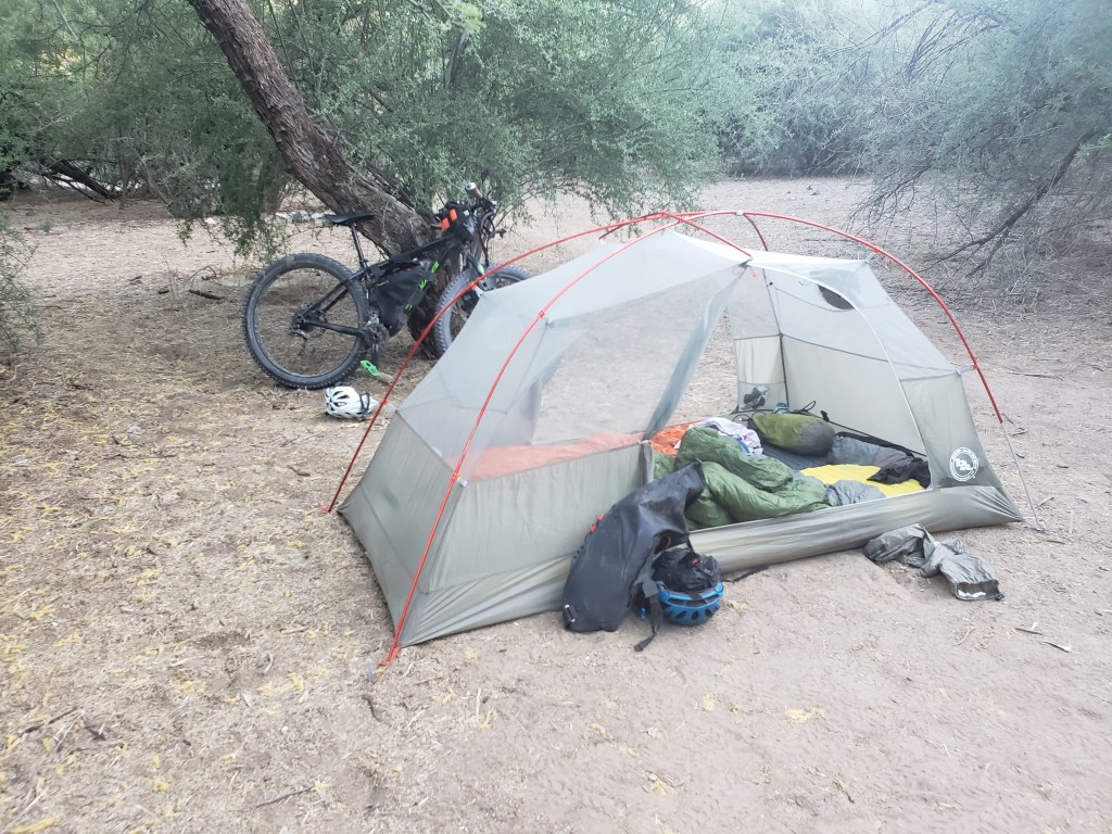
- Tent – Big Agnes Copper Spur HV UL2 (1 tent split between us)
- Water filter – Katadyn BeFree Water Filtration System 1.0L
- Water bottles – 2 x 1.5 L Nalgene
- Water storage – 3 L HydraPak Seeker Bladder

Clothing
We have one outfit we ride in and one outfit we carry for camp.
Riding Clothes
- Helmet
- Sunglasses
- Quick dry long sleeve shirt
- Fingerless padded cycling gloves
- Chamois
- Riding shorts (Sean) or tights (Bekah)
- Darn Tough Socks
- Shoes
- Brooks Cascadia (Sean)
- Pearl Izumi X-Alp Launch (Bekah)
Packed Clothing
- Rain jacket – Outdoor Research Helium II
- Rain pants – REI Co-op
- Puffy
- Montbell Ex Light Anorak (Sean)
- Mountain Hardwear Ghost Whisperer (Bekah)
- Synthetic T-Shirt
- Thermal tights – Patagonia Capilene Thermal Weight Bottoms
- Thermal Baselayer Top – Patagonia R1 Fleece
- Buff
- Hat
- Wool beanie
- Exoficcio underwear
- Black running shorts
- Camp socks
- Gloves

Food Stuff
Note: We are riding stoveless.
- P38 can opener
- Talenti jar
- Spoon
- Pocket Knife
- OP sack
Personal and Tech Items
- Wallet
- Phone
- 20000 mah Anker battery
- Dual Anker Charging block (USB-C to USB-C)
- Two USB C charging cords
- Charging cord for headlight
- Headphones
- Headlamp

Bike Tools and Parts
- Multi tool
- Tire levers
- Backup tube
- Tube pump
- Tire sealant
- Valve core remover
- Lube
- Rag
Toiletries
- Toothbrush
- Toothpaste
- Hand sanitizer
- Small pack towel
- Toilet paper
- Trowel
- Wipes
- Sunscreen

Click here to check out our experience on the WWR

Western Wildlands Route Segment 4 – Bear Lake, ID to Hailey, ID

Wow it’s really starting to feel like we’ve come a long way from the wall at the Mexican border! Here’s Segment 4 through Southern Idaho as we travel northbound on the Western Wildlands Route (WWR).
Day 33 – 90.4 / +5000 ft elevation gain
The first 55 miles of our day wrapped up Segment 5 at the UT / ID state line at beautiful Bear Lake. We had an additional 6 miles of riding adjacent to the lake in Idaho before the route took us east and up into the mountains for a late afternoon climb.
Around 5:30, we came to a 20 mile stretch of private land leaving us with the choice to stop there or commit to another 20 miles for a 90 mile day. Since it was relatively early and the sun was providing light well after 9:00, we made the decision to keep moving. We made a brief dinner stop at an LDS church that generously provided water and continued into cattle and farm country Idaho. At 8:30, we reentered public land and took the first available campsite in an aspen grove wrapping up our longest day yet at 90 miles and over 5000 ft of elevation gain.


Day 34 – 81.3 Miles / +5100 ft elevation gain
Our morning began with a brief climb that took us to a main highway. We glided about 3 miles downhill and took a turn back onto a dirt road by a reservoir. It was Memorial Day and lots of families were still out RV camping and playing with their ATVs, side by sides, and guns. We cycled on climbing gradually under a clear blue sky. Our max elevation for the day was around 8000 ft, and we were pleased to not encounter any snow.
We glided down the dirt towards the little town of Soda Springs for a resupply. Thankfully, the grocery store was open on the holiday. We took our bounty and rode 2 miles to Hooper Soda Springs park for an evening picnic where we sipped naturally carbonated water from the spring. Leaving the lovely park, we were about 15 miles away from public land. We set out for our evening ride back into farm country and pitched the tent as soon as we were able.


Day 35 – 70 Miles / +2700 ft elevation gain
We awoke on day 5 since our last time sleeping in a bed and had one thing on our mind – town. We were 70 miles away from Blackfoot and hoped to get in before 5:00. The route took us by a number of creeks leading to the Blackfoot River. The landscape was mostly cattle land with rolling hills in the distance. We crossed the Blackfoot River and enjoyed paralleling the Blackfoot canyon as we neared town. As lunch time approached, we conveniently found a fenced in picnic table under a shade tree marking a historical site of a former schoolhouse. We were elated to get out of the scorching sunshine for a quick break.
In the afternoon, we exited the mountains and rode on a mix of dirt and paved backroads through massive fields. The ride was mostly flat as we entered Blackfoot stoked for a shower and town food.


Day 36 – 75 Miles / +1500 elevation gain
Just outside of Blackfoot, we were once again surrounded by big fields probably full of potatoes as apparantly Blackfoot is the “potato capitol of the world.” The pavement turned to dirt, and the houses became fewer and further between. Just as I was wondering what we were doing out there, a couple of locals stopped in their passing truck to ask us the same question. They couldn’t quite grasp when I said yes, we were out there intentionally.
Slowly, the route started to gradually climb, and we left the fields for public land. The mountains in the distance seemed so far away as we crossed an arid expanse of sage brush and gravel under abundant sunshine.
It was just about lunch time when we arrived at Well #2 which contained the only available water for about 50 miles to the town of Arco. We ate lunch in the sliver of shadow the tank created, probably also the only shade for 50 miles, and filled our bottles for the hot ride.
The sun beamed down on us as we rode toward Big Butte, an impressive stand alone mountain. The lack of shade provided no reason to stop, so we rode on through the afternoon. After many hours, we were actually approaching the mountains we had seen in the distance this morning. We arrived in the small town of Arco around 6:30 hungry, thirsty, and grateful for the shower at the KOA campground.


Day 37 – 50.9 Miles / +1200 ft elevation gain
We left Arco after coffee and headed back into farm and field country. After a dozen or so miles on dirt, we hit pavement and headed up a pass into Craters of the Moon National Monument with miles upon miles of lava rock lining the highway. We cruised down the other side of the pass under the scorching sun and eventually made our turn onto a gravel road.
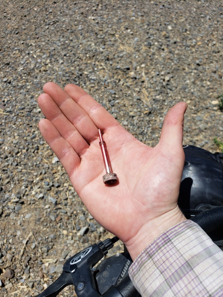
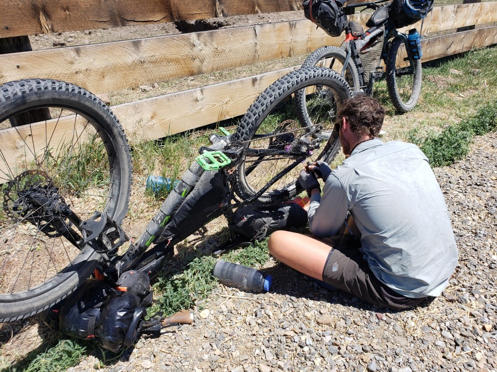
Only three miles after the turn, I heard a hissing noise, and my seat started to bounce. I hollered at Sean and stopped, noticing the massive thing I had hit. Not a nail, not a screw, maybe a piece of a valve? It was still stuck in my tire and had created a second puncture from the inside of the sidewall. My tires are setup tubeless, so we stopped, removed the object, and hoped the sealant would do its job. Though it seemed hopeful, any slight pressure to either puncture just made sealant spray everywhere. We decided to put in the backup tube and head back to the highway that way if we needed help at least people would be around.
Our backup tube was a little smaller in width than the tire itself. It seemed to roll fine on dirt, but a couple miles later on pavement, the tire went flat again. Feeling out of options, we stuck out our thumbs at passing trucks to get a ride to a bike shop in Hailey about 30 miles away.
Moments later, a truck pulled over and offered us a ride about half way. We gratefully accepted and loaded up the truck. Mark was a fellow cyclist, understanding of our predicament and happy to help. He dropped us at a highway junction, and he headed the other direction. We waited just about 15 minutes until Cindy pulled over and brought us into the town of Hailey. She was also a cyclist and eager to help. She brought us to a local bike shop that was still open late in the afternoon and wished us luck.
We knew that bike parts are in high demand and low supply and weren’t too surprised to find out they didn’t have any 29″ tires of any width. Brian, a mechanic, was extremely kind and helpful and went out of his way to find out if any bike shops in the area had any 29s. Incredibly, he found a shop in Ketchum a few miles north and actually on our route. We thanked him and loaded onto the free bus that connects Hailey to the ski town of Ketchum and grabbed an expensive but lovely hotel for the evening.
In the morning, Backwoods Outfitters had a tire that would work for me and quickly set it up tubeless. We were once again ready to roll. Though we weren’t thrilled to skip a section of the route, we understand that stuff happens, adjustments are made, and thankfully the journey can continue.

WWR Segment 4 – Overall Experience
Leaving Bear Lake, we tore into the heart of cattle and farm country Idaho. This segment still had plenty of climbing but mostly stayed between 5000-6000 feet which I would consider lower than a lot of the route. Lucky for us, we passed through this section of very little shade during an atypical heatwave. Yay!
We never had to carry more than a full day of food but did have to bring a little extra water than the 3 liters we typically carry on the fork. A lot of this segment passed through large swaths of private ranching lands and fields stretching our days a little longer than usual as we sought out public land for camping. Frankly, this wasn’t the most exciting segment, but it’s all part of riding across the country.
WWR Cumulative Stats
- 37 Days
- 8 0-Mile Days
- 1858.7 Miles
- 106,000 ft elevation gain
- Average daily movement (w/o 0 mile days)
- 64.1 miles per day
- 3700 ft elevation gain per day
(miles and elevation gain tracked with Strava)

More from the Western Wildlands Route
- Segment 5 – Soldier Summit to Bear Lake
- Segment 6 – Kanab to Soldier Summit
- Segment 7 – Grand Canyon to Kanab
- Segment 8 – Globe to Grand Canyon
- Segment 9 – MEX Border to Globe
Join us here, on Instagram, or Facebook as we tackle the Western Wildlands Route (WWR) by bicycle. Click the links above to see more of the story!
Western Wildlands Route Segment 5 – Soldier Summit, UT to Bear Lake, ID

We’ve been riding our bikes from the Mexican border northbound on the Western Wildlands Route (WWR) and have made it to Idaho! This is our experience from Segment 5.
(Links to previous segments can be found at the bottom of this post.)
Days 28-30 – 0 Miles
As explained in my last post (WWR – Segment 6), we weren’t able to stick to the official route through Utah’s high elevation in late May as it was still covered in snow. We made a solid effort, but it just wasn’t passable. Instead, we rode around the snow covered Skyline Drive section to American Fork to connect with a friend and take 3 full days off riding in Salt Lake City. It was a much needed rest both physically and mentally for ourselves and, it turned out, our bikes needed a break and some work as well. Our three days were spent eating as many baked goods as possible, catching up with friends, cleaning our mud covered bikes, replacing both of our chains and cassettes on the bikes. Salt Lake City is surprisingly great at vegan food, and we ate to our heart’s content.

Day 31 – 77.3 Miles / +3500 ft
It was time to head back to cycling all day, and we got a lift back to American Fork right where we left off. Our day was spent riding bike paths and highway back to the WWR. First we rode on a lovely bike path through Orem that connected to the paved Provo River Parkway. We were stoked not to be riding the highway and enjoyed a beautiful ride following the river without having to worry about traffic. The 6 miles was over before we knew it, and we switched over to highway riding northeast on Highway 189.
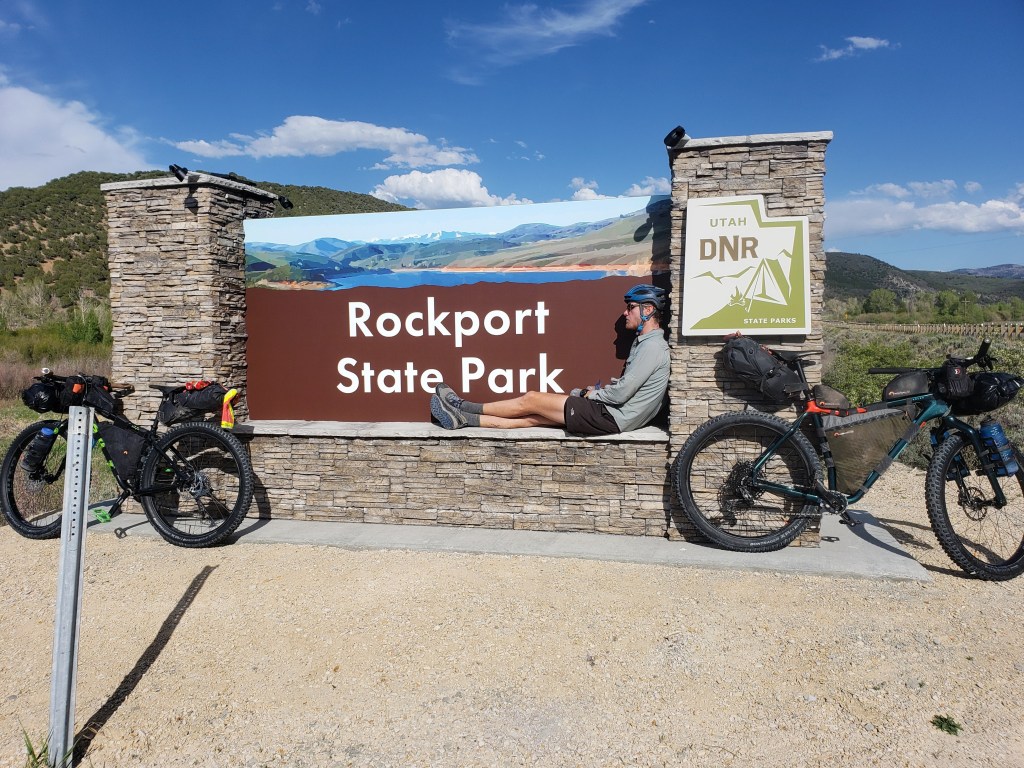
My new chain and cassette were giving me a little trouble, but thankfully there was a bike shop right off the highway that was available to make a few derailer adjustments for me on the spot. A few minutes later, we were back at it and reached Heber City for a quick resupply. From there, we switched to Highway 32 and then some county roads as we headed towards Rockport State Park to rejoin the WWR. Just north of the park, we intersected Interstate 80 and jumped on the gravel rail trail adjacent to the interstate. Our final 8 miles for the day brought us to an RV park right off the interstate that would suffice for the evening’s campsite. We went to bed tired and happy to be back on route.

Day 32 – 79 Miles / +3400 ft
We packed up early and got some coffee to properly caffeinate ourselves for the long ride ahead. We left the tiny town of Coalville and headed straight into rural northeast Utah occasionally crossing the state line into Wyoming. The day was a mix of pavement and dirt, back roads and highway riding. We did a quick resupply in Evanston,WY then left the city again for cattle town USA. We had dinner at a town park in the tiny town of Woodruff and got just far enough out of town to reach public land. Not the most amazing campsite for the night, but we had little choice.


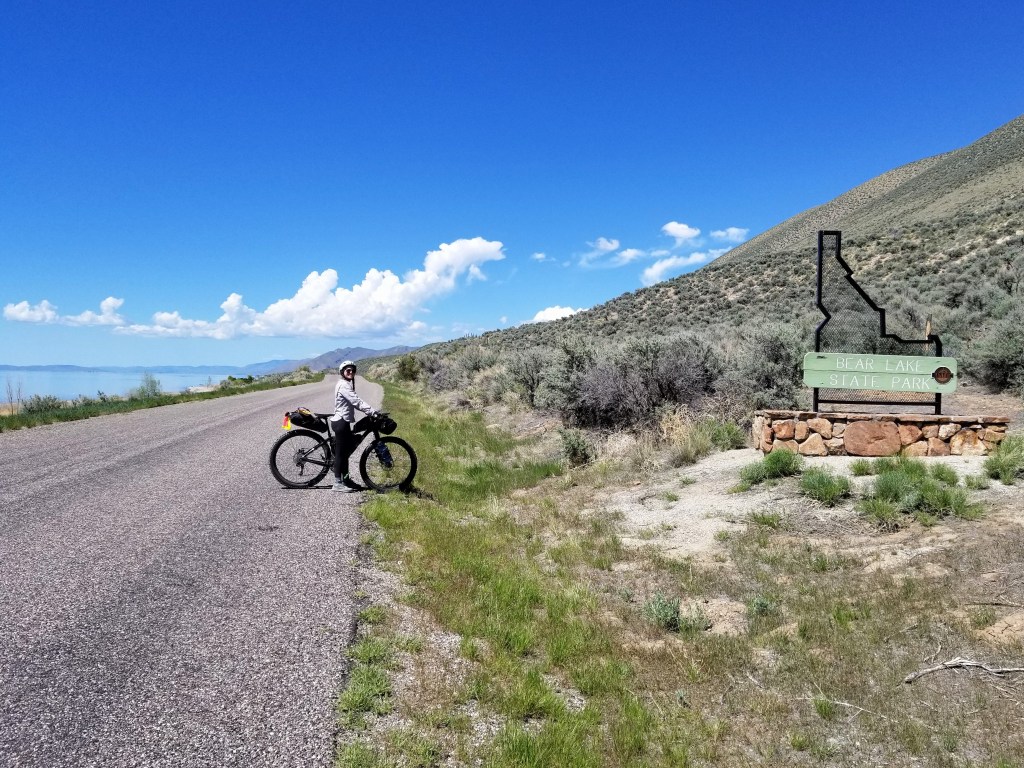
Day 33 – 90.4 Miles / +5000 ft
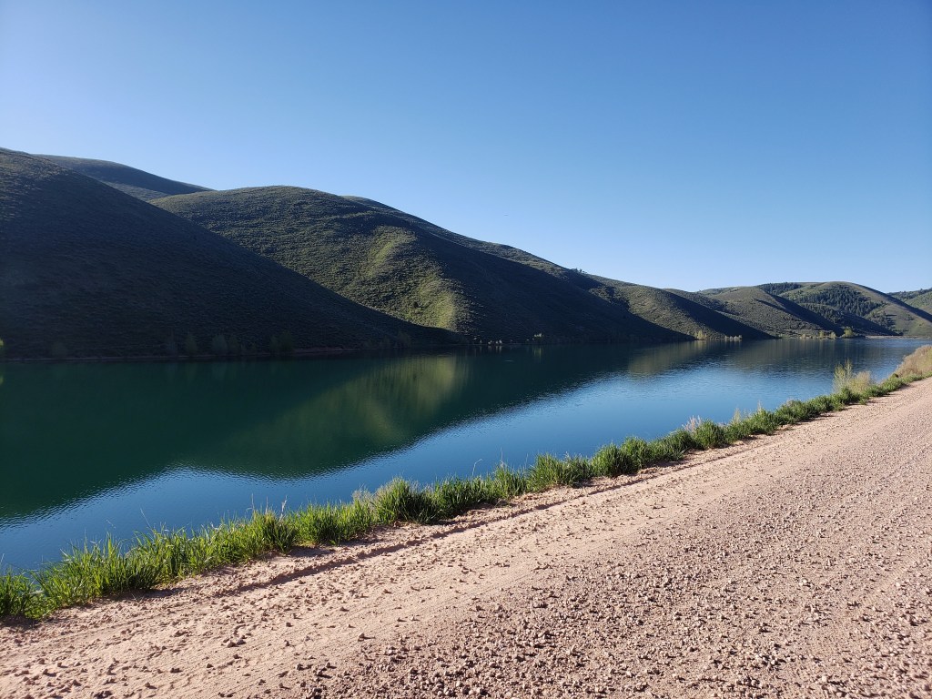
Our morning began on dirt with a big slow climb which made for a tough but beautiful morning ride. We exited dirt for highway and glided down four beautiful winding miles which ended with incredible views of Bear Lake. We resupplied at a little gas station / general store and headed towards the lake. It was just about 70° with a slight breeze, perfect for all the people out recreating on Memorial Day weekend. The next twenty miles were like a dream as we rode along the east side of the lake in a wide bike lane. The bike lane ended as we crossed the UT / ID state line marking the end of Segment 6. It didn’t quite mark the end of our day, but I’ll pick up where I left off in the next post.


WWR Segment 5 – Overall Experience
246.7 Miles / +11900 ft elevation gain
Our time in Salt Lake City was much needed and so appreciated in every way. Our lifestyle has blessed us with friends all over the country, and we are so grateful for their help when we tackle ambitious trips. This Segment marks about the half way point and rest, recovery, and repair were in deep order.
We were so glad to get back to the WWR after riding highway a couple hundred miles around the snowed in section. We would love to make a bikepacking trip out of the Skyline Drive section that we missed.
Segment 5, from where we rejoined the route, featured some long climbs, little tiny towns, and lots of wide open spaces. Water was plentiful enough that 3 L carrying capacity was sufficient. Food resupply was 70-90 miles apart so we needed a day and a little extra at a time which was not bad at all. In late May, the temperature was in the mid 60s-70s with abundant sunshine in the day and maybe dipping into the mid 40s at night.
Bear Lake is stunning!! Up in the northeast corner of Utah and sharing a state line with Idaho, Bear Lake is a massive beautiful spot to come recreate. We were there Memorial Day weekend and saw plenty of people, but not the massive crowds swarming at more popular destinations. Van lifers, RVers, Airbnb-ers should all consider a stop here!
WWR Cumulative Stats
- 33 Days
- 8 0-Mile Days
- 1581.5 Miles
- 95,500 ft elevation gain
- Average Daily Movement (w/o 0-mile days)
- 63.3 Miles
- 3800 ft elevation gain
(miles and elevation gain tracked with Strava)
More from the Western Wildlands Route
- Segment 6 – Kanab to Soldier Summit, UT
- Segment 7 – Grand Canyon to Kanab, UT
- Segment 8 – Globe, AZ to Grand Canyon
- Segment 9 – AZ / MEX Border to Globe, AZ
Join us here, on Instagram, or Facebook as we tackle the Western Wildlands Route (WWR) by bicycle. We have a few more weeks to see how much of the 2700 mile route we can get done.
Western Wildlands Route Segment 6 – Kanab, UT to Soldier Summit, UT

We are riding the Western Wildlands Route (WWR) on bicycles northbound and started at the AZ / Mexican border about 3 weeks ago. Since we are tackling the route northbound, “Segment 6” is our fourth segment.
Click to read Segment 7, Segment 8, and Segment 9.
Day 22 – 80.5 Miles / +5900 ft
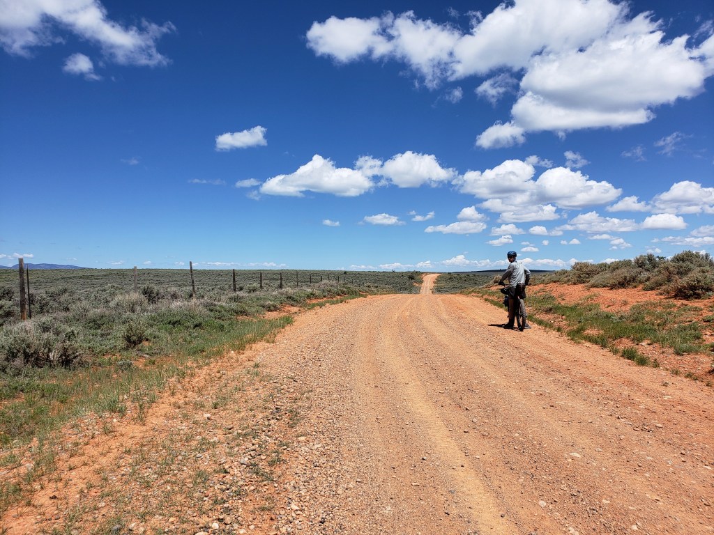
We left the care of Lynn and Richard in Kanab and headed back out on the WWR after our highway reroute through the Navajo Nation. We were elated to return to the backroads with big views and a lot less stress of worrying about cars. We had just entered Utah, and the scenery seemed to know we were in a different state. Just north of Kanab we cruised through a section of Grand Staircase Escalante featuring towering flat top monoliths. Our day was mostly spent climbing from around 5,000 ft to nearly 8,000 ft. on forest service roads.
Around 6:00, we headed into Bryce Canyon National Park for a quick view and resupply. The route had us enter the park though an unofficial entrance which led to an encounter with an unhappy park ranger. I did my best to explain the route, that we would pay, and that perhaps the designers of this route and the park should communicate. She promptly “reported us” to the gate keepers and deeply annoyed me. We checked out the view, got a quick resupply, and paid the $35 park entrance fee for the 25 minutes we spent there. We headed north from the park and reentered national forest land where we found a campsite for the night.

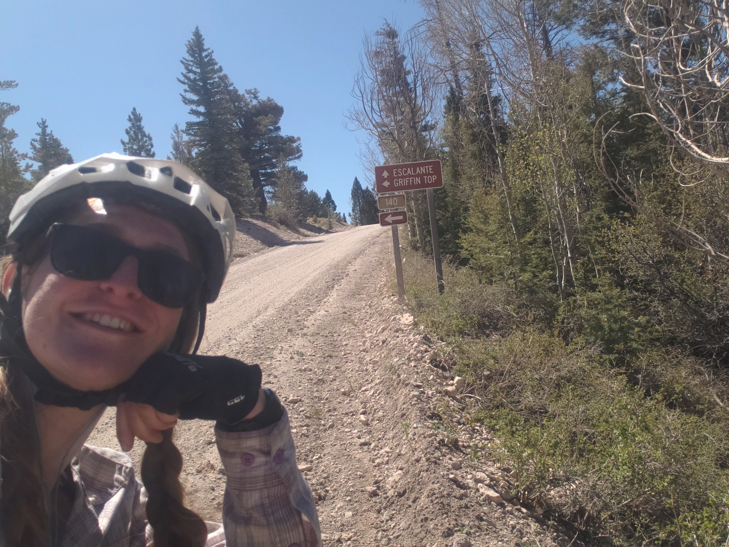
Day 23 – 80.4 Miles / +5300 ft
We woke early and realized for the first time of the trip that we were cold, but it didn’t take too long to warm up as we rode. Our whole morning and early afternoon was spent climbing Griffin Top up a dirt road from 7000 ft to 10500 ft. By late afternoon, we started a long, fun descent to the tiny town of Loa back down to 7000 ft. The 20 mile downhill ride was dreamy as we glided through open meadows with stunning views of towering canyon walls in the distance. We could feel the wind starting to pick up as we headed into Loa with occasional gusts pushing our bikes across the dirt road. In town, we resupplied at the small general store, hopeful that maybe we’d find a cheap hotel room to get out of the wind. Unfortunately, that was just a dream, and we rode out of town looking for the nearest suitable spot to pop up our tent. As we were riding out of town, a dog started chasing us from a house that had a small cattle operation in their back yard. We did our best to shoo it away, but it was pretty set on following us. A mile down the road, we turned onto the highway, and the dog continued to follow us. We rode on the shoulder, the dog following us and chasing cars in either direction with a couple very close calls. I shuddered at the thought of being somewhat responsible if the dog were to get hit. A couple miles later, we found a spot, ate dinner, and pitched our tent as the wind howled. We spent an unrestful night listening to the wind attempting to fold our tent and seeing the little dog use our tent to try and block the wind.


Day 24 – 54 Miles / +2500 ft
In the morning, big gray clouds filled the sky, the wind remained intermittent, and the little dog was still roaming around our tent. We packed up the bikes, and as if on cue, the little dog began running by our bikes when we took off. We returned to the highway for a couple miles while the dumb dumb little dog chased cars and wandered in the middle of the road. As we hit the dirt, I found a number for a semi-local animal shelter to see if they had any advice. I explained the situation to the lovely volunteer, but she didn’t really have any solutions. She told us the dog was a cattle dog, may or may not be claimed and regularly fed, and thanked us for trying to help it. Basically, she said don’t feed it and don’t worry about it. Once we were off pavement, I was able to relax a little more and enjoy the ride. The next 15 miles we spent riding dirt roads to Fish Lake while the little dog (who I named Gerry) trotted along keeping an impressive pace.
When we arrived at Fish Lake, a couple was out photographing the beautiful aspen grove we were riding through. We said our hellos, and the gentleman informed us we were standing in Pando, the world’s largest known living organism. Pando is an aspen clone consisting of over 40,000 individual trees covering 106 acres. We had heard of the grove, but we didn’t know we would be riding to it. It was quite a lovely surprise. The couple noticed Gerry, and we explained the situation. Thankfully, they were willing to hold onto the dog while we pedaled away on pavement for fear the dog would once again try to start a fight with traffic.
From Fish Lake, most of the rest of the ride to Salina was downhill. We followed the WWR through a canyon following Little Lost Creek. The sun overpowered the cloud cover as we headed toward town. We came out of the canyon returning to big wind gusts, crossed Interstate 80, and got to Salina. We both immediately agreed to end our day in town to escape the elements and clean up.


Day 25 – 61.3 Miles / +6300 ft
We awoke early knowing we had a big day of climbing ahead of us. Thankfully the wind had died down, but the forecast called for highs in the 60s over the next couple days and lows dipping below freezing. And that was for town at 5,000 ft in elevation. We were heading up to 10,000+ ft.
We started the climb just outside of Salina heading up into Fish Lake National Forest on gravel roads under clear sunny skies. The climb was slow and steady with the steepest portion between miles 15 – 20 where we had to push our bikes on occasional short segments. The landscape changed from sage scrub, to pine trees, and then miles of Aspen trees. We took our lunch break around 1, and the sky was almost completely overcast. As soon as we stopped riding, the cold settled in, and we did our best to keep our lunch short and keep moving. Eventually, we got to and above treeline and came to our first patch of snow for the day. We crossed the section and continued up. At this point, the WWR was on a road called Skyline Drive that essentially just rides the ridge for over 50 miles between 9,000 and 10,700 ft. As we continued on, we came to more and more patches of snow. In between the snow, the clear patches were completely saturated, and the clay mud began accumulating on our tires. Mud, gravel, and little sticks started piling up on the tires growing quickly layer after layer. It seemed we were discovering what Utah’s “impassible mud” was all about.
Our next hurdle was a stretch of snow as far as we could see. We were about 500 ft and a mile or so shy of the high point for the day. Beyond that point, however, we wouldn’t come down below 9,000 ft for 50 or so miles. We started questioning what we should do as clouds loomed and snow stretched as far as we could see. We decided to attempt to carry on, literally carrying our bikes over large sections of snow. When we came to uncovered ground, we attempted to ride, but eventually the mud clogged and locked our tires. We were left without much option – we had to turn back.
We carried our bikes back down what we had struggled through feeling defeated. As we exited the snow, we tried unclogging some mud from the wheel enabling them to spin once more. As we gained speed on the downhill, mud and rocks began to fling free and the majority of the debris came off of the bikes. It was a little heartbreaking making the descent, but we knew we were making the right choice. Without knowing what route to take, we retraced our ride downhill back to Salina. What took us 8+ hours to climb took us under 2 hours to descend. We returned to the hotel wet, dirty, and cold to create a new game plan for this segment.


Day 26 – 50.8 Miles / +1500 ft
Overnight, the low in town was about 28 degrees. At 10,000 ft, it probably got down to around 15. We were happy to wake up warm and decided our only option was to ride the highway around Skyline Drive since the WWR simply wasn’t passible yet for bikes. The high for the day was 60, and the sky remained overcast. We watched the mountains and ridgeline to the east completely covered in snow knowing we made the right choice.
We were grateful for the wide shoulder and light traffic as we rode our way north up Highway 89 through the heart of cattle country, ubiquitous to the rural West, and Mormon country, unique to Utah. It became abundantly clear that it was Sunday as we rode since all the little towns seemed like ghost towns, every business aside from the few chain fast food restaurants, chain stores like Family Dollar, and gas stations were closed. Most of the towns featured signs marking them as part of the “Historic Mormon Pilgrim Route.”
In the late afternoon we arrived in Mount Pleasant, another tiny town along the highway. We considered ourselves lucky to find a Subway open so we could loiter somewhere indoors instead of outside in the spitting rain and 50 degrees. We had intended on camping, but a lodge was a little too tempting knowing overnight would dip down to around freezing and had the potential for rain.
Day 27 – 78.4 Miles / +1900 ft
We considered returning back to the route at Soldier’s Summit but knew that there would be a few points that reached 10,000 ft. We had already been planning meeting some friends in Park City to take a few days off in Salt Lake. Due to the reroute, it became a little more convenient to meet in American Fork so we made that our aim for the day. We spent the morning riding up the sleepy Highway 89. About 10 miles outside of Provo, we intersected with the much busier Highway 6 and headed downhill into a headwind with cars and semis whizzing by. Thankfully, it didn’t take us too long to reach Spanish Fork where we left the highway and Google Maps sent us through town and wound us to Provo. We arrived at Brigham Young University thankful for a bike lane! After 60 miles of riding with very little breaks, we were thrilled to find a Chipotle with a patio and quite literally the best view from a Chipotle I could have imagined as Mount Timpanogos towered over the city. After lunch, we finished our final 18 miles to meet up with our friend and enjoyed a few days off.

Segment 6 – 405.4 Miles / +23,400 ft gain
WWR Cumulative Stats
- 27 Days
- 5 0-Mile Days
- 1334.8 Miles
- 83,600 ft elevation gain
- Average Daily Movement (w/o 0-mile days)
- 60.6 Miles
- 3800 ft elevation gain
(miles and elevation gain tracked with Strava)
More from the Western Wildlands Route
- Segment 5 – Soldier Summit to Bear Lake
- Segment 7 – Grand Canyon to Kanab
- Segment 8 – Globe to Grand Canyon
- Segment 9 – MEX / AZ border to Globe
Join us here, on Instagram, or Facebook as we tackle the Western Wildlands Route (WWR) by bicycle. We have a few more weeks to see how much of the 2700 mile route we can get done.
Western Wildlands Route Segment 7 – Grand Canyon, AZ to Kanab, UT

We are riding the Western Wildlands Route (WWR) on bicycles northbound and started at the AZ / Mexican border about 3 weeks ago. Since we are tackling the route northbound, “Segment 7” is our third segment.
Click to read Segment 8 and Segment 9.
Day 18 – 75.5 Miles / +3000 ft Gain
It’s a little hard to pull yourself away from the beauty of the Grand Canyon, but we had miles to ride. Our hard work was essentially done for the day, and we cruised downhill for nearly 30 miles to the town of Cameron.
During the ride, we crossed the boundary to the Navajo Nation. The Navajo typically generously allow riders of the route to traverse their land, parks, and back roads with a permit. However, due to the ongoing pandemic, all Navajo Nation parks and back roads were closed. Therefore, this isn’t the typical experience one would have riding Segment 7 of the WWR, and it left us with the only option of riding the highway between the Grand Canyon and Kanab. Not ideal, not impossible. We resupplied in Cameron and got a spot at a no services campground in the tiny Navajo town.


Day 19 – 82.77 Miles / +3500 ft Gain
We started our morning extra early hoping to get ahead of the traffic that was heading north towards Page and Lake Powell. It was a hot day with two major climbs matched with two seemingly endless descents. We spent our day pedaling hard and listening to music as car after car whizzed by us on the busy highway. While we wished we were out on the dirt, the scenery from the highway did not disappoint. We enjoyed the cruise by massive red rock monoliths and canyon walls that stretched for dozens of miles. We somehow finished 80 miles of riding and got to Page by 2:00 and headed to a hotel room for the night.


Day 20 – 77.4 Miles / +3500 ft Gain
We moved our watches into Mountain Daylight Time, happy to have an extra hour of light in the evening, and headed to Kanab, UT. Leaving Page, we crossed the Glen Canyon Dam and headed basically due west. We were grateful for the reduced traffic compared to the precious days’ ride. But the day came with a new challenge – a relentless head wind. We pedaled frantically trying to overcome the feelings of despair. It was a long day we were both ready to be done with. Just as I was about to surrender to the wind, we arrived to Kanab thrilled to get out of the elements.
Two really delightful things happened in Kanab. First, we headed to a small pharmacy in town and got our final dose of the COVID vaccine. Woohoo, what a gift! Second, we headed to Lynn and Richard’s house to take a day off of riding.
Day 21 – 0 Miles, Day Off in Kanab
We met Lynn and Richard in 2019 after our thruhike of the Arizona Trail. Lynn was so gracious then to pick us up from the northern terminus about an hour away from her home in Kanab and bring us back to “Chateaux Relaxo.”
Now, in 2021, Lynn and Richard were spoiling us again. We arrived on the same day they were hosting some friends to share photos of some rock art Richard and two others had recently encountered on a grueling hike. Our hosts and their guests welcomed us warmly, and we thoroughly enjoyed being included in the presentation.
We spent the next day resting, nursing sore arms and mild post-vaccine symptoms. Lynn was overly kind in driving us to the store for resupply and then making the most fantastic vegan dinner for us that I am still dreaming about – pecan crusted sweet potatoes, falafel, roasted mixed vegetables, quinoa, cashew cream topping, a cranberry sauce, and a garden salad. I am drooling just thinking about it.
After a delightful early breakfast, coffee, and conversation with Lynn, we packed our bikes and headed north excited to be back on the roads far less traveled.


WWR Segment 7 – Overall Experience
Well, I’d be lying if I said I wasn’t disappointed to have missed the actual route here. It’s just an entirely different experience riding on the highway vs riding backroads. Of course, the reason for the closure is justified, and I hold no grudge. I only have the desire to return to see what Segment 7 holds.
The highway work around was fine, nothing too terrible. We did have a couple sketchy stretches were we held our breath and hoped the drivers of the death machines passing us were paying attention. Arriving in Page and then Kanab safely was a huge relief.
Lynn and Richard were such a huge blessing on this trip, and we are just overwhelmed with gratitude. Thank you for your kindness, support, and hospitality that you bestowed upon us and continue to give the hiker and biker communities. We can’t wait to see you again!
WWR Cumulative Stats
- 21 Total Days
- 5 0-Mile Days
- 929.4 Miles
- 60,200 ft elevation gain
- Average Daily Movement (w/o 0’s)
- Daily Miles – 58
- Daily Elevation Gain – +3700 ft
(miles and elevation gain tracked with Strava)
More from the Western Wildlands Route
Join us here, on Instagram, or Facebook as we tackle the Western Wildlands Route (WWR) by bicycle. We have a few more weeks to see how much of the 2700 mile route we can get done.
