
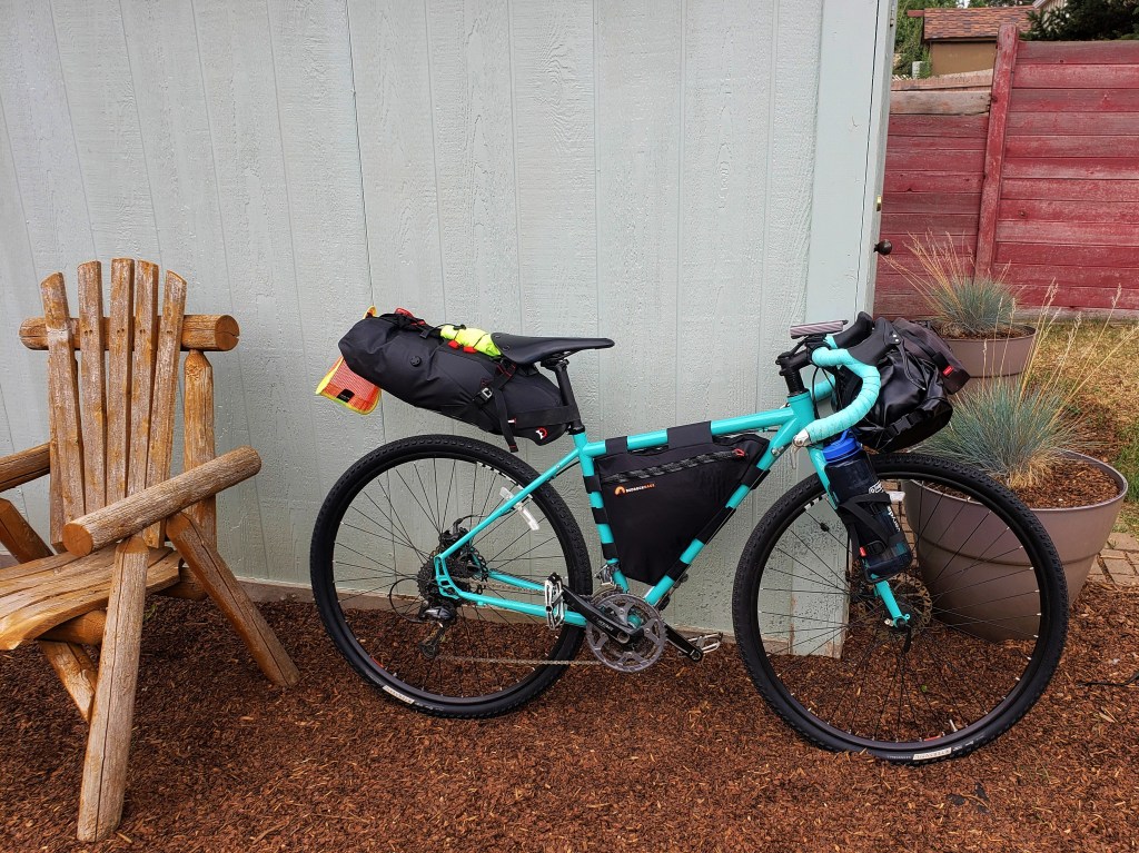
Western Wildlands Route SEGMENT 8 – Globe, AZ to Grand Canyon, AZ

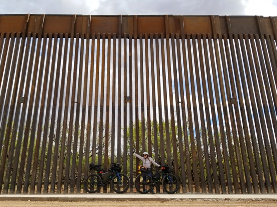
We are riding the Western Wildlands Route (WWR) on bicycles northbound and started at the AZ / Mexican border a couple weeks ago. Since we are tackling the route northbound, “Segment 8” is our second segment.
Click here to read our first segment – Segment 9.

Day 12 – 47.3 Miles / +7000 ft gain
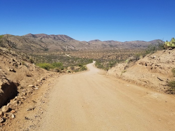
We left our lovely hotel room in Globe prepared for a big day of climbing knowing we were leaving the desert floor behind and heading up to higher elevation. The road out of town brought us around Roosevelt Lake, and we began climbing immediately. It was another day of abundant sunshine beaming down on us as we slowly climbed a paved road up the Sierra Ancha mountains. By mid-afternoon, towering pine trees replaced saguaro cacti providing much appreciated shade. We reached the top just in time to pitch the tent for the night.


Day 13 – 61.8 Miles / +5100 ft gain
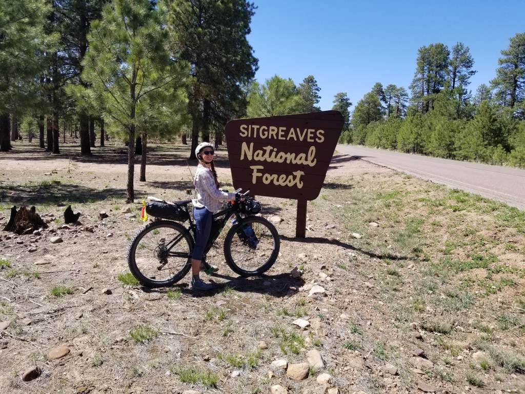
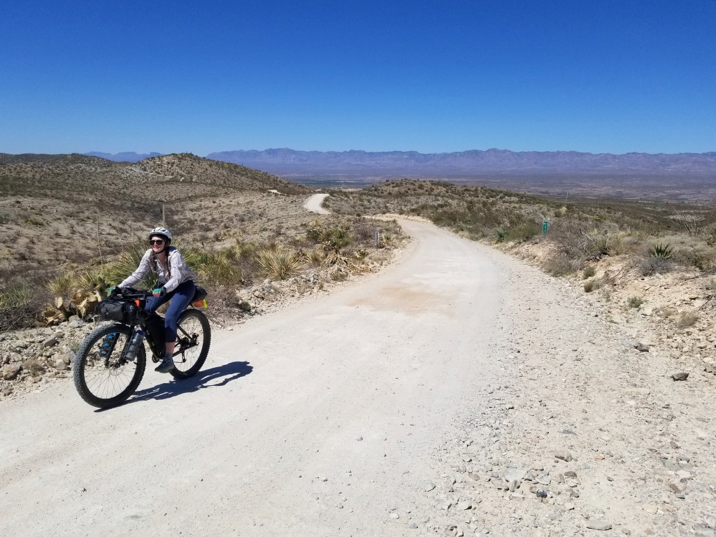
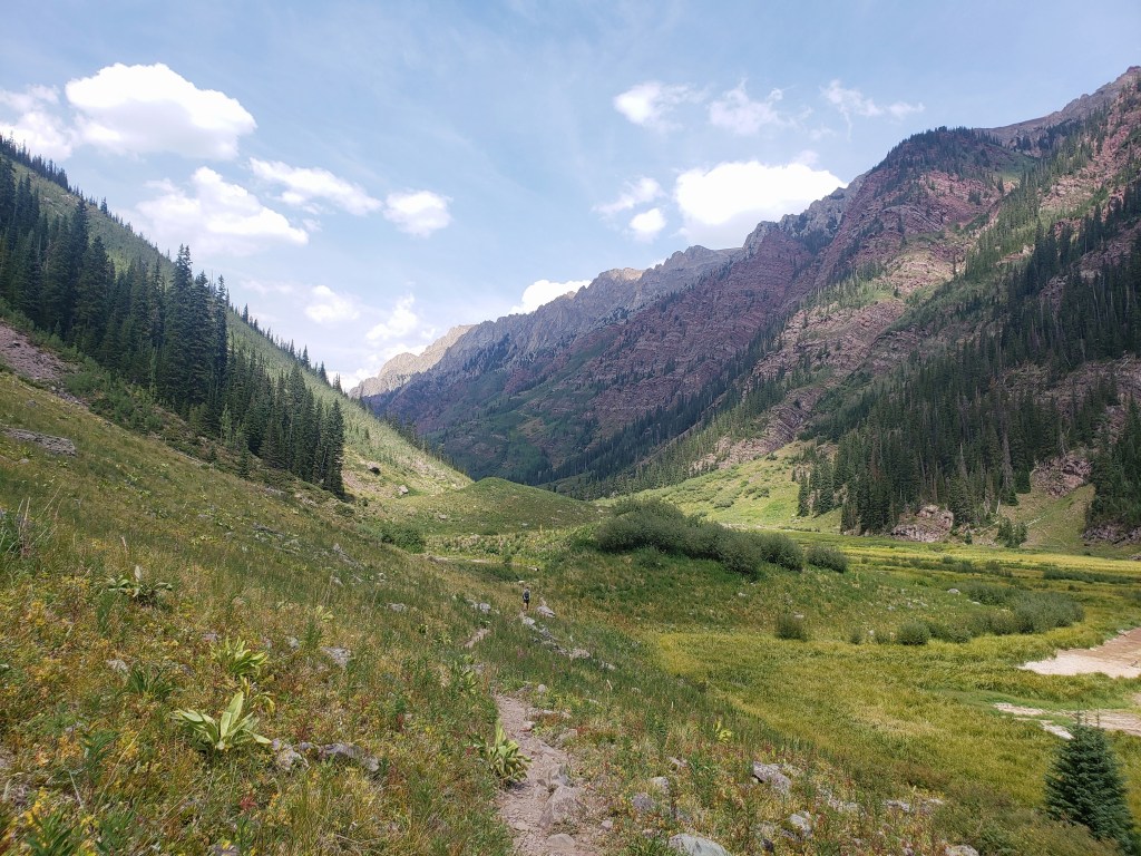
Our day began with nearly 15 miles of descent into the tiny town of Young. We resupplied and weren’t surprised to find out our day would once again be filled with climbing. The paved road out of town soon became dirt as we pedaled up the Mogollan Rim thankful for the shade and cooler temperatures. If you’re looking for a place to bring a camper, look no further. The area had countless spots to pull off and park out in the national forest with incredible views off the rim. We bookmarked this one for future van life.

Day 14 – 82.6 Miles / +3700 ft gain
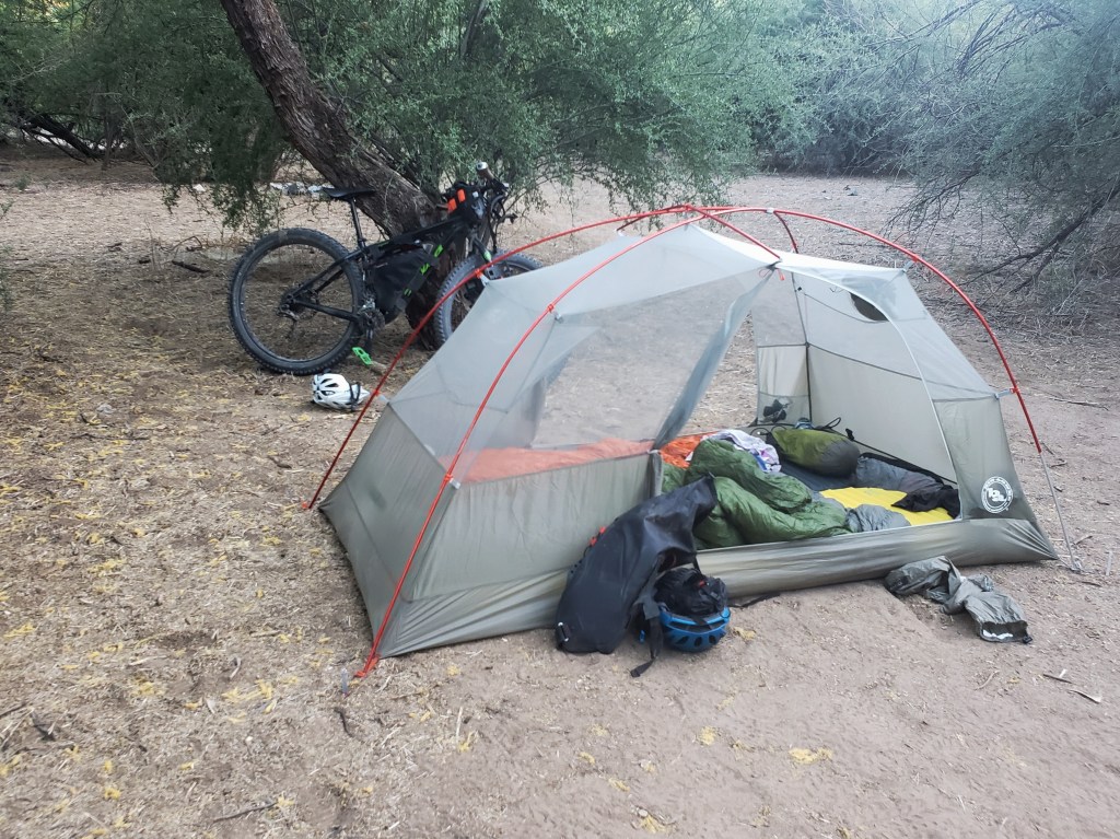
How can a day with so much downhill riding still have 3700 ft of gain? Who knows, but we still had a marvelous day. We finished our long stretch of mixed ascents and descents on the rim and headed down to the tiny town of Happy Jack to resupply in their gas station. We pushed on riding dirt in what felt like the literal middle of nowhere. Suddenly, we were zooming down a canyon as the sun was about to set. We thankfully found a campsite at about the last second possible before it was dark and eagerly awaited the morning.


Day 15 – 60.9 Miles / +5600 ft gain
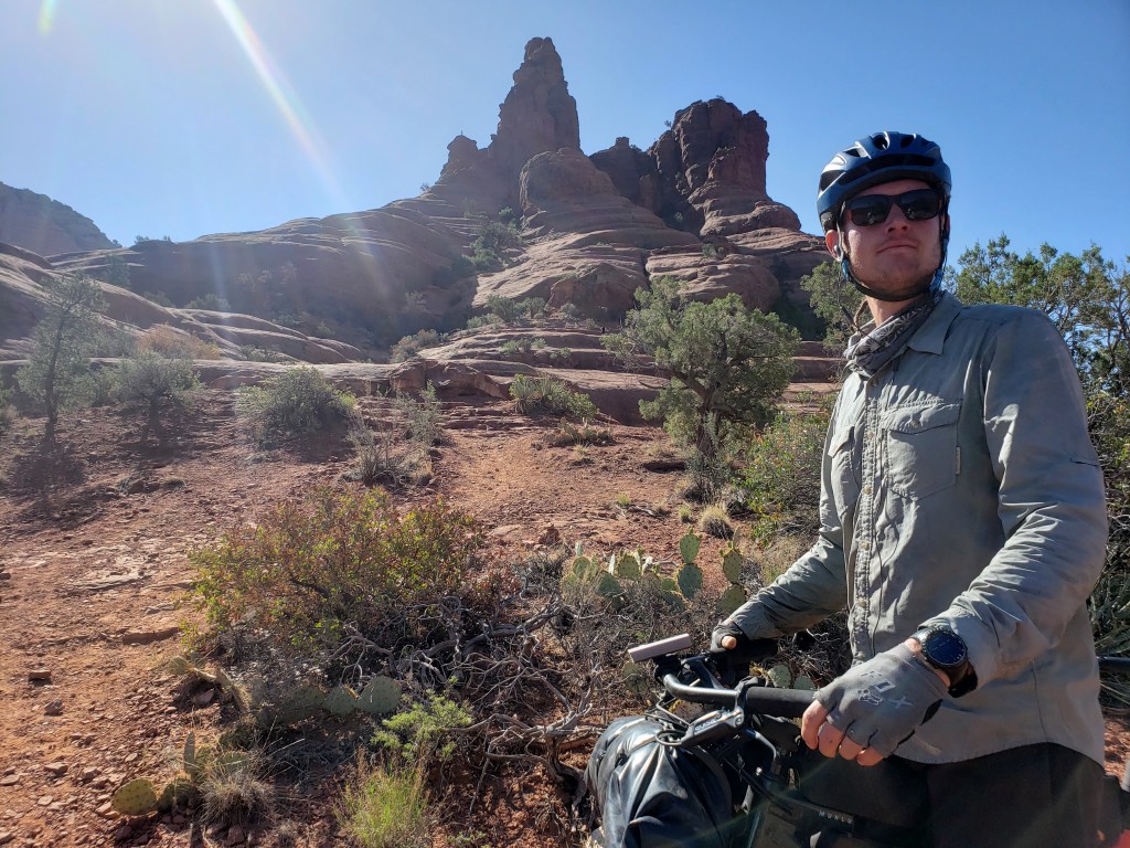
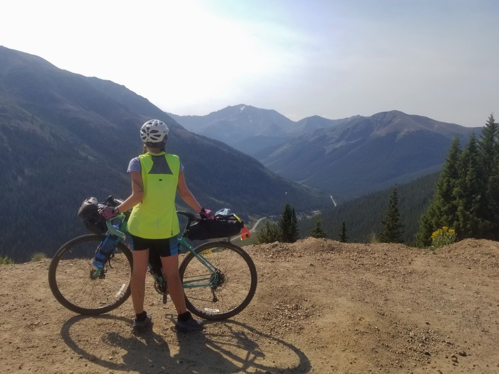
We knew we had a big day of climbing ahead of us, but it was made a little easier knowing we were just outside of Sedona for morning coffee, and we were aiming to end our day in a hotel room in Flagstaff. After properly caffeinating, we headed out for the ride.
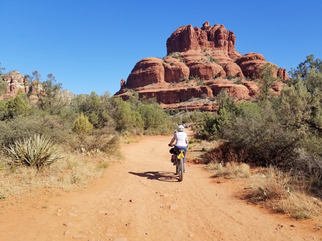
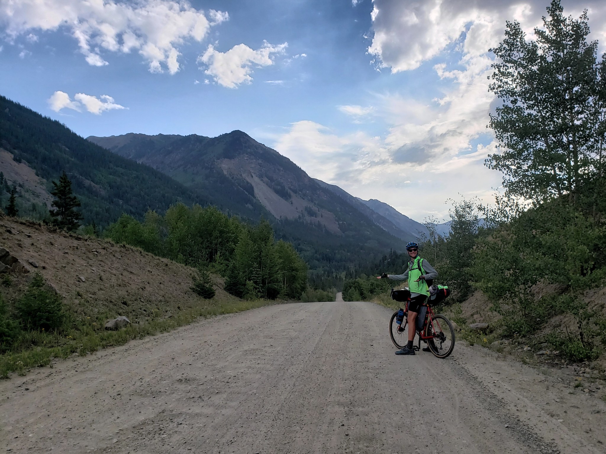
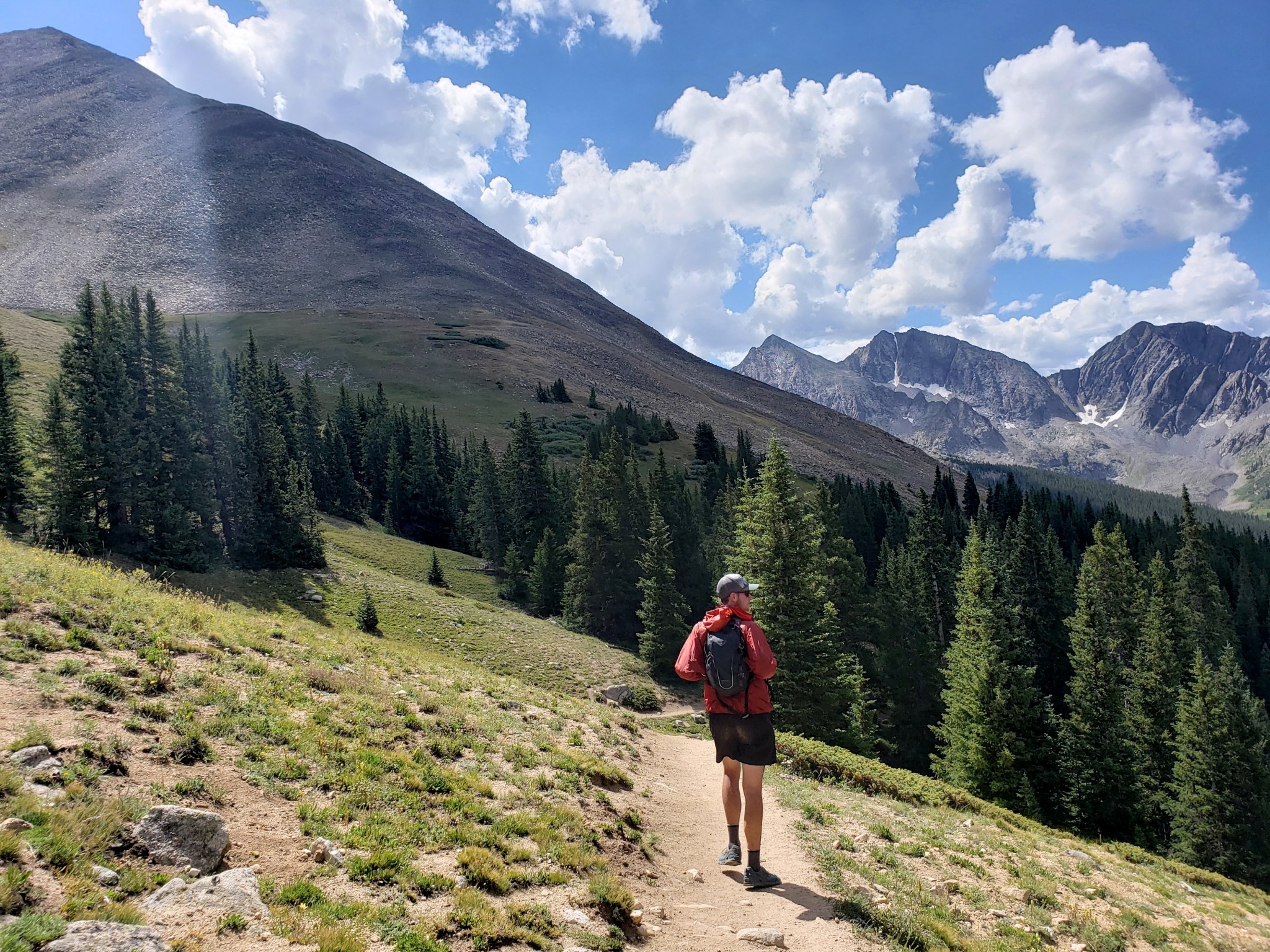
Wow, our first time in Sedona was such a treat. Just outside of town, we hit a gravel trail designed for hikers and bikers surrounded by stunning red rock formations. The 3 mile trail left us all smiles but was over in a flash. We were tempted to do the trail over again but knew there was more work to be done.
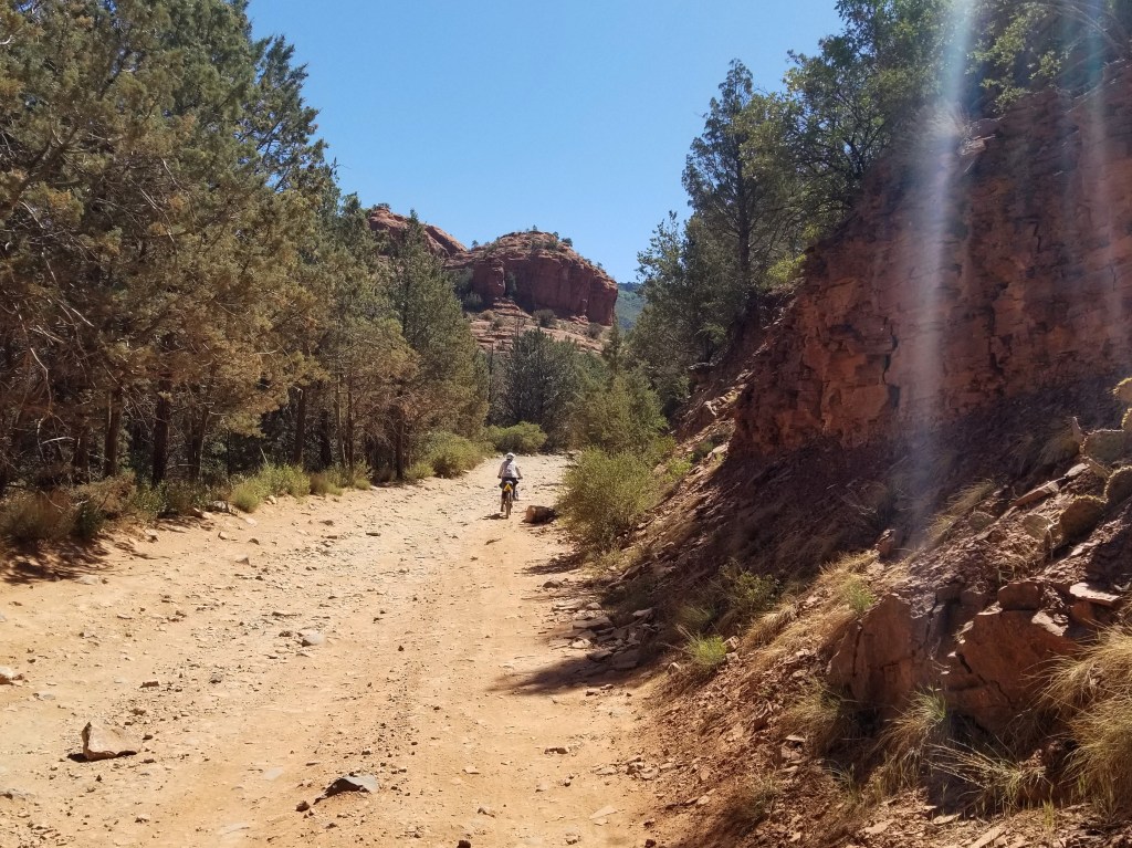
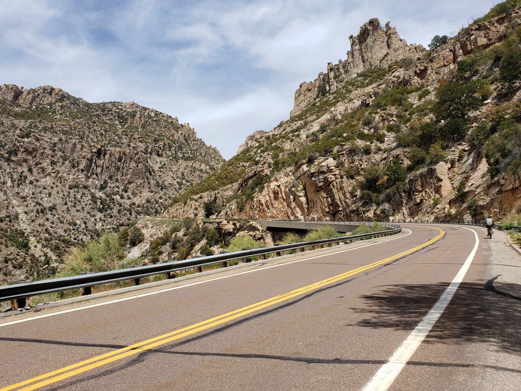
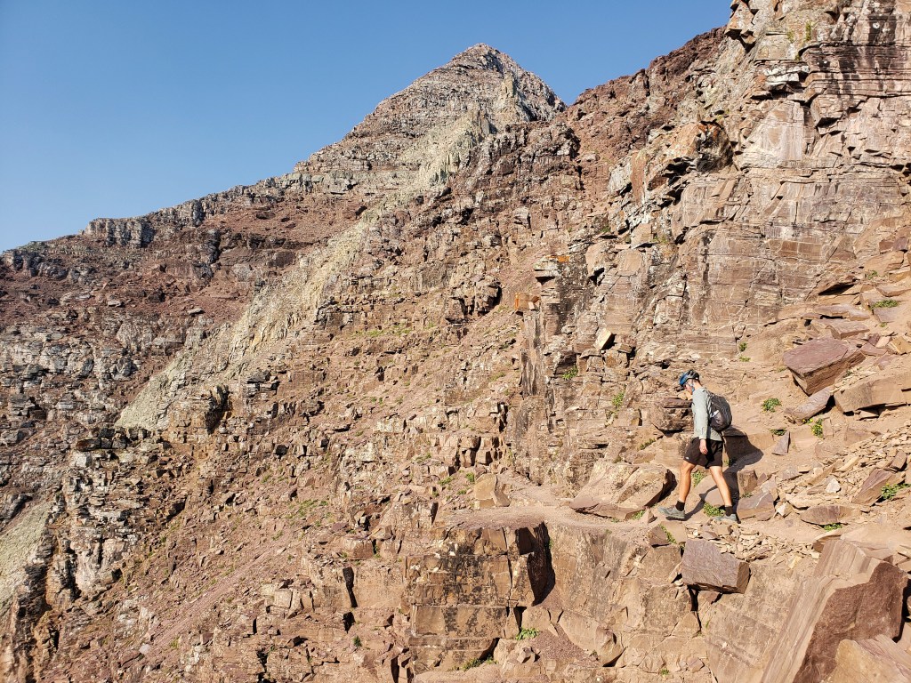
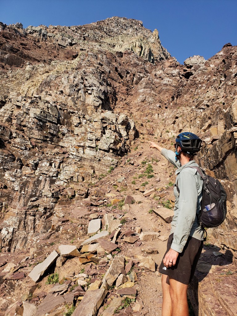
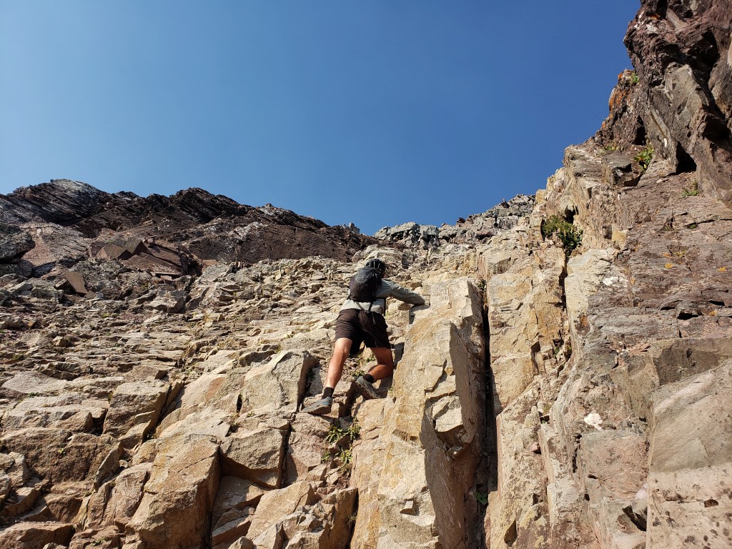
Onward through town, we headed up a canyon and the paved road once again turned to dirt, this time full of chunky rocks. Our pace wasn’t much faster than walking, but we managed to cycle up, up, up with incredible views and cheers from the tourists on jeep tours that passed us. We were grateful the trail mellowed out, but we still had dozens of gravel miles ahead of us. The afternoon dragged on as I eagerly awaited a shower in town, but I filled the time with podcasts and enjoyed the ride. Eventually we made it to Flagstaff thrilled for a day off.


Day 16 – 0 Miles – Day off in Flagstaff
Day 17 – 61.3 Miles / +4300 ft
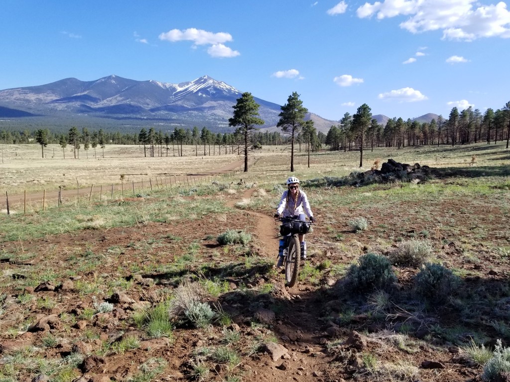
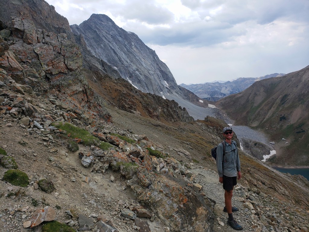
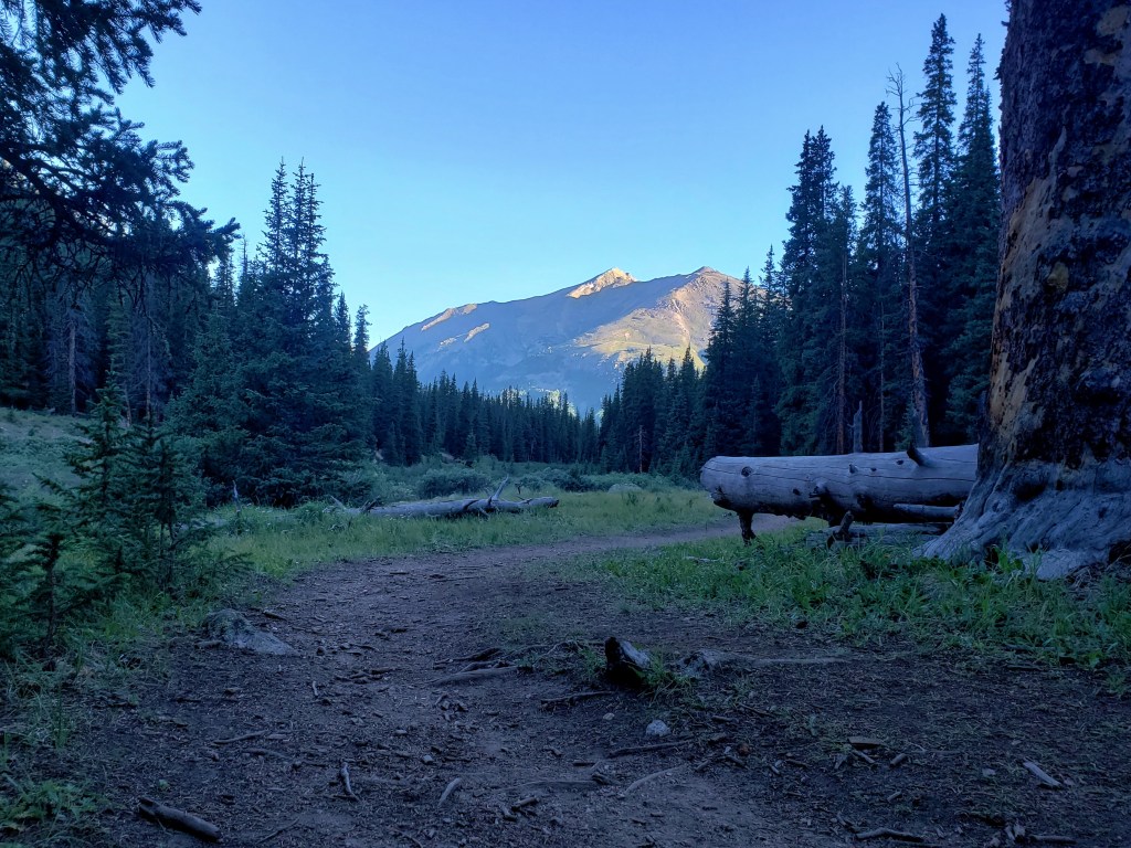
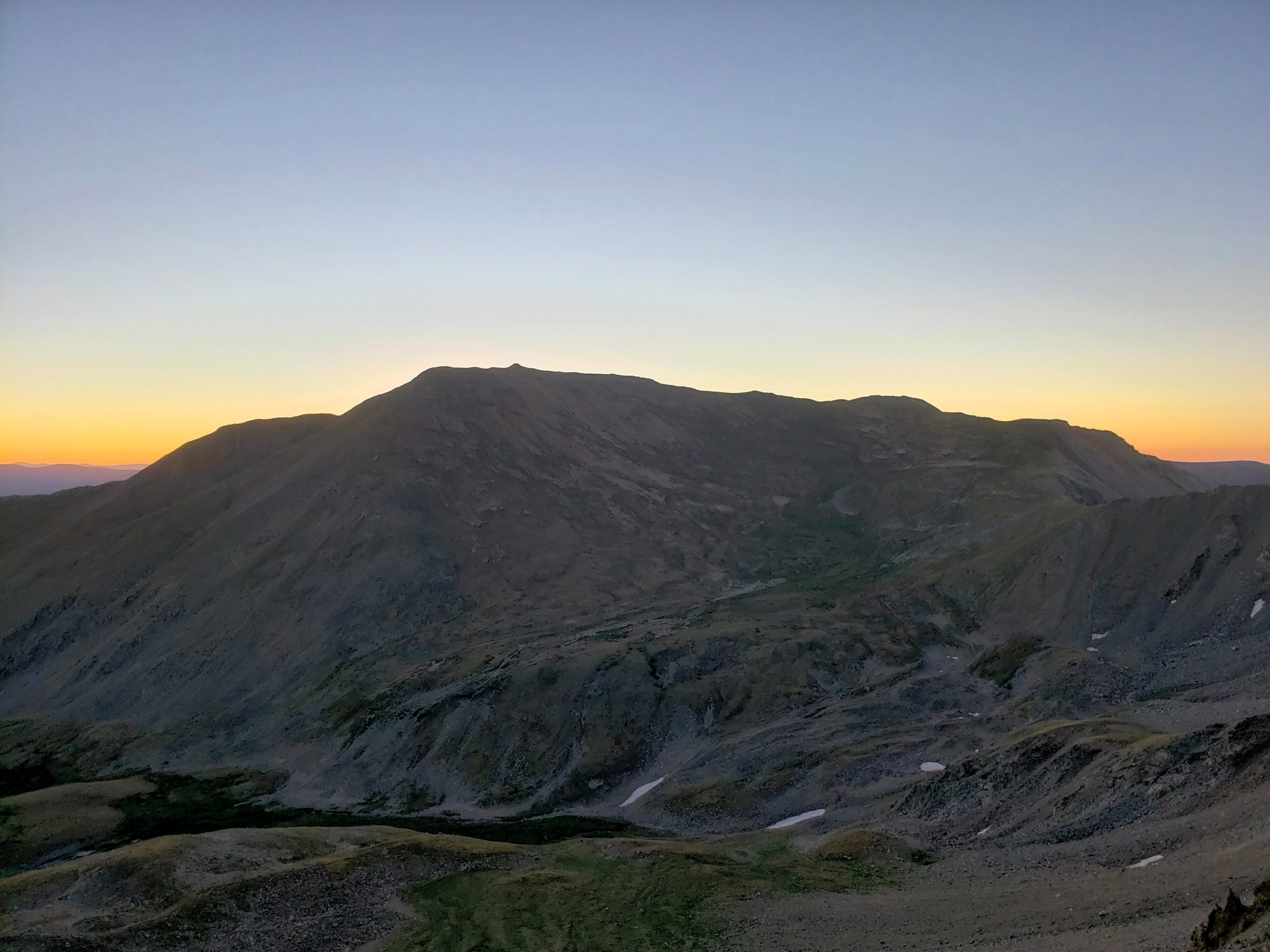
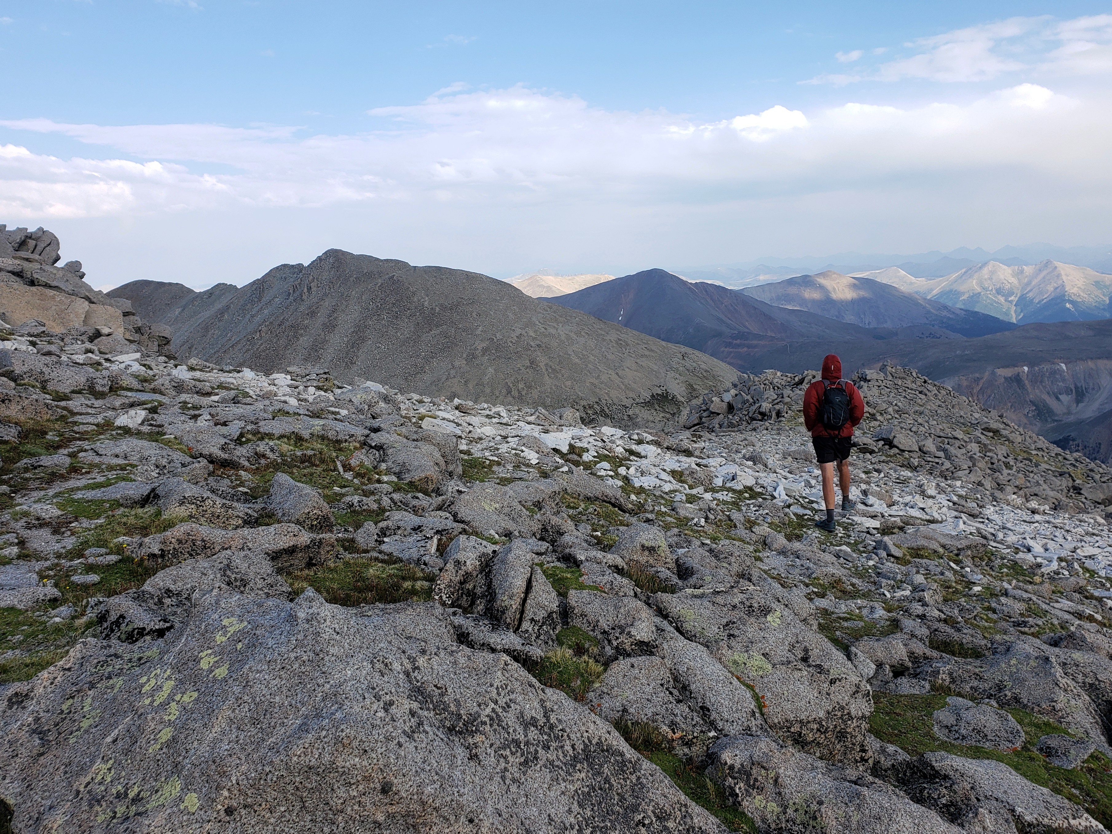
We left the hotel room and headed towards Humphrey’s Peak that towers over Flagstaff. Climbing began immediately as we made our way around the stunning mountain. As we climbed the east side, we entered an area that had burn damage and encountered our first section of blown down trees, lifting our bikes over and dipping under the tree carcasses discarded like pick-up sticks.
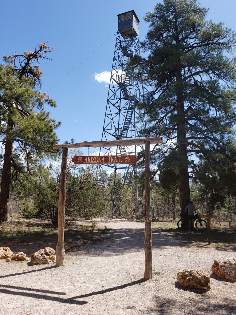
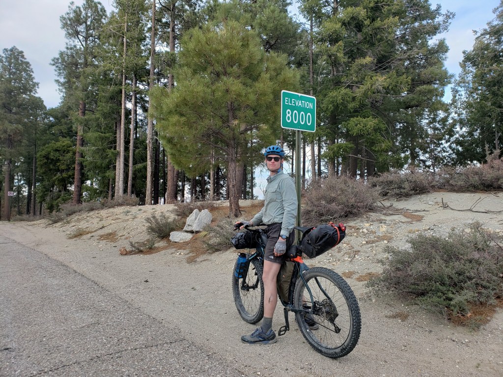
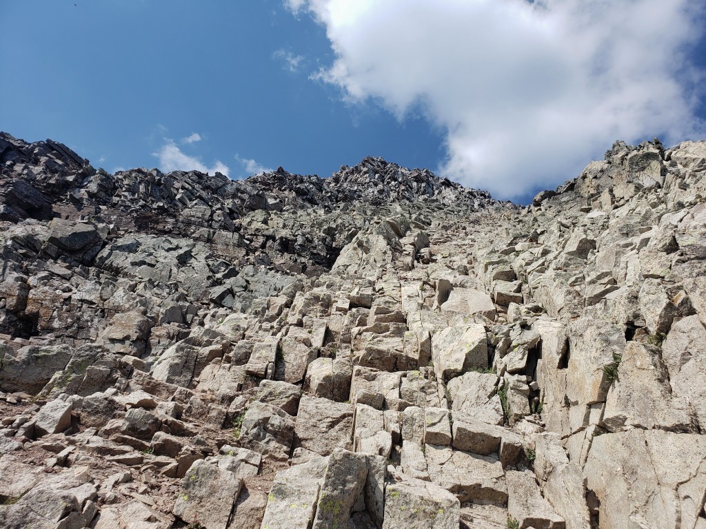
At about 9,000 ft, we started to head down the mountain. The terrain was a mix of dirt road and our first significant stretch of single track as the WWR coincided with a dreamy section of the Arizona Trail. We finished our day just as the sun was setting with Humphrey Peak far in the distance.


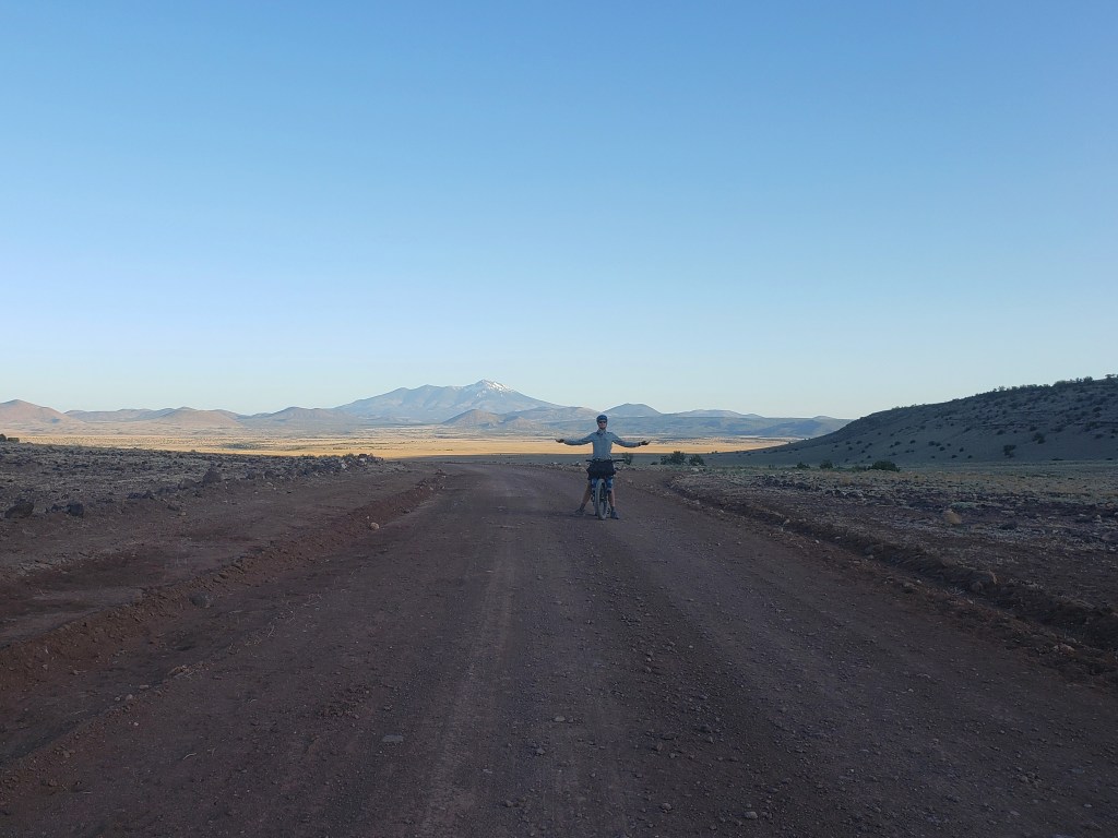
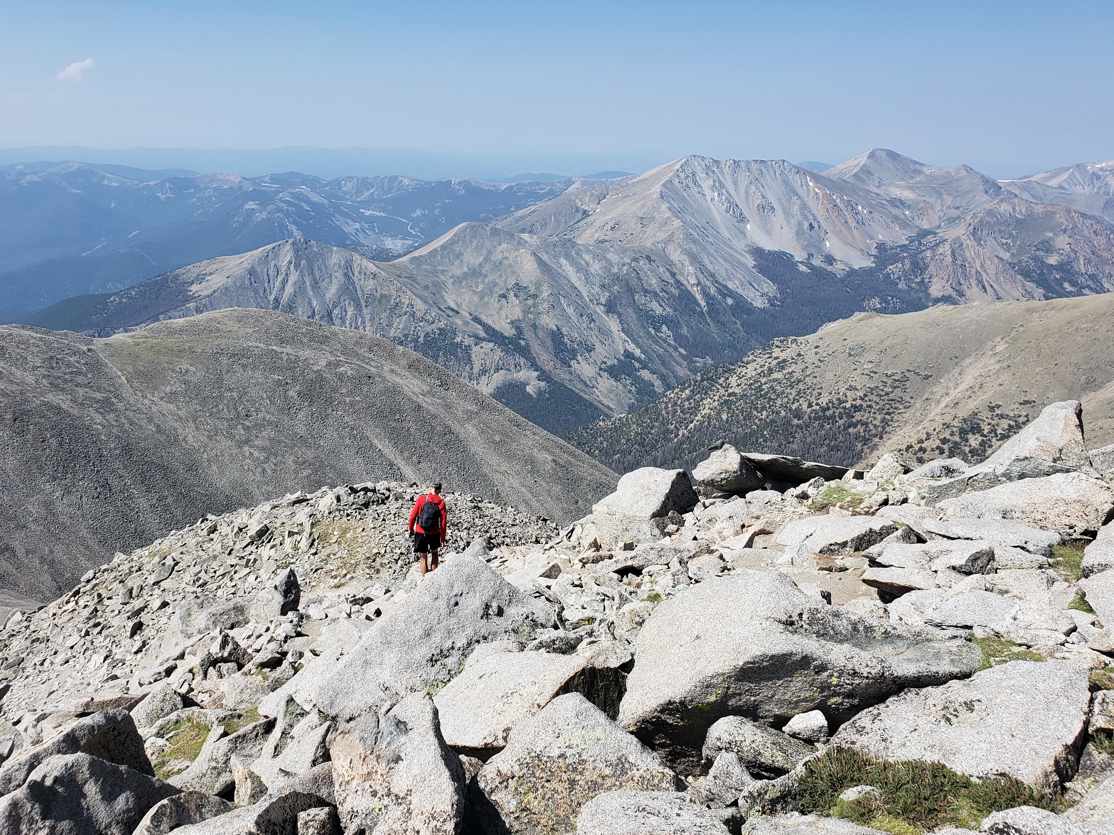
Day 18 – 75.5 Miles / +3000 ft gain
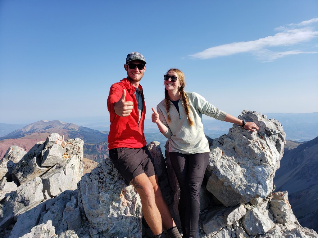
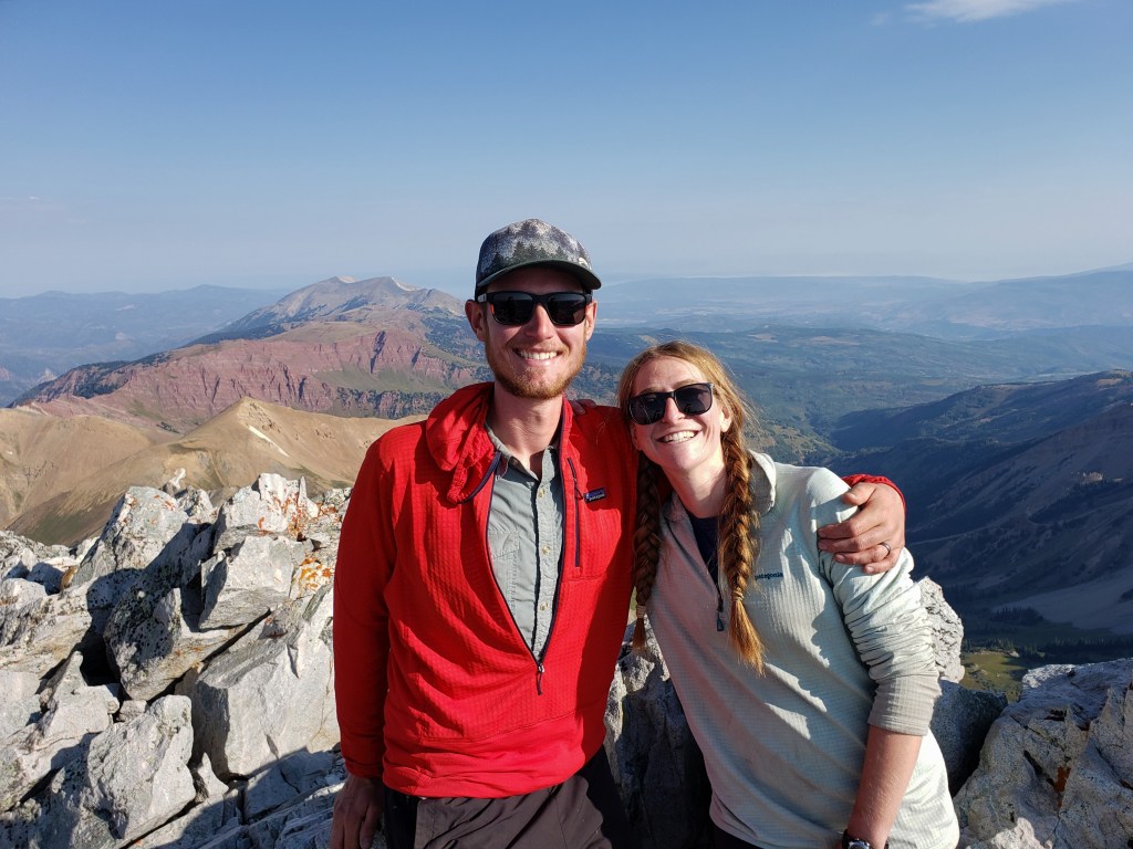
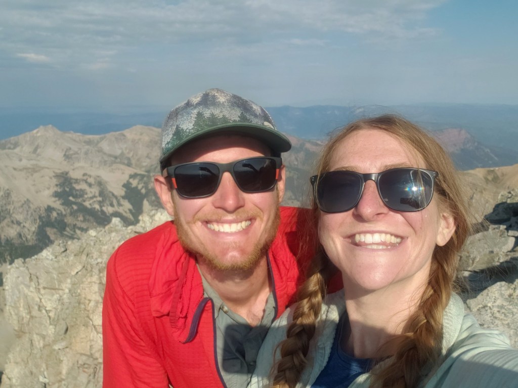
The first half of our day was, you guessed it, climbing. But thankfully, we enjoyed the mellow grade as the sun was rising that brought us up to Grandview Tower. We stopped to enjoy the view and prepared for the easy 12 miles ahead to the East entrance of Grand Canyon National Park. By noon, we arrived at the park and greeted the canyon in awe of its depth and beauty, happy to take it in from a new vantage point. After hiking rim to rim on the Arizona Trail and our additional one day double crossing, the Grand Canyon has become a very special place for us – one we will continue to come back to over and over. This spot marks the end of Segment 8.


WWR Segment 8 – Overall Experience
Wow, this segment had no shortage of climbing. During the six days of riding Segment 8, we averaged about 4800 ft of elevation gain and 65 miles of riding each day.
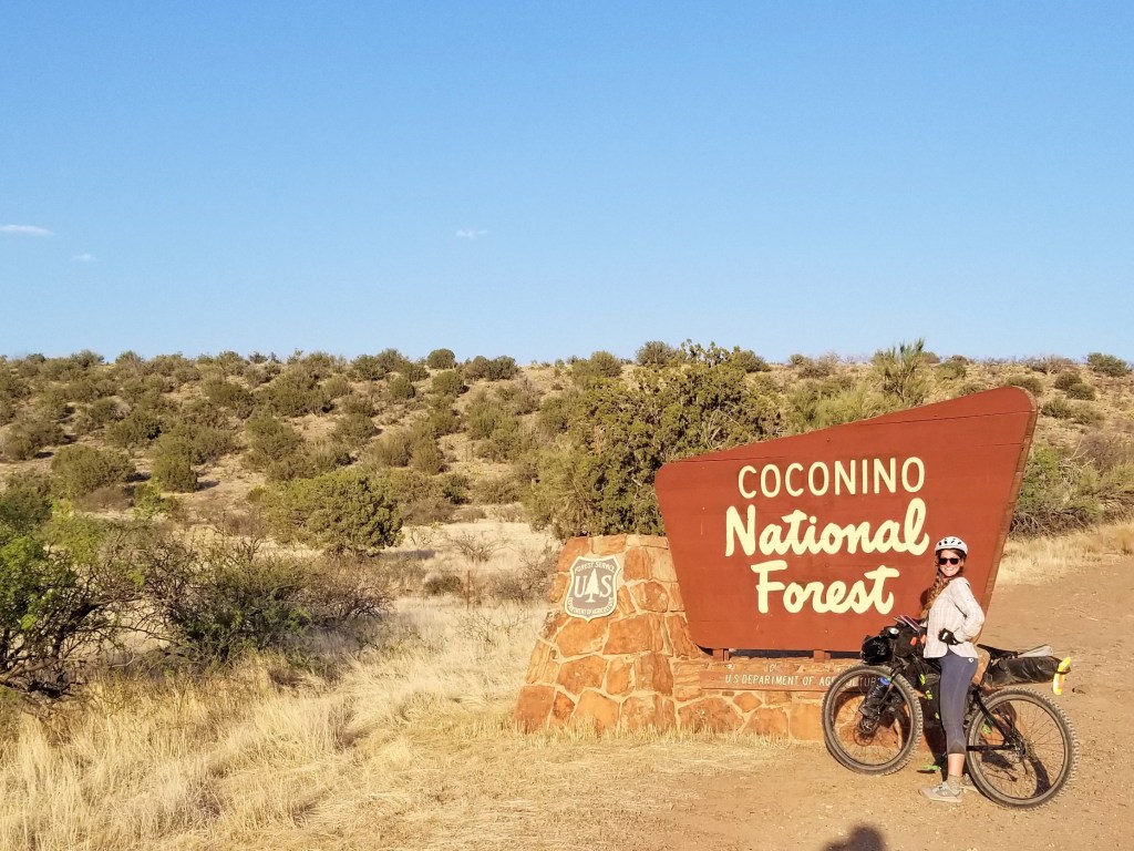
When we left Globe, we left the depths of the desert floor behind and headed into towering Ponderosa pine forests. Tiny towns dot the 200 miles between Globe and Sedona. The entire segment from Globe to the Grand Canyon averaged 70 miles between food and water resupply, 2 of those resupplies were at gas stations or small town markets.
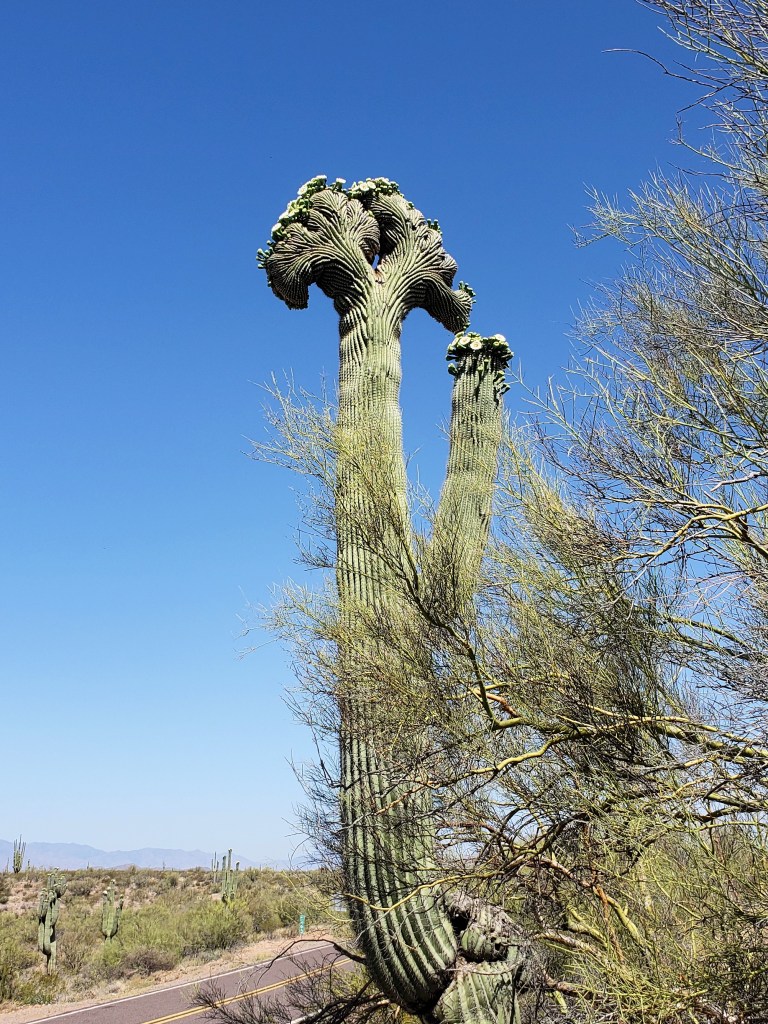
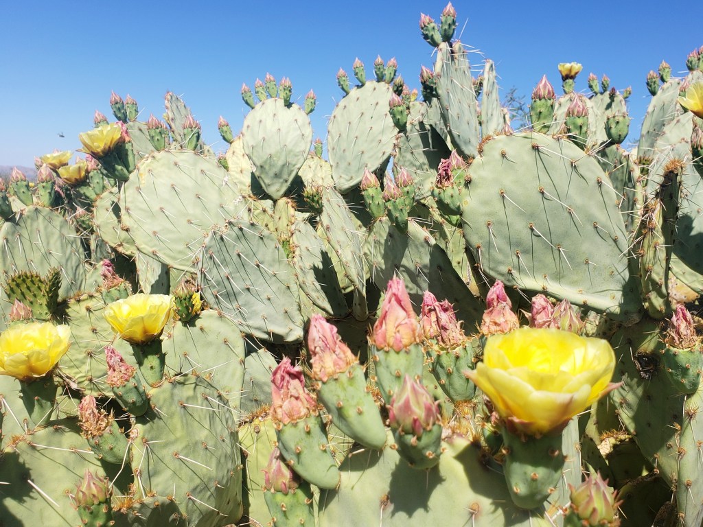
Our first time in Sedona was epic, and we can’t wait to go back for future van life. The rock formations and rich colors were absolutely mesmerizing and distracted us from the challenging climb heading towards Flagstaff. From the Crested Saguaro to the pine forests and red rock canyons, I’d call Segment 8 a tour of the highlights and diversity of Arizona.
We’re working hard, having a blast, and are excited to continue our journey north on the WWR!
WWR Cumulative Stats
- 18 Total Days
- 4 0-Mile Days
- 769.2 Miles
- 53,200 ft elevation gain
- Average Daily Movement (w/o 0’s)
- Daily Miles – 55
- Daily Elevation Gain – 3800 ft
(miles and elevation gain tracked with Strava)
Click here to see our first segment – Segment 9

Join us here, on Instagram, or Facebook as we tackle the Western Wildlands Route (WWR) by bicycle. We have another month to see how much of the 2700 mile route we can get done.
Western Wildlands Route SEGMENT 9 – AZ / Mex Border to Globe, AZ

We just started the Western Wildlands Route (WWR) on bicycles northbound starting at the AZ / Mexican border. Since we are tackling the route northbound, “Segment 9” is our first segment.
Day 1 – 35 miles / +600 ft gain
Woohoo! The day was finally here to wrap up all the little details and head out on the bikes. We left Sierra Vista, the nearest town to the trailhead, in the early afternoon to tap the Mexican border. About 4 miles north of the wall, we hit our first stretch of dirt road and headed south. After a couple pics and a snack, we started the long journey north on the Western Wildlands Route.
Day 2 – 60.4 miles / +2000 ft gain
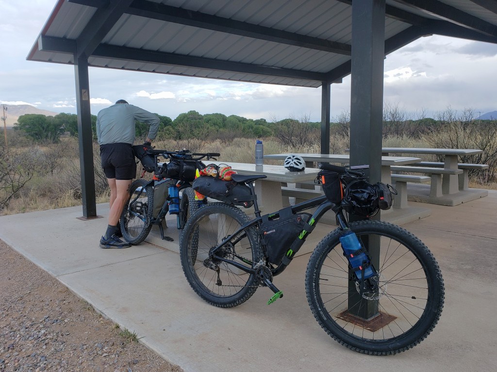
Our day was a mix of dirt and pavement. We rolled through the tiny historic town of Tombstone and ate a quick lunch before returning to the desert dirt roads. We ended the day in Benson right off the I-10. With no camping prospects nearby, we decided to stay in town for the night.


Day 3 – 62 miles / +3600 ft gain
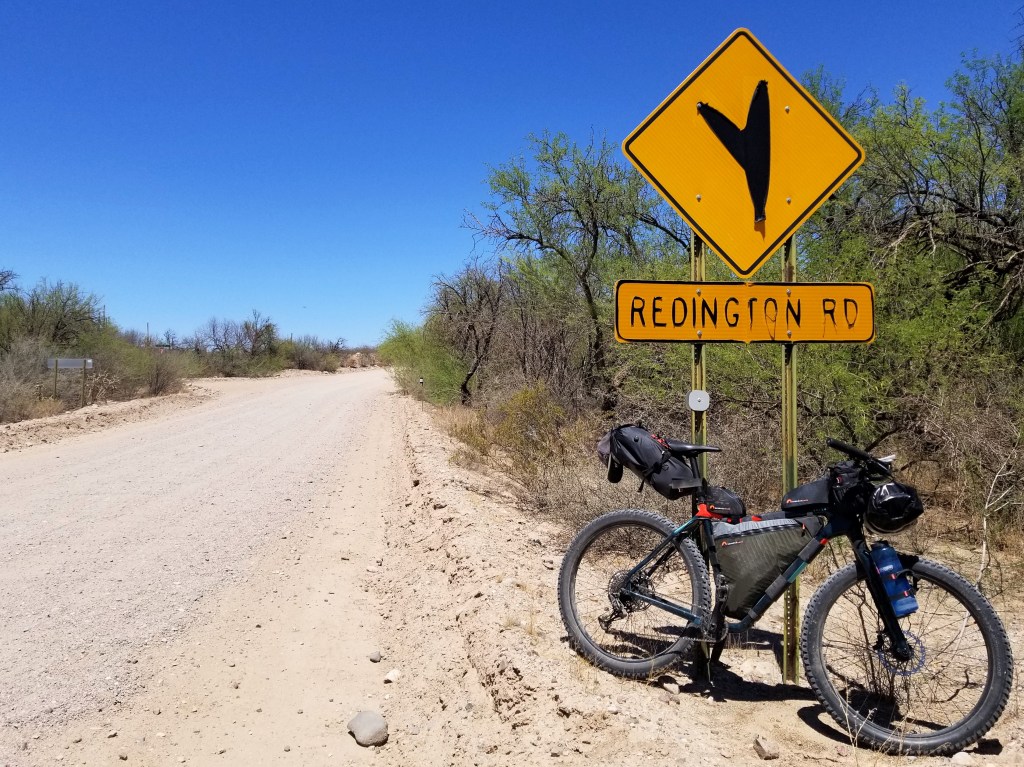
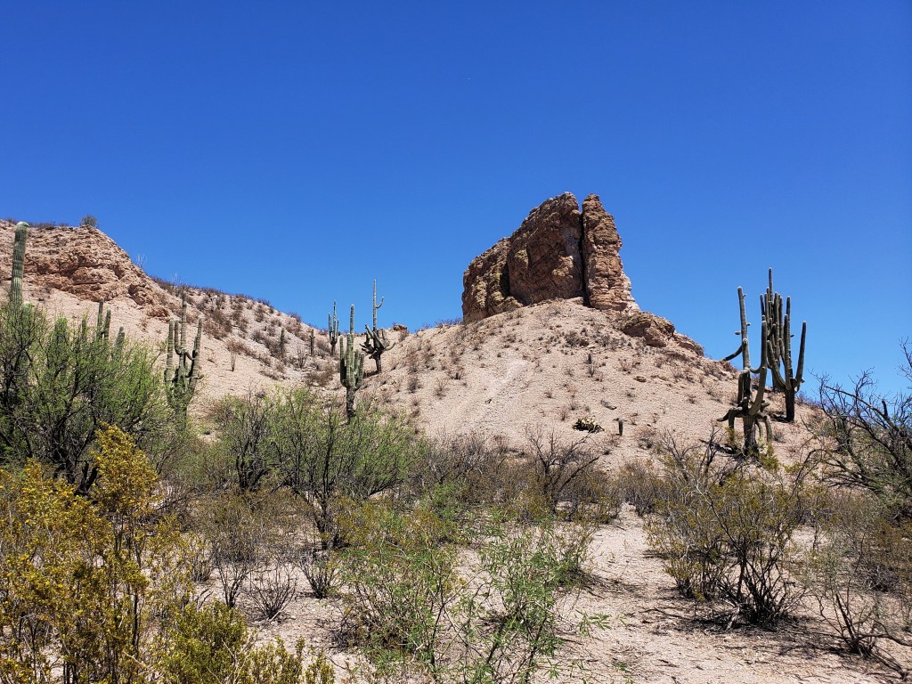
We got an early start from the hotel and continued north. The first 25 or so miles were on paved back roads. Eventually, we happily hit dirt and took a quick stop for water and lunch at the Cascabel Community Center. The saguaro cacti started to take over the desert floor and abundant sunshine spilled down on us. We spent the afternoon slowly climbing between Mount Mica and Mount Lemmon.


Day 4 – 54 miles / +6500 ft gain
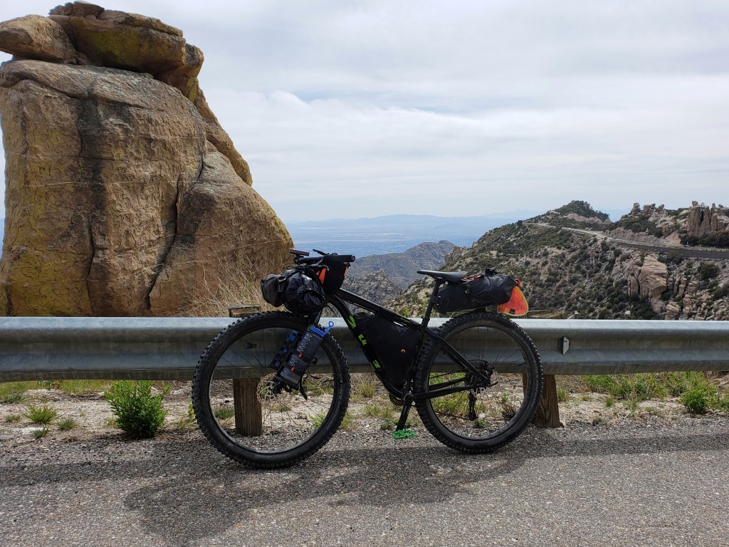
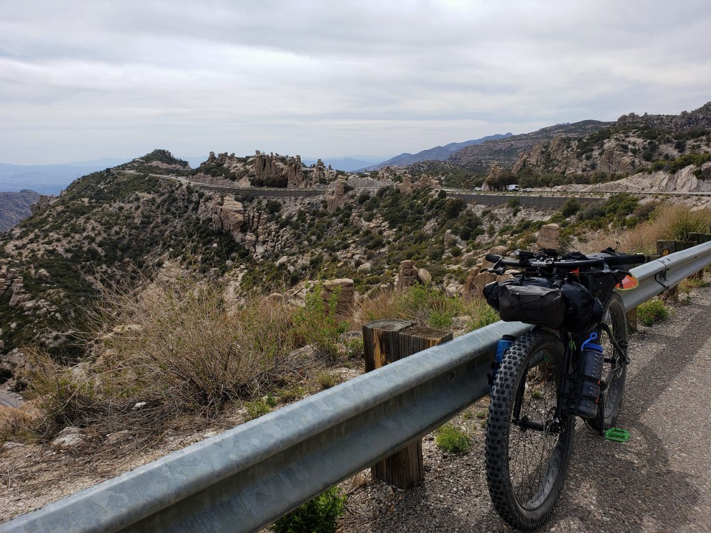
We awoke knowing we had a big day ahead of us – climbing over 6000 ft to the top of Mount Lemmon. We made a quick stop in the outskirts of Tucson to resupply and headed out for our big climb. Thankfully, we met Shelby, a cyclist turned cyclist shuttler for the day, who let us pump up our tires since the ride up was on pavement.The slog was slow and steady hovering around 90° to start and shedding about 3 degrees with every 1000 ft we climbed. Depending on the grade of the road, we averaged between 3-5 miles per hour for about 8 hours. With show tunes in my ear, I really didn’t mind the slog.
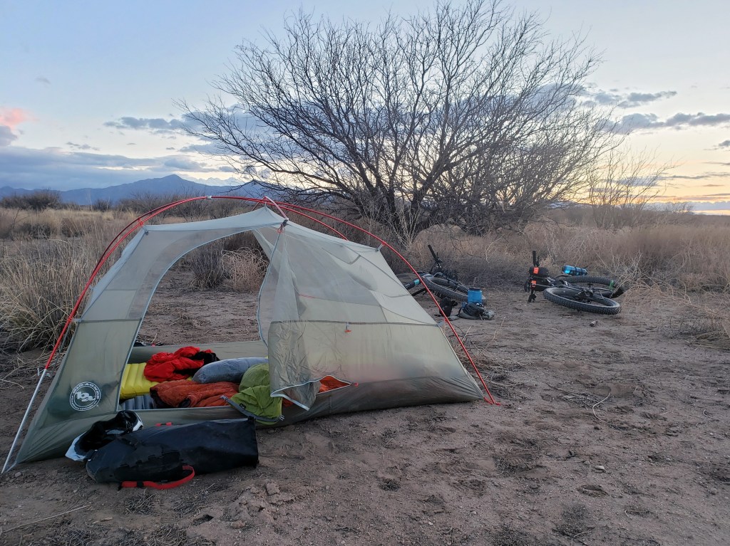
There were a couple developed campsites on the way up, but we were feeling strong and decided to do the whole climb in one day and continue onto dirt to begin the descent. By about 6:00 pm, we hit 8,000 ft which is a bit shy of the summit but all the route commanded of us. We hit the dirt and started the descent. But it wasn’t effortless. The road was flush with potholes, baseball sized rocks and other gravel, and stretches of washboard. We let a little air out of the tires, but the ride down was still a little rough. Just before dark, we found a stealth campsite for the night proud of our hard work for the day.


Day 5 – 27.2 Miles / +2000 ft gain
We continued our descent down Lemmon and eventually tackled some rolling hills as we made our way to the tiny town of Oracle which we had previously visited during our thruhike of the Arizona Trail in 2019. We stopped for snacks and resupply at the Dollar General.
While on our break, we came to a sad realization that we were both experiencing some nerve issues in our wrists causing numbness and tingling for both of us with Sean additionally experiencing lack of grip strength and limited range of motion in some fingers. We decided to stay in Oracle for the night while we considered our options.
Days 6-9 – 26 Miles
We spent the night reading about “Cyclists Palsy,” a relatively common injury among cyclists, particularly those riding long distances. The main cause is putting too much weight on your wrists when the majority of your weight should be on the saddle. Considering we had just descended a long rough ride down Mount Lemmon, it all seemed pretty clear how the injury had happened and the changes we needed to make. Our reading also indicated that without rest and adjustments, the nerve damage could be permanent. Properly spooked, we decided to head to Tucson only 25 highway miles away to take a few rest days.
Over the next three days, we saw mild improvements indicating we hadn’t permanently severed the ulnar nerve which signals the pinkie and ring fingers. We made some bike adjustments to accommodate a better riding position, and I added new ergonomic grips. Hopeful, we headed back to the route.
Day 10 – 70.7 Miles / +4300 ft gain
We quickly returned to the route outside of Oracle and happily hit the dirt all smiles. It was a scorcher, but we were elated to be back at it. We spent the day flowing on the dirt road with a brief stop in a tiny town for resupply and ended at a lovely BLM campsite.
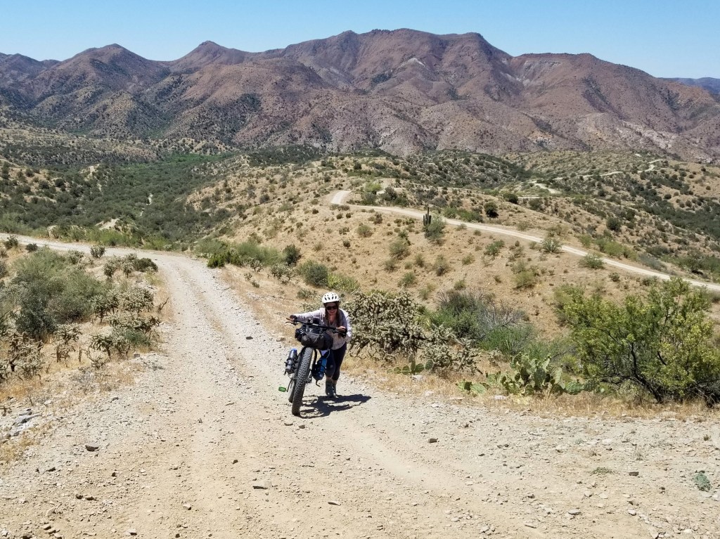
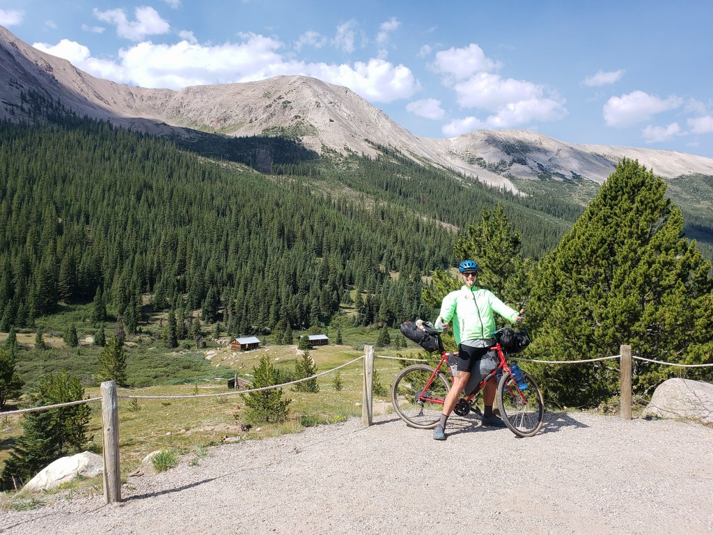
Day 11 – 44.5 Miles / +5500 ft gain
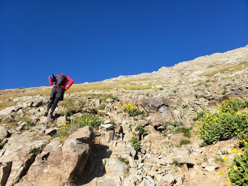
We started our day with a few miles on pavement before we turned onto dirt. We made a quick stop by Wind Spirit Community Center in Dripping Springs to stock up on water for the day. Our host Jerry showed us some really nice hospitality with fresh squeezed blood orange juice and all we could eat clementines straight from the tree. We took off around 8 with a huge climb ahead of us up the Pinal Mountains.
Eventually our very manageable climb up dirt became too steep to ride and the hike a bike began. We had about 6 miles to get to the top most of which involved pushing our bikes up the steep grade.
Despite the heat and the 1-2 mile per hour pace, we still managed to enjoy our afternoon -especially when we hit the top and cruised our way down to the town of Globe.


WWR – Segment 9 – Overall Experience
While we have tackled two bike tours in the last couple years, this ride is our first on mountain bikes and mostly off pavement. The route claims about 80% on unpaved surfaces and that figure has been mostly accurate. On our previous bike tours, I spent a lot of time concerned about where we were going. This time around, I’m thoroughly enjoying where we are. This style of riding is considerably more similar to backpacking – miles and miles in between tiny towns with a few cities sprinkled in.
I fell in love with AZ during our Arizona Trail thruhike a couple years ago and for good reason – abundant sunshine, fascinating desert flora, interesting rock formations, incredible skyscapes, and pine forests providing shade after tough ascents. It’s been a delight to return and experience it all over again.
The WWR has no shortage of elevation gain. Minus the days spent nursing an injury, we’ve averaged 3500 ft of gain each day. The long steep slogs bring us down to 3-5 mph, emphasis on the 3. We haven’t hit too much single track and this section only had a short stretch where the road was too rough and steep to ride.
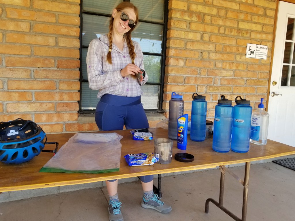
On this section, water and food have been 50-70 miles apart. We’ve maxed out of water carrying capacity of 6 L each a few times, but it’s been enough to get us to the next source which so far has just been from town and no natural water sources. Food selection has been a little lack luster at some of the gas stations we’ve been obligated to resupply at, but somehow we’ve still maintained our vegan diet and aren’t carrying a stove. (More about vegan backpacking / bikepacking food here.)
It’s become pretty clear that we don’t quite have enough time to do the entire route all in one go with adventure number two on the horizon and a hard date we need to meet up with some friends in June. Regardless, we’re having a great time, thrilled to be living our best life outside.
WWR Cumulative Stats
- 11 Total Days
- 3 0-Mile Days
- 379.8 Miles
- 24,500 ft elevation gain
(miles and elevation gain tracked with Strava)
Join us here or on Instagram as we tackle the Western Wildlands Route (WWR) by bicycle. We have another month to see how much of the 2700 mile route we can get done.
Summer of Summits: Carbondale to Denver

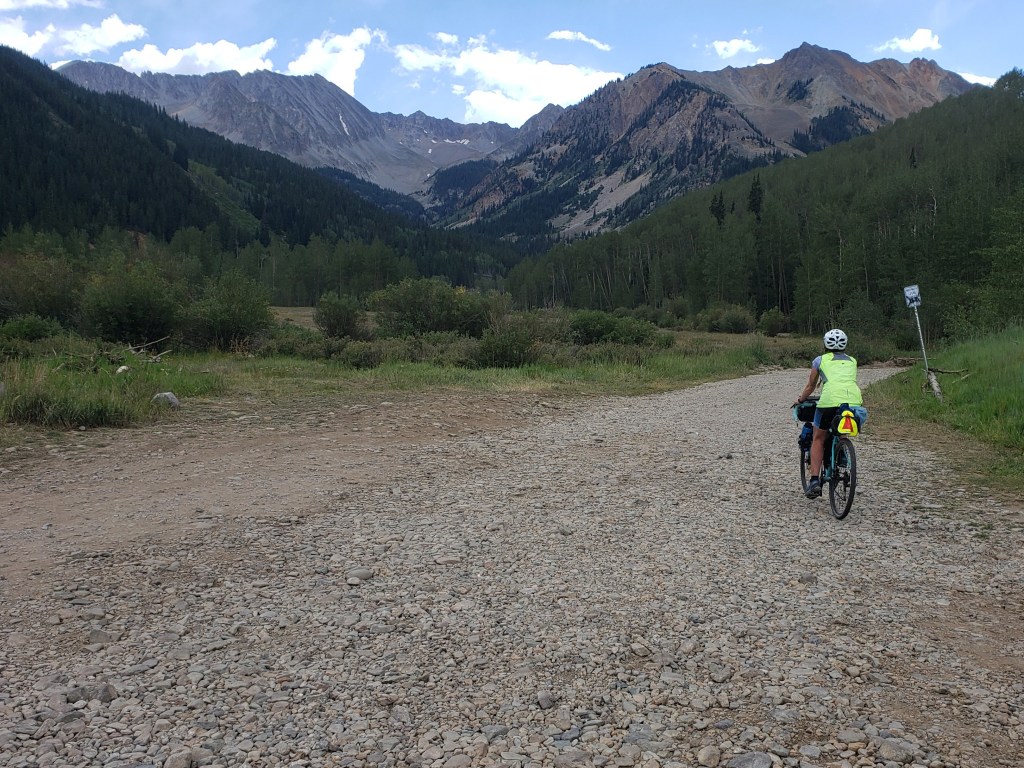
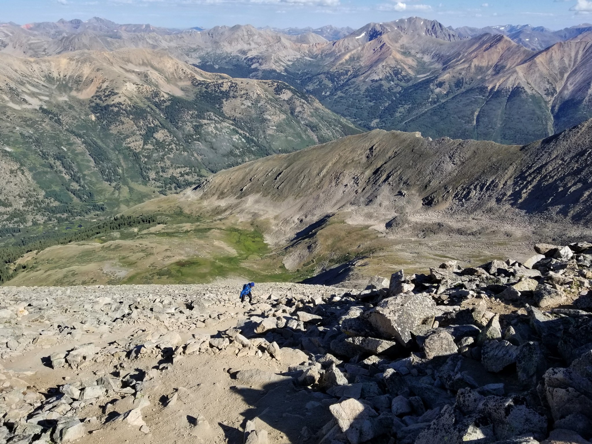
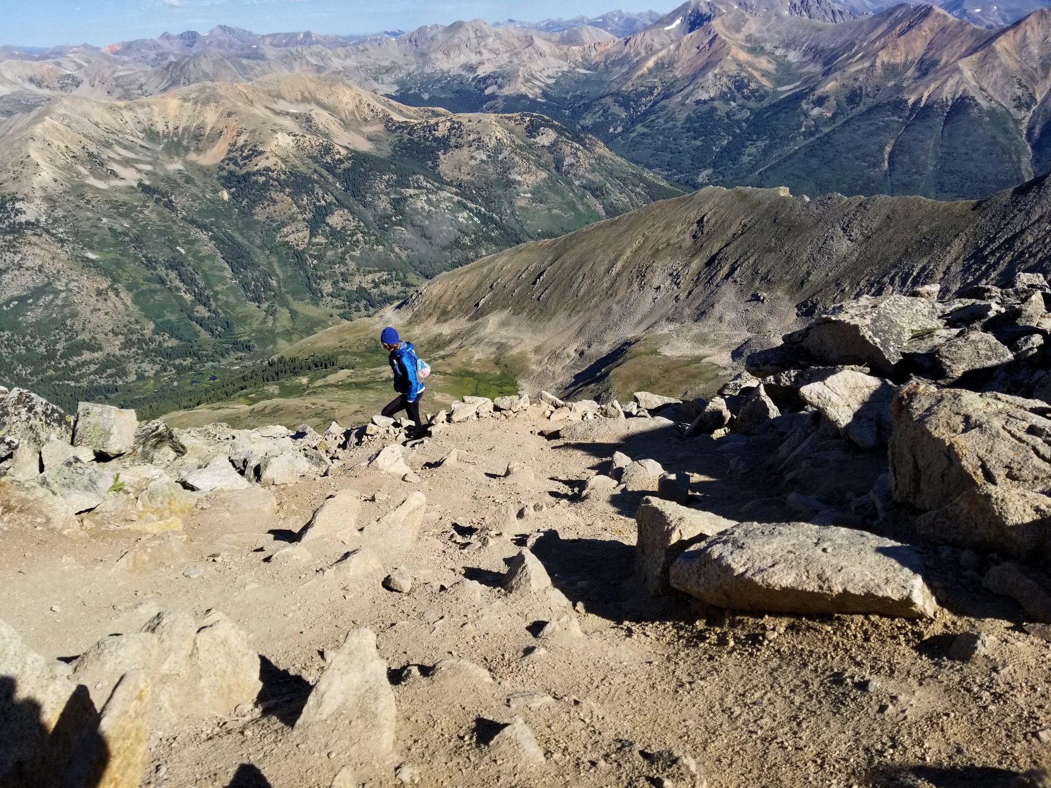
After successfully climbing Capitol Peak, we returned to our bikes and headed 24 miles to our hotel room we had booked in Carbondale. In my last post, I mentioned that we waffled for awhile on whether or not to attempt Capitol. What I didn’t mention was that we weren’t just unsure about whether or not to do that peak, but whether or not we wanted to continue riding and summiting 14ers at all. Geographically, we were at point where we needed to make a decision. We could ride 180 miles back to Denver directly from Carbondale, or we could ride the same mileage south towards the San Juans and further away from our eventual destination. We were both feeling the strain of the past seven weeks, hundreds of miles of riding our bikes, and the constant elevation gain from climbing mountains. Our bodies really made the decision for us – we were ready to head back to Denver.
We took a couple days to rest in Carbondale before heading back the way we came. The I-70, and adjacent bike lane, was still closed due to the Grizzly Creek fire, so we didn’t have a choice but to head east up and over Independence Pass.
Day 48 – 55 miles biking / +6000 ft elevation gain
We left Carbondale in a smoky haze and took the Rio Grande bike path that connects the Roaring Fork Valley all the way to Aspen. The ride was pleasant and well graded. We had a steady cruise to town passing Capitol Peak in the distance as we rode. We stopped briefly in Aspen for lunch and a small resupply, then the challenging part of our day began. From town, we had 20 miles and 4000 ft of gain to grind out on the narrow highway to the top of Independence Pass. We sank into a slow and steady pace while cars buzzed around us. We took breaks often grateful for the overcast sky.

It took us over four hours to get to the top, and we arrived completely exhausted. From Carbondale, we had climbed over 6000 ft for the day. We recalled our perfect campsite just a few miles down the east side of the pass and headed down eager to make camp and sleep.
Day 49 – 63 miles biking / +2800 ft elevation gain
After such a huge day, we set our sites on Frisco for the evening about 60 miles away. Though we had plenty of elevation gain and loss, there was only one big pass which was considerably smaller than Independence.
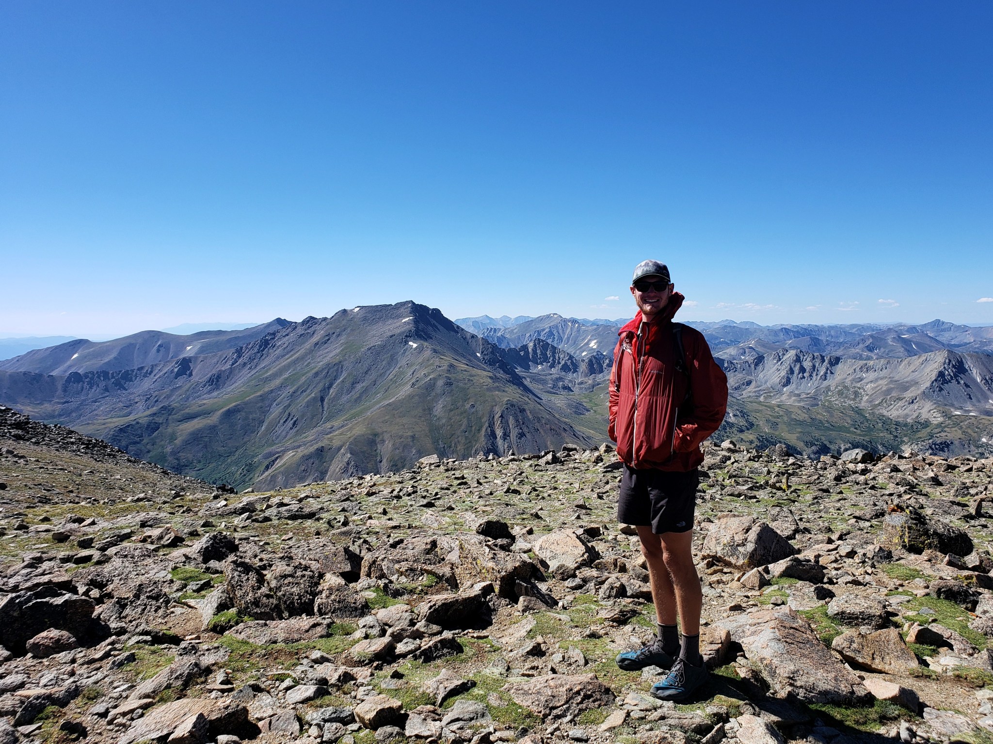
First, we got to enjoy about 15 miles downhill passing La Plata trailhead and the tiny town of Twin Lakes. From there, we headed north and gently uphill on Highway 24 back towards Leadville spotting Mt Elbert and Mt Massive through the haze.
After Leadville, we took Highway 91 north with just one short pass to pump before a long downhill cruise to Frisco. The work was a little tedious, but nothing compared to the previous day’s slog. As we were climbing, a tiny cloud system rolled in a sputtered a few rain drops as we climbed 1300 ft up Fremont Pass. We were stoked to make it to the top knowing that we’d travel 2400 ft downhill over the remaining 18 miles.

We flew down the other side of Fremont Pass. Thankfully, the highway had a wide shoulder, and we were able to send it. We both clocked ourselves over 40 mph. Once we made it to Copper Mountain resort, the final few miles were back on a bike path to Frisco. We settled into a hotel room for the night and rested for our final day of riding.
Day 50 – 86 miles biking / +4700 ft elevation gain; 8400 ft elevation loss (!!)
We decided to undertake a big day knowing there was a bunch of downhill riding to Denver. But we still had a little work to do to get us there. We started our day from Frisco on a lovely bike path that wound around Dillon Reservoir and connected us to Keystone Resort.
From Keystone, we were back on the highway doing 4-5 miles per hour as we climbed Loveland Pass. I settled into an episode of Armchair Expert (with Bill Gates!) and let myself be distracted. We reached Loveland Pass by 11 stoked that the most challenging part of our long ride was done.


From the top, we started a long downhill descent first on the highway then joining a bike path in Loveland Resort. The bike path took us right by the Grays and Torreys trailhead where it turned into a frontage road by I-70. From there we cruised into Georgetown. After a quick lunch, we continued the mostly downhill ride to Idaho Springs.

From Idaho Springs, we had about 1200 ft of climbing to do mostly on a highway a county road. As we arrived to Bergen Park, our climbing was officially done, a moment of joy and relief. We joined the busy Highway 74 on the wide shoulder and cruised downhill passing the cute town of Evergreen and entering a gorgeous canyon. We had a blast effortlessly riding with incredible views. Eventually, we exited the canyon passing by Red Rocks Amphitheatre and wishing I was going to see Umphreys instead of just listening to them in my headphones. Soon, we were winding through Bear Creek Lake Park and Fox Hollow Golf Course. At this point, we were just a few miles through the neighborhoods to our friends house southwest of the city. At about 5:30, we pulled into the driveway officially ending our Summer of Summits – 1000+ miles of riding our bikes and climbing 33 14ers in 50 days.

In total – 50 Days
1038 Miles Biking / +101,600 ft elevation gain
255 Miles Hiking / +104,100 ft elevation gain
33 – 14,000+ ft Summits
- Capitol Peak
- Snowmass Mountain
- Maroon Peak, North Maroon Peak, & Pyramid Peak
- Castle & Conundrum Peaks
- La Plata Peak
- Huron Peak, Missouri Mtn, Mt Oxford, & Mt Belford
- Mt Shavano & Tabeguache Peak
- Mt Princeton & Mt Antero
- Mt Harvard, Mt Columbia, & Mt Yale
- Mount Sherman
- Mount Massive & Mount Elbert
- Mount of the Holy Cross
- Mt Democrat, Mt Cameron, Mt Lincoln, and (not) Mt Bross
- Quandary Peak
- Torreys and Grays Peaks
- Mount Bierstadt
- Mount Evans
- Long’s Peak
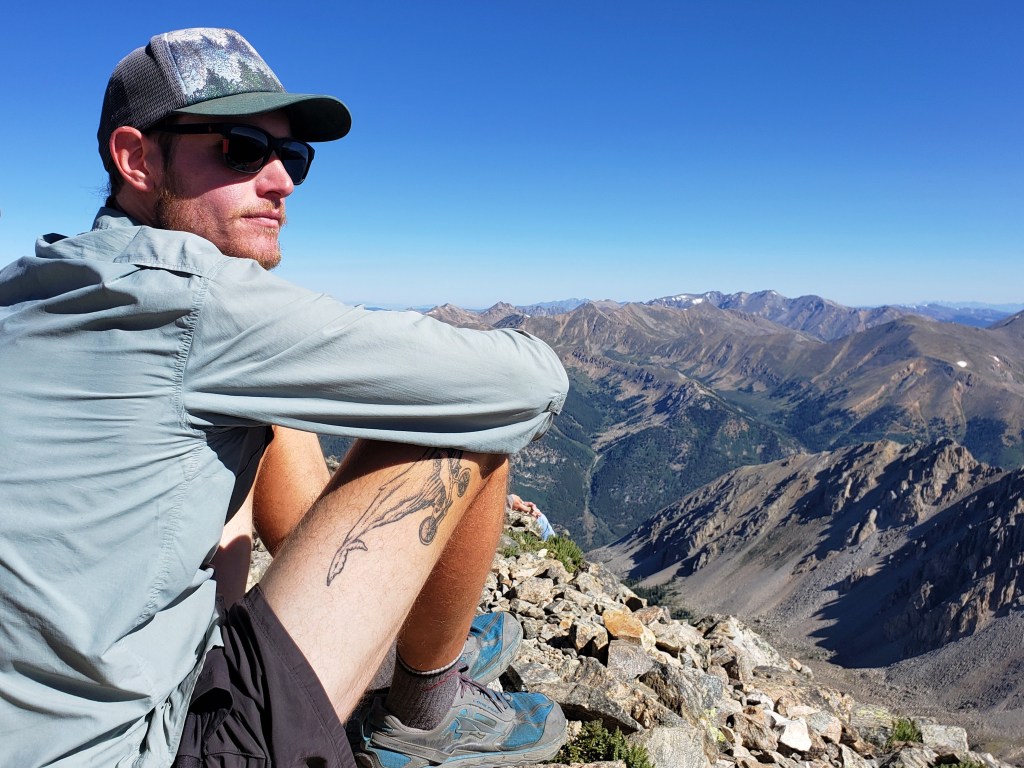
We are Bekah and Sean – long distance hikers, bikers, and adventure travelers. Follow our life in motion here or on Instagram.
Summer of Summits: Capitol Peak

Day 44 – 18 miles biking / +2300 ft elevation gain
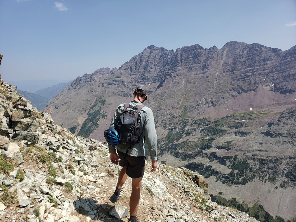
We woke up later than usual and took our time packing up still uncertain of our next move. Capitol Peak was the next 14er en route, and we were still uncertain as to whether or not to attempt the summit. If you didn’t know, Capitol Peak is infamous for being Colorado’s most dangerous 14er with the crux of the hike being “the knife edge” – a fully exposed sharp ridge with severe dropoffs on either side. Many deaths have occurred on the climb including 5 in 2017 alone. Our morning was filled with a back and forth debate on whether or not to attempt the climb with both of us unable to make up our minds. We were exhausted from this long trip, my ankle was super swollen from rolling it returning from Snowmass, and the alternative, ie town and not risking our lives, was beckoning. We weighed the pros and cons multiple times before finally settling the debate. “We won’t regret doing it,” I told Sean. It was decided. We would make the attempt.
Leading up to this summit, we’d talked to other climbers along various other mountains about the severity of the climb and how it compares to other 14ers. Several times we’d heard it’s no worse than Pyramid Peak or Maroon Bells and had met dozens of people with less experience that had successfully achieved the summit. With all of that in mind, we began our bike ride towards Capitol Creek Trailhead.
The first half of the ride was super pleasant as we wound downhill for about 9 miles past beautiful ranches nestled in the valley. The second half kicked our butts as we climbed 2300 ft under relentless sunshine. The closer we got to our destination, the harder the ride became. Eventually, the pavement turned back to dirt, and the grade of the climb only got steeper. The final mile to camp contained too much sand to bike through, so we had no choice but to push our bikes up the hill. We arrived at the trailhead around 3:30 completely wiped. A group of older hikers inquired about our trip and was quick to offer a beer which we were eager to receive. After a couple podcasts and dinner, we went to bed super early nervously anticipating the climb ahead.
Day 45 – 17 miles hiking / +5300 ft elevation gain; 24 miles biking / 3300 ft elevation loss
The alarm rang at 1:00 am, and we broke everything down and packed the bikes. I hadn’t slept too well and was ready to get going. At 1:40, the walk began. We followed the trail through the woods in the dark and not too long after starting saw eyes glowing ahead of us. A skunk had stopped in the middle of the trail, tail raised, to check us out. We waited. We played a little game of cat and mouse for an annoying amount of time. I’m not sure if we were the cat or the mouse. I think he knew he had the power. Eventually, the skunk left the trail, and we were able to continue. The first six miles of trail were easy walking with a gradual climb up to Capitol Lake. When we left the forest canopy, we felt lucky to catch some shooting stars streaking across the sky, likely from the tail end of the Perseid meteor shower. Once we reached the lake, we climbed a steep set of switchbacks to a saddle which finished the easy hiking portion of the climb.
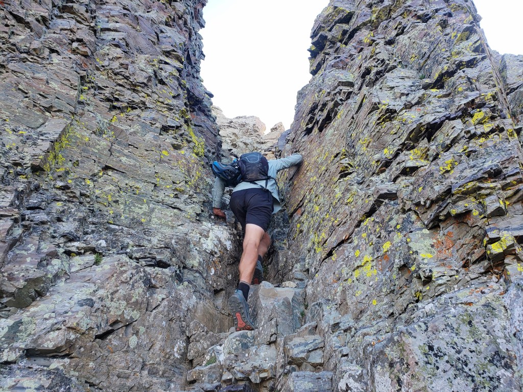
From the saddle, the next section was spent looking for cairns as we skirted the cliffs next to the ridge. It was still too dark to see without our headlamps, so we patiently scoured the terrain looking for the safest route. The cliffside section was short, then it was onto the boulder field.

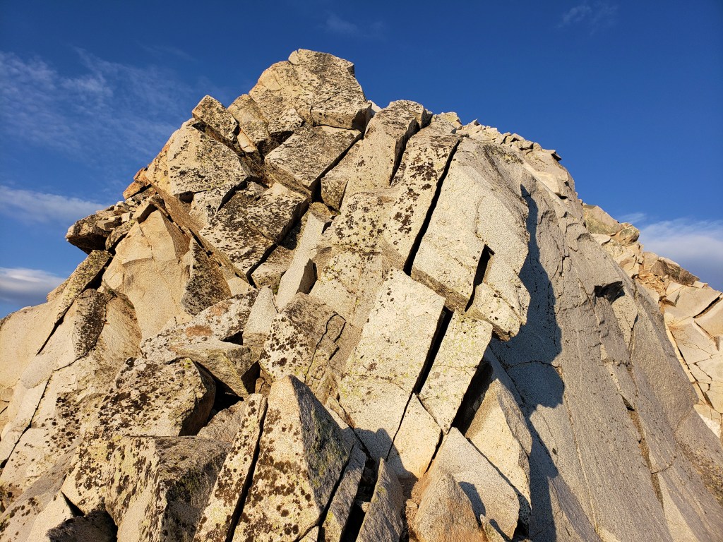
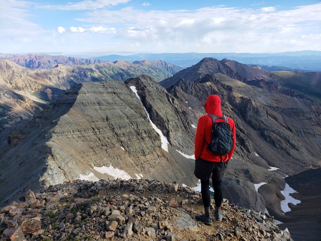
Dawn was starting to break, and we were getting out first real glimpse of our surroundings. We boulder hopped along slowly and carefully as the sun rose, the sky turning a myriad of colors. As we turned a corner, K2 came into sight. Familiar from studying the route, we knew Capitol Peak would come into view just beyond K2.

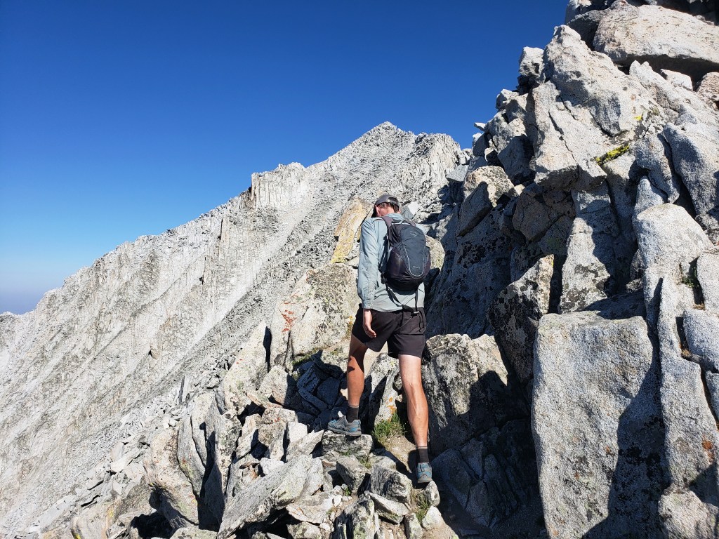
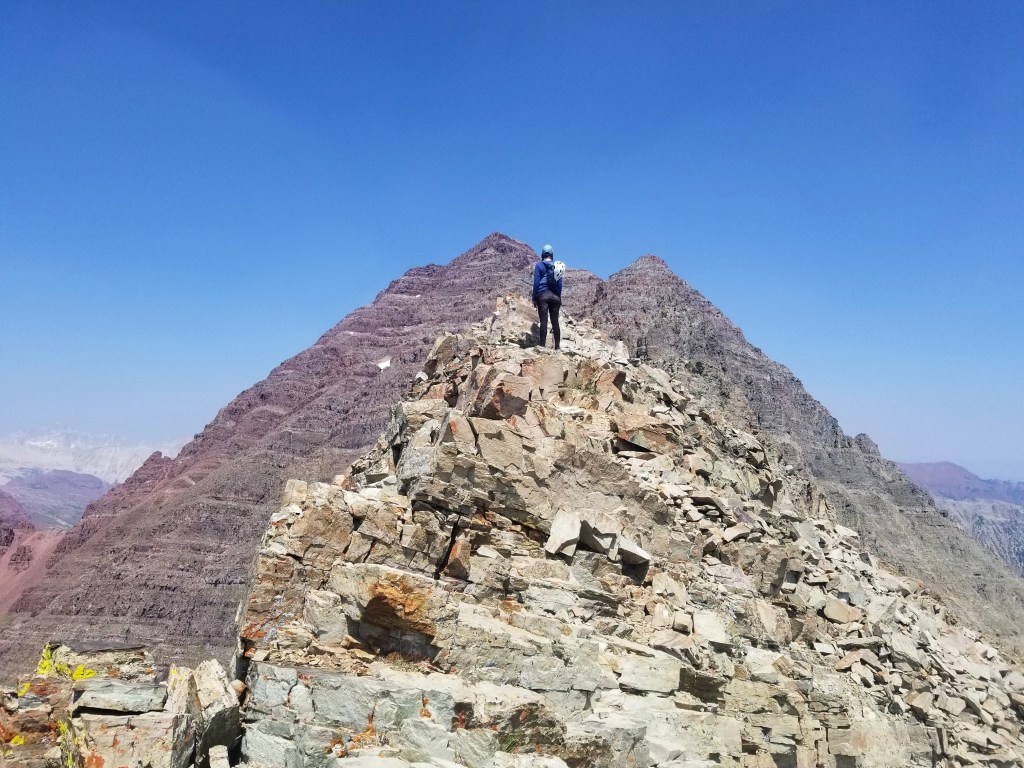
14ers.com gives instructions to summit K2 or bypass by skirting around. We decided to summit and pulled ourselves up with some Class 3 climbing. From the summit of K2, Capitol Peak rose in the distance, the knife edge connecting the peaks.

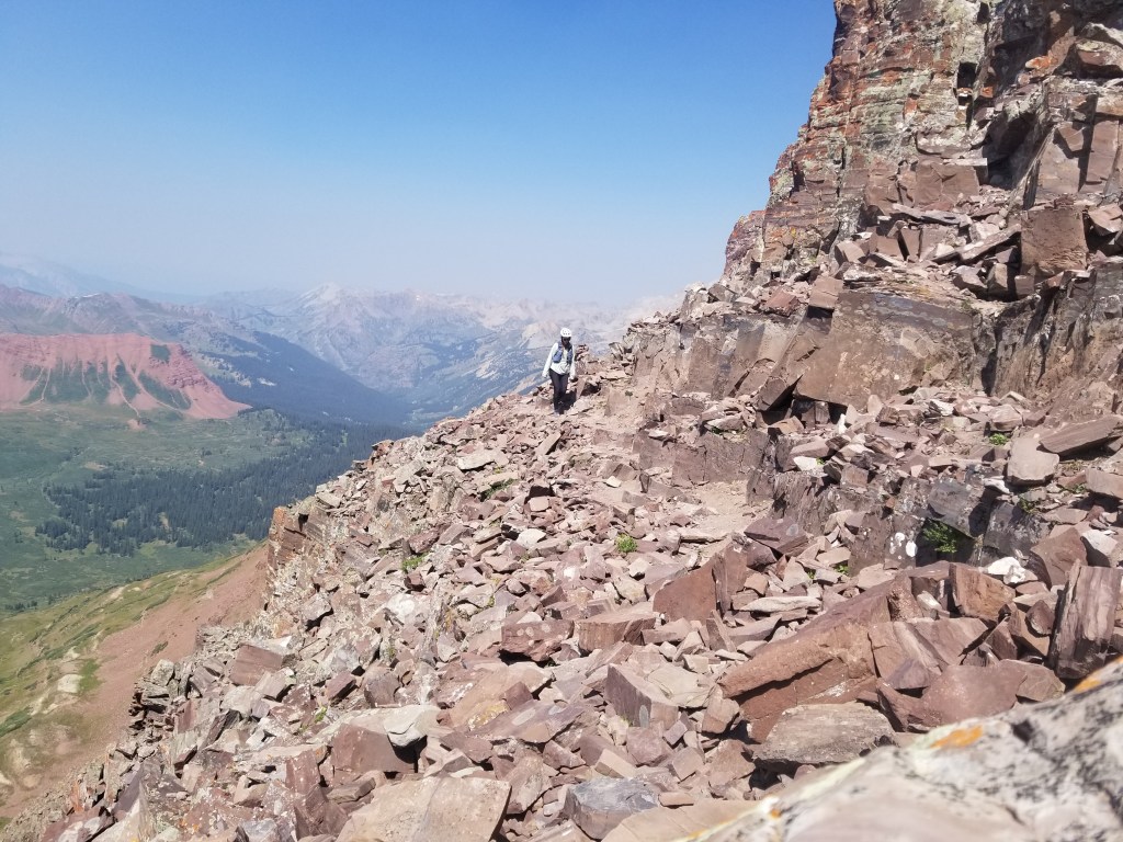
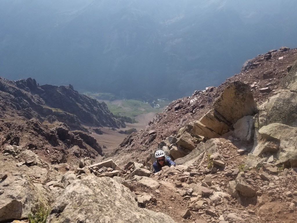
We came down slightly from K2 and pushed onward both of us checking in with each other frequently to make sure we were comfortable moving forward. We could see 3 climbers ahead of us, and we continued to gain on them. We watched as two crossed the knife edge slowly, carefully, successfully. As we approached, climber three was sitting safely cliff side and told us she had reached her limit. Sean led the way mostly walking along the left side of the ridge while holding onto the top. My turn. Gulp.
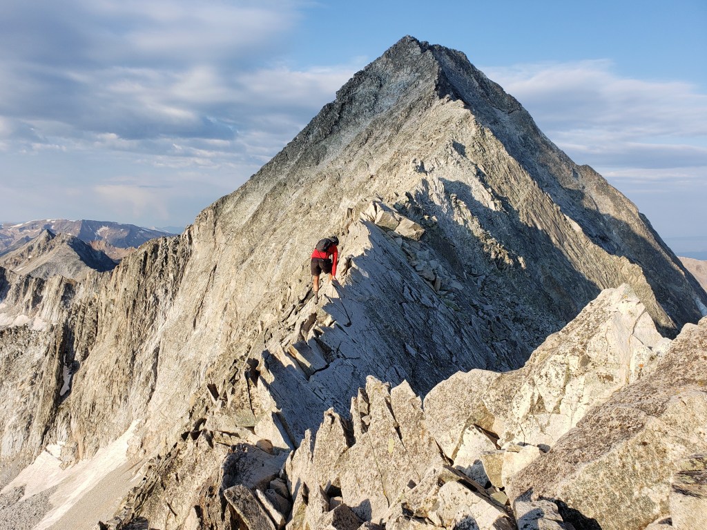
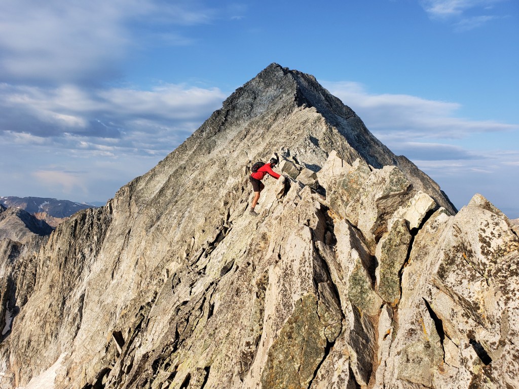
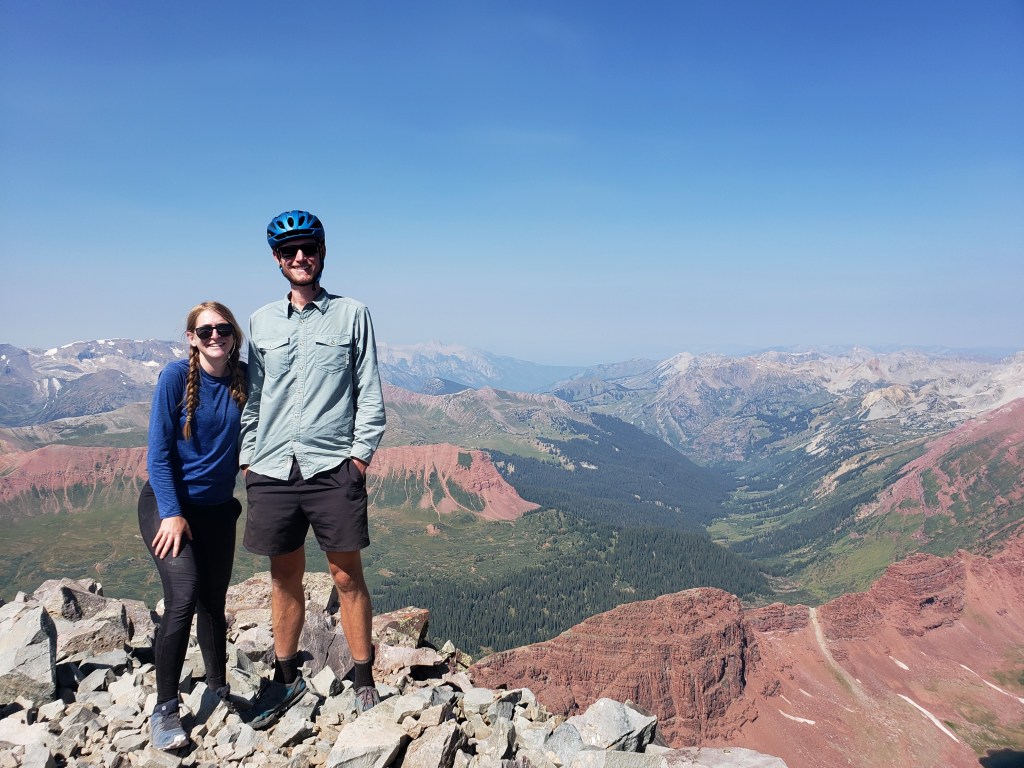
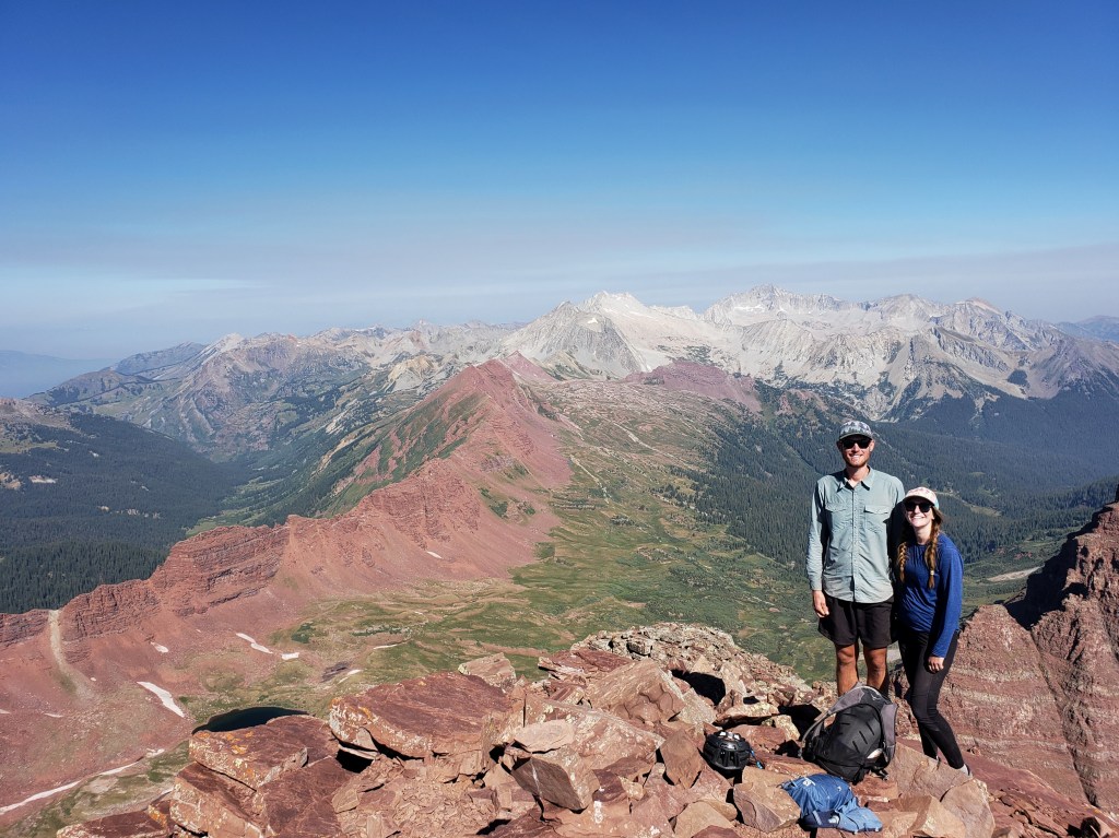
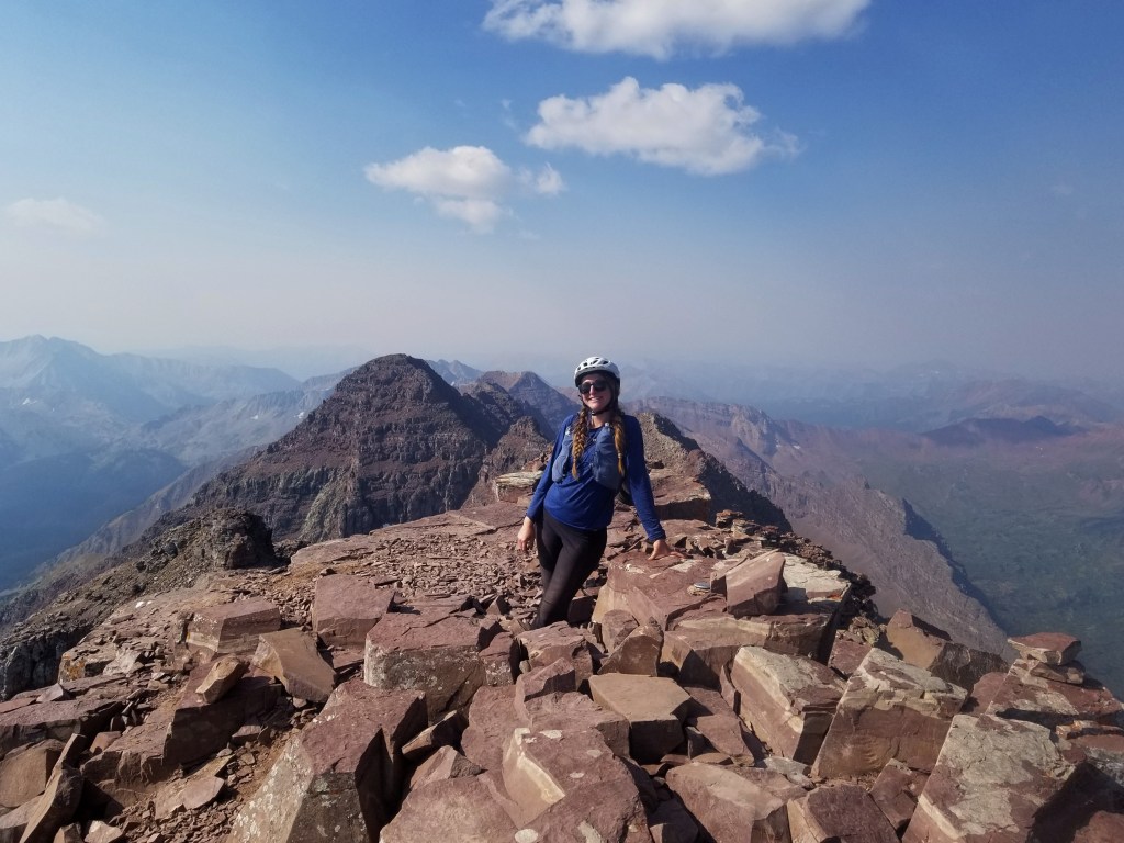
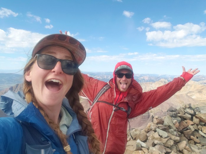
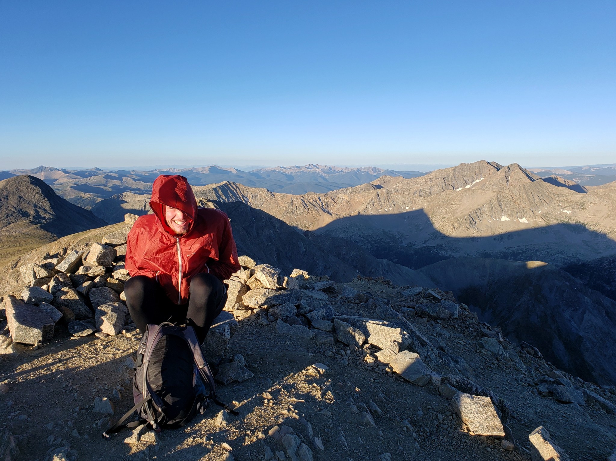
I searched the knife edge for foot and hand holds grateful the rock was solid, yet couldn’t seem to find the courage to walk. Instead, I decided to inch worm my way across in the most literal way you can imagine. The ridge was below my chest, my legs straddling the mountain, and I used my arms to pull my way across. It took me way longer to cross than Sean with many deep breaths, positive affirmations, and reminding myself not to look down. I was elated to exit the knife edge with my feet safely below me though we still had about 500 ft of Class 3 and 4 climbing to the summit. We ended up catching the other 2 climbers ahead of us and continued route finding together as a group of four. The remaining route proved not terribly difficult as long as I didn’t get too caught up in looking down. We all reached the summit together ecstatic to have safely climbed Colorado’s most difficult 14er.
After enjoying the summit, it was time to head back down the mountain. The only thing on my mind was recrossing the knife edge, but knowing I had already done it once helped calm my nerves a little.
As we neared the ridge, Sean managed to dislodge a big rock. He was completely stable, but the rock flipped over the edge of the mountain causing a small rock slide. We watched the rocks tumble down the mountain falling hundreds of feet in a snowball effect before settling out of sight far below us.

Not long after, it was time to cross the knife edge once more. The process was still time consuming, but I was able to cross without going full worm for too long. I rejoiced on the other side knowing I was almost out of the death zone.


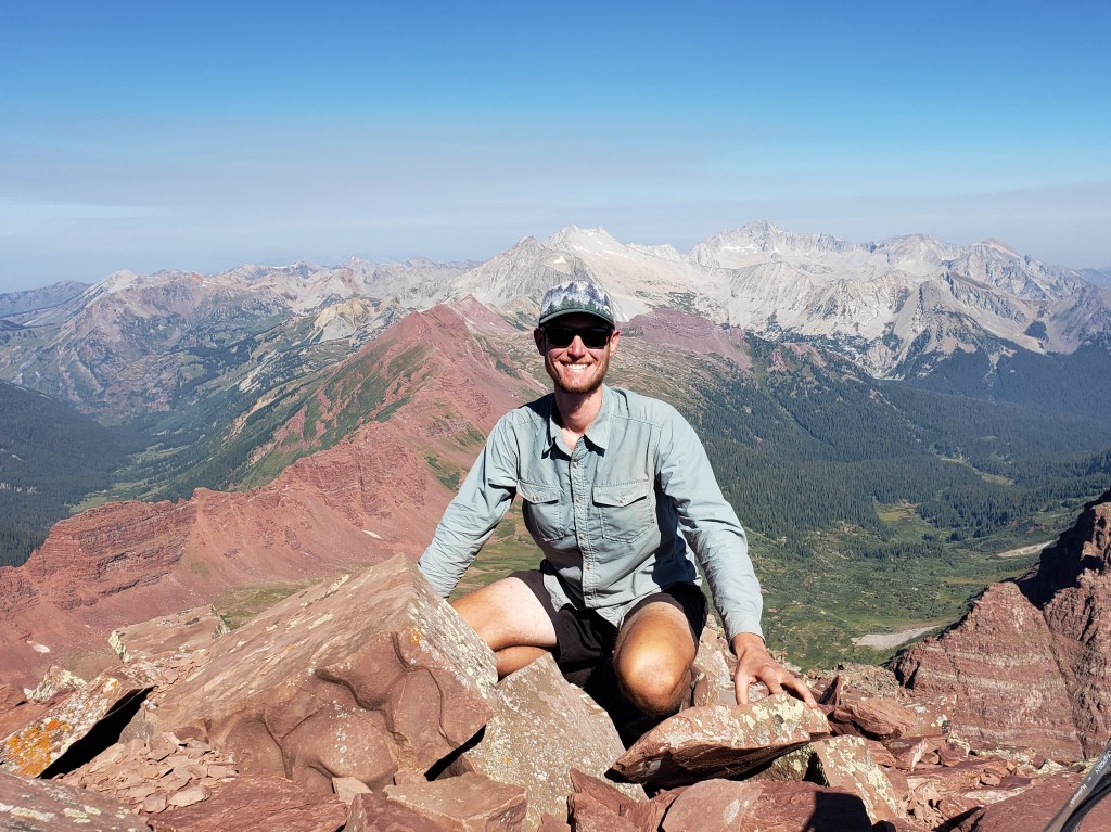
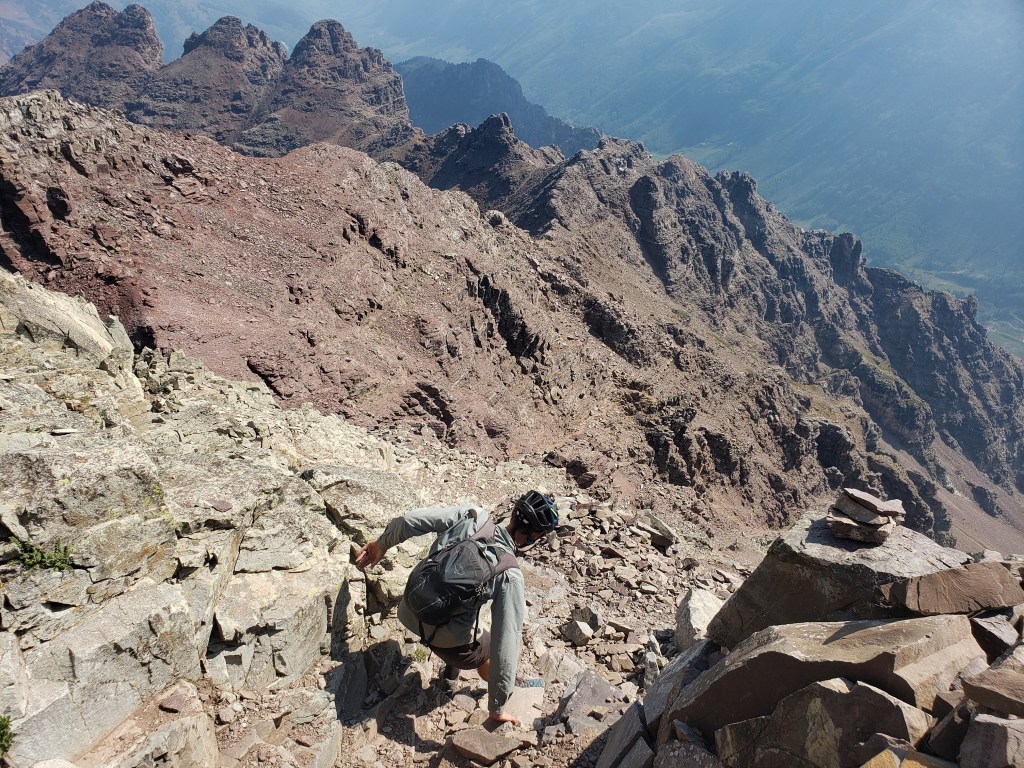
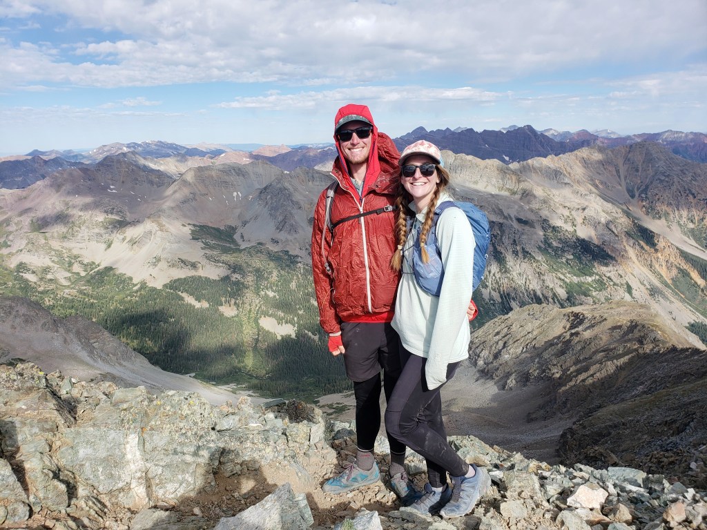
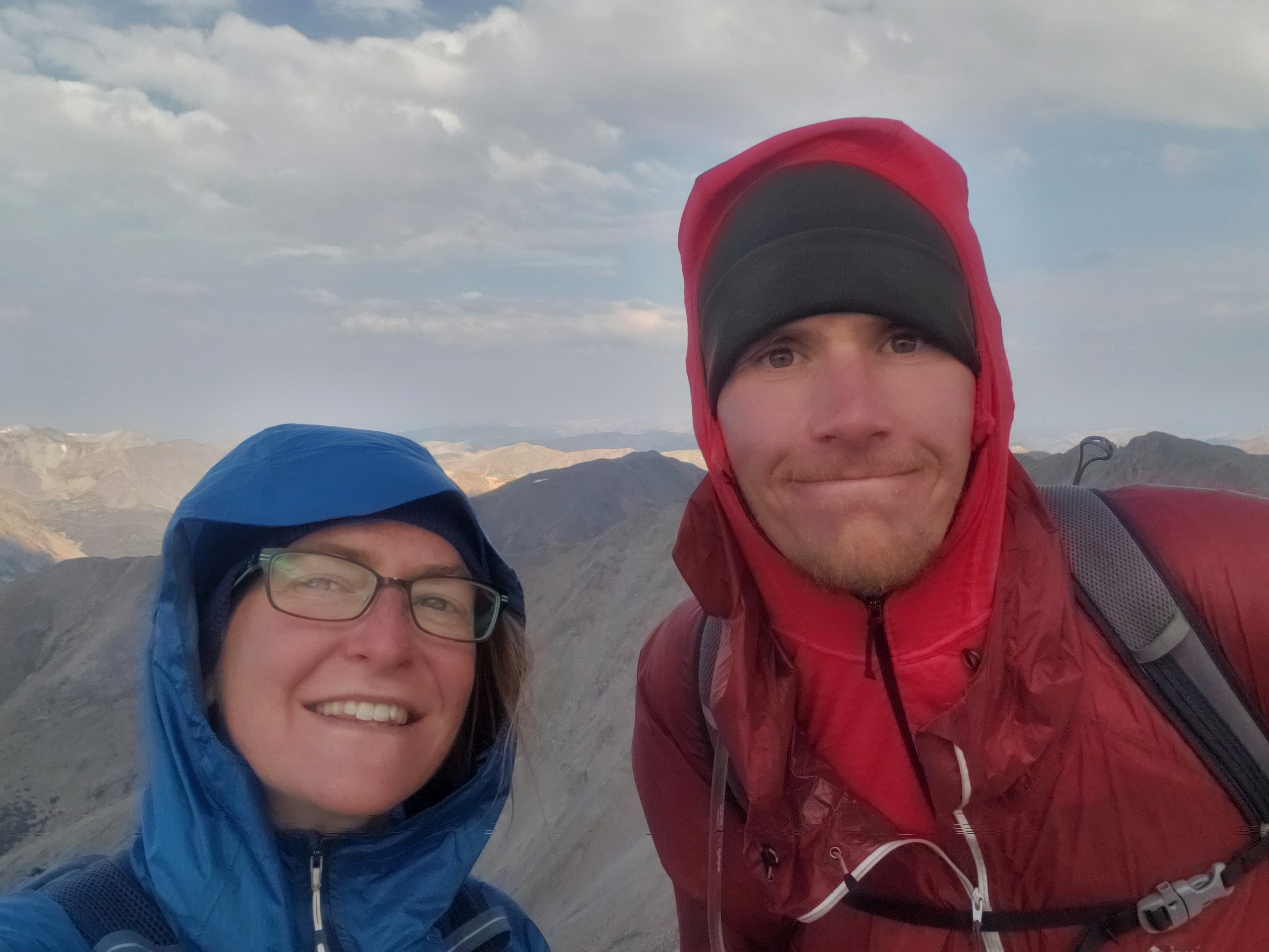
When we approached K2, we decided to skirt the summit as instructed by 14ers.com. The route, however, proved just as difficult, if not moreso, than just going to the summit itself. After our final sketchy Class 3 / 4 moves, we finally reached the other side of K2 and let out a sigh of relief. The most dangerous part of our climb was over, and the joy of summiting Capitol Peak, #33 since we left Denver July 7, was setting in.
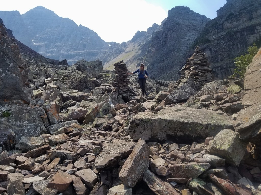
We smashed some snacks and then began the tedious boulder hop back to the saddle. It took some careful footing, but it wasn’t too long before we reached the cliffs. Considering we had skirted the cliffs in the dark, we really had no recollection of the route we had traversed. Slowly and carefully we crossed a couple gullies of loose rocks and gravel then, finally, returned to the saddle. We had completed all of the challenging climbing aspects leaving just the hiking portion back to the trailhead.
We retraced our way down the steep switchbacks to Capitol Lake and started on the 6 easy miles back to the bikes. As we hiked, we past many eager backpackers coming up to Capitol Lake. As with Snowmass, most people backpack into the lake and then summit the next day. We were among the minority doing the entire traverse in one day.

We were also pleased knowing that we wouldn’t be with a couple dozen climbers the next day on a summit attempt. While we were grateful to share the summit with two others, crowds on slim routes with loose rocks aren’t necessarily safe or appealing. The joy of being finished with Capitol Peak and the pride in our accomplishment only grew as we neared the trailhead. I let myself be distracted by the podcast “You Made It Weird” with Pete Holmes interviewing Josh Gad on our way back. (Another of my favorites. Click here to check it out!)

At 3:10 we made our triumphant return back to the trailhead, 13.5 hours after we had started. We slammed some cold soaked ramen noodles and started riding eagerly to town. 24 miles away, our much earned hotel room was calling.

If you’re keeping track…
834 Miles Biking / +88,100 ft elevation gain
255 Miles Hiking / +104,100 ft elevation gain
33 – 14,000+ ft Summits
- Capitol Peak
- Snowmass Mountain
- Maroon Peak, North Maroon Peak, & Pyramid Peak
- Castle & Conundrum Peaks
- La Plata Peak
- Huron Peak, Missouri Mtn, Mt Oxford, & Mt Belford
- Mt Shavano & Tabeguache Peak
- Mt Princeton & Mt Antero
- Mt Harvard, Mt Columbia, & Mt Yale
- Mount Sherman
- Mount Massive & Mount Elbert
- Mount of the Holy Cross
- Mt Democrat, Mt Cameron, Mt Lincoln, and (not) Mt Bross
- Quandary Peak
- Torreys and Grays Peaks
- Mount Bierstadt
- Mount Evans
- Long’s Peak
We are Bekah and Sean, out on an adventure to summit as many CO 14ers as possible this summer and reaching them via bicycle! Follow along here or on Instagram as we complete our Summer of Summits.
Summer of Summits: Snowmass Mountain

Day 42 – 13 miles biking / +1500 ft elevation gain
Summiting both Maroon Bells and Pyramid Peak left us exhausted, so we opted to stay in Aspen before our next hike. Thankfully, the Snowmass Creek trailhead was only 13 miles away. We began our ride in the afternoon and were pleased to find the route almost entirely connected by bike paths. Still, those 13 miles and 1500 ft of elevation gain took nearly all of my energy to complete. We setup camp by the trailhead and went to bed early for the long day ahead of us.
Day 43 – 22 miles hiking / +5800 ft of elevation gain
Our hike began at 2:45 am, and we slowly made our way down the long approach to Snowmass Lake where the real climbing begins. The majority of peak baggers would backpack into the lake and summit on separate days, but we were attempting to do all 22 miles in one day. By the light of our headlamps, we meandered through the woods. At the six mile mark, we hit the “log jam” and crossed a creek using various trees that had fallen by avalanche. Around 6:00, we reached mile 9. Dawn had just broken, and we were greeted with views of Snowmass glittering off the reflection of Snowmass Lake.

We ate breakfast in silence while taking in the views and studying the route we would be climbing. Then, we were off towards the summit. The trail wound through willow bushes along the shore and opened into a pile of boulders. We rock hopped while climbing which was technically simple, yet tedious.

The boulders gave way to a faint trail of dirt and gravel, and we continued up and up. We crested a hill which revealed another massive boulder field stretching all the way to the ridge. Our objective was to gain the ridge and follow it to the summit. We hopped, climbed, and navigated rocks of all shapes and sizes as we made our way up. The grade was relentless, and I had to stop and take a breath every few steps. Maybe it was the fact that we started before 3 am, maybe it was the steepness of the boulder scramble. Whatever it was, I felt pooped. Nevertheless, we continued on and up and up and up until we finally stood on the ridge leading to the summit.


The final push was a rock scramble with some exposure and Class 3 maneuvers. Compared to the last couple summits, however, the climb seemed simple. Or perhaps my skills and comfort level are adjusting to the circumstances. Regardless, it took about 35 minutes on the ridge to the summit where we collapsed for about 25 minutes. Trailhead to summit took about 8 hours.

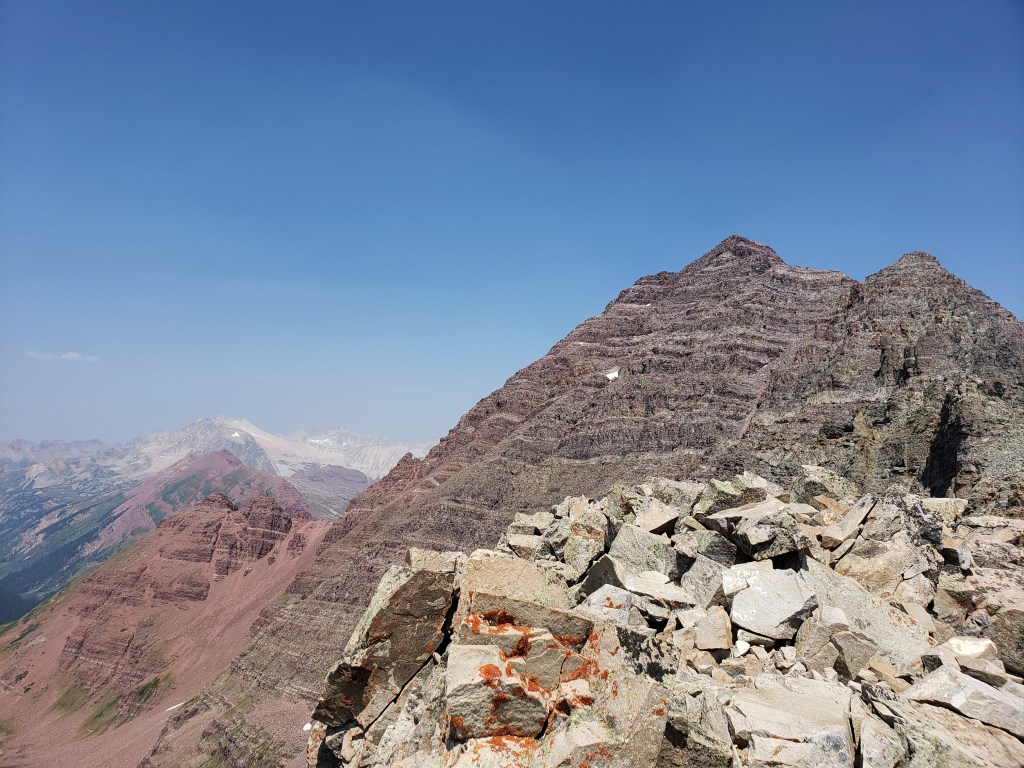
From the summit, we could see the Maroon Bells and Pyramid Peak through the smoky haze. Capitol Peak, the next summit en route, was also in view. After pictures and a brief rest, we began the long process of retracing our steps down the mountain.

We carefully made our way down the ridge to the point where we had crossed over, then started boulder hopping down the mountain. Picking through boulders was, unsurprisingly, a lot easier going down than up.


The next section was a bit slower and more challenging as we did our best not to slip with gravel and dirt underfoot. My least favorite moment of the day thus far was slipping only to get a handful of thistle thorns in my hand. Well, at least they weren’t in my butt.

After what seemed like an eternity, we boulder hopped the final section and wound through the willow bushes along the lake. It was already past 1, and we still had 9 miles to get back to the trailhead.

At this point, we both popped in our headphones and let podcasts entertain us back to the trailhead. Though we were both feeling the long day, we enjoyed the views coming back to camp that we hadn’t seen in the dark. We crossed the log jam with just 6 miles to go.


Not long after, the thistle thorns in my hand were no longer the most painful part of my day. One step on a stick caused my left ankle to roll inwards, and I fell into the middle of the trail from pain. The swelling started immediately. I’m really good at rolling my ankle, but usually the left one is dependable. Damn stick. After a few moments and many choice words, I made it to my feet and continued hobbling down the trail.
My pace slowed, and I tried to let Roman Mars’s voice soothe me as I listened to a 99% Invisible podcast episode. (Pretty much my favorite podcast, click here to check it out!) I was grateful for easy terrain, but the trail seemed to go on forever.
I rejoiced when I saw cars in the distance parked at the trailhead and my camp for the night. It had been just over 14 hours since our hike began. I immediately took some ibuprofen and started snacking. Not long after, a man who we had met the night before invited us to his camp for beers. Days like this require beers. We were thrilled and oh so grateful for the refreshment and company. Will was eager to hear our stories and delighted us with his own tales of adventure travel.
We went to bed early and slept in late, just a short ride ahead of us for the next day. We still had a decision to make – were we ready to attempt Colorado’s most infamous and dangerous 14er? Should we ride to Capitol Peak?
If you’re keeping track…
792 Miles Biking / +82,500 ft elevation gain
238 Miles Hiking / +98,800 ft elevation gain
32 – 14,000+ ft Summits
- Snowmass Mountain
- Maroon Peak, North Maroon Peak, & Pyramid Peak
- Castle & Conundrum Peaks
- La Plata Peak
- Huron Peak, Missouri Mtn, Mt Oxford, & Mt Belford
- Mt Shavano & Tabeguache Peak
- Mt Princeton & Mt Antero
- Mt Harvard, Mt Columbia, & Mt Yale
- Mount Sherman
- Mount Massive & Mount Elbert
- Mount of the Holy Cross
- Mt Democrat, Mt Cameron, Mt Lincoln, and (not) Mt Bross
- Quandary Peak
- Torreys and Grays Peaks
- Mount Bierstadt
- Mount Evans
- Long’s Peak
We are Bekah and Sean, out on an adventure to summit as many CO 14ers as possible this summer and reaching them via bicycle! Follow along here or on Instagram as we complete our Summer of Summits.
Summer of Summits: Maroon Bells & Pyramid Peak

Day 37 – 10 miles biking / +500 ft elevation gain
After completing Castle and Conundrum Peaks, we were stoked for a day off. We spent our day eating a lot of food, catching up with friends, and mostly not working out even though we did ride 10 miles round trip.
Day 38 – 21 miles biking / +1800 ft elevation gain; 2 miles hiking / +600 ft elevation gain
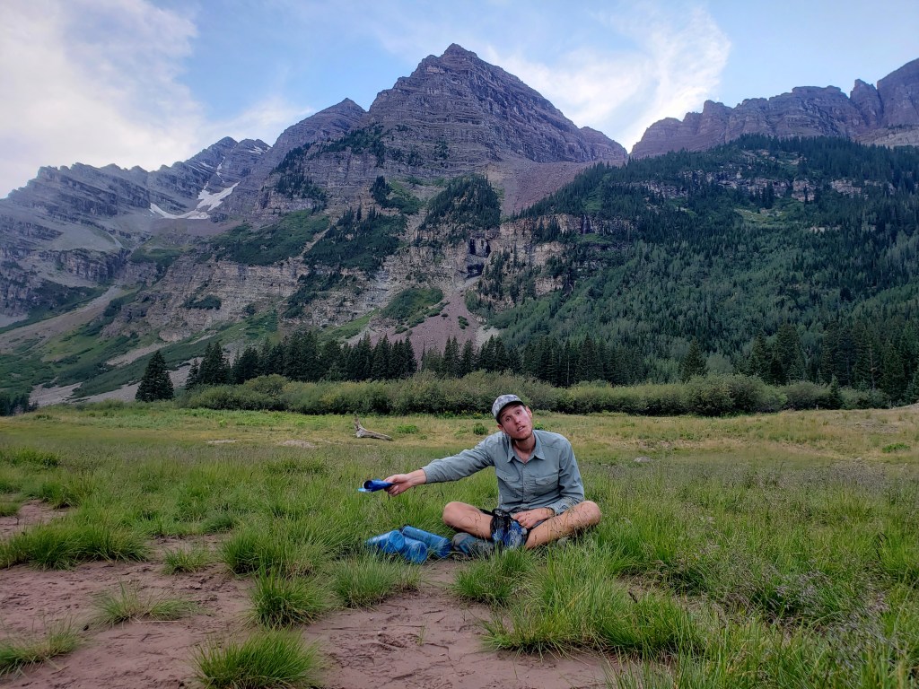
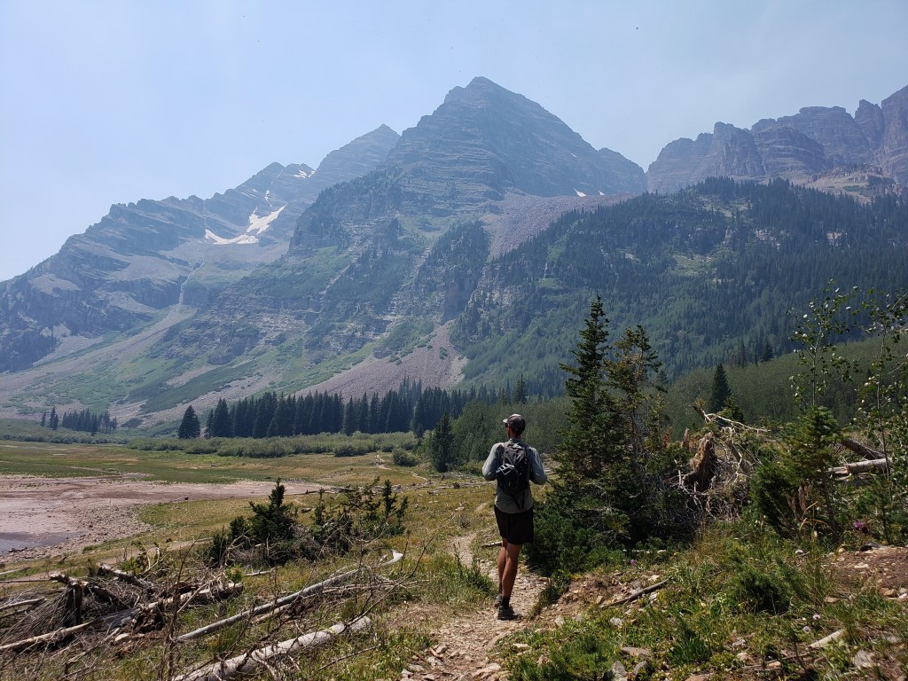
In the morning we readied ourselves for the long weekend ahead. We had mailed ourselves our larger backpacks to hike into the Maroon Bells wilderness area to tackle three major summits – Maroon Peak, North Maroon Peak, and Pyramid Peak.
Late afternoon, we took off on bikes up to Maroon Lake, switched our gear into our backpacks, and hiked the brief 2 miles to Crater Lake. At Crater Lake, we found a perfect campsite in the woods that we would call home for the next three nights.


Day 39 – 7 miles hiking / +4200 ft elevation gain
The first of the three peaks was the tallest, longest hike, and lowest class. If you didn’t know, climbs are rated from Class 1 – 5, then climbers use 5.1, 5.2, etc to describe the steepness of the pitch. In terms of hiking, a Class 1 is a walk up. Class 2 usually has boulder scrambles with some exposure. Class 3 involves busting some creative moves with significant exposure and an increase in the chance of fatal mistakes. Class 4 is just shy of needing ropes. Maroon Peak is a Class 3 route with plenty of exposure, somewhat challenging route finding, and high rockfall potential. If you’re not ok with heights, none of these peaks are for you.
We began from our camp at Crater Lake at 5:20 walking for about 40 minutes in the dark before sunrise. As we began our long uphill ascent, the trail was solely comprised of loose gravel and dirt making for a slow go. Just before 9, we reached the ridge where 14ers.com warns that the difficult portion of the hike begins within the final 1000 ft to the summit.


We worked our way around narrow ledges following cairns through slots and winding our way across rocks. The steepest and scariest part of the traverse was crossing two gullies full of loose rocks in a range of sizes. Each step was calculated, tested, and deliberate, and still it felt like the entire gully could collapse at anytime sending us along with it.


We carefully made it across gully 1 which only led to gully 2. After slowly and safely crossing, we began climbing a steep pitch to the “wide gully” which was thankfully less steep. After a few more creative moves, we were at the summit.


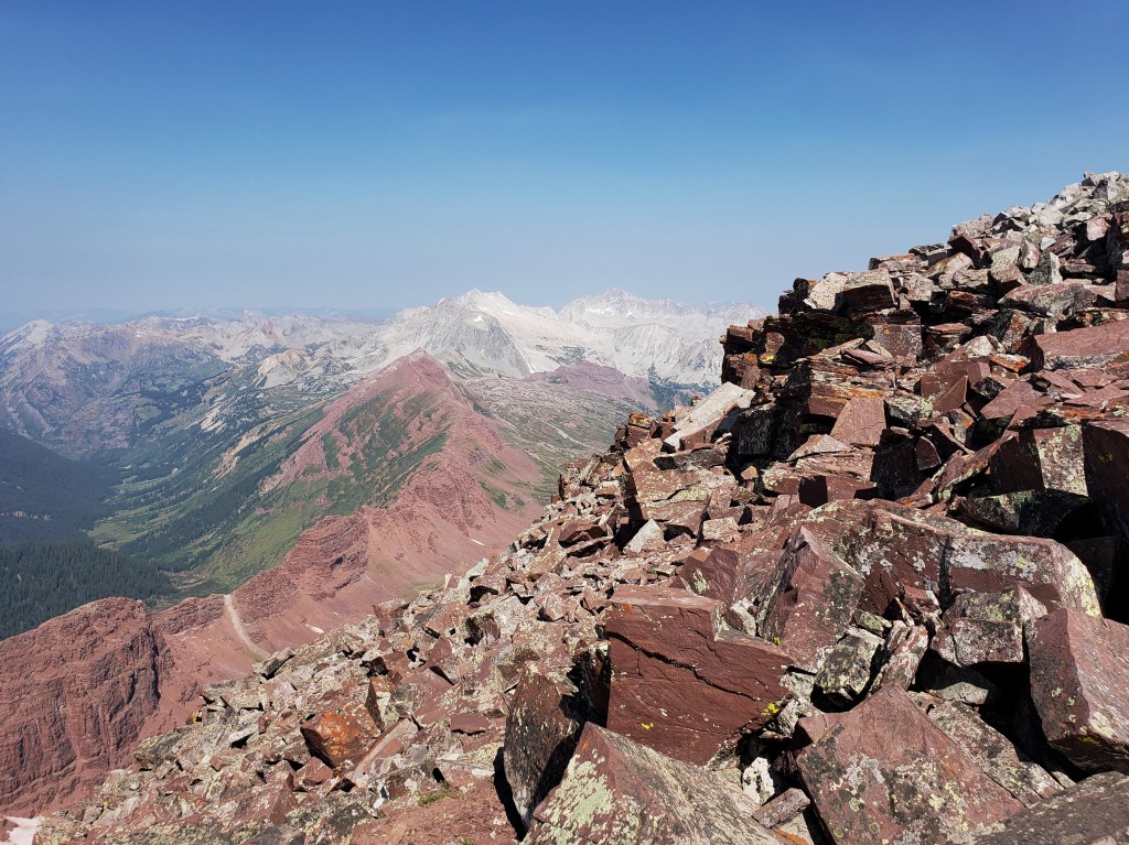
The views were surreal. The valleys below were a striking contrast of green and red with Capitol Peak and Snowmass glittering silver in the distance. Two women shared the summit with us, the only other hikers we had seen throughout the day. The haze from the Grizzly Creek Fire in Glenwood Springs was noticeable in the air, but thankfully didn’t deter too much from our enjoyment. After about 30 minutes at the summit, we began the long hike down.
We descended from the summit, slowly crossed the temperamental gullies, and dropped below the ridge. We were happy to be back on safer territory, but the remaining hike was no easy walk. Ahead of us was several thousand feet of steep downhill walking on slick dirt with essentially nothing to grip. Both of us fell at least three times during the tedious walk.
About 9 and a half hours after we started, we finally returned to camp. We enjoyed food, podcasts, and sleep until our next big ascent the following day.
Day 40 – 6 miles hiking / +4000 ft elevation gain
We began our first Class 4 at 5 am. I was feeling a mix of nerves and anxiety about the climb ahead knowing the challenges of yesterday’s summit. Still, up we went grateful that the trail wasn’t just slick dirt like the Maroon Peak trail. As the sun rose, the sky was considerably thicker with smoke noticeable in sight and breath.


The first challenge of the hike was crossing the rock glacier. There wasn’t much elevation change through this section, but it still required concentration as we crossed uneven boulders. Once through the rock glacier, we returned to trail and continued our way up. As we rounded a corner, we got a great look at North Maroon as well as South Maroon we had summited yesterday. We could see hikers on South Maroon and suddenly a big puff of smoke arose from the summit. Confused, but with no immediate answers, we pressed on.


We headed into our first gully which was plenty steep and had some loose rock, but nothing compared to yesterday’s hike. After 600 ft ascent, we exited the gully, rounded some narrow ledges, and entered gully #2. Up we went, slowly and carefully on loose rock and slick gravel traversing a significantly steeper 600 ft.

Once we exited the gully, the remaining route was Class 3 and 4 moves climbing steep walls with narrow ledges, occasionally searching for hand and foot holds while clinging to a rock wall. At times, I surprised myself with upper body strength I didn’t know I had.


At the summit, a group of four men greeted us as they had just completed the Class 5 traverse from South Maroon to North Maroon. Assuming they were the ones we spotted earlier, we inquired about the puff of smoke. They informed us that one of their brothers had passed 10 years ago on that very traverse, and the smoke we had seen was them spreading his ashes on the mountain.

The group soon left, and we enjoyed the summit for a few minutes. Truthfully, the hike had been tough, and I questioned my abilities for tomorrow’s acsent of Pyramid Peak which was described as an even more difficult climb. Not long after we had spoken our doubts, two other hikers joined us on the summit. One hiker had already done Pyramid and reassured us that since we had done these peaks, Pyramid was within our grasp.
With a little confidence boost, we headed down the mountain. The climbing section was slow and steady, followed by the steep gullies. Thankfully, it was quicker than descending South Maroon, but the entire hike still took just shy of 9 hours.


Day 41 – 6 miles hiking / +4000 ft elevation gain; 11 miles biking downhill
We woke at 4 am, broke down camp, and hiked all of our stuff to the spur trail of Pyramid Peak which was a little closer to the parking area. We stashed our bags in the woods and began the hike up Pyramid with our day packs. The trail began as an uphill hike on a defined trail with plenty of stair steps. As the sun rose, we made it to “the gates,” large cairns that framed our first views of the summit and welcomed us to another much larger rock glacier.


We spent about an hour boulder hopping until we reached a steep slope that would take us to the ridge. The slope was, not surprisingly, super slick and full of loose rocks. Another hour passed, and we found ourselves on the ridge greeted by a couple of mountain goats. Sean studied the route from 14ers.com and declared that we just had some narrow ledges and 1000 ft of complex climbing to go!


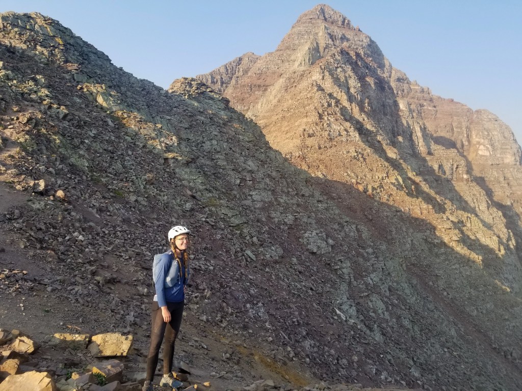
After a short break, we began the difficult section of the hike. First, narrow ledges took us around the mountain. One ledge even had a nice size gap in it we had to jump over. After clinging to the mountain while shimmying along the ledge, we reached the infamous “green wall.” The steep wall looked intimidating, but I was pleased to find that the wall had plenty of hand and foot holds. I did my best to focus on the task at hand and absolutely not look down. After a few hundred feet of climbing, we exited the green wall. It was a great feeling to stand on two feet, but I questioned how going down would be.

At this point, we were about 500 ft below the summit and still had some Class 3/4 climbing ahead. The climb was mostly chunky walls with ledges in between. It was difficult, but I was pleased with my abilities as the summit came into sight. Moments later, we reached the summit stoked that we had successfully completed the Class 4 route.


The views of Maroon Bells from Pyramid were amazing! Looking at the peaks it was hard to believe we had stood on those summits days before. We spent a little more time than usual at the summit, then began the traverse down.
First, we came down the rock bands which were surprisingly simple. When we reached the green wall, I was definitely nervous, but as we descended we found it was actually really easy to navigate. Next, we skirted the ledges and were once again greeted by mountain goats when we returned to the saddle. What took us 2 hours to ascend only took 1 hour to descend.

Going down the steep slope and crossing the boulder field was slow and tedious, and we rejoiced when we reached the gates. Once back on an actual trail, the feelings of accomplishment set in. We were elated that we had successfully summited all 3 challenging peaks.

Once we reached our backpacks, we walked down the trail to the parking area, ate lunch, and packed our bikes. The all downhill cruise to town was the cherry on top of such an incredible day. Despite our fears going into the hike, Pyramid Peak became one of our favorite 14ers we had done so far!

If you’re keeping track…
779 Miles Biking / +81,000 ft elevation gain
216 Miles Hiking / +93,000 ft elevation gain
31 – 14,000+ ft Summits
- Maroon Peak, North Maroon Peak, & Pyramid Peak
- Castle & Conundrum Peaks
- La Plata Peak
- Huron Peak, Missouri Mtn, Mt Oxford, & Mt Belford
- Mt Shavano & Tabeguache Peak
- Mt Princeton & Mt Antero
- Mt Harvard, Mt Columbia, & Mt Yale
- Mount Sherman
- Mount Massive & Mount Elbert
- Mount of the Holy Cross
- Mt Democrat, Mt Cameron, Mt Lincoln, and (not) Mt Bross
- Quandary Peak
- Torreys and Grays Peaks
- Mount Bierstadt
- Mount Evans
- Long’s Peak
We are Bekah and Sean, out on an adventure to summit as many CO 14ers as possible this summer and reaching them via bicycle! Follow along here or on Instagram as we complete our Summer of Summits.
Summer of Summits: Castle & Conundrum Peaks

Day 35 – 38 miles biking / +3200 ft elevation gain, 4300 ft elevation loss
From our gorgeous campsite, we were only 4.5 miles and 1300 ft from the top of Independence Pass, the highest paved pass in North America. If you’re cruising around Colorado, this is a highway not to be missed! We had a blast riding up through the valleys and winding our way to the top. A little less than an hour of riding brought us all the way up with astounding views in every direction.


After a few photos, we hopped back on the bikes and cruised down 20 miles and 4200 ft in less than an hour with a brief stop at the former mining town of Independence. We immediately rode to get some food and resupply for the next day’s hike.
From downtown Aspen, we rode the bike paths up to Castle Creek Road and began a 12 miles ascent to where the pavement ended. Castle Creek Valley was gorgeous and the 1900 ft of elevation gain wasn’t too difficult considering the road was paved! (Everything’s nicer in Aspen 😁)
When the pavement ended, the road turned to a chunky gravel road with lots of baseball sized rocks and potholes. We road a small portion of it but had to push uphill for about a half mile before we could find a campsite. We made camp and set an early alarm.
Day 36 – 12 miles hiking / +5000 ft elevation gain; 16 miles biking
The majority of the distance of the hike we walked on the 4 wheel drive road up Castle Peak. We began just before 5 am and briskly walked the road using our headlamps. We witnessed a beautiful sunrise as the light lit up the surrounding peaks.

Around 6:30, the road turned to “trail” crossing a boulder field and leading to a permanent snowfield. There was a pretty clear line already carved in the snow, and we made our way easily across.


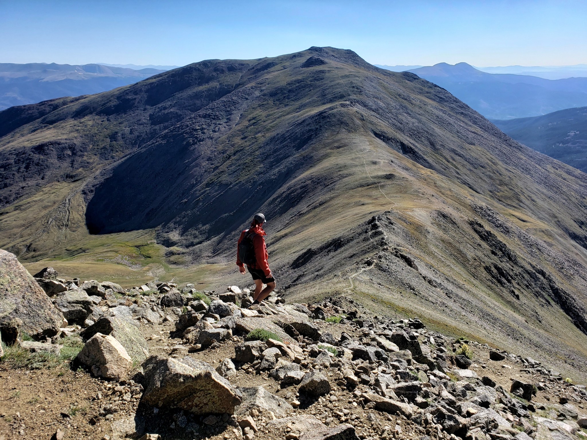
The next section was a set of slick, steep switchbacks leading to the ridge through loose gravel and dirt. There were a few options to get to the summit, but we decided to ride the ridge as it seemed like the simplest route. We climbed up and over rock walls and did our best not to look down the sheer drop offs on either side.


Just after 8 we made it to our first summit of the day, Castle Peak. Beyond Conundrum Peak, we could see the Elk Range including the Maroon Bells, Pyramid Peak, Capitol Peak, and Snowmass. We were amazed by the contrasting colors of the red peaks of the Bells and the shimmering silver of Capitol and Snowmass.
After a few minutes at the summit, we headed down the other side of the ridge towards Conundrum Peak. Other than a short steep section of loose rock, the route was simple and took about a half hour from peak to peak.

We enjoyed our time here soaking it all in and chatting with some fellow hikers. A couple of locals informed us of the fire that had just broken out in Glenwood Springs about 40 miles away. At some angles we could see the billowing smoke.


After snacking, we headed back towards Castle Peak to retrace our footsteps down the mountain. Some hikers decided to take a faint trail from the saddle between the mountains, but after checking out the route, we opted for the longer hike over more stable ground.


We headed back up to the summit of Castle, down the ridge, and then to the switchbacks. The snowfield was much quicker on the way down as we opted to glissade through it for a little fun. Not long after, we returned to the 4 wheel drive road and briskly walked back to camp.


After packing up camp, we now had the joy of riding our bikes down Castle Creek Road 1900 ft over twelve miles. If you didn’t already know, there are no bad views in Aspen. The road had a few ups which gave it a roller coaster effect. We were both grinning the whole way to town, blissfully enjoying the cruise, the sunshine, and the day off in Aspen that awaited us!
If you’re keeping track…
737 Miles by Bike / +58,000 ft elevation gain
195 Miles Hiking / +80,200 ft elevation gain
28 – 14,000+ ft Summits
- Castle & Conundrum Peaks
- La Plata Peak
- Huron Peak, Missouri Mtn, Mt Oxford, & Mt Belford
- Mt Shavano & Tabeguache Peak
- Mt Princeton & Mt Antero
- Mt Harvard, Mt Columbia, & Mt Yale
- Mount Sherman
- Mount Massive & Mount Elbert
- Mount of the Holy Cross
- Mt Democrat, Mt Cameron, Mt Lincoln, and (not) Mt Bross
- Quandary Peak
- Torreys and Grays Peaks
- Mount Bierstadt
- Mount Evans
- Long’s Peak
We are Bekah and Sean, out on an adventure to summit as many CO 14ers as possible this summer and reaching them via bicycle! Follow along here or on Instagram as we complete our Summer of Summits.
Summer of Summits: La Plata Peak

Day 33 – 27 miles biking / 1500+ ft elevation gain
Camping at the same spot 3 nights in a row was glamorous, but it was time to move on. From Missouri Gulch Trailhead, we had a 27 mile ride ahead of us to La Plata Trailhead. We rode the bumpy dirt road 8 miles back to Highway 24 and a few miles later we headed west on Highway 82. About 6 miles up 82, we came to the tiny and familiar town of Twin Lakes. The Twin Lakes General Store barely had what we needed for a couple days, but we managed to make it work just as we had for a resupply while hiking the Continental Divide Trail a couple years prior.
After snacking and resupplying, we continued riding another 10 beautiful miles to the trailhead. There was limited dispersed camping available, but thankfully we found a spot and setup camp.
Day 34 – 10 miles hiking / +4400 ft elevation gain; 4 miles biking / 600+ ft elevation gain
In the morning, we let the alarm lapse a little, packed up our bikes, and started walking at 6:40. We began our hike winding through aspen groves and up rock and dirt stairs. Above treeline, magnificent views of the surrounding mountains were revealed though we still couldn’t tell which was La Plata Peak.

Next we climbed a set of short steep switchbacks passing a few hikers along the way. Once we made it to ridgeline, the remaining hike was mostly a rock scramble to the summit.
The secret is out about La Plata Peak. It’s a gorgeous, well maintained trail with little technical skills needed to summit. It was a Sunday, so we weren’t surprised to be sharing the trail with maybe 50 others. The trail was well marked and well worn, and many cairns along the way made navigating simple. As we neared the summit, the views of the Sawatch and Elk Ranges were astounding. We made it to the summit at 9:30 just about 3 hours after we started.


With just a short bike ride ahead, we had plenty of time to linger at the summit. It was a perfect bluebird day, and I was delighted that the wind was calm. After about a half hour enjoying the summit, we retraced our steps back down the mountain returning to camp at about 12:30.


We ate our lunch eagerly and decided to take a little rest and listen to a podcast. Around 3:30, we hopped on the bikes and rode for about 4.5 miles up the highway putting us 5 miles away from the top of Independence Pass.

Just before the highway got super steep, we found a trailhead in one of the road’s switchbacks with a picture perfect camping spot. We got plenty of rest and were looking forward to the following day’s ride to Aspen!

If you’re keeping track…
683 Miles by Bike / +54,800 ft elevation gain
183 Miles Hiking / +75,200 ft elevation gain
26 – 14,000+ ft Summits
- Huron Peak, Missouri Mtn, Mt Oxford, & Mt Belford
- Mt Shavano & Tabeguache Peak
- Mt Princeton & Mt Antero
- Mt Harvard, Mt Columbia, & Mt Yale
- Mount Sherman
- Mount Massive & Mount Elbert
- Mount of the Holy Cross
- Mt Democrat, Mt Cameron, Mt Lincoln, and (not) Mt Bross
- Quandary Peak
- Torreys and Grays Peaks
- Mount Bierstadt
- Mount Evans
- Long’s Peak
We are Bekah and Sean, out on an adventure to summit as many CO 14ers as possible this summer and reaching them via bicycle! Follow along her or on Instagram as we complete our Summer of Summits.
Summer of Summits: Huron Peak, Missouri Mtn, Mount Oxford & Mount Belford

This summer we’re attempting to summit as many 14,000+ ft mountains in CO as possible, and we’re reaching the trailheads by bike! Join us on our Summer of Summits.
Day 30 – 24 miles by bike / +1900 ft elevation gain
Thanks to Thermarest’s warranty and Trailhead Outfitters in Buena Vista, I was able to make a quick exchange of my busted sleeping pad for a brand new one. We spent a couple hours in town killing time while my bike got a brake adjustment, then we were on our way to the next trailhead.
We took off for our 24 mile ride mostly north up Highway 24, then about 8 miles on county road 390 to Missouri Gulch Trailhead to access Mt Belford, Mt Oxford, and Missouri Mountain. 4 more miles further on the same road gave us access to Huron Peak via Lulu Gulch. We found a stealth campsite between the two trailheads and setup camp for the next couple nights. We decided to tackle Huron Peak first.
Day 31 – 11 miles hiking / +3900 ft elevation gain; 6 miles biking / +600 ft elevation gain
Though most people do Huron Peak as an “out and back” trail, we noticed our All Trails app has a route making a loop through Lulu Gulch. We decided to do a couple extra miles to change up the scenery. We went up Lulu Gulch just as the sun was rising. The first section of trail was basically a 4 wheel drive road with long sweeping switchbacks. Once we were above treeline, the road ended and the ridge walk began. This route was clearly lightly traveled, and the trail was undefined. We essentially just followed the ridgeline from saddle to saddle until it connected to the main trail.


Once we joined the main trail, we noticed more people above and below us. We headed towards the home stretch to the summit in awe of the surrounding views. We reached the summit around 9:30 and didn’t have to rush down. The weather was perfect, and, for once, the wind wasn’t too strong.


About a half hour later, we headed down taking the main trail back to our bikes. The trail was incredibly well made with nice switchbacks followed by a short set of rock steps. Eventually, we wound through the woods and back to our bikes. We rode the three miles back to camp and enjoyed the day resting up for tomorrow’s big ascent.

Day 32 – 16 miles hiking / +7300 ft elevation gain; 2 miles biking
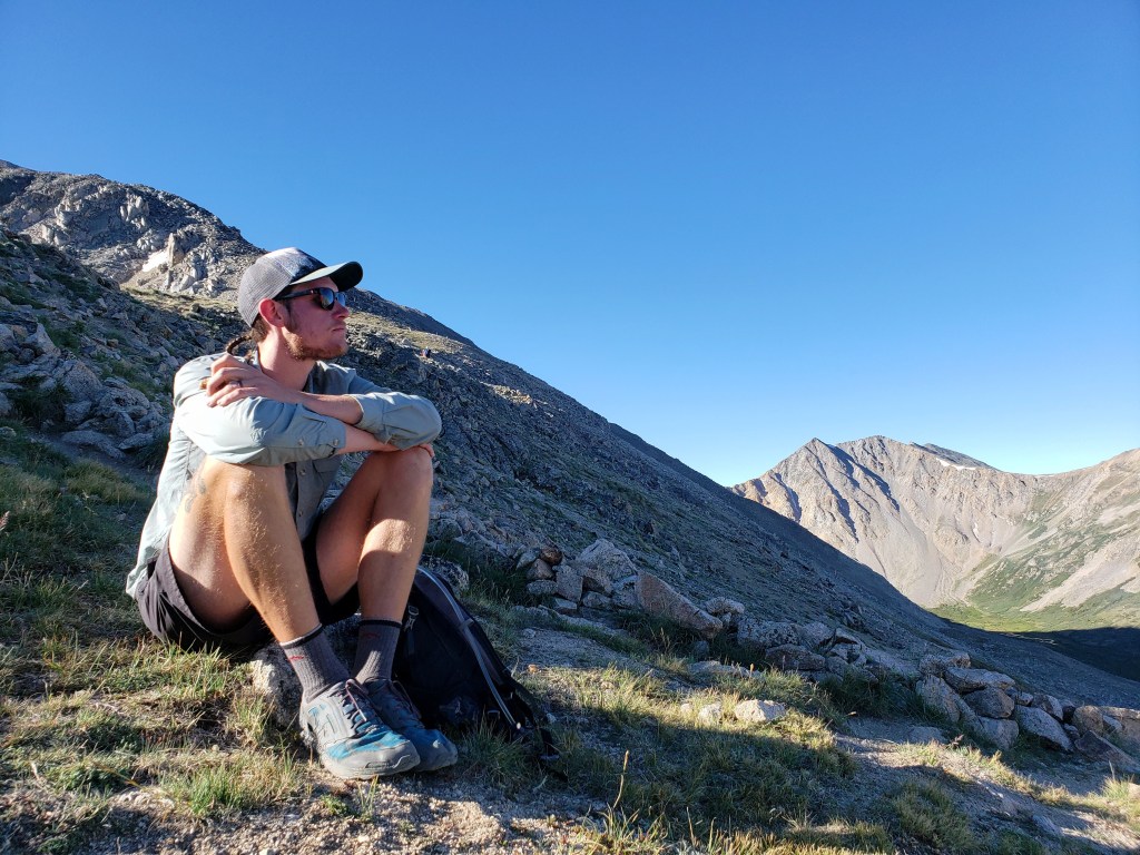
We got up at 3:00 am to ensure we’d be off the summits before the afternoon on a big day of hiking. We rode the bikes 1 mile to the trailhead and took off into the woods at 3:30 by the light of our headlamps. We decided to head towards Missouri Mountain first. Time, miles, and elevation gain fly by for me in the dark as I’m only concentrating on the five feet in front of me. As we exited treeline, the moon and stars sparkled above which slowly faded as day broke behind Mount Belford. The light illuminated the valley and revealed the mountain we were ascending.

We reached Missouri’s ridge just as the first beams of light were hitting the tops of the peaks on the other side. Huron glowed in the sunshine. The views were incredible but were accompanied by a harsh, bitter wind. We rode the ridge for a while with a short stretch of slick, loose gravel. At about 6:30, we reached our first summit of the day.


We didn’t linger long as the wind wasn’t too inviting. I scurried as quickly as I could back down the ridge to the other side of the mountain to escape the cold. We retraced our steps down the Missouri Mountain spur trail, then continued climbing up Elkhead Pass and the back side of Belford.

The trail took us just shy of Belford summit with a fork towards Mount Oxford. We headed towards Oxford which took us down a steep 500 ft to a saddle then up 500 ft to the summit. The wind was still cutting as we were exposed above treeline, but the air was warming as the morning grew on.
At 9:30, we reached our second summit. The wind was fierce, but we were grateful to enjoy our snacks in a rock nest. Views of Mt Harvard were directly to the south with Princeton and Yale in the distance. Other than the wind, the weather seemed to be holding out with barely any clouds in the sky.

After our break at the summit, we headed back towards Mt Belford for our third and final summit of the day. We retraced the 500 ft down then the super steep and slick 500 ft back up.

Oxford to Belford took just about an hour. It was at this summit that we saw the most people. We found another nice wind block and enjoyed the last summit, pleased with our day’s work. It was finally time to head down the mountain.

The main trail up Belford that we were now descending has a long series of short steep switchbacks. Heading down the switchies was a slow go as welwe for sturdy footholds among the slick gravel.
Slowly but surely we made it back to the valley we had traversed by head lamp and eventually under treeline. From summit to trailhead took about two hours. All in all, the hike took 10 hours and consisted of 16.4 miles of hiking with 7300 ft of combined elevation gain between the three summits. After, we rode the 1 mile back to camp eager for lunch. #23, #24, #25 in the bag!!
If you’re keeping track…
653 Miles by Bike / +54,800 ft elevation gain
183 Miles Hiking / +75,200 ft elevation gain
25 – 14,000+ ft Summits
- Huron Peak, Missouri Mtn, Mt Oxford, & Mt Belford
- Mt Shavano & Tabeguache Peak
- Mt Princeton & Mt Antero
- Mt Harvard, Mt Columbia, & Mt Yale
- Mount Sherman
- Mount Massive & Mount Elbert
- Mount of the Holy Cross
- Mt Democrat, Mt Cameron, Mt Lincoln, and (not) Mt Bross
- Quandary Peak
- Torreys and Grays Peaks
- Mount Bierstadt
- Mount Evans
- Long’s Peak
We are Bekah and Sean, out on an adventure to summit as many CO 14ers as possible this summer and reaching them via bicycle! Follow along here or on Instagram as we complete our Summer of Summits.
Summer of Summits: Mt. Shavano & Tabeguache Peak

This summer we’re attempting to summit as many 14,000+ ft mountains in CO as possible, and we’re reaching the trailheads by bike! Join us on our Summer of Summits.
Day 28 – 14 miles biking / +2700 ft elevation gain
Our time off in Salida evaporated, and it was time to head to our next trailhead. Thankfully, Mt. Shavano and Tabeguache Peak were only 14 miles away from town. We headed due west towards the mountains staying on back roads the entire way. The final six miles were on a gravel road to the trailhead. We were pleasantly surprised that the elevation gain was evenly graded and the whole ride took about 2 and a half hours. Though trail was within the national forest boundary, the surrounding area was on BLM land. We found a dispersed campsite and soon realized we would have company – cows. I blew up my NeoAir sleeping pad which started making a popping noise not long after. The middle of the inflatable pad had become delaminated causing a beach ball effect right in the middle. Thankfully, I had signal and was able to schedule an in-store replacement for the next day in Buena Vista. Not only did the sleeping pad keep me up, the cows were constantly stomping around or snoring which made for a pretty sleepless night.
Day 29 – 10 miles hiking / +5200 ft elevation gain; 31 miles biking / +1000 ft elevation gain
Our day began at about 4:30, and the full moon illuminated the early morning. We started our hike at 5 with a long approach through the forest. The sun was rising just as we got to treeline. Clouds hung in the air and the wind grew as we climbed higher and higher. Just before 8, we approached a saddle with our first summit, Mt Shavano, in sight. The wind whipped from the other side of the ridge and a dark cloud loomed. Suddenly, rain started pelting us as we considered what we should do. Thankfully, a nest built of rocks was nearby, and we ducked for cover.
We could see some patches of blue sky, so we decided to time the storm and wait it out. We spent the next 20 minutes grateful for the structure that blocked the wind. The time ticked slowly as we got colder by the passing minute. We considered whether we’d have to turn back and try to summit the following day undoing thousands of feet of climbing. Thankfully, the rain stopped, and the clouds broke. We continued toward the first summit.

From Mount Shavano summit, we could see Tabeguache Peak and the connecting ridge. We took a couple quick pics and started descending.
Once we reached the saddle, our second ascent was about a 400 ft climb. The sun finally came back out from behind the clouds as we approached the summit. We took in the views and could clearly make out the switchbacks of the ATV road climbing Mt Antero behind us.


We left Tabeguache Peak and headed back down towards the saddle. Now we got to climb 500 ft back up Mt Shavano to reach the approach trail. At the summit for the second time, we took another pic now that the sky was hazy but mostly cloud free. We were glad to actually have all the climbing done and started our long descent back to camp.

The whole hike took just at 8 hours to complete. We scarfed some lunch, packed up the bikes, and began our 30 mile ride to Buena Vista. First, we wound down the chunky gravel road to the highway. Next, we spent about two hours rolling up and down hills as we passed view points of several mountains we had already summited. We were ecstatic to reach Buena Vista (and my new sleeping pad!) after a very long day.
If you’re keeping track…
621 Miles by Bike / +52,300 ft elevation gain
156 Miles Hiking / +64,000 ft elevation gain
21 – 14,000+ ft Summits
- Mt Shavano & Tabeguache Peak
- Mt Princeton & Mt Antero
- Mt Harvard, Mt Columbia, & Mt Yale
- Mount Sherman
- Mount Massive & Mount Elbert
- Mount of the Holy Cross
- Mt Democrat, Mt Cameron, Mt Lincoln, and (not) Mt Bross
- Quandary Peak
- Torreys and Grays Peaks
- Mount Bierstadt
- Mount Evans
- Long’s Peak
We are Bekah and Sean, out on an adventure to summit as many CO 14ers as possible this summer and reaching them via bicycle! Follow along here or on Instagram as we complete our Summer of Summits.
